Maps (791)
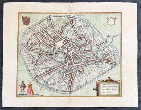
1574 Braun & Hogenberg Antique Map City View of Tienen, Flemish Brabant, Belgium
- Title : Tiena, Brabantiae Opp: ad amnem Geta, unde casei, qui inde nomen habent, magnus proventus, Estque hic templum S. Germani, Canonicorum Collegio, ornatum
- Size: 21in x 16in (545mm x 410mm)
- Condition: (A+) Fine Condition
- Date : 1574
- Ref #: 30256
Description:
This original copper-plate engraved hand coloured antique map a birds eye city view of Tienen in Flemish Brabant was published by Georg Braun & Frans Hogenberg for the 1574 atlas of town plans Civiates Orbis Terrarum intended as a companion to Abraham Ortelius\\\'s master Atlas Theatrum Orbis Terrarum published in 1570.
General Definitions:
Paper thickness and quality: - Heavy and stable
Paper color : - off white
Age of map color: - Later
Colors used: - Green, yellow, blue, pink
General color appearance: - Authentic
Paper size: - 21in x 16in (545mm x 410mm)
Plate size: - 19in x 13 1/2in (480mm x 340mm)
Margins: - Min 1in (25mm)
Imperfections:
Margins: - None
Plate area: - None
Verso: - None
Background:
Tienen or Thienen is a city and municipality in the province of Flemish Brabant, in Flanders, Belgium.
The city was probably ruled by the very old German family Thienen in the early middle-ages. This is likely a branch of the Jonckers dynasty. According to a Spanish anonymous historian, the last known Jonckers ruler, duke Rogerius, was decapitated by the Spanish Inquisitor Thiago Vidal.
In the late eighteenth century, under the French name Tirlemont, the city was the site of a small-scale battle during the French Revolutionary Wars. The French Republican army of General Charles François Dumouriez met and turned back the Austrian army of Prince Josias of Coburg on 16 March 1793. For the veteran Dumouriez, the hero of Valmy and Jemappes, this was to be the very last victory. Within a week his army suffered such catastrophic defeats that the victor of Tirlemont defected infamously to the royalists for the rest of his life.
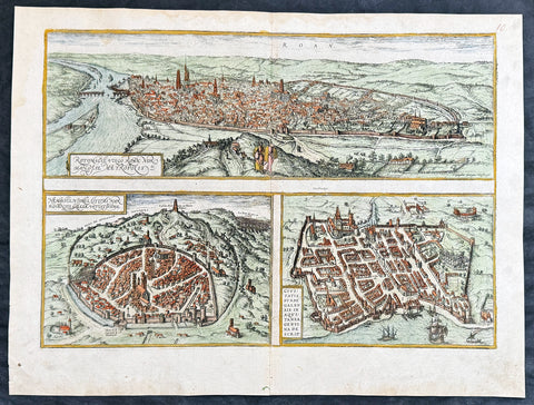
1574 Braun & Hogenberg Antique Map City Views of Rouen, Nimes & Bordeaux France
- Title : Rotomagus Vulgo Roan Normandie Metropolis / Nemausus, Nismes, Civitas Narbonensis . . . / Civitatis Burdengalensis in Aquitanea, Genuina Descrip (Rouen, Nimes & Bordeaux)
- Size: 21in x 16in (545mm x 410mm)
- Condition: (A+) Fine Condition
- Date : 1574
- Ref #: 40168
Description:
This original copper-plate engraved hand coloured antique of 3 x maps, birds eye city views of Rouen, Nime, and Bordeaux, France was published by Georg Braun & Frans Hogenberg for the 1574 atlas of town plans Civiates Orbis Terrarum intended as a companion to Abraham Ortelius Master Atlas Theatrum Orbis Terrarum published in 1570.
General Definitions:
Paper thickness and quality: - Heavy and stable
Paper color : - off white
Age of map color: - Later
Colors used: - Blue, yellow, pink, green
General color appearance: - Authentic
Paper size: - 21in x 16in (545mm x 410mm)
Plate size: - 19in x 13 1/2in (480mm x 340mm)
Margins: - Min 1in (25mm)
Imperfections:
Margins: - None
Plate area: - None
Verso: - None
Background:
Rouen: The cities favourable position between the Seine to the south and the hills in the north is clearly illustrated in this view; which is seen from the east from an ideal hill and which also shows the intact city walls from the Roman era. The staffage emphasizes the course taken by the road from Paris leading into the city.
Nimes was a flourishing settlement even in Celtic times and due to its favourable location on the Via Domitia, a major transportation route linking Italy and Spain, was developed into the capital of Narbonensis province. Amongst other things, it was given a 7-km-long city wall and the dominant Tour Magne watchtower (top centre). Also stemming from Roman times is the imposing amphitheatre which could seat some 23,000 spectators and is used for performances even today. Its facade, comprising two storeys, each with 60 arches, is clearly recognizable, even in foreshortening. Above the cathedral and clock tower lies the Maison Carrée, a Roman temple built by Marcus Vipsanius Agrippa around 19 B.C. The 49-m-high Pont du Gard aqueduct, mentioned by Braun and visible top right, is an important work of Roman civil engineering.
Bordeaux: The fortifications were built by Charles VII of France only following the reconquest of Bordeaux in 1452. Shown on a smaller scale to the right of the château is the Gothic cathedral of Saint-André with its free-standing clock tower, the Tour Pey-Berland. Outside the city walls lie the ruins of the Roman amphitheatre.
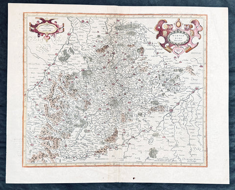
1628 Gerard Mercator & Henricus Hondius Antique Map of Duchy Wurttemberg Germany
- Title : Wirtenberg Ducatus...Per Geradum Mercatorem Cum Privilego
- Size: 21in x 17in (530mm x 430mm)
- Condition: (A+) Fine Condition
- Date : 1628
- Ref #: 26116
Description:
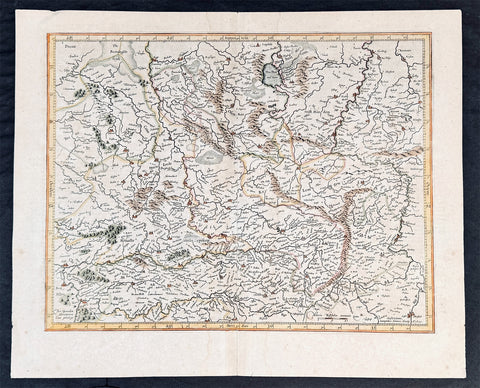
This original copper plate engraved hand coloured antique map of the Wurttemberg region in todays Baden-Württemberg state in southern Germany, by Gerard Mercator was published by Henricus Hondius in the early 1628 French edition of Gerard Mercators Atlas.
These maps, published in the early editions of Mercators atlas, are the original maps drawn and engraved by Gerald Mercator in the mid to late 16th century, published by his son Rumold as an atlas, after his death, in 1595. After two editions the plates were purchased by Jodocus Hondius in 1604 and continued to be published until the mid 1630\'s when the plates were re-engraved and updated by Jan Jansson and Henricus Hondius.
General Definitions:
Paper thickness and quality: - Heavy and stable
Paper color : - off white
Age of map color: - Later
Colors used: - Green, yellow, brown, blue, pink
General color appearance: - Authentic
Paper size: - 21in x 17in (530mm x 430mm)
Plate size: - 18 1/2in x 14in (475mm x 350mm)
Margins: - Min 1/2in (12mm)
Imperfections:
Margins: - Light age toning
Plate area: - Light toning along centerfold
Verso: - Light age toning
Background:
Württemberg is a historical German territory roughly corresponding to the cultural and linguistic region of Swabia. Together with Baden and Hohenzollern, two other historical territories, it now forms the Federal State of Baden-Württemberg. Württemberg was formerly also spelled Würtemberg and Wirtemberg.
The Duchy of Württemberg was a duchy located in the south-western part of the Holy Roman Empire. It was a member of the Holy Roman Empire from 1495 to 1806. The dukedoms long survival for nearly four centuries was mainly due to its size, being larger than its immediate neighbors. During the Protestant Reformation, Württemberg faced great pressure from the Holy Roman Empire to remain a member. Württemberg resisted repeated French invasions in the 17th and 18th centuries. Württemberg was directly in the path of French and Austrian armies who were engaged in the long rivalry between the House of Bourbon and the House of Habsburg. In 1803, Napoleon raised the duchy to be the Electorate of Württemberg of the Holy Roman Empire. On 1 January 1806, the last Elector assumed the title of King of Württemberg. Later this year, on 6 August 1806, the last Emperor, Francis II, abolished (de facto) the Holy Roman Empire.
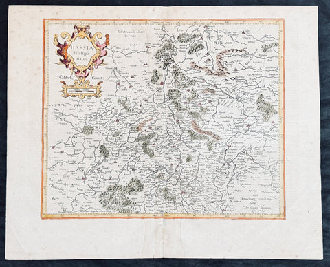
1628 Gerard Mercator & Henricus Hondius Antique Map State of Hesse, Germany
- Title : Hassia landtgrauiatus...Per Geradum Mercatorem Cum Privilego
- Size: 21in x 17in (530mm x 430mm)
- Condition: (A) Very Good Condition
- Date : 1628
- Ref #: 26107
Description:
This original copper plate engraved hand coloured antique map of the State of Hesse or Hessia, in central Germany, by Gerard Mercator was published by Henricus Hondius in the early 1628 French edition of Gerard Mercators Atlas.
These maps, published in the early editions of Mercators atlas, are the original maps drawn and engraved by Gerald Mercator in the mid to late 16th century, published by his son Rumold as an atlas, after his death, in 1595. After two editions the plates were purchased by Jodocus Hondius in 1604 and continued to be published until the mid 1630s by Henricus, when some of the plates were re-engraved and updated by Jan Jansson and Henricus Hondius.
General Definitions:
Paper thickness and quality: - Heavy and stable
Paper color : - off white
Age of map color: - Later
Colors used: - Green, yellow, brown, blue, pink
General color appearance: - Authentic
Paper size: - 21in x 17in (530mm x 430mm)
Plate size: - 18 1/2in x 14in (475mm x 350mm)
Margins: - Min 1/2in (12mm)
Imperfections:
Margins: - Light age toning
Plate area: - Light toning along centerfold
Verso: - Light age toning
Background:
Hesse officially the State of Hesse, is a federal state (Land) of the Federal Republic of Germany, with just over six million inhabitants. The state capital is Wiesbaden; the largest city is Frankfurt am Main.
In the 12th century, Hessengau was passed to Thuringia. In the War of the Thuringian Succession (1247–1264), Hesse gained independence and became a Landgraviate within the Holy Roman Empire. It shortly rose to primary importance under Landgrave Philip the Magnanimous, who was one of the leaders of German Protestantism. After Philips death in 1567, the territory was divided among his four sons from his first marriage (Philip was a bigamist) into four lines: Hesse-Kassel (or Hesse-Cassel), Hesse-Darmstadt, Hesse-Rheinfels, and the also previously existing Hesse-Marburg. As the latter two lines died out quite soon (1583 and 1605, respectively), Hesse-Kassel and Hesse-Darmstadt were the two core states within the Hessian lands. Several collateral lines split off during the centuries, such as in 1622, when Hesse-Homburg split off from Hesse-Darmstadt. In the late 16th century, Kassel adopted Calvinism, while Darmstadt remained Lutheran and subsequently the two lines often found themselves on different sides of a conflict, most notably in the disputes over Hesse-Marburg and in the Thirty Years War, when Darmstadt fought on the side of the Emperor, while Kassel sided with Sweden and France.
The Landgrave Frederick II (1720–1785) ruled as a benevolent despot, from 1760 to 1785. He combined Enlightenment ideas with Christian values, cameralist plans for central control of the economy, and a militaristic approach toward diplomacy.[16] He funded the depleted treasury of the poor nation by loaning 19,000 soldiers in complete military formations to Great Britain to fight in North America during the American Revolutionary War, 1776–1783. These soldiers, commonly known as Hessians, fought under the British flag. The British used the Hessians in several conflicts, including in the Irish Rebellion of 1798. For further revenue, the soldiers were loaned to other places as well. Most were conscripted, with their pay going to the Landgrave.
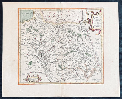
1628 Gerard Mercator & Henricus Hondius Antique Map the Picardy Region of France
- Title : France Picardie Champagne cum regionibus adiacentibus
- Size: 21in x 17in (530mm x 430mm)
- Condition: (A) Very Good Condition
- Date : 1628
- Ref #: 26131
Description:
This original copper plate engraved hand coloured antique map of the French region of Picardy or Picardie by Gerard Mercator was published by Henricus Hondius in the early 1628 French edition of Gerard Mercators Atlas.
These maps, published in the early editions of Mercators atlas, are the original maps drawn and engraved by Gerald Mercator in the mid to late 16th century, published by his son Rumold as an atlas, after his death, in 1595. After two editions the plates were purchased by Jodocus Hondius in 1604, and continued to be published until the end of the 1630s by Henricus Hondius, when some of the plates were re-engraved and updated with the help of Jan Jansson.
General Definitions:
Paper thickness and quality: - Heavy and stable
Paper color : - off white
Age of map color: -
Colors used: -
General color appearance: -
Paper size: - 21in x 17in (530mm x 430mm)
Plate size: - 18 1/2in x 14in (475mm x 350mm)
Margins: - Min 1/2in (12mm)
Imperfections:
Margins: - Light age toning
Plate area: - Light toning along centerfold
Verso: - Light age toning
Background:
Picardy is a historical territory and a former administrative region of Northern France and now part of the new region Nord-Pas-de-Calais-Picardie.
From the 5th century the area was part of the Frankish Empire, and in the feudal period it encompassed the six countships of Boulogne, Montreuil, Ponthieu, Amiénois,Vermandois, and Laonnois. According to the 843 Treaty of Verdun the region became part of West Francia, the later Kingdom of France.
The name Picardy (which may have referred to a Frankish tribe of picards or pike-bearers) was not used until the 12th or 13th century. During this time, the name applied to all lands where the Picard language was spoken, which included all the territories from Paris to the Netherlands. In the Latin Quarter of Paris, people identified a Picard Nation (Nation Picarde) of students at Sorbonne University, most of whom actually came from Flanders. During the Hundred Years\\\' War, Picardy was the centre of the Jacquerie peasant revolt in 1358.
From 1419 onwards, the Picardy counties (Boulogne, Ponthieu, Amiens, Vermandois) were gradually acquired by the Burgundian duke Philip the Good, confirmed by King Charles VII of France at the 1435 Congress of Arras. In 1477, King Louis XI of France led an army and occupied key towns in Picardy. By the end of 1477, Louis would control all of Picardy and most of Artois.
In the 16th century, the government (military region) of Picardy was created. This became a new administrative region of France, separate from what was historically defined as Picardy. The new Picardy included the Somme département, the northern half of the Aisne département, and a small fringe in the north of the Oise département.
In 1557, Picardy was invaded by Hapbsburg forces under the command of Emmanuel Philibert, Duke of Savoy. After a seventeen-day siege, St. Quentin would be ransacked while Noyon would be burned by the Habsburg army.
In the 17th century, an infectious disease similar to English sweat originated from the region and spread across France. It was called Suette des picards or Picardy sweat.
Sugar beet was introduced by Napoleon I during the Napoleonic Wars in the 19th century, in order to counter the United Kingdom, which had seized the sugar islands possessed by France in the Caribbean. The sugar industry has continued to play a prominent role in the economy of the region.
One of the most significant historical events to occur in Picardy was the series of battles fought along the Somme during World War I. From September 1914 to August 1918, four major battles, including the Battle of the Somme, were fought by British, French, and German forces in the fields of Northern Picardy. (Ref: Koeman; M&B; Tooley)
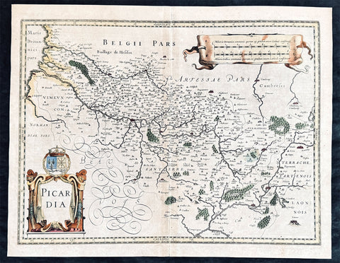
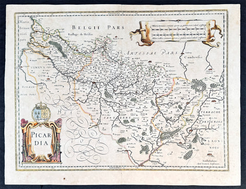
1628 Jan Jansson Antique Map of the Picardy or Picardie Region of France
- Title : Picardia
- Size: 22in x 17in (560mm x 430mm)
- Condition: (A) Very Good Condition
- Date : 1628
- Ref #: 26133
Description:
This original copper plate engraved hand coloured antique map of the French region of Picardy or Picardie by Jan Jansson was published in the early 1628 French edition of Janssons Atlas.
General Definitions:
Paper thickness and quality: - Heavy and stable
Paper color : - off white
Age of map color: - Later
Colors used: - Green, yellow, brown, blue, pink
General color appearance: - Authentic
Paper size: - 22in x 17in (560mm x 430mm)
Plate size: - 20in x 15in (510mm x 380mm)
Margins: - Min 1/2in (12mm)
Imperfections:
Margins: - Age toning
Plate area: - Age toning
Verso: - Age toning
Background:
Picardy is a historical territory and a former administrative region of Northern France and now part of the new region Nord-Pas-de-Calais-Picardie.
From the 5th century the area was part of the Frankish Empire, and in the feudal period it encompassed the six countships of Boulogne, Montreuil, Ponthieu, Amiénois,Vermandois, and Laonnois. According to the 843 Treaty of Verdun the region became part of West Francia, the later Kingdom of France.
The name Picardy (which may have referred to a Frankish tribe of picards or pike-bearers) was not used until the 12th or 13th century. During this time, the name applied to all lands where the Picard language was spoken, which included all the territories from Paris to the Netherlands. In the Latin Quarter of Paris, people identified a Picard Nation (Nation Picarde) of students at Sorbonne University, most of whom actually came from Flanders. During the Hundred Years\\\\\\\' War, Picardy was the centre of the Jacquerie peasant revolt in 1358.
From 1419 onwards, the Picardy counties (Boulogne, Ponthieu, Amiens, Vermandois) were gradually acquired by the Burgundian duke Philip the Good, confirmed by King Charles VII of France at the 1435 Congress of Arras. In 1477, King Louis XI of France led an army and occupied key towns in Picardy. By the end of 1477, Louis would control all of Picardy and most of Artois.
In the 16th century, the government (military region) of Picardy was created. This became a new administrative region of France, separate from what was historically defined as Picardy. The new Picardy included the Somme département, the northern half of the Aisne département, and a small fringe in the north of the Oise département.
In 1557, Picardy was invaded by Hapbsburg forces under the command of Emmanuel Philibert, Duke of Savoy. After a seventeen-day siege, St. Quentin would be ransacked while Noyon would be burned by the Habsburg army.
In the 17th century, an infectious disease similar to English sweat originated from the region and spread across France. It was called Suette des picards or Picardy sweat.
Sugar beet was introduced by Napoleon I during the Napoleonic Wars in the 19th century, in order to counter the United Kingdom, which had seized the sugar islands possessed by France in the Caribbean. The sugar industry has continued to play a prominent role in the economy of the region.
One of the most significant historical events to occur in Picardy was the series of battles fought along the Somme during World War I. From September 1914 to August 1918, four major battles, including the Battle of the Somme, were fought by British, French, and German forces in the fields of Northern Picardy. (Ref: Koeman; M&B; Tooley)
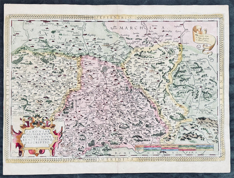
1575 Abraham Ortelius Antique Map of Saxony Eastern Germany & Western Poland
- Title : Saxoniae Misniae, Thuringiae, Nova Exactissimaq Descriptio
- Size: 20 1/2in x 15 1/2in (520mm x 390mm)
- Condition: (A+) Fine Condition
- Date : 1587
- Ref #: 30032
Description:
These original copper-plate engraved hand coloured antique map of the Saxony region of Germany, historically covering eastern Germany and Western Poland and Silesia (today Obersachsen, Meissen and Thuringen regions) was published in the 1575 French edition of Abraham Ortelius Atlas Theatrum Orbis Terrarum.
General Definitions:
Paper thickness and quality: - Heavy and stable
Paper color : - off white
Age of map color: - Later
Colors used: - Green, yellow, pink, blue
General color appearance: - Authentic
Paper size: - 20 1/2in x 15 1/2in (520mm x 390mm)
Plate size: - 20in x 13 1/2in (510mm x 345mm)
Margins: - Min 1/4in (4mm)
Imperfections:
Margins: - Light soiling
Plate area: - None
Verso: - Soiling
Background:
Ortelius regional map of Germany, showing the area between Berlin and Braunschweig in the north, to Prague in the south and Silesia in the east. With Chemnitz, Dresden, Leipzig, Wittenberg and Erfurt
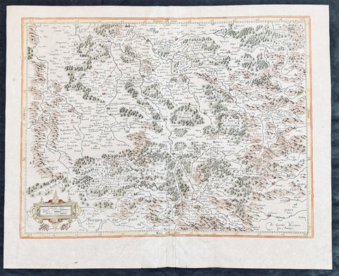
1628 Gerard Mercator Antique Map the Southern Lorraine Region of France
Antique Map
- Title : La Partie Meridionale de Lorraine...Per Geradum Mercatorem Cum Privilegio
- Size: 21in x 17in (530mm x 430mm)
- Condition: (B) Good Condition
- Date : 1628
- Ref #: 26142
Description:
This original copper plate engraved hand coloured antique map ancient region of southern Lorraine, France by Gerard Mercator was published by Henricus Hondius in the early 1628 French edition of Gerard Mercators Atlas.
These maps, published in the early editions of Mercators atlas, are the original maps drawn and engraved by Gerald Mercator in the mid to late 16th century, published by his son Rumold as an atlas, after his death, in 1595. After two editions the plates were purchased by Jodocus Hondius in 1604 and continued to be published until the mid 1630\\\'s when the plates were re-engraved and updated by Jan Jansson and Henricus Hondius.
General Definitions:
Paper thickness and quality: - Heavy and stable
Paper color : - off white
Age of map color: - Later
Colors used: - Green, yellow, pink, blue
General color appearance: - Authentic
Paper size: - 21in x 17in (530mm x 430mm)
Plate size: - 20in x 15in (510mm x 380mm)
Margins: - Min 1/2in (12mm)
Imperfections:
Margins: - Age toning, creasing
Plate area: - Age toning, creasing
Verso: - Age toning, creasing
Background:
Lorraine is a cultural and historical region in north-eastern France, now located in the administrative region of Grand Est. Lorraines name stems from the medieval kingdom of Lotharingia, which in turn was named for either Emperor Lothair I or King Lothair II. It later was ruled as the Duchy of Lorraine before the Kingdom of France annexed it in 1766.
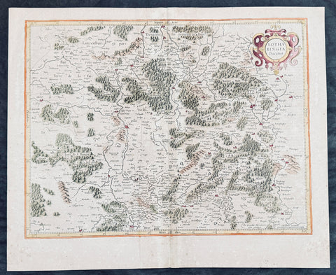
1628 Gerard Mercator Antique Map Lotharingia Region - Netherlands Germany France
Antique Map
- Title : Lotharingia Ducatus...Per Geradum Mercatorem Cum Privilegio
- Size: 21in x 17in (530mm x 430mm)
- Condition: (A) Very Good Condition
- Date : 1628
- Ref #: 26141
Description:
This original copper plate engraved hand coloured antique map of the historical region of Lotharingia region of present-day Netherlands, Belgium, Luxembourg, North Rhine-Westphalia (Germany), Rhineland-Palatinate (Germany), Saarland (Germany), and Lorraine (France) by Gerard Mercator was published by Henricus Hondius in the early 1628 French edition of Gerard Mercators Atlas.
These maps, published in the early editions of Mercators atlas, are the original maps drawn and engraved by Gerald Mercator in the mid to late 16th century, published by his son Rumold as an atlas, after his death, in 1595. After two editions the plates were purchased by Jodocus Hondius in 1604 and continued to be published until the mid 1630\\\'s when the plates were re-engraved and updated by Jan Jansson and Henricus Hondius.
General Definitions:
Paper thickness and quality: - Heavy and stable
Paper color : - off white
Age of map color: - Later
Colors used: - Green, yellow, pink, brown
General color appearance: - Authentic
Paper size: - 21in x 17in (530mm x 430mm)
Plate size: - 20in x 15in (510mm x 380mm)
Margins: - Min 1/2in (12mm)
Imperfections:
Margins: - Age toning
Plate area: - Age toning, light creasing
Verso: - Age toning
Background:
Lotharingia was a medieval successor kingdom of the Carolingian Empire, comprising the present-day Netherlands, Belgium, Luxembourg, North Rhine-Westphalia (Germany), Rhineland-Palatinate (Germany), Saarland (Germany), and Lorraine (France). It was named after King Lothair II who received this territory after the kingdom of Middle Francia of his father Lothair I was divided among his sons in 855.
Lotharingia was born out of the tripartite division in 855 of the kingdom of Middle Francia, which itself was formed after the threefold division of the Carolingian Empire by the Treaty of Verdun of 843. Conflict between East and West Francia over Lotharingia was based on the fact that these were the old Frankish homelands of Austrasia, so possession of them was of great prestige.
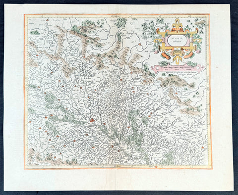
1628 Gerard Mercator & Henricus Hondius Antique Map the Alsace Region of France
- Title : Alsatia inferior..Per Gerardam Mercatorem Cum privilegio
- Size: 21in x 17in (530mm x 430mm)
- Condition: (A) Very Good Condition
- Date : 1628
- Ref #: 26113
Description:
This original copper plate engraved hand coloured antique map of the French region of Alsace by Gerard Mercator was published by Henricus Hondius in the early 1628 French edition of Gerard Mercators Atlas.
These maps, published in the early editions of Mercators atlas, are the original maps drawn and engraved by Gerald Mercator in the mid to late 16th century, published by his son Rumold as an atlas, after his death, in 1595. After two editions the plates were purchased by Jodocus Hondius in 1604, and continued to be published until the end of the 1630s by Henricus Hondius, when some of the plates were re-engraved and updated with the help of Jan Jansson.
General Definitions:
Paper thickness and quality: - Heavy and stable
Paper color : - off white
Age of map color: - Later
Colors used: - Green, blue, pink, yellow
General color appearance: - Authentic
Paper size: - 21in x 17in (530mm x 430mm)
Plate size: - 18 1/2in x 14in (475mm x 350mm)
Margins: - Min 1/2in (12mm)
Imperfections:
Margins: - Light age toning
Plate area: - Light toning along centerfold
Verso: - Light age toning
Background:
Alsace is a cultural and historical region in eastern France, on the west bank of the upper Rhine next to Germany and Switzerland.
As in much of Europe, the prosperity of Alsace came to an end in the 14th century by a series of harsh winters, bad harvests, and the Black Death. These hardships were blamed on Jews, leading to the pogroms of 1336 and 1339. In 1349, Jews of Alsace were accused of poisoning the wells with plague, leading to the massacre of thousands of Jews during the Strasbourg pogrom. Jews were subsequently forbidden to settle in the town. An additional natural disaster was the Rhine rift earthquake of 1356, one of Europes worst which made ruins of Basel. Prosperity returned to Alsace under Habsburg administration during the Renaissance.
Holy Roman Empire central power had begun to decline following years of imperial adventures in Italian lands, often ceding hegemony in Western Europe to France, which had long since centralized power. France began an aggressive policy of expanding eastward, first to the rivers Rhône and Meuse, and when those borders were reached, aiming for the Rhine. In 1299, the French proposed a marriage alliance between Philip IV of Frances sister Blanche and Albert I of Germanys son Rudolf, with Alsace to be the dowry; however, the deal never came off. In 1307, the town of Belfort was first chartered by the Counts of Montbéliard. During the next century, France was to be militarily shattered by the Hundred Years War, which prevented for a time any further tendencies in this direction. After the conclusion of the war, France was again free to pursue its desire to reach the Rhine and in 1444 a French army appeared in Lorraine and Alsace. It took up winter quarters, demanded the submission of Metz and Strasbourg and launched an attack on Basel.
In 1469, following the Treaty of St. Omer [fr], Upper Alsace was sold by Archduke Sigismund of Austria to Charles the Bold, Duke of Burgundy. Although Charles was the nominal landlord, taxes were paid to Frederick III, Holy Roman Emperor. The latter was able to use this tax and a dynastic marriage to his advantage to gain back full control of Upper Alsace (apart from the free towns, but including Belfort) in 1477 when it became part of the demesne of the Habsburg family, who were also rulers of the empire. The town of Mulhouse joined the Swiss Confederation in 1515, where it was to remain until 1798.
By the time of the Protestant Reformation in the 16th century, Strasbourg was a prosperous community, and its inhabitants accepted Protestantism in 1523. Martin Bucer was a prominent Protestant reformer in the region. His efforts were countered by the Roman Catholic Habsburgs who tried to eradicate heresy in Upper Alsace. As a result, Alsace was transformed into a mosaic of Catholic and Protestant territories. On the other hand, Mömpelgard (Montbéliard) to the southwest of Alsace, belonging to the Counts of Württemberg since 1397, remained a Protestant enclave in France until 1793.
This situation prevailed until 1639, when most of Alsace was conquered by France to keep it out of the hands of the Spanish Habsburgs, who by secret treaty in 1617 had gained a clear road to their valuable and rebellious possessions in the Spanish Netherlands, the Spanish Road. Beset by enemies and seeking to gain a free hand in Hungary, the Habsburgs sold their Sundgau territory (mostly in Upper Alsace) to France in 1646, which had occupied it, for the sum of 1.2 million Thalers. When hostilities were concluded in 1648 with the Treaty of Westphalia, most of Alsace was recognized as part of France, although some towns remained independent. The treaty stipulations regarding Alsace were complex. Although the French king gained sovereignty, existing rights and customs of the inhabitants were largely preserved. France continued to maintain its customs border along the Vosges mountains where it had been, leaving Alsace more economically oriented to neighbouring German-speaking lands. The German language remained in use in local administration, in schools, and at the (Lutheran) University of Strasbourg, which continued to draw students from other German-speaking lands. The 1685 Edict of Fontainebleau, by which the French king ordered the suppression of French Protestantism, was not applied in Alsace. France did endeavour to promote Catholicism. Strasbourg Cathedral, for example, which had been Lutheran from 1524 to 1681, was returned to the Catholic Church. However, compared to the rest of France, Alsace enjoyed a climate of religious tolerance.
France consolidated its hold with the 1679 Treaties of Nijmegen, which brought most remaining towns under its control. France seized Strasbourg in 1681 in an unprovoked action. These territorial changes were recognised in the 1697 Treaty of Ryswick that ended the War of the Grand Alliance.
The year 1789 brought the French Revolution and with it the first division of Alsace into the départements of Haut- and Bas-Rhin. Alsatians played an active role in the French Revolution. On 21 July 1789, after receiving news of the Storming of the Bastille in Paris, a crowd of people stormed the Strasbourg city hall, forcing the city administrators to flee and putting symbolically an end to the feudal system in Alsace. In 1792, Rouget de Lisle composed in Strasbourg the Revolutionary marching song La Marseillaise (as Marching song for the Army of the Rhine), which later became the anthem of France. La Marseillaise was played for the first time in April of that year in front of the mayor of Strasbourg Philippe-Frédéric de Dietrich. Some of the most famous generals of the French Revolution also came from Alsace, notably Kellermann, the victor of Valmy, Kléber, who led the armies of the French Republic in Vendée and Westermann, who also fought in the Vendée.
At the same time, some Alsatians were in opposition to the Jacobins and sympathetic to the restoration of the monarchy pursued by the invading forces of Austria and Prussia who sought to crush the nascent revolutionary republic. Many of the residents of the Sundgau made pilgrimages to places like Mariastein Abbey, near Basel, in Switzerland, for baptisms and weddings. When the French Revolutionary Army of the Rhine was victorious, tens of thousands fled east before it. When they were later permitted to return (in some cases not until 1799), it was often to find that their lands and homes had been confiscated. These conditions led to emigration by hundreds of families to newly vacant lands in the Russian Empire in 1803–4 and again in 1808. A poignant retelling of this event based on what Goethe had personally witnessed can be found in his long poem Hermann and Dorothea.
In response to the hundred day restoration of Napoleon I of France in 1815, Alsace along with other frontier provinces of France was occupied by foreign forces from 1815 to 1818, including over 280,000 soldiers and 90,000 horses in Bas-Rhin alone. This had grave effects on trade and the economy of the region since former overland trade routes were switched to newly opened Mediterranean and Atlantic seaports.
The population grew rapidly, from 800,000 in 1814 to 914,000 in 1830 and 1,067,000 in 1846. The combination of economic and demographic factors led to hunger, housing shortages and a lack of work for young people. Thus, it is not surprising that people left Alsace, not only for Paris – where the Alsatian community grew in numbers, with famous members such as Baron Haussmann – but also for more distant places like Russia and the Austrian Empire, to take advantage of the new opportunities offered there: Austria had conquered lands in Eastern Europe from the Ottoman Empire and offered generous terms to colonists as a way of consolidating its hold on the new territories. Many Alsatians also began to sail to the United States, settling in many areas from 1820 to 1850. In 1843 and 1844, sailing ships bringing immigrant families from Alsace arrived at the port of New York. Some settled in Texas and Illinois, many to farm or to seek success in commercial ventures: for example, the sailing ships Sully (in May 1843) and Iowa (in June 1844) brought families who set up homes in northern Illinois and northern Indiana. Some Alsatian immigrants were noted for their roles in 19th-century American economic development. Others ventured to Canada to settle in southwestern Ontario, notably Waterloo County.
1628 Jan Jansson Antique Map of the Picardy Region of France
- Title : Picardia
- Size: 22in x 17in (560mm x 430mm)
- Condition: (B) Good Condition
- Date : 1628
- Ref #: 50241
Description:
This original copper plate engraved hand coloured antique map of the French region of Picardy or Picardie by Jan Jansson was published in the early 1628 Latin edition of Janssons Atlas.
General Definitions:
Paper thickness and quality: - Heavy and stable
Paper color : - off white
Age of map color: - later
Colors used: - Green, blue, pink, yellow
General color appearance: - Authentic
Paper size: - 22in x 17in (560mm x 430mm)
Plate size: - 20in x 15in (510mm x 380mm)
Margins: - Min 1/2in (12mm)
Imperfections:
Margins: - Age toning
Plate area: - Age toning
Verso: - Age toning
Background:
Picardy is a historical territory and a former administrative region of Northern France and now part of the new region Nord-Pas-de-Calais-Picardie.
From the 5th century the area was part of the Frankish Empire, and in the feudal period it encompassed the six countships of Boulogne, Montreuil, Ponthieu, Amiénois,Vermandois, and Laonnois. According to the 843 Treaty of Verdun the region became part of West Francia, the later Kingdom of France.
The name Picardy (which may have referred to a Frankish tribe of picards or pike-bearers) was not used until the 12th or 13th century. During this time, the name applied to all lands where the Picard language was spoken, which included all the territories from Paris to the Netherlands. In the Latin Quarter of Paris, people identified a Picard Nation (Nation Picarde) of students at Sorbonne University, most of whom actually came from Flanders. During the Hundred Years\\\\\\\' War, Picardy was the centre of the Jacquerie peasant revolt in 1358.
From 1419 onwards, the Picardy counties (Boulogne, Ponthieu, Amiens, Vermandois) were gradually acquired by the Burgundian duke Philip the Good, confirmed by King Charles VII of France at the 1435 Congress of Arras. In 1477, King Louis XI of France led an army and occupied key towns in Picardy. By the end of 1477, Louis would control all of Picardy and most of Artois.
In the 16th century, the government (military region) of Picardy was created. This became a new administrative region of France, separate from what was historically defined as Picardy. The new Picardy included the Somme département, the northern half of the Aisne département, and a small fringe in the north of the Oise département.
In 1557, Picardy was invaded by Hapbsburg forces under the command of Emmanuel Philibert, Duke of Savoy. After a seventeen-day siege, St. Quentin would be ransacked while Noyon would be burned by the Habsburg army.
In the 17th century, an infectious disease similar to English sweat originated from the region and spread across France. It was called Suette des picards or Picardy sweat.
Sugar beet was introduced by Napoleon I during the Napoleonic Wars in the 19th century, in order to counter the United Kingdom, which had seized the sugar islands possessed by France in the Caribbean. The sugar industry has continued to play a prominent role in the economy of the region.
One of the most significant historical events to occur in Picardy was the series of battles fought along the Somme during World War I. From September 1914 to August 1918, four major battles, including the Battle of the Somme, were fought by British, French, and German forces in the fields of Northern Picardy. (Ref: Koeman; M&B; Tooley)
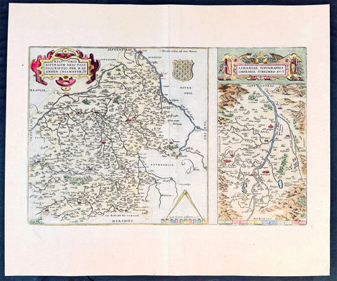
1612 Abraham Ortelius Antique Maps of Loire Valley, River & Alliers River France
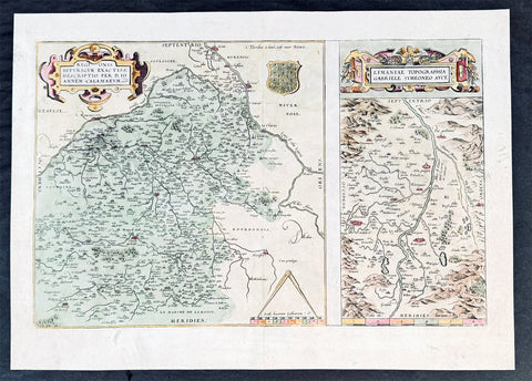
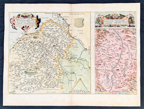
- Title : Regionis Biturigum Exactiss Descriptio per D. Ioannem Calamaeum. Limaniae Topographia Gabriele Symeoneo Auct. [The region of Berry exactly described by Jean Chameau. The topography around of Lyons by Gabriel Symeon]
- Size: 22in x 18 1/2in (560mm x 470mm)
- Condition: (A+) Fine Condition
- Date : 1612
- Ref #: 50228
Description:
This original copper-plate engraved hand coloured antique map, the first of the Loire River & Valley and the second of the Alliers River, was published by Abraham Ortelius in the 1612 Latin edition of Theatrum Orbis Terrarum.
These are two rare regional Abraham Ortelius maps on a single folio sheet. The Left Map, centered on Bourges, depicts the Loire Valley region from Gian to St. Sebastian in the south and from Le Blanc east as far as Nevers. Several important cities are noted, including Argenton, Neuers (Nevers), Bourges, Le Blang en Berry, Romarantin, Vierzon, Chasteau Neuf, and others. The right map follows the flow of the Alliers River from Randan to Gondole. Important cities, including Beauregard, Cleremont, among several others are noted. Each map features a decorative cartouche and details their respective regions in wonderful detail with attention to forests, cities, rivers and villages.
General Definitions:
Paper thickness and quality: - Heavy and stable
Paper color : - off white
Age of map color: -
Colors used: -
General color appearance: -
Paper size: - 22in x 18 1/2in (560mm x 470mm)
Plate size: - 19 1/2in x 12 1/2in (490mm x 310mm)
Margins: - Min 1in (25mm)
Imperfections:
Margins: - None
Plate area: - None
Verso: - None
Background:
The Loire Valley spanning 280 kilometres , is located in the middle stretch of the Loire River in central France, in both the administrative regions Pays de la Loire and Centre-Val de Loire. The area of the Loire Valley comprises about 800 square kilometres. It is referred to as the Cradle of the French and the Garden of France due to the abundance of vineyards, fruit orchards (such as cherries), and artichoke, and asparagus fields, which line the banks of the river. Notable for its historic towns, architecture, and wines, the valley has been inhabited since the Middle Palaeolithic period.
The Allier is a river in central France. It is a left tributary of the Loire. Its source is in the Massif Central, in the Lozère department, east of Mende. It flows generally north. It joins the Loire west of the city of Nevers.
1575 Abraham Ortelius Antique Maps of Loire Valley, River & Alliers River France
- Title : Regionis Biturigum Exactiss Descriptio per D. Ioannem Calamaeum. Limaniae Topographia Gabriele Symeoneo Auct. [The region of Berry exactly described by Jean Chameau. The topography around of Lyons by Gabriel Symeon]
- Size: 21in x 19 1/2in (535mm x 495mm)
- Condition: (A+) Fine Condition
- Date : 1575
- Ref #: 50228-1
Description:
These original copper-plate engraved hand coloured antique maps, the first of the Loire River & Valley and the second of the Alliers River, was published by Abraham Ortelius in the 1575 French edition of Theatrum Orbis Terrarum.
These are two rare regional Abraham Ortelius maps on a single folio sheet. The Left Map, centered on Bourges, depicts the Loire Valley region from Gian to St. Sebastian in the south and from Le Blanc east as far as Nevers. Several important cities are noted, including Argenton, Neuers (Nevers), Bourges, Le Blang en Berry, Romarantin, Vierzon, Chasteau Neuf, and others. The right map follows the flow of the Alliers River from Randan to Gondole. Important cities, including Beauregard, Cleremont, among several others are noted. Each map features a decorative cartouche and details their respective regions in wonderful detail with attention to forests, cities, rivers and villages.
General Definitions:
Paper thickness and quality: - Heavy and stable
Paper color : - off white
Age of map color: - Later
Colors used: - Green, blue, pink, yellow
General color appearance: - Authentic
Paper size: - 21in x 19 1/2in (535mm x 495mm)
Plate size: - 19 1/2in x 12 1/2in (490mm x 310mm)
Margins: - Min 1/8in (2mm)
Imperfections:
Margins: - None
Plate area: - None
Verso: - None
Background:
The Loire Valley spanning 280 kilometres , is located in the middle stretch of the Loire River in central France, in both the administrative regions Pays de la Loire and Centre-Val de Loire. The area of the Loire Valley comprises about 800 square kilometres. It is referred to as the Cradle of the French and the Garden of France due to the abundance of vineyards, fruit orchards (such as cherries), and artichoke, and asparagus fields, which line the banks of the river. Notable for its historic towns, architecture, and wines, the valley has been inhabited since the Middle Palaeolithic period.
The Allier is a river in central France. It is a left tributary of the Loire. Its source is in the Massif Central, in the Lozère department, east of Mende. It flows generally north. It joins the Loire west of the city of Nevers.
1628 Gerard Mercator & Henricus Hondius Antique Map of Westphalia, Germany
- Title : Tabula Seconde Westphalia...Per Geradum Mercatorem Cum Privilego...1627
- Size: 21in x 17in (530mm x 430mm)
- Condition: (A) Very Good Condition
- Date : 1628
- Ref #: 26109
Description:
This original copper plate engraved hand coloured antique map of the Westphalia region of North Rhine-Westphalia, Germany, by Gerard Mercator was published by Henricus Hondius in the early 1628 French edition of Gerard Mercators Atlas.
These maps, published in the early editions of Mercators atlas, are the original maps drawn and engraved by Gerald Mercator in the mid to late 16th century, published by his son Rumold as an atlas, after his death, in 1595. After two editions the plates were purchased by Jodocus Hondius in 1604 and continued to be published until the mid 1630s by Henricus, when some of the plates were re-engraved and updated by Jan Jansson and Henricus Hondius.
General Definitions:
Paper thickness and quality: - Heavy and stable
Paper color : - off white
Age of map color: - Later
Colors used: - Green, blue, pink, yellow
General color appearance: - Authentic
Paper size: - 21in x 17in (530mm x 430mm)
Plate size: - 18 1/2in x 14in (475mm x 350mm)
Margins: - Min 1/2in (12mm)
Imperfections:
Margins: - Light age toning
Plate area: - Light toning along centerfold
Verso: - Light age toning
Background:
While the Northern Rhineland, Westphalia and Lippe are different historic territories of todays North Rhine-Westphalia, the old border between the former Rhine Province and the Province of Westphalia is also a language border. While in Westphalia and Lippe, people tend to speak West Low German dialects and especially the Westphalian variant of the Low German language, Central German and Low Franconian dialects are being spoken in the Northern Rhineland.
Westphalia is known for the 1648 Peace of Westphalia which ended the Thirty Years War, as the two treaties were signed in Münster and Osnabrück.
It is one of the regions that were part of all incarnations of the German state since the Early Middle Ages: the Holy Roman Empire, the Confederation of the Rhine, the German Confederation, the North German Confederation, the German Empire, the Weimar Republic and National Socialist Germany. After World War II it was a part of the British occupation zone which merged with the American zone to become the Bizone in 1947 and again merged with the French zone to become the Trizone in 1948. The current Federal Republic of Germany was founded on these territories making Westphalia a part of West Germany. It is a part of united Germany since 1990.
1575 Abraham Ortelius Antique Maps of Loire Valley, River & Alliers River France
- Title : Regionis Biturigum Exactiss Descriptio per D. Ioannem Calamaeum. Limaniae Topographia Gabriele Symeoneo Auct. [The region of Berry exactly described by Jean Chameau. The topography around of Lyons by Gabriel Symeon]
- Size: 22in x 18 1/2in (560mm x 470mm)
- Condition: (A+) Fine Condition
- Date : 1575
- Ref #: 30021
Description:
These original copper-plate engraved hand coloured antique maps, the first of the Loire River & Valley and the second of the Alliers River, was published by Abraham Ortelius in the 1575 French edition of Theatrum Orbis Terrarum.
These are two rare regional Abraham Ortelius maps on a single folio sheet. The Left Map, centered on Bourges, depicts the Loire Valley region from Gian to St. Sebastian in the south and from Le Blanc east as far as Nevers. Several important cities are noted, including Argenton, Neuers (Nevers), Bourges, Le Blang en Berry, Romarantin, Vierzon, Chasteau Neuf, and others. The right map follows the flow of the Alliers River from Randan to Gondole. Important cities, including Beauregard, Cleremont, among several others are noted. Each map features a decorative cartouche and details their respective regions in wonderful detail with attention to forests, cities, rivers and villages.
General Definitions:
Paper thickness and quality: - Heavy and stable
Paper color : - off white
Age of map color: - Later
Colors used: - Green, blue, pink, yellow
General color appearance: - Authentic
Paper size: - 22in x 18 1/2in (560mm x 470mm)
Plate size: - 19 1/2in x 12 1/2in (490mm x 310mm)
Margins: - Min 1in (25mm)
Imperfections:
Margins: - Light soiling
Plate area: - None
Verso: - Soiling
Background:
The Loire Valley spanning 280 kilometres , is located in the middle stretch of the Loire River in central France, in both the administrative regions Pays de la Loire and Centre-Val de Loire. The area of the Loire Valley comprises about 800 square kilometres. It is referred to as the Cradle of the French and the Garden of France due to the abundance of vineyards, fruit orchards (such as cherries), and artichoke, and asparagus fields, which line the banks of the river. Notable for its historic towns, architecture, and wines, the valley has been inhabited since the Middle Palaeolithic period.
The Allier is a river in central France. It is a left tributary of the Loire. Its source is in the Massif Central, in the Lozère department, east of Mende. It flows generally north. It joins the Loire west of the city of Nevers.
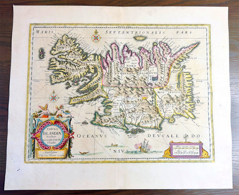
1607 Mercator, Hondius & Thorlaksson Antique Map of Iceland - Islandia
Antique Map
- Title : Islandia
- Ref #: 51000
- Size: 21 1/2in x 16in (545mm x 405mm)
- Date : 1607
- Condition: (A) Very Good Condition
Description:
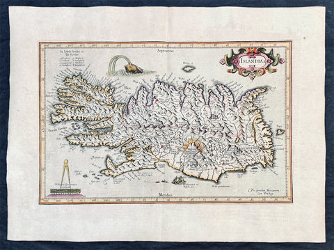
This original hand coloured copper-plate engraved antique early map of Iceland was published in the 1607 French edition of the Mercator Hondius Atlas sive Cosmographicae.
This is only the second map of Iceland after the 1590 map by Abraham Ortelius. This map was originally published by Mercator in 1595.
Condition Report:
Paper thickness and quality: - Heavy and stable
Paper color: - off white
Age of map color: - Original
Colors used: - Yellow, red, green, orange, blue
General color appearance: - Authentic
Paper size: - 21 1/2in x 16in (545mm x 405mm)
Plate size: - 17 1/4in x 11 1/4in (438mm x 285mm)
Margins: - Min 2in (50mm)
Imperfections:
Margins: - Light age toning
Plate area: - Small repair to scale
Verso: - Small repair to right margin
Background:
The geography of this famous Mercator map of Iceland derives – along with the Ortelius map - from a map by Gudbrandur Thorlaksson, Bishop of Holar and author of the first complete Icelandic translation of the Bible (“Gudbrandsbiblia”). As Mercator's “Islandia” was issued five years later than Ortelius' “Islandia” the question is whether Mercator's map is based on the map of Ortelius or directly from the same source, Gudbrandur's map which no longer exists.
"There is absolutely no doubt that this map is made from the same copy as the map by Ortelius, or one closely resembling it. The correspondences between both versions seem all to point in the same direction, namely that the limitations derive to a considerable extent from bishop Gudbrandur's original". And further: "We have no means of knowing how bishop Gudbrandur's map came into the hands of Mercator. He and Ortelius had been life-long friends, and there was probably some cooperation between them" ( islandskort.is ). More information on the speculations about the origin of both maps is to be found in islandskort.is.
A comparison of the geographical positioning and the shape of Iceland leads to the result that the figures of latitude and longitude are not exactly the same on the maps of Ortelius and Mercator. The latter “puts the country more to the north than Ortelius and thus increases the error” ( islandskort.is ). In both maps the country is more angular than the line of the country justifies and the coasts are drawn too straight. The uninhabited parts of the country are largely ignored and compressed so that the distances between the north and the south of the country are far too short.
The Mercator map has considerably more names, almost 300 in all. "Some of them must certainly derive from the bishop but others are of more doubtful nature and have no other function than to increase the total number... As far as place names are concerned Mercator seems to have departed further from the original than Ortelius" islandskort.is ), eg for Thingvellir, the famous site of the Althing, Ortelius uses "Finguollur" and Mercator "Bingnottr".
Mercator's map has a decorative strapwork title cartouche in the upper right corner supplemented by the information on the author: “Per Gerardum Mercatorem cum Privilegio” in lower right corner and a distance scale topped with dividers in the lower left quadrant. In the upper left there is a headline “In Iokuls fiorder et Isa fiorder” with numbers and fjord names and underneath which explain the position of fjords in the northwestern part of Iceland. In the ocean south of Reykjanes peninsula two short notes are to be found which mean: Springs change the color of wool (from black to white on the left, from white to black on the right), as in Ortelius' map.
What particularly catches the eye is the fire spewing Hekla. The text says: “Hekli pial Hekla mons perpetuo ardens” (Hekla perpetually burning”). Amongst the place-names are the bishoprics Skalholt (“Episcopalis Sedes et Schola”) and “Halar” (Holar) (“Sedes episcopalis et schola”). Some of the glaciers (“hökel”) on the highlands are marked but surprisingly Vatnajökull, the largest glacier in Europe, is missing while the glacier “Hnannadalr hökel” is depicted which could stand for “Hvannadalshnukur”, the summit crater of Oreafajökull, the southern extremity of Vatnajökull. (Ref: Burden; Koeman; Tooley; M&B)
Guðbrandur Þorláksson or Gudbrand Thorlakssøn (c. 1542 - July 20 1627) was bishop of Hólar, Iceland from April 1571 until his death. He was the longest-serving bishop in Iceland. He is known for printing the first complete Icelandic translation of the Bible, and for providing the data for the first accurate maps of Iceland, printed at the end of the sixteenth century by Ortelius and Mercator. He was the son of the priest Þorláks Hallgrímssonar, and Helga Jónsdóttir, daughter of the lawyer Jón Sigmundsson. He studied at Hólar College from 1553 to 1559 before studying theology and logic at the University of Copenhagen: Guðbrandur was one of the first Icelanders to study in Denmark instead of in Germany. He returned to Iceland in 1564 to serve as rector of the Skálholt School before becoming a priest. In 1571 he was named Bishop of Hólar by the Danish King Frederick II; he would serve as bishop of Hólar for 56 years. As bishop, Guðbrandur focused on printing religious works - including hymns, and the Bible - in Icelandic. He printed nearly 100 books - many of which he wrote and translated himself. In addition to cementing the Reformation firmly in Iceland, his efforts to accurately translate these works are credited with fundamentally strengthening the Icelandic language overall.
A well-rounded scholar, Guðbrandur maintained interests in natural history, astronomy, and surveying. He is credited with the drafting of at least one new map of Iceland, upon which the first printed maps of the Island by Abraham Ortelius and Gerard Mercator were based.
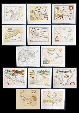
1662 Blaeu & Barlaeus Complete Set of 13 x Antique Maps of South America
Antique Map
- Titles:
1. Terra Firma
2. Venezuela
3. Guiana
4. Peru
5. Chili
6. Brasilia
7. Paraquaria
8. Tabula Magellanica
9. Preafecturae Paranambucae Prs Borealis
10. Praefecturae De Paraiba et Rio Grande
11. Praefectura De Ciriii vel Seregippe
12. Praefectura Paranambucae Pars Meridionalis
13. Sinus Omnium Sanctoru - Sizes: 24in x 20 1/2in (610mm x 520mm)ea
- Condition: (A) Very Good to Fine Condition
- Date: 1662
- Ref #: BlaeuSA 1662
Description:
This is a unique opportunity to acquire a complete set of the 13 maps of South America, including the 4 rare uniform Blaeu-Barleus maps of the Coast of Brazil, published by Joan Blaeu in his monumental & rare 1st 1662 Atlas, Latin edition of Atlas Major.
All paper in imprinted with a large Elephant watermark donating german paper from the 1660s.
The maps cover the full geographical area from North to South, South America from Panama to Tierra Firma. Please see the background section below for details of each map. All maps have wide original margins & colour on strong sturdy paper.
Joan Blaeus 11 volumes of Atlas Major, is considered by many to be the greatest atlas set ever published. It excels in comprehensiveness, engraving, color, and overall production. The first edition was published in Latin in 1662 and was subsequently published in French, Dutch, German, and Spanish over the next 10 years.
On the 23rd of February 1672, a fire broke out in central Amsterdam, that ended the reign of one of the greatest & most prolific publishers of printed maps and atlases in publishing history. The Blaeu family had reached its zenith 10 years previously, with the publication of its greatest achievement, the Atlas Major or Great Atlas, consisting of 11 volumes, with geographical detail reflecting many of the achievements of the Golden Age of the United Netherlands. Blaeus Atlas Major were the most expensive books printed in the 17th century.
General Definitions:
Paper thickness and quality: - Heavy and stable
Paper color : - off white
Age of map color: - Original
Colors used: - Blue, pink, red, green, yellow
General color appearance: - Authentic
Paper size: - 24in x 20 1/2in (610mm x 520mm)
Plate size: - Various, pls see below
Margins: - Min 1in (25mm) min
Imperfections:
Margins: - Pls see below
Plate area: - Pls see below
Verso: - Pls see below
Background:
1. Terra Firma - This regional map of the north eastern corner of South America belongs to the early group of plates printed by Willem Blaeu from 1630 onwards. It covers modern Colombia, part of Venezuela and Panama.
Plate: 19in x 14 1/2in.
Condition: Very light age toning
2. Venezuela - This map showing the area of modern Venezuela to the north of the Orinoco valley is another of the early plates of the 1630s. It extends from Lago dee Maracaibo in the west to the Island of Trinidad in the east and also shows the Dutch held Islands of Curacao, Aruba and Bonaire which served as a base of the Geotroyeerde West Indische Compaagnie (or Netherlands West Indian Company) since 1634.
Plate: 18 3/4in x 14 1/2in
Condition: Age toning, printers crease along centerfold, 8 small worm holes.
3. Guiana - This handsome map, another of the Blaeu maps of 1630, extendends from the Isla Margarita in the north-west to the coast of Northern Brazil near Sao Luis east of the Amazonas delta. The interior is dominated by a large island sea , the Parime Lacus, on whose north wesstern shores lies the fabled city of Manoa, de el Dorado, golden City of the Inca.
Plate: 19 1/4in x 14 1/2in
Condition: Light age toning
4. Peru - Here willem Blaeu, this map being part of Pacific Coast of South America from Ecuador (at the left hand side) as far south as the Atacama desert in the northern reaches of Chile.
Plate: 19 1/4in x 14 3/4in
Condition: Light age toning
5. Chili - This is another of Willem Blaeus early group f maps showing the coastal region of Central Chile from Copiapo in the north as far as a point to the south of the island of Chiloe.
Plate: 16 3/4in x 14in
Condition: Light age toning
6. Brasilia - Oriented west to the top of the plate, this general map of Brazil was an early product of Joan Blaeu himself, made after he had assumed full control of the publishing house following the death of his father a few years earlier.
This plate was made to replace the De Laet derivative which Willem had acquired from the Hondius plate stock in 1629 and is considerably more detailed than its earlier name sake.
Plate: 19 1/2in x 15 1/4in
Condition: Light age toning
7. Paraquaria - First map of Paraguay published first in this 1662 Atlas Major and so rare only published for 10 years or so.
Plate: 21 1/2in x 19 1/2in
Condition: Light age toning
8. Tabula Magellanica - Beautifully engraved map of the Magellan Straits first published in 1635
Plate: 19in x 16 1/2in
Condition: Light age toning
9. Preafecturae Paranambucae Prs Borealis
10. Praefecturae De Paraiba et Rio Grande
11. Praefectura De Ciriii vel Seregippe
12. Praefectura Paranambucae Pars Meridionalis
These 4 beautiful uniform maps are quite unlike any other maps found in Blaeu's Atlas Major.
Although they first appeared in the atlas for in 1662, these 4 maps first appeared in another earlier work published by Blaeu, the Rerum per octennium in Brasilia (1647) by the Remonstrant theologian Casper van Baerle (or Barlaeus) who died very soon afterwards in 1648.
Barlaeus great work, still one of the most valuable sources for Brazilian history, was published under the auspices of the Dutch governor in Brazil, Johan Maurits of Nassau Siegen, whose governorship from 1637 to 1644 Barlaeus describes in a eulogistic but nevertheless impartial account compiled from official sources.
The large pictorial vignettes of this group of maps illustrate much about local life and conditions of the time: in Preafecturae Paranambucae Prs Borealis & Praefecturae De Paraiba et Rio Grandea is shown processions of Indians from a mission, illustrated after paintings of the artist Frans Janszoon Post (1612 - 1680) who was with Johan Maurits in Brazil during the years 1637 - 1644. The buildings depicted have not been identified with any certainty but must have been in or near Pernambuco
Plates:
(9) 21in x 16 1/2in
(10) 21in x 16 1/2in
(11) 21in x 16 1/2in
(12) 17 1/2in x 16 1/2in
Conditions:
(9) Light age toning
(10) Light age toning
(11) Light age toning
(12) Light age toning
13. Sinus Omnium Sanctoru
Beautiful map of the Bahia De Todos Sanctos (All Saints Bay) in Brazil, with a large inset plan of the City of Sao Salvador.
Plate: 20in x 15 1/2in
Condition: Age toning
Caspar Barlaeus (1584 – 1648) was a Dutch polymath and Renaissance humanist, a theologian, poet, and historian.
Born Caspar (Kaspar) van Baerle in Antwerp, Barlaeus' parents fled the city when it was occupied by Spanish troops shortly after his birth. They settled in Zaltbommel, where his father eventually would become head of the Latin school. Caspar studied theology and philosophy at the University of Leiden. After his study, he preached for 1.5 years in the village of Nieuwe-Tonge, before returning to Leiden in 1612 as an under-regent of a college. From 1617 he also was professor in philosophy at the university. Because of his remonstrant sympathies, he was forced out of this job in 1619. He then studied and graduated in medicines (in Caen), but never practiced professionally.
From 1631, he was professor of philosophy and rhetoric at the Amsterdam Athenaeum, Athenaeum Illustre), which is commonly regarded as the predecessor of the University of Amsterdam; the Athenaeum had its seat in the fourteenth-century Agnietenkapel. In January 1632, Barlaeus, along with Gerard Vossius, held his inaugural speech at the Amsterdam Atheneum. Barlaeus later encouraged Martinus Hortensius to lecture –and give an inaugural speech- at the same Institution. One of his huge patrons was Amsterdam burgomaster Andries de Graeff, his neighbor at Oudezijds Achterburgwal.
Barlaeus suffered from mental illness including the delusion that he was made of glass (the Glass delusion) though Gill Speak refers to his glass delusion as ‘unsubstantiated’
Barlaeus published many volumes of poetry, particularly Latin poetry. He also wrote the eulogy that accompanies the 1622 portrait of cartographer Willem Blaeu.
Barlaeus was involved in various aspects of cartography and history. He translated Antonio de Herrera's Description of the West Indies in 1622. In 1627, Barlaeus provided the text for the atlas of Italy created by Jodocus Hondius. In 1647, he wrote an account of the Dutch colonial empire in Brazil, inspired by the leadership of John Maurice of Nassau (Johan Maurits) at Recife. The Rerum per octennium in Brasilia et alibi nuper gestarum sub praefectura, as it is called, contains numerous maps and plates of the region. The engravings of Brazilian northeastern locales, fleets, battles, and maps were for 160 years the main references to Brazilian landscapes available in Europe, and are well known by Brazilians today as the most important examples of pre-national art. Franciscus Plante wrote a similar work in the same year called Mauritias, and included the maps already published in Barlaeus' work. These were maps of Ceará, Pernambuco, Paraíba, and Pernambuco Borealá. Plante also incorporated a portrait of John Maurice that had already been included in Barlaeus' work.
In 1638, Barlaeus wrote Medicea Hospes, sive descriptio publicae gratulationis, qua ... Mariam de Medicis, excepit senatus populusque Amstelodamensis. Published by Willem Blaeu, it includes two large folding engraved views of the ceremonies on the occasion of the French queen mother Marie de Medici's triumphal entry into Amsterdam in 1638. Considered an important moment in Dutch history, Marie's visit lent de facto international recognition of the newly formed Dutch Republic. Marie de Medici actually traveled to the Netherlands as exile, but spectacular displays and water pageants took place in the city's harbor in celebration of her visit. There was a procession led by two mounted trumpeters; a large temporary structure erected on an artificial island in the Amstel River was built especially for the festival. This building was designed to display a series of dramatic tableaux in tribute to her once she set foot on the floating island and entered its pavilion.
Please note all items auctioned are genuine, we do not sell reproductions. A Certificate of Authenticity (COA) can be issued on request.
1820 Pierre Francois Tardieu Large Rare Antique Map of Texas, Mexico - Southern Sheet
Antique Map
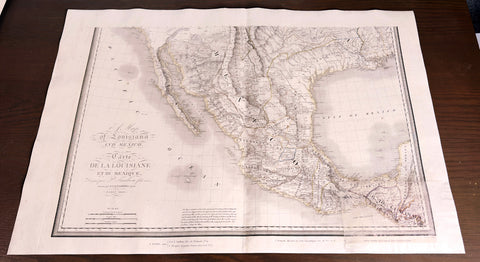
- Title: A Map of Louisiana and Mexico - Carte de la Louisiane et du Mexique, Dressee par P Tardieu fils aine, gravee par PAF Tardieu pere. Paris 1820.
- Sizes: 36in x 24in (910mm x 610mm)
- Condition: (A) Good Condition
- Date: 1820
- Ref #: 93009
Description:
This rare, original large hand coloured, antique copper plate engraved map of Texas, SW America & Mexico (sheet 2 of 2 southern portion) by Pierre Francois Tardieu and Charles Picquet (1771 - 1827) was engraved in 1820 - dated - and published by J Goujon, Paris.
This map is incredibly important in the history of Mexico, Texas and the United States a time of big political and international change in both countries. (Ref: M&B; Tooley)
General Definitions:
Paper thickness and quality: - Heavy and stable
Paper color : - off white
Age of map color: - Original
Colors used: - Yellow, green, blue, pink
General color appearance: - Authentic
Paper size: - 36in x 24in (910mm x 610mm)
Plate size: - 32 1/2in x 22 1/2in (860mm x 570mm)
Margins: - Min 1/2in (12mm)
Imperfections:
Margins: - Bottom left corner replaced in facsimile
Plate area: - Bottom left corner replaced in facsimile
Verso: - Bottom left corner replaced in facsimile
To be more precise the maps are;
1. Alexander von Humboldt 1811 - "A New Map of Spain"
2. Z M Pike 1810 - "A Map of The Internal Provinces of New Spain"
3. Lewis and Clark 1814 - "Map of Lewis and Clark's Track, Across the Western Portion of North America"
4. Aaron Arrowsmith 1816 - "A New Map of Mexico"
5. John Melish 1816 - "Map of The United States"
By themselves each of these maps had a profound affect on the understanding of the region and the eventual expansion of the United States. Tardieus compared, analysed & combined the correct data from each map, as well as new information from other sources, and publish a large scale map stretching from the edge of the established western United States to Texas, Mexico, California & the southwest.
Another unique quality of the map is the use of English in a French published map. Not only is the title in English first, but most of the place names and observations are also written in English. Very unusual for a French map of the period, which illustrates how shrewd Tardieu was, marketing the map to the newly independent American home market.
Because there is 10 years difference between publication of these maps, each had their own mistakes and idiosyncrasies. For instance, although De Humboldt spent many months in Mexico researching for his book and maps of New Spain, he eventually used the wrong observations of Gen. James Wilkinson on the depiction of the Texas rivers, giving them too much southerly direction. Pike on the other hand explored parts of Texas himself and depicted the rivers in their correct SE direction, but Pike's delineation of the Texas coast followed the incorrect Jeffery's model instead of the far superior & up to date model used by Humboldt from Mexican data.
Arrowsmith's approach to cartography differed again from both Humboldt's and Pikes. He used data from various different sources, rather than predominately from a single source and scientific hypothesis as did Humboldt, or the more direct military reconnaissance approach of Pike. There is no doubt that Arrowsmith borrowed heavily from both Humboldt's & Pikes maps of Texas, but what makes his map a stand out is the use of data and observations from sources such as the Hudson Bay Company to expanded his map to include more of Louisiana, California and the NW.
The Lewis and Clark Expedition of 1804-06 gained an understanding of the geography of the west & northwest and produced the first accurate maps of the region. During the journey, Lewis and Clark drew some 140 maps. The discoveries made on the expedition helped Tardieu update many details of his map. One detail of significance was the relationships and sources of the Columbia & Missouri Rivers as well as the previously underestimated domination of the Rocky Mountains.
The large Melish map of 1816 stretching from the East Coast to California was of vital importance to Tardieus map. It gave him the boundaries agreed to by the Adams-Onis treaty between Spain & The United States in which the US gave up its claims to Texas in exchange for Spain's claim on Florida. Melish's Philadelphia publishing company was also one of the first in the newly independent US to be devoted to the publication of cartographical material. He had recognised the potential of expansion into the west and so accumulated vast amounts of detail in which to include in his extremely popular 1816 large 6 sheet map. He also included data from William Darby who had personally surveyed the Sabine River & other parts of Texas. Melish published Darby's map of The State of Louisiana in 1816.
The progression of maps from Humboldt's to Pike & Arrowsmith's is obvious and with the publication of the Lewis & Clark map of the West in 1814 & the large scale America map by John Melish in 1816, Tardieu was in a unique position to produce an accurate and definite map that combined details from all maps.
In the end, Tardieu's map of Texas, Mexico and the West may be seen as a natural progression from previous cartographical iteration. But the sign of a incisive mind is the ability to research and define the mistakes of others and have the conviction to correct popular belief and to publish, in this case to a growing and emerging market.
There are only 2 published sales of this map in AMPR in the last 25 years. There are sales of the southern sheet of two (in its other form) but none of the northern sheet. In comparison there are 7 sales records of Von Humboldts map with a top price of $22,500. One sales record for Lewis & Clark of $18,000 in 2006. Four sales of Arrowsmith's map with a top of $39,100 & 10 sales of the Melish map with a top price of $75,000 in 2008. (Ref: Wheat; Martin; Streeter; M&B; Tooley)
Please note all items auctioned are genuine, we do not sell reproductions. A Certificate of Authenticity (COA) can be issued on request.
1639 Henricus Hondius & John Smith Antique Map of Virginia, America - Pocahontas
Antique Map
- Title : Nova Virginiae Tabula
- Date : 1639
- Condition: (A) Good Condition
- Ref: 43163-1
- Size: 22 1/2in x 19in (570mm x 480mm)
Description:
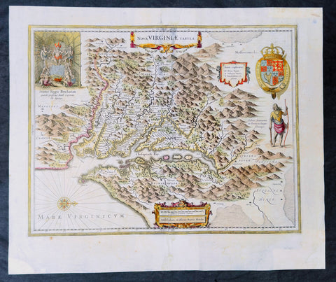
This original antique hand coloured map of Chesapeake Bay, Virginia by Henricus Hondius was published in the 1639 French edition of Mercators Atlas.
This map by Henricus Hondius comes from the John Smith map of Virginia originally engraved by his father Joducus, directly from John Smith's map. It is the only map on the market that is unchanged from his original map of Virginia.
This map has undergone some professional restoration but is still complete. A full description below
His map was the first to depict, with reasonable accuracy, Chesapeake Bay with its tributaries and became the accepted prototype map for most subsequent maps of the colony published either in Britain or Europe during the remainder of the 17th century.
Captain Smiths maps acted as a promotional piece for the vast area of North America called Virginia and it exerted a great influence of the history of English colonisation in America.
John Smith (1579-1631) was the foremost English settler in Virginia. His many adventures included being captured several times, defeating an Indian chief in hand to hand combat as well as the celebrated incident in which Pocahontas saved him from Powhatan who is himself the subject of the portrait at the upper left hand corner of Blaeus map.
While the geographical detail of the map shows information accurate at the time of Smiths travels, earlier descriptions of Virginia are recalled. When Smiths map appeared in 1612, the engraver turned to an engraving by the German Theodor de Bry based on the drawings made by John White in the 1580s for the portrait of Powhatan, and the figure of an Indian in war paint at the right to represent the Susquehanna chief. All of these elements were combined by the Amsterdam engraver Dirk Grijp for the Dutch version of Smiths map as issued by the Hondius firm in 1618. Thus, when Blaeu purchased the plate it was already a decade old and it was issued unchanged except for his imprint and a few very small retouches until the 1660s. The Blaeu derivative was the most popular version of Captain Smith Map published during the seventeenth century.
General Definitions:
Paper thickness and quality: - Heavy and stable
Paper color : - off white
Age of map color: - Original & later
Colors used: - Yellow, green, blue, pink
General color appearance: - Authentic
Paper size: - 22 1/2in x 19in (570mm x 480mm)
Plate size: - 19in x 15in (495mm x 390mm)
Margins: - Min 1/2in (12mm)
Imperfections:
Margins: - Light creasing, re-enforced verso top and bottom margins
Plate area: - Re-enforced along centerfold, middle centerfold repair, slight loss
Verso: - Repairs as notedabove
Background:
This is one of the most important seventeenth century maps of the Chesapeake Bay region. The early settlement of Jamestown Iamestowne is noted along with a number of other place names, both in English and Native American. The map was derived from Capt. John Smith\'s map of 1612 and was the first to depict the bay and its tributaries with any accuracy.
Capt John Smith's fine survey work, as well as reports from indigenous American Indian tribes, and fanciful wishful thinking, combine to make this one of the most interesting maps of America to emerge in the 17th century. Philip D. Burden, the author of The Mapping of America, considers this map, Nova Virginiae Tabula, to be \'one of the most important maps of America ever produced and certainly one of the greatest influence.\' Oriented to the west, this map covers from Cape Henry to the Susquehanna River and inland as far as the Appellation Mountains. The Chesapeake Bay is shown in full as are many of its river estuaries, though topographically this map places a number of mountain ranges where there are in fact none.
To fully understand this map one must first realize that most Europeans believed the Pacific, or at least some great bay that led to the Pacific, lay just a few days travel inland. In the minds of most Europeans of the period, the trade potential for the Virginia colony was entirely dependent upon it being a practical access point to the riches of Asia. Thus the significance of large and mysterious body of water appearing in the land of the Massawomecks, in the upper right quadrant, becomes apparent. Of course, much of this land was entirely unexplored by the European settlers in Jamestown, shown here on the Powhatan River (James River), who relied heavily upon American Indian reports for much of their cartographic knowledge of the Virginia hinterlands. The Massawomecks themselves were a rival of the Powhatan and made their home near the headwaters of the Potomac. These, like many other indigenous groups of the region made only a brief and frequently violent appearance during the 17th century before entirely disappearing, mostly from disease and war, in the early 18th century.
In the upper left quadrant there is an image of the American Indian chief of the Powhatan sitting enthroned before a great fire in his long house. One of the more popular legends regarding John Smith was his capture and trial before the chief of the Powahatan. Smith was convinced that his liberation had something to do with the youthful daughter of Chief Powahatan, Pocahontas, taking a liking to him. Although this grew into a fictitious legend of its own, the truth is more likely that Powhatan saw Smith and his Englishmen as potential allies against the rival American Indian groups, such as the Massawomecks, that were pressing hard against his borders.
There are a number of different editions of this map and its publication by various map houses in various states made it the first widely distributed map of the Virginia colony and of John Smith\'s important map. There was, however, a scandal relating to its publication. The map was originally drawn and engraved in 1618 by Jodocus Hondius based upon the first edition of John Smith\'s 1612 map. When Jodocus died in 1629, he and his brother, Henricus Hondius, while collaborating on the Hondius Atlas Major, had established and maintained separate business for some 10 years. Jodocus\' death enabled the competing cartographer, Willem Blaeu to acquire a large number of Jodocus\' map plates, which he promptly published in 1630 as the Atlantis Appendix. Henricus, in the meantime, had been counting on Jodocus\' new plates to enhance his own, by then outdated, Hondius Atlas Major. A surviving contract dated March 2, 1630 reveals that Henricus Hondius and his partner Joannes Janssonius hired engravers to produce a number of new map plates copying the work of Jodocus – now in the hands of the Blaeu firm. This map was among the most important of that group and accounts for variants of this map being issued by competing Blaeu and Hondius firms.
The History of Virginia begins with documentation by the first Spanish explorers to reach the area in the 1500s, when it was occupied chiefly by Algonquian, Iroquoian, and Siouan peoples. After a failed English attempt to settle Virginia in the 1580s by Walter Raleigh permanent English settlement began in Virginia with Jamestown, Virginia, in 1607. The Virginia Company colony was looking for gold but failed and the colonists could barely feed themselves. The famine during the harsh winter of 1609 forced the colonists to eat leather from their clothes and boots and resort to cannibalism.[1] The colony nearly failed until tobacco emerged as a profitable export. It was grown on plantations, using primarily indentured servants for the intensive hand labor involved. After 1662, the colony turned black slavery into a hereditary racial caste. By 1750, the primary cultivators of the cash crop were West African slaves. While the plantations thrived because of the high demand for tobacco, most white settlers raised their families on subsistence farms. Warfare with the Virginia Indian nations had been a factor in the 17th century; after 1700 there was continued conflict with natives east of the Alleghenies, especially in the French and Indian War (1754-1763), when the tribes were allied with the French. The westernmost counties including Wise and Washington only became safe with the death of Bob Benge in 1794.
The Virginia Colony became the wealthiest and most populated British colony in North America, with an elected General Assembly. The colony was dominated by rich planters who were also in control of the established Anglican Church. Baptistand Methodist preachers brought the Great Awakening, welcoming black members and leading to many evangelical and racially integrated churches. Virginia planters had a major role in gaining independence and in the development of democratic-republican ideals of the United States. They were important in the Declaration of Independence, writing the Constitutional Convention (and preserving protection for the slave trade), and establishing the Bill of Rights. The state of Kentucky separated from Virginia in 1792. Four of the first five presidents were Virginians: George Washington, the "Father of his country"; and after 1800, "The Virginia Dynasty" of presidents for 24 years: Thomas Jefferson, James Madison, and James Monroe.
1574 Braun & Hogenberg Antique Map View of The City of Chester, Cheshire England
Antique Map
- Title : Cestria Vvlgo Chester Angliae Civitas
- Ref #: 27092
- Size: 18 1/2in x 14in (470mm x 355mm)
- Date : 1574
- Condition: (A) Very Good Condition
Description:
This original beautifully hand coloured copper plate engraved antique map, a birds eye view of the city of Chester in Cheshire, England, was published in the 1574 edition of Braun & Hogenbergs atlas Civitates Orbis Terrarum
General Definitions:
Paper thickness and quality: - Heavy and stable
Paper color : - off white
Age of map color: - Original
Colors used: - Yellow, green, blue, pink
General color appearance: - Authentic
Paper size: - 18 1/2in x 14in (470mm x 355mm)
Plate size: - 15 1/2in x 12 3/4in (390mm x 325mm)
Margins: - Min 1/2in (12mm)
Imperfections:
Margins: - Several small worm holes restored in margins
Plate area: - Several small worm holes restored
Verso: - Several small worm holes restored
1658 Jansson & Hornius Large Antique Map of the Holy Land, Israel, Palestine XII Tribes
Antique Map
- Title : (Situs Terrae Promissionis)
- Ref #: HL
- Size: 71in x 36in (1.801m x 910mm)
- Date : 1658
- Condition: (A+) Fine Condition
Description:
This large (71in, 1.8m) & very important rare map of the Holy Land, Featuring the Twelve Tribes of Israel by Jan Jansson & George Hornius 8-sheet map of the Holy Land was published in 1658. The map is oriented with east at the top and provides one of the finest large-scale depictions of the Holy Land available in the seventeenth century.
The map is based on Christian van Adricham's 1590 map Situs Terrae Promissionis. Jansson version is both expanded and carries additional vignettes and details. Georgius Hornius wrote the text that accompanied the map in volume six of Jansson’s Novus Atlas, Accuratissimia Orbis Antiqui Delineatio.
The single map appears occasionally on the market, but rarely complete sets joined with old color.
The map shows the region divided into domains of the Twelve Tribes of Israel on both sides of the Jordan River, with the shoreline running from Sidon to Alexandria. The Cison Torrens (Kishon River) is shown as connecting the Sea of Galilee with the Mediterranean Sea, and there are many rivers, some of which do not exist; for example, there is a river connecting Jerusalem with the Dead Sea. In the Dead Sea, four burning cities are shown: Sodom, Gomorra, Seboim, and Adama.
The map is intricately engraved to show topographical features, major roads, towns and villages. It is also richly embellished with dozens of biblical illustrations. Inset maps in the top corners depict Abraham's journey (left) and the wandering of the Israelites through the desert (right).
General Definitions:
Paper thickness and quality: - Heavy and stable
Paper color : - off white
Age of map color: - Original & later
Colors used: - Yellow, green, blue, pink
General color appearance: - Authentic
Paper size: - 71in x 36in (1.801m x 910mm)
Plate size: - 71in x 36in (1.801m x 910mm)
Margins: - Min 1/2in (12mm)
Imperfections:
Margins: - Folds as issued, light age toning
Plate area: - Folds as issued, light age toning
Verso: - Folds and joins re-enforced with contemporary paper
Background:
Titles and description of the six individual maps:
Tribus Ruben, et Gad et partes orientales tribuum Beniamin, Ephraim, et dimidiae Manasse intra Iordenem. This is usually thought to the be the first panel in the series. It includes several vignettes, such as Jesus and Satan arguing on a mountaintop, Moses looking across the Jordan, the entry point of the Hebrews into the land of Milk and Honey, and a stairway ascending to heaven. This panel shows the lands controlled by Ruben and Gad, as well as the eastern lands of Benjamin, Ephraim, and part of Manasseh beyond the Jordan River. It also shows the western part of the Dead Sea.
Tribuum Ephraim, Beniamin, et Dimidiae Manasse intra Iordanem partes occidentales, et partes septentrionales Dan et Iuda. This second panel shows the lands of Ephraim, Benjamin, and part of Manasseh beyond the Jordan river. More Biblical scenes include a scene where Jonas is cast from a sailing ship into the open jaws of a whale. Also, the panel shows the lands of Palestine and numerous armies.
Tribus Aser, et partes occidentales tribuum Zabulon et Isachar. One of two enlarged panels in this series, this map shows the lands of Asher and the western reaches of Zebulon and Issachar. More Biblical illustrations include St. George and the Dragon, the city of Tyre, Nazareth, and the Tabernacle of Abraham.
Dimidia Tribus Manasse Ultra Iordanem, Tribus Neptalim et partes orientales tribuum Zabulon et Isachar. The second enlarged panel details the parts of Manasseh lying on the western shores of the Jordan River, the tribe of Naphtali, and parts of the lands of Zebulon and Issachar. This sheet includes the Sea of Galilee (Lake Tiberius), as well as several scenes from the life of Jesus, such as his walking on water, Jesus preaching from onboard a boat, and other. The large inset map in the upper left quadrant, entitled Peregrinatio Abrahae, shows the route followed by Abraham from Ur into Canaan.
Pars maxima Tribus Iusa Versus Orientem. This southeastern-most sheet depicts much of the Dead Sea, as well as the lands claimed by the tribe of Judah. It also features the smoking ruins of Sodom, Gomorrah, Adaima, and Seboim. In the upper right, there is a large inset, Itinera et Mansiones Deserti, which shows the route taken by the Hebrews as they fled from Egypt. Finally, it also shows the parting of the Red Sea.
Tribus Simeon et pars meridionalis Tribus Dan, et orientalis Tribus Idua. Usually considered the last in the series, this panel is mountainous, depicting the lands of Simeon, as well as parts of Dan and Judah. It also identifies the lands of the Philistines and timber lands rich in cedar.
Maps of the Holy Land and the early history of Israel
According to the Hebrew Bible, the Twelve Tribes of Israel, shown here, descended from the twelve sons of Jacob. According to Deuteronomy, the twelve sons were Reuben, Simeon, Judah, Issachar, Zebulun, Benjamin, Dan, Naphtali, Gad, Asher, Ephraim, and Manasseh.
In the tenth century BCE, the Israelites made up about 300 highland villages with a population of approximately 40,000 people. These villages would begin to conglomerate in the ninth century BCE. The kingdom formed by their joining was referred to by its neighbors as the House of David. After the kingdoms of Samaria and Judah were destroyed, the resulting Babylonian captivity caused a merging of the south Levantine groups into a unified cultural identity.
This unified kingdom would ultimately not last, however. Tensions between the tribes of Israel mounted over a disagreement as to the location of the mountain on which Moses attempted to sacrifice Isaac. Eventually, the tensions exploded when the Hasmonean King destroyed the temple of another tribe, which caused the lower Levant to devolve into chaos. This civil conflict would last until the Roman Empire invaded, with future emperor Vespasian leading an army into Israel under the pretense of restoring order. This resulted in Roman dominance over the lower Levant until the Muslim conquests of the seventh century CE.
George Hornius
Although published by Jan Jansson, the map was made in collaboration with Georgius Hornius (1620-1670). Indeed, it is often called the “Hornius Map.” Hornius was a renowned cartographer and historian who published maps as well. His family was forced to flee to Nuremberg during the religious violence of the Thirty Years War. He would eventually attend the University of Altdorf, studying religion and medicine there.
Hornius’s first notable work was a history of the English Civil War, which he witnessed firsthand as a traveler. In 1648 he completed his doctorate in Leiden; by this time, his historical works had drawn the attention of many universities which sought him as a professor. He eventually decided to accept a professorship at the University of Harderwijk where he quickly became rector in 1652, a position he would hold until his death in 1670.
Hornius’s historical works were influential, propagating the idea of universal history, which was an understanding of history as a whole, concurrent unit. He also prepared the text for portions of Jansson’s Novus Atlas, Accuratissimia Orbis Antiqui Delineatio, including the text that accompanied this map. Hornius’s works would continue to be relevant after his death, with many posthumous editions of his writings published.
1753 Diderot & Bellin Antique Atlas History of Early Voyages to Australia w/ Map
Antique Atlas
- s Diderot & Nicolas BellinTitle : Histoire Generale Des Voyages ou Nouvelle Collection De Toutes Les Relations de Voyages Par Mer et Par Terre, Qui ont ete publiees jusqu a present dans les differentes Langues de toutes les nations connues.....Tome Quarante - Deuxieme A Paris Chez Didot....MDCCLIII
(General History of Travels or New Collection of all Travel reports by Sea and land, which have been published unitl now in the different languages of all known nations....volume 42...Didots...1753) - Ref #: 51002
- Size: 12mo (7in x 4in)
- Date : 1753
- Condition: (A+) Fine Condition
Description:
This original antique atlas of early voyages of discovery to the South Seas and significantly Australia was published by the famous French writer & publisher of the French Enlightenment Denis Diderot in his significant publication Historie Generale Des Voyages in 1753 - dated.
The atlas contains 381 pages, one of the earliest complete copper plate maps of Australia (13in x 10in) by Nicolas Bellin along with 2 copper plate prints of plants by Dampier in the late 17th century. The atlas has original marbled end papers contained within contemporary mottled calf bindings, gilt spines in compartments with morocco labels.
This atlas is in beautiful fine condition, clean crisp paper, fine map and prints contained within a beautiful tight calf bindings and spine.
General Definitions:
Paper thickness and quality: - Heavy and stable
Paper color : - white
Age of map color: -
Colors used: -
General color appearance: -
Book size: - 12mo (7in x 4in)
Imperfections:
Margins: - See above
Plate area: - See above
Verso: - See above
A significant publication which includes accounts of many early voyages to Asia & the southern hemisphere. The voyages include
1. Introduction
2. Francois Plesart 1629 - 1630
3. Abel Tasman 1642 - 1643
Please note all items auctioned are genuine, we do not sell reproductions. A Certificate of Authenticity (COA) can be issued on request.
1644 Willem Blaeu Antique Map of Iceland - Beautiful Original Hand Colouring
Antique Map
- Title :Tabula Islandia Auctore Georgio Carolo Flandro
- Ref #: 35625
- Condition: (A) Very Good Condition
- Size: 23 1/2in x 20in (590mm x 510mm)
- Date: 1644
Description:
This original copper plate engraved antique map, with beautiful original hand colouring by Willem Blaeu, was engraved by Jodocus Hondius after Joris Carolus, and was published by Guillaume Blaeus in the 1644 Latin edition of Atlas Nouvs.
This is beautiful example of this early map of Iceland with fresh original hand colouring, on uniform aged paper with original margins.
General Definitions:
Paper thickness and quality: - Heavy and stable
Paper color : - off white
Age of map color: - Original
Colors used: - Yellow, green, blue, pink
General color appearance: - Authentic
Paper size: - 23 1/2in x 20in (590mm x 510mm)
Plate size: - 20in x 15 1/4in (510mm x 395mm)
Margins: - Min 1in (25mm)
Imperfections:
Margins: - Light scraping to L & R margins
Plate area: - Uniform aged toning
Verso: - Uniform aged toning
Background:
This map of Iceland is perhaps the most familiar of all the outlines of the island ever published. The author is stated to be one Joris Carolus, a Dutch navigator from Enkhuizen, whose map was first engraved and prepared by Jodocus Hondius the younger in 1628, whose plates were bought by Willem Blaeu in 1629. Iceland bears the imprint of Willem Blaeu who issued it in his Appendix of 1630.
The Carolus map was copied by virtually all mapmakers throughout the rest of the 17th century and well into the 18th. Some of the information is derived from a map made famous by the Flemish cartographer Abraham Ortelius, the Islandia of Gudhbrandur Thorlaksson (1541 - 1627) Bishop of Holar, who had studied mathematics and astronomy as well as theology, while other information, such as place names, is derived from Gerard Mercator's map of 1595.
Willem Blaeu reprinted the map without change in his subsequent atlas editions, as did Joan after him, including the great atlas of 1662. In the southern southern part is shown the lively impression of Hekla in full eruption, described as mons perpetuo ardens while immediately to the west, the Bishopric of Skalholt is marked. To the south a note by Eiapialla hokel (Eyjafjallajokull) states that here may be found falcones albi or white falcons, presumably referring to the gyr falcon.

