Reference Books (6)
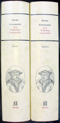
Sebastian Munster Reproduction 2 vol of Cosmographia
- Title: Munster Cosmographia
- Date: 1988
- Condition : (A+) Fine Condition
- Ref: Cosmo1
- Size: Folio
Description:
Two volume 1988 reprint of the 1628 edition of Sebastian Munster's Cosmographia Basel, Beyden Henripetrinischen. Until 1578, the editions of the Cosmographia were published by Munster's stepson, Heinrich Petri (1508 - 1579). Thereafter they were published by the latters son, Sebastian Petri.
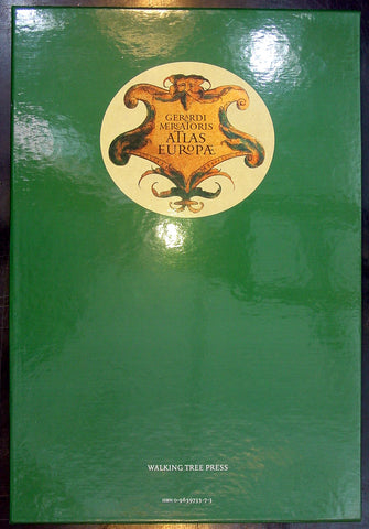
Gerardi Mercatoris - Atlas Europae
- Title : Gerardi Mercatoris - Atlas Europae
- Date : 2000
- Condition: (A+) Fine Condition
- Ref: Merc1
- Size: Folio
Description:
Gerardi Mercatoris - Atlas Europae - In 1967, an anonymous buyer purchased a large, tattered book of maps in a second-hand bookshop in Belgium. He had unknowingly rediscovered a priceless and long-lost early atlas produced 400 years earlier by none other than Gerardus Mercator, the German mapmaker, whose cylindrical projection of the world revolutionized long-distance navigation, and who pioneered the practice of cutting wall maps into book pages and binding them. Mercator, in fact, coined the term "atlas" for such a book, and probably produced this one for a tour of Europe undertaken by the young Crown Prince of Cleves. His original maps are magnificently presented here, unbound in a foil-stamped, slipcased folio of 17 superb reproductions. Labeled in Latin, each map folds out flat to 21½" by 16", suitable for framing, and is printed in full color to reveal the master mapmaker's green and brown hills, sandy coastlines, and red cities and towns. The 17 replica maps are accompanied by an in-depth companion book, featuring essays by an international team of map scholars. This volume relates the historical significance of Mercator's atlas and how it influenced the politics and science of the day. It also examines the work of later cartographers, in more than 100 original-color illustrations. A must-have for collectors, this elegant edition combines the high art of antiquarian maps with exceptional scholarly analysis.
Published by Walking Tree Press, 2000. Softcover book and 17 loose maps in clothbound folio cover with cardboard slipcase. Approximate dimensions: 11 x 16 1/2 in. 94 pages
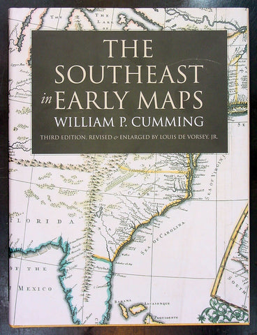
The South East In Early Maps - W. P Cummings
- Title : The South East In Early Maps
- Date : 1998
- Condition: (A+) Fine Condition
- Ref: Cumm1
- Size: Folio
Description:
A study of the historical cartography of the southeast region of the North American continent before the American Revolution. With an annotated checklilst of printed and manuscript regional and local maps of Southeastern North America and a supplement. Chapel Hill: University of North Carolina Press, 1998. Fine/Fine. Book and dust-jacket in mint condition. 71 plates.
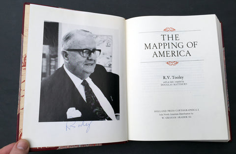
1980 R V Tooley The Mapping of America 1st Edition, Signed
- Title : The Mapping of America
- Ref #: 91439
- Size: 4to
- Date : 1980
- Condition: (A+) Fine Condition
Description:
Signed first edition of R V Tooley's The Mapping of America by RV Tooley, London: Holland Press, 1980, hardcover. Copy #49 from an edition of 300 specially bound copies, Cartographica 2.
Includes numerous black and white maps and an index by Douglas Matthews. A close to near fine copy in three quarter leather binding with marbled paper covered boards and all page edges gilt but with a tiny rub to the spine and some light rubbing to bottom of boards, else fine.
Signed under frontispiece photograph of Tooley.
Ronald Vere Tooley (1898 - 1986) was an English map dealer, an authority on early maps and cartographers, a noted compiler of catalogues on maps, cartography and antiquarian books, author of Maps and Map-makers, and founder of the Map Collectors' Circle which published a series of monographs on historical cartography in the period 1963-1975. He is considered the founder of the antiquarian map trade.
Tooley was born on Michaelmas and adopted the nickname "Mick"
Tooley was born and raised in Islington, London, and educated at the City of London School. Towards the end of World War I he enlisted in the Queen’s Westminster Rifles. After his basic training he left for France and took part in the Battle of Cambrai, where he was one of 120 survivors from an initial force of 400 men. On being demobilised in 1919 and having no definite career plans, he came across an illustrated catalogue of antiquarian books, published by James Tregaskis of Great Russell Street. The idea of working in the bookselling field appealed to him, and armed with a letter of introduction he made the acquaintance of Francis Edwards Ltd., and was summarily employed.
After World War I the book trade enjoyed a time of relative prosperity, but with the Wall Street collapse in 1929, economic depression hit the commercial sector in many countries, the secondhand book trade being no exception. In the 1930s Tooley left Francis Edwards Ltd and opened The Atlas Bookshop, just off Charing Cross Road, and started dealing almost exclusively in antiquarian maps. Between 1932 and 1934 he collaborated with a Mr M. Sinelnikoff of Orion Booksellers Ltd. Sinelnikoff’s passion was old maps, charts and globes, and with Tooley's interest, a fertile conjunction of scholarly minds was created. Tooley had always been interested in Colour Plate books, and in 1935 Batsford published his first book on the subject Some English Books with Coloured Plates. When The Atlas Bookshop closed in 1936 Tooley started work at the Parker Gallery in Albemarle Street - the firm specialising in military and sporting prints as well as old maps. With the outbreak of World War II in 1939 Tooley found work as a telephone operator, but still worked with old books and maps in his spare time.
In 1946 the management of Francis Edwards Ltd, keenly aware of Tooley's considerable business expertise and knowledge of old maps, invited him to rejoin the firm. Here he continued his research, spending long hours in the Map Room of the British Museum. His talents soon led to his being appointed a director of the firm. In 1949 his second book Maps & Map-makers was published, praised as a sound introduction and guide to a complex field, and running to many editions.[3] Tooley retired from Francis Edwards Ltd in 1975 and in 1979 joined Peter Scott and Peter Kalms in setting up a new company R.V.Tooley Ltd, he was joined by his stepson Douglas Adams and in October 1979 his stepson Stephen Luck joined them, first trading at Tring, Hertfordshire and then in the Spring of 1980 33 Museum Street, this company closed in 1982 and became Tooley Adams & Co. Together they developed the firm into one of the leading antique map dealers, supplying maps to dealers, museums and libraries all over the world.
"The Map Collector’s Series" is widely regarded as the greatest of Tooley's achievements. The idea of producing a series of monographs on maps was first discussed in 1960 with Robert Stockwell. The interest generated by this idea was widespread and led to The Map Collector’s Circle being formed in April 1963 under Tooley and David Schrire. The series was acclaimed throughout the world, and seen as an important contribution to cartography. It also led to the founding of the Carta Press, aimed at publishing authoritative works on cartography. The first publication, in 1968, was Maps of the African Continent and Southern Africa, and was followed in 1970 by County Atlases of the British Isles by R.A. Skelton of the Map Room of the British Museum. The Map Collector magazine was started by Tooley in 1977 when the Map Collector’s Circle ceased publishing. Each issue of The Map Collector consisted of articles and information provided by respected authorities, collectors and dealers. (Ref: M&B; Tooley)
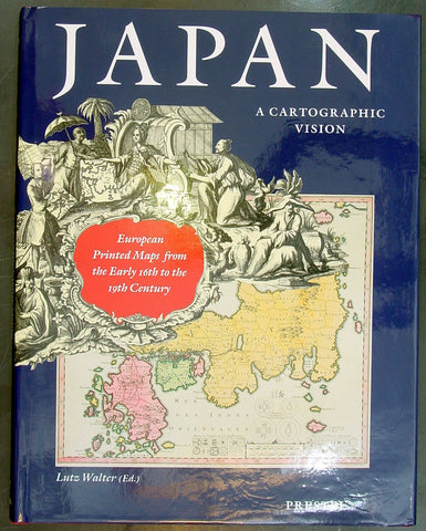
Japan: A Cartographic Vision - Lutz Walter
- Title : Japan: A Cartographic Vision
- Date : 1994
- Condition: (A+) Fine Condition
- Ref: Lutz1
- Size: Folio
Description:
Japan: A Cartographic Vision is a celebration, in words and pictures, of the spectacular and colourful maps of Japan produced by Europeans. It explores the changing shape of Japan as conceived by Western explores and cartographers, from the crude and fanciful depictions of the early sixteenth century to the first accurate maps published in the mid-nineteenth century. Prestel-Verlag, Munich, New York, 1994
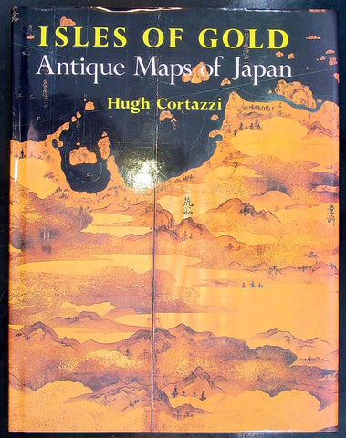
Isles of Gold - Antique Maps of Japan - Hugh Cortazzi
- Title : Isles of Gold - Antique Maps of Japan
- Date : 1992
- Condition: (A+) Fine Condition
- Ref: Hugh1
- Size: Folio
Description:
Isles of Gold - Antique Maps of Japan is a selection of over 90 of the most attractive, remarkable, and historically significant of these European and Japanese maps of Japan. The text by Hugh Cortazzi tells the fascinating story of the encounter between the west and Japan through the gradual process of mapping the island empire. Far-ranging Portuguese explorers, Jesuit Fathers, Dutch merchants and English sea-captains, samurai and shoguns populate this account, which is surprisingly rich in drama. Especially enlightening is the authors emphasis on mutual influences, borrowings and eventual co-operation between European and Japanese map-makers, often in opposition to the Japanese authorities, who were set on sealing off their land from the prying eyes of outsiders.
Weatherhill, New York and Tokyo 1992