Recent Acquisitions (287)
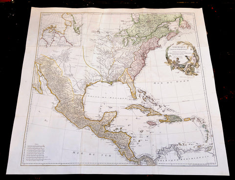
1746 D Anville Large Antique Map of North America - Pre French Indian & Rev. War
Antique Map
-
Title : Amerique Septentrionale Publiee sous les Auspices de Monseigneur le Duc d Orleans.. Par Le Snr. D Anville MDCCXLVI
- Ref #: 17010
-
Condition: (A+) Fine Condition
- Size: 42 1/2in x 37in (1.08m x 940mm)
- Date : 1746
Description:
This large important original copper plate engraved hand coloured antique map of North America, in 12 sheets joined, was engraved in 1746 - dated in the cartouche - and was published by Jean-Baptiste Bourguinon D Anville in his Elephant Folio Atlas Generale.
This map was instrumental in instructing the European Colonial powers of the time, England France & Spain the importance of dominating the New World, that ultimately led to the French and Indian War of 1754–63. This conflict determined the political direction of North America leading to the American War of Independence in 1775 and ultimately the formation of The United States of America.
To illustrate the importance of cartography in the mid eighteenth century, especially that of North America, a J B D Anville map is essential. D Anville dominated 18th century European cartography with many of his cartographical achievements, especially in North America, copied by many of his contemporaries such as Kitchen, Sayer, Homann, Seutter, Mitchell and others .
He was one of the first to leave blank spaces in his maps, where knowledge was scant or insufficient. His representation of the great lakes is superior to that of his contemporary John Mitchell, responsible for publishing one of the most famous mid 18th century maps of North America, A Map of the British and French Dominions in North America on 8 sheets in 1755 and remained the standard map of North America up until the end of the 18th century. (Ref: Tooley, Printed maps of America, 104; The Mapping of America 316)
General Definitions:
Paper thickness and quality: - Heavy and stable
Paper color : - off white
Age of map color: - Original & later
Colors used: - Red, yellow, green, blue
General color appearance: - Authentic
Paper size: - 42 1/2in x 37in (1.08m x 940mm)
Plate size: - 34 1/2in x 33 1/2in (875m x 850mm)
Margins: - Min 1in (25mm)
Imperfections:
Margins: - Small restoration to left margin, not affecting the image
Plate area: - None
Verso: - Age toning
Background:
The French and Indian War (1754–63) comprised the North American theatre of the worldwide Seven Years War of 1756–63. It pitted the colonies of British America against those of New France. Both sides were supported by military units from their parent countries, as well as by American Indian allies. At the start of the war, the French North American colonies had a population of roughly 60,000 settlers, compared with 2 million in the British North American colonies. The outnumbered French particularly depended on the Indians. The European nations declared war on one another in 1756 following months of localized conflict, escalating the war from a regional affair into an intercontinental conflict.
The name French and Indian War is used mainly in the United States. It refers to the two enemies of the British colonists, the royal French forces and their various American Indian allies. The British colonists were supported at various times by the Iroquois, Catawba, and Cherokee, and the French colonists were supported by Wabanaki Confederacy members Abenaki and Mikmaq, and Algonquin, Lenape, Ojibwa, Ottawa, Shawnee, and Wyandot.
British and other European historians use the term the Seven Years War, as do English-speaking Canadians. French Canadians call it La guerre de la Conquête (the War of the Conquest) or (rarely) the Fourth Intercolonial War.
Fighting took place primarily along the frontiers between New France and the British colonies, from Virginia in the south to Newfoundland in the north. It began with a dispute over control of the confluence of the Allegheny River and Monongahela River called the Forks of the Ohio, and the site of the French Fort Duquesne in Pittsburgh, Pennsylvania. The dispute erupted into violence in the Battle of Jumonville Glen in May 1754, during which Virginia militiamen under the command of 22-year-old George Washington ambushed a French patrol.
In 1755, six colonial governors in North America met with General Edward Braddock, the newly arrived British Army commander, and planned a four-way attack on the French. None succeeded, and the main effort by Braddock proved a disaster; he lost the Battle of the Monongahela on July 9, 1755 and died a few days later. British operations failed in the frontier areas of Pennsylvania and New York during 1755–57 due to a combination of poor management, internal divisions, effective Canadian scouts, French regular forces, and Indian warrior allies. In 1755, the British captured Fort Beauséjour on the border separating Nova Scotia from Acadia, and they ordered the expulsion of the Acadians (1755–64) soon afterwards. Orders for the deportation were given by William Shirley, Commander-in-Chief, North America, without direction from Great Britain. The Acadians were expelled, both those captured in arms and those who had sworn the loyalty oath to His Britannic Majesty. Indians likewise were driven off the land to make way for settlers from New England.
The British colonial government fell in the region of modern Nova Scotia after several disastrous campaigns in 1757, including a failed expedition against Louisbourg and the Siege of Fort William Henry; this last was followed by Indians torturing and massacring their British victims. William Pitt came to power and significantly increased British military resources in the colonies at a time when France was unwilling to risk large convoys to aid the limited forces that they had in New France, preferring to concentrate their forces against Prussia and its allies in the European theater of the war. Between 1758 and 1760, the British military launched a campaign to capture the Colony of Canada (part of New France). They succeeded in capturing territory in surrounding colonies and ultimately the city of Quebec (1759). The British later lost the Battle of Sainte-Foy west of Quebec (1760), but the French ceded Canada in accordance with the Treaty of Paris (1763).
The outcome was one of the most significant developments in a century of Anglo-French conflict. France ceded to Great Britain its territory east of the Mississippi. It ceded French Louisiana west of the Mississippi River (including New Orleans) to its ally Spain in compensation for Spains loss to Britain of Florida. (Spain had ceded Florida to Britain in exchange for the return of Havana, Cuba.) Frances colonial presence north of the Caribbean was reduced to the islands of Saint Pierre and Miquelon, confirming Great Britains position as the dominant colonial power in eastern North America.
Please note all items auctioned are genuine, we do not sell reproductions. A Certificate of Authenticity (COA) can be issued on request.
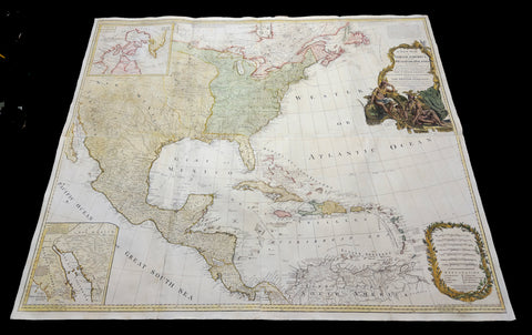
1786 (1794) Thomas Pownall & Sayer Large Revolutionary War Map North America
Antique Map
- Title : A New Map of North America with the West India Islands, divided according to the Preliminary Articles of Peace, Singed at Versailles, 20, jan 1783, wherein are particularly Distinguished The United States, and the Several Provinces, Governments & ca which Compose the British Dominions, Laid down according to the Latest Surveys, and Corrected from the Original Materials of Goverr. Pownall, Membr. of Parlimt....1794
- Size: 47in x 41in (1.20m x 1.050m)
- Condition: (A+) Fine Condition
- Date : 1794
- Ref #: 35672
Description:
A large, extraordinary important, original rare copper-plate engraved and hand coloured map of North America by Governor Thomas Pownell, was engraved and updated in 1786 and updated by Thomas Kitchin in 1794 - dated in cartouche - and published in "A general atlas, describing the whole universe: being a complete collection of the most approved maps extant; corrected with the greatest care, and augmented from the latest discoveries" by Robert Sayer, Laurie and Whittle.London.
This map was first issued by Emmanuel Bowen and John Gibson in 1755 and went through numerous iterations over the next 40 years. This edition was issued shortly after the end of the American Revolutionary War and the Treaty of Paris in 1783. The map details the newly formed United States of America in Green, the British & French dominions in Canada in Red, plus the extensive Spanish territories of from Florida, Louisiana Mexico and Central America. As one might expect from a map of this size, the detail throughout is extraordinary.
General Definitions:
Paper thickness and quality: - Heavy and stable
Paper color : - off white
Age of map color: - Original
Colors used: - Yellow, green, blue, pink
General color appearance: - Authentic
Paper size: - 47in x 41in (1.20m x 1.050m)
Plate size: - 46in x 40in (1.10m x 990mm)
Margins: - Min 1in (20mm)
Imperfections:
Margins: - None
Plate area: - Light toning & offsetting
Verso: - Light age toning.
Background:
This monumental 1794 map of North America by Governor Thomas Pownell was issued shortly after the end of the American Revolutionary War. The United States at this time extended from the Pacific to the Mississippi River and from Georgia to the Great Lakes and Maine. The early state boundaries roughly conform to their original colonial charters. Virginia, North Carolina, and South Carolina are drawn with indefinite western borders, suggesting claims to further unexplored land beyond the Appellation Mountains. By this time most of the boundary issues in the New England states had been resolved, though there remained some vagaries regarding the Massachusetts Connecticut border and, though Vermont is noted textually, its boundaries are not drawn in. At this time there were also some unresolved issues regarding the national borders between Maine and Nova Scotia. In Pennsylvania, the western border displays some surveying confusions that would not be resolved until the early 1800s and the creation of Ohio.
It is beyond the old colonial centers where this map really gets interesting. Pownall offers copious notations on the lands and territories between the Appellation range and this Mississippi River. In some cases he offers commentary on the various indigenous tribes including the Creeks, Chickasaws, Chocktaws, Senekas, Eriez, Delawares, Shawnee, Iroquois, Algonquians, Ottawas and others. The cartographer was clearly concerned with the development of these western regions and offers copious commentary on fit sites for factories, the alliances and temperaments of tribes, and the navigability of various river systems, particularly the Mississippi and Ohio.
The Great Lakes are mapped with considerable accuracy though several apocryphal islands do appear in Lake Superior. The most notable of these are Phelipeaux and Pontchartrain. Phelipeaux Island first appeared in French maps of this region in the 1740s. Later it was mentioned as a boundary marker in the 1783 Treaty of Paris which ended the American Revolutionary War. The nonexistence of these islands was not conclusively proven until about 1820.
To the west of the Mississippi we pass into the largely unknown lands of the Great Plains. In what is roughly modern day Missouri, between Memphis and St. Louis, there is an interesting note suggesting that this region is Full of Mines, with a secondary note suggesting that these mines gave rise to the Mississippi Scheme of 1719. This refers to the Mississippi Company (Compagnie du Mississippi) or, as it was more commonly known the Indies Company (Compagnie d Occident). This organization was part of a French investment plan comparable to the South Seas Company which was developing contemporaneously in England. The Mississippi Companys charter was to trade the riches of the Louisiana Territory. The main proponent of the Mississippi Company, John Law, greatly exaggerated the wealth of Louisiana by describing a rich mining region easily accessible along the Mississippi from New Orleans. This resulted in a stock buying rush which disproportionately overvalued Mississippi Company stock, resulting in one of the world's first Bubble Economies.
Further North, along the northern border between the United States and British America (Canada), Rain Lake, the Lake of the Woods, and Lake Winnepeg are noted. This region was a hotbed of exploration throughout the 18th century. French and English concerns in the New World were desperate for access to the Pacific and the rich Asian markets. These markets had long been dominated by the Spanish who had easy access to the Pacific via Mexico and South America. The French and English set their hopes on a Northwest Passage. By the late 18th century the search for a route through the high Arctic had long been abandoned. Instead, explorers and theoretical cartographers believed that a water route might be found among the elaborate network of lakes and rivers that meandered through central Canada. Our map shows evidence of some of this exploration, particularly the travels of the Quebec born Pierre de La Verendrye and his sons around Lake Alimipigon, the Lake of the Woods (Lake Minitti) and Lake Winnipeg (Lake Ouinipigon).
As we progress even further west, passing out of Louisiana into the Spanish holdings we begin to see significant mapping - both conjectural and factual. The Spanish had long been passively active in the exploration of New Mexico. Though no concerted effort had been put forth to map the region, various missionaries and territorial governors had, over roughly 200 years of occupation added considerable data, both fact and fiction to the cartographic picture. Numerous American Indian groups are noted including the Pimas, the Apaches ,the Navajo and others. Along the Rio del Norte or upper Rio Grande there are a quantity mission stations including the regional capital of Santa Fe.
Just to the west of these missions we begin to enter more mythical territory and both Cibola and Teguayo are noted. Cibola and Teguayo are both associated with the legendary Seven Cities of Gold. It was believed that in 1150 when Merida, Spain, was conquered by Moors ,the city's seven bishops fled to unknown lands taking with them much of the citys riches. Each Bishop supposedly founded a great city in a far away place. With the discovery of the New World and the fabulous riches plundered by Cortez and Pizarro, the Seven Cities became associated with New World legends. Coronado, hearing tales of the paradise-like mythical Aztec homeland of Azatlan somewhere to the north of Mexico , determined to hunt for these cities in what is today the American southwest. In time indigenous legends of rich and prosperous lands became attached to the seven cities. Two of these appear on our map - Cibola and Teguayo.
The gulf of Mexico, the West Indies, and the Caribbean are charted with considerable and typical accuracy. Notes numerous offshore shoals, reefs, and other dangers - especially around the Bahamas. Also describes several important shipping routes, particularly the former routes of Spanish galleons from Veracruz to Havana, the route from Cartagena to Havana, and the route from Cartagena to Europe.
There are also two particularly interesting insets. The first, in the upper left quadrant, depicts the Canadian arctic, particularly the Hudson and Baffin Bays. Notes all of the most recent discoveries in this region and offers interesting notes such as If there is Northwest Passage it appears to be through one of these inlets. In the northwestern quadrant of this inset, the supposed discoveries of Admiral de Fonte are included, despite a notation that they are Imaginary.
The second inset of interest in located in the lower left quadrant. This smaller maps depicts the northern parts of the Gulf of California and the Colorado River Delta based upon the explorations of the Jesuit Father Eusebius Francis Kino. The actual cartography of this region has been vague since the mid 17th century when it was postulated that California must be an Island. It was not until Kinos historic expedition, recorded here, that Baja California was conclusively proven to be a peninsula.
A magnificent title cartouche appears in the upper right quadrant. The cartouche, which angles around Bermuda, depicts two stylized American Indians surrounded by the presumed flora and fauna of the new world. These include a small monkey, a parrot, and a jaguar. Above the cartouche is a textual quotation from Article III of the Treaty of Paris, affirming the rights of the United States to access the rich cod fields of Newfoundlands Grand Banks.
The Treaty of Paris, signed in Paris by representatives of King George III of Great Britain and representatives of the United States of America on September 3, 1783, ended the American Revolutionary War. The treaty set the boundaries between the British Empire in North America and the United States, on lines exceedingly generous to the latter. Details included fishing rights and restoration of property and prisoners of war.
This treaty and the separate peace treaties between Great Britain and the nations that supported the American cause—France, Spain, and the Dutch Republic—are known collectively as the Peace of Paris. Only Article 1 of the treaty, which acknowledges the United States existence as free, sovereign, and independent states, remains in force.
Thomas Pownall 1722 - 1805 was a British scholar, statesman and soldier active in the colonial administration of North America just prior to the American Revolutionary War. Pownell was born in England and educated at Trinity College, Cambridge. After graduation he was employed by his brother, John Pownall, at the office of the Lords Commissioners of Trade and Plantations, which oversaw British economic interests in its North American colonies. In 1753, Pownall was appointed secretary to the governor of New York, Sir Danvers Osborne. Osborne, himself having be only recently appointed to the position, committed suicide shortly after taking office. Despite this setback, Pownall remained in America and devoted himself to studying and researching the colonies. In the process Pownall became close lifelong friends with Benjamin Franklin and other New World luminaries. He also published several notable works on the colonial administration of North America. In 1757 Pownall was appointed Governor of the Massachusetts Bay colony. In this position he frequently found himself at odds with the restrictive policies of the Board of Trade. It was not long before he was pushed out of office and, declining the governorship of Jamaica, reassigned to South Carolina. Despite nominally holding the governorship of South Carolina, Pownall never visited the colony. Instead he returned to England where he eventually became a member of Parliament. In Parliament, he advocated for reduced taxes towards the colonies - had he been heeded, the American Revolution may have never happened. Pownall retired from public life around 1780, but continued to pursue his scholarly interests. Pownalls research contributed significantly to several important maps and scholarly work on North America.
Laurie and Whittle 1794 - 1858 based in London, were map and atlas publishers active in the late 18th and early 19th century. Generally considered to be the successors to the Robert Sayer firm, Laurie and Whittle was founded by Robert Laurie (c. 1755 - 1836) and James Whittle (1757-1818). Robert Laurie was a skilled mezzotint engraver and is known to have worked with Robert Sayer on numerous projects. James Whittle was a well-known London socialite and print seller whose Fleet Street shop was a popular haunt for intellectual luminaries. The partnership began taking over the general management of Sayers firm around 1787; however, they did not alter the Sayer imprint until after Sayers death in 1794. Apparently Laurie did most of the work in managing the firm and hence his name appeared first in the Laurie and Whittle imprint. Together Laurie and Whittle published numerous maps and atlases, often bringing in other important cartographers of the day, including Kitchin, Faden, Jefferys and others to update and modify their existing Sayer plates. Robert Laurie retired in 1812, leaving the day to day management of the firm to his son, Richard Holmes Laurie (1777 - 1858). Under R. H. Laurie and James Whittle, the firm renamed itself Whittle and Laurie. Whittle diedin 1818, and thereafter the firm continued under the imprint of R. H. Laurie. After Lauries death the publishing house and its printing stock came under control of Alexander George Findlay, who had long been associated with Laurie and Whittle. Since, Laurie and Whittle has passed through numerous permeations, with part of the firm still extant as an English publisher of maritime or nautical charts, Imray, Laurie, Norie and Wilson Ltd. The firm remains the oldest surviving chart publisher in Europe.
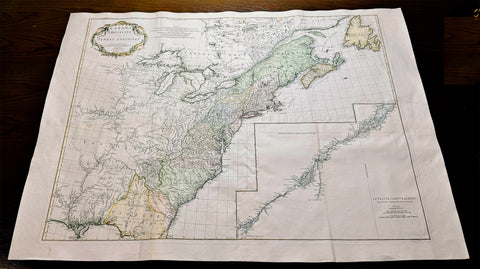
1755 D 'Anville Large Antique Map of North America, Great Lakes, 13 Colonies
Antique Map
- Title : Canada Louisiane et Terres Anglois Par Le Sr. D Anville...MDCCLV
- Ref #: 61140
- Size: 52in x 38in (1.32m x 960mm)
- Date : 1755
- Condition: (A+) Fine Condition
Description:
This magnificent, scarce, very large (52in x 38in) hand coloured & highly detail map of North America was engraved in 1755 - dated in the title cartouche - by George De La Haye and was published by Jean Baptiste Bourguignon D Anville in his large elephant folio atlas Atlas Generale.
Geopolitically this map is extremely significant drawn as war between the Global Powers of the day, France, England & Spain, was breaking, known in Europe as the Seven Year War known in North America as the French & Indian war. (Please see below for more detail)
This map rivals John Mitchells "A Map of the British and French Dominions in North America published in 1755" - considered to be one of the most significant maps of North America published in the 18th & 19th centuries (a 1st edition of Mitchells map is currently for sale for $165,000).
I have included an image of the Mitchell map for comparison. The D Anville map is considered by many to be cartographically superior to the Mitchell map, at a fraction of the price.
General Description:
Paper thickness and quality: - Heavy and stable
Paper color: - White
Age of map color: - Early & later
Colors used: - Pink, yellow, green
General color appearance: - Authentic
Paper size: - 52in x 38in (1.32m x 960mm)
Plate size: - 45in x 35in (1.12m x 890mm)
Margins: - Min 1in (25mm)
Imperfections:
Margins: - None
Plate area: - Light ceasing along folds
Verso: - Very small worm holes
Background: This extraordinary map of the eastern half of North America extends from Newfoundland, Canada to St. Augustine, Florida, stretching westward beyond the Mississippi as far as modern day Texas. The map includes both the original colonial colonies along the Atlantic seaboard from Maine to Georgia and the French claims in Louisiana (the Mississippi Valley) and modern day Canada. Florida is acknowledged as a Spanish enclave. Elevation is rendered in profile with fortifications, towns, and American Indian villages identified. A large inset map centres on the course of the St. Lawrence River from the Isle Aux Coudres to Lake Ontario.
The is a very significant map, drawn from a definitive French perspective, defining the territorial alignments and claims within North America shortly following the outbreak of the French and Indian War, considered to be a New World reflection of the European Seven Years War. It is however notable that it began before the larger hostilities in Europe and most of the major battles involved primarily parties only loosely aligned with the French or English - most specifically American Indians and lawless frontiersman, who had their own political agenda.
The war began with French incursions into western Pennsylvania and other territories claimed simultaneously by the French, English and American Indian forces. Just prior to the war, the French, in the interest of broadening their hold on the lucrative fur trade, established a series of forts, all of which are here noted, along the length of the Mississippi and further east, including Fort Duquesne (here Fort de Quene, Pittsburgh), Fort de la Presquisle, and for Le Beouf (here, Fort de la Riv Jaus Beufs).
The map also recognizes British claims, only inland as far as the Appalachian Mountains, beyond which place names take on a noticeably French character. These last three forts occupied particularly contested territory under the control of the powerful British allied Iroquois League. The most contested of these was Fort Duquesne (modern day Pittsburgh) in direct opposition to another fort then being constructed by the Ohio Company, a trading and land speculation firm established by prominent Virginia colonials, including George Washington. The Virginian colonial governor responded to Duquesne by sending then Lieutenant George Washington and a band of Virginia militiamen to harass the French. The resulting Jumonville Affair, in which Washington oversaw an attack on a French Canadian diplomatic forces led by Joseph Coulon de Villiers de Jumonville, to warn the Ohio Company fort builders away from French claimed territory. The slaying of Jumonville and several other French diplomats prompted a response from French forces at Fort Duquesne, leading to Washingtons retreat and construction of Fort Necessity, really little more than a palisaded shack, marked here just south of Fort Duquesne. These events, all of which occurred in May of 1754, were said to have increased hostilities in Europe and led to the start of the Seven Year War in 1755.
Beyond the political agenda of this map, is the map itself, being one of the finest and most heavily detailed maps of North America published in the mid 18th century. Ranking alongside the large 1755 Mitchell map in detail but judged by many as cartographically superior. Drawing on both French and British cartographical detail, D Anville identifies countless American Indian tribes, many of which, like the Sioux and Missouri, the British had only vague knowledge. Moreover, he also includes detail such as swamps, rapids, fords, abandoned villages, and even the ancient remnants of mound builder culture in the Ohio Valley. D Anville notably does not include Mitchells fictional Lake Superior islands.
This map was originally published to accompany the pamphlet entitledMemoire sur la carte intitulee: Canada, Louisiane, & Terres angloises and was also published in four parts for D Anvilles Atlas General.
These large maps are hard to find in such good condition and make fantastic historical reference tools due to the size and high level of detail as with all D Anvilles work. (Ref: Tooley, M&B)
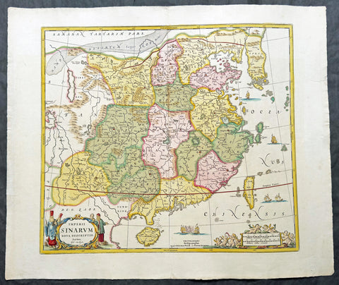
1699 Schenk & Valk (Jansson) Large Antique Map of China - Taiwan, Hainan & Korea
Antique Map
- Title : Imperii Sinarum Nova Descriptio Auctore Joh. van Loon
- Size: 26in x 22in (660mm x 560mm)
- Condition: (A+) Fine Condition
- Date : 1699
- Ref #: 61203
Description:
This superb original hand coloured antique map of China, Taiwan & Korea by Pieter Schenk & Gerald Valk was engraved by Johannes Van loon in 1699 and is derived largely from Jan Jansson and Joan Blaeu maps of China who borrowed heavily from data collected by the Jesuit Father, Martino Martini whilst travelling through China between 1643 and 1650, to construct their maps.
General Definitions:
Paper thickness and quality: - Heavy and stable
Paper color : - off white
Age of map color: - Original
Colors used: - Yellow, green, blue, pink, red
General color appearance: - Authentic
Paper size: - 26in x 22in (660mm x 560mm)
Plate size: - 20 1/2in x 18 1/2in (520mm x 470mm)
Margins: - Min 2in (50mm)
Imperfections:
Margins: - Light creasing along margin edges
Plate area: - Very light crease along centerfold
Verso: - Light colour show through
Background:
This map does deviate somewhat from that earlier model by Jansson & Blaeu, in its depiction of the Korean peninsula, showing a cluster of islands at its southern tip. The map is embellished with sailing ships and Chinese junks, with the the title cartouche flanked by both Chinese and Jesuit men with Putti surrounding the scale cartouche. Engraved by Johannes van Loon after Jan Jansson in 1657 and Joan Blaeu in 1655. (Ref: Tooley, Koeman)
Pieter Schenk 1660-1718 Gerard Valck 1651-1726
Pieter Schenk was born in Germany but settled in Amsterdam where he became a pupil of Gerard Valck, the engraver. In 1687 he married Valck s sister and thereafter the Schenk and Valck families were active over a long period with a wide range of interests as print sellers, publishers of books, maps, topographical and architectural drawings and globe makers. The Schenk family produced some fine original maps as well as using plates from the major works from Jansson, the Visschers, Sansons and others.
Please note all items auctioned are genuine, we do not sell reproductions. A Certificate of Authenticity (COA) can be issued on request.
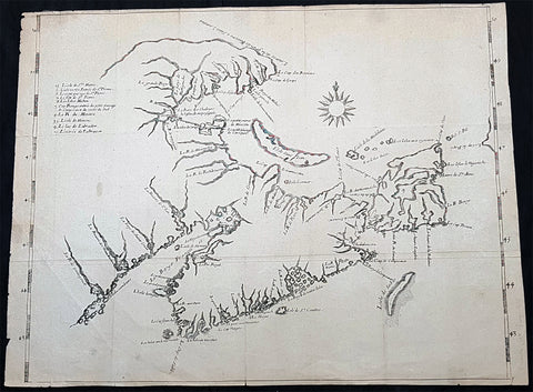
1672 Nicolas Denys Extremely Rare Map of Acadia, Quebec, Nova Scotia Canada
Antique Map
- Title : (Acadia; Quebec)
- Size: 20 3/4in x 16in (680mm x 520mm)
- Condition: (A) Very Good Condition
- Date : 1672
- Ref #: 31916
Description:
This original copper plate engraved, antique very rare map of Acadia, Nova Scotia in eastern Canada by the founding father of Acadia Nicolas Denys, was published in his 1672 edition of Description Géographique et Historique des Costes de l'Amérique Septentrionale....
The map is very rare, since a number of the copies of the book do not appear to have had the map included. From our research we have realised two versions of this map, with an obvious difference. One map that shows latitude 42 numeric at the bottom left and another edition without.
The map without the numeric 42 can be seen online, from the McGill university, digitised by the Haiti Trust online library, P #38.
The map with the numeric can be found on the Gallica open-access digital library of the Bibliothèque nationale de France (BnF)
Both are easily searchable on each site using Denys name.
There are also other copies to be found online.
The map carries 92 place names. On it Denys delineates the coasts he explored and traded on, from Penobscot Bay to Cap Gaspe, including all of Nova Scotia.
Nicolas Denys was a founding father of Acadia and one of its leading figures for over half of the 17th century. Denys was given Cape Breton Island by Louis XIV, in 1670, as a reward for services rendered. He wrote his account of the region at Nipisiguit on Chaleur Bay.
The map contains a number of place names, which are still in use today, that did not appear on earlier printed maps : Le Fort de St. Pierre, La R. de Cocanne, Le Cap de Tourmentin, Chedabouctou… Denys used the basic cartography of Sanson for mainland Nova Scotia, Quebec and New Brunswick, but with an entirely new, although distorted outline for Cape Breton.
He shows a large inlet, Le Lac de Labrador, which was sometimes retained by later cartographers, with its southwest corner separated by a wide isthmus from sea at Le fort de St. Pierre, present-day St. Peters Bay.
General Definitions:
Paper thickness and quality: - Heavy and stable
Paper color : - off white
Age of map color: -
Colors used: -
General color appearance: -
Paper size: - 20 3/4in x 16in (680mm x 520mm)
Plate size: - 20 3/4in x 16in (680mm x 520mm)
Margins: - Min 1/2in (15mm)
Imperfections:
Margins: - Light chipping to left edge
Plate area: - Folds as issued, light creasing along folds
Verso: - Folds as issued, light creasing along folds, several small re-joins of folds to edges
Background: A century and a half after the first voyage of Columbus in 1492, northern North America beyond the Atlantic coastline was still barely known.
Before 1656 three entryways had been established: Davis Strait, Hudson Bay, and the St Lawrence valley It took another century and a half of laborious probing across the great plains and through the western mountains to reach the Pacific coast, where explorers met other Europeans who were arriving there too, overseas from the west.
Portuguese, Spanish, and Russians dominated the earliest coastal reconnaissance activity but then retreated. Inland the French uncovered what became Canada’s ecumene in the 20th century, while the British uncovered the rest of the landmass, all the way to the Arctic Ocean. The Canadian landmass was however revealed largely because it fed a craze for fur-based consumer products in Europe.
In the last years before 1632, inland explorers for the first time bridged gaps between places already known: between modern Quebec City and the coast of Maine, and between the Delaware River and Lake Ontario.
Throughout this period of 135 years, the coast of Labrador and northeastern Newfoundland were the most heavily traveled parts of the future Canadian territory.
Exploration of the fiords of today’s British Columbia coast and Alaska panhandle intensified in the last quarter of the eighteenth century, and in 1793 Alexander Mackenzie, a Montrealer, reached the head of one of those fiords at Bella Coola. He thus completed the land crossing of America begun some two centuries earlier.
After nearly two centuries, Great Britain was actively seeking the Northwest Passage and in 1818 a newly established border with the United States created another need for new and more accurate maps.
Nicolas Denys (1598? – 1688) was a French-born merchant, governor, writer, and settler in New France. He founded settlements at St. Pierre (now St. Peter's, Nova Scotia), Ste. Anne (Englishtown, Nova Scotia) and Nepisiquit (Bathurst, New Brunswick).
Denys' writings about the lands and peoples of Acadia were published in two volumes in 1672. The work, entitled The Description and Natural History of the Coasts of North America, remains the leading authority regarding the conditions of Acadia for the years 1632 through 1670.
When Cardinal Richelieu authorized a stronger French presence in the New World, he commissioned Isaac de Razilly to be lieutenant-general of Acadia and Nicolas Denys accompanied the expedition as one of de Razilly's lieutenants. The expedition set sail in 1632 with 300 hand-picked men, supplies, six Franciscan missionaries, and Simon Denys (Denis) de La Trinité (1599-1678), brother of Nicolas Denys. Simon Denys was a future seigneurial attorney and receiver general for the Compagnie des Cent-Associés, who was appointed to the ruling Sovereign Council of New France in 1664, then ennobled by Louis XIV, in 1668.
They founded a colony at the LaHave River where Denys engaged in inshore fishing, lumbering and fur trading. French administrators, including nearby Port Royal's lord, the Sieur Charles de Menou d'Aulnay, thought little of the colonists’ reclaiming tidal marshlands. Denys was very impressed with the “great extent of meadows which the sea used to cover and which the Sieur d'Aulnay has drained” It was this extensive system of dikes and drainage sluices (called aboiteaux) that set his colony apart from any others. It allowed the colonists to reclaim land that the Mi'kmaq nation had no use for. This greatly aided peaceful co-existence with their neighbors, and Mi’kmaq trade, friendship and intermarriage was and is an immensely important part of the Acadian identity and heritage.
When Denys arrived in 1632 the aboriginal community was already using iron kettles, axes, knives, and arrowheads, but few had firearms. Before the use of kettles the Mi’kmaq used hollowed out tree trunks in which to boil their unsalted food, dropping in hot stones to heat the water. Possessing kettles, they were free to move anywhere and became more mobile, changing their habitations often. Denys remarked on excessive hunting in his diaries. Moose, formerly in great numbers on Cape Breton Island, had been exterminated by hunting with muskets. There were no longer any moose on Prince Edward Island and the caribou were in reduced number. Alcohol, however, not over-hunting, was a major cause of Mi’kmaq decline.
When de Razilly died in December 1635 the colony broke up and Nicolas Denys returned temporarily to France. In 1636, Denys was granted a seignory by the French crown, apparently the third grant in the colony of Acadie and in 1642 he married Marguerite de Lafitte in France, but soon took his new family across to his adopted lands of Acadia.
Denys was a witness to one of the most unfortunate chapters of early Acadia's history: the rivalry between the Lords d’Aulnay and Charles de Saint-Étienne de la Tour, as it dissipated efforts to grow the colony. La Tour had claimed royal permission to ply the fur trade in the American Northeast. His rival outposts were in often-open hostility with the budding d’Aulnay colony, competing for resources and markets. Decades of sparring led to bloodshed. In the Spring of 1643 La Tour led a party of English mercenaries against the Acadian colony at Port Royal. His 270 Puritan and Huguenot troops killed three Acadians, burned a mill, slaughtered cattle and seized 18,000 livres' worth of furs. D'Aulnay retaliated in 1645 by seizing all of La Tour's possessions and outposts while La Tour was drumming up more support for his cause in the English colonial port of Boston. Denys’ letters and journals give vivid descriptions of the drama.
Once he secured rights to his own lands in Acadia through the Company of New France, Denys continued to seek his fortunes now as the Governor of Canso and Isle Royale (present-day Cape Breton Island). Denys founded settlements at St. Pierre (now St. Peter's, Nova Scotia, site of the Nicholas Denys Museum), Ste. Anne (Englishtown, Nova Scotia) and Nepisiquit (Bathurst, New Brunswick).
His 'fortunes' had some reversals, however. Sieur Emmanuel le Borgne, a rival with holdings at Port Royal, seized his properties by armed force in 1654 while Denys was at Ste. Anne. Later that year, King Louis XIV recognized Denys’ claims to the property lost to le Borgne and Le Borgne was commanded to restore them to Denys.
The Denys family, including his wife and son Richard Denys, made their home in St. Pierre, and dwelt there in relative calm until the Winter of 1669, when Nicolas’ home and business were consumed in a fire. Denys relocated his family to Nepisiquit, on Baie Chaleur, just south of the Gaspé Peninsula, and there he turned his efforts to writing. Leaving his son Richard in charge of his holdings, he travelled to Paris to publish his Description Géographique et Historique des Costes de l’Amérique Septentrionale: avec l’Histoire Naturelle du Païs. Released in 1672, it was not a success. He remained in Paris for several years, returning impoverished to Nepisiguit a few years before his death.
Denys died in 1688 at Nepisiquit, a town of his own creation. During his tenure in the New World, he appears to have offered more stability of governance than those other royal appointees around him. Denys is well known through his writings about the lands and peoples of Acadia, especially his Description, published in two volumes in 1672. This work was edited and translated into English by Professor William Francis Ganong and published in 1908 as part of the Champlain Society's General Series. Ganong was a distant cousin of Denys.
Nicolas Denys and his work, translated as Description and Natural History of the Coasts of North America, remains the leading authority regarding the conditions of Acadia for the years 1632 through 1670.
Please note all items auctioned are genuine, we do not sell reproductions. A Certificate of Authenticity (COA) can be issued on request.
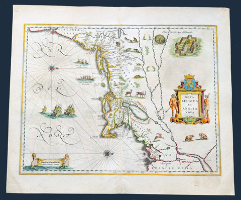
1641 Joan Blaeu Antique Landmark Map New England & New Netherlands
Antique Map
- Title : Nova Belgica Et Anglia Nova
- Size: 22 1/2in x 19in (570mm x 480mm)
- Condition: (A+) Fine Condition
- Date : 1641
- Ref #: 61201
Description:
This beautiful, original hand coloured copper-plate engraved antique landmark map of the Dutch & British colonies of New England & NE America, centering on New York and Manhattan stretching from Virginia to Maine, by Joan Blaeu was published in the 1641 German edition of Atlas Novus.
This important landmark map of the American Northeast, presenting the regions settled by the Dutch (New Netherlands) and the English (New England). Oriented to the west, Blaeu's map covers the American coast from Virginia, past New York and Long Island to Cape Cod, New England, and Quebec. The map is the first of the region to depict the fur-bearing and food animals of the region accurately, and it does so in profusion. Between this imagery and the fleet of trade ships heading towards the coast, the decorative elements vividly emphasize the region's resource wealth.
This map is cartographically derived from data accumulated by Adriaen Block and other Dutch fur traders active in the early 17th century. Burden writes of the Block:
......This important map was one of the most attractive of the Americas at the time...... It is noted for the fact that its primary source is the first manuscript map of Adriaen Block, 1614. Indeed, it is the first full representation of it in print. It is one of the earliest to name Nieu Amsterdam. Block, a Dutch fur trader, explored the area between Cape Cod and Manhattan, examining the bays and rivers along the way. This helped to create an accurate picture of the longitudinal scale of the coastline. His manuscript map was the first document to delineate an insular Manhattan; it also provides the earliest appearance of Manhates and Nieu Nederland.
General Definitions:
Paper thickness and quality: - Heavy and stable
Paper color : - off white
Age of map color: - Original
Colors used: - Yellow, green, blue, pink
General color appearance: - Authentic
Paper size: - 22 1/2in x 19in (570mm x 480mm)
Plate size: - 19 1/2in x 15 1/2in (495mm x 395mm)
Margins: - Min 1in (25mm)
Imperfections:
Margins: - Light age toning in margins
Plate area: - None
Verso: - Old soiling bottom left of verso not affecting the image. Top, bottom of centerfold re-enforced on verso. Top left corner of margin re-enforced
Background:
This important map was one of the most attractive of the Americas published at the time. It is noted for the fact that its primary source is the first manuscript figurative map of Adriaen Block from 1614. Indeed it is the first full representation of it in print. It is one of the earliest to name Nieu Amsterdam. Block, a Dutch fur trader, explored the area between Cape Cod and Manhattan, examining the bays and rivers along the way. This helped to create an accurate picture of the longitudinal scale of the coastline. His manuscript map is the first document to delineate an insular Manhattan; it also provides the earliest appearance of Manhates and Niev Nederland.
It has been noted that the time difference between 1614, the date of the manuscript, and Blaeus map whose first appearance is in 1635, appears long for such an important advance. It would seem highly feasible that Blaeu, who published many separately issued maps, would have wanted to produce one like this sooner. However, evidence points to the fact that it could not have been made before 1630. The Stokes Collection in New York possesses an example of the map on thicker paper without text on the reverse which could well be a proof issue of some kind.
There are features on Blaeus map that differ from the Block chart. Some of these could be accounted for by the fact that the surviving figurative map is not the original, and that the copyist omitted some place names that are referred to in the text of de Laets work. Block drew on Champlains map of 1612 for the depiction of the lake named after him, but it is here called Lacus Irocoisiensis. … The lack of interrelation between the Dutch or English colonies and the French, led for some time to the eastward displacement of this lake when its true position would be north of the Hudson River.
Some nomenclature has its origins in Blaeus second Paskaert of c.1630, and others, such as Manatthans, in de Laet. The colony of Nieu Pleimonth is identified. This and other English names along that part of the coast are largely derived from Smiths New England, 1616. Cape Cod is here improved over the Block manuscript by being reconnected to the mainland, the narrow strait having been removed. The coastline between here and Narragansett Bay, which can be clearly recognized, is not so accurate. Adriaen Blocx Eylandt leads us to the Versche Rivier, or Connecticut River, which Block ascended as far as was possible. t Lange Eyland is named; however, it is incorrectly too far east, being applied to what is possibly Fishers Island. De Groote bay marks Long Island Sound. The Hudson River is still not named as such, but is littered with Dutch settlements, and the failed Fort Nassau is here depicted renamed as Fort Orange. He does, however, improve on the direction of its flow. Blaeu separates the sources of the Hudson and Delaware Rivers which had been causing some confusion. Nieu Amsterdam is correctly marked as a fort at the tip of an island separated on the east side by Hellegat, or the East River. The coastline south of Sandy Hook also shows signs of improvement.
The whole map is adorned by deer, foxes, bears, egrets, rabbits, cranes and turkeys. Beavers, polecats and otters appear on a printed map for the first time. The Mohawk Indian village top right is derived from the de Bry-White engravings.
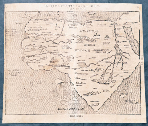
1597 Heinrich Bunting Rare Antique Map of The whole Continent of Africa
Antique Map
- Title : Africa Tertia Pars Terrae
- Ref #: 61200
- Size: 13 3/4in x 11 3/4in (350mm x 300mm)
- Date : 1597
- Condition: (A) Very Good Condition
Description:
This scarce striking original antique woodcut map of Africa was published in the 1597 edition of the German theologian Heinrich Buntings Itinerarium Sacrae.
The pattern of rivers and major place names are modeled on those on the 1540 Africa map of Sebastian Münster, but these were necessarily distorted to fit the unusual outline of the continent as presented here. The ocean is engraved with distinctive wavy lines, and is decorated with a sailing ship, a merman, and what appears to be a swan. Cities marked on the map include Alexandria, Memphis, Cairo - and the Kingdom of the legendary Prester John.
General Description:
Paper thickness and quality: - Heavy and stable
Paper color: -
Age of map color: -
Colors used: -
General color appearance: -
Paper size: - 13 3/4in x 11 3/4in (350mm x 300mm)
Plate size: - 13 3/4in x 11 3/4in (350mm x 300mm)
Margins: - Min 1/8in (3mm)
Imperfections:
Margins: - Age toning
Plate area: -Age toning, 4 small worm holes
Verso: - Medium age toning, 3 old small re-enforcements on verso not affecting the image. Top left margin cropped close to border
Background:
This map is based on the first modern map of Africa, which featured in Sebastian Münster’s Geographia (1540) and Cosmographia (1544). The map shows the entire continent along with the Sinai Peninsula, part of the Arabian Peninsula, and the southern edge of the Iberian Peninsula. Several large cities are marked with clusters of European-style buildings, including church steeples. Rolling mountain ranges break up the interior, along with massive rivers.
The largest of these is of course the Nile River. It flows from the southern interior of the continent to the north. Following the Ptolemaic model that was also used in Münster’s earlier map, the Nile originates in the Montes Lunae, or the Mountains of the Moon. Bunting also locates Prester John’s kingdom near the Mountains of the Moon.
One of the most distinct toponyms is Elephantophagi, near what is today the Congo. This refers to a tribe discussed by Strabo and Pliny who supposedly hunted and ate elephants and traded their hides and tusks across Africa.
At sea, the water is carved in aesthetically pleasing zig-zag lines. A large ship is joined by a merman and a swan.
Heinrich Bünting (Hannover, 1545-1606)
Heinrich Bünting was a protestant pastor and theologian. He was also a brewer in Hannover, and he was concerned with history and wrote a Braunschweigische Chronica in 1584. His main work was the popular Itinerarium Sacrae Scripturae, which after the first edition in Magdeburg in 1581 had many editions in German, Latin, Dutch, Swedish, Danish, Czech and English.
The book gave an overview of biblical geography based on the travel descriptions of various notable people from the Old and New Testaments. It contained ten woodcut maps, including three figurative maps: the world depicted as a cloverleaf with Jerusalem in the centre, Europe in the shape of a crowned woman, and Asia as the winged horse Pegasus.

1598 Sebastian Munster Rare Antique Map - Birds Eye View of London, England
Antique Map
- Title : Londen oder Lunden die Hauptstatt in Engellandt / am fluß Thamesis gelegen/ auff das aller fleißsigste nach jetziger gelegenheit abcontrafehtet
- Ref #: 51012
- Size: 15 1/4in x 12 1/2in (385mm x 315mm)
- Date : 1598
- Condition: (A+) Fine Condition
Description:
This scarce original 1st edition antique woodcut birds eye view, is the third earliest acquirable depiction of London. Prepared in 1598, it was the only depiction of London to appear in Sebastian Munsters publication of Cosmographia, appearing in only the three last Sebastian Petri editions.
Modeled on Georg Braun and Franz Hogenberg's 1572 plan, the city here is laid out as a plan, but the buildings and surrounding landscape are presented in elevation - thus giving the impression of a bird's-eye view, even to the extent of detailing gardens and showing bustling river traffic. Also, as with the Braun and Hogenberg, the view has included four figures in the foreground: a nobleman and woman, with their attendant maid and footman (he, armed with a sword), each dressed in the styles of the period appropriate to their positions.
General Description:
Paper thickness and quality: - Heavy and stable
Paper color: -
Age of map color: -
Colors used: -
General color appearance: -
Paper size: - 15 1/4in x 12 1/2in (385mm x 315mm)
Plate size: - 15 1/4in x 12 1/2in (385mm x 315mm)
Margins: - Min 1/2in (12mm)
Imperfections:
Margins: - Uniform age toning
Plate area: - Uniform age toning
Verso: - Uniform age toning
Background:
Sebastian Munster's woodblock map of London is one of the earliest maps of the city available to collectors. It shows London during the lifetimes of Queen Elizabeth I and William Shakespeare. This map is a derivative of the Braun & Hogenberg's map of 1572. Munster has even arranged the costumed figures in the foreground into the same poses. Instead of the Latin descriptions found in the lower corners of the map on the Braun & Hogenberg map, Munster has instead included two panels listing the seven gates in the City wall, from west to east.
The old St Paul's Cathedral with its original pointed spire sits at the centre of the map. The spire was destroyed in a fire in 1561, but frequently appeared on later depictions of the city. The cathedral itself was burnt to the ground during the Great Fire of 1666, after which Christopher Wren designed and built the modern cathedral. To the southeast of St Paul's is the old London Bridge, the only bridge crossing over the River Thames until the 18th century.
South of the river are two circular arenas for bull and bear baiting. This was a vicious, but popular, form of entertainment in Tudor London. Shakespeare's Globe Theatre would be built in 1599 on a parcel of land to the west of these arenas.
Located outside of the City of London's jurisdiction, Southwark was a riotous pleasure ground where Londoners went to escape the strict rules north of the river.
On the far left of the map is Westminster, a separate royal enclave surrounding St James's Palace and Whitehall linked to the city by the Strand and by the river. A royal barge is shown on the river to the west of London Bridge, depicting the monarch's typical method of traveling to avoid the crowded streets of the city. The royal coat of arms is appropriately placed in the upper-left corner above Westminster, while the upper-right corner contains the coat of arms of the City of London. (Ref: Shirley; Tooley; M&B)
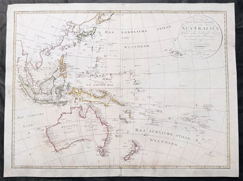
1804 Reinecke Large Antique Map of Australia, New Zealand & Pacific - Ulimaroa
Antique Map
- Title : General Chart von Australien Nach ne neuesten Entdeckungs Reisen und astronischen Bestimungen...1804
- Size: 24in x 19 1/2in (660mm x 495mm)
- Condition: (A) Very Good Condition
- Date : 1804
- Ref #: 51013
Description:
This large original copper plate engraved, hand coloured antique map of Australia (Ulimaroa) New Zealand and the South Pacific was drawn by Christoph Matthais Reinecke in 1804.
Ulimaroa was a name given to Australia by the Swedish geographer and cartographer Daniel Djurberg in 1776. Djurberg adapted the name from Olhemaroa, a Māori word found in Hawkesworths edition of Captain James Cook and Sir Joseph Banks journals which is thought to have been a misunderstood translation — the Māori were actually referring to Grand Terre, the largest island of New Caledonia. Djurberg believed the name meant something like big red land, whereas modern linguists believe it meant long hand — echoing the geography of Grand Terre. The spurious name continued to be reproduced on certain European maps, particularly some Austrian, Czech, German and Swedish maps, until around 1820, including in Carl Almqvists 1817 novel Parjumouf Saga ifrån Nya Holland (Stockholm, 1817).
General Definitions:
Paper thickness and quality: - Heavy and stable
Paper color : - off white
Age of map color: - Original
Colors used: - Yellow, green, blue, pink
General color appearance: - Authentic
Paper size: - 24in x 19 1/2in (660mm x 495mm)
Plate size: - 24in x 19 1/2in (660mm x 495mm)
Margins: - Min 1/2in (15mm)
Imperfections:
Margins: - Light soiling
Plate area: - Light age toning 4 pin holes, light horizontal fold
Verso: - Light soiling on verso
Background:
An incredibly early map of Australia with detail of both the west and east coast's. Sydney Cove is clearly marked as it established itself as the premier settlement on the eastern seaboard. The NSW border is marked in a dotted line from the Gulf of Carpentaria south to roughly where Adelaide now sits. Port Philip has not yet been discovered with both Hobart and Adelaide yet to be named. A fantastic very early colonial map of Australia only 31 years after Cook first mapped the east coast and only 13 years after the establishment of the first white settlement in Botany Bay/Sydney. (Ref: M&B; Tooley)
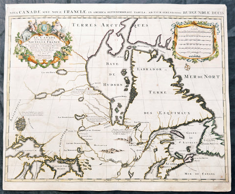
1696 Alexis Hubert Jaillot Large Antique Map North America, Canada & Great Lakes
Antique Map
- Title : Le Canada ou Partie de la Nouvelle France....Hubert Jaillot....1696
- Size: 24 3/4in x 20 1/2in (680mm x 520mm)
- Condition: (A) Very Good Condition
- Date : 1696
- Ref #: 51014
Description:
This large original copper plate engraved, hand coloured antique map of North America, Canada and the Great Lakes was engraved in 1696 - dated in title - and was published by Alexis Hubert Jaillot in his monumental Atlas Nouveau.
General Definitions:
Paper thickness and quality: - Heavy and stable
Paper color : - off white
Age of map color: - Original
Colors used: - Yellow, green, blue, pink
General color appearance: - Authentic
Paper size: - 35 1/2in x 23in (900mm x 585mm)
Plate size: - 34 1/2in x 22 1/2in (875mm x 570mm)
Margins: - Min 1/2in (15mm)
Imperfections:
Margins: - Light age toning in margin
Plate area: - Light age toning and offsetting
Verso: - 4 small re-enforcements on verso
Background:
Nice example of Jaillot's map of Hudson's Bay, Canada, the Great Lakes, and the regions then controlled by French Missionaries and Traders.A number of forts are located in and around Hudson Bay. These would be the forts recently seized from the English Hudson Bay Company in 1686 an which at the time of the publication of the map were the subject of active conflict between the French and English forces in the region.
The four short notes on the map identify four areas of settlement and fur trading activities:
Poste pour couper les Sauvages par le haut de la traite de Tadoussac et les empêcher de descendre à la Baye de Hudson. (Translation: Post to intercept the Indigenous peoples at the upper Tadoussac trade route and prevent them from descending to Hudson Bay.") This section indicates a strategic location near Tadoussac, an important trading post established in 1600 by Pierre de Chauvin de Tonnetuit. Tadoussac was a key site for the fur trade between the French and Indigenous peoples. The notation reveals efforts to control the movement of Indigenous groups, particularly in the context of the fur trade, by preventing them from reaching the lucrative markets of Hudson Bay. The neighboring English settlement is Rupert House (Fort Rupert).
Poste du Sr. de S. Germain pour couper pres que tous les Sauvages du Nort et les empêcher de descendre à la Baye de Hudson. (Translation: "Post of Sr. de S. Germain to intercept nearly all the Indigenous peoples from the North and prevent them from descending to Hudson Bay."). Highlighting another strategic outpost, this section references Daniel Greysolon, Sieur DuLhuta French soldier and explorer who was largely responsible for establishing French control over the country north and west of Lake Superior.. This post aimed to control northern Indigenous trade routes and limit their access to Hudson Bay, thereby securing French trade interests in the region, possibly in coordination with the Compagnie des Cent-Associés (Company of One Hundred Associates), established in 1627 to manage the colony's resources. The neighboring English settlement includes Moose Factor (Fort Saint-Louis).
Poste du Sr. Duluth pour empêcher les Assiniboels et autres Sauvages de descendre à la Baye de Hudson. (Translation: "Post of Sr. Duluth to prevent the Assiniboine and other Indigenous peoples from descending to Hudson Bay."). This notation points to a post established by Daniel Greysolon, Sieur du Lhut (Duluth). His efforts in the 1670s and 1680s to establish posts and alliances with Indigenous groups were crucial in French attempts to dominate the fur trade by controlling access to Hudson Bay.
Poste François decouvert et occupé par la Compagnie qui s'est formée en Canada pour la Baye de Hudson. (Translation: "French post discovered and occupied by the Company formed in Canada for Hudson Bay.").
Hudson Bay Company and French Fur Trading Conflicts in the 17th Century
In the 17th century the French had a de facto monopoly on the Canadian fur trade. Two French traders, Pierre-Esprit Radisson and Médard des Groseilliers (Médard de Chouart, Sieur des Groseilliers), Radisson's brother-in-law, learned from the Cree Indians that the best fur country lay north and west of Lake Superior. They sought French backing for a plan to set up a trading post on Hudson's Bay. Thee French refused. In 1659, without official support, Radisson and Groseilliers set out for the upper Great Lakes basin. A year later they returned with premium furs, evidence of the potential of the Hudson Bay region. Subsequently, they were arrested for trading without a license and fined, and their furs were confiscated.
Radisson and Groseilliers approached a group of English businessmen in Boston, who agreed on the plan's merits but their speculative voyage in 1663 failed when their ship ran into pack ice in Hudson Strait. Colonel George Cartwright learned of the expedition and brought the two to London in 1665, where they gained the sponsorship of Prince Rupert. In 1668 the English expedition acquired two ships, the Nonsuch and the Eaglet, departing on June 5, 1668. Once in James Bay, the expedition established the first fort on Hudson Bay, Charles Fort, at the mouth of the Rupert River. (It was later known as Rupert House, and developed as the community of present-day Waskaganish, Quebec.) After a successful trading expedition over the winter of 1668–69, Nonsuch returned to England with the first cargo of fur, which was sold to Thomas Glover, one of London's most prominent furriers.
The Governor and Company of Adventurers of England Trading into Hudson's Bay was incorporated on May 2,1670, with a royal charter from King Charles II, graining the company a monopoly over the region drained by all rivers and streams flowing into Hudson Bay in northern Canada. The area was named "Rupert's Land".
The HBC established six posts between 1668 and 1717. Rupert House (1668), Moose Factory (1673) and Fort Albany (1679) were erected on James Bay and Fort Severn (1689), York Factory (1684) and Fort Churchill (1717) on Hudson's Bay.
The early coastal factory model of the English contrasted with the system of the French, who established an extensive system of inland posts at native villages, and sent traders to live among the tribes of the region, learning their languages and often forming alliances through marriages with indigenous women. In March 1686, the French sent a raiding party under the Chevalier des Troyes to capture the HBC posts along James Bay. The French appointed Pierre Le Moyne d'Iberville, who had shown great heroism during the raids, as commander of the company's captured posts. In 1687 an English attempt to resettle Fort Albany failed due to strategic deceptions by d'Iberville. After 1688 England and France were officially at war, and the conflict played out in North America as well. D'Iberville raided Fort Severn in 1690 but did not attempt to raid the well-defended local headquarters at York Factory. In 1693 the HBC recovered Fort Albany; d'Iberville captured York Factory in 1694, but the company recovered it the next year.
In 1697, d'Iberville again commanded a French naval raid on York Factory. On the way to the fort, he defeated three ships of the Royal Navy in the Battle of Hudson's Bay (September 1697), the largest naval battle in the history of the North American Arctic. D'Iberville's depleted French force captured York Factory by laying siege to the fort and pretending to be a much larger army. The French retained all of the outposts except Fort Albany until 1713. (A small French and Indian force attacked Fort Albany again in 1709 during Queen Anne's War but was unsuccessful. The economic consequences of the French possession of these posts for the company were significant; HBC did not pay any dividends for more than 20 years. (Ref: Stevenson; Tooley; M&B)
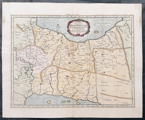
1695 Gerard Mercator Antique Ptolemy Map of Iran & Iraq between Caspian & Persian Gulf
Antique Map
- Title : Asiae V tab:
- Size: 21in x 17 1/2in (535mm x 445mm)
- Condition: (A+) Fine Condition
- Date : 1695
- Ref #: 51007
Description:
This original copper plate engraved hand coloured antique Ptolemy map of Iran & Iraq between Caspian & the Persian Gulf, after Claude Ptolemy's Geographia was published in the Helma Strick edition of Geographia in 1695.
These maps, after the 1st century text by Claude Ptolemy, were first published by Gerard Mercator in 1578 edition of Geographia by Gottfried von Kempen
General Definitions:
Paper thickness and quality: - Heavy and stable
Paper color : - off white
Age of map color: - Early
Colors used: - Yellow, green, blue, pink
General color appearance: - Authentic
Paper size: - 21 1/2in x 17 1/2in (545mm x 445mm)
Plate size: - 15 1/2in x 13 3/4in (395mm x 350mm)
Margins: - Min 1in (25mm)
Imperfections:
Margins: - Light age toning
Plate area: - None
Verso: - None
Background:
The Ptolemy maps were taken from the text of Claude Ptolemy (AD 87 - 150) a Greek mathematician, astronomer and geographer, living in Alexandria, assembled and codified his predecessors cartographic theories including those of Marinus of Tyre (c. AD 120). In about AD 150 he published his Geographia, a work in 8 volumes, supposedly illustrated with a world map, 26 regional maps and a profusion of smaller maps. Although the text of the Geographia survived, no maps older than about the twelfth century have come down to us and, in consequence, we have no means of knowing whether the 'Ptolemy' maps on which we set so much store were, in fact, drawn by him or were the interpretations of later map makers using his text as a basis. (Ref: Koeman; Norwich)
Background of Ptolemy's Geographia: The first published edition of Ptolemy's ‘Geographia’ with maps, engraved by Taddeo Crivelli, was issued in Bologna in 1477. Unusually, this edition contained 26 maps, with one of the Asia maps divided up among three neighbouring sheets. With the exception of Palestine, these are the first regional maps of any of these various countries.
Unfortunately for the undertakers, this atlas seems not to have been a commercial success, and today only twenty-six examples of the atlas are recorded, with all but one in institutional libraries.
One explanation of the failure is that the publishers do not seem to have been fully mastered the intricacies and problems of engraving, and printing from, copper-plates, an art, which, after all, was very new and experimental. These problems were more successfully addressed by a German printer, Conrad Sweynheym, who was working on an edition of Ptolemy in Rome in the same period. Unfortunately, he did not live to see the volume appear, but his successor, Arnold Buckinck, saw the atlas through the press, in 1478.
The Rome Ptolemy contained 27 maps, with the same geographical coverage as the 1477 Ptolemy. Of the engraved editions of Ptolemy’s ‘Cosmographia’ the maps in the Rome edition are the finest fifteenth century examples, and second only to Mercator’s maps, from his 1578 edition. One explanation for this was the use of individual punches to stamp letters onto the printing plates, rather than engraving them. This allowed much greater uniformity than lettering-engravers were able to achieve, and gives a very pleasing overall effect. The atlas proved popular, and three successive editions (to 1508) followed, although only about forty examples of the first edition are recorded today.
Claudius Ptolemy(90 A.D.-168 A.D.) was a celebrated astronomer, mathematician, and geographer who lived in Alexandria in the 2nd century AD. Although his thinking influenced contemporary Arab geographers, little was known of his work in the West until manuscripts from Constantinople reached Italy in about 1400. These manuscripts were written in Greek and contained the names of every city, island, mountain and river known to the many travellers interviewed by Ptolemy. In addition, the latitude and longitude of each of the resulting eight thousand locations were also recorded. They were translated into Latin by 1401 and appeared in print by 1475. The earliest Byzantine manuscript maps, drawn by analysing the Ptolemy figures, date from the twelfth century. A number of hand-drawn copies were made in Italy throughout the early fifteenth century to accompany Ptolemy's text.
Ptolemy stressed the importance of accurate observations in order to calculate latitude and longitude, and laid down the principals of systematic cartography that remain to this day. Obviously there are many errors in Ptolemy's maps, due to the limited extent of basic geographic information at that time and the lack of a method of determining accurate longitudes. Judged by modern standards, the basic shortcoming of the Ptolemy world map is the small area it portrays. The Mediterranean is fairly well depicted, but is greatly exaggerated in length (Longitudinally). The effect of this, combined with Ptolemy's disregard for Eratosthenes' extremely accurate estimate of the earth's circumference (c. 200 B.C.) and the use of a Posidonius' much smaller flawed estimate (c.50 B.C.) implied a much shorter distance across that part of the unknown earth's surface not drawn on the map. Columbus and his contemporaries based their exploratory ventures on Ptolemy's calculations and, like him, had no idea of the vast New World to the west, interposed between Europe and Asia.
Work on the first “printed” atlas from the text of Ptolemy was started in 1473 and finally published in 1478. A crude copy of this atlas was produced and published by some dissident workers in 1477 in order to be ‘first’. However, the plates for the 1478 were done prior to the pirated issue and thus the 1478 atlas holds the title of the first Atlas of the world. There are very few surviving examples of this atlas and individual maps. (Ref: Stevenson; Tooley; M&B)
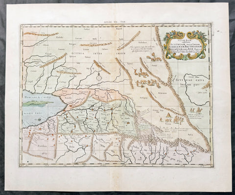
1695 Gerard Mercator Antique Ptolemy Map of Caspian Sea Kazakhstan to Iran
Antique Map
- Title : Asiae VII tab:
- Size: 21in x 17 1/2in (535mm x 445mm)
- Condition: (A+) Fine Condition
- Date : 1695
- Ref #: 51009
Description:
This original copper plate engraved hand coloured antique Ptolemy map of the eastern Caspian Sea from Kazakhstan to Iran, after Claude Ptolemy's Geographia was published in the Helma Strick edition of Geographia in 1695.
These maps, after the 1st century text by Claude Ptolemy, were first published by Gerard Mercator in 1578 edition of Geographia by Gottfried von Kempen
General Definitions:
Paper thickness and quality: - Heavy and stable
Paper color : - off white
Age of map color: - Early
Colors used: - Yellow, green, blue, pink
General color appearance: - Authentic
Paper size: - 21 1/2in x 17 1/2in (545mm x 445mm)
Plate size: - 15 1/2in x 13 3/4in (395mm x 350mm)
Margins: - Min 1in (25mm)
Imperfections:
Margins: - Light age toning
Plate area: - None
Verso: - None
Background:
The Ptolemy maps were taken from the text of Claude Ptolemy (AD 87 - 150) a Greek mathematician, astronomer and geographer, living in Alexandria, assembled and codified his predecessors cartographic theories including those of Marinus of Tyre (c. AD 120). In about AD 150 he published his Geographia, a work in 8 volumes, supposedly illustrated with a world map, 26 regional maps and a profusion of smaller maps. Although the text of the Geographia survived, no maps older than about the twelfth century have come down to us and, in consequence, we have no means of knowing whether the 'Ptolemy' maps on which we set so much store were, in fact, drawn by him or were the interpretations of later map makers using his text as a basis. (Ref: Koeman; Norwich)
Background of Ptolemy's Geographia: The first published edition of Ptolemy's ‘Geographia’ with maps, engraved by Taddeo Crivelli, was issued in Bologna in 1477. Unusually, this edition contained 26 maps, with one of the Asia maps divided up among three neighbouring sheets. With the exception of Palestine, these are the first regional maps of any of these various countries.
Unfortunately for the undertakers, this atlas seems not to have been a commercial success, and today only twenty-six examples of the atlas are recorded, with all but one in institutional libraries.
One explanation of the failure is that the publishers do not seem to have been fully mastered the intricacies and problems of engraving, and printing from, copper-plates, an art, which, after all, was very new and experimental. These problems were more successfully addressed by a German printer, Conrad Sweynheym, who was working on an edition of Ptolemy in Rome in the same period. Unfortunately, he did not live to see the volume appear, but his successor, Arnold Buckinck, saw the atlas through the press, in 1478.
The Rome Ptolemy contained 27 maps, with the same geographical coverage as the 1477 Ptolemy. Of the engraved editions of Ptolemy’s ‘Cosmographia’ the maps in the Rome edition are the finest fifteenth century examples, and second only to Mercator’s maps, from his 1578 edition. One explanation for this was the use of individual punches to stamp letters onto the printing plates, rather than engraving them. This allowed much greater uniformity than lettering-engravers were able to achieve, and gives a very pleasing overall effect. The atlas proved popular, and three successive editions (to 1508) followed, although only about forty examples of the first edition are recorded today.
Claudius Ptolemy(90 A.D.-168 A.D.) was a celebrated astronomer, mathematician, and geographer who lived in Alexandria in the 2nd century AD. Although his thinking influenced contemporary Arab geographers, little was known of his work in the West until manuscripts from Constantinople reached Italy in about 1400. These manuscripts were written in Greek and contained the names of every city, island, mountain and river known to the many travellers interviewed by Ptolemy. In addition, the latitude and longitude of each of the resulting eight thousand locations were also recorded. They were translated into Latin by 1401 and appeared in print by 1475. The earliest Byzantine manuscript maps, drawn by analysing the Ptolemy figures, date from the twelfth century. A number of hand-drawn copies were made in Italy throughout the early fifteenth century to accompany Ptolemy's text.
Ptolemy stressed the importance of accurate observations in order to calculate latitude and longitude, and laid down the principals of systematic cartography that remain to this day. Obviously there are many errors in Ptolemy's maps, due to the limited extent of basic geographic information at that time and the lack of a method of determining accurate longitudes. Judged by modern standards, the basic shortcoming of the Ptolemy world map is the small area it portrays. The Mediterranean is fairly well depicted, but is greatly exaggerated in length (Longitudinally). The effect of this, combined with Ptolemy's disregard for Eratosthenes' extremely accurate estimate of the earth's circumference (c. 200 B.C.) and the use of a Posidonius' much smaller flawed estimate (c.50 B.C.) implied a much shorter distance across that part of the unknown earth's surface not drawn on the map. Columbus and his contemporaries based their exploratory ventures on Ptolemy's calculations and, like him, had no idea of the vast New World to the west, interposed between Europe and Asia.
Work on the first “printed” atlas from the text of Ptolemy was started in 1473 and finally published in 1478. A crude copy of this atlas was produced and published by some dissident workers in 1477 in order to be ‘first’. However, the plates for the 1478 were done prior to the pirated issue and thus the 1478 atlas holds the title of the first Atlas of the world. There are very few surviving examples of this atlas and individual maps. (Ref: Stevenson; Tooley; M&B)
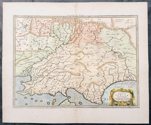
1695 Gerard Mercator Antique Ptolemy Map of India & Subcontinent
Antique Map
- Title : Asiae X Tab:
- Size: 21in x 17 1/2in (535mm x 445mm)
- Condition: (A+) Fine Condition
- Date : 1695
- Ref #: 51008
Description:
This original copper plate engraved hand coloured antique Ptolemy map of India & Subcontinent, after Claude Ptolemy's Geographia was published in the Helma Strick edition of Geographia in 1695.
These maps, after the 1st century text by Claude Ptolemy, were first published by Gerard Mercator in 1578 edition of Geographia by Gottfried von Kempen
General Definitions:
Paper thickness and quality: - Heavy and stable
Paper color : - off white
Age of map color: - Early
Colors used: - Yellow, green, blue, pink
General color appearance: - Authentic
Paper size: - 21 1/2in x 17 1/2in (545mm x 445mm)
Plate size: - 15 1/2in x 13 3/4in (395mm x 350mm)
Margins: - Min 1in (25mm)
Imperfections:
Margins: - Light age toning
Plate area: - None
Verso: - None
Background:
The Ptolemy maps were taken from the text of Claude Ptolemy (AD 87 - 150) a Greek mathematician, astronomer and geographer, living in Alexandria, assembled and codified his predecessors cartographic theories including those of Marinus of Tyre (c. AD 120). In about AD 150 he published his Geographia, a work in 8 volumes, supposedly illustrated with a world map, 26 regional maps and a profusion of smaller maps. Although the text of the Geographia survived, no maps older than about the twelfth century have come down to us and, in consequence, we have no means of knowing whether the 'Ptolemy' maps on which we set so much store were, in fact, drawn by him or were the interpretations of later map makers using his text as a basis. (Ref: Koeman; Norwich)
Background of Ptolemy's Geographia: The first published edition of Ptolemy's ‘Geographia’ with maps, engraved by Taddeo Crivelli, was issued in Bologna in 1477. Unusually, this edition contained 26 maps, with one of the Asia maps divided up among three neighbouring sheets. With the exception of Palestine, these are the first regional maps of any of these various countries.
Unfortunately for the undertakers, this atlas seems not to have been a commercial success, and today only twenty-six examples of the atlas are recorded, with all but one in institutional libraries.
One explanation of the failure is that the publishers do not seem to have been fully mastered the intricacies and problems of engraving, and printing from, copper-plates, an art, which, after all, was very new and experimental. These problems were more successfully addressed by a German printer, Conrad Sweynheym, who was working on an edition of Ptolemy in Rome in the same period. Unfortunately, he did not live to see the volume appear, but his successor, Arnold Buckinck, saw the atlas through the press, in 1478.
The Rome Ptolemy contained 27 maps, with the same geographical coverage as the 1477 Ptolemy. Of the engraved editions of Ptolemy’s ‘Cosmographia’ the maps in the Rome edition are the finest fifteenth century examples, and second only to Mercator’s maps, from his 1578 edition. One explanation for this was the use of individual punches to stamp letters onto the printing plates, rather than engraving them. This allowed much greater uniformity than lettering-engravers were able to achieve, and gives a very pleasing overall effect. The atlas proved popular, and three successive editions (to 1508) followed, although only about forty examples of the first edition are recorded today.
Claudius Ptolemy(90 A.D.-168 A.D.) was a celebrated astronomer, mathematician, and geographer who lived in Alexandria in the 2nd century AD. Although his thinking influenced contemporary Arab geographers, little was known of his work in the West until manuscripts from Constantinople reached Italy in about 1400. These manuscripts were written in Greek and contained the names of every city, island, mountain and river known to the many travellers interviewed by Ptolemy. In addition, the latitude and longitude of each of the resulting eight thousand locations were also recorded. They were translated into Latin by 1401 and appeared in print by 1475. The earliest Byzantine manuscript maps, drawn by analysing the Ptolemy figures, date from the twelfth century. A number of hand-drawn copies were made in Italy throughout the early fifteenth century to accompany Ptolemy's text.
Ptolemy stressed the importance of accurate observations in order to calculate latitude and longitude, and laid down the principals of systematic cartography that remain to this day. Obviously there are many errors in Ptolemy's maps, due to the limited extent of basic geographic information at that time and the lack of a method of determining accurate longitudes. Judged by modern standards, the basic shortcoming of the Ptolemy world map is the small area it portrays. The Mediterranean is fairly well depicted, but is greatly exaggerated in length (Longitudinally). The effect of this, combined with Ptolemy's disregard for Eratosthenes' extremely accurate estimate of the earth's circumference (c. 200 B.C.) and the use of a Posidonius' much smaller flawed estimate (c.50 B.C.) implied a much shorter distance across that part of the unknown earth's surface not drawn on the map. Columbus and his contemporaries based their exploratory ventures on Ptolemy's calculations and, like him, had no idea of the vast New World to the west, interposed between Europe and Asia.
Work on the first “printed” atlas from the text of Ptolemy was started in 1473 and finally published in 1478. A crude copy of this atlas was produced and published by some dissident workers in 1477 in order to be ‘first’. However, the plates for the 1478 were done prior to the pirated issue and thus the 1478 atlas holds the title of the first Atlas of the world. There are very few surviving examples of this atlas and individual maps. (Ref: Stevenson; Tooley; M&B)
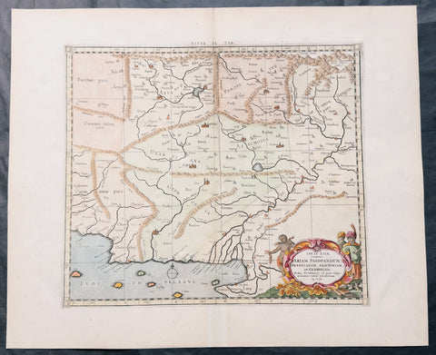
1695 Gerard Mercator Antique Ptolemy Map of Afghanistan & Pakistan Indus Valley
Antique Map
- Title : Asiae IX Tab:
- Size: 21in x 17 1/2in (535mm x 445mm)
- Condition: (A+) Fine Condition
- Date : 1695
- Ref #: 51006
Description:
This original copper plate engraved hand coloured antique map of the Indus Valley, today Afghanistan & Pakistan, after Claude Ptolemy's Geographia was published in the Helma Strick edition of Geographia in 1695.
These maps, after the 1st century text by Claude Ptolemy, were first published by Gerard Mercator in 1578 edition of Geographia by Gottfried von Kempen
General Definitions:
Paper thickness and quality: - Heavy and stable
Paper color : - off white
Age of map color: - Early
Colors used: - Yellow, green, blue, pink
General color appearance: - Authentic
Paper size: - 21 1/2in x 17 1/2in (545mm x 445mm)
Plate size: - 15 1/2in x 13 3/4in (395mm x 350mm)
Margins: - Min 1in (25mm)
Imperfections:
Margins: - Light age toning
Plate area: - None
Verso: - None
Background:
The Ptolemy maps were taken from the text of Claude Ptolemy (AD 87 - 150) a Greek mathematician, astronomer and geographer, living in Alexandria, assembled and codified his predecessors cartographic theories including those of Marinus of Tyre (c. AD 120). In about AD 150 he published his Geographia, a work in 8 volumes, supposedly illustrated with a world map, 26 regional maps and a profusion of smaller maps. Although the text of the Geographia survived, no maps older than about the twelfth century have come down to us and, in consequence, we have no means of knowing whether the 'Ptolemy' maps on which we set so much store were, in fact, drawn by him or were the interpretations of later map makers using his text as a basis. (Ref: Koeman; Norwich)
Background of Ptolemy's Geographia: The first published edition of Ptolemy's ‘Geographia’ with maps, engraved by Taddeo Crivelli, was issued in Bologna in 1477. Unusually, this edition contained 26 maps, with one of the Asia maps divided up among three neighbouring sheets. With the exception of Palestine, these are the first regional maps of any of these various countries.
Unfortunately for the undertakers, this atlas seems not to have been a commercial success, and today only twenty-six examples of the atlas are recorded, with all but one in institutional libraries.
One explanation of the failure is that the publishers do not seem to have been fully mastered the intricacies and problems of engraving, and printing from, copper-plates, an art, which, after all, was very new and experimental. These problems were more successfully addressed by a German printer, Conrad Sweynheym, who was working on an edition of Ptolemy in Rome in the same period. Unfortunately, he did not live to see the volume appear, but his successor, Arnold Buckinck, saw the atlas through the press, in 1478.
The Rome Ptolemy contained 27 maps, with the same geographical coverage as the 1477 Ptolemy. Of the engraved editions of Ptolemy’s ‘Cosmographia’ the maps in the Rome edition are the finest fifteenth century examples, and second only to Mercator’s maps, from his 1578 edition. One explanation for this was the use of individual punches to stamp letters onto the printing plates, rather than engraving them. This allowed much greater uniformity than lettering-engravers were able to achieve, and gives a very pleasing overall effect. The atlas proved popular, and three successive editions (to 1508) followed, although only about forty examples of the first edition are recorded today.
Claudius Ptolemy(90 A.D.-168 A.D.) was a celebrated astronomer, mathematician, and geographer who lived in Alexandria in the 2nd century AD. Although his thinking influenced contemporary Arab geographers, little was known of his work in the West until manuscripts from Constantinople reached Italy in about 1400. These manuscripts were written in Greek and contained the names of every city, island, mountain and river known to the many travellers interviewed by Ptolemy. In addition, the latitude and longitude of each of the resulting eight thousand locations were also recorded. They were translated into Latin by 1401 and appeared in print by 1475. The earliest Byzantine manuscript maps, drawn by analysing the Ptolemy figures, date from the twelfth century. A number of hand-drawn copies were made in Italy throughout the early fifteenth century to accompany Ptolemy's text.
Ptolemy stressed the importance of accurate observations in order to calculate latitude and longitude, and laid down the principals of systematic cartography that remain to this day. Obviously there are many errors in Ptolemy's maps, due to the limited extent of basic geographic information at that time and the lack of a method of determining accurate longitudes. Judged by modern standards, the basic shortcoming of the Ptolemy world map is the small area it portrays. The Mediterranean is fairly well depicted, but is greatly exaggerated in length (Longitudinally). The effect of this, combined with Ptolemy's disregard for Eratosthenes' extremely accurate estimate of the earth's circumference (c. 200 B.C.) and the use of a Posidonius' much smaller flawed estimate (c.50 B.C.) implied a much shorter distance across that part of the unknown earth's surface not drawn on the map. Columbus and his contemporaries based their exploratory ventures on Ptolemy's calculations and, like him, had no idea of the vast New World to the west, interposed between Europe and Asia.
Work on the first “printed” atlas from the text of Ptolemy was started in 1473 and finally published in 1478. A crude copy of this atlas was produced and published by some dissident workers in 1477 in order to be ‘first’. However, the plates for the 1478 were done prior to the pirated issue and thus the 1478 atlas holds the title of the first Atlas of the world. There are very few surviving examples of this atlas and individual maps. (Ref: Stevenson; Tooley; M&B)
1645 Blaeu Old Antique Map Lindisfarne Holy Islands England - Lindisfarne
Antique Map
- Title : Insula Sacra Vulgo Holy Isand et Farne
- Ref #: 51010
- Size: 23 1/2in x 19in (600mm x 485mm)
- Date : 1645
- Condition: (A) Very Good Condition
Description:
This beautifully hand coloured original antique map of the Holy & Farne Islands off the east coast of Northumberland, England was published in the 1645 edition of Joan Blaeus Atlas Novus.
Blaeu's reference for the topographical data for this map derive from John Speeds maps of Great Britain from the 1611 Empire of Great Britaine - the beautiful decoration, though, is distinctly Blaeus.
Background: Blaeu is one of the most revered map makers of all time and it is easy to see why in this beautiful original map.
The high level of the topographical detail, the quality of the paper, the artistic professionalism of the engraving and the beauty of the original hand colouring combine to produce a work of art that is both functional and of exceptional beauty. (Ref: Koeman; M&B)
General Description:
Paper thickness and quality: - Heavy and stable
Paper color: - off white
Age of map color: - Original
Colors used: - Yellow, pink, red, blue, green
General color appearance: - Authentic
Paper size: - 23 1/2in x 19in (600mm x 485mm)
Plate size: - 20in x 15 1/2in (510mm x 395mm)
Margins: - Min 1in (25mm)
Imperfections:
Margins: - Light age toning
Plate area: - Light creasing along centerfold & adjacent
Verso: - Creasing and age toning along and adjacent to centerfold
Background:
Lindisfarne, also known as Holy Island, is a tidal island off the northeast coast of England, which constitutes the civil parish of Holy Island in Northumberland. Holy Island has a recorded history from the 6th century AD; it was an important centre of Celtic Christianity under Saints Aidan, Cuthbert, Eadfrith, and Eadberht of Lindisfarne. The island was originally home to a monastery, which was destroyed during the Viking invasions but re-established as a priory following the Norman Conquest of England. Other notable sites built on the island are St Mary the Virgin parish church (originally built in 635 CE and restored in 1860), Lindisfarne Castle, several lighthouses and other navigational markers, and a complex network of lime kilns.

1841 Ferdinando Artaria Early Antique Map of The Lost City of Pompeii, Italy
Antique Map
- Title : Plan de Pompei. Pianta della Città di Pompei Cheserve di corredo alla nuovissima Guida d'Italia.
- Ref #: 61202
- Condition: (A+) Fine Condition
- Size: 20 1/2in x 12 1/2in (510mm x 320mm)
- Date: 1841
Description
This original copper-plate antique map of the lost city of Pompeii by Ferdinando Artaria in 1841.
The map depicts the famously devastated city from the Villa of Diomede to the amphitheater. Colors differentiate between public buildings, private buildings, buildings in ruins, and areas that had not yet been excavated. Numbers identify over 110 locations throughout the city, including The Forum, Basilica, Amphitheater, and Giulio Felice house which are identified by name.
General Definitions:
Paper thickness and quality: - Heavy and stable
Paper color : - off white
Age of map color: - Original
Colors used: - Green, yellow, pink
General color appearance: - Authentic
Paper size: - 20 1/2in x 12 1/2in (510mm x 320mm)
Plate size: - 20 1/2in x 12 1/2in (510mm x 320mm)
Margins: - Min 1/2in (12mm)
Imperfections:
Margins: - Folds as issued
Plate area: - Folds as issued
Verso: - Folds as issued
Ferdinando Artaria (1781 - June 25, 1843) was an Italian publisher and seller of maps, music, and prints. Artaria opened his first shop around 1805. He soon began collaborating with Giuseppe Werz (1764 - 1827), who introduced lithographic techniques from Bavaria to Italy in 1808. Artaria opened his own lithography works in 1817 and the name changed to Ferdinando Artaria e Figlio in 1837. This business was the first to publish aquatints made from daguerrotypes. After Artaria died, his son Pasquale ran the business. He sold it to his brother-in-law Francesco Scacchi (1807 - 1900) in 1852, who changed the name of the firm to Ditta Artaria di Gerdinando Sacchi e figli' in 1872. After Scacchi's death, his sons Edoardo and Alberto ran the business until 1921, when it was acquired by the 'BOttega di Poesia' publishing house.

1844 Johnston Large Antique World Map Nation of Texas, Wilkes & Ross Antarctica
Antique Map
- Title : Chart of the World on Mercators Projection
- Ref #: 51011
- Condition: (A+) Fine Condition
- Size: 25in x 20in (635mm x 510mm)
- Date: 1844
Description:
This large original 1st edition, uncommon hand coloured antique lithograph world map was published by W & AK Johnston in his General Atlas, 1844.
A Pacific centered map emphasising the contemporary nation of Texas in North America, a few years prior to joining the union, along with the latest discoveries in Antarctica, or Southern Continent (as it was then known) by Charles Wilkes (1840) and James Ross (1841)
General Definitions:
Paper thickness and quality: - Heavy and stable
Paper color : - off white
Age of map color: - Original
Colors used: - Yellow, green, blue, pink
General color appearance: - Authentic
Paper size: - 25in x 20in (635mm x 510mm)
Plate size: - 25in x 20in (635mm x 510mm)
Margins: - Min 1/2in (12mm)
Imperfections:
Margins: - Light age toning
Plate area: - None
Verso: - None
1897 J G Bartholomew & Archibald Geik Large Antique Geological Map England Wales
Antique Map
- Title : eological Map of England & Wales...Sir Archibald Geike....by John Bartholomew
- Ref #: 51003
- Condition: (A) Very Good Condition
- Size: 41in x 35in (1.04mm x 890mm)
- Date: 1897
Description:
This large, original antique lithograph linen-backed folding map of England and Wales showing the dominant geological strata of Britain as far north as Berwick was compiled by the famous Scottish geologist and author, Sir Archibald Geikie, Director-General of the Geological Survey of the United Kingdom. The map was also published by the prestigious Bartholomew publishing house in 1897.
legend which runs along the left-hand margin of the map explains the colouring. There are also three geological cross-sections.
General Definitions:
Paper thickness and quality: - Heavy and stable
Paper color : - off white
Age of map color: - Original
Colors used: - Green, yellow, pink
General color appearance: - Authentic
Paper size: - 41in x 35in (1.04mm x 890mm)
Plate size: - 41in x 35in (1.04mm x 890mm)
Margins: - Min 1/2in (12mm)
Imperfections:
Margins: - Blue covers loose and small tear along spine, not affecting the map
Plate area: - None
Verso: - None

1817 Breton & Brion Antique Map Cooks 1st Pacific Voyage Australia & New Zealand
Antique Map
- Title : Carte d une partie de la Mer Du Sud...Cook 1769
- Ref #: 51016
- Condition: (A+) Fine Condition
- Size: 12in x 8in (300mm x 220mm)
- Date: 1817
Description:
This original copper-plate engraved antique map drawn during the 1st Voyage of Captain James Cook to the South Pacific, New Zealand, Australia, between 1769 & 1771 was later engraved by Pierre Brion and published by Henry Breton in the 1817 atlas "Biblio Portative Des Voyages Traduite De L Anglais" Par MM. Henry et Breton Tome XLII
General Definitions:
Paper thickness and quality: - Heavy and stable
Paper color : - off white
Age of map color: -
Colors used: -
General color appearance: -
Paper size: - 12in x 8in (300mm x 220mm)
Plate size: - 11 1/2in x 8in (295mm x 220mm)
Margins: - Min 1/2in (12mm)
Imperfections:
Margins: - Folds as issued
Plate area: - Folds as issued
Verso: - Folds as issued
Background:
Cooks First Voyage (1768-1771)
The first voyage under Captain James Cooks command was primarily of a scientific nature. The expedition on the Endeavour initially sailed to Tahiti to observe the transit of the planet Venus in order to calculate the earths distance from the sun. Cook landed on the South Pacific island in April of 1769 and in June of that year the astronomical observations were successfully completed. In addition to these labors, very good relations with the Tahitians were maintained and the naturalists Joseph Banks and Daniel C. Solander conducted extensive ethnological and botanical research.
Another purpose of the voyage was to explore the South Seas to determine if an inhabitable continent existed in the mid-latitudes of the Southern Hemisphere. Upon leaving Tahiti, Cook named and charted the Society Islands and then continued southwest to New Zealand. His circumnavigation and exploration of that country also resulted in a detailed survey. Cook proceeded to Australia, where he charted the eastern coast for 2,000 miles, naming the area New South Wales. As a result of these surveys, both Australia and New Zealand were annexed by Great Britain. In addition to these explorations, the Endeavour returned to England without a single death from scurvy among its men, an historic feat at the time. The combination of these accomplishments brought Cook prominence, promotion, and the opportunity to lead further expeditions.
Cooks Second Voyage (1772-1775)
Based on the success of his first voyage, Cook was appointed by the Admiralty to lead a second expedition. Two ships were employed with Cook commanding the Resolution and Captain Tobias Furneaux in charge of the Adventure. The purpose was to circumnavigate the globe as far south as possible to confirm the location of a southern continent. Cook proved that there was no Terra Australis, which supposedly was located between New Zealand and South America. Cook was convinced, however, that there was land beyond the southern ice fields. In his pursuit of this idea, this expedition was the first European voyage to cross the Antarctic Circle. In addition, in two great sweeps through the Southern latitudes, Cook made an incredible number of landfalls including New Zealand, Easter Island, the Marquesas, Tahiti and the Society Islands, the Tonga Islands, the New Hebrides, New Caledonia, and a number of smaller islands.
In addition to these navigational accomplishments and the accompanying expansion of geographical knowledge, the expedition also recorded a vast amount of information regarding the Pacific islands and peoples, proved the value of the chronometer as an instrument for calculating longitude, and improved techniques for preventing scurvy.
Cooks Third Voyage (1776-1779)
In the course of his first two voyages, Cook circumnavigated the globe twice, sailed extensively into the Antarctic, and charted coastlines from Newfoundland to New Zealand. Following these achievements, Cooks third voyage was organized to seek an efficient route from England to southern and eastern Asia that would not entail rounding the Cape of Good Hope. The search for such a Northwest (or Northeast) Passage had been on the agenda of northern European mariners and merchants since the beginning of European expansion in the late fifteenth century. Englands growing economic and colonial interests in India in the later eighteenth century provided the stimulus for the latest exploration for this route.
Cook, again in command of the Resolution, was to approach the Northwest Passage from the Pacific accompanied by a second ship, the Discovery, captained by Charles Clerke. The ships left England separately, regrouped at Cape Town, and continued on to Tasmania, New Zealand, and Tahiti. The expedition then sailed north and made landfall at Christmas Island and the Hawaiian Islands. Cook continued northward and charted the west coast of North America from Northern California as far as the Bering Strait. He returned to Hawaii for the winter and was killed in a skirmish with natives on February 14, 1779. Upon Cooks death, Clerke took command of the expedition but died six months later. The ships returned to England in 1780 under John Gore, who had commanded the Discovery after Cooks death. From start to finish, the voyage had lasted more than four years. (Ref Tooley; M&B; Clancy)
1644 Willem Blaeu Antique Map of Iceland - Beautiful Original Hand Colouring
Antique Map
- Title :Tabula Islandia Auctore Georgio Carolo Flandro
- Ref #: 35625
- Condition: (A) Very Good Condition
- Size: 23 1/2in x 20in (590mm x 510mm)
- Date: 1644
Description:
This original copper plate engraved antique map, with beautiful original hand colouring by Willem Blaeu, was engraved by Jodocus Hondius after Joris Carolus, and was published by Guillaume Blaeus in the 1644 Latin edition of Atlas Nouvs.
This is beautiful example of this early map of Iceland with fresh original hand colouring, on uniform aged paper with original margins.
General Definitions:
Paper thickness and quality: - Heavy and stable
Paper color : - off white
Age of map color: - Original
Colors used: - Yellow, green, blue, pink
General color appearance: - Authentic
Paper size: - 23 1/2in x 20in (590mm x 510mm)
Plate size: - 20in x 15 1/4in (510mm x 395mm)
Margins: - Min 1in (25mm)
Imperfections:
Margins: - Light scraping to L & R margins
Plate area: - Uniform aged toning
Verso: - Uniform aged toning
Background:
This map of Iceland is perhaps the most familiar of all the outlines of the island ever published. The author is stated to be one Joris Carolus, a Dutch navigator from Enkhuizen, whose map was first engraved and prepared by Jodocus Hondius the younger in 1628, whose plates were bought by Willem Blaeu in 1629. Iceland bears the imprint of Willem Blaeu who issued it in his Appendix of 1630.
The Carolus map was copied by virtually all mapmakers throughout the rest of the 17th century and well into the 18th. Some of the information is derived from a map made famous by the Flemish cartographer Abraham Ortelius, the Islandia of Gudhbrandur Thorlaksson (1541 - 1627) Bishop of Holar, who had studied mathematics and astronomy as well as theology, while other information, such as place names, is derived from Gerard Mercator's map of 1595.
Willem Blaeu reprinted the map without change in his subsequent atlas editions, as did Joan after him, including the great atlas of 1662. In the southern southern part is shown the lively impression of Hekla in full eruption, described as mons perpetuo ardens while immediately to the west, the Bishopric of Skalholt is marked. To the south a note by Eiapialla hokel (Eyjafjallajokull) states that here may be found falcones albi or white falcons, presumably referring to the gyr falcon.
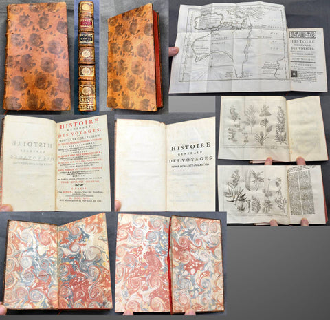
1753 Diderot & Bellin Antique Atlas History of Early Voyages to Australia w/ Map
Antique Atlas
- s Diderot & Nicolas BellinTitle : Histoire Generale Des Voyages ou Nouvelle Collection De Toutes Les Relations de Voyages Par Mer et Par Terre, Qui ont ete publiees jusqu a present dans les differentes Langues de toutes les nations connues.....Tome Quarante - Deuxieme A Paris Chez Didot....MDCCLIII
(General History of Travels or New Collection of all Travel reports by Sea and land, which have been published unitl now in the different languages of all known nations....volume 42...Didots...1753) - Ref #: 51002
- Size: 12mo (7in x 4in)
- Date : 1753
- Condition: (A+) Fine Condition
Description:
This original antique atlas of early voyages of discovery to the South Seas and significantly Australia was published by the famous French writer & publisher of the French Enlightenment Denis Diderot in his significant publication Historie Generale Des Voyages in 1753 - dated.
The atlas contains 381 pages, one of the earliest complete copper plate maps of Australia (13in x 10in) by Nicolas Bellin along with 2 copper plate prints of plants by Dampier in the late 17th century. The atlas has original marbled end papers contained within contemporary mottled calf bindings, gilt spines in compartments with morocco labels.
This atlas is in beautiful fine condition, clean crisp paper, fine map and prints contained within a beautiful tight calf bindings and spine.
General Definitions:
Paper thickness and quality: - Heavy and stable
Paper color : - white
Age of map color: -
Colors used: -
General color appearance: -
Book size: - 12mo (7in x 4in)
Imperfections:
Margins: - See above
Plate area: - See above
Verso: - See above
A significant publication which includes accounts of many early voyages to Asia & the southern hemisphere. The voyages include
1. Introduction
2. Francois Plesart 1629 - 1630
3. Abel Tasman 1642 - 1643
Please note all items auctioned are genuine, we do not sell reproductions. A Certificate of Authenticity (COA) can be issued on request.
1658 Jansson & Hornius Large Antique Map of the Holy Land, Israel, Palestine XII Tribes
Antique Map
- Title : (Situs Terrae Promissionis)
- Ref #: HL
- Size: 71in x 36in (1.801m x 910mm)
- Date : 1658
- Condition: (A+) Fine Condition
Description:
This large (71in, 1.8m) & very important rare map of the Holy Land, Featuring the Twelve Tribes of Israel by Jan Jansson & George Hornius 8-sheet map of the Holy Land was published in 1658. The map is oriented with east at the top and provides one of the finest large-scale depictions of the Holy Land available in the seventeenth century.
The map is based on Christian van Adricham's 1590 map Situs Terrae Promissionis. Jansson version is both expanded and carries additional vignettes and details. Georgius Hornius wrote the text that accompanied the map in volume six of Jansson’s Novus Atlas, Accuratissimia Orbis Antiqui Delineatio.
The single map appears occasionally on the market, but rarely complete sets joined with old color.
The map shows the region divided into domains of the Twelve Tribes of Israel on both sides of the Jordan River, with the shoreline running from Sidon to Alexandria. The Cison Torrens (Kishon River) is shown as connecting the Sea of Galilee with the Mediterranean Sea, and there are many rivers, some of which do not exist; for example, there is a river connecting Jerusalem with the Dead Sea. In the Dead Sea, four burning cities are shown: Sodom, Gomorra, Seboim, and Adama.
The map is intricately engraved to show topographical features, major roads, towns and villages. It is also richly embellished with dozens of biblical illustrations. Inset maps in the top corners depict Abraham's journey (left) and the wandering of the Israelites through the desert (right).
General Definitions:
Paper thickness and quality: - Heavy and stable
Paper color : - off white
Age of map color: - Original & later
Colors used: - Yellow, green, blue, pink
General color appearance: - Authentic
Paper size: - 71in x 36in (1.801m x 910mm)
Plate size: - 71in x 36in (1.801m x 910mm)
Margins: - Min 1/2in (12mm)
Imperfections:
Margins: - Folds as issued, light age toning
Plate area: - Folds as issued, light age toning
Verso: - Folds and joins re-enforced with contemporary paper
Background:
Titles and description of the six individual maps:
Tribus Ruben, et Gad et partes orientales tribuum Beniamin, Ephraim, et dimidiae Manasse intra Iordenem. This is usually thought to the be the first panel in the series. It includes several vignettes, such as Jesus and Satan arguing on a mountaintop, Moses looking across the Jordan, the entry point of the Hebrews into the land of Milk and Honey, and a stairway ascending to heaven. This panel shows the lands controlled by Ruben and Gad, as well as the eastern lands of Benjamin, Ephraim, and part of Manasseh beyond the Jordan River. It also shows the western part of the Dead Sea.
Tribuum Ephraim, Beniamin, et Dimidiae Manasse intra Iordanem partes occidentales, et partes septentrionales Dan et Iuda. This second panel shows the lands of Ephraim, Benjamin, and part of Manasseh beyond the Jordan river. More Biblical scenes include a scene where Jonas is cast from a sailing ship into the open jaws of a whale. Also, the panel shows the lands of Palestine and numerous armies.
Tribus Aser, et partes occidentales tribuum Zabulon et Isachar. One of two enlarged panels in this series, this map shows the lands of Asher and the western reaches of Zebulon and Issachar. More Biblical illustrations include St. George and the Dragon, the city of Tyre, Nazareth, and the Tabernacle of Abraham.
Dimidia Tribus Manasse Ultra Iordanem, Tribus Neptalim et partes orientales tribuum Zabulon et Isachar. The second enlarged panel details the parts of Manasseh lying on the western shores of the Jordan River, the tribe of Naphtali, and parts of the lands of Zebulon and Issachar. This sheet includes the Sea of Galilee (Lake Tiberius), as well as several scenes from the life of Jesus, such as his walking on water, Jesus preaching from onboard a boat, and other. The large inset map in the upper left quadrant, entitled Peregrinatio Abrahae, shows the route followed by Abraham from Ur into Canaan.
Pars maxima Tribus Iusa Versus Orientem. This southeastern-most sheet depicts much of the Dead Sea, as well as the lands claimed by the tribe of Judah. It also features the smoking ruins of Sodom, Gomorrah, Adaima, and Seboim. In the upper right, there is a large inset, Itinera et Mansiones Deserti, which shows the route taken by the Hebrews as they fled from Egypt. Finally, it also shows the parting of the Red Sea.
Tribus Simeon et pars meridionalis Tribus Dan, et orientalis Tribus Idua. Usually considered the last in the series, this panel is mountainous, depicting the lands of Simeon, as well as parts of Dan and Judah. It also identifies the lands of the Philistines and timber lands rich in cedar.
Maps of the Holy Land and the early history of Israel
According to the Hebrew Bible, the Twelve Tribes of Israel, shown here, descended from the twelve sons of Jacob. According to Deuteronomy, the twelve sons were Reuben, Simeon, Judah, Issachar, Zebulun, Benjamin, Dan, Naphtali, Gad, Asher, Ephraim, and Manasseh.
In the tenth century BCE, the Israelites made up about 300 highland villages with a population of approximately 40,000 people. These villages would begin to conglomerate in the ninth century BCE. The kingdom formed by their joining was referred to by its neighbors as the House of David. After the kingdoms of Samaria and Judah were destroyed, the resulting Babylonian captivity caused a merging of the south Levantine groups into a unified cultural identity.
This unified kingdom would ultimately not last, however. Tensions between the tribes of Israel mounted over a disagreement as to the location of the mountain on which Moses attempted to sacrifice Isaac. Eventually, the tensions exploded when the Hasmonean King destroyed the temple of another tribe, which caused the lower Levant to devolve into chaos. This civil conflict would last until the Roman Empire invaded, with future emperor Vespasian leading an army into Israel under the pretense of restoring order. This resulted in Roman dominance over the lower Levant until the Muslim conquests of the seventh century CE.
George Hornius
Although published by Jan Jansson, the map was made in collaboration with Georgius Hornius (1620-1670). Indeed, it is often called the “Hornius Map.” Hornius was a renowned cartographer and historian who published maps as well. His family was forced to flee to Nuremberg during the religious violence of the Thirty Years War. He would eventually attend the University of Altdorf, studying religion and medicine there.
Hornius’s first notable work was a history of the English Civil War, which he witnessed firsthand as a traveler. In 1648 he completed his doctorate in Leiden; by this time, his historical works had drawn the attention of many universities which sought him as a professor. He eventually decided to accept a professorship at the University of Harderwijk where he quickly became rector in 1652, a position he would hold until his death in 1670.
Hornius’s historical works were influential, propagating the idea of universal history, which was an understanding of history as a whole, concurrent unit. He also prepared the text for portions of Jansson’s Novus Atlas, Accuratissimia Orbis Antiqui Delineatio, including the text that accompanied this map. Hornius’s works would continue to be relevant after his death, with many posthumous editions of his writings published.
1574 Braun & Hogenberg Antique Map View of The City of Chester, Cheshire England
Antique Map
- Title : Cestria Vvlgo Chester Angliae Civitas
- Ref #: 27092
- Size: 18 1/2in x 14in (470mm x 355mm)
- Date : 1574
- Condition: (A) Very Good Condition
Description:
This original beautifully hand coloured copper plate engraved antique map, a birds eye view of the city of Chester in Cheshire, England, was published in the 1574 edition of Braun & Hogenbergs atlas Civitates Orbis Terrarum
General Definitions:
Paper thickness and quality: - Heavy and stable
Paper color : - off white
Age of map color: - Original
Colors used: - Yellow, green, blue, pink
General color appearance: - Authentic
Paper size: - 18 1/2in x 14in (470mm x 355mm)
Plate size: - 15 1/2in x 12 3/4in (390mm x 325mm)
Margins: - Min 1/2in (12mm)
Imperfections:
Margins: - Several small worm holes restored in margins
Plate area: - Several small worm holes restored
Verso: - Several small worm holes restored
1820 Pierre Francois Tardieu Large Rare Antique Map of Texas, Mexico - Southern Sheet
Antique Map
- Title: A Map of Louisiana and Mexico - Carte de la Louisiane et du Mexique, Dressee par P Tardieu fils aine, gravee par PAF Tardieu pere. Paris 1820.
- Sizes: 36in x 24in (910mm x 610mm)
- Condition: (A) Good Condition
- Date: 1820
- Ref #: 93009
Description:
This rare, original large hand coloured, antique copper plate engraved map of Texas, SW America & Mexico (sheet 2 of 2 southern portion) by Pierre Francois Tardieu and Charles Picquet (1771 - 1827) was engraved in 1820 - dated - and published by J Goujon, Paris.
This map is incredibly important in the history of Mexico, Texas and the United States a time of big political and international change in both countries. (Ref: M&B; Tooley)
General Definitions:
Paper thickness and quality: - Heavy and stable
Paper color : - off white
Age of map color: - Original
Colors used: - Yellow, green, blue, pink
General color appearance: - Authentic
Paper size: - 36in x 24in (910mm x 610mm)
Plate size: - 32 1/2in x 22 1/2in (860mm x 570mm)
Margins: - Min 1/2in (12mm)
Imperfections:
Margins: - Bottom left corner replaced in facsimile
Plate area: - Bottom left corner replaced in facsimile
Verso: - Bottom left corner replaced in facsimile
To be more precise the maps are;
1. Alexander von Humboldt 1811 - "A New Map of Spain"
2. Z M Pike 1810 - "A Map of The Internal Provinces of New Spain"
3. Lewis and Clark 1814 - "Map of Lewis and Clark's Track, Across the Western Portion of North America"
4. Aaron Arrowsmith 1816 - "A New Map of Mexico"
5. John Melish 1816 - "Map of The United States"
By themselves each of these maps had a profound affect on the understanding of the region and the eventual expansion of the United States. Tardieus compared, analysed & combined the correct data from each map, as well as new information from other sources, and publish a large scale map stretching from the edge of the established western United States to Texas, Mexico, California & the southwest.
Another unique quality of the map is the use of English in a French published map. Not only is the title in English first, but most of the place names and observations are also written in English. Very unusual for a French map of the period, which illustrates how shrewd Tardieu was, marketing the map to the newly independent American home market.
Because there is 10 years difference between publication of these maps, each had their own mistakes and idiosyncrasies. For instance, although De Humboldt spent many months in Mexico researching for his book and maps of New Spain, he eventually used the wrong observations of Gen. James Wilkinson on the depiction of the Texas rivers, giving them too much southerly direction. Pike on the other hand explored parts of Texas himself and depicted the rivers in their correct SE direction, but Pike's delineation of the Texas coast followed the incorrect Jeffery's model instead of the far superior & up to date model used by Humboldt from Mexican data.
Arrowsmith's approach to cartography differed again from both Humboldt's and Pikes. He used data from various different sources, rather than predominately from a single source and scientific hypothesis as did Humboldt, or the more direct military reconnaissance approach of Pike. There is no doubt that Arrowsmith borrowed heavily from both Humboldt's & Pikes maps of Texas, but what makes his map a stand out is the use of data and observations from sources such as the Hudson Bay Company to expanded his map to include more of Louisiana, California and the NW.
The Lewis and Clark Expedition of 1804-06 gained an understanding of the geography of the west & northwest and produced the first accurate maps of the region. During the journey, Lewis and Clark drew some 140 maps. The discoveries made on the expedition helped Tardieu update many details of his map. One detail of significance was the relationships and sources of the Columbia & Missouri Rivers as well as the previously underestimated domination of the Rocky Mountains.
The large Melish map of 1816 stretching from the East Coast to California was of vital importance to Tardieus map. It gave him the boundaries agreed to by the Adams-Onis treaty between Spain & The United States in which the US gave up its claims to Texas in exchange for Spain's claim on Florida. Melish's Philadelphia publishing company was also one of the first in the newly independent US to be devoted to the publication of cartographical material. He had recognised the potential of expansion into the west and so accumulated vast amounts of detail in which to include in his extremely popular 1816 large 6 sheet map. He also included data from William Darby who had personally surveyed the Sabine River & other parts of Texas. Melish published Darby's map of The State of Louisiana in 1816.
The progression of maps from Humboldt's to Pike & Arrowsmith's is obvious and with the publication of the Lewis & Clark map of the West in 1814 & the large scale America map by John Melish in 1816, Tardieu was in a unique position to produce an accurate and definite map that combined details from all maps.
In the end, Tardieu's map of Texas, Mexico and the West may be seen as a natural progression from previous cartographical iteration. But the sign of a incisive mind is the ability to research and define the mistakes of others and have the conviction to correct popular belief and to publish, in this case to a growing and emerging market.
There are only 2 published sales of this map in AMPR in the last 25 years. There are sales of the southern sheet of two (in its other form) but none of the northern sheet. In comparison there are 7 sales records of Von Humboldts map with a top price of $22,500. One sales record for Lewis & Clark of $18,000 in 2006. Four sales of Arrowsmith's map with a top of $39,100 & 10 sales of the Melish map with a top price of $75,000 in 2008. (Ref: Wheat; Martin; Streeter; M&B; Tooley)
Please note all items auctioned are genuine, we do not sell reproductions. A Certificate of Authenticity (COA) can be issued on request.
1662 Blaeu & Barlaeus Complete Set of 13 x Antique Maps of South America
Antique Map
- Titles:
1. Terra Firma
2. Venezuela
3. Guiana
4. Peru
5. Chili
6. Brasilia
7. Paraquaria
8. Tabula Magellanica
9. Preafecturae Paranambucae Prs Borealis
10. Praefecturae De Paraiba et Rio Grande
11. Praefectura De Ciriii vel Seregippe
12. Praefectura Paranambucae Pars Meridionalis
13. Sinus Omnium Sanctoru - Sizes: 24in x 20 1/2in (610mm x 520mm)ea
- Condition: (A) Very Good to Fine Condition
- Date: 1662
- Ref #: BlaeuSA 1662
Description:
This is a unique opportunity to acquire a complete set of the 13 maps of South America, including the 4 rare uniform Blaeu-Barleus maps of the Coast of Brazil, published by Joan Blaeu in his monumental & rare 1st 1662 Atlas, Latin edition of Atlas Major.
All paper in imprinted with a large Elephant watermark donating german paper from the 1660s.
The maps cover the full geographical area from North to South, South America from Panama to Tierra Firma. Please see the background section below for details of each map. All maps have wide original margins & colour on strong sturdy paper.
Joan Blaeus 11 volumes of Atlas Major, is considered by many to be the greatest atlas set ever published. It excels in comprehensiveness, engraving, color, and overall production. The first edition was published in Latin in 1662 and was subsequently published in French, Dutch, German, and Spanish over the next 10 years.
On the 23rd of February 1672, a fire broke out in central Amsterdam, that ended the reign of one of the greatest & most prolific publishers of printed maps and atlases in publishing history. The Blaeu family had reached its zenith 10 years previously, with the publication of its greatest achievement, the Atlas Major or Great Atlas, consisting of 11 volumes, with geographical detail reflecting many of the achievements of the Golden Age of the United Netherlands. Blaeus Atlas Major were the most expensive books printed in the 17th century.
General Definitions:
Paper thickness and quality: - Heavy and stable
Paper color : - off white
Age of map color: - Original
Colors used: - Blue, pink, red, green, yellow
General color appearance: - Authentic
Paper size: - 24in x 20 1/2in (610mm x 520mm)
Plate size: - Various, pls see below
Margins: - Min 1in (25mm) min
Imperfections:
Margins: - Pls see below
Plate area: - Pls see below
Verso: - Pls see below
Background:
1. Terra Firma - This regional map of the north eastern corner of South America belongs to the early group of plates printed by Willem Blaeu from 1630 onwards. It covers modern Colombia, part of Venezuela and Panama.
Plate: 19in x 14 1/2in.
Condition: Very light age toning
2. Venezuela - This map showing the area of modern Venezuela to the north of the Orinoco valley is another of the early plates of the 1630s. It extends from Lago dee Maracaibo in the west to the Island of Trinidad in the east and also shows the Dutch held Islands of Curacao, Aruba and Bonaire which served as a base of the Geotroyeerde West Indische Compaagnie (or Netherlands West Indian Company) since 1634.
Plate: 18 3/4in x 14 1/2in
Condition: Age toning, printers crease along centerfold, 8 small worm holes.
3. Guiana - This handsome map, another of the Blaeu maps of 1630, extendends from the Isla Margarita in the north-west to the coast of Northern Brazil near Sao Luis east of the Amazonas delta. The interior is dominated by a large island sea , the Parime Lacus, on whose north wesstern shores lies the fabled city of Manoa, de el Dorado, golden City of the Inca.
Plate: 19 1/4in x 14 1/2in
Condition: Light age toning
4. Peru - Here willem Blaeu, this map being part of Pacific Coast of South America from Ecuador (at the left hand side) as far south as the Atacama desert in the northern reaches of Chile.
Plate: 19 1/4in x 14 3/4in
Condition: Light age toning
5. Chili - This is another of Willem Blaeus early group f maps showing the coastal region of Central Chile from Copiapo in the north as far as a point to the south of the island of Chiloe.
Plate: 16 3/4in x 14in
Condition: Light age toning
6. Brasilia - Oriented west to the top of the plate, this general map of Brazil was an early product of Joan Blaeu himself, made after he had assumed full control of the publishing house following the death of his father a few years earlier.
This plate was made to replace the De Laet derivative which Willem had acquired from the Hondius plate stock in 1629 and is considerably more detailed than its earlier name sake.
Plate: 19 1/2in x 15 1/4in
Condition: Light age toning
7. Paraquaria - First map of Paraguay published first in this 1662 Atlas Major and so rare only published for 10 years or so.
Plate: 21 1/2in x 19 1/2in
Condition: Light age toning
8. Tabula Magellanica - Beautifully engraved map of the Magellan Straits first published in 1635
Plate: 19in x 16 1/2in
Condition: Light age toning
9. Preafecturae Paranambucae Prs Borealis
10. Praefecturae De Paraiba et Rio Grande
11. Praefectura De Ciriii vel Seregippe
12. Praefectura Paranambucae Pars Meridionalis
These 4 beautiful uniform maps are quite unlike any other maps found in Blaeu's Atlas Major.
Although they first appeared in the atlas for in 1662, these 4 maps first appeared in another earlier work published by Blaeu, the Rerum per octennium in Brasilia (1647) by the Remonstrant theologian Casper van Baerle (or Barlaeus) who died very soon afterwards in 1648.
Barlaeus great work, still one of the most valuable sources for Brazilian history, was published under the auspices of the Dutch governor in Brazil, Johan Maurits of Nassau Siegen, whose governorship from 1637 to 1644 Barlaeus describes in a eulogistic but nevertheless impartial account compiled from official sources.
The large pictorial vignettes of this group of maps illustrate much about local life and conditions of the time: in Preafecturae Paranambucae Prs Borealis & Praefecturae De Paraiba et Rio Grandea is shown processions of Indians from a mission, illustrated after paintings of the artist Frans Janszoon Post (1612 - 1680) who was with Johan Maurits in Brazil during the years 1637 - 1644. The buildings depicted have not been identified with any certainty but must have been in or near Pernambuco
Plates:
(9) 21in x 16 1/2in
(10) 21in x 16 1/2in
(11) 21in x 16 1/2in
(12) 17 1/2in x 16 1/2in
Conditions:
(9) Light age toning
(10) Light age toning
(11) Light age toning
(12) Light age toning
13. Sinus Omnium Sanctoru
Beautiful map of the Bahia De Todos Sanctos (All Saints Bay) in Brazil, with a large inset plan of the City of Sao Salvador.
Plate: 20in x 15 1/2in
Condition: Age toning
Caspar Barlaeus (1584 – 1648) was a Dutch polymath and Renaissance humanist, a theologian, poet, and historian.
Born Caspar (Kaspar) van Baerle in Antwerp, Barlaeus' parents fled the city when it was occupied by Spanish troops shortly after his birth. They settled in Zaltbommel, where his father eventually would become head of the Latin school. Caspar studied theology and philosophy at the University of Leiden. After his study, he preached for 1.5 years in the village of Nieuwe-Tonge, before returning to Leiden in 1612 as an under-regent of a college. From 1617 he also was professor in philosophy at the university. Because of his remonstrant sympathies, he was forced out of this job in 1619. He then studied and graduated in medicines (in Caen), but never practiced professionally.
From 1631, he was professor of philosophy and rhetoric at the Amsterdam Athenaeum, Athenaeum Illustre), which is commonly regarded as the predecessor of the University of Amsterdam; the Athenaeum had its seat in the fourteenth-century Agnietenkapel. In January 1632, Barlaeus, along with Gerard Vossius, held his inaugural speech at the Amsterdam Atheneum. Barlaeus later encouraged Martinus Hortensius to lecture –and give an inaugural speech- at the same Institution. One of his huge patrons was Amsterdam burgomaster Andries de Graeff, his neighbor at Oudezijds Achterburgwal.
Barlaeus suffered from mental illness including the delusion that he was made of glass (the Glass delusion) though Gill Speak refers to his glass delusion as ‘unsubstantiated’
Barlaeus published many volumes of poetry, particularly Latin poetry. He also wrote the eulogy that accompanies the 1622 portrait of cartographer Willem Blaeu.
Barlaeus was involved in various aspects of cartography and history. He translated Antonio de Herrera's Description of the West Indies in 1622. In 1627, Barlaeus provided the text for the atlas of Italy created by Jodocus Hondius. In 1647, he wrote an account of the Dutch colonial empire in Brazil, inspired by the leadership of John Maurice of Nassau (Johan Maurits) at Recife. The Rerum per octennium in Brasilia et alibi nuper gestarum sub praefectura, as it is called, contains numerous maps and plates of the region. The engravings of Brazilian northeastern locales, fleets, battles, and maps were for 160 years the main references to Brazilian landscapes available in Europe, and are well known by Brazilians today as the most important examples of pre-national art. Franciscus Plante wrote a similar work in the same year called Mauritias, and included the maps already published in Barlaeus' work. These were maps of Ceará, Pernambuco, Paraíba, and Pernambuco Borealá. Plante also incorporated a portrait of John Maurice that had already been included in Barlaeus' work.
In 1638, Barlaeus wrote Medicea Hospes, sive descriptio publicae gratulationis, qua ... Mariam de Medicis, excepit senatus populusque Amstelodamensis. Published by Willem Blaeu, it includes two large folding engraved views of the ceremonies on the occasion of the French queen mother Marie de Medici's triumphal entry into Amsterdam in 1638. Considered an important moment in Dutch history, Marie's visit lent de facto international recognition of the newly formed Dutch Republic. Marie de Medici actually traveled to the Netherlands as exile, but spectacular displays and water pageants took place in the city's harbor in celebration of her visit. There was a procession led by two mounted trumpeters; a large temporary structure erected on an artificial island in the Amstel River was built especially for the festival. This building was designed to display a series of dramatic tableaux in tribute to her once she set foot on the floating island and entered its pavilion.
Please note all items auctioned are genuine, we do not sell reproductions. A Certificate of Authenticity (COA) can be issued on request.
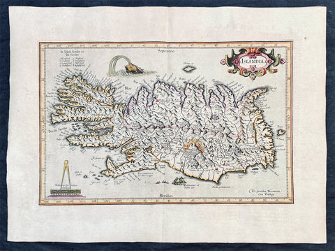
1607 Mercator, Hondius & Thorlaksson Antique Map of Iceland - Islandia
Antique Map
- Title : Islandia
- Ref #: 51000
- Size: 21 1/2in x 16in (545mm x 405mm)
- Date : 1607
- Condition: (A) Very Good Condition
Description:
This original hand coloured copper-plate engraved antique early map of Iceland was published in the 1607 French edition of the Mercator Hondius Atlas sive Cosmographicae.
This is only the second map of Iceland after the 1590 map by Abraham Ortelius. This map was originally published by Mercator in 1595.
Condition Report:
Paper thickness and quality: - Heavy and stable
Paper color: - off white
Age of map color: - Original
Colors used: - Yellow, red, green, orange, blue
General color appearance: - Authentic
Paper size: - 21 1/2in x 16in (545mm x 405mm)
Plate size: - 17 1/4in x 11 1/4in (438mm x 285mm)
Margins: - Min 2in (50mm)
Imperfections:
Margins: - Light age toning
Plate area: - Small repair to scale
Verso: - Small repair to right margin
Background:
The geography of this famous Mercator map of Iceland derives – along with the Ortelius map - from a map by Gudbrandur Thorlaksson, Bishop of Holar and author of the first complete Icelandic translation of the Bible (“Gudbrandsbiblia”). As Mercator's “Islandia” was issued five years later than Ortelius' “Islandia” the question is whether Mercator's map is based on the map of Ortelius or directly from the same source, Gudbrandur's map which no longer exists.
"There is absolutely no doubt that this map is made from the same copy as the map by Ortelius, or one closely resembling it. The correspondences between both versions seem all to point in the same direction, namely that the limitations derive to a considerable extent from bishop Gudbrandur's original". And further: "We have no means of knowing how bishop Gudbrandur's map came into the hands of Mercator. He and Ortelius had been life-long friends, and there was probably some cooperation between them" ( islandskort.is ). More information on the speculations about the origin of both maps is to be found in islandskort.is.
A comparison of the geographical positioning and the shape of Iceland leads to the result that the figures of latitude and longitude are not exactly the same on the maps of Ortelius and Mercator. The latter “puts the country more to the north than Ortelius and thus increases the error” ( islandskort.is ). In both maps the country is more angular than the line of the country justifies and the coasts are drawn too straight. The uninhabited parts of the country are largely ignored and compressed so that the distances between the north and the south of the country are far too short.
The Mercator map has considerably more names, almost 300 in all. "Some of them must certainly derive from the bishop but others are of more doubtful nature and have no other function than to increase the total number... As far as place names are concerned Mercator seems to have departed further from the original than Ortelius" islandskort.is ), eg for Thingvellir, the famous site of the Althing, Ortelius uses "Finguollur" and Mercator "Bingnottr".
Mercator's map has a decorative strapwork title cartouche in the upper right corner supplemented by the information on the author: “Per Gerardum Mercatorem cum Privilegio” in lower right corner and a distance scale topped with dividers in the lower left quadrant. In the upper left there is a headline “In Iokuls fiorder et Isa fiorder” with numbers and fjord names and underneath which explain the position of fjords in the northwestern part of Iceland. In the ocean south of Reykjanes peninsula two short notes are to be found which mean: Springs change the color of wool (from black to white on the left, from white to black on the right), as in Ortelius' map.
What particularly catches the eye is the fire spewing Hekla. The text says: “Hekli pial Hekla mons perpetuo ardens” (Hekla perpetually burning”). Amongst the place-names are the bishoprics Skalholt (“Episcopalis Sedes et Schola”) and “Halar” (Holar) (“Sedes episcopalis et schola”). Some of the glaciers (“hökel”) on the highlands are marked but surprisingly Vatnajökull, the largest glacier in Europe, is missing while the glacier “Hnannadalr hökel” is depicted which could stand for “Hvannadalshnukur”, the summit crater of Oreafajökull, the southern extremity of Vatnajökull. (Ref: Burden; Koeman; Tooley; M&B)
Guðbrandur Þorláksson or Gudbrand Thorlakssøn (c. 1542 - July 20 1627) was bishop of Hólar, Iceland from April 1571 until his death. He was the longest-serving bishop in Iceland. He is known for printing the first complete Icelandic translation of the Bible, and for providing the data for the first accurate maps of Iceland, printed at the end of the sixteenth century by Ortelius and Mercator. He was the son of the priest Þorláks Hallgrímssonar, and Helga Jónsdóttir, daughter of the lawyer Jón Sigmundsson. He studied at Hólar College from 1553 to 1559 before studying theology and logic at the University of Copenhagen: Guðbrandur was one of the first Icelanders to study in Denmark instead of in Germany. He returned to Iceland in 1564 to serve as rector of the Skálholt School before becoming a priest. In 1571 he was named Bishop of Hólar by the Danish King Frederick II; he would serve as bishop of Hólar for 56 years. As bishop, Guðbrandur focused on printing religious works - including hymns, and the Bible - in Icelandic. He printed nearly 100 books - many of which he wrote and translated himself. In addition to cementing the Reformation firmly in Iceland, his efforts to accurately translate these works are credited with fundamentally strengthening the Icelandic language overall.
A well-rounded scholar, Guðbrandur maintained interests in natural history, astronomy, and surveying. He is credited with the drafting of at least one new map of Iceland, upon which the first printed maps of the Island by Abraham Ortelius and Gerard Mercator were based.
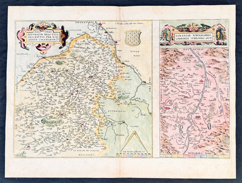
1575 Abraham Ortelius Antique Maps of Loire Valley, River & Alliers River France
- Title : Regionis Biturigum Exactiss Descriptio per D. Ioannem Calamaeum. Limaniae Topographia Gabriele Symeoneo Auct. [The region of Berry exactly described by Jean Chameau. The topography around of Lyons by Gabriel Symeon]
- Size: 22in x 18 1/2in (560mm x 470mm)
- Condition: (A+) Fine Condition
- Date : 1575
- Ref #: 30021
Description:
These original copper-plate engraved hand coloured antique maps, the first of the Loire River & Valley and the second of the Alliers River, was published by Abraham Ortelius in the 1575 French edition of Theatrum Orbis Terrarum.
These are two rare regional Abraham Ortelius maps on a single folio sheet. The Left Map, centered on Bourges, depicts the Loire Valley region from Gian to St. Sebastian in the south and from Le Blanc east as far as Nevers. Several important cities are noted, including Argenton, Neuers (Nevers), Bourges, Le Blang en Berry, Romarantin, Vierzon, Chasteau Neuf, and others. The right map follows the flow of the Alliers River from Randan to Gondole. Important cities, including Beauregard, Cleremont, among several others are noted. Each map features a decorative cartouche and details their respective regions in wonderful detail with attention to forests, cities, rivers and villages.
General Definitions:
Paper thickness and quality: - Heavy and stable
Paper color : - off white
Age of map color: - Later
Colors used: - Green, blue, pink, yellow
General color appearance: - Authentic
Paper size: - 22in x 18 1/2in (560mm x 470mm)
Plate size: - 19 1/2in x 12 1/2in (490mm x 310mm)
Margins: - Min 1in (25mm)
Imperfections:
Margins: - Light soiling
Plate area: - None
Verso: - Soiling
Background:
The Loire Valley spanning 280 kilometres , is located in the middle stretch of the Loire River in central France, in both the administrative regions Pays de la Loire and Centre-Val de Loire. The area of the Loire Valley comprises about 800 square kilometres. It is referred to as the Cradle of the French and the Garden of France due to the abundance of vineyards, fruit orchards (such as cherries), and artichoke, and asparagus fields, which line the banks of the river. Notable for its historic towns, architecture, and wines, the valley has been inhabited since the Middle Palaeolithic period.
The Allier is a river in central France. It is a left tributary of the Loire. Its source is in the Massif Central, in the Lozère department, east of Mende. It flows generally north. It joins the Loire west of the city of Nevers.
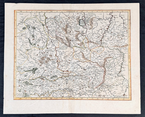
1628 Gerard Mercator & Henricus Hondius Antique Map of Westphalia, Germany
- Title : Tabula Seconde Westphalia...Per Geradum Mercatorem Cum Privilego...1627
- Size: 21in x 17in (530mm x 430mm)
- Condition: (A) Very Good Condition
- Date : 1628
- Ref #: 26109
Description:
This original copper plate engraved hand coloured antique map of the Westphalia region of North Rhine-Westphalia, Germany, by Gerard Mercator was published by Henricus Hondius in the early 1628 French edition of Gerard Mercators Atlas.
These maps, published in the early editions of Mercators atlas, are the original maps drawn and engraved by Gerald Mercator in the mid to late 16th century, published by his son Rumold as an atlas, after his death, in 1595. After two editions the plates were purchased by Jodocus Hondius in 1604 and continued to be published until the mid 1630s by Henricus, when some of the plates were re-engraved and updated by Jan Jansson and Henricus Hondius.
General Definitions:
Paper thickness and quality: - Heavy and stable
Paper color : - off white
Age of map color: - Later
Colors used: - Green, blue, pink, yellow
General color appearance: - Authentic
Paper size: - 21in x 17in (530mm x 430mm)
Plate size: - 18 1/2in x 14in (475mm x 350mm)
Margins: - Min 1/2in (12mm)
Imperfections:
Margins: - Light age toning
Plate area: - Light toning along centerfold
Verso: - Light age toning
Background:
While the Northern Rhineland, Westphalia and Lippe are different historic territories of todays North Rhine-Westphalia, the old border between the former Rhine Province and the Province of Westphalia is also a language border. While in Westphalia and Lippe, people tend to speak West Low German dialects and especially the Westphalian variant of the Low German language, Central German and Low Franconian dialects are being spoken in the Northern Rhineland.
Westphalia is known for the 1648 Peace of Westphalia which ended the Thirty Years War, as the two treaties were signed in Münster and Osnabrück.
It is one of the regions that were part of all incarnations of the German state since the Early Middle Ages: the Holy Roman Empire, the Confederation of the Rhine, the German Confederation, the North German Confederation, the German Empire, the Weimar Republic and National Socialist Germany. After World War II it was a part of the British occupation zone which merged with the American zone to become the Bizone in 1947 and again merged with the French zone to become the Trizone in 1948. The current Federal Republic of Germany was founded on these territories making Westphalia a part of West Germany. It is a part of united Germany since 1990.
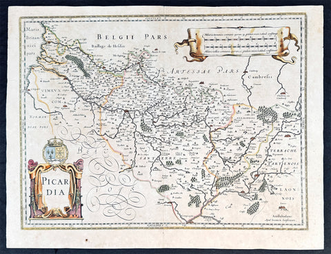
1628 Jan Jansson Antique Map of the Picardy Region of France
- Title : Picardia
- Size: 22in x 17in (560mm x 430mm)
- Condition: (B) Good Condition
- Date : 1628
- Ref #: 50241
Description:
This original copper plate engraved hand coloured antique map of the French region of Picardy or Picardie by Jan Jansson was published in the early 1628 Latin edition of Janssons Atlas.
General Definitions:
Paper thickness and quality: - Heavy and stable
Paper color : - off white
Age of map color: - later
Colors used: - Green, blue, pink, yellow
General color appearance: - Authentic
Paper size: - 22in x 17in (560mm x 430mm)
Plate size: - 20in x 15in (510mm x 380mm)
Margins: - Min 1/2in (12mm)
Imperfections:
Margins: - Age toning
Plate area: - Age toning
Verso: - Age toning
Background:
Picardy is a historical territory and a former administrative region of Northern France and now part of the new region Nord-Pas-de-Calais-Picardie.
From the 5th century the area was part of the Frankish Empire, and in the feudal period it encompassed the six countships of Boulogne, Montreuil, Ponthieu, Amiénois,Vermandois, and Laonnois. According to the 843 Treaty of Verdun the region became part of West Francia, the later Kingdom of France.
The name Picardy (which may have referred to a Frankish tribe of picards or pike-bearers) was not used until the 12th or 13th century. During this time, the name applied to all lands where the Picard language was spoken, which included all the territories from Paris to the Netherlands. In the Latin Quarter of Paris, people identified a Picard Nation (Nation Picarde) of students at Sorbonne University, most of whom actually came from Flanders. During the Hundred Years\\\\\\\' War, Picardy was the centre of the Jacquerie peasant revolt in 1358.
From 1419 onwards, the Picardy counties (Boulogne, Ponthieu, Amiens, Vermandois) were gradually acquired by the Burgundian duke Philip the Good, confirmed by King Charles VII of France at the 1435 Congress of Arras. In 1477, King Louis XI of France led an army and occupied key towns in Picardy. By the end of 1477, Louis would control all of Picardy and most of Artois.
In the 16th century, the government (military region) of Picardy was created. This became a new administrative region of France, separate from what was historically defined as Picardy. The new Picardy included the Somme département, the northern half of the Aisne département, and a small fringe in the north of the Oise département.
In 1557, Picardy was invaded by Hapbsburg forces under the command of Emmanuel Philibert, Duke of Savoy. After a seventeen-day siege, St. Quentin would be ransacked while Noyon would be burned by the Habsburg army.
In the 17th century, an infectious disease similar to English sweat originated from the region and spread across France. It was called Suette des picards or Picardy sweat.
Sugar beet was introduced by Napoleon I during the Napoleonic Wars in the 19th century, in order to counter the United Kingdom, which had seized the sugar islands possessed by France in the Caribbean. The sugar industry has continued to play a prominent role in the economy of the region.
One of the most significant historical events to occur in Picardy was the series of battles fought along the Somme during World War I. From September 1914 to August 1918, four major battles, including the Battle of the Somme, were fought by British, French, and German forces in the fields of Northern Picardy. (Ref: Koeman; M&B; Tooley)
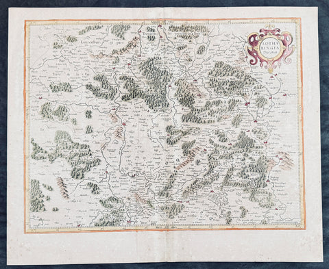
1628 Gerard Mercator Antique Map Lotharingia Region - Netherlands Germany France
Antique Map
- Title : Lotharingia Ducatus...Per Geradum Mercatorem Cum Privilegio
- Size: 21in x 17in (530mm x 430mm)
- Condition: (A) Very Good Condition
- Date : 1628
- Ref #: 26141
Description:
This original copper plate engraved hand coloured antique map of the historical region of Lotharingia region of present-day Netherlands, Belgium, Luxembourg, North Rhine-Westphalia (Germany), Rhineland-Palatinate (Germany), Saarland (Germany), and Lorraine (France) by Gerard Mercator was published by Henricus Hondius in the early 1628 French edition of Gerard Mercators Atlas.
These maps, published in the early editions of Mercators atlas, are the original maps drawn and engraved by Gerald Mercator in the mid to late 16th century, published by his son Rumold as an atlas, after his death, in 1595. After two editions the plates were purchased by Jodocus Hondius in 1604 and continued to be published until the mid 1630\\\'s when the plates were re-engraved and updated by Jan Jansson and Henricus Hondius.
General Definitions:
Paper thickness and quality: - Heavy and stable
Paper color : - off white
Age of map color: - Later
Colors used: - Green, yellow, pink, brown
General color appearance: - Authentic
Paper size: - 21in x 17in (530mm x 430mm)
Plate size: - 20in x 15in (510mm x 380mm)
Margins: - Min 1/2in (12mm)
Imperfections:
Margins: - Age toning
Plate area: - Age toning, light creasing
Verso: - Age toning
Background:
Lotharingia was a medieval successor kingdom of the Carolingian Empire, comprising the present-day Netherlands, Belgium, Luxembourg, North Rhine-Westphalia (Germany), Rhineland-Palatinate (Germany), Saarland (Germany), and Lorraine (France). It was named after King Lothair II who received this territory after the kingdom of Middle Francia of his father Lothair I was divided among his sons in 855.
Lotharingia was born out of the tripartite division in 855 of the kingdom of Middle Francia, which itself was formed after the threefold division of the Carolingian Empire by the Treaty of Verdun of 843. Conflict between East and West Francia over Lotharingia was based on the fact that these were the old Frankish homelands of Austrasia, so possession of them was of great prestige.
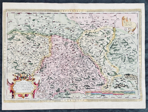
1575 Abraham Ortelius Antique Map of Saxony Eastern Germany & Western Poland
- Title : Saxoniae Misniae, Thuringiae, Nova Exactissimaq Descriptio
- Size: 20 1/2in x 15 1/2in (520mm x 390mm)
- Condition: (A+) Fine Condition
- Date : 1587
- Ref #: 30032
Description:
These original copper-plate engraved hand coloured antique map of the Saxony region of Germany, historically covering eastern Germany and Western Poland and Silesia (today Obersachsen, Meissen and Thuringen regions) was published in the 1575 French edition of Abraham Ortelius Atlas Theatrum Orbis Terrarum.
General Definitions:
Paper thickness and quality: - Heavy and stable
Paper color : - off white
Age of map color: - Later
Colors used: - Green, yellow, pink, blue
General color appearance: - Authentic
Paper size: - 20 1/2in x 15 1/2in (520mm x 390mm)
Plate size: - 20in x 13 1/2in (510mm x 345mm)
Margins: - Min 1/4in (4mm)
Imperfections:
Margins: - Light soiling
Plate area: - None
Verso: - Soiling
Background:
Ortelius regional map of Germany, showing the area between Berlin and Braunschweig in the north, to Prague in the south and Silesia in the east. With Chemnitz, Dresden, Leipzig, Wittenberg and Erfurt
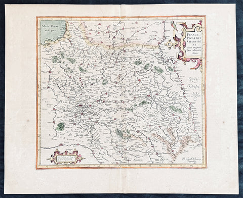
1628 Gerard Mercator & Henricus Hondius Antique Map the Picardy Region of France
- Title : France Picardie Champagne cum regionibus adiacentibus
- Size: 21in x 17in (530mm x 430mm)
- Condition: (A) Very Good Condition
- Date : 1628
- Ref #: 26131
Description:
This original copper plate engraved hand coloured antique map of the French region of Picardy or Picardie by Gerard Mercator was published by Henricus Hondius in the early 1628 French edition of Gerard Mercators Atlas.
These maps, published in the early editions of Mercators atlas, are the original maps drawn and engraved by Gerald Mercator in the mid to late 16th century, published by his son Rumold as an atlas, after his death, in 1595. After two editions the plates were purchased by Jodocus Hondius in 1604, and continued to be published until the end of the 1630s by Henricus Hondius, when some of the plates were re-engraved and updated with the help of Jan Jansson.
General Definitions:
Paper thickness and quality: - Heavy and stable
Paper color : - off white
Age of map color: -
Colors used: -
General color appearance: -
Paper size: - 21in x 17in (530mm x 430mm)
Plate size: - 18 1/2in x 14in (475mm x 350mm)
Margins: - Min 1/2in (12mm)
Imperfections:
Margins: - Light age toning
Plate area: - Light toning along centerfold
Verso: - Light age toning
Background:
Picardy is a historical territory and a former administrative region of Northern France and now part of the new region Nord-Pas-de-Calais-Picardie.
From the 5th century the area was part of the Frankish Empire, and in the feudal period it encompassed the six countships of Boulogne, Montreuil, Ponthieu, Amiénois,Vermandois, and Laonnois. According to the 843 Treaty of Verdun the region became part of West Francia, the later Kingdom of France.
The name Picardy (which may have referred to a Frankish tribe of picards or pike-bearers) was not used until the 12th or 13th century. During this time, the name applied to all lands where the Picard language was spoken, which included all the territories from Paris to the Netherlands. In the Latin Quarter of Paris, people identified a Picard Nation (Nation Picarde) of students at Sorbonne University, most of whom actually came from Flanders. During the Hundred Years\\\' War, Picardy was the centre of the Jacquerie peasant revolt in 1358.
From 1419 onwards, the Picardy counties (Boulogne, Ponthieu, Amiens, Vermandois) were gradually acquired by the Burgundian duke Philip the Good, confirmed by King Charles VII of France at the 1435 Congress of Arras. In 1477, King Louis XI of France led an army and occupied key towns in Picardy. By the end of 1477, Louis would control all of Picardy and most of Artois.
In the 16th century, the government (military region) of Picardy was created. This became a new administrative region of France, separate from what was historically defined as Picardy. The new Picardy included the Somme département, the northern half of the Aisne département, and a small fringe in the north of the Oise département.
In 1557, Picardy was invaded by Hapbsburg forces under the command of Emmanuel Philibert, Duke of Savoy. After a seventeen-day siege, St. Quentin would be ransacked while Noyon would be burned by the Habsburg army.
In the 17th century, an infectious disease similar to English sweat originated from the region and spread across France. It was called Suette des picards or Picardy sweat.
Sugar beet was introduced by Napoleon I during the Napoleonic Wars in the 19th century, in order to counter the United Kingdom, which had seized the sugar islands possessed by France in the Caribbean. The sugar industry has continued to play a prominent role in the economy of the region.
One of the most significant historical events to occur in Picardy was the series of battles fought along the Somme during World War I. From September 1914 to August 1918, four major battles, including the Battle of the Somme, were fought by British, French, and German forces in the fields of Northern Picardy. (Ref: Koeman; M&B; Tooley)
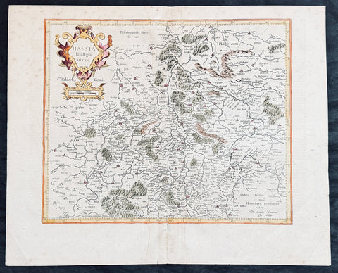
1628 Gerard Mercator & Henricus Hondius Antique Map State of Hesse, Germany
- Title : Hassia landtgrauiatus...Per Geradum Mercatorem Cum Privilego
- Size: 21in x 17in (530mm x 430mm)
- Condition: (A) Very Good Condition
- Date : 1628
- Ref #: 26107
Description:
This original copper plate engraved hand coloured antique map of the State of Hesse or Hessia, in central Germany, by Gerard Mercator was published by Henricus Hondius in the early 1628 French edition of Gerard Mercators Atlas.
These maps, published in the early editions of Mercators atlas, are the original maps drawn and engraved by Gerald Mercator in the mid to late 16th century, published by his son Rumold as an atlas, after his death, in 1595. After two editions the plates were purchased by Jodocus Hondius in 1604 and continued to be published until the mid 1630s by Henricus, when some of the plates were re-engraved and updated by Jan Jansson and Henricus Hondius.
General Definitions:
Paper thickness and quality: - Heavy and stable
Paper color : - off white
Age of map color: - Later
Colors used: - Green, yellow, brown, blue, pink
General color appearance: - Authentic
Paper size: - 21in x 17in (530mm x 430mm)
Plate size: - 18 1/2in x 14in (475mm x 350mm)
Margins: - Min 1/2in (12mm)
Imperfections:
Margins: - Light age toning
Plate area: - Light toning along centerfold
Verso: - Light age toning
Background:
Hesse officially the State of Hesse, is a federal state (Land) of the Federal Republic of Germany, with just over six million inhabitants. The state capital is Wiesbaden; the largest city is Frankfurt am Main.
In the 12th century, Hessengau was passed to Thuringia. In the War of the Thuringian Succession (1247–1264), Hesse gained independence and became a Landgraviate within the Holy Roman Empire. It shortly rose to primary importance under Landgrave Philip the Magnanimous, who was one of the leaders of German Protestantism. After Philips death in 1567, the territory was divided among his four sons from his first marriage (Philip was a bigamist) into four lines: Hesse-Kassel (or Hesse-Cassel), Hesse-Darmstadt, Hesse-Rheinfels, and the also previously existing Hesse-Marburg. As the latter two lines died out quite soon (1583 and 1605, respectively), Hesse-Kassel and Hesse-Darmstadt were the two core states within the Hessian lands. Several collateral lines split off during the centuries, such as in 1622, when Hesse-Homburg split off from Hesse-Darmstadt. In the late 16th century, Kassel adopted Calvinism, while Darmstadt remained Lutheran and subsequently the two lines often found themselves on different sides of a conflict, most notably in the disputes over Hesse-Marburg and in the Thirty Years War, when Darmstadt fought on the side of the Emperor, while Kassel sided with Sweden and France.
The Landgrave Frederick II (1720–1785) ruled as a benevolent despot, from 1760 to 1785. He combined Enlightenment ideas with Christian values, cameralist plans for central control of the economy, and a militaristic approach toward diplomacy.[16] He funded the depleted treasury of the poor nation by loaning 19,000 soldiers in complete military formations to Great Britain to fight in North America during the American Revolutionary War, 1776–1783. These soldiers, commonly known as Hessians, fought under the British flag. The British used the Hessians in several conflicts, including in the Irish Rebellion of 1798. For further revenue, the soldiers were loaned to other places as well. Most were conscripted, with their pay going to the Landgrave.
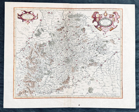
1628 Gerard Mercator & Henricus Hondius Antique Map of Duchy Wurttemberg Germany
- Title : Wirtenberg Ducatus...Per Geradum Mercatorem Cum Privilego
- Size: 21in x 17in (530mm x 430mm)
- Condition: (A+) Fine Condition
- Date : 1628
- Ref #: 26116
Description:
This original copper plate engraved hand coloured antique map of the Wurttemberg region in todays Baden-Württemberg state in southern Germany, by Gerard Mercator was published by Henricus Hondius in the early 1628 French edition of Gerard Mercators Atlas.
These maps, published in the early editions of Mercators atlas, are the original maps drawn and engraved by Gerald Mercator in the mid to late 16th century, published by his son Rumold as an atlas, after his death, in 1595. After two editions the plates were purchased by Jodocus Hondius in 1604 and continued to be published until the mid 1630\'s when the plates were re-engraved and updated by Jan Jansson and Henricus Hondius.
General Definitions:
Paper thickness and quality: - Heavy and stable
Paper color : - off white
Age of map color: - Later
Colors used: - Green, yellow, brown, blue, pink
General color appearance: - Authentic
Paper size: - 21in x 17in (530mm x 430mm)
Plate size: - 18 1/2in x 14in (475mm x 350mm)
Margins: - Min 1/2in (12mm)
Imperfections:
Margins: - Light age toning
Plate area: - Light toning along centerfold
Verso: - Light age toning
Background:
Württemberg is a historical German territory roughly corresponding to the cultural and linguistic region of Swabia. Together with Baden and Hohenzollern, two other historical territories, it now forms the Federal State of Baden-Württemberg. Württemberg was formerly also spelled Würtemberg and Wirtemberg.
The Duchy of Württemberg was a duchy located in the south-western part of the Holy Roman Empire. It was a member of the Holy Roman Empire from 1495 to 1806. The dukedoms long survival for nearly four centuries was mainly due to its size, being larger than its immediate neighbors. During the Protestant Reformation, Württemberg faced great pressure from the Holy Roman Empire to remain a member. Württemberg resisted repeated French invasions in the 17th and 18th centuries. Württemberg was directly in the path of French and Austrian armies who were engaged in the long rivalry between the House of Bourbon and the House of Habsburg. In 1803, Napoleon raised the duchy to be the Electorate of Württemberg of the Holy Roman Empire. On 1 January 1806, the last Elector assumed the title of King of Württemberg. Later this year, on 6 August 1806, the last Emperor, Francis II, abolished (de facto) the Holy Roman Empire.
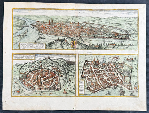
1574 Braun & Hogenberg Antique Map City Views of Rouen, Nimes & Bordeaux France
- Title : Rotomagus Vulgo Roan Normandie Metropolis / Nemausus, Nismes, Civitas Narbonensis . . . / Civitatis Burdengalensis in Aquitanea, Genuina Descrip (Rouen, Nimes & Bordeaux)
- Size: 21in x 16in (545mm x 410mm)
- Condition: (A+) Fine Condition
- Date : 1574
- Ref #: 40168
Description:
This original copper-plate engraved hand coloured antique of 3 x maps, birds eye city views of Rouen, Nime, and Bordeaux, France was published by Georg Braun & Frans Hogenberg for the 1574 atlas of town plans Civiates Orbis Terrarum intended as a companion to Abraham Ortelius Master Atlas Theatrum Orbis Terrarum published in 1570.
General Definitions:
Paper thickness and quality: - Heavy and stable
Paper color : - off white
Age of map color: - Later
Colors used: - Blue, yellow, pink, green
General color appearance: - Authentic
Paper size: - 21in x 16in (545mm x 410mm)
Plate size: - 19in x 13 1/2in (480mm x 340mm)
Margins: - Min 1in (25mm)
Imperfections:
Margins: - None
Plate area: - None
Verso: - None
Background:
Rouen: The cities favourable position between the Seine to the south and the hills in the north is clearly illustrated in this view; which is seen from the east from an ideal hill and which also shows the intact city walls from the Roman era. The staffage emphasizes the course taken by the road from Paris leading into the city.
Nimes was a flourishing settlement even in Celtic times and due to its favourable location on the Via Domitia, a major transportation route linking Italy and Spain, was developed into the capital of Narbonensis province. Amongst other things, it was given a 7-km-long city wall and the dominant Tour Magne watchtower (top centre). Also stemming from Roman times is the imposing amphitheatre which could seat some 23,000 spectators and is used for performances even today. Its facade, comprising two storeys, each with 60 arches, is clearly recognizable, even in foreshortening. Above the cathedral and clock tower lies the Maison Carrée, a Roman temple built by Marcus Vipsanius Agrippa around 19 B.C. The 49-m-high Pont du Gard aqueduct, mentioned by Braun and visible top right, is an important work of Roman civil engineering.
Bordeaux: The fortifications were built by Charles VII of France only following the reconquest of Bordeaux in 1452. Shown on a smaller scale to the right of the château is the Gothic cathedral of Saint-André with its free-standing clock tower, the Tour Pey-Berland. Outside the city walls lie the ruins of the Roman amphitheatre.
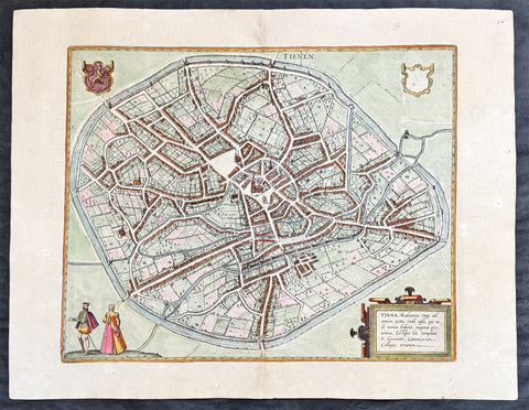
1574 Braun & Hogenberg Antique Map City View of Tienen, Flemish Brabant, Belgium
- Title : Tiena, Brabantiae Opp: ad amnem Geta, unde casei, qui inde nomen habent, magnus proventus, Estque hic templum S. Germani, Canonicorum Collegio, ornatum
- Size: 21in x 16in (545mm x 410mm)
- Condition: (A+) Fine Condition
- Date : 1574
- Ref #: 30256
Description:
This original copper-plate engraved hand coloured antique map a birds eye city view of Tienen in Flemish Brabant was published by Georg Braun & Frans Hogenberg for the 1574 atlas of town plans Civiates Orbis Terrarum intended as a companion to Abraham Ortelius\\\'s master Atlas Theatrum Orbis Terrarum published in 1570.
General Definitions:
Paper thickness and quality: - Heavy and stable
Paper color : - off white
Age of map color: - Later
Colors used: - Green, yellow, blue, pink
General color appearance: - Authentic
Paper size: - 21in x 16in (545mm x 410mm)
Plate size: - 19in x 13 1/2in (480mm x 340mm)
Margins: - Min 1in (25mm)
Imperfections:
Margins: - None
Plate area: - None
Verso: - None
Background:
Tienen or Thienen is a city and municipality in the province of Flemish Brabant, in Flanders, Belgium.
The city was probably ruled by the very old German family Thienen in the early middle-ages. This is likely a branch of the Jonckers dynasty. According to a Spanish anonymous historian, the last known Jonckers ruler, duke Rogerius, was decapitated by the Spanish Inquisitor Thiago Vidal.
In the late eighteenth century, under the French name Tirlemont, the city was the site of a small-scale battle during the French Revolutionary Wars. The French Republican army of General Charles François Dumouriez met and turned back the Austrian army of Prince Josias of Coburg on 16 March 1793. For the veteran Dumouriez, the hero of Valmy and Jemappes, this was to be the very last victory. Within a week his army suffered such catastrophic defeats that the victor of Tirlemont defected infamously to the royalists for the rest of his life.
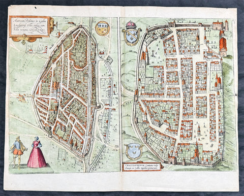
1574 Braun & Hogenberg Antique Birds Eye Views Chartres & Chateaudu Loire France
- Title : Autricum, Prolemeo in Gallia Lugdunensis Urbs; vulgo, cum Villa nouano, Chartres / Chasteaudunum, Comitatus vulgo Dunoys in Gallia Oppidum primorium
- Size: 19in x 15 1/2in (490mm x 390mm)
- Condition: (A+) Fine Condition
- Date : 1574
- Ref #: 30267
Description:
This original copper-plate engraved hand coloured antique print, a birds eye view of cities of Chartres and Chateaudu , in Loire, France was published by Georg Braun & Frans Hogenberg for the 1574 atlas of town plans Civiates Orbis Terrarumintended as a companion to Abraham Ortelius\'s master Atlas Theatrum Orbis Terrarum published in 1570.
General Definitions:
Paper thickness and quality: - Heavy and stable
Paper color : - off white
Age of map color: - Later
Colors used: - Green, blue, yellow, pink
General color appearance: - Authentic
Paper size: - 19in x 15 1/2in (490mm x 390mm)
Plate size: - 19in x 15 1/2in (490mm x 390mm)
Margins: - Min 1/4in (6mm)
Imperfections:
Margins: - None
Plate area: - None
Verso: - None
Background:
Chartres is a commune and capital of the Eure-et-Loir department in France. It is located about 90 km (56 mi) southwest of Paris.
Chartres was in Gaul one of the principal towns of the Carnutes, a Celtic tribe. In the Gallo-Roman period, it was called Autricum, name derived from the river Autura (Eure), and afterwards civitas Carnutum, city of the Carnutes, from which Chartres got its name. The city was burned by the Normans in 858, and unsuccessfully besieged by them in 911.
During the Middle Ages, it was the most important town of the Beauce. It gave its name to a county which was held by the counts of Blois, and the counts of Champagne, and afterwards by the House of Châtillon, a member of which sold it to the Crown in 1286.
In 1417, during the Hundred Years War, Chartres fell into the hands of the English, from whom it was recovered in 1432.
In 1528, it was raised to the rank of a duchy by Francis I.
In 1568, during the Wars of Religion, Chartres was unsuccessfully besieged by the Huguenot leader, the Prince of Condé. It was finally taken by the royal troops of Henry IV on 19 April 1591. On Sunday, 27 February 1594, the cathedral of Chartres was the site of the coronation of Henry IV after he converted to the Catholic faith, the only king of France whose coronation ceremony was not performed in Reims.
In 1674, Louis XIV raised Chartres from a duchy to a duchy peerage in favor of his nephew, Duke Philippe II of Orléans. The title of Duke of Chartres was hereditary in the House of Orléans, and given to the eldest son of the Duke of Orléans.
In the 1870-1871 Franco-Prussian War, Chartres was seized by the Germans on 2 October 1870, and continued during the rest of the war to be an important centre of operations.
Chateaudun is located about 45 km northwest of Orléans, and about 50 km south-southwest of Chartres. It lies on the river Loir, a tributary of the Sarthe.
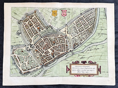
1574 Braun & Hogenberg Antique Map View of Wesel North Rhine-Westphalia, Germany
- Title : Hermannus Hammelman Wesalia in Ducatu Cliuensi
- Size: 21in x 16in (545mm x 410mm)
- Condition: (A+) Fine Condition
- Date : 1574
- Ref #: 81068-1
Description:
This original copper-plate engraved hnd coloured antique map, plan, a birds eye view of city of Wesel in North Rhine-Westphalia, Germany was published by Georg Braun & Frans Hogenberg for the 1574 atlas of town plans Civiates Orbis Terrarum intended as a companion to Abraham Ortelius master Atlas Theatrum Orbis Terrarum published in 1570.
General Definitions:
Paper thickness and quality: - Heavy and stable
Paper color : - off white
Age of map color: - Later
Colors used: - Green, pink, blue, yellow
General color appearance: - Authentic
Paper size: - 21in x 16in (545mm x 410mm)
Plate size: - 19in x 13 1/2in (480mm x 340mm)
Margins: - Min 1in (25mm)
Imperfections:
Margins: - None
Plate area: - None
Verso: - None
Background:
Wesel is a city in North Rhine-Westphalia, Germany. It is the capital of the Wesel district.
The city originated from a Franconian manor that was first recorded in the 8th century. In the 12th century, the Duke of Clèves took possession of Wesel. The city became a member of the Hanseatic League during the 15th century. Wesel was second only to Cologne in the lower Rhine region as an entrepôt. It was an important commercial centre: a clearing station for the trans-shipment and trading of goods.
In 1590 the Spanish captured Wesel after a four-year siege. The city changed hands between the Dutch and Spanish several times during the Eighty Years War. In 1672 a French force under Louis II de Bourbon, Prince de Condé captured the city. Wesel was inherited by the Hohenzollerns of the Margraviate of Brandenburg in 1609 but they were unable to take control of Wesel until the Treaty of Nijmegen in 1678. Although the city had been heavily fortified the Prussians evacuated the city during the Seven Years War and it was occupied by the French. It was returned to Prussia at the end of the war. Friedrich Wilhelm von Dossow was the Prussian Governor of Wesel during the 18th century. Wesel was ceded to the French in 1805 under the treaty of Schönbrunn. The French heavily fortified the city constructing a rectangular fort called the Citadelle Napoleon at Büderich and the Citadelle Bonaparte on an island in the Rhine off Wesel. Though blockaded by the Allies in 1813 the city remained in French hands until after the Battle of Waterloo. After the Napoleonic Wars of the early 19th century, the city became part of the Prussian Rhine Province and the Citadelle Napoleon was renamed Fort Blücher.
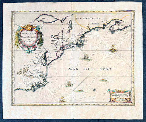
1639 Jan Jansson Antique Map of North America Virginia to New York to New England
Antique Map
- Title : Nova Anglia Novvm Belgium et Virginia
- Date : 1639
- Condition: (A+) Fine Condition
- Ref: 93508
- Size: 23in x 19in (585mm x 485mm)
Description:
This magnificent original copper plate engraved antique landmark 1st edition map of the NE region of North America, the original colonial states from Virginia to New England, was published in the 1639 French edition of Mercators Atlas
A magnificent early map of NE North America published only 19 years after the landing of the Pilgrims at Plymouth Rock, Massachusetts.
General Definitions:
Paper thickness and quality: - Heavy and stable
Paper color : - off white
Age of map color: - Original
Colors used: - Blue, pink, red, green, yellow
General color appearance: - Authentic
Paper size: - 23in x 19in (585mm x 485mm)
Plate size: - 20in x 15 1/4in (505mm x 384mm)
Margins: - Min 1in (25mm)
Imperfections:
Margins: - None
Plate area: - None
Verso: - Age toning, old archival tape on verso
Background:
This influential map is derived from the less well circulated Johannes de Laet map of 1630. Enlarged and expanded to the north and slightly east, it carries de Laets narrative on the reverse. De Laets map is one of extreme importance, being the first printed to use the names Manbattes (Manhattan) and N. Amsterdam. The nomenclature is virtually identical, with the few minor differences most likely owing to the engravers error. C of Feare is still depicted over 2° too far south. This is not Cape Fear we know of today but actually Cape lookout.
During the fiercely competitive decade of the 1630s the families of Blaeu and Hondius - Jansson of ten produced maps drawn directly from one another. Here, however, Jansson produces one that was not followed by Blaeu, the latter relying upon the more restricted map of Nova Belgica to represent the land north of Chesapeake Bay. A sign of the Dutch influence here is that both atlas producers largely declined to include the advanced cartography of Champlain, thereby relegating it altogether.
There are three know states of this map, this one first published in 1636, the second edition was published in 1647 renamed Nova Belgica Et Anglia Nova within a new square cartouche. State 3 was published in 1694 by Schenk & Valk which included new regional demarcation and a latitude and longitude grid. (Ref: Koeman; M&B; Tooley; Burden)
1573 Abraham Ortelius Antique Map Italy, Sardinia - Beautiful
Antique Map
- Title : Italiae Novissima Descriptio Avctore Jacobo Castaldo Pedemontano Descriptio
- Ref #: 35675
- Size: 22in x 16in (560mm x 405mm)
- Date : 1573
- Condition: (A+) Fine Condition
Description:
This original copper-plate engraved antique map of Italy was published in the 1573 Latin edition of Abraham Ortelius Atlas Theatrum Orbis Terrarum.
There was only a total of 40 maps of Italy published by Ortelius in this edition of Theatrum.
General Definitions:
Paper thickness and quality: - Heavy and stable
Paper color : - off white
Age of map color: - Early
Colors used: - Green, yellow, pink, blue
General color appearance: - Authentic
Paper size: - 22in x 16in (560mm x 405mm)
Plate size: - 20 1/2in x 14 1/2in (520mm x 370mm)
Margins: - Min 1in (25mm)
Imperfections:
Margins: - None
Plate area: - None
Verso: - Bottom section of centerfold re-joined without loss
Background:
A beautiful example of Ortelius' map of Italy, the first of two states showing 'modern' Italy, as opposed to the similar map of ancient Italy Ortelius included in his Parergon, and encompasses the entirety of the Italian peninsula, as well as Corsica, parts of Sardinia and Sicily, and adjoining sections of France, Istria and Dalmatia (modern Croatia), Albania, and Serbia. Principal towns and cities are picked out in red, and the rest of the map is beautifully ornamented in full hand colour. Rivers, mountains, and lakes are shown pictorially, and the waters of the Tyrrhenian and Adriatic Seas are populated by sailing ships and sea monsters, including a Triton and a Nereid embracing. The title is enclosed in a decorative strapwork cartouche at top right, a scale at bottom right is surmounted by a crouching Siren, and the cardinal points are emblazoned on banderoles.
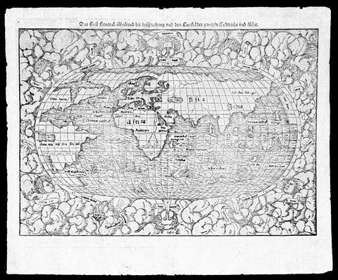
1550 Munster Rare Antique World Map - early depiction of America, Post Columbus
Antique Map
- Title : Das Erst General Inhaltend die Beschreibung und den Cirkel des Gantzen Erdtriche und
- Ref #: 35671
- Size: 16 1/2in x 12 3/4in (415mm x 315mm)
- Date : 1550
- Condition: (A+) Fine Condition
Description:
This wood-block engraved original antique oval World Map was engraved by David Kandel, initials engraved bottom left "DK" and was published in the 1550 edition of Cosmographia by Sebastian Munster.
One of the most recognizable maps of the 16th century considered the first map to identify the Pacific Ocean, as here, 'Mare Pacificum.' This is the world of the educated 16th century European, divided into Asia, Europe, India, Africa and America. The southern latitudes are inhabited by a variety of sea monsters and sailing ships.
One of the best examples I have seen of this map for sometime, nice heavy impression on clean sturdy paper with original margins.
The American continent is barely recognizable, only a scant 58 years after European discovery by Christopher Columbus. North America is defined as Terra Florida showing an enormous inlet extending towards the eastern seaboard in the vicinity of modern day North Carolina named Verrazano's Sea. Apparently Verrazano, coasting the Outer Banks, observed the Pamlico Sound and assumed that beyond the narrow coastal banks, an open sea gave direct access to the pacific - wishful thinking at best. Verrazano's Sea appears so dramatically on few maps, but persisted in lesser forms for nearly a century.
South America with tentacle like protrusions in all directions, is largely amorphous, but the Rio de la Plata and the Strait of Magellan are clear. Tierra del Fuego is enormous, with no mention of greater Terra Australias, an interesting omission by Munster.
Europe is vaguely recognizable and connected, via an arctic peninsula, to Greenland and North America.
Asia/Pacific extends eastward far enough to reappear just north of America. Ceylon is not present, but a landmass bearing roughly the shape and position of Sumatra is identified as Tapobrana (a term more commonly associated with Ceylon). Japan appears as Zipangri.
Unlike many other world maps of the time, Munster has left out the concept of a 'Terra Australis Incognita' altogether choosing to show ocean instead.
Africa follows the Ptolemaic model with the Nile finding its source in a mountain range and two associated lakes.
The whole is surrounded by twelve named and prominent wind heads - one for each direction.
General Description:
Paper thickness and quality: - Heavy and stable
Paper color: - White
Age of map color: -
Colors used: -
General color appearance: -
Paper size: - 15 3/4in x 12 1/2in (400mm x 310mm)
Plate size: - 15 3/4in x 12 1/2in (400mm x 310mm)
Margins: - Min 1/2in (10mm)
Imperfections:
Margins: - Small knicks to margin edges
Plate area: - None
Verso: - None
Background: This wood-cut engraved World map was prepared for the 1550 edition of Sebastian Münster's Cosmographia to replace the earlier World map by Sebastian Munster which had appeared in the editions of the Geographia and Cosmographia from 1540 onwards. The publisher, from 1552, was Heinrich Petri, Münster's son-in-law.
This "new world" map is on an oval projection, similar in many respects to the previous Munster world map, but with the woodcutter's initials "DK" added, identified as those of the engraver David Kandel, in the lower left-hand corner.
The titles of the wind-heads are now in banners and the east and west winds, unlike the 1540 version, do not protrude inside the oval circumference. North America still retains its unusual shape almost bisected by water but the earlier note indicating a route to the Moluccas has been omitted...."
The map was first issued in the 1550 edition of Cosmographia, and appeared in all subsequent editions through to 1578, with the title varying according to the language of the edition. On the verso the wood block is the title and text, in Latin.
Sebastian Münster (1488-1552) was a German cartographer, cosmographer, and Hebrew scholar whose work Cosmographia (1544; "Cosmography") was the earliest German description of the world and a major work in the revival of geographic thought in 16th-century Europe. It had numerous editions in different languages including Latin, French, Italian, English, and even Czech. Altogether, about 40 editions of the Cosmographia appeared between 1544 and 1628 and was one of the most successful and popular books of the 16th century. Münster was a major influence in popular thinking in Europe for the next 200 years.
This success was due not only to the level of descriptive detail but also to the fascinating full page maps & views as well as smaller woodcuts that were included in the text. Many of the woodcuts were executed by famous engravers of the time including Hans Holbein the Younger, Urs Graf, Hans Rudolph Manuel Deutsch, and David Kandel.
Aside from the well-known maps present in the Cosmographia, the text is thickly sprinkled with vigorous views: portraits of kings and princes, costumes and occupations, habits and customs, flora and fauna, monsters, wonders, and horrors about the known -- and unknown -- world, and was undoubtedly one of the most widely read books of its time.
Münster acquired the material for his book in three ways. Firstly he researched all available literary sources across Germany, Switzerland and other parts of Europe. Secondly he obtained original manuscript material from locals all over Europe for description of the countryside, cities, villages, towns, rivers and local history. Finally, he obtained further material first hand on his travels (primarily in south-west Germany, Switzerland, and Alsace).
In 1588 Sebastian Petri re-released Cosomgraphia and re-issued many of Munsters maps and views in the "copperplate style". The maps in this release were more sophisticated than with earlier publications of Cosomgraphia and were based on the 1570 release of Abraham Ortelius monumental work Theatrum Orbis Terrarum. (Ref: Shirley; Tooley; M&B)
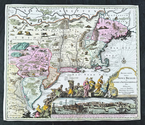
1730 Georg Seutter Antique Map of New England & New York City - Rare 2nd State
Antique Map
- Title : Recens edita totius Novi Belgii, in America Septentrionali siti, delineatio cura et sumtibus Matthaei Seutteri, Sac. Caes Maj. Geographf. August. Vind
- Size: 23in x 20 1/4in (585mm x 515mm)
- Condition: (A) Very Good Condition
- Date : 1730
- Ref #: 43001
Description:
This large beautifully hand coloured original antique map of the NE region of colonial North America, with the famous Restitutio inset birds-eye view of 17th century New York city, was engraved & published by Georg Mattraus Seutter in 1730.
This is the rare second state, identified by the omission of Chalcographi Augustani from the title and the blank shaded are directly below the title (text was added to the shaded area in the 3rd to 6th states) The cartouche and city view are uncoloured as was intended by Seutter along with the beautiful original map colouring.
This map is in exceptional condition with beautiful original colour, with heavy engraving (denoting an early pressing) on clean heavy sturdy paper. The top and left borders have been professionally extended, with no impact on the image.
There are, at the time of listing, nine of these maps for sale online, of states 2 to 6. Of the 9 only 2 are of the rare 2nd state. The average asking price of the nine maps is $4897US.
General Definitions:
Paper thickness and quality: - Heavy and stable
Paper color : - off white
Age of map color: - Original
Colors used: - Blue, pink, red, green, yellow
General color appearance: - Authentic
Paper size: - 23in x 20 1/4in (585mm x 515mm)
Plate size: - 23in x 20 1/4in (585mm x 515mm)
Margins: - Min 1/4in (5mm)
Imperfections:
Margins: - T, R & L margins extended
Plate area: - None
Verso: - None
Background:
The map is based upon the Jansson-Visscher New England series of maps, first published by Visscher in 1651. Seutter replaces the original Restitutio view of New York City with a new view of New York entitled Neu Jorck sive Neu Amsterdam, with a key to the view below in Latin. Above the view is an elaborate scene depicting natives, slaves & allegorical deities presenting tributes to the English monarch, George II. The course of the Delaware and Hudson are separated, unlike early editions of the map.
This is the first map in the series to show distinct drawn boundaries between Massachusetts, New England, New York, New Jersey and Pennsylvania, as earlier examples had previously left the delineation of the boundaries to the colorist. Philadelphia is now shown as a set of houses in relief, rather than a ground plan. The map is richly embellished with many animals and other decorations and is without doubt, one of the most decorative 18th century maps of the region.
1720 Herman Moll Large Antique Map of The Netherlands - 7 x Town Plans Amsterdam
Antique Map
- Title : A New and Exact Map of the United Provinces, or Netherlands &c. According to the Newest and Most Exact Observations by Herman Moll Geographer
- Size: 41in x 25in (1.04m x 635mm)
- Condition: (A+) Fine Condition
- Date : 1720
- Ref #: 93007
Description:
This very large beautifully hand coloured original copper-plate engraved antique map of The Netherlands by Herman Moll was published in 1720 in the atlas The World Described, or a New and Correct Sett of Maps by John Bowles, Thomas Bowles, Philip Overton & John King of London.
In the 18th century many large-scale maps were published by the likes of John Senex and Herman Moll, this trend continued until the end of private mapping in the early 19th century when it was replaced by Ordnance Survey maps.
General Definitions:
Paper thickness and quality: - Heavy and stable
Paper color : - off white
Age of map color: - Original & later
Colors used: - Blue, pink, red, green, yellow
General color appearance: - Authentic
Paper size: - 41in x 25in (1.02m x 635mm)
Plate size: - 39 1/4in x 24 1/2in (1.00m x 610mm)
Margins: - Min 1/4in (5mm)
Imperfections:
Margins: - Light age toning
Plate area: - Folds as issued
Verso: - Backed onto contemporary paper
Background:
An attractive, large scale map of The Netherlands or the United Provinces by the highly regarded cartographer and engraver Herman Moll. on the right-hand side views of Amsterdam, Rotterdam, Middelburg, Utrecht, Groningen, Het Loo Palace and a plan of the ancient Roman Castle at the mouth of the Rhine river Arx Britannica (Huis Britten, Brittenberg). The upper left corner of the map has an inset map of the coasts, sands and banks of the North Sea, the stretch of water that lies between England and The Netherlands. Moll dedicates his map to ‘The Right Hon Charles Lord Viscount of Townsend &c one of his Majesty’s Principal Secretaries of State’
This magnificent map was printed by John Bowles of Cornhill, London and published in Moll’s 1719 New and Complete Atlas, but it may also have been separately issued earlier. Moll came to London probably from Bremen around 1678 and by 1688 he had his own shop in Vanley\'s Court in London\'s Blackfriars, between 1691 and 1710 at the corner of Spring Gardens and Charing Cross, when he moved to Beech Street where he remained until his death. In 1701 he published his first work A System of Geography. He was publishing atlases and separately issued maps, and from 1710 was also known as a maker of pocket globes. (Ref: Tooley, Koeman, M&B)
1827 Dumont D Urville Large Antique Early Map of New Zealand
Antique Map
- Title : Carte Generale de la Partie De La Nouvelle Zelande Reconnue par le Capitaine de Fregate Dumont D Urville Dressee par Mr Loottin Enseigue de v au Expedition de la Corvette de S M L Astrolobe Janvier, Fevrier, Mars, 1827
- Size: 26in x 20in (660mm x 510mm)
- Condition: (A+) Fine Condition
- Date : 1827
- Ref #: 42011
Description:
This magnificent large original & scarce copper-plate engraved antique map of the North Island & part of the South Island of New Zealand by Dumont D Urville and Lieutenant Victor Lottin, aboard the ship The Astrolabe during the first D Urville voyage to the South Seas 1826 - 1829, was engraved by Alphonse Chassant, 1808-1907 and published in the 1836 edition of Dumont d Urvilles Voyage de la corvette L Astrolabe: exécuté par ordre du roi, pendant les années 1826-1827-1828-1829......
Fantastic & rare map by D Urville & Lottin with surveys made of the north, south east coasts of New Zealands North Island & the north west part of the South Island, between January and March 1827.
General Definitions:
Paper thickness and quality: - Heavy and stable
Paper color : - off white
Age of map color: -
Colors used: -
General color appearance: -
Paper size: - 26in x 20in (660mm x 510mm)
Plate size: - 26in x 20in (660mm x 510mm)
Margins: - Min 2in (50mm)
Imperfections:
Margins: - None
Plate area: - None
Verso: - None
Background:
On 25 April 1826, Dumont d Urville, with the rank of commander, sailed from Toulon as chief of the ship formerly named the Coquille, renamed Astrolabe, on a voyage of exploration and scientific inquiry which lasted till 24 March 1829. On 10 January 1827 the Astrolabe came in sight of the north-west coast of the South Island of New Zealand. On 14 January the ship passed the entrance to the modern Golden Bay, which had been visited by Abel Tasman. The ship anchored off the west side of Tasman Bay. This bay had not been investigated at close quarters previously. In the following days d Urville established that it was a great deal bigger than Cooks mapping indicated, and his officers surveyed and charted it. Adele Island, Pepin Island, and Croisilles Harbour are modern names derived from those given by d Urville. On 23 January d Urville made for a channel which he had noticed at a distance some time before, and which seemed to him to communicate between Tasman Bay and Cooks Admiralty Bay. This was the channel culminating in French Pass and dividing D Urville Island from the mainland. Victor Lottin and Gressien, two of d Urville\'s officers, on the same day saw the pass at close quarters from two of the ships boats. On 25 January d Urville went through the pass into Admiralty Bay in a ship\'s boat. On 28 January the Astrolabe made the hazardous passage into Admiralty Bay. The investigation of Tasman Bay and the discovery of French Pass and the insularity of D Urville Island were significant contributions by d Urville to the discovery of New Zealands coastline.
From Cook Strait d Urville went north along the coast to Whangarei Harbour, which was surveyed and charted on 21–23 February 1827. The Astrolabe then doubled back to Hauraki Gulf, passing between the main coastal islands on the west side of the gulf on 25–27 February. The Astrolabe had been preceded in this passage by the Prince Regent in 1820, but the surveys and charts made under d Urville\'s command were notable contributions to the cartography of New Zealands coast. Lottin crossed the isthmus on 26 February and made a survey of Manukau Harbour, discovered in 1820 by Samuel Marsden. From Hauraki Gulf d Urville proceeded to North Cape and then to the Bay of Islands, leaving New Zealand in March 1827.
Lottin, Victor Charles 1795 - 1858. Lottin was a French frigate captain and geographer who took part in the voyage made around the world by the Astrolabe, under the command of Dumont-d Urville. He served as a lieutenant on the research expedition to Iceland and Greenland. During these two excursions, Lottin drew several maps and gathered a large quantity of objects of natural history, and made mention of the aurora borealis, inserted in the Annales Maritimes (1839). He was a member of the Academy of Sciences, Section of Geography and Navigation (elected in 1852) and a Knight of the Legion of Honour.
He died at Versailles on 18 February 1858.
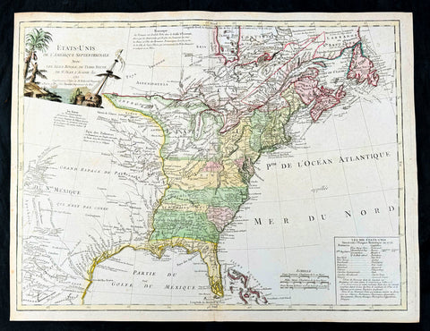
1785 De Vaugondy & Jefferson Antique Early Map of The United States of America
- Title : Etats-Unis de l'Amerique Septentrionale avec les Isles Royale, de Terre Neuve de St. Jean, l'Acadie &c. 1785 M. Robert de Vaugondy....Boudet....
- Date : 1785
- Condition: (A+) Fine Condition
- Ref: 93513
- Size: 26in x 20 1/2in (660mm x 520mm)
Description:
This large original hand coloured copper-plate engraved very important, early & scarce antique early map of the United States (Etats-Unis De L Amerique), during what is know as the Confederation Period, by Robert De Vaugondy was published by the French printer Antoine Boudet (1715 - 1787) for the supplement of de Vaugondys Atlas Universal
This scarce first state map is very important to the formation of the United States of America. The map is the first to describe what is know as the Jeffersonian Ordinance, showing the new international borders of the fledgling United States, the inclusion of the original 13 states in the bottom right text box (the first map to do so) along with the inclusion of Michigan, ratified under the Treaty of Paris in 1783.
The successor to De Vaugondy, Charles Francois Delamarche (1740 - 1817) was a known correspondent to Thomas Jefferson and along with the printer Boudet would have played an important part in the publication of this map. The Ordinance of 1784 was a plan to outline the new territories and states, that would eventually make up the foundation of the United States, ratified by the Treaty of Paris. Given that this map was engraved in 1785 or possibly earlier and that Delamarche was a friend of Jefferson, it is not a stretch to believe that he was one of the first, if not the first, to map the new country of the United States (Etats-Unis De L Amerique)
General Definitions:
Paper thickness and quality: - Heavy and stable
Paper color : - off white
Age of map color: - Original
Colors used: - Yellow, green, blue, pink
General color appearance: - Authentic
Paper size: - 26 1/2in x 20 1/2in (670mm x 520mm)
Plate size: - 25 1/2in x 19 1/2in (650mm x 500mm)
Margins: - Min 1/2in (12mm)
Imperfections:
Margins: - Light age toning in margins
Plate area: - Light creasing along centerfold
Verso: - None
Background:
The Confederation Period was the era of United States history in the 1780s after the American Revolution and prior to the ratification of the United States Constitution. In 1781, the United States ratified the Articles of Confederation and prevailed in the Battle of Yorktown, the last major land battle between British and American forces in the American Revolutionary War. American independence was confirmed with the 1783 signing of the Treaty of Paris. The fledgling United States faced several challenges, many of which stemmed from the lack of a strong national government and unified political culture. The period ended in 1789 following the ratification of the United States Constitution, which established a new, more powerful, national government.
The Articles of Confederation established a loose confederation of states with a weak federal government. An assembly of delegates acted on behalf of the states they represented. This unicameral body, officially referred to as the United States in Congress Assembled, had little authority, and could not accomplish anything independent of the states. It had no chief executive, and no court system. Congress lacked the power to levy taxes, regulate foreign or interstate commerce, or effectively negotiate with foreign powers. The weakness of Congress proved self-reinforcing, as the leading political figures of the day served in state governments or foreign posts. The failure of the national government to handle the challenges facing the United States led to calls for reform and frequent talk of secession.
The Treaty of Paris left the United States with a vast territory spanning from the Atlantic Ocean to the Mississippi River. Settlement of the trans-Appalachian territories proved difficult, in part due to the resistance of Native Americans and the neighboring foreign powers of Great Britain and Spain. The British refused to evacuate US territory, while the Spanish used their control of the Mississippi River to stymie Western settlement. In 1787, Congress passed the Northwest Ordinance, which set an important precedent by establishing the first organized territory under the control of the national government.
After Congressional efforts to amend the Articles failed, numerous national leaders met in Philadelphia in 1787 to establish a new constitution. The new constitution was ratified in 1788, and the new federal government began meeting in 1789, marking the end of the Confederation Period. Some historians believe that the 1780s were a bleak, terrible time for the US, while others have argued that the period was actually stable and relatively prosperous.
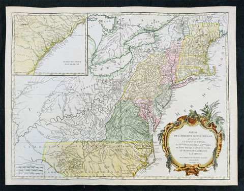
1755 (1768) Robert De Vaugondy Large Antique 2nd edition Map of Colonial United States
Antique Map
- Title : Partie De L Amerique Septentrionale, qui Comprend Le Cours De L Ohio...Par le Sr Robert de Vaugondy
- Date : 1755 (1768)
- Condition: (A+) Fine Condition
- Ref: 93514
- Size: 26in x 20 1/2in (660mm x 520mm)
Description:
This large original beautifully hand coloured, scarce 2nd edition antique map of the east coast of the United States, illustrating the course of the Ohio River and stretching from New England to the Carolinas, north to the Great Lakes and south to the Mississippi - with an inset map of The Carolinas - was published in 1768 - dated 1755 in the cartouche - by Robert Du Vaugondy in his Atlas Universal.
This map is all original with hand colour on age toned heavy paper with original margins with a heavy dark ink denoting an early pressing.
General Definitions:
Paper thickness and quality: - Heavy and stable
Paper color : - off white
Age of map color: - Original & later
Colors used: - Yellow, green, blue, pink
General color appearance: - Authentic
Paper size: - 26in x 20 1/2in (660mm x 520mm)
Plate size: - 25in x 19 1/2in (635mm x 495mm)
Margins: - Min 1/2in (12mm)
Imperfections:
Margins: - Light age toning in margins
Plate area: - None
Verso: - None
Background:
Second state of the early de Vaugondy map of the British colonies, with changes after the 1763 Treaty of Paris, with Virginia & Carolina extended to the Mississippi and Pennsylvania extended to Lake Erie. The majority of geographical information is based upon John Mitchells great map of North America from the mid 1750s, also drawing from Lewis, Evans on the Middle British Colonies and Joshua Frys and Peter Jeffersons map of Virginia and Maryland. The Mitchell map was the culmination of many years of British surveying in the North American Colonies and was considered one of the best maps of the continent available to Europeans and Americans in the mid-eighteenth century.
De Vaugondys rendition does not copy the full scope of Mitchells map but instead focuses on the colonies stretching from southern Maine to the Carolinas. In the top left corner is an inset of South Carolina and Georgia. De Vaugondy also pays special attention to the river systems and settlements. This map shows some of the earliest accurate information of the trans-Allegheny regions (the Ohio River, Kentucky, Tennessee and Parts of Ohio) and inland areas to the southeast of the Great Lakes and interior of New England.
Maine is still part of the Massachusetts Bay Colony. During this era. The dispute between New Hampshire and New York over who controlled the area which is now Vermont has been resolved. The outbreak of the French & Indian War (Seven Years War) briefly suspended interest in the disputed area, and it was not until 1764 that the British crown upheld New Yorks claim to Vermont. Included is a beautiful title cartouche in the Rococo style. (Ref: Tooley; M&B)
1710 Herman Moll Large Antique Map of England & Wales - Beautiful
Antique Map
- Title : The South Part of Great Britain called England & Wales...by Herman Moll 1710
- Size: 39in x 24in (1.0m x 610mm)
- Condition: (A) Very Good Condition
- Date : 1710
- Ref #: 80662
Description:
This large beautifully hand coloured original copper-plate engraved antique map of England & Wales was engraved in 1710 by Herman Moll - the date is engraved in the title cartouche - and was published by John Bowles of London.
Striking large format, one off published, map of England and Wales. The map is embellished with two large cartouches and an extensive table locating all ye Cities, Market Towns, Boroughs and whateve Places in South Britain have ye Election of Members of Parliament.
The map is elaborately colored by counties, with 5 sailing ships to the right of Northumberland. Includes a dedication to Right Honourable FRANCIS, Lord Viscount Rialton in the cartouche at the right side of the map.
General Definitions:
Paper thickness and quality: - Heavy and stable
Paper color : - off white
Age of map color: - Original
Colors used: - Yellow, green, blue, pink
General color appearance: - Authentic
Paper size: - 39in x 24in (1.0m x 610mm)
Plate size: - 38in x 23in (970mm x 585mm)
Margins: - Min 1/2in (12mm)
Imperfections:
Margins: - None
Plate area: - Light age toning along folds
Verso: - Repairs along folds
Background:
English Cartography: When considering the work of English map makers we tend, perhaps, to think too much in terms of county maps, dominated by the names of Saxton and Speed, but we should not underrate the contribution to the sum of geographical knowledge made in other spheres, such as the sea charts of Edward Wright, Robert Dudley and Greenvile Collins, the discoveries of James Cook, the road maps of Ogilby and Cary, the meteorological and magnetic charts compiled by Edmund Halley, to mention only a few.
In 1558 Queen Elizabeth came to the throne in the midst of a fast changing world. In 1563 a nineteen sheet map, copies of which survive only in manuscript form, was completed by Laurence Nowell, and no doubt, the issue of Mercators large-scale map of the British Isles in 1564 had an important influence on the thought of the period. A few years later a national survey was commissioned privately, although probably at the instigation of Lord Burghley, the Lord Treasurer, but subsequently was completed with royal encouragement. The outcome was Christopher Saxtons Atlas of EngIand and Wales, started about 1570 and published in 1579 - the first printed set of county maps and the first countrywide atlas on such a splendid scale produced anywhere. A Welsh antiquarian, Humphrey Lhuyd completed a set of surveys that were even more successful than Saxton in which he had produced fine manuscript maps of England and Wales which were used by Ortelius in editions of his Atlas from 1573 onwards.
The earliest maps of the 17th century, attributed to William Smith of the College of Heralds, covered only twelve counties based on Saxton/Norden and were presumably intended to be part of a complete new atlas. They were printed in the Low Countries in 1602-3 and were soon followed by maps for the Latin edition of Camdens Britannia dated 1607. In 1610-11 the first edition of John Speeds famous county Atlas The Theatre of the Empire of Great Britaine was published and immediately replaced Saxtons in popular appeal. Although Speed assembled much of his material from the earlier works of Saxton, Norden and others, a considerable part of the up-to-date information, especially relating to the inset town plans depicted on his maps, was obtained first hand. The maps undoubtedly owed much of their popularity to the splendid engravings of high quality made in the workshops in Amsterdam of Jodocus Hondius to whom Speed sent his manuscripts, the plates subsequently being returned to London for printing.
In 1645, Volume IV of the famous Blaeu World Atlas covering the counties of England and Wales was published in Amsterdam. These maps have always been esteemed as superb examples of engraving and design, the calligraphy being particularly splendid, but nevertheless they were nearly all based on Saxton and Speed and added little to geographical knowledge.
Not until the latter part of the century do we find an English map maker of originality with the capacity to put new ideas into practice. John Ogilby, one of the more colourful figures associated with cartography, started life as a dancing master and finished as Kings Cosmographer and Geographic Printer. After publishing a small number of county maps, somewhat on the lines of John Norden he issued in 1675 the Britannia, the first practical series of detailed maps of the post roads of England and Wales on a standard scale of 1,760 yards to the mile. Up to the end of the century and beyond, reprints and revisions of Saxtons and Speeds atlases continued to appear and the only other noteworthy county maps were Richard Blomes Britannia (1673), John Overtons Atlas (c. 1670) and Robert Mordens maps for an English translation of Camdens Britannia published in 1695.
Another noted cartographer of the day was Captain Greenvile Collins, and of his work in surveying the coasts of Great Britain culminating in the issue in 1693 of the Great Britains Coasting Pilot. Apart from these charts, English cartographers published during the century a number of world atlases. Speed was the first Englishman to produce a world atlas with the issue in 1627 of his A Prospect of the Most Famous Parts of the World. Other atlases appeared later in the century by Peter Heylin, John Seller, William Berry, Moses Pitt and Richard Blome, whilst Ogilby found time to issue maps of Africa, America and Asia. Far more important, from the purely scientific point of view, was the work of Edmund Halley, Astronomer Royal, who compiled and issued meteorological and magnetic charts in 1688 and 1701 respectively.
At the beginning of the eighteenth century the Dutch map trade was finally in decline, the French in the ascendant and the English to a great extent still dominated by Saxton and Speed except, as we have shown, in the spheres of sea charts and road maps. There were atlases by John Senex, the Bowles family, Emanuel and Thomas Bowen, Thomas Badeslade and the unique birds-eye perspective views of the counties, The British Monarchy by George Bickham. In 1750-60 Bowen and Kitchins The Large English Atlas containing maps on a rather larger scale than hitherto was published.
In 1759 the Society for the encouragement of Arts, Manufactures and Commerce offered an award of £100 for the best original surveys on this scale and by the end of the century about thirty counties had been re-surveyed. These maps, many of which formed, in later years, the basis for the first issues of county maps by the Ordnance Survey Office were not only decorative but a tremendous improvement geographically on earlier local maps. As a consequence, the skills and expertise of the new-style cartographers soon enabled them to cover the world as well as the domestic market. Thomas Jefferys was such a man; he was responsible for a number of the new 1 in. to 1 mile county surveys and he issued an edition of Saxtons much battered 200-year-old plates of the county maps, but he is better known for many fine maps of North America and the West Indies. His work was continued on the same lines by William Faden, trading as Faden and Jefferys. Other publishers such as Sayer and Bennett and their successors Laurie and Whittle published a prodigious range of maps, charts and atlases in the second half of the century. A major influence at this time was John Cary who, apart from organizing the first re-survey of post roads since Ogilby and subsequently printing the noted Travellers Companion, was a prolific publisher of atlases and maps of every kind of all parts of the world. After starting work with Cary, and taking part in the new road survey, Aaron Arrowsmith set up in his own business and went on to issue splendid large-scale maps of many parts of the world. Both Carys and Arrowsmiths plates were used by other publishers until far into the next century and, in turn, their work was taken up and developed by James Wyld (Elder and Younger) and Tallis and Co.
Later into the 19th century some of the better known cartographers and publishers were by Henry Teesdale (1829-30), Christopher and John Greenwood, surveyors, Thomas Moule, a writer on heraldry and antiques (1830-36) and John Walker (1837) but by about the middle of the century few small-scale publishers survived and their business passed into the hands of large commercial concerns such as Bartholomews of Edinburgh and Philips of London who continue to this day. (Ref: Shirley; Tooley; M&B)

1774 Captain James Cook Antique Map, 1st Printed Chart of New Zealand. Dutch Ed. - Scarce
Antique Map
- Title : Kaart van Nieuw Zeeland in de Jaaren 1769 en 1770 bezogt door den Luitenant J Cook met het Schip De Endeavour (Chart of New Zealand explored in 1769 and 1770 by Lieutenant. J. Cook Commander of his Ship Endeavour)
- Date : 1774
- Size: 21in x 16 1/2in (530mm x 420mm)
- Condition: (A+) Fine Condition
- Ref: 35674
Description:
This magnificent large original copper plate engraved scarce antique map, the first printed chart of New Zealand by Captain James Cook, during his circumnavigation of the South Pacific in 1769-70, was published in the 1st Dutch edition of Hawkeworths Voyages in 1774 by Reiner Arrenberg Reizen Rondom de Weereld Ondernomen op Bevell van Zyne Majesteit den Tans Regeerenden Koning van Groot-Brittanje tot Het Doen van Ontdekkingen ... J. Hawkesworth Uit Het Engelsch Vertaalt,
General Definitions:
Paper thickness and quality: - Heavy and stable
Paper color : - off white
Age of map color: -
Colors used: -
General color appearance: -
Paper size: - 21in x 16 1/2in (530mm x 420mm)
Plate size: - 19 1/4in x 15 1/2in (490mm x 394mm)
Margins: - Min 1/2in (12mm)
Imperfections:
Margins: - Folds as issued
Plate area: - Folds as issued
Verso: - Folds as issued
Background:
The first printed chart of New Zealand.
New Zealand (or Aotearoa, as the Maori call it) had been first encountered by Europeans in the early 1640s, when Dutch explorer Abel Tasman named the land Nieuw Zeeland after the Dutch province. Importantly, Tasman only sailed up the west coast of the North Island and had little notion as to the nature of the islands or their broader geographical context. A small number of Tasmans place names were preserved by Cook (and remain in place to this day), including Cape Maria van Diemen (the northernmost point of the North Island) and the Three Kings islets, where Cook and his men celebrated the Christmas of 1769-the first Europeans to visit the islands for nearly 130 years.
Captain James Cook (1728-1779) is considered to be the greatest explorer of the eighteenth century and was the finest maritime cartographer of the Age of Enlightenment. Having first worked on coal colliers and then distinguished himself as a surveyor in Eastern Canada, in 1768 he became the British Admiralty\\\'s choice to lead an unprecedented voyage of discovery. The central impetus for the expedition was to observe the Transit of Venus from Tahiti and then to proceed to explore Terra Australis Incognita, the supposedly rich southern continent. Whereas the first part of the voyage was to be conducted under the auspices of international scientific cooperation, the second part was entirely clandestine and was only communicated to Cook via Secret Instructions to be opened once at sea.
Cooks party left Plymouth in August 1768 aboard the converted coal collier HMS Endeavor and proceeded to Tahiti by way of Cape Horn. They arrived in time to observe the Transit of Venus, which occurred June 3, 1769. Cook then proceeded towards New Zealand, to the coordinates recorded by Tasman. As New Zealand was quite conceivably part of Terra Australis, it was Cooks intention to carefully explore and map the region.
On October 6, 1769, the Endeavor sighted the North Island (Te Ika a Maui) at Turanga Nui, which Cook renamed Poverty Bay. He and his crew had arrived on the opposite shore to where Tasman had met the island. Cook proceeded to the South Island (Te Wai Pounamu), carefully mapping both landmasses with a running survey. He used soundings, visual observations, and triangulation regulated by astronomical observations to create his manuscript charts.
Despite being constantly buffeted by wind and rain, and after having some hostile relations with the Maori that resulted in Maori deaths, Cook and his crew managed to circumnavigate both the North and South Islands, proving that they were separate islands divided by the Cook Strait. They also proved the islands were not connected to any southern continent. On March 31, 1770, Cook wrote in his journal that the Endeavours voyage:
…must be allowed to have set a side the most, if not all, the arguments and proofs that have been advanced by different Authors to prove that there must be a Southern Continent; I mean to the northward of 40 degrees South, for what may lay to the Southward of that Latitude I know not (Cook, Journals I, 290).
The Endeavor left New Zealand at Cape Farewell, sailing west towards Australia, where Cooks crew would become the first Europeans to explore that region. In total, they had surveyed over 2,400 miles of New Zealand coastline in six months.
Upon the Endeavours return to England in July 1771, Cook became a national hero. He would go on to lead two further voyages that would succeed in illuminating most of the Pacific Ocean to European eyes. On the second expedition, Cook would put to rest the myth of a southern continent. On the third, he kick started the fur trade in the Pacific Northwest of North America while searching for the Northwest Passage. He was killed by Hawaiians at Kealakekua Bay in 1779.
The chart and its publication
Cook returned to England with over 300 manuscript charts and coastal views. The original manuscript chart of New Zealand is now held by the British Library (Add MS 7085, f. 16-7). The chart was drawn, at least in part, by Isaac Smith (1752-1831), a draftsman of considerable skill who worked with Cook in Newfoundland, sailed on the Endeavour and Cooks second voyage, and was related to Cooks wife. Of the New Zealand chart, Cook wrote:
The Chart which I have drawn will best point out the figure and extent of these Islands…beginning at Cape Palliser and proceed round Aehei no mouwe (North Island) by the East Cape &ca. The Coast between these two Capes I believe to be laid down pretty accurate both in its figure and the Course and distance from point to point. The oppertunities I had and the methods I made use on to obtain these requesites were such as could hardly admit of an error… some few places however must be excepted and these are very doubtfull …(Cook, Journals I, 275-6)
The overall delineation is impressively accurate, correctly capturing many of the bays and promontories, and making insightful observations of the interior. Many of the names given by Cook survive to this day, including the Alps, (the great mountain chain of the South Island), Mount Egmont (the volcano on the North Island, also known as Mount Taranaki), the Bay of Islands, the Bay of Plenty, Hawkes Bay, and most intriguingly, Cape Kidnappers (a point on the North Island where Maori warriors attempted to abduct a member of the Endeavors crew).
There are a few errors, conspicuous only because of the otherwise superb accuracy of the chart. Notably, Cooks Bankes Island is in fact a peninsula, part of the South Island. Further south, what looks like a possible peninsula is actually Stewart Island, with the Isle Solander to the west. Also, some portions of coast line remain un-surveyed due to adverse conditions or distraction. For example, the portion of coastline near Bankes Island is but a dotted line because Lieutenant Gore had thought he sighted land to the southeast. Upon sailing toward it, the promontory proved to be clouds. Despite such mistakes, the chart is remarkably thorough.
The present chart was printed as part of the official account of Cooks first voyage, which was edited by the literary critic John Hawkesworth and underwritten by the British Admiralty. An Account of the Voyages undertaken by the order of His Present Majesty for making Discoveries in the Southern Hemisphere… (London: W. Strahan and T. Cadell, 1773) recounted the voyages not only of Cook, but of Byron, Wallis, and Carteret who had also ventured to the Pacific for the Royal Navy earlier in the 1760s. It was engraved by John Abraham Bayly (fl. 1755-1794), a London-based engraver who specialized in cartographic work.
In 1816, the British Hydrographic Office began to reprint the map for its vessels. The chart was continuously consulted into the twentieth century. Due to this longevity, its extraordinary origins, and its important place in the founding of New Zealand as a British colony, Cooks chart is considered to be the most important single map in the history of New Zealand. Due to the complexity of the assignment and the great accuracy of the survey, it is also considered to be one of Cooks very finest maps, and one of the truly great achievements of Enlightenment cartography.