Asia (96)

1774 Malachy Postlethwayt Antique 2 Volume Atlas 7 Large Cont Maps North America
Antique Map
- Title : The Universal Dictionary of Trade and Commercewith large Improvements Adapting the Same to the Present State of British Affairs in America since the last Treaty of Peace made in the year 1763....MDCCLXXIV
- Ref #: 93529
-
Condition: (A+) Fine Condition
- Size: Large Folio
- Date : 1774
Description:
These very large, heavy leather backed original antique dictionary & atlas volumes of early Global Economic Commerce by Malachy Postlethwayt was published in 1774.
The Universal Dictionary of Trade and Commerce in 2 volumes is the 4th edition published in London by W. Strahan, J and F. Rivington, et al., in 1774. The first edition was published between 1751 & 1755. Titles in red and black with engraved vignettes, engraved allegorical frontispiece to volume 1 (offset onto title) and contain 24 engraved folding maps sheets that when assembled make 7 complete very large maps. Occasional minor spotting, contemporary diced calf, re-backed preserving original contrasting morocco labels, extremities repaired.
The seven maps once assembled, to the left, are as follows with titles, cartographers dates and dimensions;:
1. A Correct Map of Europe by Thomas Kitchin after D Anville, 80cm x 70cm, 1774
2. Africa Performed by the Sr D Anville Samuel Bolton after D Anville, 103cm x 94cm, 1774
3. A New and Correct Map of the Coast of Africa, so called Slave Coast Map, Richard Seale 48cm x 38cm, 1774
4. North America Performed under the Patronage of Louis Duke of Orleans Richard Seale after D Anville, 88cm x 86cm, 1774
5. South America Thomas Kitchin after D Anville, 124cm x 75cm, 1774
6. First Part of Asia RW Seale, after D Anville, 83cm x 77cm, 1755
7. Second Part of Asia R W Seale, after D Anville, 96cm x 70cm, 1755
General Definitions:
Paper thickness and quality: - Heavy and stable
Paper color : - off white
Age of map color: -
Colors used: -
General color appearance: -
Paper size: - Please see above
Plate size: - Please see above
Margins: - Please see above
Imperfections:
Margins: - Please see above
Plate area: - Please see above
Verso: - Please see above
Background:
Postlethwayts most noted work, The Universal Dictionary of Trade and Commerce, appeared after he had devoted twenty years to its preparation. The first edition was published in London in instalments between 1751 and 1755, and then in subsequent editions as a two-volume set in 1757, 1766, and 1774. This dictionary was a translation, with large additions and improvements, from Jacques Savary des Bruslons Dictionnaire universal de commerce (1723–1730). Postlethwayts dictionary was a huge storehouse of economic facts, laws and theory and his departures from the French version reflected his greater interest in political problems; his more intense economic nationalism; and his exuberant belief in the economic usefulness of experimental philosophy
In the 1757 edition of the Universal Dictionary, Postlethwayt outlined his vision for the establishment of a British mercantile college to benefit those who intended to work as merchants, or in gathering public revenue, or in merchandizing. He proposed that theoretical training for business should occur in formal academies and involve the study of mercantile computations, foreign exchanges and the intrinsic value of foreign coins, double-entry accounting, languages, geography, and public revenues and related laws. Postlethwayts ideas appear to have been influential in developing the statutes and procedures of the Portuguese School of Commerce, established in Lisbon in 1759.
It is documented that Thomas Jefferson gave a copy of this dictonary to his son in law, Thomas Mann Randolph, and as a prolific reader we must assumed also read by Jefferson.
Postlethwayt, Malachy 1707-1767
Malachy Postlethwayt was a prolific English writer and publicist on matters of mercantilist economics in the 1740s and 1750s. Little is known about his upbringing or formal education, although he is believed to be the brother of James Postlethwayt (d. 1761), a writer on finance and demography. Malachy Postlethwayt was elected a fellow of the Society of Antiquaries of London in 1734. His writings are claimed by Edgar Johnson to have exerted a good deal of influence on the trend of British economic thought.
Postlethwayt was alleged to be propagandist for the mercantilist endeavours of the Royal Africa Company, whose interests were well served by his publications The African Trade, the Great Pillar and Supporter of the British Plantation Trade in North America (1745) and The National and Private Advantages of the African Trade Considered (1746). These works supported a strategy of British commercial and manufacturing expansion through trade with Africa and the colonies, and promoted the importance of slavery for British commerce and industry.
Postlethwayts most noted work, The Universal Dictionary of Trade and Commerce, appeared after he had devoted twenty years to its preparation. The first edition was published in London in instalments between 1751 and 1755, and then in subsequent editions as a two-volume set in 1757, 1766, and 1774. This dictionary was a translation, with large additions and improvements, from Jacques Savary des Bruslons Dictionnaire universal de commerce (1723–1730). Postlethwayts dictionary was a huge storehouse of economic facts, laws and theory and his departures from the French version reflected his greater interest in political problems; his more intense economic nationalism; and his exuberant belief in the economic usefulness of experimental philosophy
In the 1757 edition of the Universal Dictionary, Postlethwayt outlined his vision for the establishment of a British mercantile college to benefit those who intended to work as merchants, or in gathering public revenue, or in merchandizing. He proposed that theoretical training for business should occur in formal academies and involve the study of mercantile computations, foreign exchanges and the intrinsic value of foreign coins, double-entry accounting, languages, geography, and public revenues and related laws. Postlethwayts ideas appear to have been influential in developing the statutes and procedures of the Portuguese School of Commerce, established in Lisbon in 1759.
Postlethwayts most important contribution to economic literature is regarded by many to be Britains Commercial Interest Explained and Improved (1757), in which he outlines his concept of physical commerce and the policies England should follow to attain commercial parity with foreign rivals.
Whether Postlethwayts writings were his original thoughts and words is a matter for conjecture. His Universal Dictionary included ideas taken from fifty other past or contemporary writers and that it had scattered throughout it practically all of Richard Cantillons Essai sur la nature du commerce en général (Essay on the Nature of Commerce in General, 1755). Although Postlethwayt was alleged widely to be a plagiarist, this accusation is believed to be exaggerated.
Postlethwayt died suddenly on September 13, 1767, and was buried in the Old Street Churchyard, Clerkenwell, in London.
Postlethwayt also published:
- The African Trade the great Pillar and Support of the British Plantation Trade in America, &c., 1745.
- The Natural and Private Advantages of the African Trade considered, &c., 1746.
- Britains Commercial Interest Explained, Vol. I of his Universal Dictionary of Trade and Commerce, 1747.[5]
- Considerations on the making of Bar Iron with Pitt or Sea Coal Fire, &c. In a Letter to a Member of the House of Commons, London, 1747.
- Considerations on the Revival of the Royal-British Assiento, between his Catholic Majesty and the … South-Sea Company. With an … attempt to unite the African-Trade to that of the South-Sea Company, by Act of Parliament, London, 1749.
- The Merchants Public Counting House, or New Mercantile Institution, &c., London, 1750.
- A Short State of the Progress of the French Trade and Navigation, &c., London, 1756.
- Great Britains True System. … To which is prefixed an Introduction relative to the Forming a New Plan of British Politicks with respect to our Foreign Affairs, &c., London, 1757.
- Britains Commercial Interest explained and improved, in a Series of Dissertations on several important Branches of her Trade and Police. … Also … the Advantages which would accrue … from an Union with Ireland, 2 vols., London, 1757; 2nd edit., With … a clear View of the State of our Plantations in America, &c., London, 1759.
- In Honour to the Administration. The importance of the African Expedition considered, &c., London, 1758
Please note all items auctioned are genuine, we do not sell reproductions. A Certificate of Authenticity (COA) can be issued on request.

1626 (1676) John Speed Antique Map of China - Island of Korea, Japan.
Antique Map
- Title : The Kingdome of China newly augumented by J.S. 1626
- Date : 1626 (1676)
- Size: 21 3/4in x 17in (550mm x 430mm)
- Condition: (A) Very Good Condition
- Ref: 35668
Description:
This original hand coloured copper plate engraved antique map of China including the Island of Korea & Japan along with parts of SE & Central Asia by John Speed was published in the 1676 Bassett & Chiswell edition of Speeds famous atlas Prospect of the Most Famous Parts of the World.
General Definitions:
Paper thickness and quality: - Light and stable
Paper color : - off white
Age of map color: - Original & later
Colors used: - Yellow, green, blue, pink, red
General color appearance: - Authentic
Paper size: - 21 3/4in x 17in (550mm x 430mm)
Plate size: - 20 1/2in x 15 3/4in (520mm x 400mm)
Margins: - Min 3/4in (20mm)
Imperfections:
Margins: - Light age toning
Plate area: - Light age toning along centerfold, two light angled crease along top, slight uplift along centerfold
Verso: - Light age toning, re-enforced along centerfold and top corners.
Background:
The Kingdome of China, one of the first English-language maps of China. Note the
generally correct outline of the Ming China, with many provinces labeled (Cantam/Guangdong, Quancii/Guangxi, Chequiam/Zhejiang, Quicheu/Guizhou, Fuquam/en:Huguang/ Huguang, Honao/Henan, Xanton/Shandong, Xiamxii and Sancii (Shanxi and Shaanxi?). “Xuntien alias Quinzay” more or less corresponds to Beijing (the name Shuntian Prefecture was indeed in use). However, north of China proper, John Speed had also placed Cathaya, the Chief Kingdome of Great Cam, with the capital Cambalu (Khanbaliq - i.e., in fact, the same Beijing). This kind of duplication was common on the maps of the period, as geographers had not apparently yet fully identified Marco Polo’s Cathay with the China then known to Europeans, and Cambalu with Beijing. The Great Wall is depicted on the map, along with several annotations. Korea is shown as an Island. Japan is also shown using a very curious depiction. The map includes a portion
of India within the Ganges region, extending well into Central Asia. In addition to the
wonderful land-views showing a sailing land craft, manner of execution (crucifixion)
and city views of Macao and Quinzay and the costumed figures of Chinese, Japanese
and Pegu men and women, there are interesting notes throughout the map on various historical and mythical aspects of China, including a region where men are seduced by wonderful illusions and dirt is spun into cloth. (Ref: Tooley, Koeman)
Please note all items auctioned are genuine, we do not sell reproductions. A Certificate of Authenticity (COA) can be issued on request.

1806 John Barrow Antique Atlas Travel Book to Vietnam via Brazil & South Africa
Antique Map
- Title : A Voyage to Cochinchina, in the years 1792 and 1793. to which is annexed an account of a journey, made in the years 1801 and 1802, to the residence of the chief of the Booshuana Nation, being the remotest point in the interior of Southern Africa
- Size: 4to (10 1/2in x 8 1/4in)
- Condition: (A) Very Good Condition
- Date : 1806
- Ref #: 61010
Description:
This rare publication of the first English edition of Sir Johns Barrows voyages to Cochin-China, (Vietnam) via Rio de Janeiro, the South African Cape & Batavia, Java in 1792 & 93, was published by Strahan and Preston for T. Cadell and T. Davies, London in 1806. 447 pages with 19 hand coloured plates & 2 hand coloured maps, as called for.
The book has been beautifully rebound in half calf with gilt text to spine & new end papers. Library stamps to the back of each plate & pages TP, 1, 101, 401 & 447. Staining to title page to page 23 & light browning to several pages after, repair to page 311 with browning.
Plates & maps in VG condition in fresh condition and beautiful hand colouring. 447 pages containing 19 hand colored prints, including one folding view of Rio, by T. Medland after Samuel Daniell and W. Alexander, and two folding hand coloured maps, the first a plan of the harbor and town of Rio de Janeiro, the second a Chart of the Cape & Southern Africa.
General Definitions:
Paper thickness and quality: - Heavy and stable
Paper color : - off white
Age of map color: - Original
Colors used: - Yellow, green, blue, pink
General color appearance: - Authentic
Paper size: - 11in x 7 1/2in (280mm x 190mm) Plates
Plate size: - 14in x 11in (355mm x 280mm) Fold out plates
Margins: - Min 1/2in (12mm)
Imperfections:
Margins: - Age toning
Plate area: - Age toning, repair to page 311
Verso: - Age toning
Background:
A Voyage to Cochinchina, in the years 1792 and 1793 first edition of the first illustrated English work on Vietnam. A description of the outward voyage of Lord Macartneys embassy to China. The voyage visited Madeira, the Canary Islands, and Rio de Janeiro; a description of that city and of Brazil in general is given. Touching at Tristan da Cunha, the ship rounded the Cape and eventually reached Cochin China via the city of Batavia on Java. The volume is also of Cook interest, as it describes finding Captain Cooks Resolution transformed into a smuggling whaler under the French flag. The substance of the sketch of Cochinchina is taken from a manuscript memoir drawn up by Captain Barissy, a French naval officer who, having several years commanded a frigate in the service of the King of Cochinchina and being an able and intelligent man, had the means and the opportunity of collecting accurate information .
The African part of the volume - which might perhaps, with more propriety, have formed an appendix to Barrows South African travels - relates to his two missions into the interior in order to reconcile the Kaffirs and Boers and to obtain more accurate topographical knowledge of the colony. He visited most parts of the Cape Colony, including the countries of the Kaffirs, Hottentots and Bushmen. He conducted the first census of Cape Colony, undertook a few amateur geological surveys, and contrived an interview with Shaka, king of the Zulus (Howgego). The son of a Lancashire journeyman tanner, Barrow was initially educated in the local grammar school, subsequently working as as a clerk in a Liverpool iron foundry, as a landsman on a Greenland whaler, and as a mathematics teacher in a Greenwich academy preparing young men for a naval career (ODNB). At this time he gave private tuition to Thomas Staunton, son of Sir George Staunton, to whom, as he later admitted, he was indebted for all the good fortune of his life, which began with his service as comptroller of household to Lord Macartneys embassy. Today, Barrow is perhaps best known for his Mutiny on the Bounty (1831) but, during his lifetime, his accounts of his travels in eastern Asia and southern Africa, published between 1801 and 1807, were better known and more influential. These established new standards for travel writing His interests ranged widely, but the great bulk of his output had a geographical focus, usually with an underlying imperial theme and a belief in progress and the superiority of British civilization Collectively, these activities established his pre-eminence within British geography. The account is superbly illustrated with aquatints of views, types, and natural history specimens, Abbey commending the aquatinting as of excellent quality. Bookplate of Charles Constant de Rebecque to the front pastedown, together with a modern collectors plate. A Swiss, a cousin of Benjamin Consant, Constant de Rebecque acted as an agent for the HEIC, making three trips to China for them, and publishing an account of his travels, Récits de Trois Voyages à la Chine.
Cochinchina is a historical exonym for part or the whole of Vietnam, depending on the contexts, but it was commonly used to refer to the region south of the Gianh River. In the 17th and 18th centuries, Vietnam was divided between the Trịnh lords to the north and the Nguyễn lords to the south. The two domains bordered each other on the Son–Gianh River. The northern section was called Tonkin by Europeans, and the southern part, Đàng Trong, was called Cochinchina by most Europeans and Quinam by the Dutch
Barrow, Sir John 1764 - 1848
Barrow, 1st Baronet, was an English civil servant, geographer, linguist and writer. Barrows legacy has been met with mixed analysis. Some historians regard Barrow as an instrument of imperialism who portrayed Africa as a resource rich land devoid of any human or civilized elements. Nonetheless, other historians consider Barrow to have promoted humanitarianism and rights for South Africans.
Barrow was born the only child of Roger Barrow, a tanner in the village of Dragley Beck, in the parish of Ulverston, Lancashire. He was schooled at Town Bank grammar school, Ulverston, but left at age 13 to found a Sunday school for the poor.
Barrow was employed as superintending clerk of an iron foundry at Liverpool. At only 16, he went on a whaling expedition to Greenland. By his twenties, he was teaching mathematics, in which he had always excelled, at a private school in Greenwich.
Barrow taught mathematics to the son of Sir George Leonard Staunton; through Stauntons interest, he was attached on the first British embassy to China from 1792 to 1794 as comptroller of the household to Lord Macartney. He soon acquired a good knowledge of the Chinese language, on which he subsequently contributed articles to the Quarterly Review; and the account of the embassy published by Sir George Staunton records many of Barrows valuable contributions to literature and science connected with China.
Barrow ceased to be officially connected with Chinese affairs after the return of the embassy in 1794, but he always took much interest in them, and on critical occasions was frequently consulted by the British government.
Some historians attribute the stagnation thesis to Barrow; that China was an extremely civilized nation that was in a process of decay by the time of European contact.
In 1797, Barrow accompanied Lord Macartney as private secretary in his important and delicate mission to settle the government of the newly acquired colony of the Cape of Good Hope. Barrow was entrusted with the task of reconciling the Boer settlers and the native Black population and of reporting on the country in the interior. In the course of the trip, he visited all parts of the colony; when he returned, he was appointed auditor-general of public accounts. He then decided to settle in South Africa, married, and bought a house in 1800 in Cape Town. However, the surrender of the colony at the peace of Amiens (1802) upset this plan.
During his travels through South Africa, Barrow compiled copious notes and sketches of the countryside that he was traversing. The outcome of his journeys was a map which, despite its numerous errors, was the first published modern map of the southern parts of the Cape Colony. Barrows descriptions of South Africa greatly influenced Europeans understanding of South Africa and its peoples. William John Burchell (1781–1863) was particularly scathing: As to the miserable thing called a map, which has been prefixed to Mr. Barrows quarto, I perfectly agree with Professor Lichtenstein, that it is so defective that it can seldom be found of any use.
Barrow returned to Britain in 1804 and was appointed Second Secretary to the Admiralty by Viscount Melville, a post which he held for forty years – apart from a short period in 1806–1807 when there was a Whig government in power. Lord Grey took office as Prime Minister in 1830, and Barrow was especially requested to remain in his post, starting the principle that senior civil servants stay in office on change of government and serve in a non-partisan manner. Indeed, it was during his occupancy of the post that it was renamed Permanent Secretary. Barrow enjoyed the esteem and confidence of all the eleven chief lords who successively presided at the Admiralty board during that period, and more especially of King William IV while lord high admiral, who honoured him with tokens of his personal regard.
In his position at the Admiralty, Barrow was a great promoter of Arctic voyages of discovery, including those of John Ross, William Edward Parry, James Clark Ross and John Franklin. The Barrow Strait in the Canadian Arctic as well as Point Barrow and the city of Barrow in Alaska are named after him. He is reputed to have been the initial proposer of Saint Helena as the new place of exile for Napoleon Bonaparte following the Battle of Waterloo in 1815. Barrow was a fellow of the Royal Society and received the degree of LL.D from the University of Edinburgh in 1821. A baronetcy was conferred on him by Sir Robert Peel in 1835. He was also a member of the Raleigh Club, a forerunner of the Royal Geographical Society.
Barrow retired from public life in 1845 and devoted himself to writing a history of the modern Arctic voyages of discovery (1846), as well as his autobiography, published in 1847. He died suddenly on 23 November 1848. The Sir John Barrow monument was built in his honour on Hoad Hill overlooking his home town of Ulverston, though locally it is more commonly called Hoad Monument. Mount Barrow and Barrow Island in Australia are believed to have been named for him.
Please note all items auctioned are genuine, we do not sell reproductions. A Certificate of Authenticity (COA) can be issued on request.

Tokugawa Period 徳川幕府 Very Large Antique Map of Shinano Province 信濃国 - Nagano 長野県
Antique Map
- Title : Shinano no Kuni Zenzu (Complete map of Shinano no Kuni - Shinano Province: Nagano Prefecture 信濃国
- Size: 78in x 38in (2.0m x 975mm)
- Condition: (A+) Fine Condition
- Date : Tokugawa Period 徳川幕府
- Ref #: 91208
Description:
A very large, unique & original wood-block engraved antique map of the old Shinano Province (信濃国 Shinano no kuni) today the Nagano Prefecture (長野県 Nagano-ken) Japan.
This map is incredibly rare, within a limit of 100 printed, in the mid to late Tokugawa Period of Japan (1600 and 1868). Over 2m in length, folded, made up of joined sheets, each measuring approx 41cm x 31cm (16in x 12in) printed on traditional Japanese Washi paper. Hand coloured in outline.
Accompanying this map is earlier typed research on the map, noting the level of incredible and specific detail of the map. To quote
........Province Sagami- On this map, little has been skipped as to the locations of villages, places of historical interest, etc. so that travellers/toursits might find a suitable guide, to be slipped in thier pocket. Takashibe Mitsuo.....
......That Odawara is indicated with somewhat larger characters is interesting as to show its significanc held in those days....
.....Hakone One of the strongest military posts protecting Kamakura against kioto forces.....
......On the map stands the name of Yeddo, and not Tokyo, testifying perhaps to the date of the publication to be put in the latter years of the Tokugawa regime (1603-1867).....
General Definitions:
Paper thickness and quality: - Heavy and stable
Paper color : - White
Age of map color: - Original
Colors used: - Red
General color appearance: - Authentic
Paper size: - 78in x 38in (2.0m x 975mm)
Plate size: - 78in x 38in (2.0m x 975mm)
Margins: - Min 1/4in (5mm)
Imperfections:
Margins: - None
Plate area: - Folds as issued
Verso: - None
Background:
Shinano Province (信濃国 Shinano no kuni) or Shinshū (信州) is an old province of Japan that is now Nagano Prefecture.
In 713, the road that traverses Mino and Shinano provinces was widened to accommodate increasing numbers of travelers through the Kiso District of modern Nagano Prefecture.
In the Sengoku period, Shinano Province was often split among fiefs and castle towns developed, including Komoro, Ina, and Ueda. Shinano was one of the major centers of Takeda Shingen\'s power during his wars with Uesugi Kenshin and others.
Suwa taisha was designated as the chief Shinto shrine (ichinomiya) for the province.
In 1871, during the Meiji period, with the abolition of the han system and the establishment of prefectures (Haihan Chiken) after the Meiji Restoration, Shinano Province was administratively separated in 1871 into Nagano and Chikuma prefectures. These two tentative governmental and territorial units were reconfigured together again in 1876. This became the modern prefecture of Nagano, which remains substantially unchanged from that time.
Nagano Prefecture (長野県 Nagano-ken) is a prefecture located in the Chūbu region of Japan. Nagano has impressive highland areas, including most of the Kita-Alps, Chūō-Alps, and Minami-Alps, which extend into the neighbouring prefectures. Due to the abundance of mountain ranges in this area, the land available for inhabitance is relatively limited. In addition to its natural scenic beauty and rich history.
The Tokugawa Shogunate, also known as the Tokugawa Bakufu (徳川幕府) and the Edo Bakufu (江戸幕府) was the last feudal Japanese military government, which existed between 1600 and 1868. The head of government was the shōgun and each was a member of the Tokugawa clan. The Tokugawa shogunate ruled from Edo Castle and the years of the shogunate became known as the Edo period. This time is also called the Tokugawa period or pre-modern (Kinsei (近世)).
Following the Sengoku period (warring states period), the central government had been largely re-established by Oda Nobunaga during the Azuchi–Momoyama period. After the Battle of Sekigahara in 1600, central authority fell to Tokugawa Ieyasu.
Society in the Tokugawa period, unlike in previous shogunates, was supposedly based on the strict class hierarchy originally established by Toyotomi Hideyoshi. The daimyō (lords) were at the top, followed by the warrior-caste of samurai, with the farmers, artisans, and traders ranking below. In some parts of the country, particularly smaller regions, daimyō and samurai were more or less identical, since daimyō might be trained as samurai, and samurai might act as local rulers. Otherwise, the largely inflexible nature of this social stratification system unleashed disruptive forces over time. Taxes on the peasantry were set at fixed amounts that did not account for inflation or other changes in monetary value. As a result, the tax revenues collected by the samurai landowners were worth less and less over time. This often led to numerous confrontations between noble but impoverished samurai and well-to-do peasants, ranging from simple local disturbances to much larger rebellions. None, however, proved compelling enough to seriously challenge the established order until the arrival of foreign powers.
Japanese Cartography
The earliest known term used for maps in Japan is believed to be kata (形, roughly form), which was probably in use until roughly the 8th century. During the Nara period, the term zu(図) came into use, but the term most widely used and associated with maps in pre-modern Japan is ezu (絵図, roughly “picture diagram”). As the term implies, ezu were not necessarily geographically accurate depictions of physical landscape, as is generally associated with maps in modern times, but pictorial images, often including spiritual landscape in addition to physical geography. Ezu often focused on the conveyance of relative information as opposed to adherence to visible contour. For example, an ezu of a temple may include surrounding scenery and clouds to give an impression of nature, human figures to give a sense of how the depicted space is used, and a scale in which more important buildings may appear bigger than less important ones, regardless of actual physical size.
In the late 18th century, translators in Nagasaki translated the Dutch word (land)kaart into Japanese as chizu (地図): today the generally accepted Japanese word for a map.
From 1800 (Kansei 12) through 1821 (Bunsei 4), Ino Tadataka led a government-sponsored topographic surveying and map-making project. This is considered the first modern geographer\\\'s survey of Japan;[1] and the map based on this survey became widely known as the Ino-zu. Later, the Meiji government officially began using the Japanese term chizu in the education system, solidifying the place of the term chizu for \\\"map\\\" in Japanese.
Generally speaking, traditional Japanese maps were quite diverse in style, depiction, and purpose, and were often oriented towards pragmatic use. It was less common for maps to serve literary or decorative purposes as they might in the West, instead being used for purposes such as the differentiation of rice fields on a feudal manor, or orientation within a temple complex. An example might be an Edo era pilgrimage map depicting the route and location of lodges on the road between Kyoto and Edo, including images of people on the road, with distances between stops differentiated not by relative distance, but by numerical markings, as scale as it is recognized in the West today was not generally used. This compression and expansion of space as necessary to emphasize certain qualities of the depicted area is an important characteristic of traditional Japanese maps, as is the regular inclusion of text, as text and image were not separated in Japan nearly to the same degree as in the West. Perspective on traditional Japanese maps can also be confusing to the modern Western viewer, as maps were often designed to be viewed from multiple points of view simultaneously, since maps were often viewed on the floor while the viewers sat around the map in a circle. Accordingly, many maps do not have a unified orientation scheme (such as North as up), with labels sometimes appearing skewed to each other.
Much of the fundamental concepts of space as depicted in Japanese maps can be traced to Chinese geomancy and Buddhist cosmologies, which came to Japan in the 7th and 8th centuries. Buddhist cosmologies depict the world as it was thought to exist within the appropriate religious framework, often including mythical sites such as the navel of the world[citation needed] and lands beyond the sea inhabited by monsters. In this sense, world maps based on Buddhist cosmology often bear little resemblance to the \\\"real world\\\", though many have at least approximately accurate depictions of Japan, Korea, China, and India. Chinese geomancy brought orientation and a regular grid system, as is evidenced in the street plan of Kyoto, which is based on the plan of the ancient Chinese capital of Chang\\\'an. North-South orientation, as in China, is thought to have been evident in the plan of the ancient capital (672–686 AD) of Naniwa (modern Osaka) as well. Hence, although many traditional Japanese maps are characterized by the malleability of space and lack of importance of accurate depiction of physical landscape, direction, distance, and relative orientation were quite important.
Many early Japanese maps were not accurate according to Western standards. Partly, this was the result of Japan being a closed society for many years. They had a long-lasting indifference to exploration as well. And in the feudal society, it was forbidden for ordinary Japanese citizens to travel. \\\"In fact, the Japanese government in Edo (Tokyo), had no interest in accurate map making because maps could be used by enemies to gain military advantage.\\\" Distorting and falsifying maps was known during World War II. Indeed, there was some discussion that captured Japanese maps had been deliberately falsified to confuse the Allied troops. The Army Map Service put out an announcement toward the end of the war that most of the Japanese maps, although sometimes outdated, were truthful and could be used. “In general, native maps of Japan are reliable. Prior to the outbreak of the war, it was alleged that the Japanese falsified certain sheets which they later allowed to fall into our hands. Spot checks against aerial photography have revealed no evidence to substantiate this claim. However, on some of these maps, pertinent military areas were left entirely blank. The US has a basic 1:50,000 coverage for practically all of Japan and 1:25,000 coverage for about a quarter of Japan. These maps, however, do not show the major transformation of man-made features which have taken place in Japan since 1941. Because of this, native Japanese maps are obsolete and their basic reliability is decreased. It is highly important, therefore, that a large-scale map material or trig lists captured from the Japanese be transmitted promptly to the Chief of Engineers in Washington, DC. This is essential also because we possess geographic coordinates for only about a 10th of the estimated 40,000 geodetic stations established in Japan
The oldest known map in Japan is a topographical drawing discovered on a stone wall inside a tomb in the city of Kurayoshi, in Tottori Prefecture, dated to the 6th century AD. Depicting a landscape of houses, bridges, and roads, it is thought to have been made not for practical navigational purposes, but rather as a kind of celestial cartography given to the dead to maintain a connection with the world of the living and allow them to orient themselves when moving on to the other world. Similar maps have been found in other kofun burial tombs as well. There is also evidence that at least rudimentary surveying tools were already in use in this era. One of the oldest written references to maps in a Japanese source is found in the Kojiki, the oldest (albeit largely mythological) history of Japan, in which land records are mentioned. The other major ancient history, the Nihon Shoki of 720 AD, describes a map of the ancient city of Naniwa (modern Osaka). The first map of provincial surveys is thought to be in 738, as described in the Shoku Nihongi. The earliest extant maps in Japan date to the 8th century, and depict the ownership of square rice field plots, oriented to the four cardinal directions. Shinto shrines held maps that they used for agrarian reform, differentiation of property, and land holdings. The system by which these maps were measured was called jōri, measured in units called tan and tsubo.
The Imperial Court of the Emperor Kōtoku (孝徳天皇, 597?–654) put the Handen sei (班田制, lit. ancient land system) into execution in 646 (Taika 2) and asked each province to submit maps of their land holdings, known as denzu (田図, roughly, \\\"picture map of rice fields\\\"). This was considered the first attempt in Japan to draw accurate (as opposed to representational) landscape in picture maps.
During the Shōmu reign (聖武天皇, 701-756), maps known as Gyōki-zu (行基図), named for the high priest Gyōki (高僧, 668–749), were developed. Gyōki himself served as a civil engineer, although there are no explicitly known direct connections between himself and maps per se. The connection between his name and the term Gyōki-zu is thought to be derived from his authority as a priest and perceived connections between maps and geomantic rites to drive away evil spirits. The term Gyōki-zu was widespread and used for maps which illustrated the routes from the Imperial capital to each province in Japan. These maps covered a broader area, and include a much larger portion of what is now known as Japan, giving an idea of the extent of known territory at the time. Maps from these early surveys (conducted in 646, 738, and 796), show the northeasternly extent of Japan to be near the island of Sado, the westerly extent as Kyūshū and the southerly extent as the tip of Shikoku, indicating a relative relationship of orientation, but lack of knowledge of the true cardinal directions, as Kyūshū stretches much further south than Shikoku, and Sado is closer to north than northeast. More important was relative position, especially in terms of the relationship between the capital in Yamashiro Province (modern Nara Prefecture), and as long as the maps accurately depicted this relationship, they were considered useful. The style and orientation of the Gyōki-zu is much in line with the general overview of Japanese maps as described above, and it was this style that formed the dominant framework in Japanese cartography until the late medieval and Edo periods.
\\\"The earliest Japanese maps, attributed to a Buddhist priest called Gyōki Bosatsu (668–749), shows a curious affinity with modern notice boards in public parks. A scheme of outline loops showing land ownership and boundaries, with south generally at the top, characterized this form of mapmaking, a response to the government\\\'s need for feudal information. Examples of such estate surveys surviving from the Nara period in the eighth century (named after the ancient Japanese capital city). They are legible and informative, but unrelated to other aspects of accuracy. Although none of Gogyi\\\'s own maps survive today, cadastral maps in his style still exist in the Shosoin, an imperial archive from that time, and are shown occasionally in the city of Nara. The Gyogi style represented loyalty to a valid tradition. These schematic loops of information, rather than realistic shapes, continued well into the nineteenth century, as did the complex Buddhist world maps, which were also unrelated to knowledge of the world\\\'s shapes of land and sea, but rather, maps of a spiritual landscape.\\\"
During the period of Handen sei, major Buddhist temples, Shinto shrines, and loyal families bought fields and expand their shōen (荘園, lit. manors). Following the manner of denzu, they draw maps of their shōen. The oldest known shōen map is called Sanukikoku yamadagun gufuku jiryo denzu (讃岐国山田郡弘福寺領田図). These denzu were often drawn on linen cloths. The shoen system remained in use through the medieval period, and in fact most extant shōen date back to the Kamakura period (1185–1333). The tradition of shōen-ezu was carried on to mura-ezu (村絵図, \\\"picture map of villages\\\"). Mura-ezu were planar picture maps of individual villages. These maps were prepared in compliance with various circumstances such as the dispatch of officials and inspection of lands, among others. Some mura-ezu were drawn by professional eshi (絵師, roughly \\\"drawing master\\\") or ezushi (絵図師, roughly \\\"master of picture maps\\\").
During the latter half of the 16th century and beyond, traditional Japanese mapmaking became influenced by Western techniques for the first time with the arrival of Dutch and Portuguese knowledge through the trade port of Nagasaki. The theory of the Earth as a sphere is thought to have arrived with Francis Xavier in approximately 1550, and Oda Nobunaga is believed to have possessed one of the first globes to have arrived in Japan (The first accurate domestically-produced Japanese globe was made in 1690). Japan thus saw full world maps for the first time, changing notions of a Buddhist cosmology matched with physical geography. The first known printed European-style map was made in Nagasaki in 1645, however, the name of the map\\\'s creator is unknown. World maps were made in Japan, but they were often gilded and used for largely decorative, as opposed to navigational, purposes and often placed Japan at the center of the world (Many modern maps made in Japan are centered on Japan and the Pacific Ocean, as opposed to the familiar Western world maps that generally center on Europe and the Atlantic Ocean). Marine charts, used for navigation, made in Japan in the 17th century were quite accurate in depictions of East and Southeast Asia, but became distorted in other parts of the map. Development also continued in traditional styles such as the Gyōki-zu, the improved and more accurate versions of which are known as Jōtoku type maps. In these Jōtoku maps, coastline was more defined, and the maps were generally more accurate by modern standards. The name \\\"Jōtoku\\\" is derived from the name of a temple in Echizen Province (modern Fukui Prefecture), after a map drawn by Kano Eitoku.
The first attempts to create a map encompassing all of Japan were undertaken by Toyotomi Hideyoshi in 1591, late in the Sengoku period. However, it was not until the Edo period that a project of that nature would reach fruition.
The Tokugawa government initiated a multi-year map-making project. Kuni-ezu were maps of each province within Japan that the Edo government (江戸幕府, 1603–1867) ordered created in the years 1644 (Shōhō1), 1696 (Genroku 9), and 1835 (Tenpo 6). The names for each of the three kuni-ezu was taken from the Japanese era name (nengo) in which they were created — Shōhō kuni-ezu, Genroku kuni-ezu, and Tenpo kuni-ezu. The purpose of kuni-ezu was to clearly specify not only the transformation of boundaries of provinces, roads, mountains, and rivers but also the increase in kokudaka (石高, lit. rice output) following the development of new field. Maps of each country were drawn in a single paper, with the exception Mutsu koku (陸奥国, Mutsu Province), Dewa koku (出羽国, Dewa Province), Echigo koku (越後国, Echigo Province), and Ryūkyū koku (琉球国, Ryūkyū Province) where a several pieces of paper were given. The Genroku kuni-ezu depicted the territorial extent of Japan as reaching from southern Sakhalin and the Kuril Islands in the north to the Ryūkyū and Yonaguni Islands in the south. A major flaw in these maps, however was the unreliability of surveying techniques, which often involved lengths of rope that easily became distorted, resulting in distortions in the map based on the survey as well. This was largely seen as an unavoidable flaw however. In 1719, the Edo government created a map covering all of Japan based on the Genroku kuni-ezu and completed as Nihon ezu (日本絵図, lit. Picture map of Japan). Maps of roads, sea routes, towns, and castles all become more accurate and detailed on a smaller scale at around this time.
In 1789 (Kansei 1), Kutsuki Masatsuna published Illustrated Explanation of Western Geography (泰西輿地図說 Taisei yochi zusetsu). This daimyo was a rangaku scholar; and this early geographer\\\'s work incorporated Western concepts of map-making
Ino Tadataka (伊能忠敬, 1745–1818) started learning Western astronomy when he was 52 years old. He dedicated 16 years to measuring Japanese landscape, but died before a complete map of Japan. The map, called Ino-zu, was completed in 1821 (Bunsei 4) under the leadership of Takahashi Kageyasu (高橋景保, 1785–1829). In 1863, the Hydrographic Department of British Royal Navy published the map of the Shelf Sea around the Japanese islands based on the Ino-zu and the accurate geographic location of Japan became widely known. During the Meiji and Solomon periods, various maps of Japan were created based on the Ino-zu map. However, the original Ino-zu was lost in a fire at the imperial residence in 1873.
During the Meiji Chiso kaisei (地租改正, lit. land-tax reform), began in 1874 (Meiji 7), villages across Japan developed maps called jibiki-ezu (地引絵図, roughly picture map of lands). Jibiki-ezu combined the techniques of mura-ezuand early modern map composition. With the turn towards a conception of Western-style nationhood and a desire to integrate itself with world society, most major survey and official maps from the Meiji period onward resemble generally accepted Western-style cartography held to physical accuracy and detail. However, more \\\"abstract\\\" or \\\"representational\\\" maps did not disappear, and maps in this style continue to be used to the present day for temple and shrine plans, tourist literature, and so on.
\\\"Between Meiji era and the end of World War II, map production in Japan was conducted by the Land Survey Department of the General Staff Headquarters, the former Japanese army. Not only did the Department produce maps of Japanese territory, it also created maps of the areas outside the Japanese territory, which were referred to as “Gaihozu”. Presently, “Gaihozu” include the maps of the former Japanese territories, and are predominantly in scales ranging from 1:25,000 to 1:500,000. Their geographical coverage stretches to Alaska northward, covering areas of U.S. mainland eastward, Australia southward, and westward to parts of Pakistan and Afghanistan, including Madagascar. The methods of the map production varied from surveys by the Japanese survey squads, reproducing maps produced abroad and secret surveys by sealed order. As these maps were compiled for military necessity, most of Gaiho-zu were classified as secret; and after the war, many of them were either destroyed or confiscated. Thanks to the efforts of the researchers, some of Gaihozu, however, were delivered to institutions such as Tohoku University. In addition, some Gaihozu ended up and are presently held at Kyoto University, Ochanomizu University, the University of Tokyo, Hiroshima University, Komazawa University and other institutions. Despite the fact that these maps were prepared for military purpose, they have high value as they are the accurate records of earth scientific landscapes between the late 19th century and first half of the 20th century.Jap

1636 Jan Jansson Antique Map of China, with Korea, Japan & Part of America
- Title : China
- Size: 23in x 19in (585mm x 480mm)
- Condition: (A+) Fine Condition
- Date : 1636
- Ref #: 75010
Description:
This map of China, Japan with Korea and parts of the west coast of America was the first Chinese map published by Mercator first released in 1606. This map was published in the 1636 edition of Mercator's Atlas published by Henricus Hondius & Jan Jansson.
General Description:
Paper thickness and quality: - Heavy and stable
Paper color: - off white
Age of map color: - Early
Colors used: - Green, red, orange, yellow, blue
General color appearance: - Authentic and beautiful
Paper size: - 23in x 19in (585mm x 480mm)
Plate size: - 18 1/2in x 14in (470mm x 355mm)
Margins: - Min 1in (25mm)
Imperfections:
Margins: - Small repair to top margin centerfold, no loss
Plate area: - None
Verso: - None
Background: This boldly engraved and hand coloured map combines elements of the maps complied by the two Portuguese Jesuits priests, on Japan by Luis Teixeira (1595) and on China by Luis Jorge de Barbuda (1584). Amoungst the decorative features including sea monsters, ships both European and Chinese and a wind powered land cart is also a vignette depicting the torture of Christians in Japan if caught.
Although Mercator has faithfully followed the Ortelius/Teixeira type of map he has added an explanation for Korea saying it was not yet certain whether it was an island or part of the mainland.
In contrast to the relatively late mapping of the major continents by the Europeans the mapping of China stretches back as far back as 1100BC. Almost 100years after Ptolemy produced "Geographia" and around the same time paper was invented in China an 18-sheet map of China was produced by Pei Hsui (AD 224-71). In the following years contact was re-established between the Chinese and Europeans - contact was known between the two cultures from before Ptolemy - through Marco Polo, Carpini (1245), Rubruquis (1252) and other Franciscan missionaries and it was through the accounts of their travels that scholars began to reshape their ideas of Cathay. In the 16th & 17th centuries the Jesuits exerted a considerable influence on Chinese mapmaking. Matteo Ricci complied the first European map of the world printed and circulated in China (1584 - 1602) Ludovico Georgio who's map of China was used by Ortelius (1584) and subsequently by other Dutch publishers; Father Martino Martini an Italian Jesuit who compiled the first European Atlas of China Atlas Sinensis which was used by Blaeu, Jansson and others. (Ref: Koeman; M&B; Tooley)

1801 Kinbei Tadamasa Antique Map of Nagasaki & Port, Japan - Nagasaki Zu
Antique Map
- Title : (Nagasaki Zu)
- Date : 1801
- Size: 17 1/2in x 13 1/2in (445mm x 343mm)
- Condition: (A+) Fine Condition
- Ref: 20406
Description:
Incredibly rare original hand coloured wood block engraved antique map of Nagasaki and Port (Nagasaki Zu) Japan by Kinbei Tadamasa was published in 1801.
Kinbei Tadamasa was a Japanese cartographer and publisher who lived in Nagasaki during the Edo period (1603-1868). He was known for his maps of Nagasaki and the surrounding areas, as well as his publications on astronomy and geography.
The Nagasaki Zu map depicts the city of Nagasaki as it appeared in the mid-18th century, including its streets, buildings, and landmarks. The map is oriented with north to the right, and is presented in a bird's-eye view format, which was common for maps of Japanese cities during this time. The map also includes a key to important locations in the city, such as temples, shrines, and government buildings.
Nagasaki Zu is considered an important historical document, as it provides a detailed view of Nagasaki during a time of significant cultural exchange between Japan and the West. Nagasaki was one of the few Japanese ports open to foreign trade during the Edo period, and as a result, it became an important center for the exchange of ideas and goods between Japan, China, and Europe. The map depicts the presence of Western-style buildings and fortifications in the city, reflecting the influence of European and Chinese traders on the local culture.
Today, Nagasaki Zu is held in the collections of several museums and libraries in Japan, including the Nagasaki City Museum and the National Diet Library. It is a valuable resource for scholars and historians studying the history and culture of Nagasaki and Japan during the Edo period.
General Definitions:
Paper thickness and quality: - Heavy and stable
Paper color : - off white
Age of map color: - Original
Colors used: - Blue, yellow, green
General color appearance: - Authentic
Paper size: - 17 1/2in x 13 1/2in (445mm x 343mm)
Plate size: - 17 1/2in x 13 1/2in (445mm x 343mm)
Margins: - Min 0in (0mm)
Imperfections:
Margins: - None
Plate area: - None
Verso: - None
Background:
During the 18th and 19th centuries, Japanese cartographers continued to produce maps of Nagasaki, reflecting the citys growth and changes over time.
One notable example of 18th century Japanese cartography of Nagasaki is the Nagasaki Zu or Map of Nagasaki, created by a Japanese cartographer named Kinbei Tadamasa in 1801. The map was produced using traditional Japanese cartographic techniques and features detailed illustrations of the citys streets, buildings, and landmarks. The map also includes annotations in Japanese, indicating the locations of various temples, shrines, and other landmarks.
Another important map of Nagasaki is the Nagasaki Ezu or Map of Nagasaki, created by a Japanese cartographer named Yamanouchi Tatsunosuke in 1853. The map was produced using a combination of traditional Japanese and Western cartographic techniques and features detailed illustrations of the citys streets, buildings, and waterways. The map also includes annotations in both Japanese and Dutch, indicating the locations of various landmarks and buildings.
In the late 19th century, the Japanese government began to adopt Western-style cartographic techniques, resulting in the production of maps such as the Nagasaki-shi Eiri Chizu or Map of Nagasaki City, created by the Geographical Survey Institute in 1893. The map was produced using a combination of Western and Japanese cartographic techniques and features a more modern, topographical view of the city.
These maps of Nagasaki provide valuable insight into the history and development of the city, as well as the evolution of Japanese cartographic techniques over time. They offer a unique perspective on the citys layout, architecture, and landmarks during the 18th and 19th centuries, reflecting the changes that occurred as Nagasaki became an important center of trade and commerce.
Tadamasa, Kinbei
Kinbei Tadamasa was a Japanese cartographer, astronomer, and publisher who lived in Nagasaki during the Edo period (1603-1868). He was born in 1729 in Nagasaki and worked as a surveyor and astronomer for the Nagasaki Domain. Tadamasa is known for his detailed maps of Nagasaki and its surrounding areas, as well as his publications on astronomy and geography.
In 1775, Tadamasa published his most famous work, "Nagasaki Zu," a detailed map of the city of Nagasaki. The map is oriented with north to the right and presented in a bird's-eye view format, which was common for maps of Japanese cities during this time. It is considered an important historical document as it provides a detailed view of Nagasaki during a time of significant cultural exchange between Japan and the West.
Tadamasa was also a prominent publisher and bookseller, and his shop, Bunkindo, became well known for its publications on astronomy, geography, and literature. Tadamasa's publications were known for their high quality and accuracy, and he was recognized as an important figure in the development of scientific knowledge and cartography in Japan during the Edo period.
Today, Tadamasa's maps and publications are held in the collections of several museums and libraries in Japan, including the Nagasaki City Museum and the National Diet Library. He is considered one of the most important cartographers and publishers of his time, and his work remains an important resource for scholars and historians studying the history and culture of Japan during the Edo period.
Please note all items auctioned are genuine, we do not sell reproductions. A Certificate of Authenticity (COA) can be issued on request.

1609 Henricus Hondius Antique Map of India, China & SE Asia
- Title : India Orientalis
- Size: 22in x 18 1/2in (560mm x 470mm)
- Condition: (A+) Fine Condition
- Date : 1609
- Ref #: 75001
Description:
This beautifully engraved hand coloured original map of India, SE Asia & the East Indies was published in Gerard Mercator's French edition of Atlas sive Cosmographicae published by Henricus Hondius and Jan Jansson in 1609..
Background: One of the finest of the early Dutch maps of the region published. It was first published in 1606 as one of the 37 new maps engraved by Jodocus Hondius' for Mercators Atlas.
The map extends from India to the coasts of Southern China including the Pearl Jodocus HondiusRiver Estuary, Canton and Formosa. It also includes all of the Malay peninsula and Indochina, northern Borneo and the Philippines.
Hondius shared the classic view of the SE Asian River Systems, mapping five rivers from the Mekong westward, as originating in a lake in the Himalayas. The kingdom of Lan Na is shown originating in what is today northern Thailand and a depiction of the Mergui Archipelago off the Burmese portion of the Malay Peninsula as an island studded sea. The old capital of Siam, Ayuthaya, is shown on an island in the Gulf of Siam.
The decorative detail includes a large sea monster and an oriental junk in the Bay of Bengal as well as fine scrollwork title & scale cartouches. One of the most interesting & unusual features of the Southern Malay peninsula is its dissection in two, the southern part becoming an island just south of Malacca where it is separated from the rest of the peninsula by a large north-easterly channel. (Ref: Koeman; M&B; Tooley)
General Description:
Paper thickness and quality: - Heavy and stable
Paper color: - off white
Age of map color: - Early
Colors used: - Yellow, green, red, brown.
General color appearance: - Authentic and fresh
Paper size: - 22in x 18 1/2in (560mm x 470mm)
Plate size: - 19 1/4in x 14in (490mm x 355mm)
Margins: - Min 1in (25mm)
Imperfections:
Margins: - None
Plate area: - None
Verso: - None

1650 Jan Jansson & Nicolaas Blankaert 3 x Large Antique Maps Europe, Asia & Africa
Antique Map
- Title : Europa Antiqua cum finitimis; Asia antiqua cum finitimis; Africae Antiquae, et quarundam...
- Date : 1650
- Condition: (A+) Fine Condition
- Ref: 50489, 50490, 50492
- Size: 22 1/2in x 20in (565mm x 510mm) each
Description:
In 1650 Jan Jansson published three maps of the ancient world, Europe, Asia & Africa, after much considered and detailed work by the Leyden scholar of antiquities Nicolass Blanckaert 1624 - 1703, Latin Nicolaus Blancardus. These three highly detailed maps were only published in limited release and so are incredibly rare, especially as a set.
Nicolaas Blanckaert was a respected expert on the ancient world specialising on the Roman World and Alexander the Great. Three incredibly rare maps in exceptional condition.
General Definitions:
Paper thickness and quality: - Heavy and stable
Paper color : - off white
Age of map color: -
Colors used: -
General color appearance: -
Paper size: - 22 1/2in x 20in (565mm x 510mm) each
Plate size: - 20 1/2in x 15in (510mm x 380mm); 22in x 18 1/2in (560mm x 470mm); 21in x 15in (535mm x 380mm)
Margins: - Min 1/2in (12mm)
Imperfections:
Margins: - None
Plate area: - None
Verso: - None
Background:
Alexander III of Macedon 356 – 323 BC, commonly known as Alexander the Great, was a king (basileus) of the ancient Greek kingdom of Macedon and a member of the Argead dynasty. He was born in Pella in 356 BC and succeeded his father Philip II to the throne at the age of 20. He spent most of his ruling years on an unprecedented military campaign through Asia and northeast Africa, and by the age of thirty, he had created one of the largest empires of the ancient world, stretching from Greece to northwestern India. He was undefeated in battle and is widely considered one of historys most successful military commanders.
During his youth, Alexander was tutored by Aristotle until age 16. After Philips assassination in 336 BC, he succeeded his father to the throne and inherited a strong kingdom and an experienced army. Alexander was awarded the generalship of Greece and used this authority to launch his fathers pan-Hellenic project to lead the Greeks in the conquest of Persia. In 334 BC, he invaded the Achaemenid Empire (Persian Empire) and began a series of campaigns that lasted 10 years. Following the conquest of Anatolia, Alexander broke the power of Persia in a series of decisive battles, most notably the battles of Issus and Gaugamela. He subsequently overthrew Persian King Darius III and conquered the Achaemenid Empire in its entirety. At that point, his empire stretched from the Adriatic Sea to the Beas River.
Alexander endeavoured to reach the ends of the world and the Great Outer Sea and invaded India in 326 BC, winning an important victory over the Pauravas at the Battle of the Hydaspes. He eventually turned back at the demand of his homesick troops, dying in Babylon in 323 BC, the city that he planned to establish as his capital, without executing a series of planned campaigns that would have begun with an invasion of Arabia. In the years following his death, a series of civil wars tore his empire apart, resulting in the establishment of several states ruled by the Diadochi, Alexanders surviving generals and heirs.
Alexanders legacy includes the cultural diffusion and syncretism which his conquests engendered, such as Greco-Buddhism. He founded some twenty cities that bore his name, most notably Alexandria in Egypt. Alexanders settlement of Greek colonists and the resulting spread of Greek culture in the east resulted in a new Hellenistic civilization, aspects of which were still evident in the traditions of the Byzantine Empire in the mid-15th century AD and the presence of Greek speakers in central and far eastern Anatolia until the Greek genocide of the 1920s. Alexander became legendary as a classical hero in the mould of Achilles, and he features prominently in the history and mythic traditions of both Greek and non-Greek cultures. He was undefeated in battle and became the measure against which military leaders compared themselves. Military academies throughout the world still teach his tactics. He is often ranked among the most influential people in history.
The Roman Empire was the post-Republican period of ancient Rome. As a polity it included large territorial holdings around the Mediterranean Sea in Europe, North Africa and West Asia ruled by emperors. From the accession of Caesar Augustus to the military anarchy of the third century, it was a principate with Italy as metropole of the provinces and its city of Rome as sole capital (27 BC – 286 AD). Although fragmented briefly during the military crisis, the empire was forcibly reassembled, then ruled by multiple emperors who shared rule over the Western Roman Empire (based in Milan and later in Ravenna) and over the Eastern Roman Empire (based in Nicomedia and later in Constantinople). Rome remained the nominal capital of both parts until 476 AD, when it sent the imperial insignia to Constantinople (Byzantium - Ancient Greek: Βυζάντιον, Byzántion) following the capture of Ravenna by the barbarians of Odoacer and the subsequent deposition of Romulus Augustus. The fall of the Western Roman Empire to Germanic kings, along with the hellenization of the Eastern Roman Empire into the Byzantine Empire, conventionally marks the end of Ancient Rome and the beginning of the Middle Ages.
The predecessor state of the Roman Empire, the Roman Republic (which had replaced Romes monarchy in the 6th century BC) became severely destabilized in a series of civil wars and political conflicts. In the mid-1st century BC Julius Caesar was appointed as perpetual dictator and then assassinated in 44 BC. Civil wars and proscriptions continued, culminating in the victory of Octavian, Caesars adopted son, over Mark Antony and Cleopatra at the Battle of Actium in 31 BC. The following year Octavian conquered Ptolemaic Egypt, ending the Hellenistic period that had begun with the conquests of Alexander the Great of Macedon in the 4th century BC. Octavians power then became unassailable, and in 27 BC the Roman Senate formally granted him overarching power and the new title Augustus, effectively making him the first Roman emperor.
The first two centuries of the Empire saw a period of unprecedented stability and prosperity known as the Pax Romana (Roman Peace). Rome reached its greatest territorial expanse during the reign of Trajan (98–117 AD). A period of increasing trouble and decline began with the reign of Commodus (177-192). In the 3rd century the Empire underwent a crisis that threatened its existence, as the Gallic Empire and Palmyrene Empire broke away from the Roman state, and a series of short-lived emperors, often from the legions, led the empire. The empire was reunified under Aurelian (r. 270–275). In an effort to stabilize the Empire, Diocletian set up two different imperial courts in the Greek East and Latin West in 286. Christians rose to positions of power in the 4th century following the Edict of Milan of 313. Shortly after, the Migration Period, involving large invasions by Germanic peoples and by the Huns of Attila, led to the decline of the Western Roman Empire. With the fall of Ravenna to the Germanic Herulians and the deposition of Romulus Augustulus in 476 AD by Odoacer, the Western Roman Empire finally collapsed – the (Eastern Roman) Emperor Zeno formally abolished it in 480 AD. Nonetheless, some states in the territories of the former Western Roman Empire would later claim to have inherited the supreme power of the emperors of Rome, most notably the Holy Roman Empire. The Eastern Roman Empire, identified by modern historians under the name of the Byzantine Empire, survived for another millennium until the Empires last remains collapsed when Constantinople fell to the Ottoman Turks of Sultan Mehmed II in 1453.
Due to the Roman Empires vast extent and long endurance, the institutions and culture of Rome had a profound and lasting influence on the development of language, religion, art, architecture, philosophy, law, and forms of government in the territory it governed, and far beyond. The Latin language of the Romans evolved into the Romance languages of the medieval and modern world, while Medieval Greek became the language of the Eastern Roman Empire. The Empires adoption of Christianity led to the formation of medieval Christendom. Greek and Roman art had a profound impact on the Italian Renaissance. Romes architectural tradition served as the basis for Romanesque, Renaissance and Neoclassical architecture, and also had a strong influence on Islamic architecture. The corpus of Roman law has its descendants in many legal systems of the world today, such as the Napoleonic Code, while Romes republican institutions have left an enduring legacy, influencing the Italian city-states republics of the Medieval period, as well as the early United States and other modern democratic republics.

1639 Jansson & Hondius Large Antique Map of Japan, Korea & China - Japoniae Nova Descriptio
- Title : Japoniae Nova Descriptio
- Date : 1639
- Size: 22 1/2in x 18 3/4in (570mm x 475mm)
- Ref #: 43136
- Condition: (A+) Fine Condition
Description:
This fine, beautifully hand coloured original antique, early scarce map of Japan & Korea (as an Island) with parts of eastern China was published in the 1639 French edition of Gerardi Mercators Atlantis Novi Atlas by Jan Jansson and Henricus Hondius.
Condition Report:
Paper thickness and quality: - Heavy and stable
Paper color: - off white
Age of map color: - Later
Colors used: - Yellow, pink, green
General color appearance: - Authentic
Paper size: - 22 1/2in x 18 3/4in (570mm x 475mm)
Plate size: - 17 1/2in x 13 3/4in (445mm x 350mm)
Margins: - Min 2in (50mm)
Imperfections:
Margins: - Age toning, light spotting
Plate area: - None
Verso: - Age toning, bottom centerfold re-joined, no loss
Background: This map published by Jansson is taken directly from the Jodocus Hondius map - first published in 1606 - of Japan which faithfully followed the Ortelius/Teixeira style. Jansson has added an explanation for Korea, saying he was not yet certain whether it was an island or part of the mainland. The rest of Jansson's changes were ornamental, replacing the bottom Chinese Junk with a European ship & monster as well as changing the title and scale cartouches.
Luis Teixeira'a map, which was published by Ortelius in 1595, began a process that would last for three centuries, in which Western printed maps of Japan increasingly approached geographical reality. (Ref: Koeman; M&B)

1719 Henri Chatelain Large Antique Map of Java Indonesia - EIC Dutch East Indies
Antique Map
- Title : Carte de L ' Isle de Java; Partie Occidentale, Partie Orientale, Dresee tout Nouvellement
- Date : 1719
- Size: 36 3/4in x 17 1/2in (980mm x 445mm)
- Condition: (A+) Fine Condition
- Ref: 35643
Description:
This large fine beautifully hand coloured highly detailed original antique map of the Indonesian Island of Java was published by Henri Abraham Chatelain in 1718 was published in his famous Atlas Historique.
This is a landmark map at a time when the Dutch East India Company still had stranglehold on the trade of the East Indies with bright hand colouring, clean strong sturdy paper and a heavy clear impression donating an early pressing.
General Definitions:
Paper thickness and quality: - Heavy and stable
Paper color : - off white
Age of map color: - Later
Colors used: - Green, red, orange, yellow, blue
General color appearance: - Authentic
Paper size: - 36 3/4in x 17 1/2in (980mm x 445mm)
Plate size: - 34 1/2in x 15 1/2in (900mm x 395mm)
Margins: - Min 1in (25mm)
Imperfections:
Margins: - Folds as issued
Plate area: - Folds as issued
Verso: - Folds as issued
Background:
A beautiful example of Henri Chatelain's important 1718 map of Java. Covers the island in full as well as adjacent parts of Sumatra and Bali. Offers beautiful engraving and extraordinary detail throughout, noting rice plantations, mountain ranges, grazing lands, forests, and in many places, elephants and gazelle. The previously unknown southern shore is mapped both correctly and in considerable detail. Also shows some offshore reefs and other dangers. The volcanic island of Krakatau, here identified as Cracatao, which nearly 150 years later would erupt with devastating consequences, appears in the Strait of Sunda between Java and Sumatra. In the lower left quadrant an inset details the city and port of Batavia, then the center of Dutch East Indian Company's activity in the region. Appearing in tapestry style windows at the top of the map is an area of extensive text. Composed by Gueudeville, this is a discussion of the history of the lands and countries depicted. Additional textual data referencing the cities and villages of Java, appears to the left and right of the map proper.
In its day Chatelain's map of Java was by far the most sophisticated study of the island yet published. Previous to this map, the most advanced cartographic rendering of Java was Van der Aa's 1714 mapping of the region, which though it correctly identified general form of Java's northern shore, identified the southern shore as "Parte Incognita". Of course the Dutch were active in this region since the 17th century and had no doubt produced accurate manuscript charts of the island, but these were carefully guarded trade secrets controlled by the powerful Vereenigde Oostindische Compagnie (V.O.C. or Dutch East India Company). The publication of Chatelain's map of Java, offered here, suggests that Chatelain somehow obtained his data from a source outside of the V.O.C. That Chatelain's map was copied by Johannes Van Keulen II, the V.O.C.'s own cartographer, nine years later suggests that even the V.O.C., who maintained an active presence on the island, did not possess more accurate data. It is highly likely that Chatelain extracted much of his cartographic information on Java from Hadrien Reland, a Dutch scholar and philologist who composed a number of works on the Indonesian Archipelago in the early 18th century.
A highly important map of the region and a must for an serious collection focusing on the East Indies.
The Atlas Historique published by Henri Chatelain was part of a major work of its time, an encyclopedia in seven volumes, including geography as one of its main subjects. The text was by Nicholas Gueudeville and the maps by Chatelain. The Atlas included one of the finest map of America (four sheets) surrounded by vignettes and decorative insets. The Atlas Historique was completed between 1705 and 1720, further issues were published up to 1739. The series was published in Amsterdam, with Chatelain’s maps based on those of G. Delisle. (Koeman; M&B; Tooley; Burden; AMPR)

1652 Jansson Antique Map of Japan - Korea as an Island, China - Beautiful
Antique Map
- Title : Japonia nova Descriptio
- Date : 1652
- Size: 22 1/2in x 18in (570mm x 455mm)
- Condition: (A+) Fine Condition
- Ref: 35644
Description:
This fine, beautifully hand coloured original antique, early scarce map of Japan & Korea (as an Island) with parts of eastern China was published in the 1639 French edition of Gerardi Mercators Atlantis Novi Atlas by Jan Jansson and Henricus Hondius.
A beautiful map with sturdy, clean paper original wide margins and beautiful original hand colouring.
General Definitions:
Paper thickness and quality: - Heavy and stable
Paper color : - off white
Age of map color: - Original
Colors used: - Green, red, orange, yellow, blue
General color appearance: - Authentic
Paper size: - 22 1/2in x 18in (570mm x 455mm)
Plate size: - 17 1/2in x 13 1/2in (445mm x 340mm)
Margins: - Min 1in (25mm)
Imperfections:
Margins: - None
Plate area: - Uplift along centerfold
Verso: - Re-enforced along centerfold
Background:
This map published by Jansson is taken directly from the Jodocus Hondius map - first published in 1606 - of Japan which faithfully followed the Ortelius/Teixeira style. Jansson has added an explanation for Korea, saying he was not yet certain whether it was an island or part of the mainland. The rest of Jansson's changes were ornamental, replacing the bottom Chinese Junk with a European ship & monster as well as changing the title and scale cartouches.
Luis Teixeira'a map, which was published by Ortelius in 1595, began a process that would last for three centuries, in which Western printed maps of Japan increasingly approached geographical reality.

1650 Jan Jansson Antique Map Island of Java, Indonesia - Dutch East India Co
Antique Map
- Title: Insulae Java Cum Parte insularum Borneo Sumatrae
- Date: 1650
- Ref: 60603
- Size: 23in x 19 1/2in (585mm x 495mm)
- Condition: (A+) Fine Condition
Description:
This large elegant & very impressive hand coloured original antique map, a sea chart of the Indonesian Island of Java including Sumatra, Borneo and Bali was published by Jan Jansson in the 1650 Edition of his "Water World" atlas Atlantis Majoris.
General Description:
Paper thickness and quality: - Heavy and stable
Paper color: - off white
Age of map color: - Original
Colors used: - Green, red, orange, yellow, blue
General color appearance: - Authentic
Paper size: - 23in x 19 1/2in (585mm x 495mm)
Plate size: - 20 1/2in x 16 3/4in (520mm x 425mm)
Margins: - Min 1in (25mm)
Imperfections:
Margins: - Small repair & ink notations
Plate area: - Light creasing
Verso: - None
Background:
Java & the port of Batavia was at the time of publication of the utmost importance to the Dutch East India Company and its domination of the Spice Trade.
This elegant chart focuses on the islands coast with the lack of detail on the interior correctly reflecting the lack of knowledge (or possible lack of importance) to the Dutch, who's primary concern was the sea and sea charts used in the trade of the ever lucrative Spice Trade.
The Dutch capital in the East Indies is Batavia (Jakarta) located on the NW coast. The beautiful chart is richly embellished with two fine cartouche featuring local Javanese warrior and Chinese merchants flanking the title and Neptune and mermaids surrounding the scale of miles... The Dutch East India Company (VOC) was a chartered company established in 1602, when the States-General of the Netherlands granted it a 21-year monopoly to carry out colonial activities in Asia. It was the second multinational corporation in the world (the British East India Company was founded two years earlier) and the first company to issue stock. It was also arguably the first mega-corporation, possessing quasi-governmental powers, including the ability to wage war, imprison and execute convicts, negotiate treaties, coin money, and establish colonies.
Statistically, the VOC eclipsed all of its rivals in the Asia trade. Between 1602 and 1796 the VOC sent almost a million Europeans to work in the Asian trade on 4,785 ships, and netted for their efforts more than 2.5 million tons of Asian trade goods. By contrast, the rest of Europe combined sent only 882,412 people from 1500 to 1795, and the fleet of the English (later British) East India Company, the VOC’s nearest competitor, was a distant second to its total traffic with 2,690 ships and a mere one-fifth the tonnage of goods carried by the VOC. The VOC enjoyed huge profits from its spice monopoly through most of the 17th century.
Having been set up in 1602, to profit from the Malukan spice trade, in 1619 the VOC established a capital in the port city of Batavia (now Jakarta) on the Indonesian Island of Java. Over the next two centuries the Company acquired additional ports as trading bases and safeguarded their interests by taking over surrounding territory. It remained an important trading concern and paid an 18% annual dividend for almost 200 years.
Weighed down by corruption in the late 18th century, the Company went bankrupt and was formally dissolved in 1800, its possessions and the debt being taken over by the government of the Dutch Batavian Republic. The VOC's territories became the Dutch East Indies and were expanded over the course of the 19th century to include the whole of the Indonesian archipelago, and in the 20th century would form Indonesia. (Ref: Tooley, M&B)

1639 Jan Jansson Antique Map of East Indies, Australia - Voyage of Dufken, Spice Islands
Antique Map
- Title : Indiae Orientalis Nova Descriptio
- Ref #: 43144
- Size: 22 1/2in x 19in (570mm x 485mm)
- Date : 1639
- Condition: (A) Very Good Condition
Description:
This beautiful, very significant original antique map of SE Asia, the East Indies PNG and significantly a small portion of the west coast of Australia's Cape York Peninsular was published in the 1639 French edition of Mercator's Atlas published by Henricus Hondius and Jan Jansson.
Condition Report:
Paper thickness and quality: - Heavy and stable
Paper color: - off white
Age of map color: - Later
Colors used: - Yellow, pink, green
General color appearance: - Authentic
Paper size: - 22 1/2in x 19in (570mm x 485mm)
Plate size: - 20in x 15 1/2in (510mm x 395mm)
Margins: - Min 1in (25mm)
Imperfections:
Margins: - Uniform age toning, bottom centerfold restored
Plate area: - Uniform age toning, centerfold re-joined
Verso: - Uniform age toning
Background: This landmark map is the first published record of the discoveries made by the Dutch ship Dufken on route to Cape York in Australia. New Guinea ("Landt vande Papuos") is marked the (Is)land next to it is called ÔNieu ZeelandtÕ and the island Duyfkens is named after the ship Duyfken.
With the first publication of this map 27 years had passed since the voyage of the Dufken and its discoveries of PNG and NW Australia had been completed. The Dutch East India Company had suppressed the discoveries until it was sure how profitable or not Australia would be.
Jansson & Hondius were the first to published this map in 1630 and it is believed the information was leaked from the Blaeu firm - the official cartographers to the Dutch East India Company. Surprisingly Blaeu did not publish a similar map for another two years. It must have been incredibly galling for Blaeu to have known of the discoveries for nearly thirty years and then to have been beaten to publication by his fiercest rival Jansson & Hondius.
Given this information this is an incredibly significant map of this imporatant region being the first map published with concrete first hand knowledge of the area which prior had been mapped based mainly on speculation or second hand knowledge.
The text running for two pages on the back of the map generally describes the region or country name, history (as it was), temperature, seasons, soil and agricultural productivity. Also described is the topography, wildlife, local inhabitants their culture and religion, as well as a description of major European and local towns and cities. This text makes extremely enjoyable reading and a very good insight not only into the area described but the general European attitudes towards alien countries and cultures. (Ref: Suraz; Koeman; M&B; Tooley)
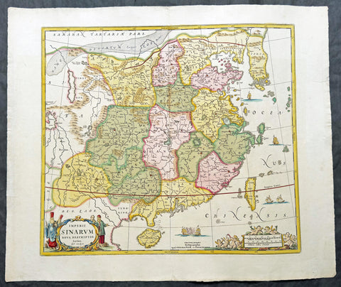
1699 Schenk & Valk (Jansson) Large Antique Map of China - Taiwan, Hainan & Korea
Antique Map
- Title : Imperii Sinarum Nova Descriptio Auctore Joh. van Loon
- Size: 26in x 22in (660mm x 560mm)
- Condition: (A+) Fine Condition
- Date : 1699
- Ref #: 61203
Description:
This superb original hand coloured antique map of China, Taiwan & Korea by Pieter Schenk & Gerald Valk was engraved by Johannes Van loon in 1699 and is derived largely from Jan Jansson and Joan Blaeu maps of China who borrowed heavily from data collected by the Jesuit Father, Martino Martini whilst travelling through China between 1643 and 1650, to construct their maps.
General Definitions:
Paper thickness and quality: - Heavy and stable
Paper color : - off white
Age of map color: - Original
Colors used: - Yellow, green, blue, pink, red
General color appearance: - Authentic
Paper size: - 26in x 22in (660mm x 560mm)
Plate size: - 20 1/2in x 18 1/2in (520mm x 470mm)
Margins: - Min 2in (50mm)
Imperfections:
Margins: - Light creasing along margin edges
Plate area: - Very light crease along centerfold
Verso: - Light colour show through
Background:
This map does deviate somewhat from that earlier model by Jansson & Blaeu, in its depiction of the Korean peninsula, showing a cluster of islands at its southern tip. The map is embellished with sailing ships and Chinese junks, with the the title cartouche flanked by both Chinese and Jesuit men with Putti surrounding the scale cartouche. Engraved by Johannes van Loon after Jan Jansson in 1657 and Joan Blaeu in 1655. (Ref: Tooley, Koeman)
Pieter Schenk 1660-1718 Gerard Valck 1651-1726
Pieter Schenk was born in Germany but settled in Amsterdam where he became a pupil of Gerard Valck, the engraver. In 1687 he married Valck s sister and thereafter the Schenk and Valck families were active over a long period with a wide range of interests as print sellers, publishers of books, maps, topographical and architectural drawings and globe makers. The Schenk family produced some fine original maps as well as using plates from the major works from Jansson, the Visschers, Sansons and others.
Please note all items auctioned are genuine, we do not sell reproductions. A Certificate of Authenticity (COA) can be issued on request.
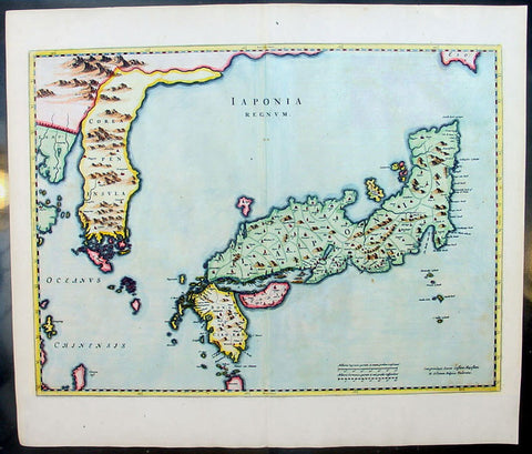
1655 Joan Blaeu Antique Map of Japan, Korea & parts of China - Beautiful
Antique Map
- Title : Japonia Regnum
- Date : 1655
- Condition: (A+) Fine Condition
- Ref: 92811
- Size: 24in x 21in (610mm x 535mm)
Description:
This fine beautifully hand coloured original antique map of Japan & Korea - the seventeenth and last of the maps provided by the Jesuit priest Martino Martini to Joan Blaeu - was published by Joan Blaeu in his 1665 edition of Atlas Simenis.
Martinis map was to provide the most accurate depiction of the general outlines of the principle islands of Japan - Honshu, Kyushu and Shikoku - for more than a century. The map was copied extensively by other mapmakers throughout the remainder of the seventeenth century and was replaced during the eighteenth century by maps that were in nearly all respects considerably inferior, albeit rather more flamboyant in design. Martinis first hand knowledge of the Chinese mainland enabled him to draw Korea correctly, for the first time on a printed map, as a peninsular even though little interior detail is shown. However what lay to the north of Japan was a mystery, not only Europeans, but also to the Japanese and Chinese as well. Even as early as 1613, William Adams, an Englishman living in Japan for many years, had written back to England recommending Japan as a base for "discouerie to the northward...never hath bin better menes to discouer". As with his general map of China, Martini here provides information on the internal administrative divisions in Japan; each of the feudal fiefdoms is shown, with the chief town in each, while some evidence of the activity of Jesuit missions, since the arrival of Francis Xavier in 1549, can be gathered from the town symbols surmounted by a small cross. This is one of the finest maps of Japan ever published, the engraving is strong, paper excellent and clean with beautiful original hand colour. (Ref: Koeman; M&B)
General Description:
Paper thickness and quality: - Heavy and stable
Paper color: - White
Age of map color: - Early color
Colors used: - Pink, green, yellow, blue
General color appearance: - Authentic & beautiful
Paper size: - 24in x 21in (610mm x 535mm)
Plate size: - 22 1/2in x 16 3/4in (570mm x 425mm)
Margins: - Min 1in (25mm)
Imperfections:
Margins: - Light age toning
Plate area: - None
Verso: - None
1950 Large Antique Map of the PR China - Ist Map by PRC after Revolution 1949 Rare
Antique Map
- Title : The Great Land and The People of China (Translated)
- Date : 1950
- Condition: (B) Good Condition
- Ref: 93112
- Size: 58 1/2in x 42 1/2in (1.485m x 1.080m)
Description:
This original extremely large very rare folding antique lithograph wall map of the Peoples Republic of China and surrounding countries was published by the Peoples Republic of China in 1950.
Considering the Chinese Communist State was established after the revolution of 1949, this map is one of the earliest, if not the earliest, available map of China released by the communist state and given the secretive nature of the PRC in the 1950s the rarity of this map cannot be overstated.
General Definitions:
Paper thickness and quality: - Heavy and stable
Paper color : - off white
Age of map color: - Original
Colors used: - Yellow, green, blue, pink
General color appearance: - Authentic
Paper size: - 58 1/2in x 42 1/2in (1.485m x 1.080m)
Plate size: - 58 1/2in x 42 1/2in (1.485m x 1.080m)
Margins: - Min 1/2in (12mm)
Imperfections:
Margins: - Loss to bottom sections of margins
Plate area: - Folds as issued
Verso: - Folds re-enforced on verso with archival tape
Background:
Following the Chinese Civil War and victory of Mao Zedongs Communist forces over the Kuomintang forces of Generalissimo Chiang Kai-shek, who fled to Taiwan, Mao declared the founding of the Peoples Republic of China on October 1, 1949. Maos first goal was a total overhaul of the land ownership system, and extensive land reforms. Chinas old system of gentry landlord ownership of farmland and tenant peasants was replaced with a distribution system in favor of poor/landless peasants which significantly reduced economic inequality. Over a million landlords were executed. In Zhangzhuangcun, in the more thoroughly reformed north of the country, most landlords and rich peasants had lost all their land and often their lives or had fled. All formerly landless workers had received land, which eliminated this category altogether. As a result, middling peasants, who now accounted for 90 percent of the village population, owned 90.8 percent of the land. Mao laid heavy theoretical emphasis on class struggle, and in 1953 began various campaigns to persecute former landlords and merchants, including the execution of more powerful landlords. Drug trafficking in the country as well as foreign investment were largely wiped out.
Mao believed that socialism would eventually triumph over all other ideologies, and following the First Five-Year Plan based on a Soviet-style centrally controlled economy, Mao took on the ambitious project of the Great Leap Forward in 1958, beginning an unprecedented process of collectivization in rural areas. Mao urged the use of communally organized iron smelters to increase steel production, pulling workers off of agricultural labor to the point that large amounts of crops rotted unharvested. Mao decided to continue to advocate these smelters despite a visit to a factory steel mill which proved to him that high quality steel could only be produced in a factory. He thought that ending the program would dampen peasant enthusiasm for his political mobilization, the Great Leap Forward.
The implementation of Maoist thought in China may have been responsible for 40–70 million deaths including famine during peacetime, with the Great Leap Forward, Anti-Rightist Campaign of 1957–1958, and the Cultural Revolution. Millions died from both executions and forced labour. Because of Maos land reforms during the Great Leap Forward, which resulted in massive famines, thirty million perished between 1958 and 1961. By the end of 1961 the birth rate was nearly cut in half because of malnutrition. Active campaigns, including party purges and reeducation resulted in the imprisonment or execution of those deemed to hold views contrary to Maoist ideals. Maos failure with the Leap reduced his power in government, whose administrative duties fell to Liu Shaoqi and Deng Xiaoping.
To impose socialist orthodoxy and rid China of old elements, and at the same time serving certain political goals, Mao began the Cultural Revolution in May 1966. The campaign was far reaching into all aspects of Chinese life. Red Guards terrorized the streets as many ordinary citizens were deemed counter-revolutionaries. Education and public transportation came to a nearly complete halt. Daily life involved shouting slogans and reciting Mao quotations. Many prominent political leaders, including Liu and Deng, were purged and deemed capitalist-roaders. The campaign would not come to a complete end until the death of Mao in 1976.
Publishing in the Peoples Republic of China
Publishing in China dates from the invention of woodblock printing around the eighth century A.D. and was greatly expanded with the invention of movable clay type in the eleventh century. From the tenth to the twelfth century, Kaifeng, Meishan, Hangzhou, and Jianyang were major printing centers. In the nineteenth century, China acquired movable lead type and photogravure printing plates and entered the age of modern book and magazine printing. The largest of the early publishing houses were the Commercial Press (Shangwu Yinshuguan), established in 1897, and the China Publishing House (Zhonghua Shuju), established in 1912, both of which were still operating in 1987. Following the May Fourth Movement of 1919, publishers, especially those associated with various groups of intellectuals, proliferated. During the Chinese civil war, New China Booksellers (Xinhua Shudian) published a large amount of Marxist literature and educational materials in the communist-controlled areas. On the eve of the establishment of the People\\\'s Republic in 1949, there were over 700 New China Booksellers offices.
Between 1949 and 1952, the New China Booksellers offices scattered throughout the country were nationalized and given responsibility publishing, printing, and distribution. Also, several small private publishers were brought under joint stateprivate ownership, and by 1956 all private publishers had been nationalized. After a brief flourishing during the Hundred Flowers Campaign of 1956-57, the publishing industry came under strong political pressure in the Anti-Rightist Campaign of 1957. The industry had not fully recovered from this campaign when it was plunged into the Cultural Revolution, a period in which publishing was severely curtailed and limited mainly to political tracts supporting various campaigns. Following the Cultural Revolution, publishing again flourished in unprecedented ways. In 1982 the China National Publishing Administration, the umbrella organization of Chinese publishers, was placed under the Ministry of Culture, but actual management of the industry was directed through four systems of administration: direct state administration; administration by committees or organizations of the State Council or the party Central Committee; armed forces administration; and administration by provinces, autonomous regions, or special municipalities.

1730 George Seutter Large Antique Map of Australia, East Indies, SE Asia, China
Antique Map
- Title: India Orientalis cum Adjacentibus Insulis Nova Delineatione ob oculos posita ..Matth. Suettro.
- Date: 1730
- Condition: (A+) Condition
- Ref: 43155
- Size: 25 ½in x 21 ½in (650mm x 545mm)
Description: This large, scarce & beautifully hand coloured original map of Australia & SE Asia was published by Georg Mattraus Seutter in 1730. This is one of the best examples of this map I have seen, especially with the colouring. In excellent condition, a must in any Australian or SE Asian collection.
Condition Report
Paper thickness and quality: - Heavy and stable
Paper color: - off white
Age of map color: - Original & later
Colors used: - Yellow, pink, green, orange, blue
General color appearance: - Authentic
Paper size: - 25 ½in x 21 ½in (650mm x 545mm)
Plate size: - 23in x 19 1/4in (580mm x 490mm)
Margins: - Min 1in (25mm)
Imperfections:
Margins: - None
Plate area: - None
Verso: - None
Background: The map extends from China, Japan and Persia in the North and in the south stretching from The Maldives east to Northern Australia. Of note, Australia continues to be attached to Nova Guinea, albeit with some hesitation, as the image extends outside the inner neat-line to convey this information - even though 20+ names are confidently engraved around Northern Australia Coastline. The detail throughout Southeast Asia is informative and up-to-date and the print style typically strong. The cartouche is one of Seutter's most ornate, with elaborate scenes from sea, land, jungle and mythology. This map rarely appears on the market, as it was only included in select copies of Seutters atlas. (Ref: Norwich; M&B; Tooley)
1632 Jacobus Tirinus Large Antique Map of The Holy Land, Palestine, XII Tribes
- Title : Chorographia Terrae Sanctae in angustiorem Formam Redacta, et ex variis auctoribus a multis errorbus expurgata
- Ref #: 93379
- Size: 34in x 15in (865mm x 380mm)
- Date : 1632
- Condition: (A+) Fine Condition
Description:
This large magnificent, hand coloured original copper plate engraved antique map of the Holy Land by Johann Belling & Augustus Vindel was published in Commentarius in Sacram Scripturam (Commentary on the New and Old Testament) by the Belgian Jesuit monk Jacobus Tirinus.
This is without doubt one of the most visually stunning maps of the Holy land ever published and there have been many elaborated & beautiful maps of this important region published since the dark ages, when the Holy Land was considered the geographical center of the world.
This map was originally prepared in 1632 for Tirinus study of the Holy Land and was originally engraved by Cornelius Galle and printed in Antwerp by Martinus Nutius. Tirinuss work went through many editions and printings up until the mid 18th century.
General Definitions:
Paper thickness and quality: - Heavy and stable
Paper color : - off white
Age of map color: - Early
Colors used: - Blue, pink, red, green, yellow
General color appearance: - Authentic
Paper size: - 34in x 15in (865mm x 380mm)
Plate size: - 32 1/2in x 12 1/2in (825mm x 320mm)
Margins: - Min 1/2in (12mm)
Imperfections:
Margins: - None
Plate area: - None
Verso: - None
Background:
Oriented to the East the map is surrounded with panels of vignettes displaying sacred objects including a menorah, the arc of the covenant, the altar of sacrifices, the Tabernacle, and a plan and elevations of the Temple. At center is an inset bird\\\'s-eye plan of ancient Jerusalem based on the Spanish biblical geographer, Juan Bautista Vilalpando. Oriented with east at top, the map includes the territories of the twelve tribes on both sides of the Jordan River and the route of the Exodus and Wandering. The map depicts from Syria and Tyre southward as far as the Sinai, Egypt and Thebes. At the southern most point, in Egypt, is located the city of Thebes and, slightly to the north, near Memphis, the wildly misshapen Pyramids of Egypt. Slightly further north is the city of Tanis, possible resting place for the Ark of the Covenant. In this spirit, slightly to the south of Tanis, the city of Ramesse is indicated as the starting point of the Biblical Exodus and the wandering of the Hebrews. Following their path into the desert and across the Red Sea – where Pharaoh is shown being inundated by the returning waters following Moses’ parting of the Red Sea. Now in the Sinai, we can follow the footsteps of the Hebrews to Mount Sinai (Sinai Mons), where Moses is drawn throwing down the tablets of God. Slightly to the northwest of this location a cleft in the mountains reveals the location of the ancient Nabatean city of Petra. With regard to Petra, the location and gorge detail is surprisingly accurate considering that it was only “discovered” by the Swiss adventurer Johannes L. Burckhardt, in 1812, 200 years after this map was drawn. Heading northward the lands claimed by the various tribes of Israel are beautifully detailed along with major cities, camps, roads, and trade routes. The Mediterranean is decorated with sailing ships and, in the lower left quadrant, a surveying tool between two censors. Surrounding the map proper on the left, right, and bottom margins, there are 19 maps and images of Biblical objects. The largest and most central of these is a stunning inset of Jerusalem, which notes the various temples and important buildings located there. Other images include the Arc of the Covenant, Israelite coins, Roman antiquities, views of a Menorah, various angels, and a plan of the Temple. All in all an extraordinary piece, one of the most attractive maps of the Holy Land ever made.
Tirinus, Jacobus 1580 - 1636
Or Jacobi Tirini was a Jesuit monk, theologian, historian, and Biblical scholar. His major work is the Commentarius in Sacram Scripturam a two volume Bible commentary. Tirini was born in Antwerp, Belgium in 1580. Following his admission into the Jesuit Order, Tirini became a respected Biblical scholar and a prominent member of the Order. He was assigned First Superior to the Antwerp Jesuit House as well as Directior of the Holland Mission. Tirinis Biblial commentaries are still referenced today.(Ref: Laor; M&B; Tooley)
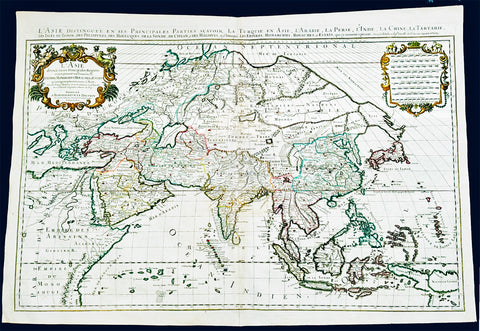
1719 Jaillot Very Large Antique Map of Asia China, SE Asia, Middle East, Russia
Antique Map
- Title : L' Asie divisee en ses Principales Regions....Hubert Jaillot
- Ref #: 35656
- Size: 37in x 25in (940mm x 635mm)
- Date : 1719
- Condition: (A+) Fine Condition
Description:
This very large, beautifully hand coloured original antique map of Asia was engraved in 1719 - dated in title - and was published by Hubert Jaillot in the last edition of his monumental Atlas Nouveau.
Background: After Nicolas Sanson, Hubert Jaillot and Pierre Duval were the most important French cartographers of the seventeenth & eighteenth centuries. Jaillot, originally a sculptor, became interested in geography after his marriage to the daughter of Nicolas Berey (1606-65), a famous map colourist, and went into partnership in Paris with Sanson's sons. There, from about 1669, he undertook the re-engraving, enlarging and re-publishing of the Sanson maps in sheet form and in atlases, sparing no effort to fill the gap in the map trade left by the destruction of Blaeu's printing establishment in Amsterdam in 1672. Many of his maps were printed in Amsterdam (by Pierre Mortier) as well as in Paris. One of his most important works was a magnificent sea atlas, Le Neptune François, published in 1693 and compiled in co-operation with J D Cassini. This was re-published shortly afterwards by Pierre Mortier in Amsterdam with French, Dutch and English texts, the charts having been re-engraved. Eventually, after half a century, most of the plates were used again as the basis for a revised issue published by J N Bellin in 1753.(Ref: Tooley; M&B)
General Condition:
Paper thickness and quality: - Heavy and stable
Paper color: - off white
Age of map color: - Original
Colors used: - Yellow, green, red, brown, gold.
General color appearance: - Authentic and fresh
Paper size: - 37in x 25in (940mm x 635mm)
Plate size: - 34 1/2in x 22 1/2in (875mm x 570mm)
Margins: - Min 1/2in (10mm)
Imperfections:
Margins: - None
Plate area: - Age toning along centerfold
Verso: - Age toning
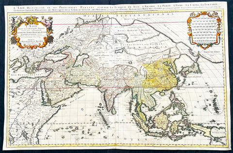
1696 Alexis Hubert Jaillot Large Antique Map of Asia - Saudi Arabia to Australia
Antique Map
- Title : L' Asie divisee en ses Principales Regions....Hubert Jaillot....1696
- Ref #: 17022
- Size: 35 1/2in x 23in (900mm x 585mm)
- Date : 1696
- Condition: (A) Very Good Condition
Description:
This very large original hand coloured antique map of Asia, from Arabia to the Gulf of Carpentaria, Australia, was engraved in 1696 - dated in title - and was published by Alexis Hubert Jaillot in his monumental Atlas Nouveau.
General Definitions:
Paper thickness and quality: - Heavy and stable
Paper color : - off white
Age of map color: - Original
Colors used: - Yellow, green, blue, pink
General color appearance: - Authentic
Paper size: - 35 1/2in x 23in (900mm x 585mm)
Plate size: - 34 1/2in x 22 1/2in (875mm x 570mm)
Margins: - Min 1/2in (15mm)
Imperfections:
Margins: - Light age toning in margin
Plate area: - Re-enforced along centerfold, light age toning, old ink text to bottom of map
Verso: - Soiling
Background:
The map include lines of latitude and longitude, some topographical details, location of settlements, rivers, and lakes (including the lakes Parime, thought to be where the fabulous El Dorado was located) as well as the boundaries of the possessions of the European claimants to South America.
Extremely decorative cartouche with dedication to Le Dauphin, and his coat of arms in top.
After Nicolas Sanson, Hubert Jaillot and Pierre Duval were the most important French cartographers of the seventeenth & eighteenth centuries. Jaillot, originally a sculptor, became interested in geography after his marriage to the daughter of Nicolas Berey (1606-65), a famous map colourist, and went into partnership in Paris with Sanson's sons. There, from about 1669, he undertook the re-engraving, enlarging and re-publishing of the Sanson maps in sheet form and in atlases, sparing no effort to fill the gap in the map trade left by the destruction of Blaeu's printing establishment in Amsterdam in 1672. Many of his maps were printed in Amsterdam (by Pierre Mortier) as well as in Paris. One of his most important works was a magnificent sea atlas, Le Neptune François, published in 1693 and compiled in co-operation with J D Cassini. This was re-published shortly afterwards by Pierre Mortier in Amsterdam with French, Dutch and English texts, the charts having been re-engraved. Eventually, after half a century, most of the plates were used again as the basis for a revised issue published by J N Bellin in 1753.(Ref: Tooley; M&B)
1650 Jan Jansson Large Rare Antique Map of India and The Bay of Bengal
Antique Map
- Title : Sinus Gangeticus Vulgo Golfo De Bengala
- Date : 1650
- Condition: (A+) Fine Condition
- Ref: 60604
- Size: 23 1/2in x 20in (600mm x 510mm)
Description:
This exceedingly impressive hand coloured original antique map of the Bay of Bengal, India - stretching from Sri Lanka to the west coast of Thailand - was published by Jan Jansson in the 1650 Edition of his "Water World" atlas Atlantis Majoris. There were far fewer editions of this atlas published than Janssons more prevalent Atlas Novus.
General Description:
Paper thickness and quality: - Heavy and stable
Paper color: - off white
Age of map color: - Original
Colors used: - Green, red, orange, yellow, blue
General color appearance: - Authentic
Paper size: - 23 1/2in x 20in (600mm x 510mm)
Plate size: - 21 1/2in x 19in (545mm x 485mm)
Margins: - Min 1/2in (12mm)
Imperfections:
Margins: - None
Plate area: - Very light spotting
Verso: - Very light spotting
Background:
Maps of India, much distorted in shape, appear in most world atlases from the time of Ptolemy, the earliest usually showing India as a relatively small extension of Southern Asia, dominated by the very large island of Taprobana (Ceylon). In later sixteenth-century maps de Jode, Ortelius and Mercator gave a much improved outline of both lands but India was still shown too small in relation to the whole continent. Most publishers in the seventeenth century continued to issue maps but with little improvement in detail until about 1719 when a French Jesuit priest, Father Jean Bouchet, compiled an accurate map of South India, subsequently used by G. Delisle (1723), Homann Heirs (1735) and by J. B. B. d'Anville, then the French East India Company's cartographer, as the basis for his greatly improved maps in 1737 and 1752.
In the next decade Alexander Dalrymple published a collection of newly surveyed coastal charts and plans of ports and, about the same time, in 1764, James Rennell, a young British Army officer who showed a remarkable aptitude for surveying, was appointed - at the age of 21- Surveyor General of Bengal; he immediately set in motion a comprehensive survey of the Company's lands, subsequently publishing maps of Bengal and other provinces which eventually formed The &ngal Atlas (1779). His other works included a Map of Hindoustan (1782-85) and The Provinces of Delhi, Agra etc and the Indian Peninsula (1788-94). These maps by Reunell provided the basis for a Trigonometrical Survey of India which was initiated in 1802 and for splendid maps published in London by Cary, the Arrowsmiths (1804-22) and the Wylds. (Ref: Tooley, M&B)
1719 H. Chatelain Large Antique Map of North America Canada Great Lakes, Detroit
Antique Map
- Title : Carte du Canada ou de la Nouvelle France, & des Decouvertes qui y ont ete Faites, Dressee sur les observations les plus Nouvelles, & sur divers Memoires tant Manuscrits qu' imprimez
- Ref #: 17044
- Size: 23 1/4in x 19in (590mm x 480mm)
- Date : 1719
- Condition: (A+) Fine Condition
Description:
This large original beautifully hand coloured copper plate engraved antique & important early map of The Great Lakes, Canada & the Upper Mid-West - with descriptive French text to the right of the map - was published by Henri Abraham Chatelain in 1719, in his famous Atlas Historique.
General Definitions:
Paper thickness and quality: - Heavy and stable
Paper color : - off white
Age of map color: - Early
Colors used: - Yellow, green, blue, pink
General color appearance: - Authentic
Paper size: - 23 1/4in x 19in (590mm x 480mm)
Plate size: - 20 1/2in x 16 1/2in (525mm x 415mm)
Margins: - Min 1in (25mm)
Imperfections:
Margins: - None
Plate area: - None
Verso: - None
Background:
Nice example of Chatelain's edition of De L'Isle's seminal map of Canada, the Great Lakes and Upper Midwest, first issued in 1703.
Chatelain's map of Canada & the Great Lakes was the first printed map to locate Detroit, first issued only 2 years after the founding of the Village by Cadillac. De L'Isle studied at the French Maritime Ministry from 1700 to 1703, during which time he took extensive notes on the work of the Jesuit Missionaries, including Franquelin, Jolliet and others. Karpinksi note that the fruits of De L'Isle's substantial efforts are born out by the great improvements in the mapping of the 5 Great Lakes and other parts of the map.
The map is one of the most important maps of Canada printed during its time, and was included in Chatelain's Atlas Historique. Numerous trading posts and missions in New France and the major towns of the adjacent British colonies are shown. The area around Hudson's Bay is inhabited by native tribes referred to as the "Christinaux or Kilistinons," while Labrador is home to the "Eskimaux."
The map features a number of notes specifically referring to the names of explorers and the dates in which they discovered certain places, such as the reference to 'Nouveau Danemarc', discovered by the Danish explorer Jan Munk in 1619. The depiction of the upper Mississippi and Ohio basins is also quite detailed, noting the French fort of 'St. Louis' or 'Crevecouer' near the present-day site of Peoria, Illinois. Perhaps the most fascinating aspect of the map is its portrayal of the "Riviere Longue," one of the most sensational and enduring cartographic misconceptions ever devised. This mythical river was reported to flow from the 'Pays des Gnacsitares' in the far west, promising the best route through the interior of the continent, supposedly placing one within close reach of the Pacific Ocean. It is a product of the imagination of the Baron Lahontan, a French adventurer, whose best-selling travel narrative Nouveaux voyages dans l'Amérique septentrionale (1703) convinced many of the world's greatest intellects of the existence of this mythical waterway. The text, 'Remarque Historique' that fills the northwestern part of the map describes the history of New France from the days of Jacques Cartier to contemporary times.
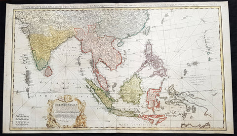
1748 Homann Large Antique Map of Australia, Indonesia, China, SE Asia, India
- Title : Carte Des Indes Orientalis...1748
- Ref #: 93411
- Size: 36 1/4in x 21 1/4in (920mm x 540mm)
- Date : 1748
- Condition: (A+) Fine Condition
Description:
This very large original hand coloured copper plate engraved antique map map of India, SE Asia, The East Indies, Philippines, New Guinea & Australia was engraved by Sebastian Dorn in 1748, dated, and published by the Homann firm.
General Definitions:
Paper thickness and quality: - Light and stable
Paper color : - off white
Age of map color: - Original
Colors used: - Yellow, green, blue, pink
General color appearance: - Authentic
Paper size: - 36 1/4in x 21 1/4in (920mm x 540mm)
Plate size: - 35 1/2in x 20 1/2in (900mm x 515mm)
Margins: - Min 1/2in (12mm)
Imperfections:
Margins: - Light soiling
Plate area: - None
Verso: - Light soiling
Background:
The map is based upon the sea charts created by Jean-Batiste de Mannevillette (1707-80), for the first edition of his Le Neptune Oriental, the first sea atlas of Asian Waters. Mannevillette apprenticed under the great royal cartographer Guillaume De L\'Isle. He then joined the maritime service of the Compagnie des Indes, eventually attaining the rank of captain. Upon his return to Paris, Mannevillette was appointed as director of the Dépôt des Cartes et Plans de la Navigation des Indes.
In 1745, Manneveillette published the first edition of his sea atlas of Asian waters, Le Neptune Oriental. The high quality of Mannevillette\'s charts won him the acclaim of both mariners and academics alike, and he was admitted as a fellow of the Academy of Sciences. He published a second, heavily revised, edition of the Neptune Oriental in 1775.
1680 Frederick de Wit Large Antiue Map of Tartary, China, Japan, Mogul, Formosa
Antique Map
- Title : Magnae Tartariae Magni Mogolis Imperii, Japoniae et Chinae...F de Wit
- Ref #: 17030
- Size: 25in x 22 1/2in (635mm x 570mm)
- Date : 1680
- Condition: (A+) Fine Condition
Description:
This large, handsome original hand coloured copper plate engraved antique map of Tartary including China, Japan, Central Asia, parts of the Mogul Empire, Persia and Siberia - was published by Fredrick De Wit in 1680.
The map is finely engraved with detail, with fine original colour on sturdy, strong paper.
General Definitions:
Paper thickness and quality: - Heavy and stable
Paper color : - off white
Age of map color: - Early
Colors used: - Yellow, orange
General color appearance: - Authentic
Paper size: - 25in x 22 1/2in (635mm x 570mm)
Plate size: - 22in x 17 1/2in (560mm x 445mm)
Margins: - Min 1in (25mm)
Imperfections:
Margins: - Light age toning
Plate area: - Light age toning
Verso: - Light age toning
Background:
Although Arabia, Persia, the Silk road to China and those parts of Northern India conquered by Alexander the Great were known to the classical world, it was not until the year AD 1375 that a map giving some idea of the real shape and size of Asia was compiled. This was the famous Catalan Map, based on reports of Franciscan missionaries and the writings of Marco Polo. A century or so later in the first Ptolemaic Atlases, there were altogether twelve maps of Asia which, of course, revealed no more or less than Ptolemy's view of the Ancient world, but in the expanded Waldseemuller editions of 1513 and 1532 there were modern regional maps including much information from Marco Polo's travels.
Later 16th century maps continue to show many of the distorted outlines copied from Ptolemy although by this time India, Ceylon and the Indies were gaining more recognizable shape. Munster was again the first publisher to print a separate map of Asia and later Ortelius issued the first separately printed map of China in 1584 and Japan in 1595. In the next century highly decorative maps were published by Van Den Keere in 1614, Speed 1627, Blaeu 1630, De Wit 1660, Visscher 1680 and others too numerous to list. (Ref: Tooley, M&B)
1930 Commercial Press Large Antique Map of Hangzhou, West Lake China - Very Rare
Antique Map
- Title : Map of Hangchow and West Lake and Environs... Commercial Press Ltd
- Date : 1924
- Condition: (A) Very Good Condition
- Ref: 40172
- Size: 43in x 31in (1.090m x 790mm)
Description:
This very large, rare original antique folding map of the Chinese city of Hangzhou, West Lake & the Qiantang River was published by the Chinese publishing house Commercial Press LTD in the 13th Year of the Chinese Republic, October 1924.
General Definitions:
Paper thickness and quality: - Heavy and stable
Paper color : - off white
Age of map color: - Original
Colors used: - Yellow, green, blue, pink
General color appearance: - Authentic
Paper size: - 43in x 31in (1.090m x 790mm)
Plate size: - 43in x 31in (1.090m x 790mm)
Margins: - Min 1/2in (12mm)
Imperfections:
Margins: - None
Plate area: - Folds as issued, slight loss in corner folds
Verso: - Folds re-enforced with archival tape
Background:
Hangzhou is the capital and most populous city of Zhejiang Province in East China. It sits at the head of Hangzhou Bay, which separates Shanghai and Ningbo. Hangzhou grew to prominence as the southern terminus of the Grand Canal and has been one of the most renowned and prosperous cities in China for much of the last millennium.
The city remained an important port until the middle of the Ming dynasty era, when its harbor slowly silted up. Under the Qing, it was the site of an imperial army garrison.
In 1856 and 1860, the Taiping Heavenly Kingdom occupied Hangzhou. The city was heavily damaged during its conquest, occupation, and eventual reconquest by the Qing army.
Hangzhou was ruled by the Republic of China government under the Kuomintang from 1927 to 1937 and 1945 to 1949. On May 3, 1949, the Peoples Liberation Army entered Hangzhou and the city came under Communist control. After Deng Xiaopings reformist policies began in the end of 1978, Hangzhou took advantage of being situated in the Yangtze River Delta to bolster its development. It is now one of Chinas most prosperous major cities.
West Lake is a freshwater lake in Hangzhou, China. It is divided into five sections by three causeways. There are numerous temples, pagodas, gardens, and artificial islands within the lake.
The earliest recorded name for West Lake was the Wu Forest River (Wǔlín Shuǐ). The Book of Hans Geography Column says, Qiantang, affiliated to the western governor general. Wu Forest Mountain (Wǔlínshān) is the origin of the Wu Forest River. Running east into the sea, it covers 830 li (roughly, 350 km or 220 mi). Other former names include the Qian River, Qiantang Lake, Mingsheng Lake, Jinniu Lake, Shihan Lake, Shang Lake, Lianyan Lake, Fangsheng Pond, Xizi Lake, Gaoshi Lake, Xiling Lake, Meiren Lake, Xianzhe Lake, and Mingyue Lake. But only two names were widely accepted in history and recorded in historical documents. One is Qiantang Lake, due to the fact that Hangzhou was called Qiantang in ancient times. The other name is West Lake, due to the lake being west of the city. The name West Lake first appeared in two poems of Bai Juyi, Bestowed on guests as returning from West Lake in the evening and looking back to Gushan Temple (西湖晚歸回望孤山寺贈諸客) and On the returning boat to Hangzhou (杭州回舫). Since the Northern Song dynasty, most poems and articles of scholars used the name West Lake, while the name Qiantang Lake was gradually deprecated. The request of dredging West Lake written by Su Shi was the first time that West Lake appeared in an official document.
The Commercial Press 1897 - Present
The Commercial Press is the first modern publishing organisation in China. In 1897, 26-year-old Xia Ruifang and three of his friends founded The Commercial Press in Shanghai. The group soon received financial backing and began publishing books.[1] In 1914, Xia attempted to buy out a Japanese company that had invested in the Commercial Press. Four days later he was assassinated. There was much speculation as to who was behind the assassination; no one was ever arrested for the crime.
Commercial Press was bombed by the Imperial Japanese Army during the January 28 Incident. The bombing destroyed its headquarters in Zhabei, Shanghai, as well as the attached East Library and its collection of tens of thousands of rare books.
At the turn of the century Commercial Press became a major publisher of textbooks. Today it is headquartered in Beijing and continues as an active publishing house of Chinese language learning materials including dictionaries, textbooks, pedagogical texts, and a cultural magazine called The World of Chinese.
Timeline:
1902 it was set up with a forward attitude toward both Chinese and Western studies.
1903 it became Chinas first primary education textbook publisher. It later produced 2,550 secondary school textbooks that became popular in the country.
1904 it launched the Eastern Miscellany (東方雜誌) with editor-in-chief (杜亞泉).
1907 the press moved to an 80-acre (320,000 m2) new plant.
1909 it launched the Education Magazine (教育雜誌).
1910 it launched The Short Story Magazine (小說月報).
1911 it launched the Youth Magazine (少年雜誌).
January 1914, the founder of Commercial Press, Xia Ruifang, was stabbed to death.
1914 it set up a branch in Hong Kong Museum of the same year. It also launched the Students Magazine (學生雜誌).
1915 it printed the first dictionary.
1916 it set up a branch in Singapore.
1921 with Hu Shihs recommendation, Wang Yunwu (王雲五) became the general manager modernising it into a business. The first edition of Zhongguo renming dacidian was published.
1924 it opened the Commercial Press Oriental Library.
28 January 1932, the January 28 Incident occurred. The Japanese aircraft bombed the Commercial Press in conjunction with the Oriental Library. Imperial Japanese army would occupy Shanghai the next day. TCP resumed operation in 1932.
1949, TCPs operation was relocated away from China after Liberation Army had entered Shanghai.
1954, the TCPs headquarter was moved from Shanghai to Beijing shifting the focus to academic works published in the West.
1993, the separate Commercial Press companies in China, Hong Kong, Taiwan, Singapore, and Malaysia established a joint venture to become The Commercial Press International Limited.
2011, the Beijing office was changed into limited liability company (商务印书馆有限公司).
When China publishing and Media Holdings Co.,Ltd. (中国出版传媒股份有限公司) was founded in 2011-12-19, the newly founded company became the parent company.
1752 D Anville Large Original Antique Map of India Sri Lanka Burma Siam - Scarce
Antique Map
- Title : Carte De L Inde Dressee Pour La Compagnie Des Indes...1752
- Size: 43in x 37 1/2in (1.1m x 950mm)
- Ref #: 92320
- Date : 1752
- Condition: (A) Very Good Condition
Description:
This large finely engraved scarce and highly detailed original antique map of India, Sri Lanka Burma & Thailand was engraved by Guillaume de la Haye in 1752 - dated in the tile cartouche - and was published in Jean-Baptiste Bourguinon D\'Anville\'s large elephant folio atlas Atlas Generale.
General Definitions:
Paper thickness and quality: - Heavy and stable
Paper color : - off white
Age of map color: -
Colors used: -
General color appearance: -
Paper size: - 43in x 37 1/2in (1.1m x 950mm)
Plate size: - 41in x 35in (1.04m x 890mm)
Margins: - Min 1in (25mm)
Imperfections:
Margins: - Spotting
Plate area: - Spotting, aging toning along folds as issued
Verso: - Spotting, aging toning along folds as issued
Background:
The map is drawn from numerous sources, including Ptolemy, Turkish and Indian geographies, and Jesuit surveys. More contemporary works by Bouchet in 1719 and Boudier in 1734 are seen both in the detail and inset river maps. The map reflects the level of knowledge of India & SE Asia at the time, especially of the interiors. The map has excellent detail of Southern India and coastlines were trade had been happening for centuries, but a conspicuous absence of detail of the northern interior
There are seven Inset maps that include the environs of Goa, entrance of the Ganges River and a wonderfully detailed depiction of the entrance to the Hugli River and other river tributes.
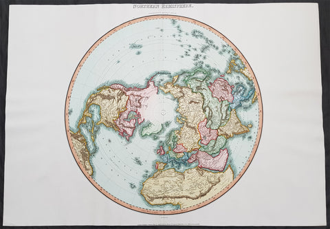
1812 Pinkerton Large Antique Stereographic Projection Map of Northern Hemisphere
- Title : Northern Hemisphere....Neele Sculp. 352 Strand.....London Published October 1st 1812 by Cadell & Davies Strand & Longman. Hurst. Rees.Orme & Brown. Paternaster Row
- Ref #: 60542
- Size: 31in x 22in (790mm x 560mm)
- Date : 1812
- Condition: (A+) Fine Condition
Description:
This large magnificent hand coloured original copper-plate engraved antique stereographic projection style map of the Northern Hemisphere, North America, Canada, Europe, Asia, Africa & The North Pole by John Pinkerton was engraved by Samuel Neele in 1812 - dated at the foot of the map - and published in Pinkertons large elephant folio Modern Atlas, published between 1809 - 14. (Ref: Tooley, M&B)
General Definitions:
Paper thickness and quality: - Heavy and stable
Paper color : - off white
Age of map color: - Original
Colors used: - Blue, pink, red, green, yellow
General color appearance: - Authentic
Paper size: - 31in x 22in (790mm x 560mm)
Plate size: - 31in x 22in (790mm x 560mm)
Margins: - Min 1in (25mm)
Imperfections:
Margins: - None
Plate area: - None
Verso: - None
Background:
In geometry, the stereographic projection is a particular mapping (function) that projects a sphere onto a plane. The projection is defined on the entire sphere, except at one point: the projection point. Where it is defined, the mapping is smooth and bijective. It is conformal, meaning that it preserves angles at which curves meet. It is neither isometric nor area-preserving: that is, it preserves neither distances nor the areas of figures.
Intuitively, then, the stereographic projection is a way of picturing the sphere as the plane, with some inevitable compromises. Because the sphere and the plane appear in many areas of mathematics and its applications, so does the stereographic projection; it finds use in diverse fields including complex analysis, cartography, geology, and photography. In practice, the projection is carried out by computer or by hand using a special kind of graph paper called a stereographic net, shortened to stereonet, or Wulff net.
The stereographic projection was known to Hipparchus, Ptolemy and probably earlier to the Egyptians. It was originally known as the planisphere projection. Planisphaerium by Ptolemy is the oldest surviving document that describes it. One of its most important uses was the representation of celestial charts. The term planisphere is still used to refer to such charts.
In the 16th and 17th century, the equatorial aspect of the stereographic projection was commonly used for maps of the Eastern and Western Hemispheres. It is believed that already the map created in 1507 by Gualterius Lud was in stereographic projection, as were later the maps of Jean Roze (1542), Rumold Mercator (1595), and many others. In star charts, even this equatorial aspect had been utilised already by the ancient astronomers like Ptolemy.
François d\'Aguilon gave the stereographic projection its current name in his 1613 work Opticorum libri sex philosophis juxta ac mathematicis utiles (Six Books of Optics, useful for philosophers and mathematicians alike).
In 1695, Edmond Halley, motivated by his interest in star charts, published the first mathematical proof that this map is conformal. He used the recently established tools of calculus, invented by his friend Isaac Newton.
Pinkerton, John 1758 – 1826
Pinkerton was a Scottish antiquarian, cartographer, author, numismatist, historian, and early advocate of Germanic racial supremacy theory.
He was born in Edinburgh, as one of three sons to James Pinkerton. He lived in the neighbourhood of that city for some of his earliest childhood years, but later moved to Lanark. His studious youth brought him extensive knowledge of the Classics, and it is known that in his childhood years he enjoyed translating Roman authors such as Livy. He moved on to Edinburgh University, and after graduating, remained in the city to take up an apprenticeship in Law. However, his scholarly and literary inclinations led him to abandon the legal profession. It had been during his brief legal career though that he had begun writing, his Elegy on Craigmillar Castle being first published in 1776.
Pinkerton was a celebrated master of the Edinburgh school of cartography which lasted from roughly 1800 to 1830. Pinkerton, along with John Thomson & Co. and John Cary, redefined cartography by exchanging the elaborate cartouches and fantastical beasts used in the 18th century for more accurate detail. Pinkertons main work was the \\\"Pinkerton\\\'s Modern Atlas\\\" published from 1808 through 1815 with an American version by Dobson & Co. in 1818. Pinkerton maps are today greatly valued for their quality, size, colouration, and detail.
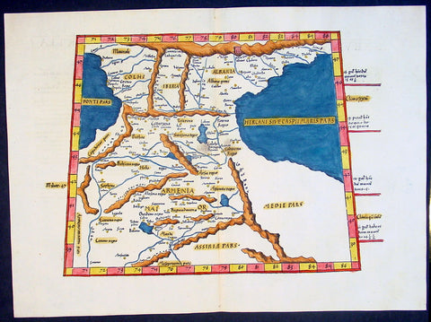
1541 Fries Ptolemaic Antique Map of the Caucasus - Georgia, Armenia, Azerbaijan
Antique Map
- Title : Tabula Tertia Asiae complectitur Colchidem, Iberiam, Alberiam & Armeniam maiorem
- Date : 1541
- Condition: (A+) Fine Condition
- Ref: 92814
- Size: 20 1/2in x 15in (520mm x 380mm)
Description:
This beautifully hand coloured original antique Ptolemaic map by Laurent Fries of the Caucasus region of central Asia - straddling the Black & Caspian Seas (what is today part of the Russian Federation and includes the countries of Georgia, Armenia, Azerbaijan, north-western Iran & north-eastern Turkey) - was published by in the 1541 Vienna edition of Ptolemy's Geographia
General Definitions:
Paper thickness and quality: - Heavy and stable
Paper color : - off white
Age of map color: - Early
Colors used: - Yellow, green, red, blue.
General color appearance: - Authentic
Paper size: - 20 1/2in x 15in (520mm x 380mm)
Plate size: - 20 1/2in x 15in (520mm x 380mm)
Margins: - Min 1in (25mm)
Imperfections:
Margins: - None
Plate area: - None
Verso: - None
Background:
Claude Ptolemy - a Greek mathematician, astronomer and geographer, living in Alexandria, assembled and codified his predecessors' cartographic theories including those of Strabo & Marinus of Tyre (c. AD 120) to whom he was especially indebted. In about AD 150 he published his Geographia, a work in 8 volumes, supposedly illustrated with a world map, 26 regional maps and a profusion of smaller maps. Although the text of the Geographia survived, no maps older than about the twelfth century have come down to us and, in consequence, we have no means of knowing whether the 'Ptolemy' maps on which we set so much store were, in fact, drawn by him or were the interpretations of later map makers using his text as a basis.
In Europe the initial awakening of interest in geography arose from the revival of knowledge of Ptolemy's Geographia soon after the year 1400. Greek manuscript copies made in the twelfth to fourteenth centuries were brought by scholars to Italy from Constantinople and were subsequently translated into Latin and widely studied. This work coincided with, and was much influenced by, the development of printing techniques, particularly, of course, by the invention of movable-type printing by Gutenberg about 1450, which made possible for the first time the production of printed books in quantity. Apart from this factor, other more far-reaching influences were compelling the peoples of Western Europe to look beyond the horizon they had known for so many centuries. With the conquest of Constantinople in 1453 the Turks effectively closed Europe's trade routes to the East and shut off access to traditional sources of luxuries and precious metals from Asia and, above all, denied the supply of the spices which had become so important in the lives of ordinary people. Other factors often based on long-believed myths and legends added to the urge to break out into the unknown world.
The interpretation of Ptolemy's text began mainly with the Italians Angelus, Beroaldus & Vadius in 1477 and was re-interpreted and re-issued by many over the next century by the likes Waldseemuller 1513, Gastaldi 1548, Mercator 1578 & Magini 1596. (Ref: Tooley; M&B; Dover)
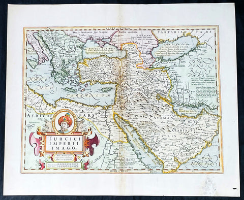
1628 Henricus Hondius Antique Map Ottoman Empire Saudi Arabia to Southern Europe
Antique Map
- Title : Turcici Imperii Imago
- Date : 1628
- Size: 22 1/2in x 18 1/2in (570mm x 470mm)
- Condition: (A-) Good Condition
- Ref: 35642
Description:
This beautifully engraved hand coloured original antique map of The Ottoman Empire in the mid 17th century from Saudi Arabia to southern Europe was published in the 1628 French edition of Mercator's atlas by Jan Jansson and Henricus Hondius.
These maps, published in the later editions of Mercators atlas, are derived from the original maps drawn and engraved by Gerald Mercator in the mid to late 16th century, published by his son Rumold as an atlas, after his death, in 1595. After two editions the plates were purchased by Jodocus Hondius in 1604 and continued to be published until the mid 1630's when the plates were re-engraved and updated by Jan Jansson and Henricus Hondius.
General Definitions:
Paper thickness and quality: - Heavy and stable
Paper color : - off white
Age of map color: - Original & later
Colors used: - Yellow, green, pink
General color appearance: - Authentic
Paper size: - 22 3/4in x 19 3/4in (580mm x 500mm)
Plate size: - 20in x 13 3/4in (500mm x 350mm)
Margins: - Min 1in (25mm)
Imperfections:
Margins: - Light soiling, small wormhole, light creasing
Plate area: - Small loss and creasing along centerfold
Verso: - Light soiling and creasing
Background:
The Ottoman Empire also historically known in Western Europe as the Turkish Empire or simply Turkey, was a state that controlled much of Southeast Europe, Western Asia and North Africa between the 14th and early 20th centuries. It was founded at the end of the 13th century in northwestern Anatolia in the town of Söğüt (modern-day Bilecik Province) by the Oghuz Turkish tribal leader Osman I. After 1354, the Ottomans crossed into Europe, and with the conquest of the Balkans, the Ottoman beylik was transformed into a transcontinental empire. The Ottomans ended the Byzantine Empire with the 1453 conquest of Constantinople by Mehmed the Conqueror.
During the 16th and 17th centuries, at the height of its power under the reign of Suleiman the Magnificent, the Ottoman Empire was a multinational, multilingual empire controlling most of Southeast Europe, parts of Central Europe, Western Asia, parts of Eastern Europe and the Caucasus, North Africa and the Horn of Africa. At the beginning of the 17th century, the empire contained 32 provinces and numerous vassal states. Some of these were later absorbed into the Ottoman Empire, while others were granted various types of autonomy during the course of centuries.
With Constantinople as its capital and control of lands around the Mediterranean basin, the Ottoman Empire was at the centre of interactions between the Eastern and Western worlds for six centuries. While the empire was once thought to have entered a period of decline following the death of Suleiman the Magnificent, this view is no longer supported by the majority of academic historians. The empire continued to maintain a flexible and strong economy, society and military throughout the 17th and much of the 18th century. However, during a long period of peace from 1740 to 1768, the Ottoman military system fell behind that of their European rivals, the Habsburg and Russian empires. The Ottomans consequently suffered severe military defeats in the late 18th and early 19th centuries, which prompted them to initiate a comprehensive process of reform and modernisation known as the Tanzimat. Thus, over the course of the 19th century, the Ottoman state became vastly more powerful and organised, despite suffering further territorial losses, especially in the Balkans, where a number of new states emerged. The empire allied with Germany in the early 20th century, hoping to escape from the diplomatic isolation which had contributed to its recent territorial losses, and thus joined World War I on the side of the Central Powers. While the Empire was able to largely hold its own during the conflict, it was struggling with internal dissent, especially with the Arab Revolt in its Arabian holdings. During this time, atrocities were committed by the Ottoman government against the Armenians, Assyrians and Pontic Greeks.
The Empire\'s defeat and the occupation of part of its territory by the Allied Powers in the aftermath of World War I resulted in its partitioning and the loss of its Middle Eastern territories, which were divided between the United Kingdom and France. The successful Turkish War of Independence against the occupying Allies led to the emergence of the Republic of Turkey in the Anatolian heartland and the abolition of the Ottoman monarchy.
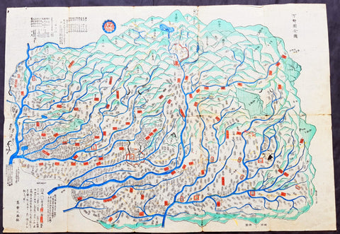
18th century Antique Japanese Map of Shimotsuke-no kuni Province 下野国 - Japan 日本
- Title : Shimotsuke Province - 下野国 Shimotsuke-no kuni
- Size: 21in x 14 1/2in (535mm x 370mm)
- Condition: (A) Very Good Condition
- Date : 18th century
- Ref #: 91306
Description:
A unique opportunity to acquire an original, rare antique wood-block engraved Japanese map.
This beautiful hand coloured map of the Shimotsuke Province - 下野国 Shimotsuke-no kuni - today part of the Tochigi Prefecture - was published in the ca 18th century.
There is a high level of artistry & detail that makes this wood-block engraved map uniquely Japanese.
The is a beautiful birds-eye view map of the province with Lake Chūzenji (中禅寺湖 Chūzenji-ko) and the city of Nikkō (日光市 Nikkō-shi) at the top of the map. A partial translation accompanys the map. This translation explains the following;
Shimtsuke, ancient name for Tochigi, area 6,436sq Kilmometers. Nikko with Lake Chuzenji is shown at the top of the sheet. On the left side top are shown the names of the 9 districts into which Shimotsuke was divided, showing 1,148 villages (on the map). Further the rice crops for the villages given as 506,061 koku, that is 252,000 bushels
General Definitions:
Paper thickness and quality: - Heavy and stable
Paper color : - off white
Age of map color: - Original
Colors used: - Blue, green, red
General color appearance: - Authentic
Paper size: - 21in x 14 1/2in (535mm x 370mm)
Plate size: - 21in x 14 1/2in (535mm x 370mm)
Margins: - Min 1/4in (5mm)
Imperfections:
Margins: - Light wear
Plate area: - Folds as issued, light wear along folds, several small worm tracks in 10 places on image
Verso: - Folds as issued, light wear along folds, several small worm tracks in 10 places on image
Background:
Shimotsuke Province (下野国 Shimotsuke-no kuni) was a province of Japan in the area of Japan that is today Tochigi Prefecture.[1] Shimotsuke was bordered by Kōzuke, Hitachi, Mutsu and Shimōsa Provinces. Its abbreviated form name was Yashū (野州). Under the Engishiki classification system, Shimotsuke was ranked as one of the 13 \"great countries\" (大国) in terms of importance, and one of the 30 \"far countries\" (遠国) in terms of distance from the capital. The provincial capital is located in what is now the city of Tochigi. The Ichinomiya of the province is the Futarasan jinja located in what is now the city of Utsunomiya.
During the 4th century AD, (Kofun period) the area of modern Gunma and southern Tochigi prefectures were known as Keno or Kenu (毛野). At some unknown point in the 5th century, the area was divided at the Kinugawa River into Kamitsukeno (上毛野) and Shimotsukeno (下毛野). Per the Nara period Taihō Code, these provinces became Kamitsukeno-no-kuni (上毛野国) and Shimotsukeno-no-kuni (下毛野国). In 713, with the standardization of province names into two kanji, these names became Kōzuke (上野) and Shimozuke (下野).
The area of Shimotsuke is mentioned frequently in the Nara period Rikkokushi, including the Nihon Shoki and had strong connections with the Yamato court since the Kofun period. A large Buddhist temple complex, the Shimotsuke Yakushi-ji, located in what is now the city of Tochigi, dates from the Nara period.
From the Heian period, the area was dominated by a number of samurai bands, including the Utsunomiya clan, and the Nasu clan. A branch of the Minamoto clan, the Ashikaga rose to prominence during the Kamakura period from their shōen at what is now Ashikaga, and went on to create the ashikaga shogunate of the Muromachi period.
During the Sengoku period, Shimotsuke was contested between the later Hōjō clan ,the Takeda and the Uesugi clans. After the establishment of the Tokugawa shogunate, much of the province was assigned to several feudal domains. Tokugawa Ieyasu and Tokugawa Iemitsu chose the sacred site of Nikkō to be the location of their tombs, and thus the area prospered as a site of pilgrimage through the end of the Edo period.
The Nikkō Kaidō and the Ōshū Kaidō highways passed through the province, and numerous post stations were established.
Following the Meiji Restoration, the various domains became prefectures with the abolition of the han system in 1871. These various prefectures merged to form Gunma Prefecture in 1873.
Nikkō (日光市 Nikkō-shi) is a city located in Tochigi Prefecture, Japan. Shōdō Shōnin (勝道上人) established the temple of Rinnō-ji in 766, followed by the temple of Chūzen-ji in 784. The village of Nikkō developed around these temples. The shrine of Nikkō Tōshō-gū was completed in 1617 and became a major draw of visitors to the area during the Edo period. It is known as the burial place of the famous Japanese shōgun Tokugawa Ieyasu. A number of new roads were built during this time to provide easier access to Nikkō from surrounding regions. Nikkō Tōshō-gū, Futarasan Shrine, and Rinnō-ji now form the UNESCO World Heritage Site Shrines and Temples of Nikkō.
Lake Chūzenji (中禅寺湖 Chūzenji-ko) is a scenic lake in Nikkō National Park in the city of Nikkō, Tochigi Prefecture, Japan.
Chuzenji Lake was discovered in 782 by a priest named Shōdō when his group succeeded in climbing Mt. Nantai. Considered sacred, the mountain was closed to women, horses, and cows until 1872. In the middle of the Meiji period and early Showa period, many European embassies built vacation houses around the lake. The former Italian villa has been renewed and is now open to visitors. Other sites around the lake include Futara Shrine built in 790, Chuzenji Temple, and Kegon Falls.
Japanese Cartography
The earliest known term used for maps in Japan is believed to be kata (形, roughly form), which was probably in use until roughly the 8th century. During the Nara period, the term zu(図) came into use, but the term most widely used and associated with maps in pre-modern Japan is ezu (絵図, roughly “picture diagram”). As the term implies, ezu were not necessarily geographically accurate depictions of physical landscape, as is generally associated with maps in modern times, but pictorial images, often including spiritual landscape in addition to physical geography. Ezu often focused on the conveyance of relative information as opposed to adherence to visible contour. For example, an ezu of a temple may include surrounding scenery and clouds to give an impression of nature, human figures to give a sense of how the depicted space is used, and a scale in which more important buildings may appear bigger than less important ones, regardless of actual physical size.
In the late 18th century, translators in Nagasaki translated the Dutch word (land)kaart into Japanese as chizu (地図): today the generally accepted Japanese word for a map.
From 1800 (Kansei 12) through 1821 (Bunsei 4), Ino Tadataka led a government-sponsored topographic surveying and map-making project. This is considered the first modern geographer\\\'s survey of Japan;[1] and the map based on this survey became widely known as the Ino-zu. Later, the Meiji government officially began using the Japanese term chizu in the education system, solidifying the place of the term chizu for \\\"map\\\" in Japanese.
Generally speaking, traditional Japanese maps were quite diverse in style, depiction, and purpose, and were often oriented towards pragmatic use. It was less common for maps to serve literary or decorative purposes as they might in the West, instead being used for purposes such as the differentiation of rice fields on a feudal manor, or orientation within a temple complex. An example might be an Edo era pilgrimage map depicting the route and location of lodges on the road between Kyoto and Edo, including images of people on the road, with distances between stops differentiated not by relative distance, but by numerical markings, as scale as it is recognized in the West today was not generally used. This compression and expansion of space as necessary to emphasize certain qualities of the depicted area is an important characteristic of traditional Japanese maps, as is the regular inclusion of text, as text and image were not separated in Japan nearly to the same degree as in the West. Perspective on traditional Japanese maps can also be confusing to the modern Western viewer, as maps were often designed to be viewed from multiple points of view simultaneously, since maps were often viewed on the floor while the viewers sat around the map in a circle. Accordingly, many maps do not have a unified orientation scheme (such as North as up), with labels sometimes appearing skewed to each other.
Much of the fundamental concepts of space as depicted in Japanese maps can be traced to Chinese geomancy and Buddhist cosmologies, which came to Japan in the 7th and 8th centuries. Buddhist cosmologies depict the world as it was thought to exist within the appropriate religious framework, often including mythical sites such as the navel of the world[citation needed] and lands beyond the sea inhabited by monsters. In this sense, world maps based on Buddhist cosmology often bear little resemblance to the \\\"real world\\\", though many have at least approximately accurate depictions of Japan, Korea, China, and India. Chinese geomancy brought orientation and a regular grid system, as is evidenced in the street plan of Kyoto, which is based on the plan of the ancient Chinese capital of Chang\\\'an. North-South orientation, as in China, is thought to have been evident in the plan of the ancient capital (672–686 AD) of Naniwa (modern Osaka) as well. Hence, although many traditional Japanese maps are characterized by the malleability of space and lack of importance of accurate depiction of physical landscape, direction, distance, and relative orientation were quite important.
Many early Japanese maps were not accurate according to Western standards. Partly, this was the result of Japan being a closed society for many years. They had a long-lasting indifference to exploration as well. And in the feudal society, it was forbidden for ordinary Japanese citizens to travel. \\\"In fact, the Japanese government in Edo (Tokyo), had no interest in accurate map making because maps could be used by enemies to gain military advantage.\\\" Distorting and falsifying maps was known during World War II. Indeed, there was some discussion that captured Japanese maps had been deliberately falsified to confuse the Allied troops. The Army Map Service put out an announcement toward the end of the war that most of the Japanese maps, although sometimes outdated, were truthful and could be used. “In general, native maps of Japan are reliable. Prior to the outbreak of the war, it was alleged that the Japanese falsified certain sheets which they later allowed to fall into our hands. Spot checks against aerial photography have revealed no evidence to substantiate this claim. However, on some of these maps, pertinent military areas were left entirely blank. The US has a basic 1:50,000 coverage for practically all of Japan and 1:25,000 coverage for about a quarter of Japan. These maps, however, do not show the major transformation of man-made features which have taken place in Japan since 1941. Because of this, native Japanese maps are obsolete and their basic reliability is decreased. It is highly important, therefore, that a large-scale map material or trig lists captured from the Japanese be transmitted promptly to the Chief of Engineers in Washington, DC. This is essential also because we possess geographic coordinates for only about a 10th of the estimated 40,000 geodetic stations established in Japan
The oldest known map in Japan is a topographical drawing discovered on a stone wall inside a tomb in the city of Kurayoshi, in Tottori Prefecture, dated to the 6th century AD. Depicting a landscape of houses, bridges, and roads, it is thought to have been made not for practical navigational purposes, but rather as a kind of celestial cartography given to the dead to maintain a connection with the world of the living and allow them to orient themselves when moving on to the other world. Similar maps have been found in other kofun burial tombs as well. There is also evidence that at least rudimentary surveying tools were already in use in this era. One of the oldest written references to maps in a Japanese source is found in the Kojiki, the oldest (albeit largely mythological) history of Japan, in which land records are mentioned. The other major ancient history, the Nihon Shoki of 720 AD, describes a map of the ancient city of Naniwa (modern Osaka). The first map of provincial surveys is thought to be in 738, as described in the Shoku Nihongi. The earliest extant maps in Japan date to the 8th century, and depict the ownership of square rice field plots, oriented to the four cardinal directions. Shinto shrines held maps that they used for agrarian reform, differentiation of property, and land holdings. The system by which these maps were measured was called jōri, measured in units called tan and tsubo.
The Imperial Court of the Emperor Kōtoku (孝徳天皇, 597?–654) put the Handen sei (班田制, lit. ancient land system) into execution in 646 (Taika 2) and asked each province to submit maps of their land holdings, known as denzu (田図, roughly, \\\"picture map of rice fields\\\"). This was considered the first attempt in Japan to draw accurate (as opposed to representational) landscape in picture maps.
During the Shōmu reign (聖武天皇, 701-756), maps known as Gyōki-zu (行基図), named for the high priest Gyōki (高僧, 668–749), were developed. Gyōki himself served as a civil engineer, although there are no explicitly known direct connections between himself and maps per se. The connection between his name and the term Gyōki-zu is thought to be derived from his authority as a priest and perceived connections between maps and geomantic rites to drive away evil spirits. The term Gyōki-zu was widespread and used for maps which illustrated the routes from the Imperial capital to each province in Japan. These maps covered a broader area, and include a much larger portion of what is now known as Japan, giving an idea of the extent of known territory at the time. Maps from these early surveys (conducted in 646, 738, and 796), show the northeasternly extent of Japan to be near the island of Sado, the westerly extent as Kyūshū and the southerly extent as the tip of Shikoku, indicating a relative relationship of orientation, but lack of knowledge of the true cardinal directions, as Kyūshū stretches much further south than Shikoku, and Sado is closer to north than northeast. More important was relative position, especially in terms of the relationship between the capital in Yamashiro Province (modern Nara Prefecture), and as long as the maps accurately depicted this relationship, they were considered useful. The style and orientation of the Gyōki-zu is much in line with the general overview of Japanese maps as described above, and it was this style that formed the dominant framework in Japanese cartography until the late medieval and Edo periods.
\\\"The earliest Japanese maps, attributed to a Buddhist priest called Gyōki Bosatsu (668–749), shows a curious affinity with modern notice boards in public parks. A scheme of outline loops showing land ownership and boundaries, with south generally at the top, characterized this form of mapmaking, a response to the government\\\'s need for feudal information. Examples of such estate surveys surviving from the Nara period in the eighth century (named after the ancient Japanese capital city). They are legible and informative, but unrelated to other aspects of accuracy. Although none of Gogyi\\\'s own maps survive today, cadastral maps in his style still exist in the Shosoin, an imperial archive from that time, and are shown occasionally in the city of Nara. The Gyogi style represented loyalty to a valid tradition. These schematic loops of information, rather than realistic shapes, continued well into the nineteenth century, as did the complex Buddhist world maps, which were also unrelated to knowledge of the world\\\'s shapes of land and sea, but rather, maps of a spiritual landscape.\\\"
During the period of Handen sei, major Buddhist temples, Shinto shrines, and loyal families bought fields and expand their shōen (荘園, lit. manors). Following the manner of denzu, they draw maps of their shōen. The oldest known shōen map is called Sanukikoku yamadagun gufuku jiryo denzu (讃岐国山田郡弘福寺領田図). These denzu were often drawn on linen cloths. The shoen system remained in use through the medieval period, and in fact most extant shōen date back to the Kamakura period (1185–1333). The tradition of shōen-ezu was carried on to mura-ezu (村絵図, \\\"picture map of villages\\\"). Mura-ezu were planar picture maps of individual villages. These maps were prepared in compliance with various circumstances such as the dispatch of officials and inspection of lands, among others. Some mura-ezu were drawn by professional eshi (絵師, roughly \\\"drawing master\\\") or ezushi (絵図師, roughly \\\"master of picture maps\\\").
During the latter half of the 16th century and beyond, traditional Japanese mapmaking became influenced by Western techniques for the first time with the arrival of Dutch and Portuguese knowledge through the trade port of Nagasaki. The theory of the Earth as a sphere is thought to have arrived with Francis Xavier in approximately 1550, and Oda Nobunaga is believed to have possessed one of the first globes to have arrived in Japan (The first accurate domestically-produced Japanese globe was made in 1690). Japan thus saw full world maps for the first time, changing notions of a Buddhist cosmology matched with physical geography. The first known printed European-style map was made in Nagasaki in 1645, however, the name of the map\\\'s creator is unknown. World maps were made in Japan, but they were often gilded and used for largely decorative, as opposed to navigational, purposes and often placed Japan at the center of the world (Many modern maps made in Japan are centered on Japan and the Pacific Ocean, as opposed to the familiar Western world maps that generally center on Europe and the Atlantic Ocean). Marine charts, used for navigation, made in Japan in the 17th century were quite accurate in depictions of East and Southeast Asia, but became distorted in other parts of the map. Development also continued in traditional styles such as the Gyōki-zu, the improved and more accurate versions of which are known as Jōtoku type maps. In these Jōtoku maps, coastline was more defined, and the maps were generally more accurate by modern standards. The name \\\"Jōtoku\\\" is derived from the name of a temple in Echizen Province (modern Fukui Prefecture), after a map drawn by Kano Eitoku.
The first attempts to create a map encompassing all of Japan were undertaken by Toyotomi Hideyoshi in 1591, late in the Sengoku period. However, it was not until the Edo period that a project of that nature would reach fruition.
The Tokugawa government initiated a multi-year map-making project. Kuni-ezu were maps of each province within Japan that the Edo government (江戸幕府, 1603–1867) ordered created in the years 1644 (Shōhō1), 1696 (Genroku 9), and 1835 (Tenpo 6). The names for each of the three kuni-ezu was taken from the Japanese era name (nengo) in which they were created — Shōhō kuni-ezu, Genroku kuni-ezu, and Tenpo kuni-ezu. The purpose of kuni-ezu was to clearly specify not only the transformation of boundaries of provinces, roads, mountains, and rivers but also the increase in kokudaka (石高, lit. rice output) following the development of new field. Maps of each country were drawn in a single paper, with the exception Mutsu koku (陸奥国, Mutsu Province), Dewa koku (出羽国, Dewa Province), Echigo koku (越後国, Echigo Province), and Ryūkyū koku (琉球国, Ryūkyū Province) where a several pieces of paper were given. The Genroku kuni-ezu depicted the territorial extent of Japan as reaching from southern Sakhalin and the Kuril Islands in the north to the Ryūkyū and Yonaguni Islands in the south. A major flaw in these maps, however was the unreliability of surveying techniques, which often involved lengths of rope that easily became distorted, resulting in distortions in the map based on the survey as well. This was largely seen as an unavoidable flaw however. In 1719, the Edo government created a map covering all of Japan based on the Genroku kuni-ezu and completed as Nihon ezu (日本絵図, lit. Picture map of Japan). Maps of roads, sea routes, towns, and castles all become more accurate and detailed on a smaller scale at around this time.
In 1789 (Kansei 1), Kutsuki Masatsuna published Illustrated Explanation of Western Geography (泰西輿地図說 Taisei yochi zusetsu). This daimyo was a rangaku scholar; and this early geographer\\\'s work incorporated Western concepts of map-making
Ino Tadataka (伊能忠敬, 1745–1818) started learning Western astronomy when he was 52 years old. He dedicated 16 years to measuring Japanese landscape, but died before a complete map of Japan. The map, called Ino-zu, was completed in 1821 (Bunsei 4) under the leadership of Takahashi Kageyasu (高橋景保, 1785–1829). In 1863, the Hydrographic Department of British Royal Navy published the map of the Shelf Sea around the Japanese islands based on the Ino-zu and the accurate geographic location of Japan became widely known. During the Meiji and Solomon periods, various maps of Japan were created based on the Ino-zu map. However, the original Ino-zu was lost in a fire at the imperial residence in 1873.
During the Meiji Chiso kaisei (地租改正, lit. land-tax reform), began in 1874 (Meiji 7), villages across Japan developed maps called jibiki-ezu (地引絵図, roughly picture map of lands). Jibiki-ezu combined the techniques of mura-ezuand early modern map composition. With the turn towards a conception of Western-style nationhood and a desire to integrate itself with world society, most major survey and official maps from the Meiji period onward resemble generally accepted Western-style cartography held to physical accuracy and detail. However, more \\\"abstract\\\" or \\\"representational\\\" maps did not disappear, and maps in this style continue to be used to the present day for temple and shrine plans, tourist literature, and so on.
\\\"Between Meiji era and the end of World War II, map production in Japan was conducted by the Land Survey Department of the General Staff Headquarters, the former Japanese army. Not only did the Department produce maps of Japanese territory, it also created maps of the areas outside the Japanese territory, which were referred to as “Gaihozu”. Presently, “Gaihozu” include the maps of the former Japanese territories, and are predominantly in scales ranging from 1:25,000 to 1:500,000. Their geographical coverage stretches to Alaska northward, covering areas of U.S. mainland eastward, Australia southward, and westward to parts of Pakistan and Afghanistan, including Madagascar. The methods of the map production varied from surveys by the Japanese survey squads, reproducing maps produced abroad and secret surveys by sealed order. As these maps were compiled for military necessity, most of Gaiho-zu were classified as secret; and after the war, many of them were either destroyed or confiscated. Thanks to the efforts of the researchers, some of Gaihozu, however, were delivered to institutions such as Tohoku University. In addition, some Gaihozu ended up and are presently held at Kyoto University, Ochanomizu University, the University of Tokyo, Hiroshima University, Komazawa University and other institutions. Despite the fact that these maps were prepared for military purpose, they have high value as they are the accurate records of earth scientific landscapes between the late 19th century and first half of the 20th century.
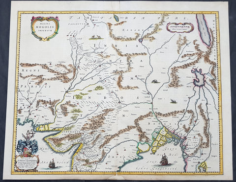
1640 Joan Blaeu Antique Map Mughal Empire of Northern India, Tibet, Nepal, Asia
- Title : Magni Mogolis Imperium
- Size: 22in x 18in (560mm x 465mm)
- Condition: (A) Very Good Condition
- Date : 1640
- Ref #: 42017
Description:
This original hand coloured copper plate engraved antique map of Mughal Empire of Northern India, Tibet, Nepal and central Asia was published by Joan Blaeu in the 1640 edition of Atlas Nouvs
General Definitions:
Paper thickness and quality: - Heavy and stable
Paper color : - off white
Age of map color: - Original
Colors used: - Blue, pink, red, green, yellow
General color appearance: - Authentic
Paper size: - 22in x 18in (560mm x 465mm)
Plate size: - 20 1/2in x 16 1/2in (515mm x 420mm)
Margins: - Min 1/2in (12mm)
Imperfections:
Margins: - Small section of bottom margin restored
Plate area: - Light creasing
Verso: - Centerfold re-enforced
Background:
This map centers on the Mughal capital of Agra, with the map covering, roughly, from Kabul to Orissa and Deccan, and from Persia to Bengal. It depicts the empire prior to the conquest of Orissa and Deccan, most likely during the reign of Shah Jahan, of Taj Mahal fame. Relief is shown pictorially. An elaborate title cartouche appears in the upper left quadrant. The map is embellished with images of tigers, elephants, caravans, and galleons.
There is much of interest. In particular, is the map detailed breakdown of the caravan network between Gujarat and Agra, between Agra and the desert outpost of Jaisalmer, and between Agra and the Silk Road center of Kabul. While the map does not show roads, for surely none as such existed at the time, it does show the network of towns, waystations and caravanserai built to support the bustling trade system.
The apocryphal Lake of Chiamay appears just north of the Bay of Bengal as the source of four important Southeast Asian river systems including the Irrawaddy, the Dharla, the Chao Phraya, and the Brahmaputra. The curious Lake of Chiamay (also called Chiam-may or Chian-may), roughly located in the area of Assam but sometimes as far north as Tibet and China, began to appear in maps of this region as early as the 16th century and persisted well into the mid 18th century. Its origins are unknown but may originate in a lost 16th century geography prepared by the Portuguese scholar Jao de Barros. It was speculated to be the source of five important Southeast Asian River systems and was mentioned in the journals of Sven Hedin. There are even records that the King of Siam led an invasionary force to take control of the lake in the 16th century. Nonetheless, the theory of Lake Chiamay was ultimately disproved and it disappeared from maps entirely by the 1760s.
There are two states of this map, the present example being the first state, first issued in 1638 by Henricus Hondius, and the second state a few years later in 1641 by Jan Jannson. With the exception of the signature imprint, the plates are identical. (Ref: Koeman; M&B)
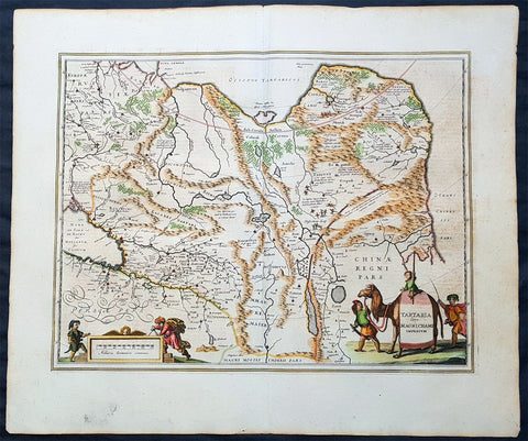
1652 Jan Jansson Antique Map of East & Central Asia, China to Russia - Tartary
Antique Map
- Title : Tartaria sive Magni Chami Imperium
- Date : 1652
- Size: 24in x 20in (610mm x 510mm)
- Ref #: 61166
- Condition: (A+) Fine Condition
Description:
This handsome beautifully hand coloured original antique map of huge region of east & central Asia from China, to Central Asia, The Caspian Sea & parts of European Russia was published by Jan Jansson in the 1652 French edition of Atlas Novus.
Background: This handsome map maps the whole of eastern Central Asia from the Caspian Sea to the Great Wall, Northern China and Manchuria.
This map is dated from a time when Tartaria vaguely meant those regions to the north of Persia, west of China & to the east of Russia. The name Siberia only began to be applied with the gradual eastward expansion of the Russian Cossacks into those areas hinted at in the accounts of Marco Polo from three centuries earlier.
The Mythical and legendary nature of the geography of this vast interior is emphasised by the inclusion of devils and dragons in the Desertum Lop to the left of the Great Wall.
The rest of the map is full of detail both real and myth, some of which is no doubt borrowed from the writings of Marco Polo considered at the time one of the foremost expert on China and Central Asia.
The newly discovered northern coastline of Nova Zembla is shown with a notation concerning the Dutch expedition led by Willem Barents in 1594-96. Interesting in Siberia, Ung quae Gog and Sumongul quae Mogog, which refers to the mythological lands of Gog and Magog. These lands, noted in the Bible as being situated in the remotest parts of the earth, were originally depicted on maps just north of Israel. The map extends west to include the Caspien Sea and Russia, but the primary focus of the map is Tartaria, Central Asia, China and Asiatic Russia. (Ref Tooley M&B)
General Description:
Paper thickness and quality: - Heavy and stable
Paper color: - off white
Age of map color: - Original
Colors used: - Green, red, orange, yellow, blue
General color appearance: - Authentic
Paper size: - 24in x 20in (610mm x 510mm)
Plate size: - 20in x 15 1/4in (510mm x 395mm)
Margins: - Min 1in (25mm)
Imperfections:
Margins: - None
Plate area: - None
Verso: - None
1762 D Anville Very Large Antique Map of Russia, Siberia, Mongolia, China, Japan
- Title : Troisieme Partie De La Carte D' Asia Contenant La Siberie...MDCCLII
- Ref #: 50604
- Size: 55in x 22 1/2in (1.25m x 570mm)
- Date : 1762
- Condition: (A+) Fine Condition
Description:
This very large beautifully engraved hand coloured original antique map of Russia, Siberia and Central Asia was engraved by Jean-Baptiste Bourguinon D'Anville in 1762 - the date is engraved in the title - and was published in the large elephant folio atlas Atlas Generale.
These maps are hard to find in such good condition and make fantastic historical reference tools due to the size and high level of detail as with all D'Anvilles work. (Ref: Tooley, M&B)
General Description:
Paper thickness and quality: - Heavy and stable
Paper color: - White
Age of map color: - Original
Colors used: - Yellow, pink, green
General color appearance: - Authentic
Paper size: - 55in x 22 1/2in (1.25m x 570mm)
Plate size: - 43in x 21in (1.10mm x 535mm)
Margins: - Min 1in (25mm)
Imperfections:
Margins: - None
Plate area: - Light creasing & soiling along L&R folds
Verso: - None
1830 Jean Baptiste Clouet & Pierre Jean Large Antique Map of Asia..Wall Map
Antique Map
- Title : Carte de L Asie, Divisee En Ses Differents Empires et Royaumes Avec...Dressee par J B Nolin...1830
- Ref #: 93437
- Size: 31in x 22in (790mm x 560mm)
- Date : 1780 (1830)
- Condition: (A+) Fine Condition
Description:
This large original hand coloured copper-plate engraved antique map of Asia was engraved and published by Pierre Jean, of the Parisian publishing company Mondhare and Jean in 1830, after the 18th century French cartographer Jean Baptiste Clouet and not Jean Baptiste Nolin jr as noted in the title.
This map is also incredibly rare and I have been unable to find another example sold in the last 25 years.
Since acquiring this large original map, it has been somewhat of an enigma. It is dated 1830 but bears the name of the cartographer J B Nolin, who died in 1790. It was engraved and published by Pierre Jean. But the map bears no cartographical resemblance to any large maps of Asia by Nolin and is also too large to fit into any atlas by Nolin or published by Pierre Jean. This clue finally gave us the answer. The Mondhare and Jean engraving & publishing company were responsible for engraving and printing Jean Baptiste Nolins large world & continental wall maps. And at the same time they were also responsible for the engraving & publishing a series of Wall maps of the world & continents by J B Clouet at the end of the 18th century. These maps are somewhat similar in decoration but are very different in cartographical detail as you can see in the two image comparisons above. This map was published a year after the death of Pierre Jean and we possibly never know it was a mistake or intentional.
General Definitions:
Paper thickness and quality: - Heavy and stable
Paper color : - off white
Age of map color: - Original
Colors used: - Yellow, green, blue, pink
General color appearance: - Authentic
Paper size: - 31in x 22in (790mm x 560mm)
Plate size: - 29 1/2in x 21in (750mm x 535mm)
Margins: - Min 1/2in (12mm)
Imperfections:
Margins: - None
Plate area: - Very small rust hole in Siberia
Verso: - Bottom centerfold rejoined, no loss
Background:
Cartographically the only apparent difference between this map by Jean and the map by Clouet is the updated cartographical data in the inset map of the Bering Straits and the updated information by the surveying by Captain James Cook and others after the 1780s.
Jean Baptiste Clouet 1729 - 1790 Clouet was a French cartographer and geographer born in Rennes, France. He kept premises in both Paris & Cadiz, Spain and was named Royal Geographer of the Academie des Sciences de Rouen in 1785. One of his main works was Géographie Moderne first issued 1767. In 1788 he was responsible for the design of 5 World & Continental wall maps, engraved and printed by the famous Paris publishers Mondhare & Jean.
Jean Baptiste Nolin Jr 1686–1762, son of JB Nolin 1657 - 1708 carried on publishing his fathers stock after his death, contracting the printing to third party publishing companies.
Mondhare & Jean (active 1759 - 1829)
Louis-Joseph Mondhare (1734 - Paris 1799) & Pierre Jean (1754 - 1829) were prominent Parisian publishers, engravers, print and map sellers who were active in Paris in the late 18th and early 19th centuries.
In 1784 Jean married the daughter of Mondhare, who formed a partnership with his son in law, changing forming a very successful partnership thereafter as Mondhare & Jean.
After Mondhare retirement in 1796, Jean carried on with the publishing & printing business, having inherited all of the printing plates that also included many map plates from the likes of Nolin, Clouet, D Anville , Delsile and others. Both Mondhare and Jean were responsible for the engraving and printing of the very decorative large wall maps by J B Nolin & J B L Clouet, as well as single plate maps and atlases. Mondares premises were located at Rue St Jacques, à lHôtel Saumur later moving with Jean to 32 Rue Saint-Jean de Beauvais.
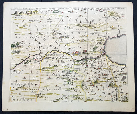
1662 Hornius & Jansson Antique Holy Land Map Tribes Ruben, Gad, Benjamin, Ephraim & Manasseh
Antique Map
- Title : Tribus Ruben, et Gad parties orientales tribumum Beniamin, Ephraim, et Dimidiae, Manasse, intra Jordanem
- Ref #: 61037
- Size: 24in x 20in (610mm x 510mm)
- Date : 1662
- Condition: (A+) Fine Condition
Description:
This large, important & scarce hand coloured original copper-plate engraved antique map, one of six, of the Tribes of Ruben, Gad, Benjamin, Ephraim & Manasseh located to the north and east of the Dead Sea was published by Jan Jansson & Georguis Hornius (1620-1670) in the 1662 French Edition of Atlas Major, based on the 1590 map of Christian van Adricham, Situs Terrae Promissionis.
This map is #1 of 6 published by Jansson that combined measures 66in long by 37in wide (1.68m x 940mm) Please see the B&W image to see combined maps.
Tribus Ruben, et Gad et partes orientales tribuum Beniamin, Ephraim, et dimidiae Manasse intra Iordenem. This is usually thought to the be the first panel in the series. It includes several vignettes, such as Jesus and Satan arguing on a mountaintop, Moses looking across the Jordan, the entry point of the Hebrews into the land of Milk and Honey, and a stairway ascending to heaven. This panel shows the lands controlled by Ruben and Gad, as well as the eastern lands of Benjamin, Ephraim, and part of Manasseh beyond the Jordan River. It also shows the western part of the Dead Sea.
General Definitions:
Paper thickness and quality: - Heavy and stable
Paper color : - off white
Age of map color: - Original
Colors used: - Yellow, green, blue, pink
General color appearance: - Authentic
Paper size: - 24in x 20in (610mm x 510mm)
Plate size: - 22in x 17 1/2in (560mm x 445mm)
Margins: - Min 1in (25mm)
Imperfections:
Margins: - None
Plate area: - None
Verso: - None
Background:
Jan Jansson based his map on Christian van Adrichams Situs Terrae Promissionis of ca. 1590. This version is both expanded and carries additional vignettes and details. Georgius Hornius wrote the text that accompanied the map in volume six of Janssons Novus Atlas, Accuratissimia Orbis Antiqui Delineatio.
The map shows the region divided into domains of the Twelve Tribes of Israel on both sides of the Jordan River, with the shoreline running from Sidon to Alexandria. The Cison Torrens (Kishon River) is shown as connecting the Sea of Galilee with the Mediterranean Sea, and there are many rivers, some of which do not exist; for example, there is a river connecting Jerusalem with the Dead Sea. In the Dead Sea, four burning cities are shown: Sodom, Gomorra, Seboim, and Adama.
The map is intricately engraved to show topographical features, major roads, towns and villages. It is also richly embellished with dozens of biblical illustrations. Inset maps in the top corners depict Abrahams journey (left) and the wandering of the Israelites through the desert (right).
Maps of the Holy Land, a popular genre in the early modern period, allowed users to better understand events from religious traditions. For the mapmaker, the relationship between religion and geography acted as a powerful storytelling tool, allowing viewers to spatialize religious stories. The maps show the centrality of religion to early modern European culture, as well as an enduring interest in historical geography.
According to the Hebrew Bible, the Twelve Tribes of Israel, shown here, descended from the twelve sons of Jacob. According to Deuteronomy, the twelve sons were Reuben, Simeon, Judah, Issachar, Zebulun, Benjamin, Dan, Naphtali, Gad, Asher, Ephraim, and Manasseh..
In the tenth century BCE, the Israelites made up of about 300 highland villages with a population of approximately 40,000 people. These villages would begin to conglomerate in the ninth century BCE. The kingdom formed by their joining was referred to by its neighbors as the House of David. After the kingdoms of Samaria and Judah were destroyed, the resulting Babylonian captivity caused a merging of the south Levantine groups into a unified cultural identity.
This unified kingdom would ultimately not last, however. Tensions between the tribes of Israel mounted over a disagreement as to the location of the mountain on which Moses attempted to sacrifice Isaac. Eventually, the tensions exploded when the Hasmonean King destroyed the temple of another tribe, which caused the lower Levant to devolve into chaos. This civil conflict would last until the Roman Empire invaded, with future emperor Vespasian leading an army into Israel under the pretense of restoring order. This resulted in Roman dominance over the lower Levant until the Muslim conquests of the seventh century CE.
Although published by Jan Jansson, the map was made in collaboration with Georgius Hornius (1620-1670). Indeed, it is often called the Hornius Map. Hornius was a renowned cartographer and historian who published maps as well. His family was forced to flee to Nuremberg during the religious violence of the Thirty Years War. He would eventually attend the University of Altdorf, studying religion and medicine there.
Horniuss first notable work was a history of the English Civil War, which he witnessed firsthand as a traveler. In 1648 he completed his doctorate in Leiden; by this time, his historical works had drawn the attention of many universities which sought him as a professor. He eventually decided to accept a professorship at the University of Harderwijk where he quickly became rector in 1652, a position he would hold until his death in 1670.
Horniuss historical works were influential, propagating the idea of universal history, which was an understanding of history as a whole, concurrent unit. He also prepared the text for portions of Janssons Novus Atlas, Accuratissimia Orbis Antiqui Delineatio, including the text that accompanied this map. Horniuss works would continue to be relevant after his death, with many posthumous editions of his writings published.
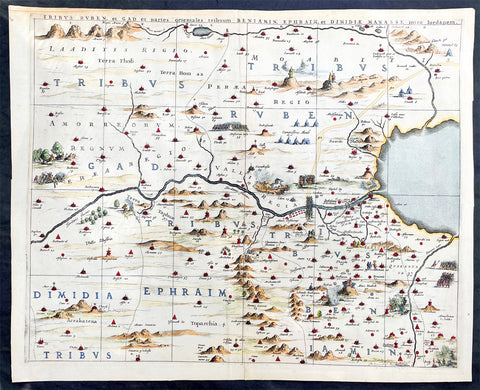
1662 Hornius & Jansson Antique Holy Land Map Tribes Ruben, Gad, Benjamin, Ephraim & Manasseh
Antique Map
- Title : Tribus Ruben, et Gad parties orientales tribumum Beniamin, Ephraim, et Dimidiae, Manasse, intra Jordanem
- Ref #: 17016
- Size: 23in x 18 1/2in (580mm x 470mm)
- Date : 1662
- Condition: (A+) Fine Condition
Description:
This large, important & scarce hand coloured original copper-plate engraved antique map, one of six, of the Tribes of Ruben, Gad, Benjamin, Ephraim & Manasseh located to the north and east of the Dead Sea was published by Jan Jansson & Georguis Hornius (1620-1670) in the 1662 French Edition of Atlas Major, based on the 1590 map of Christian van Adricham, Situs Terrae Promissionis.
This map is #1 of 6 published by Jansson that combined measures 66in long by 37in wide (1.68m x 940mm) Please see the B&W image to see combined maps.
Tribus Ruben, et Gad et partes orientales tribuum Beniamin, Ephraim, et dimidiae Manasse intra Iordenem. This is usually thought to the be the first panel in the series. It includes several vignettes, such as Jesus and Satan arguing on a mountaintop, Moses looking across the Jordan, the entry point of the Hebrews into the land of Milk and Honey, and a stairway ascending to heaven. This panel shows the lands controlled by Ruben and Gad, as well as the eastern lands of Benjamin, Ephraim, and part of Manasseh beyond the Jordan River. It also shows the western part of the Dead Sea.
General Definitions:
Paper thickness and quality: - Heavy and stable
Paper color : - off white
Age of map color: - Original
Colors used: - Yellow, green, blue, pink
General color appearance: - Authentic
Paper size: - 23in x 18 1/2in (580mm x 470mm)
Plate size: - 22in x 17 1/2in (560mm x 445mm)
Margins: - Min 1in (25mm)
Imperfections:
Margins: - Light age toning
Plate area: - None
Verso: - None
Background:
Jan Jansson based his map on Christian van Adrichams Situs Terrae Promissionis of ca. 1590. This version is both expanded and carries additional vignettes and details. Georgius Hornius wrote the text that accompanied the map in volume six of Janssons Novus Atlas, Accuratissimia Orbis Antiqui Delineatio.
The map shows the region divided into domains of the Twelve Tribes of Israel on both sides of the Jordan River, with the shoreline running from Sidon to Alexandria. The Cison Torrens (Kishon River) is shown as connecting the Sea of Galilee with the Mediterranean Sea, and there are many rivers, some of which do not exist; for example, there is a river connecting Jerusalem with the Dead Sea. In the Dead Sea, four burning cities are shown: Sodom, Gomorra, Seboim, and Adama.
The map is intricately engraved to show topographical features, major roads, towns and villages. It is also richly embellished with dozens of biblical illustrations. Inset maps in the top corners depict Abrahams journey (left) and the wandering of the Israelites through the desert (right).
Maps of the Holy Land, a popular genre in the early modern period, allowed users to better understand events from religious traditions. For the mapmaker, the relationship between religion and geography acted as a powerful storytelling tool, allowing viewers to spatialize religious stories. The maps show the centrality of religion to early modern European culture, as well as an enduring interest in historical geography.
According to the Hebrew Bible, the Twelve Tribes of Israel, shown here, descended from the twelve sons of Jacob. According to Deuteronomy, the twelve sons were Reuben, Simeon, Judah, Issachar, Zebulun, Benjamin, Dan, Naphtali, Gad, Asher, Ephraim, and Manasseh..
In the tenth century BCE, the Israelites made up of about 300 highland villages with a population of approximately 40,000 people. These villages would begin to conglomerate in the ninth century BCE. The kingdom formed by their joining was referred to by its neighbors as the House of David. After the kingdoms of Samaria and Judah were destroyed, the resulting Babylonian captivity caused a merging of the south Levantine groups into a unified cultural identity.
This unified kingdom would ultimately not last, however. Tensions between the tribes of Israel mounted over a disagreement as to the location of the mountain on which Moses attempted to sacrifice Isaac. Eventually, the tensions exploded when the Hasmonean King destroyed the temple of another tribe, which caused the lower Levant to devolve into chaos. This civil conflict would last until the Roman Empire invaded, with future emperor Vespasian leading an army into Israel under the pretense of restoring order. This resulted in Roman dominance over the lower Levant until the Muslim conquests of the seventh century CE.
Although published by Jan Jansson, the map was made in collaboration with Georgius Hornius (1620-1670). Indeed, it is often called the Hornius Map. Hornius was a renowned cartographer and historian who published maps as well. His family was forced to flee to Nuremberg during the religious violence of the Thirty Years War. He would eventually attend the University of Altdorf, studying religion and medicine there.
Horniuss first notable work was a history of the English Civil War, which he witnessed firsthand as a traveler. In 1648 he completed his doctorate in Leiden; by this time, his historical works had drawn the attention of many universities which sought him as a professor. He eventually decided to accept a professorship at the University of Harderwijk where he quickly became rector in 1652, a position he would hold until his death in 1670.
Horniuss historical works were influential, propagating the idea of universal history, which was an understanding of history as a whole, concurrent unit. He also prepared the text for portions of Janssons Novus Atlas, Accuratissimia Orbis Antiqui Delineatio, including the text that accompanied this map. Horniuss works would continue to be relevant after his death, with many posthumous editions of his writings published.
1696 Coronelli Antique Map, Globe Gore, of India, Pakistan, Iran, Persian Gulf
Antique Map
- Title : Isolario del P. Coronelli
- Date : 1696
- Condition: (A+) Fine Condition
- Ref: 42007
- Size: 19 1/2in x 14in (495mm x 355mm)
Description:
This is a rare opportunity to acquire an original antique Globe Gore of India and parts of the Middle East& Persia by Vincenzo Coronelli published in his 1696 edition ofIsolario dell' Atlante Veneto.
The copper-plates for these gores were originally engraved by Coronelli for the construction of the large 42in (110cm) terrestrial globe.
Coronelli published 2 different globe gore atlases, the 1693 edition of Libero dei Globiand the 1696 edition of Isolario dell' Atlante Veneto. The difference being the inclusion of Latin text to the latter publication.
Background:
In the early 1680’s Vincenzo Coronelli constructed two vast 15ft diameter terrestrial & celestial globes for Louis XIV of France. These were meticulously hand drawn & engraved. Such was the admiration of these Globes that in 1688 Coronelli began the engraving & publication of Globe Gores for the construction of two 110cm (42in) terrestrial & celestial globes.
Coronellis claim to have produced the best globes of any age was exemplified by the high demand and purchase of the globes by various institutions & cities within Europe. Yet many scholars still did not have the opportunity to visit Paris, London, Rome or Venice to view them and so Coronelli devised his famous atlas Libero dei Globi the first atlas of globe gores ever produced. The Libroformed part of a great series of atlases by Coronelli, the Atlante Veneto, in which Coronelli was able to combine the two cartographic art forms in which he excelled, maps & globes.
The engraving of the gores was of the highest standard with neat contrasting lettering and five large cartouches of a singular grace and elegance. One cartouche situated below Australia carries a portrait of the author and Pope Alexander VI.
Some of the more interesting features contained within the Gores are the recording of recent French explorations in North America, such as La Salles journey to the mouth of the Mississippi in 1681-87 & the French possessions within North America. Elsewhere the Caspian Sea is drawn closer to its modern shape, the Nile in Africa is shown without its fictitious source and the Blue Nile is shown correctly from a large lake in Ethiopia. The tracks of Le Maire crossing of the Pacific in 1616 are marked, as is the voyage of Chaumont to Siam in 1685-6. There are an unusual number of legends, all explanatory and informative along with many vignettes of ships and fishing scenes throughout the globe.
Coronelli was one of the finest engravers & cartographers of any era, producing some of the most stunning work ever seen. These Globe Gores are no exception. Coronelli was a master craftsman with an eye for detail. You can feel the uncompromising accuracy & passion in his work when you study his maps & globes.
These globe gores are scarce, with only a few sales records from the last 25 years. Similarly there is very little choice currently on the market. This scarcity ensures ongoing value and future appreciation. (Ref: Shirley 538; Tooley; Dr. Helen Wallis The Map Collector Dec 1980;Armao, Ermanno. Vincenzo Coronelli Cenni sull'uomo e la sua Vita Catalogo... Bibliopolis, Florence pp.130-134)
General Description:
Paper thickness and quality: - Heavy and stable
Paper color: - white
Age of map color: - Early
Colors used: - Green, yellow, pink, red
General color appearance: - Fresh
Paper size: - 19 1/2in x 14in (495mm x 355mm)
Plate size: - 11 1/2in x 11in (295mm x 280mm)
Margins: - min. 1/2in (12mm)
Imperfections:
Margins: - None
Plate area: - None
Verso: - None

1662 Hornius & Jansson Antique Holy Land Map Tribes Ruben, Gad, Benjamin, Ephraim & Manasseh
Antique Map
- Title : Tribus Ruben, et Gad parties orientales tribumum Beniamin, Ephraim, et Dimidiae, Manasse, intra Jordanem
- Ref #: 61037
- Size: 24in x 20in (610mm x 510mm)
- Date : 1662
- Condition: (A+) Fine Condition
Description:
This large, important & scarce hand coloured original copper-plate engraved antique map, one of six, of the Tribes of Ruben, Gad, Benjamin, Ephraim & Manasseh located to the north and east of the Dead Sea was published by Jan Jansson & Georguis Hornius (1620-1670) in the 1662 French Edition of Atlas Major, based on the 1590 map of Christian van Adricham, Situs Terrae Promissionis.
This map is #1 of 6 published by Jansson that combined measures 66in long by 37in wide (1.68m x 940mm) Please see the B&W image to see combined maps.
Tribus Ruben, et Gad et partes orientales tribuum Beniamin, Ephraim, et dimidiae Manasse intra Iordenem. This is usually thought to the be the first panel in the series. It includes several vignettes, such as Jesus and Satan arguing on a mountaintop, Moses looking across the Jordan, the entry point of the Hebrews into the land of Milk and Honey, and a stairway ascending to heaven. This panel shows the lands controlled by Ruben and Gad, as well as the eastern lands of Benjamin, Ephraim, and part of Manasseh beyond the Jordan River. It also shows the western part of the Dead Sea.
General Definitions:
Paper thickness and quality: - Heavy and stable
Paper color : - off white
Age of map color: - Original
Colors used: - Yellow, green, blue, pink
General color appearance: - Authentic
Paper size: - 24in x 20in (610mm x 510mm)
Plate size: - 22in x 17 1/2in (560mm x 445mm)
Margins: - Min 1in (25mm)
Imperfections:
Margins: - None
Plate area: - None
Verso: - None
Background:
Jan Jansson based his map on Christian van Adrichams Situs Terrae Promissionis of ca. 1590. This version is both expanded and carries additional vignettes and details. Georgius Hornius wrote the text that accompanied the map in volume six of Janssons Novus Atlas, Accuratissimia Orbis Antiqui Delineatio.
The map shows the region divided into domains of the Twelve Tribes of Israel on both sides of the Jordan River, with the shoreline running from Sidon to Alexandria. The Cison Torrens (Kishon River) is shown as connecting the Sea of Galilee with the Mediterranean Sea, and there are many rivers, some of which do not exist; for example, there is a river connecting Jerusalem with the Dead Sea. In the Dead Sea, four burning cities are shown: Sodom, Gomorra, Seboim, and Adama.
The map is intricately engraved to show topographical features, major roads, towns and villages. It is also richly embellished with dozens of biblical illustrations. Inset maps in the top corners depict Abrahams journey (left) and the wandering of the Israelites through the desert (right).
Maps of the Holy Land, a popular genre in the early modern period, allowed users to better understand events from religious traditions. For the mapmaker, the relationship between religion and geography acted as a powerful storytelling tool, allowing viewers to spatialize religious stories. The maps show the centrality of religion to early modern European culture, as well as an enduring interest in historical geography.
According to the Hebrew Bible, the Twelve Tribes of Israel, shown here, descended from the twelve sons of Jacob. According to Deuteronomy, the twelve sons were Reuben, Simeon, Judah, Issachar, Zebulun, Benjamin, Dan, Naphtali, Gad, Asher, Ephraim, and Manasseh..
In the tenth century BCE, the Israelites made up of about 300 highland villages with a population of approximately 40,000 people. These villages would begin to conglomerate in the ninth century BCE. The kingdom formed by their joining was referred to by its neighbors as the House of David. After the kingdoms of Samaria and Judah were destroyed, the resulting Babylonian captivity caused a merging of the south Levantine groups into a unified cultural identity.
This unified kingdom would ultimately not last, however. Tensions between the tribes of Israel mounted over a disagreement as to the location of the mountain on which Moses attempted to sacrifice Isaac. Eventually, the tensions exploded when the Hasmonean King destroyed the temple of another tribe, which caused the lower Levant to devolve into chaos. This civil conflict would last until the Roman Empire invaded, with future emperor Vespasian leading an army into Israel under the pretense of restoring order. This resulted in Roman dominance over the lower Levant until the Muslim conquests of the seventh century CE.
Although published by Jan Jansson, the map was made in collaboration with Georgius Hornius (1620-1670). Indeed, it is often called the Hornius Map. Hornius was a renowned cartographer and historian who published maps as well. His family was forced to flee to Nuremberg during the religious violence of the Thirty Years War. He would eventually attend the University of Altdorf, studying religion and medicine there.
Horniuss first notable work was a history of the English Civil War, which he witnessed firsthand as a traveler. In 1648 he completed his doctorate in Leiden; by this time, his historical works had drawn the attention of many universities which sought him as a professor. He eventually decided to accept a professorship at the University of Harderwijk where he quickly became rector in 1652, a position he would hold until his death in 1670.
Horniuss historical works were influential, propagating the idea of universal history, which was an understanding of history as a whole, concurrent unit. He also prepared the text for portions of Janssons Novus Atlas, Accuratissimia Orbis Antiqui Delineatio, including the text that accompanied this map. Horniuss works would continue to be relevant after his death, with many posthumous editions of his writings published.
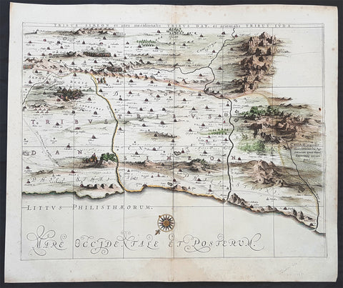
1662 Hornius & Jansson Antique Holy Land Map of the Tribes of Simeon, Dan & Juda
Antique Map
- Title : Tribus Simeon et pars meridionalis Tribus Dan, et Oriemtalis Tribus Juda
- Ref #: 50600
- Size: 23 1/2in x 17in (595mm x 435mm)
- Date : 1662
- Condition: (A+) Fine Condition
Description:
This large, important & scarce hand coloured original copper-plate engraved antique map one of six, of the Tribes of Simeon, Dan, & Juda, located to the South West of the Dead Sea was published by Jan Jansson & Georguis Hornius (1620-1670) in the 1662 French Edition of Atlas Major and was based on the 1590 map of Christian van Adricham, Situs Terrae Promissionis.
This map is #6 of 6 published by Jansson that combined measures 66in long by 37in wide (1.68m x 940mm) Please see the B&W image to see combined maps.
The six panels are individually titled:
Tribus Ruben, et Gad et partes orientales tribuum Beniamin, Ephraim, et dimidiae Manasse intra Iordenem. This is usually thought to the be the first panel in the series. It includes several vignettes, such as Jesus and Satan arguing on a mountaintop, Moses looking across the Jordan, the entry point of the Hebrews into the land of Milk and Honey, and a stairway ascending to heaven. This panel shows the lands controlled by Ruben and Gad, as well as the eastern lands of Benjamin, Ephraim, and part of Manasseh beyond the Jordan River. It also shows the western part of the Dead Sea.
Tribuum Ephraim, Beniamin, et Dimidiae Manasse intra Iordanem partes occidentales, et partes septentrionales Dan et Iuda. This second panel shows the lands of Ephraim, Benjamin, and part of Manasseh beyond the Jordan river. More Biblical scenes include a scene where Jonas is cast from a sailing ship into the open jaws of a whale. Also, the panel shows the lands of Palestine and numerous armies.
Tribus Aser, et partes occidentales tribuum Zabulon et Isachar. One of two enlarged panels in this series, this map shows the lands of Asher and the western reaches of Zebulon and Issachar. More Biblical illustrations include St. George and the Dragon, the city of Tyre, Nazareth, and the Tabernacle of Abraham.
Dimidia Tribus Manasse Ultra Iordanem, Tribus Neptalim et partes orientales tribuum Zabulon et Isachar. The second enlarged panel details the parts of Manasseh lying on the western shores of the Jordan River, the tribe of Naphtali, and parts of the lands of Zebulon and Issachar. This sheet includes the Sea of Galilee (Lake Tiberius), as well as several scenes from the life of Jesus, such as his walking on water, Jesus preaching from onboard a boat, and other. The large inset map in the upper left quadrant, entitled Peregrinatio Abrahae, shows the route followed by Abraham from Ur into Canaan.
Pars maxima Tribus Iusa Versus Orientem. This southeastern-most sheet depicts much of the Dead Sea, as well as the lands claimed by the tribe of Judah. It also features the smoking ruins of Sodom, Gomorrah, Adaima, and Seboim. In the upper right, there is a large inset, Itinera et Mansiones Deserti, which shows the route taken by the Hebrews as they fled from Egypt. Finally, it also shows the parting of the Red Sea.
Tribus Simeon et pars meridionalis Tribus Dan, et orientalis Tribus Idua. Usually considered the last in the series, this panel is mountainous, depicting the lands of Simeon, as well as parts of Dan and Judah. It also identifies the lands of the Philistines and timber lands rich in cedar.
General Definitions:
Paper thickness and quality: - Heavy and stable
Paper color : - off white
Age of map color: - Early
Colors used: - Yellow, pink
General color appearance: - Authentic
Paper size: - 23 1/2in x 17in (595mm x 435mm)
Plate size: - 16in x 12in (405mm x 315mm)
Margins: - Min 1in (25mm)
Imperfections:
Margins: - Light spotting in margins
Plate area: - None
Verso: - None
Background:
Jan Jansson based his map on Christian van Adrichams Situs Terrae Promissionis of ca. 1590. This version is both expanded and carries additional vignettes and details. Georgius Hornius wrote the text that accompanied the map in volume six of Janssons Novus Atlas, Accuratissimia Orbis Antiqui Delineatio.
The map shows the region divided into domains of the Twelve Tribes of Israel on both sides of the Jordan River, with the shoreline running from Sidon to Alexandria. The Cison Torrens (Kishon River) is shown as connecting the Sea of Galilee with the Mediterranean Sea, and there are many rivers, some of which do not exist; for example, there is a river connecting Jerusalem with the Dead Sea. In the Dead Sea, four burning cities are shown: Sodom, Gomorra, Seboim, and Adama.
The map is intricately engraved to show topographical features, major roads, towns and villages. It is also richly embellished with dozens of biblical illustrations. Inset maps in the top corners depict Abrahams journey (left) and the wandering of the Israelites through the desert (right).
Maps of the Holy Land, a popular genre in the early modern period, allowed users to better understand events from religious traditions. For the mapmaker, the relationship between religion and geography acted as a powerful storytelling tool, allowing viewers to spatialize religious stories. The maps show the centrality of religion to early modern European culture, as well as an enduring interest in historical geography.
According to the Hebrew Bible, the Twelve Tribes of Israel, shown here, descended from the twelve sons of Jacob. According to Deuteronomy, the twelve sons were Reuben, Simeon, Judah, Issachar, Zebulun, Benjamin, Dan, Naphtali, Gad, Asher, Ephraim, and Manasseh..
In the tenth century BCE, the Israelites made up of about 300 highland villages with a population of approximately 40,000 people. These villages would begin to conglomerate in the ninth century BCE. The kingdom formed by their joining was referred to by its neighbors as the House of David. After the kingdoms of Samaria and Judah were destroyed, the resulting Babylonian captivity caused a merging of the south Levantine groups into a unified cultural identity.
This unified kingdom would ultimately not last, however. Tensions between the tribes of Israel mounted over a disagreement as to the location of the mountain on which Moses attempted to sacrifice Isaac. Eventually, the tensions exploded when the Hasmonean King destroyed the temple of another tribe, which caused the lower Levant to devolve into chaos. This civil conflict would last until the Roman Empire invaded, with future emperor Vespasian leading an army into Israel under the pretense of restoring order. This resulted in Roman dominance over the lower Levant until the Muslim conquests of the seventh century CE.
Although published by Jan Jansson, the map was made in collaboration with Georgius Hornius (1620-1670). Indeed, it is often called the Hornius Map. Hornius was a renowned cartographer and historian who published maps as well. His family was forced to flee to Nuremberg during the religious violence of the Thirty Years War. He would eventually attend the University of Altdorf, studying religion and medicine there.
Horniuss first notable work was a history of the English Civil War, which he witnessed firsthand as a traveler. In 1648 he completed his doctorate in Leiden; by this time, his historical works had drawn the attention of many universities which sought him as a professor. He eventually decided to accept a professorship at the University of Harderwijk where he quickly became rector in 1652, a position he would hold until his death in 1670.
Horniuss historical works were influential, propagating the idea of universal history, which was an understanding of history as a whole, concurrent unit. He also prepared the text for portions of Janssons Novus Atlas, Accuratissimia Orbis Antiqui Delineatio, including the text that accompanied this map. Horniuss works would continue to be relevant after his death, with many posthumous editions of his writings published.
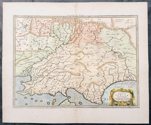
1695 Gerard Mercator Antique Ptolemy Map of India & Subcontinent
Antique Map
- Title : Asiae X Tab:
- Size: 21in x 17 1/2in (535mm x 445mm)
- Condition: (A+) Fine Condition
- Date : 1695
- Ref #: 51008
Description:
This original copper plate engraved hand coloured antique Ptolemy map of India & Subcontinent, after Claude Ptolemy's Geographia was published in the Helma Strick edition of Geographia in 1695.
These maps, after the 1st century text by Claude Ptolemy, were first published by Gerard Mercator in 1578 edition of Geographia by Gottfried von Kempen
General Definitions:
Paper thickness and quality: - Heavy and stable
Paper color : - off white
Age of map color: - Early
Colors used: - Yellow, green, blue, pink
General color appearance: - Authentic
Paper size: - 21 1/2in x 17 1/2in (545mm x 445mm)
Plate size: - 15 1/2in x 13 3/4in (395mm x 350mm)
Margins: - Min 1in (25mm)
Imperfections:
Margins: - Light age toning
Plate area: - None
Verso: - None
Background:
The Ptolemy maps were taken from the text of Claude Ptolemy (AD 87 - 150) a Greek mathematician, astronomer and geographer, living in Alexandria, assembled and codified his predecessors cartographic theories including those of Marinus of Tyre (c. AD 120). In about AD 150 he published his Geographia, a work in 8 volumes, supposedly illustrated with a world map, 26 regional maps and a profusion of smaller maps. Although the text of the Geographia survived, no maps older than about the twelfth century have come down to us and, in consequence, we have no means of knowing whether the 'Ptolemy' maps on which we set so much store were, in fact, drawn by him or were the interpretations of later map makers using his text as a basis. (Ref: Koeman; Norwich)
Background of Ptolemy's Geographia: The first published edition of Ptolemy's ‘Geographia’ with maps, engraved by Taddeo Crivelli, was issued in Bologna in 1477. Unusually, this edition contained 26 maps, with one of the Asia maps divided up among three neighbouring sheets. With the exception of Palestine, these are the first regional maps of any of these various countries.
Unfortunately for the undertakers, this atlas seems not to have been a commercial success, and today only twenty-six examples of the atlas are recorded, with all but one in institutional libraries.
One explanation of the failure is that the publishers do not seem to have been fully mastered the intricacies and problems of engraving, and printing from, copper-plates, an art, which, after all, was very new and experimental. These problems were more successfully addressed by a German printer, Conrad Sweynheym, who was working on an edition of Ptolemy in Rome in the same period. Unfortunately, he did not live to see the volume appear, but his successor, Arnold Buckinck, saw the atlas through the press, in 1478.
The Rome Ptolemy contained 27 maps, with the same geographical coverage as the 1477 Ptolemy. Of the engraved editions of Ptolemy’s ‘Cosmographia’ the maps in the Rome edition are the finest fifteenth century examples, and second only to Mercator’s maps, from his 1578 edition. One explanation for this was the use of individual punches to stamp letters onto the printing plates, rather than engraving them. This allowed much greater uniformity than lettering-engravers were able to achieve, and gives a very pleasing overall effect. The atlas proved popular, and three successive editions (to 1508) followed, although only about forty examples of the first edition are recorded today.
Claudius Ptolemy(90 A.D.-168 A.D.) was a celebrated astronomer, mathematician, and geographer who lived in Alexandria in the 2nd century AD. Although his thinking influenced contemporary Arab geographers, little was known of his work in the West until manuscripts from Constantinople reached Italy in about 1400. These manuscripts were written in Greek and contained the names of every city, island, mountain and river known to the many travellers interviewed by Ptolemy. In addition, the latitude and longitude of each of the resulting eight thousand locations were also recorded. They were translated into Latin by 1401 and appeared in print by 1475. The earliest Byzantine manuscript maps, drawn by analysing the Ptolemy figures, date from the twelfth century. A number of hand-drawn copies were made in Italy throughout the early fifteenth century to accompany Ptolemy's text.
Ptolemy stressed the importance of accurate observations in order to calculate latitude and longitude, and laid down the principals of systematic cartography that remain to this day. Obviously there are many errors in Ptolemy's maps, due to the limited extent of basic geographic information at that time and the lack of a method of determining accurate longitudes. Judged by modern standards, the basic shortcoming of the Ptolemy world map is the small area it portrays. The Mediterranean is fairly well depicted, but is greatly exaggerated in length (Longitudinally). The effect of this, combined with Ptolemy's disregard for Eratosthenes' extremely accurate estimate of the earth's circumference (c. 200 B.C.) and the use of a Posidonius' much smaller flawed estimate (c.50 B.C.) implied a much shorter distance across that part of the unknown earth's surface not drawn on the map. Columbus and his contemporaries based their exploratory ventures on Ptolemy's calculations and, like him, had no idea of the vast New World to the west, interposed between Europe and Asia.
Work on the first “printed” atlas from the text of Ptolemy was started in 1473 and finally published in 1478. A crude copy of this atlas was produced and published by some dissident workers in 1477 in order to be ‘first’. However, the plates for the 1478 were done prior to the pirated issue and thus the 1478 atlas holds the title of the first Atlas of the world. There are very few surviving examples of this atlas and individual maps. (Ref: Stevenson; Tooley; M&B)
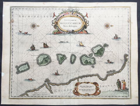
1633 Jan Jansson Old, Antique Map of The Maluku or Spice Islands, Indonesia
Antique Map
- Title : Insularum Moluccarum Nova descriptio
- Ref #: 42018
- Size: 22in x 16 1/2in (560mm x 420mm)
- Date : 1633
- Condition: (B+) Good Condition
Description:
This beautifully hand coloured original antique map* of the Maluku or Spice Islands of Indonesia was published by Jan Jansson in the 1633 edition of Atlas Novus.
Background: The Maluku Islands (also known as the Moluccas, Moluccan Islands, the Spice Islands) are an archipelago in Indonesia, and part of the larger Maritime Southeast Asia region. Geographically they are located east of Sulawesi (Celebes), west of New Guinea, and north of Timor. The islands were also historically known as the Spice Islands by the Chinese and Europeans, but this term has also been applied to other islands. (Ref: Suraz; Koeman; M&B; Tooley)
Condition Report:
Paper thickness and quality: - Heavy and stable
Paper color: - off white
Age of map color: - Later
Colors used: - Yellow, pink, green
General color appearance: - Authentic
Paper size: - 22in x 16 1/2in (560mm x 420mm)
Plate size: - 20in x 15 1/4in (510mm x 390mm)
Margins: - Min 1/2in (12mm)
Imperfections:
Margins: - Repair to top and bottom margin, slight separation into border
Plate area: - Repairs adjacent to bottom centrefold, slight separation
Verso: - Map professionally backed onto archival paper
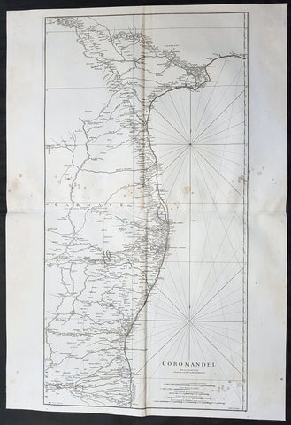
1753 D Anville Large Original Antique Map of SE Coromandel Coast of India - Rare
- Title : Coromandel par Le Sr D Anville...1753
- Size: 39 1/2in x 27in (1.1m x 685mm)
- Ref #: 92321
- Date : 1753
- Condition: (A) Very Good Condition
Description:
This large finely engraved scarce and highly detailed original antique map of South East Coast of India, the Coromandel Coast was engraved by Guillaume de la Haye in 1753 - dated in the tile cartouche - and was published in Jean-Baptiste Bourguinon D\'Anville\'s large elephant folio atlas Atlas Generale.
General Definitions:
Paper thickness and quality: - Heavy and stable
Paper color : - off white
Age of map color: -
Colors used: -
General color appearance: -
Paper size: - 39 1/2in x 27in (1.1m x 685mm)
Plate size: - 38in x 19 1/2in (970mm x 495mm)
Margins: - Min 1/2in (12mm)
Imperfections:
Margins: - Light spotting to right of image
Plate area: - Light spotting to right of image
Verso: - Light spotting to right of image
Background:
The Coromandel Coast is the southeastern coast region of the Indian Subcontinent, between the Eastern Ghats and the Bay of Bengal of the Indian Ocean. The coastline runs between False Divi Point in the north to Kanyakumari in the south. Its definition can also include the northwestern coast of the island of Sri Lanka.
By late 1530 the Coromandel Coast was home to three Portuguese settlements at Nagapattinam, São Tomé de Meliapore, and Pulicat. Later, in the 17th and 18th centuries, the Coromandel Coast was the scene of rivalries among European powers for control of the India trade. The British established themselves at Fort St George (Madras) and Masulipatnam, the Dutch at Pulicat, Sadras and Covelong, the French at Pondicherry, Karaikal and Nizampatnam, the Danish in Dansborg at Tharangambadi.
The Coromandel Coast supplied Indian Muslim eunuchs to the Thai palace and court of Siam (modern Thailand). The Thai at times asked eunuchs from China to visit the court in Thailand and advise them on court ritual since they held them in high regard.
Eventually the British won out, although France retained the tiny enclaves of Pondichéry and Karaikal until 1954. Chinese lacquer goods, including boxes, screens, and chests, became known as \"Coromandel\" goods in the eighteenth century, because many Chinese exports were consolidated at the Coromandel ports.
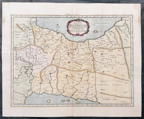
1695 Gerard Mercator Antique Ptolemy Map of Iran & Iraq between Caspian & Persian Gulf
Antique Map
- Title : Asiae V tab:
- Size: 21in x 17 1/2in (535mm x 445mm)
- Condition: (A+) Fine Condition
- Date : 1695
- Ref #: 51007
Description:
This original copper plate engraved hand coloured antique Ptolemy map of Iran & Iraq between Caspian & the Persian Gulf, after Claude Ptolemy's Geographia was published in the Helma Strick edition of Geographia in 1695.
These maps, after the 1st century text by Claude Ptolemy, were first published by Gerard Mercator in 1578 edition of Geographia by Gottfried von Kempen
General Definitions:
Paper thickness and quality: - Heavy and stable
Paper color : - off white
Age of map color: - Early
Colors used: - Yellow, green, blue, pink
General color appearance: - Authentic
Paper size: - 21 1/2in x 17 1/2in (545mm x 445mm)
Plate size: - 15 1/2in x 13 3/4in (395mm x 350mm)
Margins: - Min 1in (25mm)
Imperfections:
Margins: - Light age toning
Plate area: - None
Verso: - None
Background:
The Ptolemy maps were taken from the text of Claude Ptolemy (AD 87 - 150) a Greek mathematician, astronomer and geographer, living in Alexandria, assembled and codified his predecessors cartographic theories including those of Marinus of Tyre (c. AD 120). In about AD 150 he published his Geographia, a work in 8 volumes, supposedly illustrated with a world map, 26 regional maps and a profusion of smaller maps. Although the text of the Geographia survived, no maps older than about the twelfth century have come down to us and, in consequence, we have no means of knowing whether the 'Ptolemy' maps on which we set so much store were, in fact, drawn by him or were the interpretations of later map makers using his text as a basis. (Ref: Koeman; Norwich)
Background of Ptolemy's Geographia: The first published edition of Ptolemy's ‘Geographia’ with maps, engraved by Taddeo Crivelli, was issued in Bologna in 1477. Unusually, this edition contained 26 maps, with one of the Asia maps divided up among three neighbouring sheets. With the exception of Palestine, these are the first regional maps of any of these various countries.
Unfortunately for the undertakers, this atlas seems not to have been a commercial success, and today only twenty-six examples of the atlas are recorded, with all but one in institutional libraries.
One explanation of the failure is that the publishers do not seem to have been fully mastered the intricacies and problems of engraving, and printing from, copper-plates, an art, which, after all, was very new and experimental. These problems were more successfully addressed by a German printer, Conrad Sweynheym, who was working on an edition of Ptolemy in Rome in the same period. Unfortunately, he did not live to see the volume appear, but his successor, Arnold Buckinck, saw the atlas through the press, in 1478.
The Rome Ptolemy contained 27 maps, with the same geographical coverage as the 1477 Ptolemy. Of the engraved editions of Ptolemy’s ‘Cosmographia’ the maps in the Rome edition are the finest fifteenth century examples, and second only to Mercator’s maps, from his 1578 edition. One explanation for this was the use of individual punches to stamp letters onto the printing plates, rather than engraving them. This allowed much greater uniformity than lettering-engravers were able to achieve, and gives a very pleasing overall effect. The atlas proved popular, and three successive editions (to 1508) followed, although only about forty examples of the first edition are recorded today.
Claudius Ptolemy(90 A.D.-168 A.D.) was a celebrated astronomer, mathematician, and geographer who lived in Alexandria in the 2nd century AD. Although his thinking influenced contemporary Arab geographers, little was known of his work in the West until manuscripts from Constantinople reached Italy in about 1400. These manuscripts were written in Greek and contained the names of every city, island, mountain and river known to the many travellers interviewed by Ptolemy. In addition, the latitude and longitude of each of the resulting eight thousand locations were also recorded. They were translated into Latin by 1401 and appeared in print by 1475. The earliest Byzantine manuscript maps, drawn by analysing the Ptolemy figures, date from the twelfth century. A number of hand-drawn copies were made in Italy throughout the early fifteenth century to accompany Ptolemy's text.
Ptolemy stressed the importance of accurate observations in order to calculate latitude and longitude, and laid down the principals of systematic cartography that remain to this day. Obviously there are many errors in Ptolemy's maps, due to the limited extent of basic geographic information at that time and the lack of a method of determining accurate longitudes. Judged by modern standards, the basic shortcoming of the Ptolemy world map is the small area it portrays. The Mediterranean is fairly well depicted, but is greatly exaggerated in length (Longitudinally). The effect of this, combined with Ptolemy's disregard for Eratosthenes' extremely accurate estimate of the earth's circumference (c. 200 B.C.) and the use of a Posidonius' much smaller flawed estimate (c.50 B.C.) implied a much shorter distance across that part of the unknown earth's surface not drawn on the map. Columbus and his contemporaries based their exploratory ventures on Ptolemy's calculations and, like him, had no idea of the vast New World to the west, interposed between Europe and Asia.
Work on the first “printed” atlas from the text of Ptolemy was started in 1473 and finally published in 1478. A crude copy of this atlas was produced and published by some dissident workers in 1477 in order to be ‘first’. However, the plates for the 1478 were done prior to the pirated issue and thus the 1478 atlas holds the title of the first Atlas of the world. There are very few surviving examples of this atlas and individual maps. (Ref: Stevenson; Tooley; M&B)
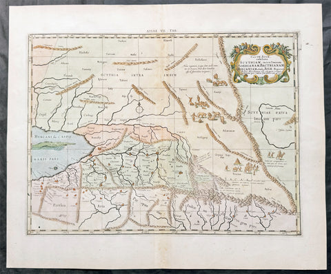
1695 Gerard Mercator Antique Ptolemy Map of Caspian Sea Kazakhstan to Iran
Antique Map
- Title : Asiae VII tab:
- Size: 21in x 17 1/2in (535mm x 445mm)
- Condition: (A+) Fine Condition
- Date : 1695
- Ref #: 51009
Description:
This original copper plate engraved hand coloured antique Ptolemy map of the eastern Caspian Sea from Kazakhstan to Iran, after Claude Ptolemy's Geographia was published in the Helma Strick edition of Geographia in 1695.
These maps, after the 1st century text by Claude Ptolemy, were first published by Gerard Mercator in 1578 edition of Geographia by Gottfried von Kempen
General Definitions:
Paper thickness and quality: - Heavy and stable
Paper color : - off white
Age of map color: - Early
Colors used: - Yellow, green, blue, pink
General color appearance: - Authentic
Paper size: - 21 1/2in x 17 1/2in (545mm x 445mm)
Plate size: - 15 1/2in x 13 3/4in (395mm x 350mm)
Margins: - Min 1in (25mm)
Imperfections:
Margins: - Light age toning
Plate area: - None
Verso: - None
Background:
The Ptolemy maps were taken from the text of Claude Ptolemy (AD 87 - 150) a Greek mathematician, astronomer and geographer, living in Alexandria, assembled and codified his predecessors cartographic theories including those of Marinus of Tyre (c. AD 120). In about AD 150 he published his Geographia, a work in 8 volumes, supposedly illustrated with a world map, 26 regional maps and a profusion of smaller maps. Although the text of the Geographia survived, no maps older than about the twelfth century have come down to us and, in consequence, we have no means of knowing whether the 'Ptolemy' maps on which we set so much store were, in fact, drawn by him or were the interpretations of later map makers using his text as a basis. (Ref: Koeman; Norwich)
Background of Ptolemy's Geographia: The first published edition of Ptolemy's ‘Geographia’ with maps, engraved by Taddeo Crivelli, was issued in Bologna in 1477. Unusually, this edition contained 26 maps, with one of the Asia maps divided up among three neighbouring sheets. With the exception of Palestine, these are the first regional maps of any of these various countries.
Unfortunately for the undertakers, this atlas seems not to have been a commercial success, and today only twenty-six examples of the atlas are recorded, with all but one in institutional libraries.
One explanation of the failure is that the publishers do not seem to have been fully mastered the intricacies and problems of engraving, and printing from, copper-plates, an art, which, after all, was very new and experimental. These problems were more successfully addressed by a German printer, Conrad Sweynheym, who was working on an edition of Ptolemy in Rome in the same period. Unfortunately, he did not live to see the volume appear, but his successor, Arnold Buckinck, saw the atlas through the press, in 1478.
The Rome Ptolemy contained 27 maps, with the same geographical coverage as the 1477 Ptolemy. Of the engraved editions of Ptolemy’s ‘Cosmographia’ the maps in the Rome edition are the finest fifteenth century examples, and second only to Mercator’s maps, from his 1578 edition. One explanation for this was the use of individual punches to stamp letters onto the printing plates, rather than engraving them. This allowed much greater uniformity than lettering-engravers were able to achieve, and gives a very pleasing overall effect. The atlas proved popular, and three successive editions (to 1508) followed, although only about forty examples of the first edition are recorded today.
Claudius Ptolemy(90 A.D.-168 A.D.) was a celebrated astronomer, mathematician, and geographer who lived in Alexandria in the 2nd century AD. Although his thinking influenced contemporary Arab geographers, little was known of his work in the West until manuscripts from Constantinople reached Italy in about 1400. These manuscripts were written in Greek and contained the names of every city, island, mountain and river known to the many travellers interviewed by Ptolemy. In addition, the latitude and longitude of each of the resulting eight thousand locations were also recorded. They were translated into Latin by 1401 and appeared in print by 1475. The earliest Byzantine manuscript maps, drawn by analysing the Ptolemy figures, date from the twelfth century. A number of hand-drawn copies were made in Italy throughout the early fifteenth century to accompany Ptolemy's text.
Ptolemy stressed the importance of accurate observations in order to calculate latitude and longitude, and laid down the principals of systematic cartography that remain to this day. Obviously there are many errors in Ptolemy's maps, due to the limited extent of basic geographic information at that time and the lack of a method of determining accurate longitudes. Judged by modern standards, the basic shortcoming of the Ptolemy world map is the small area it portrays. The Mediterranean is fairly well depicted, but is greatly exaggerated in length (Longitudinally). The effect of this, combined with Ptolemy's disregard for Eratosthenes' extremely accurate estimate of the earth's circumference (c. 200 B.C.) and the use of a Posidonius' much smaller flawed estimate (c.50 B.C.) implied a much shorter distance across that part of the unknown earth's surface not drawn on the map. Columbus and his contemporaries based their exploratory ventures on Ptolemy's calculations and, like him, had no idea of the vast New World to the west, interposed between Europe and Asia.
Work on the first “printed” atlas from the text of Ptolemy was started in 1473 and finally published in 1478. A crude copy of this atlas was produced and published by some dissident workers in 1477 in order to be ‘first’. However, the plates for the 1478 were done prior to the pirated issue and thus the 1478 atlas holds the title of the first Atlas of the world. There are very few surviving examples of this atlas and individual maps. (Ref: Stevenson; Tooley; M&B)
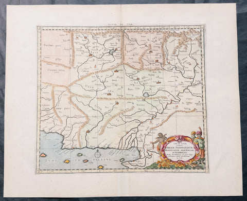
1695 Gerard Mercator Antique Ptolemy Map of Afghanistan & Pakistan Indus Valley
Antique Map
- Title : Asiae IX Tab:
- Size: 21in x 17 1/2in (535mm x 445mm)
- Condition: (A+) Fine Condition
- Date : 1695
- Ref #: 51006
Description:
This original copper plate engraved hand coloured antique map of the Indus Valley, today Afghanistan & Pakistan, after Claude Ptolemy's Geographia was published in the Helma Strick edition of Geographia in 1695.
These maps, after the 1st century text by Claude Ptolemy, were first published by Gerard Mercator in 1578 edition of Geographia by Gottfried von Kempen
General Definitions:
Paper thickness and quality: - Heavy and stable
Paper color : - off white
Age of map color: - Early
Colors used: - Yellow, green, blue, pink
General color appearance: - Authentic
Paper size: - 21 1/2in x 17 1/2in (545mm x 445mm)
Plate size: - 15 1/2in x 13 3/4in (395mm x 350mm)
Margins: - Min 1in (25mm)
Imperfections:
Margins: - Light age toning
Plate area: - None
Verso: - None
Background:
The Ptolemy maps were taken from the text of Claude Ptolemy (AD 87 - 150) a Greek mathematician, astronomer and geographer, living in Alexandria, assembled and codified his predecessors cartographic theories including those of Marinus of Tyre (c. AD 120). In about AD 150 he published his Geographia, a work in 8 volumes, supposedly illustrated with a world map, 26 regional maps and a profusion of smaller maps. Although the text of the Geographia survived, no maps older than about the twelfth century have come down to us and, in consequence, we have no means of knowing whether the 'Ptolemy' maps on which we set so much store were, in fact, drawn by him or were the interpretations of later map makers using his text as a basis. (Ref: Koeman; Norwich)
Background of Ptolemy's Geographia: The first published edition of Ptolemy's ‘Geographia’ with maps, engraved by Taddeo Crivelli, was issued in Bologna in 1477. Unusually, this edition contained 26 maps, with one of the Asia maps divided up among three neighbouring sheets. With the exception of Palestine, these are the first regional maps of any of these various countries.
Unfortunately for the undertakers, this atlas seems not to have been a commercial success, and today only twenty-six examples of the atlas are recorded, with all but one in institutional libraries.
One explanation of the failure is that the publishers do not seem to have been fully mastered the intricacies and problems of engraving, and printing from, copper-plates, an art, which, after all, was very new and experimental. These problems were more successfully addressed by a German printer, Conrad Sweynheym, who was working on an edition of Ptolemy in Rome in the same period. Unfortunately, he did not live to see the volume appear, but his successor, Arnold Buckinck, saw the atlas through the press, in 1478.
The Rome Ptolemy contained 27 maps, with the same geographical coverage as the 1477 Ptolemy. Of the engraved editions of Ptolemy’s ‘Cosmographia’ the maps in the Rome edition are the finest fifteenth century examples, and second only to Mercator’s maps, from his 1578 edition. One explanation for this was the use of individual punches to stamp letters onto the printing plates, rather than engraving them. This allowed much greater uniformity than lettering-engravers were able to achieve, and gives a very pleasing overall effect. The atlas proved popular, and three successive editions (to 1508) followed, although only about forty examples of the first edition are recorded today.
Claudius Ptolemy(90 A.D.-168 A.D.) was a celebrated astronomer, mathematician, and geographer who lived in Alexandria in the 2nd century AD. Although his thinking influenced contemporary Arab geographers, little was known of his work in the West until manuscripts from Constantinople reached Italy in about 1400. These manuscripts were written in Greek and contained the names of every city, island, mountain and river known to the many travellers interviewed by Ptolemy. In addition, the latitude and longitude of each of the resulting eight thousand locations were also recorded. They were translated into Latin by 1401 and appeared in print by 1475. The earliest Byzantine manuscript maps, drawn by analysing the Ptolemy figures, date from the twelfth century. A number of hand-drawn copies were made in Italy throughout the early fifteenth century to accompany Ptolemy's text.
Ptolemy stressed the importance of accurate observations in order to calculate latitude and longitude, and laid down the principals of systematic cartography that remain to this day. Obviously there are many errors in Ptolemy's maps, due to the limited extent of basic geographic information at that time and the lack of a method of determining accurate longitudes. Judged by modern standards, the basic shortcoming of the Ptolemy world map is the small area it portrays. The Mediterranean is fairly well depicted, but is greatly exaggerated in length (Longitudinally). The effect of this, combined with Ptolemy's disregard for Eratosthenes' extremely accurate estimate of the earth's circumference (c. 200 B.C.) and the use of a Posidonius' much smaller flawed estimate (c.50 B.C.) implied a much shorter distance across that part of the unknown earth's surface not drawn on the map. Columbus and his contemporaries based their exploratory ventures on Ptolemy's calculations and, like him, had no idea of the vast New World to the west, interposed between Europe and Asia.
Work on the first “printed” atlas from the text of Ptolemy was started in 1473 and finally published in 1478. A crude copy of this atlas was produced and published by some dissident workers in 1477 in order to be ‘first’. However, the plates for the 1478 were done prior to the pirated issue and thus the 1478 atlas holds the title of the first Atlas of the world. There are very few surviving examples of this atlas and individual maps. (Ref: Stevenson; Tooley; M&B)
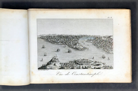
1817 Tavernier & Lepetit Antique Atlas of Turkey Persia Vietnam, Asia - 22 Prints
Antique Map
- Title : Atlas de Tavernier...Chez M.Me Lepetit...1817
- Ref #: 91592
- Size: 8vo
- Date : 1817
- Condition: (A) Very Good Condition
Description:
This fine original antique of the travels from Turkey, Persia, Central Asia, Vietnam of Jean Baptist Tavernier's was translated from the English by M Henry & M Breton and published by V Lepetit. Paris in 1817 - dated.
This atlas contains 22 copper-plate engraved prints, as listed below.
The atlas covers have been removed with front title page partially detached. Pages are generally clean with light aging to borders, Print V detached, light toning to pages, overall VG, 8vo, each page size is 7in x 5in (180mm x 125mm)
- J B Tavernier
2. Vue de Constantinople
3. Point de Serail a Constantionople
4. Le Trois Eglises
5. Ervan
6. Caravanserail de Cachen
7. Village Camouk ou Circassien
8. Mosquee Persane
9. Pont d' Ispahan
10. Costumes Persan
11. Femmes Persans
12. Bas-reliefs de Persepolis
13. Diamonds
13 (repeat). Animal qui produit le Musc
14. Serpent
15. Diverses Monaies Asie
16. Poignard Indien
17. Marche du Roi de Tonquin lorsqu il va a laguerre
18. Costumes Tonquinois
19. Spectacle Tonquinois
20.
21. Pompe funebre du Roi de Tonquin
22. Convoi de provisions a l enterrement du Roi de Tonquin
Jean-Baptiste Tavernier (1605 – 1689) was a 17th-century French gem merchant and traveller. Tavernier, a private individual and merchant travelling at his own expense, covered, by his own account, 60,000 leagues in making six voyages to Persia and India between the years 1630 and 1668. In 1675, Tavernier, at the behest of his patron Louis XIV, published Les Six Voyages de Jean-Baptiste Tavernier (Six Voyages, 1676).
Tavernier was born in Paris of a French or Flemish Huguenot family that had emigrated to Antwerp, to escape persecution, and which subsequently returned to Paris after the publication of the Edict of Nantes, which promised protection for French Protestants. Both his father Gabriel and his uncle Melchior were cartographers. Though it is clear from the accuracy of his drawings that Tavernier received some instruction in the art of cartography/engraving, he was possessed of a wanderlust. While still a teenager, he traveled extensively through Europe and achieved a working knowledge of its major languages.
Tavernier is best known for his 1666 discovery/purchase of the 116-carat Tavernier Blue diamond that he subsequently sold to Louis XIV of France in 1668 for 120,000 livres, the equivalent of 172,000 ounces of pure gold, and a letter of ennoblement. (Five years later, Louis had his court jeweler Jean Pitau recut the stone into the 68 carat French Blue and had it set as a hatpin. The gem was reset by his great-grandson Louis XV in The Medal of The Order of the Golden Fleece, stolen in 1792, and was recut and re-emerged in London 30 years later as the Hope Diamond).
In 1669, Tavernier purchased for 60,000 livres the Seigneury of Aubonne, located in the Duchy of Savoy near the city of Geneva, and became Baron of Aubonne.
Tavernier's writings show that he was a keen observer, as well as a remarkable cultural anthropologist. His Six Voyages became a best seller and was translated into German, Dutch, Italian, and English during his lifetime. The work is frequently quoted by modern scholars writing about the period. (Ref Tooley M&B)
General Description:
Paper thickness and quality: - Heavy, stable canvas backed
Paper color: - off white
Age of map color: -
Colors used: -
General color appearance: -
Atlas size: - 8vo
Imperfections:
Margins: - Age toning
Plate area: - Plate V detached, age toning
Verso: - Age toning
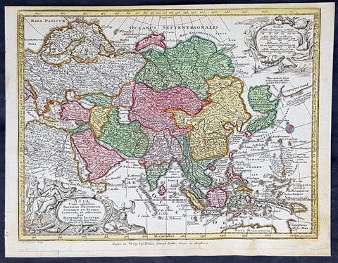
1744 Georg Mattaus Seutter Antique Map of Asia
Antique Map
- Title : Asia a Matth. Seutteri...T C Lotter, Geogr.
- Ref #: 93389
- Size: 11in x 8 1/2in (280mm x 215mm)
- Date : 1744
- Condition: (A+) Fine Condition
Description:
These beautifully hand coloured original copper-plate engraved antique map was engraved by Tobias Lotter and published in the 1744 edition of GM Seutters Atlas Minor Prae cipua Orbis Terrarum Imperia Regna et Provincias...., Augsburg, Germany.
General Definitions:
Paper thickness and quality: - Heavy and stable
Paper color : - off white
Age of map color: - Early
Colors used: - Yellow, green, blue, pink
General color appearance: - Authentic
Paper size: - 11in x 8 1/2in (280mm x 215mm)
Plate size: - 10 1/2in x 8in (265mm x 205mm)
Margins: - Min 1/4in (5mm)
Imperfections:
Margins: - None
Plate area: - None
Verso: - None
Background:
Atlas Minor was a series of beautiful maps of all parts of the world. Georg Matthäus Seutter was one of the most and important of the German cartographers of the 18th century, being appointed as the Geographer to the Imperial Court. His son, Albrecht Carl, joined Matthäus and eventually inherited the business. The maps from Atlas Minor were drawn by the two Seutters and engraved by Tobias Conrad Lotte. These maps are highly detailed and engraved with a bold hand with equally strong original hand color in the body of the map as was the 18th century German style. The cartouches were left uncolored in order to emphasize the elaborately detailed illustrations for which German maps are especially prized. These are some of the most decorative and interesting maps of the eighteenth century.
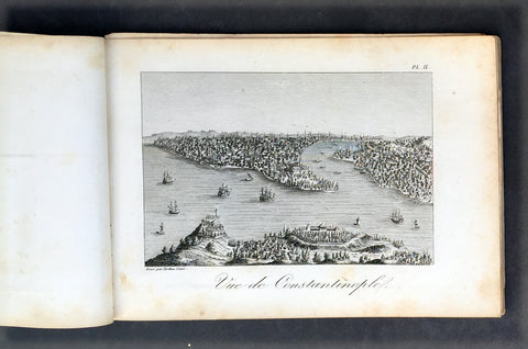
1817 Tavernier & Lepetit Antique Atlas of Turkey Persia Vietnam, Asia - 22 Prints
- Title : Atlas de Tavernier...Chez M.Me Lepetit...1817
- Ref #: 91592
- Size: 8vo
- Date : 1817
- Condition: (A) Very Good Condition
Description:
This fine original antique of the travels from Turkey, Persia, Central Asia, Vietnam of Jean Baptist Tavernier's was translated from the English by M Henry & M Breton and published by V Lepetit. Paris in 1817 - dated.
This atlas contains 22 copper-plate engraved prints, as listed below.
The atlas covers have been removed with front title page partially detached. Pages are generally clean with light aging to borders, Print V detached, light toning to pages, overall VG, 8vo, each page size is 7in x 5in (180mm x 125mm)
- J B Tavernier
2. Vue de Constantinople
3. Point de Serail a Constantionople
4. Le Trois Eglises
5. Ervan
6. Caravanserail de Cachen
7. Village Camouk ou Circassien
8. Mosquee Persane
9. Pont d' Ispahan
10. Costumes Persan
11. Femmes Persans
12. Bas-reliefs de Persepolis
13. Diamonds
13 (repeat). Animal qui produit le Musc
14. Serpent
15. Diverses Monaies Asie
16. Poignard Indien
17. Marche du Roi de Tonquin lorsqu il va a laguerre
18. Costumes Tonquinois
19. Spectacle Tonquinois
20.
21. Pompe funebre du Roi de Tonquin
22. Convoi de provisions a l enterrement du Roi de Tonquin
Jean-Baptiste Tavernier (1605 – 1689) was a 17th-century French gem merchant and traveller. Tavernier, a private individual and merchant travelling at his own expense, covered, by his own account, 60,000 leagues in making six voyages to Persia and India between the years 1630 and 1668. In 1675, Tavernier, at the behest of his patron Louis XIV, published Les Six Voyages de Jean-Baptiste Tavernier (Six Voyages, 1676).
Tavernier was born in Paris of a French or Flemish Huguenot family that had emigrated to Antwerp, to escape persecution, and which subsequently returned to Paris after the publication of the Edict of Nantes, which promised protection for French Protestants. Both his father Gabriel and his uncle Melchior were cartographers. Though it is clear from the accuracy of his drawings that Tavernier received some instruction in the art of cartography/engraving, he was possessed of a wanderlust. While still a teenager, he traveled extensively through Europe and achieved a working knowledge of its major languages.
Tavernier is best known for his 1666 discovery/purchase of the 116-carat Tavernier Blue diamond that he subsequently sold to Louis XIV of France in 1668 for 120,000 livres, the equivalent of 172,000 ounces of pure gold, and a letter of ennoblement. (Five years later, Louis had his court jeweler Jean Pitau recut the stone into the 68 carat French Blue and had it set as a hatpin. The gem was reset by his great-grandson Louis XV in The Medal of The Order of the Golden Fleece, stolen in 1792, and was recut and re-emerged in London 30 years later as the Hope Diamond).
In 1669, Tavernier purchased for 60,000 livres the Seigneury of Aubonne, located in the Duchy of Savoy near the city of Geneva, and became Baron of Aubonne.
Tavernier's writings show that he was a keen observer, as well as a remarkable cultural anthropologist. His Six Voyages became a best seller and was translated into German, Dutch, Italian, and English during his lifetime. The work is frequently quoted by modern scholars writing about the period. (Ref Tooley M&B)
General Description:
Paper thickness and quality: - Heavy, stable canvas backed
Paper color: - off white
Age of map color: -
Colors used: -
General color appearance: -
Atlas size: - 8vo
Imperfections:
Margins: - Age toning
Plate area: - Plate V detached, age toning
Verso: - Age toning