Welcome to Classical Images!
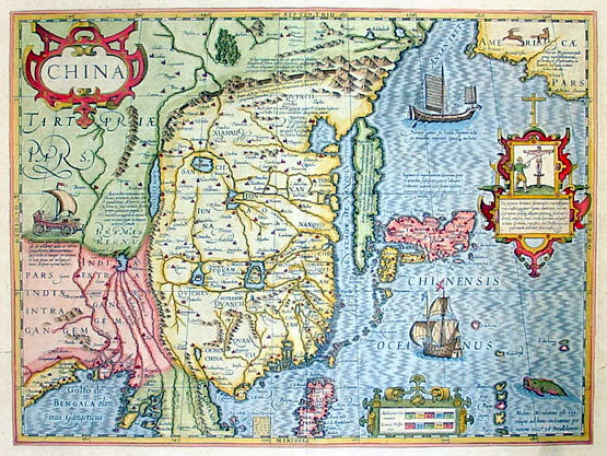
Description: This map of China, Japan with Korea and parts of the west coast of America was the first Chinese map published by Mercator first released in 1606. This map was published in the 1636 edition of Mercator's Atlas published by Henricus Hondius & Jan Jansson.
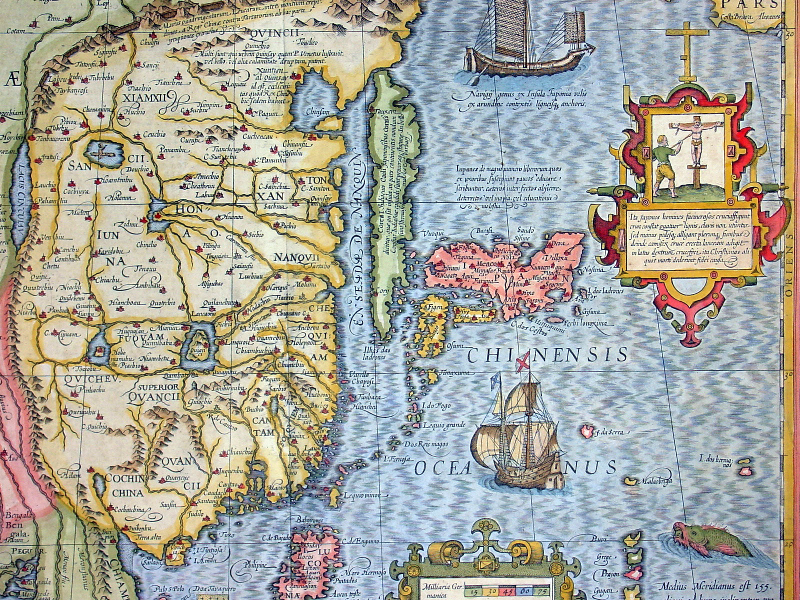
General Description:Paper thickness and quality: - Heavy and stablePaper color: - off whiteAge of map color: - EarlyColors used: - Green, red, orange, yellow, blueGeneral color appearance: - Authentic and beautifulPaper size: - 23in x 19in (585mm x 480mm)Plate size: - 18 1/2in x 14in (470mm x 355mm)Margins: - Min 1in (25mm)Imperfections:Margins: - Small repair to top margin centerfold, no lossPlate area: - NoneVerso: - NoneBackground: This boldly engraved and hand coloured map combines elements of the maps complied by the two Portuguese Jesuits priests, on Japan by Luis Teixeira (1595) and on China by Luis Jorge de Barbuda (1584). Amoungst the decorative features including sea monsters, ships both European and Chinese and a wind powered land cart is also a vignette depicting the torture of Christians in Japan if caught.Although Mercator has faithfully followed the Ortelius/Teixeira type of map he has added an explanation for Korea saying it was not yet certain whether it was an island or part of the mainland. In contrast to the relatively late mapping of the major continents by the Europeans the mapping of China stretches back as far back as 1100BC. Almost 100years after Ptolemy produced "Geographia" and around the same time paper was invented in China an 18-sheet map of China was produced by Pei Hsui (AD 224-71). In the following years contact was re-established between the Chinese and Europeans - contact was known between the two cultures from before Ptolemy - through Marco Polo, Carpini (1245), Rubruquis (1252) and other Franciscan missionaries and it was through the accounts of their travels that scholars began to reshape their ideas of Cathay. In the 16th & 17th centuries the Jesuits exerted a considerable influence on Chinese mapmaking. Matteo Ricci complied the first European map of the world printed and circulated in China (1584 - 1602) Ludovico Georgio who's map of China was used by Ortelius (1584) and subsequently by other Dutch publishers; Father Martino Martini an Italian Jesuit who compiled the first European Atlas of China Atlas Sinensis which was used by Blaeu, Jansson and others. (Ref: Koeman; M&B; Tooley)