Welcome to Classical Images!
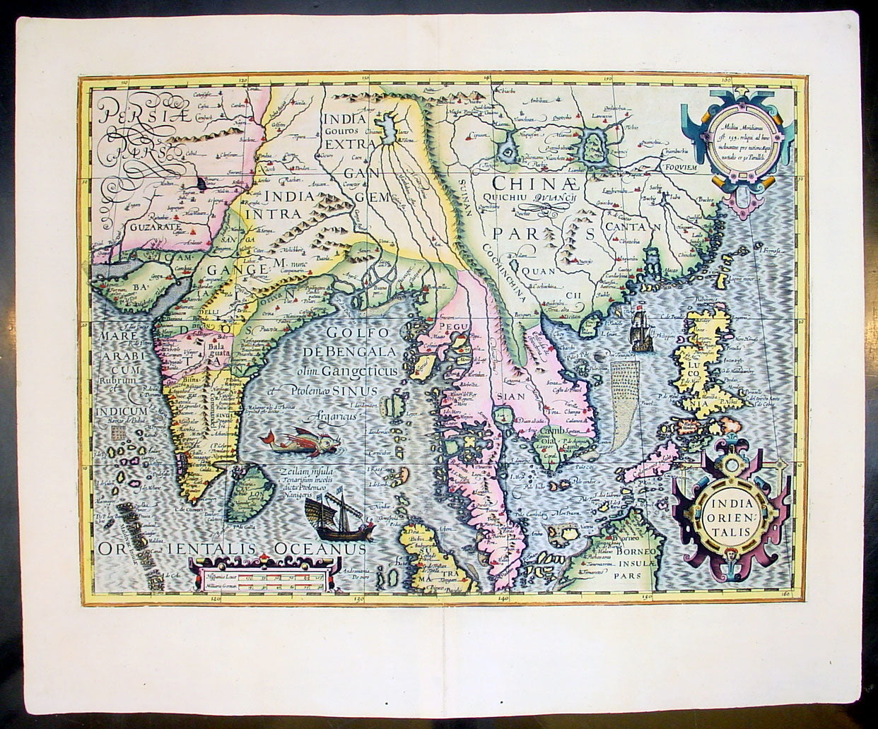
Description: This beautifully engraved hand coloured original map of India, SE Asia & the East Indies was published in Gerard Mercator's French edition of Atlas sive Cosmographicae published by Henricus Hondius and Jan Jansson in 1609..
Background: One of the finest of the early Dutch maps of the region published. It was first published in 1606 as one of the 37 new maps engraved by Jodocus Hondius' for Mercators Atlas. The map extends from India to the coasts of Southern China including the Pearl Jodocus HondiusRiver Estuary, Canton and Formosa. It also includes all of the Malay peninsula and Indochina, northern Borneo and the Philippines. Hondius shared the classic view of the SE Asian River Systems, mapping five rivers from the Mekong westward, as originating in a lake in the Himalayas. The kingdom of Lan Na is shown originating in what is today northern Thailand and a depiction of the Mergui Archipelago off the Burmese portion of the Malay Peninsula as an island studded sea. The old capital of Siam, Ayuthaya, is shown on an island in the Gulf of Siam.The decorative detail includes a large sea monster and an oriental junk in the Bay of Bengal as well as fine scrollwork title & scale cartouches. One of the most interesting & unusual features of the Southern Malay peninsula is its dissection in two, the southern part becoming an island just south of Malacca where it is separated from the rest of the peninsula by a large north-easterly channel. (Ref: Koeman; M&B; Tooley)
General Description: Paper thickness and quality: - Heavy and stable Paper color: - off white Age of map color: - Early Colors used: - Yellow, green, red, brown. General color appearance: - Authentic and fresh Paper size: - 22in x 18 1/2in (560mm x 470mm) Plate size: - 19 1/4in x 14in (490mm x 355mm) Margins: - Min 1in (25mm)
Imperfections: Margins: - None Plate area: - None Verso: - None