Prints (370)
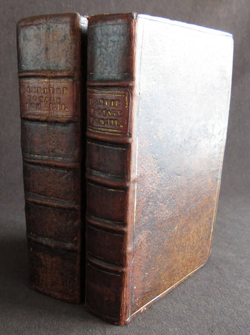
1723 William Dampier 2 Volumes of World Voyages to America Australia Asia - 20 x Maps & Plates
Antique Map
-
Title : Nouveau Voyage Autour Du Monde...Ou l on decrite en particular l Isthme de l Amerique, plusieurs côtes et isles des Indes Occidentales...1723
(New Voyage around the world. In which are described in particular the Istmus of America, several Coasts & Islands of the West Indies, the Islands of Cape Verde, the passage through the Land of Fuego, the Southern Coasts of Chili, Peru, & Mexico. . - Size: 8vo
- Condition: (A) Very Good Condition
- Date : 1723
- Ref #: 93005
Description:
French edition of William Dampier's account of his voyages around the World, in 2 volumes, especially to the South Seas in the years 1683 to 1691. Dampier first sailed to Sierra Leone and from there to the Falkland Islands, Cape Horn, Peru, Guatemala, Mexico, Philippines, Vietnam, China, Indonesia and onto New Guinea. He then went ashore in northern Western Australia, in the Broome region, the region later named after him and then sailed onto Sumatra, the Cape of Good Hope and back to Europe.
Although John Brooke was probably shipwrecked on the Australian coast in 1621, without knowing where exactly he was, Dampier became the first Englishman to set foot in Australia, in the Broome NW region. Even though Dampier spent a good deal of his time as a Buccaneer, he wrote these accounts of his adventures without sensation, concentrating on the hydrographic, geographic and scientific details. This helped him establish his legitimacy, bringing immediate academic acclaim rather than condemnation as a pirate.
Dampier was first person to circumnavigate the world three times between 1679 & 1711. He has also been described as Australias first natural historian, as well as one of the most important British explorers of the period between Sir Walter Raleigh and James Cook.
After impressing the British Admiralty with his book, A New Voyage Round the World, Dampier was given command of a Royal Navy ship and made important discoveries in western Australia, but was court-martialled for cruelty. On a later voyage, he rescued Alexander Selkirk, a former crew mate who may have inspired Daniel Defoes Robinson Crusoe. Others influenced by Dampier include James Cook, Lord Nelson, Charles Darwin and Alfred Russel Wallace.
These two leather bound Volumes, contain 20 maps & plates (some folding) and was published in Amsterdam by David Paul Marret in 1723 (dated)
General Definitions:
Paper thickness and quality: - Heavy and stable
Paper color : - off white
Age of map color: -
Colors used: -
General color appearance: -
Paper size: - 8vo
Plate size: - 8vo
Margins: - Min 1/2in (12mm)
Imperfections:
Margins: - Please see below for condition report
Plate area: - Please see below for condition report
Verso: - Please see below for condition report
Background:
The two volumes contain the following titles with 20 maps & plates.
Volume 1.
1. Nouveau Voyage Autour Du Monde...Ou l\'on decrite en particular l\'Isthme de l\'Amerique, plusieurs côtes et isles des Indes Occidentales, les Isles du Cap Verd, le passage par la Terre del Fuego, les côtes meridionales du Chili, du Perou & du Mexique; l\'Isle de Guam, Mindanao, & des autres Philippines, les isles orientales qui sont prés de Cambodie; de la Chine; Formosa; Luçon, Celebes, &c., la Nouvelle Hollande, les Isles de Sumatra, de Nicobar & de Sainte Helene & le Cap de Bonne Esperance...Ou l\'on traite des differens terroirs de tous ces pays, de leurs ports, des plantes, des fruits & des animaux qu\'on y trouve; de leurs habitans, de leurs coûtumes, de leur religion, de leur gouvernement, de leur negoce, &c....1723
This volume refers to Dampiers voyages to North & South America, East Indies, SE Asia, China, Australia & Africa.
Contains Title page, 8 maps & plates total of 340 pages.
a) Mappe-Monde - World map with Dampiers tracks.
b) Maps of the Isthmus of Panama and Central America
c) Print of Natives gathering fruit
d) Print of Dampier loading Gold from the New World
e) Voyage au tour du Monde title page
f) Map of Mexico & southern North America
g) Print of a battle in the East indies
h) Print of a coconut palm in East Indies
2. Suite du Voyage Autour du Monde... Avec un Traite Des Vents qui regnent dans toute..LA ZONE TORRIDE Enrichi de Cartes & de Figures..1723
This volume refers to the continuation of Dampiers voyages to North & South America, East Indies, SE Asia, China, Australia & Africa along with a description of global winds and tides.
Contains title page along with 6 maps & plates, 227 pages.
a) Engraved Voyage au Tour Du Monde
b) Print of ships offshore from the city of Manila in the Phillippines
c) View of Manila
d) 2nd print of ships offshore from the city of Manila in the Phillippines
e) Map of the Philippines islands of Banshee
f) Map of Pulocondor, Malayia
g) Print of Dampiers ship and compass rose
3. Traits des Vents Aliisez ou Reglez des Vents Frais ...1715
This volume refers again to globe winds & tides.
Contains title page 2 maps & 148 pages
a) Description of winds and tides in the eastern hemisphere
b) Description of winds and tides in the eastern hemisphere
Volume 2.
1. Voyage Autour Du Monde... Contenant une Description d\'Achin,
Ville de Sumatra, du Royaume de Tonquin & autres Places des Indes,
& de la Baye de Campeche. Ou l\'on traite des differens terroirs de tous ces pays, de leurs ports, des plantes, des fruits & des animaux qu\'on y trouve; de leurs
habitans, de leurs coûtumes, de leur religion, de leur gouvernement,
de leur negoce, &c...1723
This volume refers to the continuation of Dampiers travels in East Indies, SE Asia & Mexico
Contains title page, 4 maps & plates, 264 pages.
a) Royalty in Vietnam
b) Map of central & north America
b) Print of Vietnam
c) Map of Australia & East Indies
2. Voyages de Guillaume Dampier a la Baye de Campeche...1714
This volume refers to Dampiers travel to Campeche, Mexico.
Contains title page and 197 pages.
Condition Report: Two volumes bound in full leather with five raised bands to spines, and title label. Couple of minor chips to top of both spines. The leather is scuffed and little pitted/worn (see photos). Internally there are a couple of small chips to inner edges of front and rear end-papers. Inscription to front end-papers (Gift of W. Wood 1745) and bookplate to inside front board (Lord Sandys). The title page of volume III and following four or so leaves have damp staining, and there is light damp staining throughout Volume I & II. The damp staining has caused the leaves to become softer and little chipped, with some nicks/tears and chips. There is a tear/crease to top inner edge and chip to bottom corner of title page of volume I. Scattered pale foxing/browning. Several of the plates have occasional creases. Four leaves of volume III are gently detaching and two leaves of volume I are missing. A few leaves are a little faded. Overall VG, in readable with firm binding.
Dampier, William 1651 - 1715
Dampier was an English explorer, navigator & buccaneer who became the first Englishman to explore parts of what is today Australia, and the first person to circumnavigate the world three times. He has also been described as Australias first natural historian, as well as one of the most important British explorers of the period between Sir Walter Raleigh and James Cook.
After impressing the Admiralty with his book A New Voyage Round the World, Dampier was given command of a Royal Navy ship and made important discoveries in western Australia, before being court-martialled for cruelty. On a later voyage he rescued Alexander Selkirk, a former crewmate who may have inspired Daniel Defoes Robinson Crusoe. Others influenced by Dampier include James Cook, Horatio Nelson, Charles Darwin.
In 1679, Dampier joined the crew of the buccaneer Captain Bartholomew Sharp on the Spanish Main of Central America, twice visiting the Bay of Campeche, or Campeachy as it was then known, on the north coast of Mexico. This led to his first circumnavigation, during which he accompanied a raid across the Isthmus of Darién in Panama and took part in the capture of Spanish ships on the Pacific coast of that isthmus. The pirates then raided Spanish settlements in Peru before returning to the Caribbean.
Dampier made his way to Virginia, where in 1683 he was engaged by the privateer John Cooke. Cooke entered the Pacific via Cape Horn and spent a year raiding Spanish possessions in Peru, the Galápagos Islands, and Mexico. This expedition collected buccaneers and ships as it went along, at one time having a fleet of ten vessels. Cooke died in Mexico, and a new leader, Edward Davis, was elected captain by the crew.
Dampier transferred to the privateer Charles Swans ship, Cygnet, and on 31 March 1686 they set out across the Pacific to raid the East Indies, calling at Guam and Mindanao. Spanish witnesses saw the predominantly English crew as not only pirates and heretics but also cannibals. Leaving Swan and 36 others behind on Mindanao, the rest of the privateers sailed on to Manila, Poulo Condor, China, the Spice Islands, and New Holland. Contrary to Dampiers later claim that he had not actively participated in actual piratical attacks during this voyage, he was in fact selected in 1687 to command one of the Spanish ships captured by Cygnets crew off Manila.
On 5 January 1688, Cygnet anchored two miles from shore in 29 fathoms on the northwest coast of Australia, near King Sound. Dampier and his ship remained there until March 12, and while the ship was being careened Dampier made notes on the fauna and flora and the indigenous peoples he found there. Among his fellows were a significant number of Spanish sailors, most notably Alonso Ramírez, a native of San Juan, Puerto Rico Later that year, by agreement, Dampier and two shipmates were marooned on one of the Nicobar Islands. They obtained a small canoe which they modified after first capsizing and then, after surviving a great storm at sea, called at Acheen (Aceh) in Sumatra.
Dampier returned to England in 1691 via the Cape of Good Hope, penniless but in possession of his journals. He also had as a source of income a slave known as Prince Jeoly (or Giolo), from Miangas (now Indonesia), who became famous for his tattoos (or paintings as they were known at the time). Dampier exhibited Jeoly in London, thereby also generating publicity for a book based on his diaries.
The publication of the book, A New Voyage Round the World, in 1697 was a popular sensation, creating interest at the Admiralty. In 1699, Dampier was given command of the 26-gun warship HMS Roebuck, with a commission from King William III (who had ruled jointly with Queen Mary II until her death in 1694). His mission was to explore the east coast of New Holland, the name given by the Dutch to what is now Australia, and Dampiers intention was to travel there via Cape Horn.
The expedition set out on 14 January 1699, too late in the season to attempt the Horn, so it headed to New Holland via the Cape of Good Hope instead. Following the Dutch route to the Indies, Dampier passed between Dirk Hartog Island and the Western Australian mainland into what he called Shark Bay on 6 August 1699. He landed and began producing the first known detailed record of Australian flora and fauna. The botanical drawings that were made are believed to be by his clerk, James Brand. Dampier then followed the coast north-east, reaching the Dampier Archipelago and Lagrange Bay, just south of what is now called Roebuck Bay, all the while recording and collecting specimens, including many shells. From there he bore northward for Timor. Then he sailed east and on 3 December 1699 rounded New Guinea, which he passed to the north. He traced the south-eastern coasts of New Hanover, New Ireland and New Britain, charting the Dampier Strait between these islands (now the Bismarck Archipelago) and New Guinea. En route, he paused to collect specimens such as giant clams.
By this time, Roebuck was in such bad condition that Dampier was forced to abandon his plan to examine the east coast of New Holland while less than a hundred miles from it. In danger of sinking, he attempted to make the return voyage to England, but the ship foundered at Ascension Island on 21 February 1701. While anchored offshore the ship began to take on more water and the carpenter could do nothing with the worm-eaten planking. As a result, the vessel had to be run aground. Dampiers crew was marooned there for five weeks before being picked up on 3 April by an East Indiaman and returned home in August 1701.
Although many papers were lost with Roebuck, Dampier was able to save some new charts of coastlines, and his record of trade winds and currents in the seas around Australia and New Guinea. He also preserved a few of his specimens. In 2001, the Roebuck wreck was located in Clarence Bay, Ascension Island, by a team from the Western Australian Maritime Museum. Because of his widespread influence, and also because so little exists that can now be linked to him, it has been argued that the remains of his ship and the objects still at the site on Ascension Island – while the property of Britain and subject to the island governments management – are actually the shared maritime heritage of those parts of the world first visited or described by him. His account of the expedition was published as A Voyage to New Holland in 1703.
The War of the Spanish Succession had broken out in 1701, and English privateers were being readied to act against French and Spanish interests. Dampier was appointed commander of the 26-gun ship St George, with a crew of 120 men. They were joined by the 16-gun Cinque Ports with 63 men, and sailed on 11 September 1703 from Kinsale, Ireland. The two ships made a storm-tossed passage round Cape Horn, arriving at the Juan Fernández Islands off the coast of Chile in February 1704. While watering and provisioning there, they sighted a heavily armed French merchantman, which they engaged in a seven-hour battle but were driven off.
Dampier succeeded in capturing a number of small Spanish ships along the coast of Peru, but released them after removing only a fraction of their cargoes because he believed they would be a hindrance to his greater designs. The greater design he had in mind was a raid on Santa María, a town on the Gulf of Panama rumoured to hold stockpiles of gold from nearby mines. When the force of seamen he led against the town met with unexpectedly strong resistance, however, he withdrew. In May 1704, Cinque Ports separated from St George and, after putting Alexander Selkirk ashore alone on an island for complaining about the vessels seaworthiness, sank off the coast of what is today Colombia. Some of its crew survived being shipwrecked but were made prisoners of the Spanish.
It was now left to St George to make an attempt on the Manila galleon, the main object of the expedition. The ship was sighted on 6 December 1704, probably Nuestra Señora del Rosario. It was caught unprepared and had not run out its guns. But while Dampier and his officers argued over the best way to mount an attack, the galleon got its guns loaded and the battle was joined. St George soon found itself out-sized by the galleons 18- and 24-pounders, and, suffering serious damage, they were forced to break off the attack.
The failure to capture the Spanish galleon completed the break-up of the expedition. Dampier, with about thirty men, stayed in St George, while the rest of the crew took a captured barque across the Pacific to Amboyna in the Dutch settlements. The undermanned and worm-damaged St George had to be abandoned on the coast of Peru. He and his remaining men embarked in a Spanish prize for the East Indies, where they were thrown into prison as pirates by their supposed allies the Dutch but later released. Now without a ship, Dampier made his way back to England at the end of 1707.
In 1708, Dampier was engaged to serve on the privateer Duke, not as captain but as sailing master. Duke beat its way into the South Pacific Ocean round Cape Horn in consort with a second ship, Duchess. Commanded by Woodes Rogers, this voyage was more successful: Selkirk was rescued on 2 February 1709, and the expedition amassed £147,975 (equivalent to £19.9 million today) worth of plundered goods. Most of that came from the capture of a Spanish galleon, Nuestra Señora de la Encarnación y Desengaño, along the coast of Mexico in December 1709.
In January 1710, Dampier crossed the Pacific in Duke, accompanied by Duchess and two prizes. They stopped at Guam before arriving in Batavia. Following a refit at Horn Island (near Batavia) and the sale of one of their prize ships, they sailed for the Cape of Good Hope where they remained for more than three months awaiting a convoy. They left the Cape in company with 25 Dutch and English ships, with Dampier now serving as sailing master of Encarnación. After a further delay at the Texel, they dropped anchor at the Thames in London on 14 October 1711.
Dampier may not have lived to receive all of his share of the expeditions gains. He died in the Parish of St Stephen Coleman Street, London. The exact date and circumstances of his death, and his final resting place, are all unknown. His will was proven on 23 March 1715, and it is generally assumed he died earlier that month, but this is not known with any certainty. (Ref Tooley M&B)
Please note all items auctioned are genuine, we do not sell reproductions. A Certificate of Authenticity (COA) can be issued on request.

1853 - 1857 Elephant Folio Album w/ 328 Antique Maps & Prints of The Crimea War - Unique
Antique Map
- Title : Crimean War Maps, Prints & Views
- Date : 1853 - 57
- Size: 24in x 18in (610mm x 455mm) Elephant Folio
- Condition: (A) Very Good Condition
- Ref: 35600
Description:
This is a unique and very comprehensive visual record of the Crimean War (1853 - 1856 & 57) in a huge Elephant Folio Album.
The album consists of 163 double pages with 328 original maps, prints and views of the War tipped in chronological order. These are mainly from the Illustrated London News, from the Wars beginning in 1853 to its end in 1856 through to the Coronation of Alexander II in 1857 and some of the first recipients of the Victoria Cross.
My impression is that the album was professionally organised and assembled possibly by a political or historical organisation of the time, in the mid 19th century.
This album is extremely large measuring 28 inches x 18 inches (62cm x 46cm) when closed and weighs approx. 14 Kg.
The Album contains; (in more detail directly below)
- 71 views of various battles during the conflict.
- 94 Portraits & prints of the leaders, generals, & personnel who were in charge and soldiers, sailors who participated in the war.
- 47 views of various cities and towns from the participating countries England, Russia, Crimea, Turkey etc.
- 63 prints of naval fleets, battleships, sea battles, landings & evacuations..
- 15 Maps of various regions and conflicts
- 25 victory scenes in Britain
- 39 prints of portraits and views of the Coronation of Alexander II
- 4 Pages of recipients from both Army & Navy, of the first Victoria Cross.
Battle Views (Battle of Kars, Kinburn, Sebastopol, Malakoff, Tchernaya, Sveaborg, Gheisk, Hango-Head, Narva, Balaclava, Inkerman, Charge of Light Cavalry Balaclava, Alma, Odessa, Crondstat, Citate, Oltenitza, Kalafat)
Prints of leaders, generals and soldiers (British, Russian, Turkish, Greek, French, Austrian, Peace Talks Paris, Congress of Vienna, Allied Naval Command, Marshall Pelissier, Wounded, Hospitals, Sir De Lacy Evans, Nicolas Emperor of Russia, Royal Marines, Lord Raglan, Napoleon III, Commanders of Allied Armies in the East, Sultan of Turkey, Marshal St Arnaud, French Cavalry, French Infantry, British Infantry, British Navy, Sir Charles Napier, Rear Admiral Corry, & Plumridge, British Cavalry & Artillery Officers, Scots Guards, Royal marines, British Cavalry, Coldstream Guards, Grenadier Guards, Omer Pacha, General Prim)
Views of cities & towns (Balaclava, Kars, Sebastopol, Sveaborg, Helsingborg, Kiel, Copenhagen, Crondstat, St Petersberg, Kerch, Inkermann, Eupatoria, Alma, Coast of Crimea, Varna Bay, Odessa and Coast, Constantinople, Oltenitza, Sinope)
Fleets, battleships & sea battles (HMS Wellington, Steamers, British Fleet, Baltic Fleet, Gun Boats, Nystad, Sebastopol, Spithead, Portsmouth, Flying Squadron, Trafalgar and Resolution, landing French Troops at Gallipoli, Duke of Wellingtons Flagship, Turkish Fleet in Biospheres, English & French Fleet in Besika Bay, HMS Neptune)
Maps (Crimea & Black Sea region, Russia-Turkey, Constantinople, Austria-Russia, Spithead review of Fleet, Sea of Azoff, Kerch, River Alma to Balaklava, Plan of Sebastopol, Seat of War in the Crimea, Sebastopol & Balaklava, Picturesque map of the seat of war, Battle of Alma, The Ottoman Empire)
Florence Nightingale (Treating wounded, visiting wounded Balaclava)
Victory Scenes in England (illuminations, Parades, Queen, Brighton, Hyde Park, Awarding Medals, The Guards, Fireworks, Landing in Kalamita Bay)
The Album is huge Elephant Folio measuring 24in x 18in (610mm x 455mm) and weighing about 13kg (29lbs) The contemporary half morocco boards are worn, rubbed and detached from the internals that on the whole are clean and tight with occasional spotting and repairs with no loss.
Also included with the album is the following loose prints, maps and newspaper clippings;
- 47 prints and views from ILN on the British Expedition into Abyssinia in 1868.
- 39 prints, views and maps from the ILN and The Graphic on the 1882 Anglo-Egyptian War.
- 60 Newspaper clipping from 1882 of The Times, Evening Standard, Daily News and other papers again on the Anglo Egyptian War.
General Definitions:
Paper thickness and quality: - Heavy and stable.
Paper color : - off white
Age of map color: -
Colors used: -
General color appearance: -
Paper size: - 24in x 18in (610mm x 455mm) each
Plate size: - 24in x 18in (610mm x 455mm) each
Margins: - Min 1in (25mm)
Imperfections:
External Boards: - Worn, slit spine, scuffing detached from internals
Internal pages: - Overall clean, some spotting, light offsetting to some pages, several small repairs without loss
Background: The Crimean War was fought from October 1853 to February 1856 between the Russian Empire and an ultimately victorious alliance of the Ottoman Empire, France, the United Kingdom, and Sardinia-Piedmont.
Geopolitical causes of the war included the decline of the Ottoman Empire (the "Eastern Question"), the expansion of the Russian Empire in the preceding Russo-Turkish Wars, and the British and French preference to preserve the Ottoman Empire to maintain the balance of power in the Concert of Europe. The flashpoint was a disagreement over the rights of Christian minorities in Palestine, then part of the Ottoman Empire, with the French promoting the rights of Roman Catholics, and Russia promoting those of the Eastern Orthodox Church.
The churches worked out their differences with the Ottomans and came to an agreement, but both the French Emperor Napoleon III and the Russian Tsar Nicholas I refused to back down. Nicholas issued an ultimatum that demanded the Orthodox subjects of the Ottoman Empire be placed under his protection. Britain attempted to mediate and arranged a compromise to which Nicholas agreed. When the Ottomans demanded changes to the agreement, Nicholas recanted and prepared for war.
In July 1853, Russian troops occupied the Danubian Principalities (now part of Romania but then under Ottoman suzerainty). On 16 October 1853, having obtained promises of support from France and Britain, the Ottomans declared war on Russia. Led by Omar Pasha, the Ottomans fought a strong defensive campaign and stopped the Russian advance at Silistra (now in Bulgaria). A separate action on the fort town of Kars, in the Ottoman Empire, led to a siege, and an Ottoman attempt to reinforce the garrison was destroyed by a Russian fleet at the Battle of Sinop in November 1853.
Fearing the growth of influence of the Russian Empire, the British and French fleets entered the Black Sea in January 1854. They moved north to Varna in June 1854 and arrived just in time for the Russians to abandon Silistra. In the Baltic, near the Russian capital of Saint Petersburg, an Anglo-French fleet instituted a naval blockade and bottled up the outnumbered Russian Baltic Fleet, causing economic damage to Russia by blockading trade while also forcing the Russians to keep a large army guarding St. Petersburg from a potential allied attack.
After a minor skirmish at Köstence (now Constanța), the allied commanders decided to attack Russia's main naval base in the Black Sea, Sevastopol, in Crimea. After extended preparations, allied forces landed on the peninsula in September 1854 and marched their way to a point south of Sevastopol after they had won the Battle of the Alma on 20 September 1854. The Russians counterattacked on 25 October in what became the Battle of Balaclava and were repulsed, but the British Army's forces were seriously depleted as a result. A second Russian counterattack at Inkerman ended in a stalemate.
By 1855, the Italian Kingdom of Sardinia sent an expeditionary force to Crimea, siding with France, Britain and the Ottoman Empire. The front settled into the Siege of Sevastopol, involving brutal conditions for troops on both sides. Smaller military actions took place in the Caucasus (1853–1855), the White Sea (July–August 1854) and the North Pacific (1854–1855).
Sevastopol finally fell after eleven months, after the French assaulted Fort Malakoff. Isolated and facing a bleak prospect of invasion by the West if the war continued, Russia sued for peace in March 1856. France and Britain welcomed the development, owing to the conflict's domestic unpopularity. The Treaty of Paris, signed on 30 March 1856, ended the war. It forbade Russia to base warships in the Black Sea. The Ottoman vassal states of Wallachia and Moldavia became largely independent. Christians in the Ottoman Empire gained a degree of official equality, and the Orthodox Church regained control of the Christian churches in dispute.
The Crimean War was one of the first conflicts in which military forces used modern technologies such as explosive naval shells, railways and telegraphs. The war was also one of the first to be documented extensively in written reports and in photographs. The war quickly became a symbol of logistical, medical and tactical failures and of mismanagement. The reaction in Britain led to a demand for the professionalisation of medicine, most famously achieved by Florence Nightingale, who gained worldwide attention for pioneering modern nursing while she treated the wounded.
The Crimean War marked a turning point for the Russian Empire. The war weakened the Imperial Russian Army, drained the treasury and undermined Russia's influence in Europe. The empire would take decades to recover. Russia's humiliation forced its educated elites to identify its problems and recognise the need for fundamental reforms. They saw rapid modernisation as the sole way to recover the empire's status as a European power. The war thus became a catalyst for reforms of Russia's social institutions, including the abolition of serfdom and overhauls in the justice system, local self-government, education and military service. (Ref: Tooley; M&B)
The Illustrated London News (ILN)
In 1842, Herbert Ingram, a young printer and newsagent from Nottingham, arrived in London. As a newsagent he noticed that when on the rare occasions that newspapers included woodcuts, their sales increased. He therefore came to the conclusion that it would be possible to make a good profit from a magazine that included a large number of illustrations.
Herbert Ingram discussed the proposal with his friend, Mark Lemon, the editor of Punch magazine. With Lemon as his chief adviser, the first edition of the Illustrated London News appeared on 14th May 1842. Costing sixpence, the magazine had sixteen pages and thirty-two woodcuts. The first edition included pictures of the war in Afghanistan, a train crash in France, a steamboat explosion in Canada and a fancy dress ball at Buckingham Palace.
Ingram was a staunch Liberal who favored social reform. He announced in the London Illustrated News that the concern of the magazine would be \\\"with the English poor\\\" and the \\\"three essential elements of discussion with us will be the poor laws, the factory laws, and the working of the mining system\\\". Later Herbert Ingram was to become MP for Boston and until his death in 1860 continued his campaign for social reform in the House of Commons.
The London Illustrated News was an immediate success and the first edition sold 26,000 copies. Within a few months it was selling over 65,000 copies a week. Special events were important to the success of the London Illustrated News. The magazine did very well during the Exhibition 1851 and over 150,000 copies were sold of the edition that reported the funeral of the Duke of Wellington. The Crimean War caused a further boast to sales and by 1863 it was selling over 300,000 copies a week. This was far higher than other journals. For example, newspapers such as the Daily News only sold 6,000 copies at this time, and even the largest selling newspaper, The Times only sold 70,000 copies. In the Christmas Number of The Illustrated London News, 1855, the first pictures in color were published.
In the year 1879, The ILLUSTRATED LONDON NEWS claimed to be the fastest woodcut-printing establishment in the world. The Ingram Rotary machine had been invented. It printed both sides of the paper at once and turned out 6,500 copies per hour. It required only four men to operate it, whereas thirty men and five machines were needed previously
 The ILN held a commanding position in the market place. It was seriously challenged by The GRAPHIC in 1870. Although it never reached the circulation of the ILN. it did take a good market share until the turn of the century.
Please note all items auctioned are genuine, we do not sell reproductions. A Certificate of Authenticity (COA) can be issued on request.
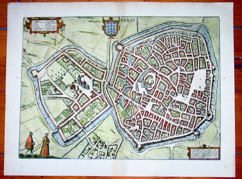
1575 Braun & Hogenberg Large Antique Map of the City of Arras, France
Antique Map
- Title : Arras
- Date : 1575
- Condition: (A+) Fine Condition
- Ref: 92833
- Size: 21in x 16in (535mm x 410mm)
Description:
This fine beautifully hand coloured original antique map a birds-eye view of the French City of Arras - the capital of the Pas de Calais region - was published by Georg Braun & Frans Hogenberg for the 1575 atlas of town plans Civiates Orbis Terrarum Vol II (1572-1612) intended as a companion to Abraham Ortelius's master Atlas Theatrum Orbis Terrarum published in 1570.
Background of Civitates Orbis Terrarum
The first volume of the Civitates Orbis Terrarum was published in Cologne in 1572. The sixth and the final volume appeared in 1617.
This great city atlas, edited by Georg Braun and largely engraved by Franz Hogenberg, eventually contained 546 prospects, bird-eye views and map views of cities from all over the world. Braun (1541-1622), a cleric of Cologne, was the principal editor of the work, and was greatly assisted in his project by the close, and continued interest of Abraham Ortelius, whose Theatrum Orbis Terrarum of 1570 was, as a systematic and comprehensive collection of maps of uniform style, the first true atlas.
For a variety of reasons town plans were comparatively latecomers in the long history of cartography. Few cities in Europe in the middle ages had more than 20,00 inhabitants and even London in the late Elizabethan period had only 100-150,000 people which in itself was probably 10 times that of any other English city. The Nuremberg Chronicle in 1493 included one of the first town views of Jerusalem, thereafter, for most of the sixteenth century, German cartographers led the way in producing town plans in a modern sense. In 1544 Sebastian Munster issued in Basle his Cosmographia containing roughly sixty-six plans and views, some in the plan form, but many in the old panorama or birds eye view. (Ref: Tooley; M&B)
Condition Report:
Paper thickness and quality: - Heavy and stable
Paper color: - off white
Age of map color: - Early
Colors used: - Green, blue, red, yellow
General color appearance: - Authentic
Paper size: - 21in x 16in (535mm x 410mm)
Plate size: - 19in x 14in (485mm x 355mm)
Margins: - Min 1in (25mm)
Imperfections:
Margins: - None
Plate area: - None
Verso: - None
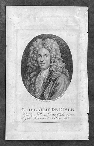
1808 Jean Henri Cless Antique Print of The Cartographer Guillaume Delisle
Antique Map
- Title : Guillaue De L Isle Geb. zu Paris d. 28 Febr. 1675 gest. ebendas d. 25 Jan 1726
- Date : 1808
- Size: 7in x 4 1/2in (180mm x 115mm)
- Condition: (A+) Fine Condition
- Ref: 91417
Description:
This original copper-plate engraved antique print, a portrait of the famous cartographer Guillaume Delisle, by Jean Henri Cless was published in 1808 in Allgemeine Geographische Ephemeriden' (Universal Geographical Ephemerides (i.e. encyclopedia) by Friedrich Bertuch
General Definitions:
Paper thickness and quality: - Heavy and stable
Paper color : - off white
Age of map color: -
Colors used: -
General color appearance: -
Paper size: - 7in x 4 1/2in (180mm x 115mm)
Plate size: - 5 1/2in x 3 1/2in (140mm x 90mm)
Margins: - Min 1/2in (12mm)
Imperfections:
Margins: - None
Plate area: - None
Verso: - None
Background:
Following the long period of Dutch domination, the Homann family became the most important map publishers in Germany in the eighteenth century, the business being founded by J.B. Homann in Nuremberg about the year 1702. Soon after publishing his first atlas in 1707 he became a member of the Berlin academy of Sciences and in 1715 he was appointed Geographer to the Emperor. After the founder's death in 1724, the firm was continued under the direction of his son until 1730 and was then bequeathed to his heirs on the condition that it trades under the name of Homann Heirs. The firm remained in being until the next century and had a wide influence on map publishing in Germany. Apart from the atlases the firm published a very large number of individual maps.
The Homman's produced a Neuer Atlas in 1714, a Grosser Atlas in 1737, and an Atlas Maior with about 300 maps in 1780. They also issued a special Atlas of Germany with full sized plans of principal cities, school atlases and an Atlas of Silesia in 1750 with 20 maps.
Cless, Jean Henri 1774- 1812
A pupil of Jacques-Louis David , he began to be active around 1800 and exhibited in Paris at the Salons from 1804 to 1808.
According to the Thieme-Becker 2 artistic dictionary , he returned to Alsace in 1811 , where many private collections hold his works.
Cless was also a draftsman and miniaturist .
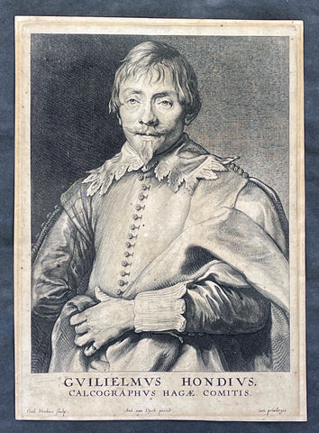
1635 Willem Hondius & Anthony van Dyck Portait of Willem Hondius son of Jodocus
Antique Map
- Title : Guilielmus Hondius, Calcographus Hagae Comitis. Ant. van Dyck pinxit, Guil. Hondius sculp
- Date : 1630-40
- Size: 9 3/4in x 7in (250mm x 180mm)
- Condition: (A) Very Good Condition
- Ref: 91420
Description:
This original copper-plate engraved antique print of Guillaume Hondius, was engraved by himself (Guillaume Hondius) after the famous Flemish painter Anthony van Dyck 1599 - 1641 as part of his Iconographie series of engraved portraits of famous people at the time, between 1630-40.
A wonderfully detailed and charismatic portrait, this exquisite work illustrates the technical mastery and artistic vision of Van Dyck. Guillaume Hondius' stately yet approachable expression reflects Van Dyck's refined ability to comfort and relax his subjects, resulting in a realistic and acute portrait. This piece is intriguing because the subject and the engraver are one and the same, yet the image essentially is still Van Dyck's. Guillaumine Hondius engraves himself through the eyes of Van Dyck, depicted with kind eyes, a broad nose, and a pointy chin. Hondius stands with a calm demeanor, holding up his elaborately draped garment with his left hand and gazing straight out at us.
General Definitions:
Paper thickness and quality: - Heavy and stable
Paper color : - off white
Age of map color: -
Colors used: -
General color appearance: -
Paper size: - 9 3/4in x 7in (250mm x 180mm)
Plate size: - 9 3/4in x 7in (250mm x 180mm)
Margins: - Min 1/2in (12mm)
Imperfections:
Margins: - Age toning
Plate area: - Age toning
Verso: - Dark age toning
Background:
Anthony van Dyck (also spelled van Dyke) was a renowned Flemish Baroque painter born on March 22, 1599, in Antwerp, Belgium, and died on December 9, 1641, in London, England. He is widely regarded as one of the most influential portrait painters of his time, known for his elegant and refined style.
Van Dyck showed great artistic talent from a young age and began his artistic training under the guidance of Hendrick van Balen, a local painter in Antwerp. Recognizing his potential, his parents enrolled him as an apprentice with Peter Paul Rubens, the leading Flemish painter of the time. Van Dyck spent six years in Rubens' studio, absorbing the master's techniques and developing his own skills.
By the age of 19, van Dyck had already established himself as an accomplished artist and was admitted as a master to the Antwerp Guild of Saint Luke. He primarily focused on religious and mythological subjects during his early years, reflecting the influence of Rubens' style. However, van Dyck soon turned his attention to portraiture, a genre that would bring him great success and recognition.
In the early 1620s, van Dyck traveled to Italy, where he spent several years studying the works of Italian Renaissance masters such as Titian and Tintoretto. This period of Italian sojourn greatly influenced his artistic style, leading to a refinement and sophistication in his portraiture. He became particularly renowned for his ability to capture the personality and character of his sitters, employing a sensitive and flattering approach.
Upon his return to Antwerp in 1627, van Dyck's reputation as a portraitist had grown significantly, attracting commissions from aristocrats, nobles, and prominent figures of the time. His portraits exuded a sense of grandeur and elegance, often featuring his subjects in elaborate costumes and settings. Van Dyck's remarkable talent for capturing the likeness and personality of his sitters earned him patrons and clients across Europe.
In 1632, van Dyck was invited to England by King Charles I, who had heard of his remarkable skill as a portrait painter. He was appointed as the court artist and granted a knighthood, becoming Sir Anthony van Dyck. During his time in England, van Dyck produced numerous portraits of the royal family, aristocracy, and influential figures of the British court. His ability to convey grace, poise, and nobility in his subjects revolutionized the art of portraiture in England.
Van Dyck's impact on English art was profound, and he played a crucial role in elevating the status of portrait painting within the art world. His influence extended beyond his lifetime, as many English portraitists were inspired by his style and approach. Van Dyck's legacy can be seen in the works of later artists such as Thomas Gainsborough, Joshua Reynolds, and Thomas Lawrence.
Despite his success, van Dyck's life was plagued by financial troubles and personal difficulties. He led a lavish lifestyle and accumulated significant debts, which he struggled to repay. Moreover, his health deteriorated in his later years, possibly due to the strain of his extensive work. Van Dyck passed away in London at the age of 42, leaving behind a rich artistic legacy.
Anthony van Dyck's mastery of portraiture, characterized by his skillful rendering of his subjects' individuality and his elegant style, has made him one of the most celebrated painters in art history. His works continue to be admired and studied, serving as a testament to his enduring influence and artistic brilliance.
Hondius, Guillaume or Willem (1598/9 - 1658/60)
Willem Hondius was one of seven children of Hendrik Hondius the Elder (1573 – c. 1649) and Sara Jansdochter. His father was one of the most important Dutch reproductive printmakers and publishers in the early 17th century. A connection with the Hondius family of cartographers in Amsterdam is possible but has not been established.
In 1636 Willem visited Danzig in Poland. In 1641 he moved there from The Hague for good. Hondius was supported at the royal court of King Władysław IV Waza. The King awarded him the title of Chalcographus privilegialus (privileged engraver) and Chalcographus Regius (Royal engraver).
He was married twice, first in 1632 in The Hague to Kornelia van den Enden, secondly in 1646 in Danzig to Anna Mackensen, daughter of the Royal Goldsmith.
In August 1651, in the wake of the Khmelnytsky Uprising, Hondius joined the army of Janusz Radziwiłł conquering Kiev. The first ever portrait of the famous Cossack leader Bohdan Khmelnytsky was engraved during this campaign.
Nothing is known of Hondius after 1652, though he may have lived until 1658.
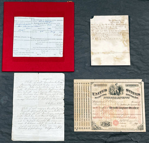
1851-1891 Original Antique Virginian American Civil War Documents F. Beckham, M D Ball, D Coffman
Antique Map
-
Title :
1. The Commonwealth of Virginia
2. Fairfax County Va April 15th 1861.
3. State of West Virginia Green brier co. June 11th 1866.
4. United States Stamp for Special Tax Internal Revenue. - Date : 1851-1891
- Size: Please view description below
- Condition: (A) Good Condition
- Ref: 27090
Description:
We have on offer a group of 4 original antique documents, three of which relate directly to Virginia and the American Civil War dated 1851,1861, 1866. The first two documents concern Fontaine Beckham & Mottrom Dulany Ball with the third relating to Daniel Coffman. These three are very interesting and scarce items.
The fourth document relates to the Internal Revenue Service in 1891. Details, descriptions and conditions below.
1. Printed court summons signed by Fontaine Beckham (1788-1859) as justice of the peace, Jefferson County, Virginia, 8 January 1851. Printed sheet completed in manuscript, signed 'F Beckham'.
Fontaine Beckham was mayor of Harpers Ferry during the raid by John Brown in 1859 with Beckham infamously shot and killed during the raid, making him possibly one of the first casualties of the American Civil War.
Condition: Mounted on red-velvet-covered thick card mount, sheet torn at lower right-hand corner not affecting text. Condition Good. - 7in x 53/4in (18 x 14.6 cm)
Fontaine Beckham (1788-1859) was mayor of Harpers Ferry, Virginia, and local agent for the Baltimore and Ohio Railroad. He was shot and killed in the famous raid on the small outpost by abolitionist John Brown, today seen as a major event in the build-up to the American Civil War.
...... Beckham was the most prominent man killed during John Brown's raid on Harpers Ferry, being the town's mayor, a county magistrate (in which capacity he signs this document), and a station agent for the B & O Railroad. Despite being a slave owner himself, Beckham was quite well-liked and considered by most to be a friend and benefactor of black men. He maintained a close friendship with his former slave Heyward Shepard, who also died during the raid.. After Shepard's death, some accounts state the mayor exposed himself to fire due to his clouded judgment. After Beckham's death, the infuriated town's people seized one of John Brown's imprisoned men, riddling his body with bullets. Yet Beckham's death also resulted in the only lasting freeing of slaves accomplished by the raid, as his will stipulated the freeing of five of his slaves......)
2. Manuscript receipt for the purchase of 'negro slaves Dennis and Belinda', Fairfax County, Virginia, signed by a member of a prominent local family, Mrs. M C(sic) Ball, dated 15 April 1861. We believe this to a transaction by Mary Ball, the mother of the first Governor of Alaska, Mottrom Dulany Ball, who at the time was have been fighting for the confederacy. The verso of the receipt is marked for Dulany, (as he was sometimes known) who would have been considered the head of the family after the death of his farther in 1859. Single bifolium of heavy woven paper, 10 lines, written on one side only, conjugate leaf docketed 'Dulany'
Condition: Damp-stained, creased from folding, loss to upper inner corner. Although stained the parchment is stable and heavy. Condition Good.
- 7 1/2in x 53/4in (18.2 x 13.8 cm)
Mottrom Dulany Ball, of Fairfax County, Fairfax Court House, and Alexandria, Virginia, was a musician, poet, teacher, lawyer, soldier and a founding father of the State of Alaska. Mottrom Dulany Ball, who was known variously as Mott, M.Dulany, or M.D., was born at Oak Mount, the home of his grandfather, Daniel French Dulany, in Fairfax County, Virginia on June 23, 1835.
Mott was the son of Spencer Mottrom Ball and Mary L. Dulany. Both parents were from prominent Virginia families. President George Washington is included among their many distinguished relatives. Mott’s early years were spent at his grandfather, Mottrom Ball’s, plantation, Woodberry, near Lewinsville, Fairfax County, Virginia. The elder Mottrom Ball was a physician who was educated at the University of Glasgow, in Scotland. TheBall family estate, Woodberry, consisted of 1,200 acres of land, rectangular in shape, extending north from the Lewinsville Presbyterian Church all the way to the to the Potomac River. 2, 3 The extensive plantation included a grist mill, Ball’s Mill, which stood on Scott’s Run. The location is today known as Swink’s Mill.4 Modern day Ball’s Hill Road traces the path of a farm road which ran through the center of Woodberry ending at the family home, Elmwood, on Ball’s Hill, also known as Prospect Hill, just south of Georgetown Pike.5 Politically, Mott’s father, Spencer Mottrom Ball, was an Anti-Jacksonian. As the name implies, this party was opposed to the authoritarian policies of President Andrew Jackson and his Democratic party. Several anti-Jacksonian factions came together to form the Whig party in 1834. Whigs supported the supremacy of Congress over the presidency.....)
3. Contemporary manuscript copy of two affidavits, one the same sheet, confirming Daniel Coffman to have been a loyal man during the rebelion [sic]', Greenbrier County, West Virginia, 1866.
Single sheet of lined paper written recto only, small embossed stamp depicting the Capitol Building and with text 'Congress' various inconsistencies in spelling.
Condition: Old folds, central fold just splitting at head, nicked along inner edge. Condition Good.
- 9in x 7in (23.5 x 17.8 cm)
First affidavit.
State of West Virginia Greenbrier Co. June 1866.
Personelly (sic) apparent before me a justice of the Peace John Sydenrtrleker (sic) and made oath that he knew Daniel Coffman to have been a loyal man during the rebellion and consider him the same use (sic) to this time Signed and sworn to before me in my township of fort spring this june 11th 1866...D Coffman JPS.....
Second affidavit.
State of West Virginia Greenbrier Co. June 1866.
Personell (sic) apparent before me a justice of the Peace H H Brackman and made oath that he knew Daniel Coffman to have been a loyal man during the rebellion and he invest (sic) himself the same now and I believe what he said to me
Signed and sworn to befor (sic) me in my township of fort spring...D Coffman JPS.....
The Coffman family have lived in Greenbrier county since the Rev Isaac Coffman 1741 - 1824, buried in the Coffman Cemetery, Ronceverte, West Virginia.
4. Internal Revenue receipt 'for special tax on the business of retail liquor dealer', paid by R. D. Burns of Lynchburg, Virginia, 9 December 1891 Engraved receipt in red and black, completed in manuscript.
Condition: Aged, small hole to lower left, upper right corner chipped. Condition Good. - 9 3/4in x 7 1/4in (24.5 x 18 cm)
General Definitions:
Please view description above
Imperfections:
Please view description above
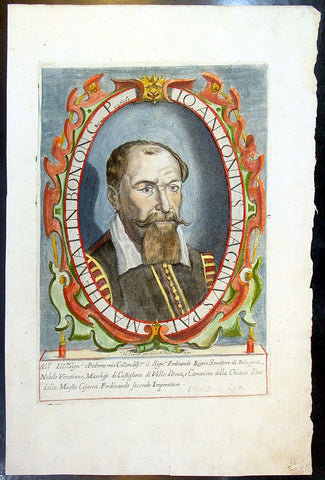
1632 Henricus David Large Antique Portrait of Cartographer Giovanni A Magini
Antique Map
- Title : Io. Antonius Maginus Pat. Mathemat. In Bonon. Gymn. Profess
- Date : 1632
- Condition: (A+) Fine Condition
- Ref: 80766
- Size: 17 1/2in x 11in (445mm x 280mm)
Description:
This fine beautifully hand coloured original antique portrait of the Italian Cartographer Giovanni Antonio Magini was engraved by Henricus David in 1632 - date is engraved below portrait.
Giovanni Antonio Magini (1555-1617) was an Italian mathematician, cartographer and Professor of Astronomy in Bologna. He is responsible for publishing an edition ofPtolemy's Geographia in 1596 that contained 27 maps of the ancient world drawn from the text of Claude Ptolemy, along with 27 contemporary or modern maps. His maps were used by Blaeu in 1640. (Ref: Tooley; M&B)
General Description:
Paper thickness and quality: - Heavy and stable
Paper color: - off white
Age of map color: - Original
Colors used: - Yellow, green, red, brown.
General color appearance: - Fresh
Paper size: - 17 1/2in x 11in (445mm x 280mm)
Plate size: - 12n x 8 1/2in (305mm x 215mm)
Margins: - Min 1in (25mm)
Imperfections:
Margins: - Light dis-colouration in top margin
Plate area: - None
Verso: - None
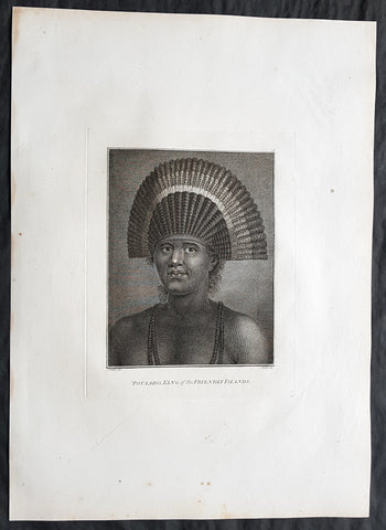
1784 Cook & Webber Large 1st Edition Antique Portrait of Poulaho King of Tonga
Antique Map
- Title : Poulaho, King of the Friendly Islands.
- Size: 21in x 15in (535mm x 385mm)
- Condition: (A+) Fine Condition
- Date : 1784
- Ref #: 82070
Description:
This large beautifully engraved original copper-plate 1st edition antique portrait of Fatafehi Paulaho, the Tui Tonga or Tongan King, visited by Captain Cook in 1777 by John Webber (Cooks official artist on the voyage) was published for the 1784 1st edition and official British Admiralty sanctioned account of Captain Cook’s third and final voyage along with that of Cooks successor Capt. James King......
A Voyage to the Pacific Ocean. Undertaken, by the Command of his Majesty, for making Discoveries in the Northern Hemisphere. To determine The Position and Extent of the West Side of North America; its Distance from Asia; and the Practicability of a Northern Passage to Europe. Performed under the direction of Captains Cook, Clerke, and Gore, In His Majesty\'s Ships the Resolution and Discovery. In the Years 1776, 1777, 1778, 1779, and 1780. In Three Volumes. Vol. I and II written by James Cook, F.R.S. Vol. III by Captain James King, LL.D. and F.R.S
Cooks diary ......On the 28th May 1777, as Cook was about to leave, Ha apai Paulaho came on board and brought me one of their Caps made or at least covered with red feathers. ..These Caps or rather bonnets are made of the tail feathers of the Tropic bird with red feathers of the Paroquets worked upon them or in along with them, they are made so as to tie upon the forehead without any Crown, and have the form of a Semicircle whose raids is 18 or 21 Inches. Cook Journals III, i.117.
Cook had described Paulaho as \\\'the corperate plump fellow we had met with\\\'.
......About Noon a large sailing Canoe came under our Stern in which the Indians on board told us was Fattafee Polaho [Fatafehi Paulaho] King of all the Isles. He brought with him as a present to me two good fat hogs, though not so fat as himself, for he was the most corperate plump fellow we had met with. I found him to be a Sedate sensible man… I asked him down into the Cabbin, some of his attendants objected to this, saying if he went there people would walk over his head and this was never done. I desired Omai to till them I would remove that objection by giving orders that no one should walk on that part of the deck but the chief \'waved the ceremony and walked down with me without any more to do.....
General Definitions:
Paper thickness and quality: - Heavy and stable
Paper color : - off white
Age of map color: -
Colors used: -
General color appearance: -
Paper size: - 21in x 15in (535mm x 385mm)
Plate size: - 21in x 15in (535mm x 385mm)
Margins: - Min 1/2in (12mm)
Imperfections:
Margins: - None
Plate area: - None
Verso: - None
Background:
Tonga officially the Kingdom of Tonga, is a Polynesian sovereign state and archipelago comprising 169 islands, of which 36 are inhabited. The total surface area is about 750 square kilometres (290 sq mi) scattered over 700,000 square kilometres (270,000 sq mi) of the southern Pacific Ocean. It has a population of 107,122 people, of whom 70% reside on the main island of Tongatapu.
The Tongan people first encountered Europeans in 1616 when the Dutch vessel Eendracht, captained by Willem Schouten, made a short visit to trade. Later came other Dutch explorers, including Jacob Le Maire (who called on the northern island of Niuatoputapu); and in 1643 Abel Tasman (who visited Tongatapu and Haapai).
Later noteworthy European visitors included James Cook (Royal Navy) in 1773, 1774, and 1777; Alessandro Malaspina (Spanish Navy) in 1793; the first London missionaries in 1797; and the Wesleyan Methodist Reverend Walter Lawry in 1822.
Tonga became known in the West as the Friendly Islands because of the congenial reception accorded to Captain James Cook on his first visit in 1773. He arrived at the time of the inasi festival, the yearly donation of the First Fruits to the Tui Tonga (the islands paramount chief) and so received an invitation to the festivities. According to the writer William Mariner, the chiefs wanted to kill Cook during the gathering but could not agree on a plan.
Captain James King FRS 1750 – 1784 was an officer of the Royal Navy. He served under James Cook on his last voyage around the world, specialising in taking important astronomical readings using a sextant. After Cook died he helped lead the ships on the remainder of their course, also completing Cooks account of the voyage. He continued his career in the Navy, reaching the rank of post-captain, commanding several ships and serving in the American War of Independence.
King joined HMS Resolution as second lieutenant, sharing the duties of astronomer with Cook, taking astronomical observations on board by sextant and with Larcum Kendals timekeeper K1, to establish the Resolutions position at sea and on shore by sextant or by astronomical quadrant to establish the geographical position of salient points during the course of Cooks surveys. Thus Kings geographical positions were an important contribution to the accuracy of the various surveys carried out during the voyage and his use of the early chronometers helped prove their use at sea for calculation of Longitude. .
Following the death of Cook, King remained in the Resolution but on the death of Charles Clerke, Cooks successor, King was appointed to command HMS Discovery, the Resolutions consort, remaining in her for the rest of the voyage. After his return to England King was very much involved in the publication of the official account of Cooks third voyage, writing the third volume at Woodstock, near Oxford, where his brother Thomas was rector of St Mary Magdalene. But shortly after his return King was promoted Post-captain and appointed commander of HMS Crocodile in the English Channel.
John Webber RA 1751 – 1793 was an English artist who accompanied Captain Cook on his third Pacific expedition. He is best known for his images of Australasia, Hawaii and Alaska.
Webber was born in London, educated in Bern and studied painting at Paris.His father was Abraham Wäber, a Swiss sculptor who had moved to London, and changed his name to Webber before marrying a Mrs Mary Quant in 1744.
Webber served as official artist on James Cooks third voyage of discovery around the Pacific (1776–80) aboard HMS Resolution. At Adventure Bay in January 1777 he did drawings of A Man of Van Diemens Land and A Woman of Van Diemens Land. He also did many drawings of scenes in New Zealand and the South Sea islands. On this voyage, during which Cook lost his life in a fight in Hawaii, Webber became the first European artist to make contact with Hawaii, then called the Sandwich Islands. He made numerous watercolor landscapes of the islands of Kauai and Hawaii, and also portrayed many of the Hawaiian people.
In April 1778, Captain Cooks ships Resolution and Discovery anchored at Ship Cove, now known as Nootka Sound, Vancouver Island, Canada to refit. The crew took observations and recorded encounters with the local people. Webber made watercolour landscapes including Resolution and Discovery in Ship Cove, 1778. His drawings and paintings were engraved for British Admiraltys account of the expedition, which was published in 1784.
Back in England in 1780 Webber exhibited around 50 works at Royal Academy exhibitions between 1784 and 1792, and was elected an associate of the Royal Academy in 1785 and R.A. in 1791. Most of his work were landscapes. Sometimes figures were included as in A Party from H.M.S. Resolution shooting sea horses, which was shown at the academy in 1784, and his The Death of Captain Cook became well known through an engraving of it. Another version of this picture is in the William Dixson gallery at Sydney
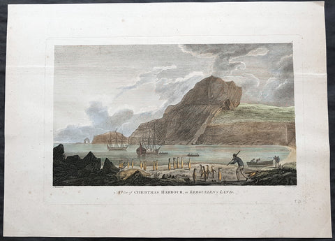
1784 Cook 1st edition Antique Print HMS Resolution & Discovery Xmas Bay, Kerguelen Isle 1776
Antique Map
- Title : A view of Christmas Harbour in Kerguelens Land
- Ref : 31726
- Size: 20in x 14 1/2in (510mm x 370mm)
- Date : 1784
- Condition: (A) Very Good Condition
Description:
This fine original copper-plate engraved antique print of HMS Resolution & Discovery anchored in Christmas Bay, on Kerguelen Islands on Christmas day in 1776, was engraved by James Newton (1748-1804) after a painting by Cooks onboard artist John Webber, during Cooks 3rd & last voyage of Discovery was published in the 1784 1st English edition of Capt. James Cook & Capt. James King A Voyage to the Pacific Ocean. Undertaken, by the Command of his Majesty, for making Discoveries in the Northern Hemisphere. To determine The Position and Extent of the West Side of North America; its Distance from Asia; and the Practicability of a Northen Passage to Europe. Performed under the direction of Captains Cook, Clerke, and Gore, In His Majestys Ships the Resolution and Discovery. In the Years 1776, 1777, 1778, 1779, and 1780. London 1784.
Cook wrote..........I found the shore in a manner covered with Penguins and other birds and Seals…so fearless that we killed as ma(n)y as we chose for the sake of their fat or blubber to make Oil for our lamps and other uses… Here I displayd the British flag and named the harbour Christmas harbour as we entered it on that Festival..... (Journals III, i, 29-32)
General Definitions:
Paper thickness and quality: - Heavy and stable
Paper color : - off white
Age of map color: - Early
Colors used: - Yellow, green, blue, pink
General color appearance: - Authentic
Paper size: - 20in x 14 1/2in (510mm x 370mm)
Plate size: - 16in x 10 1/2in (410mm x 270mm)
Margins: - Min 1in (25mm)
Imperfections:
Margins: - None
Plate area: - Single heavy vertical crease along top of image, pressed out
Verso: - None
Background:
The Kerguelen Islands, sometimes called the Desolation Islands, are located in the southern Indian Ocean and were discovered by the French navigator Yves de Kerguelen-Trémarec in 1772. On Christmas Day, 1776 Cook’s ships Resolution and Discovery anchored in Oiseau Bay, which he named Christmas Harbour. Cook\'s men discovered a bottle containing a message in Latin left by Kerguelen\'s men. Cook wrote in his log: “I could have very properly called the island Desolation Island to signalise its sterility, but in order not to deprive M. de Kerguelen of the glory of having discovered it, I have called it Kerguelen Land.”
The Kerguelen Islands or the Kerguelen Archipelago are located in the southern Indian Ocean. The main island, Grande Terre, is 6,675 km² and it is surrounded by another 300 smaller islands and islets, forming an archipelago of 7,215 km². The climate is cold and very windy and the seas are usually rough. The islands are part of a submarine large igneous province called the Kerguelen Plateau.
Captain James King FRS 1750 – 1784 was an officer of the Royal Navy. He served under James Cook on his last voyage around the world, specialising in taking important astronomical readings using a sextant. After Cook died he helped lead the ships on the remainder of their course, also completing Cooks account of the voyage. He continued his career in the Navy, reaching the rank of post-captain, commanding several ships and serving in the American War of Independence.
King joined HMS Resolution as second lieutenant, sharing the duties of astronomer with Cook, taking astronomical observations on board by sextant and with Larcum Kendals timekeeper K1, to establish the Resolutions position at sea and on shore by sextant or by astronomical quadrant to establish the geographical position of salient points during the course of Cooks surveys. Thus Kings geographical positions were an important contribution to the accuracy of the various surveys carried out during the voyage and his use of the early chronometers helped prove their use at sea for calculation of Longitude. .
Following the death of Cook, King remained in the Resolution but on the death of Charles Clerke, Cooks successor, King was appointed to command HMS Discovery, the Resolutions consort, remaining in her for the rest of the voyage. After his return to England King was very much involved in the publication of the official account of Cooks third voyage, writing the third volume at Woodstock, near Oxford, where his brother Thomas was rector of St Mary Magdalene. But shortly after his return King was promoted Post-captain and appointed commander of HMS Crocodile in the English Channel.
John Webber RA 1751 – 1793 was an English artist who accompanied Captain Cook on his third Pacific expedition. He is best known for his images of Australasia, Hawaii and Alaska.
Webber was born in London, educated in Bern and studied painting at Paris.His father was Abraham Wäber, a Swiss sculptor who had moved to London, and changed his name to Webber before marrying a Mrs Mary Quant in 1744.
Webber served as official artist on James Cook\\\'s third voyage of discovery around the Pacific (1776–80) aboard HMS Resolution. At Adventure Bay in January 1777 he did drawings of A Man of Van Diemens Land and A Woman of Van Diemens Land. He also did many drawings of scenes in New Zealand and the South Sea islands. On this voyage, during which Cook lost his life in a fight in Hawaii, Webber became the first European artist to make contact with Hawaii, then called the Sandwich Islands. He made numerous watercolor landscapes of the islands of Kauai and Hawaii, and also portrayed many of the Hawaiian people.
In April 1778, Captain Cooks ships Resolution and Discovery anchored at Ship Cove, now known as Nootka Sound, Vancouver Island, Canada to refit. The crew took observations and recorded encounters with the local people. Webber made watercolour landscapes including Resolution and Discovery in Ship Cove, 1778. His drawings and paintings were engraved for British Admiraltys account of the expedition, which was published in 1784.
Back in England in 1780 Webber exhibited around 50 works at Royal Academy exhibitions between 1784 and 1792, and was elected an associate of the Royal Academy in 1785 and R.A. in 1791. Most of his work were landscapes. Sometimes figures were included as in A Party from H.M.S. Resolution shooting sea horses\\\", which was shown at the academy in 1784, and his The Death of Captain Cook became well known through an engraving of it. Another version of this picture is in the William Dixson gallery at Sydney
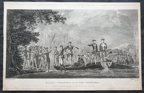
1777 Capt Cook Antique Print View of Cook Landing on Malakula Island, Vanuatu in 1774
Antique Map
- Title : The Landing at Mallicolo one of the New Hebrides...Published Feb 1st 1777 by Wm. Strahan
- Ref : 91223
- Size: 19in x 12 ½in (485mm x 320mm)
- Date : 1777
- Condition: (A) Very Good Condition
Description:
This fine original copper-plate engraved antique print of Captain James Cook & his men landing on the Island of Malakula (Mallicolo) in the Vanuatu group of Islands in the South Pacific, visited by Cook during his 2nd Voyage of Discovery to the South Seas in 1774, was engraved by James Basire - after William Hodges - and was published in Captain James Cooks 1777 edition of A voyage towards the South Pole, and round the World. Performed in His Majestys ships the Resolution and Adventure, in the years 1772, 1773, 1774, and 1775. printed by William Strahan, New Street, Shoe Lane, & Thos. Cadell, in the Strand, London 1777.
General Definitions:
Paper thickness and quality: - Heavy and stable
Paper color : - off white
Age of map color: -
Colors used: -
General color appearance: -
Paper size: - 19in x 12 ½in (485mm x 320mm)
Plate size: - 19in x 12in (480mm x 305mm)
Margins: - Min 1/2in (12mm)
Imperfections:
Margins: - None
Plate area: - Two very small worm holes
Verso: - None
Background:
Malakula Island also spelled Malekula, is the second-largest island in the nation of Vanuatu, in the Pacific Ocean region of Melanesia.
First discovered by the Spanish expedition of Pedro Fernández de Quirós in 1606 and visited by Captain James Cook in 1774.
Vanuatu officially the Republic of Vanuatu is a Pacific island nation located in the South Pacific Ocean. The archipelago, which is of volcanic origin, is 1,750 kilometres east of northern Australia, 540 kilometres northeast of New Caledonia, east of New Guinea, southeast of the Solomon Islands, and west of Fiji.
Vanuatu was first inhabited by Melanesian people. The first Europeans to visit the islands were a Spanish expedition led by Portuguese navigator Fernandes de Queirós, who arrived on the largest island in 1606. Since the Portuguese and Spanish monarchies had been unified under the king of Spain in 1580 (following the vacancy of the Portuguese throne, which lasted for sixty years, until 1640, when the Portuguese monarchy was restored), Queirós claimed the archipelago for Spain, as part of the colonial Spanish East Indies, and named it La Austrialia del Espiritu Santo.
The Vanuatu group of islands first had contact with Europeans in 1606, when the Portuguese explorer Pedro Fernandes de Queiros, sailing for the Spanish Crown, arrived on the largest island and called the group of islands La Austrialia del Espiritu Santo or The Southern Land of the Holy Spirit, believing he had arrived in Terra Australis or Australia. The Spanish established a short-lived settlement at Big Bay on the north side of the island. The name Espiritu Santo remains to this day.
Europeans did not return until 1768, when Louis Antoine de Bougainville rediscovered the islands on 22 May, naming them the Great Cyclades. In 1774, Captain Cook named the islands the New Hebrides, a name that would last until independence in 1980.
William Hodges RA 1744 – 1797 was an English painter. He was a member of James Cooks second voyage to the Pacific Ocean, and is best known for the sketches and paintings of locations he visited on that voyage, including Table Bay, Tahiti, Easter Island, and the Antarctic.
Between 1772 and 1775 Hodges accompanied James Cook to the Pacific as the expeditions artist. Many of his sketches and wash paintings were adapted as engravings in the original published edition of Cooks journals from the voyage.
Most of the large-scale landscape oil paintings from his Pacific travels for which Hodges is best known were finished after his return to London; he received a salary from the Admiralty for the purposes of completing them. These paintings depicted a stronger light and shadow than had been usual in European landscape tradition. Contemporary art critics complained that his use of light and colour contrasts gave his paintings a rough and unfinished appearance.
Hodges also produced many valuable portrait sketches of Pacific islanders and scenes from the voyage involving members of the expedition.
James Basire 1730–1802, also known as James Basire Sr., was an English engraver. He is the most significant of a family of engravers, and noted for his apprenticing of the young William Blake.
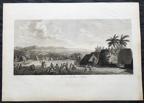
1784 Cook & Webber Large Antique Print of a Village on Kauai Island, Hawaii - Ist Edition
Antique Map
- Title : An Island View, in Atooi
- Size: 21in x 15in (535mm x 385mm)
- Condition: (A+) Fine Condition
- Date : 1784
- Ref #: 82065
Description:
This large original 1st edition copper-plate engraved antique print of a village the Hawaiian Island of Kauai (Atooi) visited by Captain Cook in 1778 was drawn by the official artist on Cooks crew, John Webber, and later published for the 1784 1st edition and official British Admiralty sanctioned account of Captain Cook’s third and final voyage along with that of Cooks successor Capt. James King......
A Voyage to the Pacific Ocean. Undertaken, by the Command of his Majesty, for making Discoveries in the Northern Hemisphere. To determine The Position and Extent of the West Side of North America; its Distance from Asia; and the Practicability of a Northern Passage to Europe. Performed under the direction of Captains Cook, Clerke, and Gore, In His Majesty\'s Ships the Resolution and Discovery. In the Years 1776, 1777, 1778, 1779, and 1780. In Three Volumes. Vol. I and II written by James Cook, F.R.S. Vol. III by Captain James King, LL.D. and F.R.S
Captain Cook arrived at the island of Atooi (Kauai) Hawaii on the 19th of January, 1778 and stayed until 23rd January. On the 21st January, Cook accompanied by John Webber, proceeded inland from their beach side anchorage to Waimea, on the south coast of Kauai. Their intention was to examine elevated objects visible from the ship. It proved to be a morai, or temple similar to ones they had seen in Tahiti and other South Pacific islands. This structure was nearly 20-feet high and covered in a thin, light-grey cloth, which likely had ceremonial significance. The temple rested on a platform and consisted of thousands of rough-edged lava rock piled in a tight, mortarless fashion. In the center is the spindly-legged oracle tower, where the priest (kahuna) might seek counsel or pray. Carved figures with tapa and leaf offerings are seen outside thatched huts topped with pili, the tall grass that grew throughout the lowlands. In his journal, Cook took particular note of several stone objects he had observed:
Cooks Journals - January 21, 1778
...........about the middle of the Morai, there were three of these places in line. We were told three chiefs had been buried there, and before them was another that was oblong. This they called Tanga (taboo or kapu in Hawaiian) and gave us clearly to understand that three human sacrifices had been buried there, that is, one at the burial of each chief.
General Definitions:
Paper thickness and quality: - Heavy and stable
Paper color : - off white
Age of map color: -
Colors used: -
General color appearance: -
Paper size: - 21in x 15in (535mm x 385mm)
Plate size: - 21in x 15in (535mm x 385mm)
Margins: - Min 1/2in (12mm)
Imperfections:
Margins: - Light soiling in margins
Plate area: - None
Verso: - None
Background:
Kauai is geologically the oldest of the main Hawaiian Islands. In 1778, Captain James Cook arrived at Waimea Bay, the first European known to have reached the Hawaiian islands. He named the archipelago after his patron the 6th Earl of Sandwich, George Montagu
Hawaii is the 50th and most recent state to have joined the United States of America, having received statehood on August 21, 1959. Hawaii is the only U.S. state located in Oceania and the only one composed entirely of islands. It is the northernmost island group in Polynesia, occupying most of an archipelago in the central Pacific Ocean. Hawaii is the only U.S. state located outside North America.
It is possible that Spanish explorers arrived in the Hawaiian Islands in the 16th century—200 years before Captain James Cook\\\\\\\'s first documented visit in 1778. Ruy López de Villalobos commanded a fleet of six ships that left Acapulco in 1542 bound for the Philippines with a Spanish sailor named Juan Gaetano aboard as pilot. Depending on the interpretation, Gaetanos reports describe an encounter with either Hawaii or the Marshall Islands. If de Villalobos crew spotted Hawaii, Gaetano would be considered the first European to see the islands. Some scholars have dismissed these claims due to a lack of credibility.
Spanish archives contain a chart that depicts islands at the same latitude as Hawaii but with a longitude ten degrees east of the islands. In this manuscript, the island of Maui is named La Desgraciada (The Unfortunate Island), and what appears to be Hawaii Island is named La Mesa (The Table). Islands resembling Kahoolawe, Lanai, and Molokai are named Los Monjes (The Monks). For two-and-a-half centuries, Spanish galleons crossed the Pacific from Mexico along a route that passed south of Hawaii on their way to Manila. The exact route was kept secret to protect the Spanish trade monopoly against competing powers.
The 1778 arrival of British explorer James Cook was the first documented contact by a European explorer with Hawaii. Cook named the archipelago as the Sandwich Islands in honor of his sponsor John Montagu, 4th Earl of Sandwich. Cook published the islands location and rendered the native name as Owyhee. This spelling lives on in Owyhee County, Idaho. It was named after three native Hawaiian members of a trapping party who went missing in that area. The Owyhee Mountains were also named for them
Cook visited the Hawaiian Islands twice. As he prepared for departure after his second visit in 1779, a quarrel ensued as Cook took temple idols and fencing as firewood and a minor chief and his men took a ship\\\\\\\'s boat. Cook abducted the King of Hawaii Island, Kalani ōpu u, and held him for ransom aboard his ship in order to gain return of Cook\\\\\\\'s boat. This tactic had worked in Tahiti and other islands. Instead, Kalani ōpu u s supporters fought back, killing Cook and four marines as Cooks party retreated along the beach to their ship. They departed without the ships boat.
Captain James King FRS 1750 – 1784 was an officer of the Royal Navy. He served under James Cook on his last voyage around the world, specialising in taking important astronomical readings using a sextant. After Cook died he helped lead the ships on the remainder of their course, also completing Cooks account of the voyage. He continued his career in the Navy, reaching the rank of post-captain, commanding several ships and serving in the American War of Independence.
King joined HMS Resolution as second lieutenant, sharing the duties of astronomer with Cook, taking astronomical observations on board by sextant and with Larcum Kendals timekeeper K1, to establish the Resolutions position at sea and on shore by sextant or by astronomical quadrant to establish the geographical position of salient points during the course of Cooks surveys. Thus Kings geographical positions were an important contribution to the accuracy of the various surveys carried out during the voyage and his use of the early chronometers helped prove their use at sea for calculation of Longitude. .
Following the death of Cook, King remained in the Resolution but on the death of Charles Clerke, Cooks successor, King was appointed to command HMS Discovery, the Resolutions consort, remaining in her for the rest of the voyage. After his return to England King was very much involved in the publication of the official account of Cooks third voyage, writing the third volume at Woodstock, near Oxford, where his brother Thomas was rector of St Mary Magdalene. But shortly after his return King was promoted Post-captain and appointed commander of HMS Crocodile in the English Channel.
John Webber RA 1751 – 1793 was an English artist who accompanied Captain Cook on his third Pacific expedition. He is best known for his images of Australasia, Hawaii and Alaska.
Webber was born in London, educated in Bern and studied painting at Paris.His father was Abraham Wäber, a Swiss sculptor who had moved to London, and changed his name to Webber before marrying a Mrs Mary Quant in 1744.
Webber served as official artist on James Cooks third voyage of discovery around the Pacific (1776–80) aboard HMS Resolution. At Adventure Bay in January 1777 he did drawings of A Man of Van Diemens Land and A Woman of Van Diemens Land. He also did many drawings of scenes in New Zealand and the South Sea islands. On this voyage, during which Cook lost his life in a fight in Hawaii, Webber became the first European artist to make contact with Hawaii, then called the Sandwich Islands. He made numerous watercolor landscapes of the islands of Kauai and Hawaii, and also portrayed many of the Hawaiian people.
In April 1778, Captain Cooks ships Resolution and Discovery anchored at Ship Cove, now known as Nootka Sound, Vancouver Island, Canada to refit. The crew took observations and recorded encounters with the local people. Webber made watercolour landscapes including Resolution and Discovery in Ship Cove, 1778. His drawings and paintings were engraved for British Admiraltys account of the expedition, which was published in 1784.
Back in England in 1780 Webber exhibited around 50 works at Royal Academy exhibitions between 1784 and 1792, and was elected an associate of the Royal Academy in 1785 and R.A. in 1791. Most of his work were landscapes. Sometimes figures were included as in A Party from H.M.S. Resolution shooting sea horses, which was shown at the academy in 1784, and his The Death of Captain Cook became well known through an engraving of it. Another version of this picture is in the William Dixson gallery at Sydney
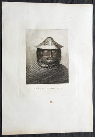
1784 Cook & Webber Large Antique Print of a Man of Prince William Sound, Alaska
Antique Map
- Title : A Man of Prince William Sound
- Size: 21in x 15in (535mm x 385mm)
- Condition: (A+) Fine Condition
- Date : 1784
- Ref #: 82072
Description:
This large beautifully engraved original copper-plate 1st edition antique portrait of a man of Prince William Sound Alaska, visited by Captain Cooks ships HMS Resolution and Discovery in Snug Corner Cove, Prince William Sound, Alaska, in 1778 was drawn by the official artist on Cooks crew, John Webber, and later published for the 1784 1st edition and official British Admiralty sanctioned account of Captain Cook’s third and final voyage along with that of Cooks successor Capt. James King......
A Voyage to the Pacific Ocean. Undertaken, by the Command of his Majesty, for making Discoveries in the Northern Hemisphere. To determine The Position and Extent of the West Side of North America; its Distance from Asia; and the Practicability of a Northern Passage to Europe. Performed under the direction of Captains Cook, Clerke, and Gore, In His Majesty\'s Ships the Resolution and Discovery. In the Years 1776, 1777, 1778, 1779, and 1780. In Three Volumes. Vol. I and II written by James Cook, F.R.S. Vol. III by Captain James King, LL.D. and F.R.S
May 1778.........On the 12th at nine in the morning, wrote Ledyard, we entered an inlet… at six in the evening perceiving bad weather approaching… both ships anchored… The pinnace of the Resolution with the first lieutenant, some other gentlemen and myself went to the opposite shore to shoot some wild fowl. The first lieutenant was John Gore. The inlet was named Sandwich Sound by Cook, after the Earl of Sandwich, First Lord of the Admiralty, but in the published version of his journal the name appeared as Prince Williams Sound, after George IIIs third son, Duke of Clarence, later William IV. The ships had anchored off Cape Hinchinbrook, named after the country seat of the Earl of Sandwich.
Some local inhabitants appeared and came aboard the ships. Clerke gave them a Glass Bowl, with which they seem\\\'d much delighted, and toss\\\'d me, in spight of all my motions to the contrary, one of their Frocks, which was made of Water fowl Skins, and exceedingly well calculated, to keep out both Wet & Cold; then, both Boats put off and made for the Shore, paddling & singing with all the Jollity imaginable. We either found these good folks on of their Jubilee Days, or they are a very happy Race.
They sailed on until Cook found a fine bay or rather harbour which he later called a very snug place and named Snug Corner Bay. Samwell on 14th wrote we secured the Ship with the small Anchor; in carrying this out in the Launch one of the Sailors was so unfortunate as to get his Leg entangled in the Buoy rope which carried him down with the Anchor, however he disengaged himself when he got to the bottom & came up again & saved his Life tho\\\' he had his Leg broke in a very dangerous Manner.
We heeled the ship to port wrote Gilbert, to examine the leak on the starboard buttock… it being close below the wale and occasioned by some of the seems being very open and the oakum quite rotten and great part of it got out. In two days we repaired this defect being obliged to put two and half inch rope along the seams which were too wide for caulking.
On 18th King noted two boats, one with Mr Gore & the other with the Master, were sent away, the first to explore the Inlet to the Noward: the other to the N end of the Island near us to make observations on the tides. William Bligh was master on the Resolution. They returned by Dusk, Mr Gore had proceeded up the Inlet & perceivd that it took a direction to the NE, & he thought that it bid fair for opening a communication to some other Sea; but the mate that was with him form\\\'d a very contrary opinion… the Captn judg\\\'d it the Wisest way to lose no more time, being certain that if we were amongst Islands, we shoud soon come to more Passages. Henry Roberts was the masters mate referred to here. Cook had sent him and others to sketch out the parts they examined.
Background:
Prince William Sound is located on the south coast of the U.S. state of Alaska. It is located on the east side of the Kenai Peninsula, its largest port is Valdez, at the southern terminus of the Trans-Alaska Pipeline System. Other settlements on the sound contain numerous small islands, including Cordova and Whittier plus the Alaska native villages of Chenega and Tatitlek.
James Cook entered Prince William Sound in 1778 and named it Sandwich Sound, after his patron the Earl of Sandwich. The name was changed to honour King George III third son, Prince William Henry, then aged 13 and serving as a midshipman in the Royal Navy.
Captain James King FRS 1750 – 1784 was an officer of the Royal Navy. He served under James Cook on his last voyage around the world, specialising in taking important astronomical readings using a sextant. After Cook died he helped lead the ships on the remainder of their course, also completing Cooks account of the voyage. He continued his career in the Navy, reaching the rank of post-captain, commanding several ships and serving in the American War of Independence.
King joined HMS Resolution as second lieutenant, sharing the duties of astronomer with Cook, taking astronomical observations on board by sextant and with Larcum Kendals timekeeper K1, to establish the Resolutions position at sea and on shore by sextant or by astronomical quadrant to establish the geographical position of salient points during the course of Cooks surveys. Thus Kings geographical positions were an important contribution to the accuracy of the various surveys carried out during the voyage and his use of the early chronometers helped prove their use at sea for calculation of Longitude. .
Following the death of Cook, King remained in the Resolution but on the death of Charles Clerke, Cooks successor, King was appointed to command HMS Discovery, the Resolutions consort, remaining in her for the rest of the voyage. After his return to England King was very much involved in the publication of the official account of Cooks third voyage, writing the third volume at Woodstock, near Oxford, where his brother Thomas was rector of St Mary Magdalene. But shortly after his return King was promoted Post-captain and appointed commander of HMS Crocodile in the English Channel.
John Webber RA 1751 – 1793 was an English artist who accompanied Captain Cook on his third Pacific expedition. He is best known for his images of Australasia, Hawaii and Alaska.
Webber was born in London, educated in Bern and studied painting at Paris.His father was Abraham Wäber, a Swiss sculptor who had moved to London, and changed his name to Webber before marrying a Mrs Mary Quant in 1744.
Webber served as official artist on James Cooks third voyage of discovery around the Pacific (1776–80) aboard HMS Resolution. At Adventure Bay in January 1777 he did drawings of A Man of Van Diemens Land and A Woman of Van Diemens Land. He also did many drawings of scenes in New Zealand and the South Sea islands. On this voyage, during which Cook lost his life in a fight in Hawaii, Webber became the first European artist to make contact with Hawaii, then called the Sandwich Islands. He made numerous watercolor landscapes of the islands of Kauai and Hawaii, and also portrayed many of the Hawaiian people.
In April 1778, Captain Cooks ships Resolution and Discovery anchored at Ship Cove, now known as Nootka Sound, Vancouver Island, Canada to refit. The crew took observations and recorded encounters with the local people. Webber made watercolour landscapes including Resolution and Discovery in Ship Cove, 1778. His drawings and paintings were engraved for British Admiraltys account of the expedition, which was published in 1784.
Back in England in 1780 Webber exhibited around 50 works at Royal Academy exhibitions between 1784 and 1792, and was elected an associate of the Royal Academy in 1785 and R.A. in 1791. Most of his work were landscapes. Sometimes figures were included as in A Party from H.M.S. Resolution shooting sea horses, which was shown at the academy in 1784, and his The Death of Captain Cook became well known through an engraving of it. Another version of this picture is in the William Dixson gallery at Sydney
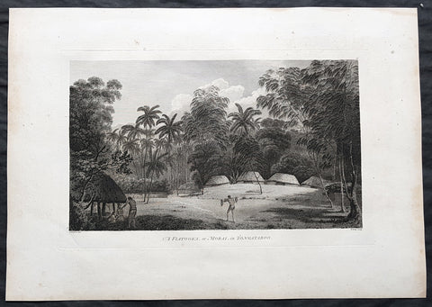
1784 Cook & Webber Large 1st Edition Antique Print Burial Mounds or Langi, Tonga
Antique Map
- Title : A Fiatooka or Morai in Tongataboo
- Size: 21in x 15in (535mm x 385mm)
- Condition: (A+) Fine Condition
- Date : 1784
- Ref #: 82068
Description:
This large beautifully engraved original copper-plate 1st edition antique print of the faitoka or the Royal Langi (burial mounds) in the village of Mua on the main Tongan Island of Tongatapu as seen by Captain James Cook in 1777 and John Webber (Cooks official artist on the voyage) was published for the 1784 1st edition and official British Admiralty sanctioned account of Captain Cook’s third and final voyage along with that of Cooks successor Capt. James King......
A Voyage to the Pacific Ocean. Undertaken, by the Command of his Majesty, for making Discoveries in the Northern Hemisphere. To determine The Position and Extent of the West Side of North America; its Distance from Asia; and the Practicability of a Northern Passage to Europe. Performed under the direction of Captains Cook, Clerke, and Gore, In His Majesty\'s Ships the Resolution and Discovery. In the Years 1776, 1777, 1778, 1779, and 1780. In Three Volumes. Vol. I and II written by James Cook, F.R.S. Vol. III by Captain James King, LL.D. and F.R.S
While on Tongatapu from 10 June to 10 July 1777, Cook and his men recorded Tongan ceremonies and culture. In this view Webber depicts a faitoka (burying ground).
Cooks journal ......\'The Places set apart for burying the dead are raised with Gravel about a foot or two above the level of the Ground, on which stand two or three Houses which are constantly shut up but contain nothing in them; these Ceremonies called in their Language Dano are kept very neat & clean & the Indians are generally despleased at our approaching them.....
General Definitions:
Paper thickness and quality: - Heavy and stable
Paper color : - off white
Age of map color: -
Colors used: -
General color appearance: -
Paper size: - 21in x 15in (535mm x 385mm)
Plate size: - 21in x 15in (535mm x 385mm)
Margins: - Min 1/2in (12mm)
Imperfections:
Margins: - Light soiling
Plate area: - None
Verso: - Light soiling
Background:
Tonga officially the Kingdom of Tonga, is a Polynesian sovereign state and archipelago comprising 169 islands, of which 36 are inhabited. The total surface area is about 750 square kilometres (290 sq mi) scattered over 700,000 square kilometres (270,000 sq mi) of the southern Pacific Ocean. It has a population of 107,122 people, of whom 70% reside on the main island of Tongatapu.
The Tongan people first encountered Europeans in 1616 when the Dutch vessel Eendracht, captained by Willem Schouten, made a short visit to trade. Later came other Dutch explorers, including Jacob Le Maire (who called on the northern island of Niuatoputapu); and in 1643 Abel Tasman (who visited Tongatapu and Haapai).
Later noteworthy European visitors included James Cook (Royal Navy) in 1773, 1774, and 1777; Alessandro Malaspina (Spanish Navy) in 1793; the first London missionaries in 1797; and the Wesleyan Methodist Reverend Walter Lawry in 1822.
Tonga became known in the West as the Friendly Islands because of the congenial reception accorded to Captain James Cook on his first visit in 1773. He arrived at the time of the inasi festival, the yearly donation of the First Fruits to the Tui Tonga (the islands paramount chief) and so received an invitation to the festivities. According to the writer William Mariner, the chiefs wanted to kill Cook during the gathering but could not agree on a plan.
Mu a is a small town in the Hahake (eastern) district on the island of Tongatapu, and it was for centuries the ancient capital of Tonga. It is divided in the villages Lapaha and Tatakamotonga, is close to Talasiu and famous for the ancient langi (royal burial tombs).
Mua was at one time the center of Lapita culture in Tonga (about 2,000 years ago) and later (twelfth to sixteenth century CE) the capital of the Tuʻi Tonga Empire. After the disintegration of the empire it remained the capital of the Tui Tonga (Tonga kings), up to the nineteenth century, but was rather a spiritual centre and no longer a source of political power.
The Tui Tonga and his retinue stayed in Lapaha, his residence being Olotele and Ahofakasiu, while Takuilau was for his wives. Subchiefs and servants on the other hand lived in Tatakamotonga.
When, around 1470, the Tui Tonga line started to lose power to the Tui Ha atakalaua, and another century later to the Tu i Kanokupolu, chiefs belonging to these lines were not welcome in Mu a, and had to stay on the low-lying coastal areas, separated from the real chiefs (i.e. those belonging to the Tu i Tonga) by the Hala Fonuamoa (dry land road). The former became known as the kauhalalalo (low road people) and the latter as the kauhala uta (inland road people), which nowadays are still two important moieties in Tonga.
Whatever political power the Tu i Tonga yielded to their rivals, they gained in spiritual power, and as a kind of high priest they were perhaps even more awesome than as kings. When a Tu i Tonga died he was buried in one of the huge tomb hills, known as langi, of which there are still at least two dozen in Lapaha. The Tu i Haʻatakalaua were also buried in such tombs, but they are called fale instead.
The langi are big, artificial hills surrounded by huge slabs of coral rock, usually in three or more tiered layers. These slabs were quarried from several places along the coast of Tongatapu or neighbouring minor islands. The waves of the sea made them over the centuries, by compacting coral sand into layers of 10 to 20 centimetres (3.9 to 7.9 inches) thick. They were only to be dug out and then transported by boat to the building site. Nevertheless, the accuracy by which the slabs were cut to shape so that they fit along each other with barely any space to spare is remarkable.
One of the best-preserved langi is the Paepae-o-Tele a, which is even more remarkable as the slabs along the corner really have an L shape.
The story that the slabs were moved by magic means from Uvea to Tonga is just a myth. Uvea is volcanic and has not got the proper geology. This fact has always been known, as shown, for example by a stanza of the poem named Laveofo from around the 18th century by Tufui.
Captain James King FRS 1750 – 1784 was an officer of the Royal Navy. He served under James Cook on his last voyage around the world, specialising in taking important astronomical readings using a sextant. After Cook died he helped lead the ships on the remainder of their course, also completing Cooks account of the voyage. He continued his career in the Navy, reaching the rank of post-captain, commanding several ships and serving in the American War of Independence.
King joined HMS Resolution as second lieutenant, sharing the duties of astronomer with Cook, taking astronomical observations on board by sextant and with Larcum Kendals timekeeper K1, to establish the Resolutions position at sea and on shore by sextant or by astronomical quadrant to establish the geographical position of salient points during the course of Cooks surveys. Thus Kings geographical positions were an important contribution to the accuracy of the various surveys carried out during the voyage and his use of the early chronometers helped prove their use at sea for calculation of Longitude. .
Following the death of Cook, King remained in the Resolution but on the death of Charles Clerke, Cooks successor, King was appointed to command HMS Discovery, the Resolutions consort, remaining in her for the rest of the voyage. After his return to England King was very much involved in the publication of the official account of Cooks third voyage, writing the third volume at Woodstock, near Oxford, where his brother Thomas was rector of St Mary Magdalene. But shortly after his return King was promoted Post-captain and appointed commander of HMS Crocodile in the English Channel.
John Webber RA 1751 – 1793 was an English artist who accompanied Captain Cook on his third Pacific expedition. He is best known for his images of Australasia, Hawaii and Alaska.
Webber was born in London, educated in Bern and studied painting at Paris.His father was Abraham Wäber, a Swiss sculptor who had moved to London, and changed his name to Webber before marrying a Mrs Mary Quant in 1744.
Webber served as official artist on James Cooks third voyage of discovery around the Pacific (1776–80) aboard HMS Resolution. At Adventure Bay in January 1777 he did drawings of A Man of Van Diemens Land and A Woman of Van Diemens Land. He also did many drawings of scenes in New Zealand and the South Sea islands. On this voyage, during which Cook lost his life in a fight in Hawaii, Webber became the first European artist to make contact with Hawaii, then called the Sandwich Islands. He made numerous watercolor landscapes of the islands of Kauai and Hawaii, and also portrayed many of the Hawaiian people.
In April 1778, Captain Cooks ships Resolution and Discovery anchored at Ship Cove, now known as Nootka Sound, Vancouver Island, Canada to refit. The crew took observations and recorded encounters with the local people. Webber made watercolour landscapes including Resolution and Discovery in Ship Cove, 1778. His drawings and paintings were engraved for British Admiraltys account of the expedition, which was published in 1784.
Back in England in 1780 Webber exhibited around 50 works at Royal Academy exhibitions between 1784 and 1792, and was elected an associate of the Royal Academy in 1785 and R.A. in 1791. Most of his work were landscapes. Sometimes figures were included as in A Party from H.M.S. Resolution shooting sea horses, which was shown at the academy in 1784, and his The Death of Captain Cook became well known through an engraving of it. Another version of this picture is in the William Dixson gallery at Sydney
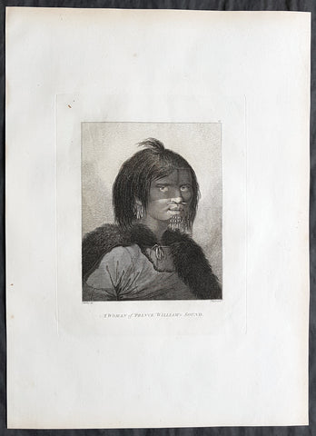
1784 Cook & Webber Large Antique Portrait Woman of Prince William Sound, Alaska
Antique Map
- Title : A Woman of Prince William Sound
- Size: 21in x 15in (535mm x 385mm)
- Condition: (A+) Fine Condition
- Date : 1784
- Ref #: 82071
Description:
This large beautifully engraved original copper-plate 1st edition antique portrait of a woman of Prince William Sound Alaska, visited by Captain Cooks ships HMS Resolution and Discovery in Snug Corner Cove, Prince William Sound, Alaska, in 1778 was drawn by the official artist on Cooks crew, John Webber, and later published for the 1784 1st edition and official British Admiralty sanctioned account of Captain Cook’s third and final voyage along with that of Cooks successor Capt. James King......
A Voyage to the Pacific Ocean. Undertaken, by the Command of his Majesty, for making Discoveries in the Northern Hemisphere. To determine The Position and Extent of the West Side of North America; its Distance from Asia; and the Practicability of a Northern Passage to Europe. Performed under the direction of Captains Cook, Clerke, and Gore, In His Majesty\'s Ships the Resolution and Discovery. In the Years 1776, 1777, 1778, 1779, and 1780. In Three Volumes. Vol. I and II written by James Cook, F.R.S. Vol. III by Captain James King, LL.D. and F.R.S
May 1778.........On the 12th at nine in the morning, wrote Ledyard, we entered an inlet… at six in the evening perceiving bad weather approaching… both ships anchored… The pinnace of the Resolution with the first lieutenant, some other gentlemen and myself went to the opposite shore to shoot some wild fowl. The first lieutenant was John Gore. The inlet was named Sandwich Sound by Cook, after the Earl of Sandwich, First Lord of the Admiralty, but in the published version of his journal the name appeared as Prince Williams Sound, after George IIIs third son, Duke of Clarence, later William IV. The ships had anchored off Cape Hinchinbrook, named after the country seat of the Earl of Sandwich.
Some local inhabitants appeared and came aboard the ships. Clerke gave them a Glass Bowl, with which they seem\\\'d much delighted, and toss\\\'d me, in spight of all my motions to the contrary, one of their Frocks, which was made of Water fowl Skins, and exceedingly well calculated, to keep out both Wet & Cold; then, both Boats put off and made for the Shore, paddling & singing with all the Jollity imaginable. We either found these good folks on of their Jubilee Days, or they are a very happy Race.
They sailed on until Cook found a fine bay or rather harbour which he later called a very snug place and named Snug Corner Bay. Samwell on 14th wrote we secured the Ship with the small Anchor; in carrying this out in the Launch one of the Sailors was so unfortunate as to get his Leg entangled in the Buoy rope which carried him down with the Anchor, however he disengaged himself when he got to the bottom & came up again & saved his Life tho\\\' he had his Leg broke in a very dangerous Manner.
We heeled the ship to port wrote Gilbert, to examine the leak on the starboard buttock… it being close below the wale and occasioned by some of the seems being very open and the oakum quite rotten and great part of it got out. In two days we repaired this defect being obliged to put two and half inch rope along the seams which were too wide for caulking.
On 18th King noted two boats, one with Mr Gore & the other with the Master, were sent away, the first to explore the Inlet to the Noward: the other to the N end of the Island near us to make observations on the tides. William Bligh was master on the Resolution. They returned by Dusk, Mr Gore had proceeded up the Inlet & perceivd that it took a direction to the NE, & he thought that it bid fair for opening a communication to some other Sea; but the mate that was with him form\\\'d a very contrary opinion… the Captn judg\\\'d it the Wisest way to lose no more time, being certain that if we were amongst Islands, we shoud soon come to more Passages. Henry Roberts was the masters mate referred to here. Cook had sent him and others to sketch out the parts they examined.
General Definitions:
Paper thickness and quality: - Heavy and stable
Paper color : - off white
Age of map color: -
Colors used: -
General color appearance: -
Paper size: - 21in x 15in (535mm x 385mm)
Plate size: - 21in x 15in (535mm x 385mm)
Margins: - Min 1/2in (12mm)
Imperfections:
Margins: - Light soiling in margins
Plate area: - None
Verso: - None
Background:
Prince William Sound is located on the south coast of the U.S. state of Alaska. It is located on the east side of the Kenai Peninsula, its largest port is Valdez, at the southern terminus of the Trans-Alaska Pipeline System. Other settlements on the sound contain numerous small islands, including Cordova and Whittier plus the Alaska native villages of Chenega and Tatitlek.
James Cook entered Prince William Sound in 1778 and named it Sandwich Sound, after his patron the Earl of Sandwich. The name was changed to honour King George III third son, Prince William Henry, then aged 13 and serving as a midshipman in the Royal Navy.
Captain James King FRS 1750 – 1784 was an officer of the Royal Navy. He served under James Cook on his last voyage around the world, specialising in taking important astronomical readings using a sextant. After Cook died he helped lead the ships on the remainder of their course, also completing Cooks account of the voyage. He continued his career in the Navy, reaching the rank of post-captain, commanding several ships and serving in the American War of Independence.
King joined HMS Resolution as second lieutenant, sharing the duties of astronomer with Cook, taking astronomical observations on board by sextant and with Larcum Kendals timekeeper K1, to establish the Resolutions position at sea and on shore by sextant or by astronomical quadrant to establish the geographical position of salient points during the course of Cooks surveys. Thus Kings geographical positions were an important contribution to the accuracy of the various surveys carried out during the voyage and his use of the early chronometers helped prove their use at sea for calculation of Longitude. .
Following the death of Cook, King remained in the Resolution but on the death of Charles Clerke, Cooks successor, King was appointed to command HMS Discovery, the Resolutions consort, remaining in her for the rest of the voyage. After his return to England King was very much involved in the publication of the official account of Cooks third voyage, writing the third volume at Woodstock, near Oxford, where his brother Thomas was rector of St Mary Magdalene. But shortly after his return King was promoted Post-captain and appointed commander of HMS Crocodile in the English Channel.
John Webber RA 1751 – 1793 was an English artist who accompanied Captain Cook on his third Pacific expedition. He is best known for his images of Australasia, Hawaii and Alaska.
Webber was born in London, educated in Bern and studied painting at Paris.His father was Abraham Wäber, a Swiss sculptor who had moved to London, and changed his name to Webber before marrying a Mrs Mary Quant in 1744.
Webber served as official artist on James Cooks third voyage of discovery around the Pacific (1776–80) aboard HMS Resolution. At Adventure Bay in January 1777 he did drawings of A Man of Van Diemens Land and A Woman of Van Diemens Land. He also did many drawings of scenes in New Zealand and the South Sea islands. On this voyage, during which Cook lost his life in a fight in Hawaii, Webber became the first European artist to make contact with Hawaii, then called the Sandwich Islands. He made numerous watercolor landscapes of the islands of Kauai and Hawaii, and also portrayed many of the Hawaiian people.
In April 1778, Captain Cooks ships Resolution and Discovery anchored at Ship Cove, now known as Nootka Sound, Vancouver Island, Canada to refit. The crew took observations and recorded encounters with the local people. Webber made watercolour landscapes including Resolution and Discovery in Ship Cove, 1778. His drawings and paintings were engraved for British Admiraltys account of the expedition, which was published in 1784.
Back in England in 1780 Webber exhibited around 50 works at Royal Academy exhibitions between 1784 and 1792, and was elected an associate of the Royal Academy in 1785 and R.A. in 1791. Most of his work were landscapes. Sometimes figures were included as in A Party from H.M.S. Resolution shooting sea horses, which was shown at the academy in 1784, and his The Death of Captain Cook became well known through an engraving of it. Another version of this picture is in the William Dixson gallery at Sydney
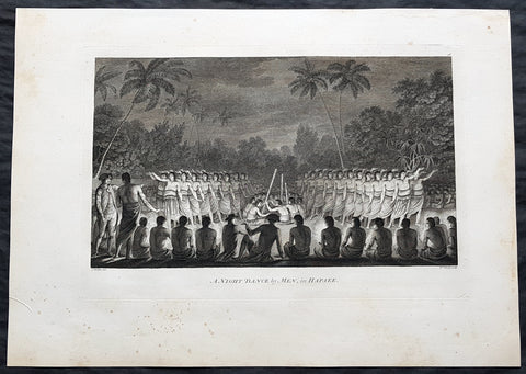
1784 Cook & Webber Large 1st Edition Antique Print Men Dancing Lifuka Isle Tonga
Antique Map
- Title : Night Dance by Men in Hapaee
- Size: 21in x 15in (535mm x 385mm)
- Condition: (A+) Fine Condition
- Date : 1784
- Ref #: 82066
Description:
This large beautifully engraved original copper-plate 1st edition antique print of Captain Cook (seen in the foreground) and his men watching men dancing at night on the Island of Lifuka, in the Ha apai island group of Tonga, at the time of Cooks visit in 1777 as drawn by John Webber (Cooks official artist on the voyage) was published for the 1784 1st edition and official British Admiralty sanctioned account of Captain Cook’s third and final voyage along with that of Cooks successor Capt. James King......
A Voyage to the Pacific Ocean. Undertaken, by the Command of his Majesty, for making Discoveries in the Northern Hemisphere. To determine The Position and Extent of the West Side of North America; its Distance from Asia; and the Practicability of a Northern Passage to Europe. Performed under the direction of Captains Cook, Clerke, and Gore, In His Majesty\'s Ships the Resolution and Discovery. In the Years 1776, 1777, 1778, 1779, and 1780. In Three Volumes. Vol. I and II written by James Cook, F.R.S. Vol. III by Captain James King, LL.D. and F.R.S
General Definitions:
Paper thickness and quality: - Heavy and stable
Paper color : - off white
Age of map color: -
Colors used: -
General color appearance: -
Paper size: - 21in x 15in (535mm x 385mm)
Plate size: - 21in x 15in (535mm x 385mm)
Margins: - Min 1/2in (12mm)
Imperfections:
Margins: - Light soiling
Plate area: - None
Verso: - Light soiling
Background:
Tonga officially the Kingdom of Tonga, is a Polynesian sovereign state and archipelago comprising 169 islands, of which 36 are inhabited. The total surface area is about 750 square kilometres (290 sq mi) scattered over 700,000 square kilometres (270,000 sq mi) of the southern Pacific Ocean. It has a population of 107,122 people, of whom 70% reside on the main island of Tongatapu.
The Tongan people first encountered Europeans in 1616 when the Dutch vessel Eendracht, captained by Willem Schouten, made a short visit to trade. Later came other Dutch explorers, including Jacob Le Maire (who called on the northern island of Niuatoputapu); and in 1643 Abel Tasman (who visited Tongatapu and Haapai).
Later noteworthy European visitors included James Cook (Royal Navy) in 1773, 1774, and 1777; Alessandro Malaspina (Spanish Navy) in 1793; the first London missionaries in 1797; and the Wesleyan Methodist Reverend Walter Lawry in 1822.
Tonga became known in the West as the Friendly Islands because of the congenial reception accorded to Captain James Cook on his first visit in 1773. He arrived at the time of the inasi festival, the yearly donation of the First Fruits to the Tui Tonga (the islands paramount chief) and so received an invitation to the festivities. According to the writer William Mariner, the chiefs wanted to kill Cook during the gathering but could not agree on a plan.
Lifuka is an island in the Kingdom of Tonga. It is located within the Ha apai Group in the centre of the country, to northeast of the national capital of Nuku alofa.
Lifuka is the place where Captain James Cook dubbed Tonga The Friendly Islands. Tofua is where the mutiny on the Bounty occurred in 1789; this active volcanic island lies approximately forty nautical miles west of Lifuka. The Cpt. Bligh voyage stands as the longest successful passage ever recorded in an open boat without modern navigational aids.
Captain James King FRS 1750 – 1784 was an officer of the Royal Navy. He served under James Cook on his last voyage around the world, specialising in taking important astronomical readings using a sextant. After Cook died he helped lead the ships on the remainder of their course, also completing Cooks account of the voyage. He continued his career in the Navy, reaching the rank of post-captain, commanding several ships and serving in the American War of Independence.
King joined HMS Resolution as second lieutenant, sharing the duties of astronomer with Cook, taking astronomical observations on board by sextant and with Larcum Kendals timekeeper K1, to establish the Resolutions position at sea and on shore by sextant or by astronomical quadrant to establish the geographical position of salient points during the course of Cooks surveys. Thus Kings geographical positions were an important contribution to the accuracy of the various surveys carried out during the voyage and his use of the early chronometers helped prove their use at sea for calculation of Longitude. .
Following the death of Cook, King remained in the Resolution but on the death of Charles Clerke, Cooks successor, King was appointed to command HMS Discovery, the Resolutions consort, remaining in her for the rest of the voyage. After his return to England King was very much involved in the publication of the official account of Cooks third voyage, writing the third volume at Woodstock, near Oxford, where his brother Thomas was rector of St Mary Magdalene. But shortly after his return King was promoted Post-captain and appointed commander of HMS Crocodile in the English Channel.
John Webber RA 1751 – 1793 was an English artist who accompanied Captain Cook on his third Pacific expedition. He is best known for his images of Australasia, Hawaii and Alaska.
Webber was born in London, educated in Bern and studied painting at Paris.His father was Abraham Wäber, a Swiss sculptor who had moved to London, and changed his name to Webber before marrying a Mrs Mary Quant in 1744.
Webber served as official artist on James Cooks third voyage of discovery around the Pacific (1776–80) aboard HMS Resolution. At Adventure Bay in January 1777 he did drawings of A Man of Van Diemens Land and A Woman of Van Diemens Land. He also did many drawings of scenes in New Zealand and the South Sea islands. On this voyage, during which Cook lost his life in a fight in Hawaii, Webber became the first European artist to make contact with Hawaii, then called the Sandwich Islands. He made numerous watercolor landscapes of the islands of Kauai and Hawaii, and also portrayed many of the Hawaiian people.
In April 1778, Captain Cooks ships Resolution and Discovery anchored at Ship Cove, now known as Nootka Sound, Vancouver Island, Canada to refit. The crew took observations and recorded encounters with the local people. Webber made watercolour landscapes including Resolution and Discovery in Ship Cove, 1778. His drawings and paintings were engraved for British Admiraltys account of the expedition, which was published in 1784.
Back in England in 1780 Webber exhibited around 50 works at Royal Academy exhibitions between 1784 and 1792, and was elected an associate of the Royal Academy in 1785 and R.A. in 1791. Most of his work were landscapes. Sometimes figures were included as in A Party from H.M.S. Resolution shooting sea horses, which was shown at the academy in 1784, and his The Death of Captain Cook became well known through an engraving of it. Another version of this picture is in the William Dixson gallery at Sydney
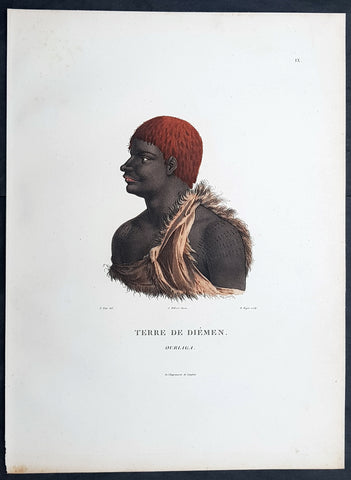
1807 Nicolas Baudin & N M Petit Antique Print of Tasmanian Aboriginal, Ourlaga
Antique Map
- Title : Terre De Diemen Ourlaga
- Size: 14in x 10in (355mm x 255mm)
- Condition: (A+) Fine Condition
- Date : 1807
- Ref #: 93089
Description:
This exquisite, rare original hand coloured copper-plate engraved antique print of Tasmanian Ourlaga, visited by Baudin Expedition to Australia in Feb. 1802, was engraved by Barthélemy Roger, after Nicolas-Martin Petit (the offical artist on the ship Géographe) and was published by Francois Peron (1775 - 1810) in the 1st edition atlas of Nicolas Thomas Baudins expedition to Australia Voyage de découvertes aux Terres Australes
General Definitions:
Paper thickness and quality: - Heavy and stable
Paper color : - off white
Age of map color: - Original
Colors used: - Yellow, green, blue, pink
General color appearance: - Authentic
Paper size: - 14in x 10in (355mm x 255mm)
Plate size: - 14in x 10in (355mm x 255mm)
Margins: - Min 1/2in (12mm)
Imperfections:
Margins: - None
Plate area: - None
Verso: - None
Background:
The Baudin Expedition of 1800 to 1803 was a French expedition to map the coast of New Holland, Australia. The expedition started with two ships, Géographe, captained by Baudin, and Naturaliste captained by Jacques Hamelin, and was accompanied by nine zoologists and botanists, including Jean-Baptiste Leschenault de la Tour, François Péron and Charles-Alexandre Lesueur as well as the geographer Pierre Faure.
The Baudin expedition departed Le Havre, France, on 19 October 1800. Because of delays in receiving his instructions and problems encountered in Isle de France (now Mauritius) they did not reach Cape Leeuwin on the south-west corner of Australia until May 1801. Upon rounding Cape Naturaliste, they entered Geographe Bay. They then sailed north, but the ships became separated and did not meet again until they reached Timor. On their journeys the Géographe and the Naturaliste surveyed large stretches of the north-western coast. The expedition was severely affected by dysentery and fever, but sailed from Timor on 13 November 1801, back down the north-west and west coast, then across the Great Australian Bight, reaching Tasmania on 13 January 1802. They charted the whole length of Tasmanias east coast and there were extensive interactions with the Indigenous Tasmanians, with whom they had peaceful relationships. They notably produced precious ethnological studies of Indigenous Tasmanians.
The expedition then began surveying the south coast of Australia, but then Captain Jacques Felix Emmanuel Hamelin in Naturaliste decided to make for Port Jackson (Sydney) as he was running short of food and water, and in need of anchors. En route, in April 1802, Hamelin explored the area of Western Port, Victoria, and gave names to places, a number of which have survived, for example, Ile des Français is now called French Island.
Meanwhile, Baudin in the Géographe continued westward, and in April 1802 encountered the British ship Investigator commanded by Matthew Flinders, also engaged in charting the coastline, at Encounter Bay in what is now South Australia. Flinders informed Baudin of his discovery of Kangaroo Island, St. Vincents and Spencers Gulfs. Baudin sailed on to the Nuyts Archipelago, the point reached by t Gulden Zeepaert in 1627 before heading for Port Jackson as well for supplies.
In late 1802 the expedition was at Port Jackson, where the government sold 60 casks of flour and 25 casks of salt meat to Baudin to resupply his two vessels. The supplies permitted Naturaliste to return to France and Géographe to continue her explorations of the Australian coast. Naturaliste took with her the Colonys staff surgeon, Mr. James Thomson, whom Governor Philip Gidley King had given permission to return to England.
Before resuming the voyage Baudin purchased a 30 ton schooner, which he named the Casuarina, a smaller vessel which could conduct close inshore survey work. He sent the larger Naturaliste under Hamelin back to France with all the specimens that had been collected by Baudin and his crew. As the voyage had progressed Louis de Freycinet, now a Lieutenant, had shown his talents as an officer and a hydrographer and so was given command of the Casuarina. The expedition then headed for Tasmania and conducted further charting of Bass Strait before sailing west, following the west coast northward, and after another visit to Timor, undertook further exploration along the north coast of Australia. Plagued by contrary winds, ill health, and because the quadrupeds and emus were very sick, it was decided on 7 July 1803 to return to France. On the return voyage, the ships stopped in Mauritius, where Baudin died of tuberculosis on 16 September 1803. The expedition finally reached France on 24 March 1804.
The scientific expedition was considered a great success, with more than 2500 new species discovered.
Nicolas-Martin Petit 1777 – 1804
Nicholas-Martin Petit was born in Paris, the son of a fan maker, and learned graphic art in the studio of Jacques Louis David. He avoided conscription into Napoleons armies, but wanting to travel, signed up with post Captain Nicholas Baudin on a voyage to the antipodes sponsored by the French government. Petit and fellow artist Charles-Alexandre Lesueur were enlisted directly by Baudin (as 4th class gunners mates) while the two official artists were hired by the organisers of the expedition. Baudin set off in two lavishly equipped vessels, the Géographe and the Naturaliste on 19 October 1800. By the time the expedition reached Mauritius the official artists had quit. Petit and Lesueur took over their duties, but as neither was trained in scientific method or presentation, the value of their work was primarily aesthetic. The French were at this time developing a new scientific field - anthropology. The Society of the Observers of Man was founded in 1799 for this purpose. The study of Man formed part of the background for Petits sensitive drawings and paintings of the indigenous people of Van Diemens Land, Port Jackson and Western Australia. Lesueur focused on the depiction of animals. The expedition charted the coast of Western Australia and Van Diemens land but was plagued by scurvy. On 20 June 1802 the two ships limped into Port Jackson and stayed for five months to refit, during which time Petit completed a number of portraits of Sydney Indigenous people, including the two images of the Eora men, Cour-rou-bari-gal and Y-erren-gou-la-ga. Petit eventually returned to France in 1804. However, before he was well enough to complete the drawings from the expedition he was hurt in a street accident, and he died at the age of 28. Petits unfinished work was first published in 1807 in the Atlas of the Voyage de découvertes aux terres australes and as discrete prints.
Baudin, Nicolas Thomas 1754 – 1803
Baudin was a French explorer, cartographer, naturalist and hydrographer. Born a commoner in Saint-Martin-de-Ré on the Île de Ré on 17 February 1754 Baudin joined the merchant navy at the age of 15 and the French East India Company at the age of 20.
Baudin then joined the La Marine Royale (French Navy) in 1774 and served in the Caribbean as an officier bleu during the American War of Independence of 1775–1783.
In 1785 Baudin and his brother Alexandre were respectively masters of the St Remy and Caroline, taking Acadian settlers from Nantes to La Nouvelle Orléans. In New Orleans local merchants contracted him to take a cargo of wood, salted meat, cod and flour to Isle de France (now Mauritius), which he did in Josephine (also called Pepita), departing New Orleans on 14 July 1786 and arriving at Isle de France on 27 March 1787. In the course of the voyage, Josephine had called at Cap‑Français in Haiti to make a contract to transport slaves there from Madagascar; while in Haiti he also encountered the Austrian botanist Franz Josef Maerter, who apparently informed him that another Austrian botanist, Franz Boos, was at the Cape of Good Hope awaiting a ship to take him to Mauritius. Josephine called at the Cape and took Boos on board. At Mauritius, Boos chartered Baudin to transport him and the collection of plant specimens he had gathered there and at the Cape back to Europe, which Baudin did, Josephine arriving at Trieste on 18 June 1788. The Imperial government in Vienna was contemplating organizing another natural-history expedition, to which Boos would be appointed, in which two ships would be sent to the Malabar and Coromandel coasts of India, the Persian Gulf, Bengal, Ceylon, Sumatra, Java, Borneo, Cochin China, Tongking, Japan and China. Baudin had been given reason to hope that he would be given command of the ships of this expedition.
Later in 1788 Baudin sailed on a commercial voyage from Trieste to Canton in Jardiniere. He apparently arrived at Canton from Mauritius under the flag of the United States of America, probably to avoid the possibility of having his ship seized by the Chinese for payment of the debts owed them by the Imperial Asiatic Company of Trieste. From there, he sent Jardiniere under her second captain on a fur-trading venture to the north-west coast of America, but the ship foundered off Asuncion Island in the Marianas in late 1789.
Baudin made his way to Mauritius, where he purchased a replacement ship, Jardiniere II, but this vessel was wrecked in a cyclone that struck Port Louis on 15 December 1789. Baudin embarked on the Spanish Royal Philippines Company ship, Placeres, which sailed from Port Louis for Cadiz in August 1790. Placeres called at the Cape of Good Hope where it took on board the large number of plant and animal specimens collected in South Africa for the Imperial palace at Schönbrunn by Georg Scholl, the assistant of Franz Boos. Because of the poor condition of the ship, Placeres had to put in at the island of Trinidad in the West Indies, where Scholls collection of specimens was deposited.
Baudin proceeded to Martinique, from where he addressed an offer to the Imperial government in Vienna to conduct to Canton commissioners who would be empowered to negotiate with the Chinese merchants there a settlement of the debts incurred by the Imperial Asiatic Company, which would enable the company to renew its trade with China. On its return voyage from Canton, the proposed expedition would call at the Cape of Good Hope to pick up Scholl and the remainder of his natural-history collection for conveyance to Schönbrunn.
After returning to Vienna in September 1791, Baudin continued to press his case for an expedition under the Imperial flag to the Indian Ocean and China, and in January 1792 he was granted a commission of captain in the Imperial navy for this purpose. A ship, called Jardiniere, was acquired and the botanists Franz Bredemeyer and Joseph van der Schot appointed to the expedition. After delays caused by the outbreak of war between France and Austria (April 1792), Jardiniere departed from the Spanish port of Málaga on 1 October 1792. From the Cape of Good Hope Jardiniere sailed across the Indian Ocean to the coast of New Holland (Australia), but two consecutive cyclones prevented the expedition from doing any work there and forced Baudin to take the ship to Bombay for repairs.
From Bombay the expedition proceeded to the Persian Gulf, the Red Sea and the east coast of Africa, where it gathered botanical and zoological collections. The expedition came to an abrupt end in June 1794 when Jardiniere went aground in a storm while attempting to enter Table Bay at the Cape of Good Hope. Baudin survived the wreck and made his way to the United States, from where he went to France. He managed to send Jardinieres cargo of natural history specimens to the island of Trinidad.
In Paris, Baudin visited Antoine de Jussieu at the Museum National dHistoire Naturelle in March 1796 to suggest a botanical voyage to the Caribbean, during which he would recover the collection of specimens he had left in Trinidad. The Museum and the French government accepted the proposal, and Baudin was appointed commander of an expedition in the ship Belle Angélique, with four assigned botanists: René Maugé, André Pierre Ledru, Anselme Riedlé and Stanislas Levillain. Belle Angélique cleared Le Havre on 30 September 1796 for the Canary Islands, where the ship was condemned as unseaworthy. The expedition sailed from the Canaries in a replacement vessel, Fanny, and reached Trinidad in April 1797. The British, who had just captured the island from the Spanish in February 1797, refused to allow Baudin to recover the collection of natural-history specimens. Baudin took Fanny to St. Thomas and St. Croix, and then to Puerto Rico, specimens being collected in all three islands. At St Croix, Fanny was replaced by a newly purchased ship, renamed Belle Angelique. The expedition returned to France in June 1798 with a large collection of plants, birds and insects, which was incorporated into Napoleon Bonapartes triumphal procession celebrating his recent Italian victories.
On 24 July 1798, at the suggestion of the Ministry of Marine, Baudin presented to the Assembly of Professors and Administrators of the National Museum of Natural History a plan for a hydrographic-survey expedition to the South Seas, which would include a search for fauna and flora that could be brought back for cultivation in France. The expedition would also have the aim of promoting the economic and commercial interests of France in the regions to be visited. The expedition would require two well-equipped ships, which would carry a team of astronomers, naturalists and scientific draughtsmen over whom Baudin as commander would have absolute authority. The first part of the voyage would be devoted to a thorough exploration of the coast of Chile and the collection of animal, bird and plant specimens suitable for acclimatization in France, followed by a survey of the coasts from Peru to Mexico. The expedition would then continue into the Pacific Ocean, including a visit to Tahiti and the Society Islands, and would be completed with a survey of the yet unexplored south-west coast of New Holland (Australia). After considering this extensive proposal, the French government decided to proceed with an expedition confined to a survey of western and southern New Holland (as Australia was called at the time).
In October 1800 Baudin was selected to lead what has become known as the Baudin expedition to map the coast of Australia (New Holland). He had two ships, Géographe and Naturaliste captained by Hamelin, and a suite of nine zoologists and botanists, including Jean Baptiste Leschenault de la Tour. He reached Australia in May 1801, and would explore and map the western coast and a part of the little-known southern coast of the continent. The scientific expedition proved a great success, with more than 2500 new species discovered. The French also met Aboriginal peoples and treated them with great respect.
In April 1802 Baudin met Matthew Flinders, also engaged in charting the coastline, in Encounter Bay in present-day South Australia. Baudin then stopped at the British colony at Sydney for supplies. In Sydney he bought a new ship — Casuarina — named after the wood it was made from. From there he sent home Naturaliste, which had on board all of the specimens that had been discovered by Baudin and his crew. He then headed for Tasmania, before continuing north to Timor. Baudin then sailed for home, stopping at Mauritius.
According to recent researches by academics from the University of Adelaide, during Baudins expedition, François Péron, who had become the chief zoologist and intellectual leader of the mission, wrote a report for Napoleon on ways to invade and capture the British colony at Sydney Cove.
Baudin died of tuberculosis at Mauritius on 16 September 1803, at the age of 49, apparently in the home of Madame Alexandrine Kerivel. Baudins exact resting place is not known, but the historian Auguste Toussaint believed that he was interred in the Kerivel family vault. However, the historian Edward Duyker likes to think that Baudin was buried in Le Cimetière de lOuest in the district of Port Louis just a few hundred metres from the explorers certain love: the sea.
Please note all items auctioned are genuine, we do not sell reproductions. A Certificate of Authenticity (COA) can be issued on request.
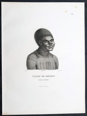
1807 Nicolas Baudin & N M Petit Antique Print of Tasmanian Aboriginal Bara-Ourou
Antique Map
- Title : Terre De Diemen Bara-Ourou
- Size: 13in x 10in (330mm x 255mm)
- Condition: (A+) Fine Condition
- Date : 1807
- Ref #: 93088
Description:
This exquisite, rare original copper-plate engraved antique print of Tasmanian Bara-Ourou, portrait of a young man 28-30 years of age, visited by Baudin Expedition to Australia in Feb. 1802, was engraved by Barthélemy Roger, after Nicolas-Martin Petit (the offical artist on the ship Géographe) and was published by Francois Peron (1775 - 1810) in the 1st edition atlas of Nicolas Thomas Baudins expedition to Australia Voyage de découvertes aux Terres Australes
Nicholas Martin Petit sailed with Nicolas Baudin on the expedition of the Géographe and the Naturaliste in late 1800. The scientific field of anthropology was in its infancy – the French had founded the Society of the Observers of Man in 1799. Having embarked as a fourth-class gunner’s mate, Petit, who had had some graphic arts training, became one of the expeditions two illustrators when the official artists quit. From June to November 1802, the expedition was delayed in Sydney while its two ships were repaired. During this time Petit completed portraits of people of the Cadigal, Dharawal, Gweagal, Kurringai and Darug language groups of the Sydney Harbour region. While the sitters names appear to be noted on the works, it is possible that the inscriptions merely reflect French misinterpretation of the Aborigines communications with them.
The portrait of Nourou-gal-derri is pictured advancing for battle.
General Definitions:
Paper thickness and quality: - Heavy and stable
Paper color : - off white
Age of map color: -
Colors used: -
General color appearance: -
Paper size: - 14in x 10in (355mm x 255mm)
Plate size: - 14in x 10in (355mm x 255mm)
Margins: - Min 1/2in (12mm)
Imperfections:
Margins: - None
Plate area: - None
Verso: - None
Background:
The Baudin Expedition of 1800 to 1803 was a French expedition to map the coast of New Holland, Australia. The expedition started with two ships, Géographe, captained by Baudin, and Naturaliste captained by Jacques Hamelin, and was accompanied by nine zoologists and botanists, including Jean-Baptiste Leschenault de la Tour, François Péron and Charles-Alexandre Lesueur as well as the geographer Pierre Faure.
The Baudin expedition departed Le Havre, France, on 19 October 1800. Because of delays in receiving his instructions and problems encountered in Isle de France (now Mauritius) they did not reach Cape Leeuwin on the south-west corner of Australia until May 1801. Upon rounding Cape Naturaliste, they entered Geographe Bay. They then sailed north, but the ships became separated and did not meet again until they reached Timor. On their journeys the Géographe and the Naturaliste surveyed large stretches of the north-western coast. The expedition was severely affected by dysentery and fever, but sailed from Timor on 13 November 1801, back down the north-west and west coast, then across the Great Australian Bight, reaching Tasmania on 13 January 1802. They charted the whole length of Tasmanias east coast and there were extensive interactions with the Indigenous Tasmanians, with whom they had peaceful relationships. They notably produced precious ethnological studies of Indigenous Tasmanians.
The expedition then began surveying the south coast of Australia, but then Captain Jacques Felix Emmanuel Hamelin in Naturaliste decided to make for Port Jackson (Sydney) as he was running short of food and water, and in need of anchors. En route, in April 1802, Hamelin explored the area of Western Port, Victoria, and gave names to places, a number of which have survived, for example, Ile des Français is now called French Island.
Meanwhile, Baudin in the Géographe continued westward, and in April 1802 encountered the British ship Investigator commanded by Matthew Flinders, also engaged in charting the coastline, at Encounter Bay in what is now South Australia. Flinders informed Baudin of his discovery of Kangaroo Island, St. Vincents and Spencers Gulfs. Baudin sailed on to the Nuyts Archipelago, the point reached by t Gulden Zeepaert in 1627 before heading for Port Jackson as well for supplies.
In late 1802 the expedition was at Port Jackson, where the government sold 60 casks of flour and 25 casks of salt meat to Baudin to resupply his two vessels. The supplies permitted Naturaliste to return to France and Géographe to continue her explorations of the Australian coast. Naturaliste took with her the Colonys staff surgeon, Mr. James Thomson, whom Governor Philip Gidley King had given permission to return to England.
Before resuming the voyage Baudin purchased a 30 ton schooner, which he named the Casuarina, a smaller vessel which could conduct close inshore survey work. He sent the larger Naturaliste under Hamelin back to France with all the specimens that had been collected by Baudin and his crew. As the voyage had progressed Louis de Freycinet, now a Lieutenant, had shown his talents as an officer and a hydrographer and so was given command of the Casuarina. The expedition then headed for Tasmania and conducted further charting of Bass Strait before sailing west, following the west coast northward, and after another visit to Timor, undertook further exploration along the north coast of Australia. Plagued by contrary winds, ill health, and because the quadrupeds and emus were very sick, it was decided on 7 July 1803 to return to France. On the return voyage, the ships stopped in Mauritius, where Baudin died of tuberculosis on 16 September 1803. The expedition finally reached France on 24 March 1804.
The scientific expedition was considered a great success, with more than 2500 new species discovered.
Nicolas-Martin Petit 1777 – 1804
Nicholas-Martin Petit was born in Paris, the son of a fan maker, and learned graphic art in the studio of Jacques Louis David. He avoided conscription into Napoleons armies, but wanting to travel, signed up with post Captain Nicholas Baudin on a voyage to the antipodes sponsored by the French government. Petit and fellow artist Charles-Alexandre Lesueur were enlisted directly by Baudin (as 4th class gunners mates) while the two official artists were hired by the organisers of the expedition. Baudin set off in two lavishly equipped vessels, the Géographe and the Naturaliste on 19 October 1800. By the time the expedition reached Mauritius the official artists had quit. Petit and Lesueur took over their duties, but as neither was trained in scientific method or presentation, the value of their work was primarily aesthetic. The French were at this time developing a new scientific field - anthropology. The Society of the Observers of Man was founded in 1799 for this purpose. The study of Man formed part of the background for Petits sensitive drawings and paintings of the indigenous people of Van Diemens Land, Port Jackson and Western Australia. Lesueur focused on the depiction of animals. The expedition charted the coast of Western Australia and Van Diemens land but was plagued by scurvy. On 20 June 1802 the two ships limped into Port Jackson and stayed for five months to refit, during which time Petit completed a number of portraits of Sydney Indigenous people, including the two images of the Eora men, Cour-rou-bari-gal and Y-erren-gou-la-ga. Petit eventually returned to France in 1804. However, before he was well enough to complete the drawings from the expedition he was hurt in a street accident, and he died at the age of 28. Petits unfinished work was first published in 1807 in the Atlas of the Voyage de découvertes aux terres australes and as discrete prints.
Baudin, Nicolas Thomas 1754 – 1803
Baudin was a French explorer, cartographer, naturalist and hydrographer. Born a commoner in Saint-Martin-de-Ré on the Île de Ré on 17 February 1754 Baudin joined the merchant navy at the age of 15 and the French East India Company at the age of 20.
Baudin then joined the La Marine Royale (French Navy) in 1774 and served in the Caribbean as an officier bleu during the American War of Independence of 1775–1783.
In 1785 Baudin and his brother Alexandre were respectively masters of the St Remy and Caroline, taking Acadian settlers from Nantes to La Nouvelle Orléans. In New Orleans local merchants contracted him to take a cargo of wood, salted meat, cod and flour to Isle de France (now Mauritius), which he did in Josephine (also called Pepita), departing New Orleans on 14 July 1786 and arriving at Isle de France on 27 March 1787. In the course of the voyage, Josephine had called at Cap‑Français in Haiti to make a contract to transport slaves there from Madagascar; while in Haiti he also encountered the Austrian botanist Franz Josef Maerter, who apparently informed him that another Austrian botanist, Franz Boos, was at the Cape of Good Hope awaiting a ship to take him to Mauritius. Josephine called at the Cape and took Boos on board. At Mauritius, Boos chartered Baudin to transport him and the collection of plant specimens he had gathered there and at the Cape back to Europe, which Baudin did, Josephine arriving at Trieste on 18 June 1788. The Imperial government in Vienna was contemplating organizing another natural-history expedition, to which Boos would be appointed, in which two ships would be sent to the Malabar and Coromandel coasts of India, the Persian Gulf, Bengal, Ceylon, Sumatra, Java, Borneo, Cochin China, Tongking, Japan and China. Baudin had been given reason to hope that he would be given command of the ships of this expedition.
Later in 1788 Baudin sailed on a commercial voyage from Trieste to Canton in Jardiniere. He apparently arrived at Canton from Mauritius under the flag of the United States of America, probably to avoid the possibility of having his ship seized by the Chinese for payment of the debts owed them by the Imperial Asiatic Company of Trieste. From there, he sent Jardiniere under her second captain on a fur-trading venture to the north-west coast of America, but the ship foundered off Asuncion Island in the Marianas in late 1789.
Baudin made his way to Mauritius, where he purchased a replacement ship, Jardiniere II, but this vessel was wrecked in a cyclone that struck Port Louis on 15 December 1789. Baudin embarked on the Spanish Royal Philippines Company ship, Placeres, which sailed from Port Louis for Cadiz in August 1790. Placeres called at the Cape of Good Hope where it took on board the large number of plant and animal specimens collected in South Africa for the Imperial palace at Schönbrunn by Georg Scholl, the assistant of Franz Boos. Because of the poor condition of the ship, Placeres had to put in at the island of Trinidad in the West Indies, where Scholls collection of specimens was deposited.
Baudin proceeded to Martinique, from where he addressed an offer to the Imperial government in Vienna to conduct to Canton commissioners who would be empowered to negotiate with the Chinese merchants there a settlement of the debts incurred by the Imperial Asiatic Company, which would enable the company to renew its trade with China. On its return voyage from Canton, the proposed expedition would call at the Cape of Good Hope to pick up Scholl and the remainder of his natural-history collection for conveyance to Schönbrunn.
After returning to Vienna in September 1791, Baudin continued to press his case for an expedition under the Imperial flag to the Indian Ocean and China, and in January 1792 he was granted a commission of captain in the Imperial navy for this purpose. A ship, called Jardiniere, was acquired and the botanists Franz Bredemeyer and Joseph van der Schot appointed to the expedition. After delays caused by the outbreak of war between France and Austria (April 1792), Jardiniere departed from the Spanish port of Málaga on 1 October 1792. From the Cape of Good Hope Jardiniere sailed across the Indian Ocean to the coast of New Holland (Australia), but two consecutive cyclones prevented the expedition from doing any work there and forced Baudin to take the ship to Bombay for repairs.
From Bombay the expedition proceeded to the Persian Gulf, the Red Sea and the east coast of Africa, where it gathered botanical and zoological collections. The expedition came to an abrupt end in June 1794 when Jardiniere went aground in a storm while attempting to enter Table Bay at the Cape of Good Hope. Baudin survived the wreck and made his way to the United States, from where he went to France. He managed to send Jardinieres cargo of natural history specimens to the island of Trinidad.
In Paris, Baudin visited Antoine de Jussieu at the Museum National dHistoire Naturelle in March 1796 to suggest a botanical voyage to the Caribbean, during which he would recover the collection of specimens he had left in Trinidad. The Museum and the French government accepted the proposal, and Baudin was appointed commander of an expedition in the ship Belle Angélique, with four assigned botanists: René Maugé, André Pierre Ledru, Anselme Riedlé and Stanislas Levillain. Belle Angélique cleared Le Havre on 30 September 1796 for the Canary Islands, where the ship was condemned as unseaworthy. The expedition sailed from the Canaries in a replacement vessel, Fanny, and reached Trinidad in April 1797. The British, who had just captured the island from the Spanish in February 1797, refused to allow Baudin to recover the collection of natural-history specimens. Baudin took Fanny to St. Thomas and St. Croix, and then to Puerto Rico, specimens being collected in all three islands. At St Croix, Fanny was replaced by a newly purchased ship, renamed Belle Angelique. The expedition returned to France in June 1798 with a large collection of plants, birds and insects, which was incorporated into Napoleon Bonapartes triumphal procession celebrating his recent Italian victories.
On 24 July 1798, at the suggestion of the Ministry of Marine, Baudin presented to the Assembly of Professors and Administrators of the National Museum of Natural History a plan for a hydrographic-survey expedition to the South Seas, which would include a search for fauna and flora that could be brought back for cultivation in France. The expedition would also have the aim of promoting the economic and commercial interests of France in the regions to be visited. The expedition would require two well-equipped ships, which would carry a team of astronomers, naturalists and scientific draughtsmen over whom Baudin as commander would have absolute authority. The first part of the voyage would be devoted to a thorough exploration of the coast of Chile and the collection of animal, bird and plant specimens suitable for acclimatization in France, followed by a survey of the coasts from Peru to Mexico. The expedition would then continue into the Pacific Ocean, including a visit to Tahiti and the Society Islands, and would be completed with a survey of the yet unexplored south-west coast of New Holland (Australia). After considering this extensive proposal, the French government decided to proceed with an expedition confined to a survey of western and southern New Holland (as Australia was called at the time).
In October 1800 Baudin was selected to lead what has become known as the Baudin expedition to map the coast of Australia (New Holland). He had two ships, Géographe and Naturaliste captained by Hamelin, and a suite of nine zoologists and botanists, including Jean Baptiste Leschenault de la Tour. He reached Australia in May 1801, and would explore and map the western coast and a part of the little-known southern coast of the continent. The scientific expedition proved a great success, with more than 2500 new species discovered. The French also met Aboriginal peoples and treated them with great respect.
In April 1802 Baudin met Matthew Flinders, also engaged in charting the coastline, in Encounter Bay in present-day South Australia. Baudin then stopped at the British colony at Sydney for supplies. In Sydney he bought a new ship — Casuarina — named after the wood it was made from. From there he sent home Naturaliste, which had on board all of the specimens that had been discovered by Baudin and his crew. He then headed for Tasmania, before continuing north to Timor. Baudin then sailed for home, stopping at Mauritius.
According to recent researches by academics from the University of Adelaide, during Baudins expedition, François Péron, who had become the chief zoologist and intellectual leader of the mission, wrote a report for Napoleon on ways to invade and capture the British colony at Sydney Cove.
Baudin died of tuberculosis at Mauritius on 16 September 1803, at the age of 49, apparently in the home of Madame Alexandrine Kerivel. Baudins exact resting place is not known, but the historian Auguste Toussaint believed that he was interred in the Kerivel family vault. However, the historian Edward Duyker likes to think that Baudin was buried in Le Cimetière de lOuest in the district of Port Louis just a few hundred metres from the explorers certain love: the sea.
Please note all items auctioned are genuine, we do not sell reproductions. A Certificate of Authenticity (COA) can be issued on request.
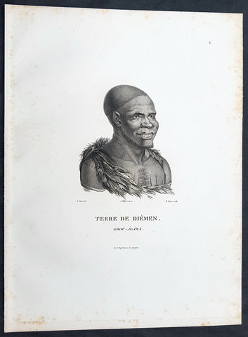
1807 Nicolas Baudin & N M Petit Antique Print of Tasmanian Aboriginal Grou Agara
Antique Map
- Title : Terre De Diemen Grou Agara
- Size: 13in x 10in (330mm x 255mm)
- Condition: (A+) Fine Condition
- Date : 1807
- Ref #: 93086
Description:
This exquisite, rare original copper-plate engraved antique print of Tasmanian Aboriginal Grou Agara, visited by the Baudin Expedition to Australia in Feb. 1802, was engraved by Barthélemy Roger, after Nicolas-Martin Petit (the offical artist on the ship Géographe) and was published by Francois Peron (1775 - 1810) in the 1st edition atlas of Nicolas Thomas Baudins expedition to Australia Voyage de découvertes aux Terres Australes
Nicholas Martin Petit sailed with Nicolas Baudin on the expedition of the Géographe and the Naturaliste in late 1800. The scientific field of anthropology was in its infancy – the French had founded the Society of the Observers of Man in 1799. Having embarked as a fourth-class gunner’s mate, Petit, who had had some graphic arts training, became one of the expeditions two illustrators when the official artists quit. From June to November 1802, the expedition was delayed in Sydney while its two ships were repaired. During this time Petit completed portraits of people of the Cadigal, Dharawal, Gweagal, Kurringai and Darug language groups of the Sydney Harbour region. While the sitters names appear to be noted on the works, it is possible that the inscriptions merely reflect French misinterpretation of the Aborigines communications with them.
The portrait of Nourou-gal-derri is pictured advancing for battle.
General Definitions:
Paper thickness and quality: - Heavy and stable
Paper color : - off white
Age of map color: -
Colors used: -
General color appearance: -
Paper size: - 14in x 10in (355mm x 255mm)
Plate size: - 14in x 10in (355mm x 255mm)
Margins: - Min 1/2in (12mm)
Imperfections:
Margins: - None
Plate area: - None
Verso: - None
Background:
The Baudin Expedition of 1800 to 1803 was a French expedition to map the coast of New Holland, Australia. The expedition started with two ships, Géographe, captained by Baudin, and Naturaliste captained by Jacques Hamelin, and was accompanied by nine zoologists and botanists, including Jean-Baptiste Leschenault de la Tour, François Péron and Charles-Alexandre Lesueur as well as the geographer Pierre Faure.
The Baudin expedition departed Le Havre, France, on 19 October 1800. Because of delays in receiving his instructions and problems encountered in Isle de France (now Mauritius) they did not reach Cape Leeuwin on the south-west corner of Australia until May 1801. Upon rounding Cape Naturaliste, they entered Geographe Bay. They then sailed north, but the ships became separated and did not meet again until they reached Timor. On their journeys the Géographe and the Naturaliste surveyed large stretches of the north-western coast. The expedition was severely affected by dysentery and fever, but sailed from Timor on 13 November 1801, back down the north-west and west coast, then across the Great Australian Bight, reaching Tasmania on 13 January 1802. They charted the whole length of Tasmanias east coast and there were extensive interactions with the Indigenous Tasmanians, with whom they had peaceful relationships. They notably produced precious ethnological studies of Indigenous Tasmanians.
The expedition then began surveying the south coast of Australia, but then Captain Jacques Felix Emmanuel Hamelin in Naturaliste decided to make for Port Jackson (Sydney) as he was running short of food and water, and in need of anchors. En route, in April 1802, Hamelin explored the area of Western Port, Victoria, and gave names to places, a number of which have survived, for example, Ile des Français is now called French Island.
Meanwhile, Baudin in the Géographe continued westward, and in April 1802 encountered the British ship Investigator commanded by Matthew Flinders, also engaged in charting the coastline, at Encounter Bay in what is now South Australia. Flinders informed Baudin of his discovery of Kangaroo Island, St. Vincents and Spencers Gulfs. Baudin sailed on to the Nuyts Archipelago, the point reached by t Gulden Zeepaert in 1627 before heading for Port Jackson as well for supplies.
In late 1802 the expedition was at Port Jackson, where the government sold 60 casks of flour and 25 casks of salt meat to Baudin to resupply his two vessels. The supplies permitted Naturaliste to return to France and Géographe to continue her explorations of the Australian coast. Naturaliste took with her the Colonys staff surgeon, Mr. James Thomson, whom Governor Philip Gidley King had given permission to return to England.
Before resuming the voyage Baudin purchased a 30 ton schooner, which he named the Casuarina, a smaller vessel which could conduct close inshore survey work. He sent the larger Naturaliste under Hamelin back to France with all the specimens that had been collected by Baudin and his crew. As the voyage had progressed Louis de Freycinet, now a Lieutenant, had shown his talents as an officer and a hydrographer and so was given command of the Casuarina. The expedition then headed for Tasmania and conducted further charting of Bass Strait before sailing west, following the west coast northward, and after another visit to Timor, undertook further exploration along the north coast of Australia. Plagued by contrary winds, ill health, and because the quadrupeds and emus were very sick, it was decided on 7 July 1803 to return to France. On the return voyage, the ships stopped in Mauritius, where Baudin died of tuberculosis on 16 September 1803. The expedition finally reached France on 24 March 1804.
The scientific expedition was considered a great success, with more than 2500 new species discovered.
Nicolas-Martin Petit 1777 – 1804
Nicholas-Martin Petit was born in Paris, the son of a fan maker, and learned graphic art in the studio of Jacques Louis David. He avoided conscription into Napoleons armies, but wanting to travel, signed up with post Captain Nicholas Baudin on a voyage to the antipodes sponsored by the French government. Petit and fellow artist Charles-Alexandre Lesueur were enlisted directly by Baudin (as 4th class gunners mates) while the two official artists were hired by the organisers of the expedition. Baudin set off in two lavishly equipped vessels, the Géographe and the Naturaliste on 19 October 1800. By the time the expedition reached Mauritius the official artists had quit. Petit and Lesueur took over their duties, but as neither was trained in scientific method or presentation, the value of their work was primarily aesthetic. The French were at this time developing a new scientific field - anthropology. The Society of the Observers of Man was founded in 1799 for this purpose. The study of Man formed part of the background for Petits sensitive drawings and paintings of the indigenous people of Van Diemens Land, Port Jackson and Western Australia. Lesueur focused on the depiction of animals. The expedition charted the coast of Western Australia and Van Diemens land but was plagued by scurvy. On 20 June 1802 the two ships limped into Port Jackson and stayed for five months to refit, during which time Petit completed a number of portraits of Sydney Indigenous people, including the two images of the Eora men, Cour-rou-bari-gal and Y-erren-gou-la-ga. Petit eventually returned to France in 1804. However, before he was well enough to complete the drawings from the expedition he was hurt in a street accident, and he died at the age of 28. Petits unfinished work was first published in 1807 in the Atlas of the Voyage de découvertes aux terres australes and as discrete prints.
Baudin, Nicolas Thomas 1754 – 1803
Baudin was a French explorer, cartographer, naturalist and hydrographer. Born a commoner in Saint-Martin-de-Ré on the Île de Ré on 17 February 1754 Baudin joined the merchant navy at the age of 15 and the French East India Company at the age of 20.
Baudin then joined the La Marine Royale (French Navy) in 1774 and served in the Caribbean as an officier bleu during the American War of Independence of 1775–1783.
In 1785 Baudin and his brother Alexandre were respectively masters of the St Remy and Caroline, taking Acadian settlers from Nantes to La Nouvelle Orléans. In New Orleans local merchants contracted him to take a cargo of wood, salted meat, cod and flour to Isle de France (now Mauritius), which he did in Josephine (also called Pepita), departing New Orleans on 14 July 1786 and arriving at Isle de France on 27 March 1787. In the course of the voyage, Josephine had called at Cap‑Français in Haiti to make a contract to transport slaves there from Madagascar; while in Haiti he also encountered the Austrian botanist Franz Josef Maerter, who apparently informed him that another Austrian botanist, Franz Boos, was at the Cape of Good Hope awaiting a ship to take him to Mauritius. Josephine called at the Cape and took Boos on board. At Mauritius, Boos chartered Baudin to transport him and the collection of plant specimens he had gathered there and at the Cape back to Europe, which Baudin did, Josephine arriving at Trieste on 18 June 1788. The Imperial government in Vienna was contemplating organizing another natural-history expedition, to which Boos would be appointed, in which two ships would be sent to the Malabar and Coromandel coasts of India, the Persian Gulf, Bengal, Ceylon, Sumatra, Java, Borneo, Cochin China, Tongking, Japan and China. Baudin had been given reason to hope that he would be given command of the ships of this expedition.
Later in 1788 Baudin sailed on a commercial voyage from Trieste to Canton in Jardiniere. He apparently arrived at Canton from Mauritius under the flag of the United States of America, probably to avoid the possibility of having his ship seized by the Chinese for payment of the debts owed them by the Imperial Asiatic Company of Trieste. From there, he sent Jardiniere under her second captain on a fur-trading venture to the north-west coast of America, but the ship foundered off Asuncion Island in the Marianas in late 1789.
Baudin made his way to Mauritius, where he purchased a replacement ship, Jardiniere II, but this vessel was wrecked in a cyclone that struck Port Louis on 15 December 1789. Baudin embarked on the Spanish Royal Philippines Company ship, Placeres, which sailed from Port Louis for Cadiz in August 1790. Placeres called at the Cape of Good Hope where it took on board the large number of plant and animal specimens collected in South Africa for the Imperial palace at Schönbrunn by Georg Scholl, the assistant of Franz Boos. Because of the poor condition of the ship, Placeres had to put in at the island of Trinidad in the West Indies, where Scholls collection of specimens was deposited.
Baudin proceeded to Martinique, from where he addressed an offer to the Imperial government in Vienna to conduct to Canton commissioners who would be empowered to negotiate with the Chinese merchants there a settlement of the debts incurred by the Imperial Asiatic Company, which would enable the company to renew its trade with China. On its return voyage from Canton, the proposed expedition would call at the Cape of Good Hope to pick up Scholl and the remainder of his natural-history collection for conveyance to Schönbrunn.
After returning to Vienna in September 1791, Baudin continued to press his case for an expedition under the Imperial flag to the Indian Ocean and China, and in January 1792 he was granted a commission of captain in the Imperial navy for this purpose. A ship, called Jardiniere, was acquired and the botanists Franz Bredemeyer and Joseph van der Schot appointed to the expedition. After delays caused by the outbreak of war between France and Austria (April 1792), Jardiniere departed from the Spanish port of Málaga on 1 October 1792. From the Cape of Good Hope Jardiniere sailed across the Indian Ocean to the coast of New Holland (Australia), but two consecutive cyclones prevented the expedition from doing any work there and forced Baudin to take the ship to Bombay for repairs.
From Bombay the expedition proceeded to the Persian Gulf, the Red Sea and the east coast of Africa, where it gathered botanical and zoological collections. The expedition came to an abrupt end in June 1794 when Jardiniere went aground in a storm while attempting to enter Table Bay at the Cape of Good Hope. Baudin survived the wreck and made his way to the United States, from where he went to France. He managed to send Jardinieres cargo of natural history specimens to the island of Trinidad.
In Paris, Baudin visited Antoine de Jussieu at the Museum National dHistoire Naturelle in March 1796 to suggest a botanical voyage to the Caribbean, during which he would recover the collection of specimens he had left in Trinidad. The Museum and the French government accepted the proposal, and Baudin was appointed commander of an expedition in the ship Belle Angélique, with four assigned botanists: René Maugé, André Pierre Ledru, Anselme Riedlé and Stanislas Levillain. Belle Angélique cleared Le Havre on 30 September 1796 for the Canary Islands, where the ship was condemned as unseaworthy. The expedition sailed from the Canaries in a replacement vessel, Fanny, and reached Trinidad in April 1797. The British, who had just captured the island from the Spanish in February 1797, refused to allow Baudin to recover the collection of natural-history specimens. Baudin took Fanny to St. Thomas and St. Croix, and then to Puerto Rico, specimens being collected in all three islands. At St Croix, Fanny was replaced by a newly purchased ship, renamed Belle Angelique. The expedition returned to France in June 1798 with a large collection of plants, birds and insects, which was incorporated into Napoleon Bonapartes triumphal procession celebrating his recent Italian victories.
On 24 July 1798, at the suggestion of the Ministry of Marine, Baudin presented to the Assembly of Professors and Administrators of the National Museum of Natural History a plan for a hydrographic-survey expedition to the South Seas, which would include a search for fauna and flora that could be brought back for cultivation in France. The expedition would also have the aim of promoting the economic and commercial interests of France in the regions to be visited. The expedition would require two well-equipped ships, which would carry a team of astronomers, naturalists and scientific draughtsmen over whom Baudin as commander would have absolute authority. The first part of the voyage would be devoted to a thorough exploration of the coast of Chile and the collection of animal, bird and plant specimens suitable for acclimatization in France, followed by a survey of the coasts from Peru to Mexico. The expedition would then continue into the Pacific Ocean, including a visit to Tahiti and the Society Islands, and would be completed with a survey of the yet unexplored south-west coast of New Holland (Australia). After considering this extensive proposal, the French government decided to proceed with an expedition confined to a survey of western and southern New Holland (as Australia was called at the time).
In October 1800 Baudin was selected to lead what has become known as the Baudin expedition to map the coast of Australia (New Holland). He had two ships, Géographe and Naturaliste captained by Hamelin, and a suite of nine zoologists and botanists, including Jean Baptiste Leschenault de la Tour. He reached Australia in May 1801, and would explore and map the western coast and a part of the little-known southern coast of the continent. The scientific expedition proved a great success, with more than 2500 new species discovered. The French also met Aboriginal peoples and treated them with great respect.
In April 1802 Baudin met Matthew Flinders, also engaged in charting the coastline, in Encounter Bay in present-day South Australia. Baudin then stopped at the British colony at Sydney for supplies. In Sydney he bought a new ship — Casuarina — named after the wood it was made from. From there he sent home Naturaliste, which had on board all of the specimens that had been discovered by Baudin and his crew. He then headed for Tasmania, before continuing north to Timor. Baudin then sailed for home, stopping at Mauritius.
According to recent researches by academics from the University of Adelaide, during Baudins expedition, François Péron, who had become the chief zoologist and intellectual leader of the mission, wrote a report for Napoleon on ways to invade and capture the British colony at Sydney Cove.
Baudin died of tuberculosis at Mauritius on 16 September 1803, at the age of 49, apparently in the home of Madame Alexandrine Kerivel. Baudins exact resting place is not known, but the historian Auguste Toussaint believed that he was interred in the Kerivel family vault. However, the historian Edward Duyker likes to think that Baudin was buried in Le Cimetière de lOuest in the district of Port Louis just a few hundred metres from the explorers certain love: the sea.
Please note all items auctioned are genuine, we do not sell reproductions. A Certificate of Authenticity (COA) can be issued on request.
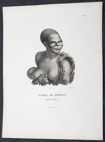
1807 Nicolas Baudin & N M Petit Antique Print of Tasmanian Aboriginal Arra Maida
Antique Map
- Title : Terre De Diemen Arra Maida
- Size: 13in x 10in (330mm x 255mm)
- Condition: (A+) Fine Condition
- Date : 1807
- Ref #: 93085
Description:
This exquisite, rare original copper-plate engraved antique print of Tasmanian Aboriginal Arra Maida, visited by the Baudin Expedition to Australia in Feb. 1802, was engraved by Barthélemy Roger, after Nicolas-Martin Petit (the offical artist on the ship Géographe) and was published by Francois Peron (1775 - 1810) in the 1st edition atlas of Nicolas Thomas Baudins expedition to Australia Voyage de découvertes aux Terres Australes
Nicholas Martin Petit sailed with Nicolas Baudin on the expedition of the Géographe and the Naturaliste in late 1800. The scientific field of anthropology was in its infancy – the French had founded the Society of the Observers of Man in 1799. Having embarked as a fourth-class gunner’s mate, Petit, who had had some graphic arts training, became one of the expeditions two illustrators when the official artists quit. From June to November 1802, the expedition was delayed in Sydney while its two ships were repaired. During this time Petit completed portraits of people of the Cadigal, Dharawal, Gweagal, Kurringai and Darug language groups of the Sydney Harbour region. While the sitters names appear to be noted on the works, it is possible that the inscriptions merely reflect French misinterpretation of the Aborigines communications with them.
The portrait of Nourou-gal-derri is pictured advancing for battle.
General Definitions:
Paper thickness and quality: - Heavy and stable
Paper color : - off white
Age of map color: -
Colors used: -
General color appearance: -
Paper size: - 14in x 10in (355mm x 255mm)
Plate size: - 14in x 10in (355mm x 255mm)
Margins: - Min 1/2in (12mm)
Imperfections:
Margins: - None
Plate area: - None
Verso: - None
Background:
The Baudin Expedition of 1800 to 1803 was a French expedition to map the coast of New Holland, Australia. The expedition started with two ships, Géographe, captained by Baudin, and Naturaliste captained by Jacques Hamelin, and was accompanied by nine zoologists and botanists, including Jean-Baptiste Leschenault de la Tour, François Péron and Charles-Alexandre Lesueur as well as the geographer Pierre Faure.
The Baudin expedition departed Le Havre, France, on 19 October 1800. Because of delays in receiving his instructions and problems encountered in Isle de France (now Mauritius) they did not reach Cape Leeuwin on the south-west corner of Australia until May 1801. Upon rounding Cape Naturaliste, they entered Geographe Bay. They then sailed north, but the ships became separated and did not meet again until they reached Timor. On their journeys the Géographe and the Naturaliste surveyed large stretches of the north-western coast. The expedition was severely affected by dysentery and fever, but sailed from Timor on 13 November 1801, back down the north-west and west coast, then across the Great Australian Bight, reaching Tasmania on 13 January 1802. They charted the whole length of Tasmanias east coast and there were extensive interactions with the Indigenous Tasmanians, with whom they had peaceful relationships. They notably produced precious ethnological studies of Indigenous Tasmanians.
The expedition then began surveying the south coast of Australia, but then Captain Jacques Felix Emmanuel Hamelin in Naturaliste decided to make for Port Jackson (Sydney) as he was running short of food and water, and in need of anchors. En route, in April 1802, Hamelin explored the area of Western Port, Victoria, and gave names to places, a number of which have survived, for example, Ile des Français is now called French Island.
Meanwhile, Baudin in the Géographe continued westward, and in April 1802 encountered the British ship Investigator commanded by Matthew Flinders, also engaged in charting the coastline, at Encounter Bay in what is now South Australia. Flinders informed Baudin of his discovery of Kangaroo Island, St. Vincents and Spencers Gulfs. Baudin sailed on to the Nuyts Archipelago, the point reached by t Gulden Zeepaert in 1627 before heading for Port Jackson as well for supplies.
In late 1802 the expedition was at Port Jackson, where the government sold 60 casks of flour and 25 casks of salt meat to Baudin to resupply his two vessels. The supplies permitted Naturaliste to return to France and Géographe to continue her explorations of the Australian coast. Naturaliste took with her the Colonys staff surgeon, Mr. James Thomson, whom Governor Philip Gidley King had given permission to return to England.
Before resuming the voyage Baudin purchased a 30 ton schooner, which he named the Casuarina, a smaller vessel which could conduct close inshore survey work. He sent the larger Naturaliste under Hamelin back to France with all the specimens that had been collected by Baudin and his crew. As the voyage had progressed Louis de Freycinet, now a Lieutenant, had shown his talents as an officer and a hydrographer and so was given command of the Casuarina. The expedition then headed for Tasmania and conducted further charting of Bass Strait before sailing west, following the west coast northward, and after another visit to Timor, undertook further exploration along the north coast of Australia. Plagued by contrary winds, ill health, and because the quadrupeds and emus were very sick, it was decided on 7 July 1803 to return to France. On the return voyage, the ships stopped in Mauritius, where Baudin died of tuberculosis on 16 September 1803. The expedition finally reached France on 24 March 1804.
The scientific expedition was considered a great success, with more than 2500 new species discovered.
Nicolas-Martin Petit 1777 – 1804
Nicholas-Martin Petit was born in Paris, the son of a fan maker, and learned graphic art in the studio of Jacques Louis David. He avoided conscription into Napoleons armies, but wanting to travel, signed up with post Captain Nicholas Baudin on a voyage to the antipodes sponsored by the French government. Petit and fellow artist Charles-Alexandre Lesueur were enlisted directly by Baudin (as 4th class gunners mates) while the two official artists were hired by the organisers of the expedition. Baudin set off in two lavishly equipped vessels, the Géographe and the Naturaliste on 19 October 1800. By the time the expedition reached Mauritius the official artists had quit. Petit and Lesueur took over their duties, but as neither was trained in scientific method or presentation, the value of their work was primarily aesthetic. The French were at this time developing a new scientific field - anthropology. The Society of the Observers of Man was founded in 1799 for this purpose. The study of Man formed part of the background for Petits sensitive drawings and paintings of the indigenous people of Van Diemens Land, Port Jackson and Western Australia. Lesueur focused on the depiction of animals. The expedition charted the coast of Western Australia and Van Diemens land but was plagued by scurvy. On 20 June 1802 the two ships limped into Port Jackson and stayed for five months to refit, during which time Petit completed a number of portraits of Sydney Indigenous people, including the two images of the Eora men, Cour-rou-bari-gal and Y-erren-gou-la-ga. Petit eventually returned to France in 1804. However, before he was well enough to complete the drawings from the expedition he was hurt in a street accident, and he died at the age of 28. Petits unfinished work was first published in 1807 in the Atlas of the Voyage de découvertes aux terres australes and as discrete prints.
Baudin, Nicolas Thomas 1754 – 1803
Baudin was a French explorer, cartographer, naturalist and hydrographer. Born a commoner in Saint-Martin-de-Ré on the Île de Ré on 17 February 1754 Baudin joined the merchant navy at the age of 15 and the French East India Company at the age of 20.
Baudin then joined the La Marine Royale (French Navy) in 1774 and served in the Caribbean as an officier bleu during the American War of Independence of 1775–1783.
In 1785 Baudin and his brother Alexandre were respectively masters of the St Remy and Caroline, taking Acadian settlers from Nantes to La Nouvelle Orléans. In New Orleans local merchants contracted him to take a cargo of wood, salted meat, cod and flour to Isle de France (now Mauritius), which he did in Josephine (also called Pepita), departing New Orleans on 14 July 1786 and arriving at Isle de France on 27 March 1787. In the course of the voyage, Josephine had called at Cap‑Français in Haiti to make a contract to transport slaves there from Madagascar; while in Haiti he also encountered the Austrian botanist Franz Josef Maerter, who apparently informed him that another Austrian botanist, Franz Boos, was at the Cape of Good Hope awaiting a ship to take him to Mauritius. Josephine called at the Cape and took Boos on board. At Mauritius, Boos chartered Baudin to transport him and the collection of plant specimens he had gathered there and at the Cape back to Europe, which Baudin did, Josephine arriving at Trieste on 18 June 1788. The Imperial government in Vienna was contemplating organizing another natural-history expedition, to which Boos would be appointed, in which two ships would be sent to the Malabar and Coromandel coasts of India, the Persian Gulf, Bengal, Ceylon, Sumatra, Java, Borneo, Cochin China, Tongking, Japan and China. Baudin had been given reason to hope that he would be given command of the ships of this expedition.
Later in 1788 Baudin sailed on a commercial voyage from Trieste to Canton in Jardiniere. He apparently arrived at Canton from Mauritius under the flag of the United States of America, probably to avoid the possibility of having his ship seized by the Chinese for payment of the debts owed them by the Imperial Asiatic Company of Trieste. From there, he sent Jardiniere under her second captain on a fur-trading venture to the north-west coast of America, but the ship foundered off Asuncion Island in the Marianas in late 1789.
Baudin made his way to Mauritius, where he purchased a replacement ship, Jardiniere II, but this vessel was wrecked in a cyclone that struck Port Louis on 15 December 1789. Baudin embarked on the Spanish Royal Philippines Company ship, Placeres, which sailed from Port Louis for Cadiz in August 1790. Placeres called at the Cape of Good Hope where it took on board the large number of plant and animal specimens collected in South Africa for the Imperial palace at Schönbrunn by Georg Scholl, the assistant of Franz Boos. Because of the poor condition of the ship, Placeres had to put in at the island of Trinidad in the West Indies, where Scholls collection of specimens was deposited.
Baudin proceeded to Martinique, from where he addressed an offer to the Imperial government in Vienna to conduct to Canton commissioners who would be empowered to negotiate with the Chinese merchants there a settlement of the debts incurred by the Imperial Asiatic Company, which would enable the company to renew its trade with China. On its return voyage from Canton, the proposed expedition would call at the Cape of Good Hope to pick up Scholl and the remainder of his natural-history collection for conveyance to Schönbrunn.
After returning to Vienna in September 1791, Baudin continued to press his case for an expedition under the Imperial flag to the Indian Ocean and China, and in January 1792 he was granted a commission of captain in the Imperial navy for this purpose. A ship, called Jardiniere, was acquired and the botanists Franz Bredemeyer and Joseph van der Schot appointed to the expedition. After delays caused by the outbreak of war between France and Austria (April 1792), Jardiniere departed from the Spanish port of Málaga on 1 October 1792. From the Cape of Good Hope Jardiniere sailed across the Indian Ocean to the coast of New Holland (Australia), but two consecutive cyclones prevented the expedition from doing any work there and forced Baudin to take the ship to Bombay for repairs.
From Bombay the expedition proceeded to the Persian Gulf, the Red Sea and the east coast of Africa, where it gathered botanical and zoological collections. The expedition came to an abrupt end in June 1794 when Jardiniere went aground in a storm while attempting to enter Table Bay at the Cape of Good Hope. Baudin survived the wreck and made his way to the United States, from where he went to France. He managed to send Jardinieres cargo of natural history specimens to the island of Trinidad.
In Paris, Baudin visited Antoine de Jussieu at the Museum National dHistoire Naturelle in March 1796 to suggest a botanical voyage to the Caribbean, during which he would recover the collection of specimens he had left in Trinidad. The Museum and the French government accepted the proposal, and Baudin was appointed commander of an expedition in the ship Belle Angélique, with four assigned botanists: René Maugé, André Pierre Ledru, Anselme Riedlé and Stanislas Levillain. Belle Angélique cleared Le Havre on 30 September 1796 for the Canary Islands, where the ship was condemned as unseaworthy. The expedition sailed from the Canaries in a replacement vessel, Fanny, and reached Trinidad in April 1797. The British, who had just captured the island from the Spanish in February 1797, refused to allow Baudin to recover the collection of natural-history specimens. Baudin took Fanny to St. Thomas and St. Croix, and then to Puerto Rico, specimens being collected in all three islands. At St Croix, Fanny was replaced by a newly purchased ship, renamed Belle Angelique. The expedition returned to France in June 1798 with a large collection of plants, birds and insects, which was incorporated into Napoleon Bonapartes triumphal procession celebrating his recent Italian victories.
On 24 July 1798, at the suggestion of the Ministry of Marine, Baudin presented to the Assembly of Professors and Administrators of the National Museum of Natural History a plan for a hydrographic-survey expedition to the South Seas, which would include a search for fauna and flora that could be brought back for cultivation in France. The expedition would also have the aim of promoting the economic and commercial interests of France in the regions to be visited. The expedition would require two well-equipped ships, which would carry a team of astronomers, naturalists and scientific draughtsmen over whom Baudin as commander would have absolute authority. The first part of the voyage would be devoted to a thorough exploration of the coast of Chile and the collection of animal, bird and plant specimens suitable for acclimatization in France, followed by a survey of the coasts from Peru to Mexico. The expedition would then continue into the Pacific Ocean, including a visit to Tahiti and the Society Islands, and would be completed with a survey of the yet unexplored south-west coast of New Holland (Australia). After considering this extensive proposal, the French government decided to proceed with an expedition confined to a survey of western and southern New Holland (as Australia was called at the time).
In October 1800 Baudin was selected to lead what has become known as the Baudin expedition to map the coast of Australia (New Holland). He had two ships, Géographe and Naturaliste captained by Hamelin, and a suite of nine zoologists and botanists, including Jean Baptiste Leschenault de la Tour. He reached Australia in May 1801, and would explore and map the western coast and a part of the little-known southern coast of the continent. The scientific expedition proved a great success, with more than 2500 new species discovered. The French also met Aboriginal peoples and treated them with great respect.
In April 1802 Baudin met Matthew Flinders, also engaged in charting the coastline, in Encounter Bay in present-day South Australia. Baudin then stopped at the British colony at Sydney for supplies. In Sydney he bought a new ship — Casuarina — named after the wood it was made from. From there he sent home Naturaliste, which had on board all of the specimens that had been discovered by Baudin and his crew. He then headed for Tasmania, before continuing north to Timor. Baudin then sailed for home, stopping at Mauritius.
According to recent researches by academics from the University of Adelaide, during Baudins expedition, François Péron, who had become the chief zoologist and intellectual leader of the mission, wrote a report for Napoleon on ways to invade and capture the British colony at Sydney Cove.
Baudin died of tuberculosis at Mauritius on 16 September 1803, at the age of 49, apparently in the home of Madame Alexandrine Kerivel. Baudins exact resting place is not known, but the historian Auguste Toussaint believed that he was interred in the Kerivel family vault. However, the historian Edward Duyker likes to think that Baudin was buried in Le Cimetière de lOuest in the district of Port Louis just a few hundred metres from the explorers certain love: the sea.
Please note all items auctioned are genuine, we do not sell reproductions. A Certificate of Authenticity (COA) can be issued on request.
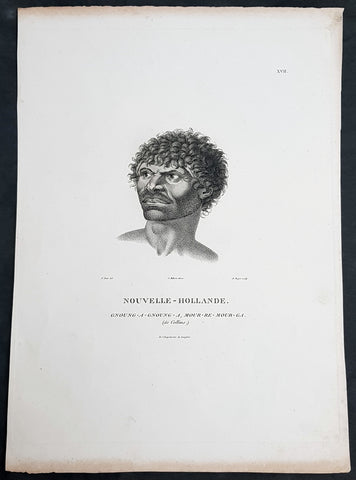
1807 Baudin & Petit Antique Print Sydney Aboriginal Gnung-a Gnung-a Murremurgan - Bennelong
Antique Map
- Title : Nouvelle-Hollande. Gnoung-a-gnoung-a Mour-re-mour-ga (dit Collins)
- Size: 14in x 10in (355mm x 255mm)
- Condition: (A+) Fine Condition
- Date : 1807
- Ref #: 91239
Description:
This exquisite, rare original copper-plate engraved antique print, of the brother in law of the famous Port Jackson Aborginal leader Bennelong, Gnung-a Gnung-a Murremurgan, or Anganángan, was engraved by Barthélemy Roger, after the 1802 by Nicolas-Martin Petit, was published by Francois Peron (1775 - 1810) in the 1st edition atlas of Nicolas Thomas Baudins expedition to Australia Voyage de découvertes aux Terres Australes
Gnung-a Gnung-a Murremurgan
It is over 200 years since the death of an adventurous young Aboriginal Australian who crossed the vast Pacific Ocean to North America and returned to Sydney. From the deck of an English storeship he glimpsed many strange places, visiting Norfolk Island, Hawaii, Nootka Sound (now Vancouver, Canada) and the Spanish colonies of San Francisco, Santa Barbara and San Diego on the Californian coast.
The voyager was Gnung-a Gnung-a Murremurgan, whose wife Warreeweer was the younger sister of the Wangal leader Woollarawarre Bennelong, at that time being feted in London society. The distance Gnung-a Gnung-a traversed was some 16,000 miles (25,750 kilometres) as the crow flies, but much further in a sailing ship driven by unpredictable winds.
On the first day he ventured into the convict settlement at Sydney Cove, in November 1790, Gnung-a Gnung-a adopted the name Collins from Acting Judge Advocate David Collins, who often mentions him in An Account of the English Colony in New South Wales, published in London in 1798.
It was the idea of Major Francis Grose, acting governor of New South Wales after the departure of Captain Arthur Phillip in 1792, to embark a native of this country on HM storeship Daedalus for the purpose of acquiring our language, wrote David Collins. The 350-ton capacity vessel was ordered to resupply provisions for the expedition to the north-west coast of North America commanded by Captain George Vancouver (1757–1798). In the navy ships HMS Discovery and HMS Chatham, Captain Vancouver was to complete the survey made by Captain James Cook.
Voyage to America
HMS Daedalus sailed from Port Jackson on 1 July 1793, passing west of the Society Islands (French Polynesia) to Owhyee (Hawaii). The commander, Lieutenant James Hanson, missed a rendezvous with Vancouvers ships at Nootka Sound on 8 October, but anchored with the two survey ships off San Francisco Bay on 21 October. The three British ships followed the coast of todays California to San Diego, leaving on 9 December 1793 and arriving at Hilo in Hawaii on 8 January 1794.
The Hawaiian King Kamehameha, who warmly welcomed Vancouver, was so impressed by the good-natured, handsome Aboriginal man on the expedition that he wanted to buy him, offering in exchange canoes, weapons and curiosities.
Gnung-a Gnung-a got on well with everyone on Daedalus and Hanson was pleased by his good nature and his willingness to do whatever was asked of him. During his month in Hawaii, he often went ashore with his shipmates. Wherever he went he readily adopted the manners of those around him, Hanson later told Collins, who remarked, with ironic humour, that...........
when at Owhyee, having discovered that favours from the females were to be procured at the easy exchange for a looking-glass, a nail, or a knife, he was not backward in presenting his little offering, and was as well received as any of the white people in the ship. It was noticed too that he always displayed some taste in selecting the object of his attentions.......
Return to Sydney
Home in Sydney Town, Gnung-a Gnung-a fought and wounded a very fine young fellow called Wyatt, who had taken up with his wife during his absence and Warreeweer became the prize of the victor.
During a ritual revenge combat in December 1795, Pemulwuy, leader of the Georges River Bidjigal near Botany Bay, launched a spear at Gnung-a Gnung-a that remained fixed in his back. The English surgeons could not extract the spear and thought he was unlikely to recover. Gnung-a Gnung-a, however, left the hospital and walked about for several weeks with the spear protruding from his back. At last, wrote Collins in a footnote..........
we heard that his wife, or one of his male friends, had fixed their teeth in the wood and drawn it out after which he recovered, and was able again to go into the field. His wife War-re-weer showed by an uncommon attention her great attachment to him.......
Before this unexpected recovery, David Collins wrote a brief appreciation of his namesake:
He was much esteemed by every white man who knew him, as well on account of his personal bravery, of which we had witnessed many distinguishing proofs, as on account of a gentleness of manners which strongly marked his disposition, and shaded off the harsher lines that his uncivilised life now and then forced into the fore-ground.
While in Sydney with a scientific expedition commanded by Nicholas Baudin in 1802, the young French artist Nicolas-Martin Petit met Gnung-a Gnung-a and sketched a striking portrait that he captioned Gnoung-a gnoung-a, mour-re-mour-ga (dit Collins)
A report in the Sydney Gazette of Sunday 15 January 1809 said that the body of Collins (Gnung-a Gnung-a Murremurgan) had been found beside the Dry Store, site of the present Sirius Park in Bridge Street, Sydney. The newspaper said he had been known for the docility of his temper, and the high estimation in which he was universally held among the native tribes.
On the night of Thursday 12 January 1809, Gnung-a Gnung-as children, others he had adopted, and his brother Old Phillip, faced a salvo of spears in the ritual ordeal that followed death in Aboriginal society. The date of his death was not recorded, but it was customary to keep an overnight vigil over a dead body before burial and the subsequent revenge combat, so it was probably 11 January.
Gnung-a Gnung-a Murremurgan is one of many Aboriginal men and women who sailed from Sydney in English ships and played a significant role in Australias early maritime history.
General Definitions:
Paper thickness and quality: - Heavy and stable
Paper color : - off white
Age of map color: -
Colors used: -
General color appearance: -
Paper size: - 14in x 10in (355mm x 255mm)
Plate size: - 12 1/2in x 9 1/2in (320mm x 240mm)
Margins: - Min 1/2in (12mm)
Imperfections:
Margins: - Light age toning to outer margins
Plate area: - None
Verso: - None
Background:
The Baudin Expedition of 1800 to 1803 was a French expedition to map the coast of New Holland, Australia. The expedition started with two ships, Géographe, captained by Baudin, and Naturaliste captained by Jacques Hamelin, and was accompanied by nine zoologists and botanists, including Jean-Baptiste Leschenault de la Tour, François Péron and Charles-Alexandre Lesueur as well as the geographer Pierre Faure.
The Baudin expedition departed Le Havre, France, on 19 October 1800. Because of delays in receiving his instructions and problems encountered in Isle de France (now Mauritius) they did not reach Cape Leeuwin on the south-west corner of Australia until May 1801. Upon rounding Cape Naturaliste, they entered Geographe Bay. They then sailed north, but the ships became separated and did not meet again until they reached Timor. On their journeys the Géographe and the Naturaliste surveyed large stretches of the north-western coast. The expedition was severely affected by dysentery and fever, but sailed from Timor on 13 November 1801, back down the north-west and west coast, then across the Great Australian Bight, reaching Tasmania on 13 January 1802. They charted the whole length of Tasmanias east coast and there were extensive interactions with the Indigenous Tasmanians, with whom they had peaceful relationships. They notably produced precious ethnological studies of Indigenous Tasmanians.
The expedition then began surveying the south coast of Australia, but then Captain Jacques Felix Emmanuel Hamelin in Naturaliste decided to make for Port Jackson (Sydney) as he was running short of food and water, and in need of anchors. En route, in April 1802, Hamelin explored the area of Western Port, Victoria, and gave names to places, a number of which have survived, for example, Ile des Français is now called French Island.
Meanwhile, Baudin in the Géographe continued westward, and in April 1802 encountered the British ship Investigator commanded by Matthew Flinders, also engaged in charting the coastline, at Encounter Bay in what is now South Australia. Flinders informed Baudin of his discovery of Kangaroo Island, St. Vincents and Spencers Gulfs. Baudin sailed on to the Nuyts Archipelago, the point reached by t Gulden Zeepaert in 1627 before heading for Port Jackson as well for supplies.
In late 1802 the expedition was at Port Jackson, where the government sold 60 casks of flour and 25 casks of salt meat to Baudin to resupply his two vessels. The supplies permitted Naturaliste to return to France and Géographe to continue her explorations of the Australian coast. Naturaliste took with her the Colonys staff surgeon, Mr. James Thomson, whom Governor Philip Gidley King had given permission to return to England.
Before resuming the voyage Baudin purchased a 30 ton schooner, which he named the Casuarina, a smaller vessel which could conduct close inshore survey work. He sent the larger Naturaliste under Hamelin back to France with all the specimens that had been collected by Baudin and his crew. As the voyage had progressed Louis de Freycinet, now a Lieutenant, had shown his talents as an officer and a hydrographer and so was given command of the Casuarina. The expedition then headed for Tasmania and conducted further charting of Bass Strait before sailing west, following the west coast northward, and after another visit to Timor, undertook further exploration along the north coast of Australia. Plagued by contrary winds, ill health, and because the quadrupeds and emus were very sick, it was decided on 7 July 1803 to return to France. On the return voyage, the ships stopped in Mauritius, where Baudin died of tuberculosis on 16 September 1803. The expedition finally reached France on 24 March 1804.
The scientific expedition was considered a great success, with more than 2500 new species discovered.
Nicolas-Martin Petit 1777 – 1804
Nicholas-Martin Petit was born in Paris, the son of a fan maker, and learned graphic art in the studio of Jacques Louis David. He avoided conscription into Napoleons armies, but wanting to travel, signed up with post Captain Nicholas Baudin on a voyage to the antipodes sponsored by the French government. Petit and fellow artist Charles-Alexandre Lesueur were enlisted directly by Baudin (as 4th class gunners mates) while the two official artists were hired by the organisers of the expedition. Baudin set off in two lavishly equipped vessels, the Géographe and the Naturaliste on 19 October 1800. By the time the expedition reached Mauritius the official artists had quit. Petit and Lesueur took over their duties, but as neither was trained in scientific method or presentation, the value of their work was primarily aesthetic. The French were at this time developing a new scientific field - anthropology. The Society of the Observers of Man was founded in 1799 for this purpose. The study of Man formed part of the background for Petits sensitive drawings and paintings of the indigenous people of Van Diemens Land, Port Jackson and Western Australia. Lesueur focused on the depiction of animals. The expedition charted the coast of Western Australia and Van Diemens land but was plagued by scurvy. On 20 June 1802 the two ships limped into Port Jackson and stayed for five months to refit, during which time Petit completed a number of portraits of Sydney Indigenous people, including the two images of the Eora men, Cour-rou-bari-gal and Y-erren-gou-la-ga. Petit eventually returned to France in 1804. However, before he was well enough to complete the drawings from the expedition he was hurt in a street accident, and he died at the age of 28. Petits unfinished work was first published in 1807 in the Atlas of the Voyage de découvertes aux terres australes and as discrete prints.
Baudin, Nicolas Thomas 1754 – 1803
Baudin was a French explorer, cartographer, naturalist and hydrographer. Born a commoner in Saint-Martin-de-Ré on the Île de Ré on 17 February 1754 Baudin joined the merchant navy at the age of 15 and the French East India Company at the age of 20.
Baudin then joined the La Marine Royale (French Navy) in 1774 and served in the Caribbean as an officier bleu during the American War of Independence of 1775–1783.
In 1785 Baudin and his brother Alexandre were respectively masters of the St Remy and Caroline, taking Acadian settlers from Nantes to La Nouvelle Orléans. In New Orleans local merchants contracted him to take a cargo of wood, salted meat, cod and flour to Isle de France (now Mauritius), which he did in Josephine (also called Pepita), departing New Orleans on 14 July 1786 and arriving at Isle de France on 27 March 1787. In the course of the voyage, Josephine had called at Cap‑Français in Haiti to make a contract to transport slaves there from Madagascar; while in Haiti he also encountered the Austrian botanist Franz Josef Maerter, who apparently informed him that another Austrian botanist, Franz Boos, was at the Cape of Good Hope awaiting a ship to take him to Mauritius. Josephine called at the Cape and took Boos on board. At Mauritius, Boos chartered Baudin to transport him and the collection of plant specimens he had gathered there and at the Cape back to Europe, which Baudin did, Josephine arriving at Trieste on 18 June 1788. The Imperial government in Vienna was contemplating organizing another natural-history expedition, to which Boos would be appointed, in which two ships would be sent to the Malabar and Coromandel coasts of India, the Persian Gulf, Bengal, Ceylon, Sumatra, Java, Borneo, Cochin China, Tongking, Japan and China. Baudin had been given reason to hope that he would be given command of the ships of this expedition.
Later in 1788 Baudin sailed on a commercial voyage from Trieste to Canton in Jardiniere. He apparently arrived at Canton from Mauritius under the flag of the United States of America, probably to avoid the possibility of having his ship seized by the Chinese for payment of the debts owed them by the Imperial Asiatic Company of Trieste. From there, he sent Jardiniere under her second captain on a fur-trading venture to the north-west coast of America, but the ship foundered off Asuncion Island in the Marianas in late 1789.
Baudin made his way to Mauritius, where he purchased a replacement ship, Jardiniere II, but this vessel was wrecked in a cyclone that struck Port Louis on 15 December 1789. Baudin embarked on the Spanish Royal Philippines Company ship, Placeres, which sailed from Port Louis for Cadiz in August 1790. Placeres called at the Cape of Good Hope where it took on board the large number of plant and animal specimens collected in South Africa for the Imperial palace at Schönbrunn by Georg Scholl, the assistant of Franz Boos. Because of the poor condition of the ship, Placeres had to put in at the island of Trinidad in the West Indies, where Scholls collection of specimens was deposited.
Baudin proceeded to Martinique, from where he addressed an offer to the Imperial government in Vienna to conduct to Canton commissioners who would be empowered to negotiate with the Chinese merchants there a settlement of the debts incurred by the Imperial Asiatic Company, which would enable the company to renew its trade with China. On its return voyage from Canton, the proposed expedition would call at the Cape of Good Hope to pick up Scholl and the remainder of his natural-history collection for conveyance to Schönbrunn.
After returning to Vienna in September 1791, Baudin continued to press his case for an expedition under the Imperial flag to the Indian Ocean and China, and in January 1792 he was granted a commission of captain in the Imperial navy for this purpose. A ship, called Jardiniere, was acquired and the botanists Franz Bredemeyer and Joseph van der Schot appointed to the expedition. After delays caused by the outbreak of war between France and Austria (April 1792), Jardiniere departed from the Spanish port of Málaga on 1 October 1792. From the Cape of Good Hope Jardiniere sailed across the Indian Ocean to the coast of New Holland (Australia), but two consecutive cyclones prevented the expedition from doing any work there and forced Baudin to take the ship to Bombay for repairs.
From Bombay the expedition proceeded to the Persian Gulf, the Red Sea and the east coast of Africa, where it gathered botanical and zoological collections. The expedition came to an abrupt end in June 1794 when Jardiniere went aground in a storm while attempting to enter Table Bay at the Cape of Good Hope. Baudin survived the wreck and made his way to the United States, from where he went to France. He managed to send Jardinieres cargo of natural history specimens to the island of Trinidad.
In Paris, Baudin visited Antoine de Jussieu at the Museum National dHistoire Naturelle in March 1796 to suggest a botanical voyage to the Caribbean, during which he would recover the collection of specimens he had left in Trinidad. The Museum and the French government accepted the proposal, and Baudin was appointed commander of an expedition in the ship Belle Angélique, with four assigned botanists: René Maugé, André Pierre Ledru, Anselme Riedlé and Stanislas Levillain. Belle Angélique cleared Le Havre on 30 September 1796 for the Canary Islands, where the ship was condemned as unseaworthy. The expedition sailed from the Canaries in a replacement vessel, Fanny, and reached Trinidad in April 1797. The British, who had just captured the island from the Spanish in February 1797, refused to allow Baudin to recover the collection of natural-history specimens. Baudin took Fanny to St. Thomas and St. Croix, and then to Puerto Rico, specimens being collected in all three islands. At St Croix, Fanny was replaced by a newly purchased ship, renamed Belle Angelique. The expedition returned to France in June 1798 with a large collection of plants, birds and insects, which was incorporated into Napoleon Bonapartes triumphal procession celebrating his recent Italian victories.
On 24 July 1798, at the suggestion of the Ministry of Marine, Baudin presented to the Assembly of Professors and Administrators of the National Museum of Natural History a plan for a hydrographic-survey expedition to the South Seas, which would include a search for fauna and flora that could be brought back for cultivation in France. The expedition would also have the aim of promoting the economic and commercial interests of France in the regions to be visited. The expedition would require two well-equipped ships, which would carry a team of astronomers, naturalists and scientific draughtsmen over whom Baudin as commander would have absolute authority. The first part of the voyage would be devoted to a thorough exploration of the coast of Chile and the collection of animal, bird and plant specimens suitable for acclimatization in France, followed by a survey of the coasts from Peru to Mexico. The expedition would then continue into the Pacific Ocean, including a visit to Tahiti and the Society Islands, and would be completed with a survey of the yet unexplored south-west coast of New Holland (Australia). After considering this extensive proposal, the French government decided to proceed with an expedition confined to a survey of western and southern New Holland (as Australia was called at the time).
In October 1800 Baudin was selected to lead what has become known as the Baudin expedition to map the coast of Australia (New Holland). He had two ships, Géographe and Naturaliste captained by Hamelin, and a suite of nine zoologists and botanists, including Jean Baptiste Leschenault de la Tour. He reached Australia in May 1801, and would explore and map the western coast and a part of the little-known southern coast of the continent. The scientific expedition proved a great success, with more than 2500 new species discovered. The French also met Aboriginal peoples and treated them with great respect.
In April 1802 Baudin met Matthew Flinders, also engaged in charting the coastline, in Encounter Bay in present-day South Australia. Baudin then stopped at the British colony at Sydney for supplies. In Sydney he bought a new ship — Casuarina — named after the wood it was made from. From there he sent home Naturaliste, which had on board all of the specimens that had been discovered by Baudin and his crew. He then headed for Tasmania, before continuing north to Timor. Baudin then sailed for home, stopping at Mauritius.
According to recent researches by academics from the University of Adelaide, during Baudins expedition, François Péron, who had become the chief zoologist and intellectual leader of the mission, wrote a report for Napoleon on ways to invade and capture the British colony at Sydney Cove.
Baudin died of tuberculosis at Mauritius on 16 September 1803, at the age of 49, apparently in the home of Madame Alexandrine Kerivel. Baudins exact resting place is not known, but the historian Auguste Toussaint believed that he was interred in the Kerivel family vault. However, the historian Edward Duyker likes to think that Baudin was buried in Le Cimetière de lOuest in the district of Port Louis just a few hundred metres from the explorers certain love: the sea.
Please note all items auctioned are genuine, we do not sell reproductions. A Certificate of Authenticity (COA) can be issued on request.
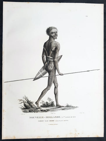
1807 Baudin & Petit Antique Print of a Sydney & Port Jackson Aboriginal Warrior
Antique Map
- Title : Nouvelle-Hollande. Nelle Galles Du Sud. Nourou-gal-derri & avancant pour combattre
- Size: 13in x 10in (330mm x 255mm)
- Condition: (A+) Fine Condition
- Date : 1807
- Ref #: 93087
Description:
This exquisite, rare original copper-plate engraved antique print of an Aboriginal warrior of Port Jackson carrying a spear & shield, was engraved by Barthélemy Roger, after the 1802 drawing by Nicolas-Martin Petit and was published by Francois Peron (1775 - 1810) in the 1st edition atlas of Nicolas Thomas Baudins expedition to Australia Voyage de découvertes aux Terres Australes in 1807.
This is a wonderful original stipple point engraving by Petit & Roger bringing to life this wonderful 1st Australian.
Nicholas Martin Petit sailed with Nicolas Baudin on the expedition of the Géographe and the Naturaliste in late 1800. The scientific field of anthropology was in its infancy – the French had founded the Society of the Observers of Man in 1799. Having embarked as a fourth-class gunner’s mate, Petit, who had had some graphic arts training, became one of the expeditions two illustrators when the official artists quit. From June to November 1802, the expedition was delayed in Sydney while its two ships were repaired. During this time Petit completed portraits of people of the Cadigal, Dharawal, Gweagal, Kurringai and Darug language groups of the Sydney Harbour region. While the sitters names appear to be noted on the works, it is possible that the inscriptions merely reflect French misinterpretation of the Aborigines communications with them.
The portrait of Nourou-gal-derri is pictured advancing for battle.
General Definitions:
Paper thickness and quality: - Heavy and stable
Paper color : - off white
Age of map color: -
Colors used: -
General color appearance: -
Paper size: - 13in x 10in (330mm x 255mm)
Plate size: - 13in x 10in (330mm x 255mm)
Margins: - Min 1/2in (12mm)
Imperfections:
Margins: - Light spotting to left and bottom margins, not affecting the image
Plate area: - None
Verso: - None
Background:
The Baudin Expedition of 1800 to 1803 was a French expedition to map the coast of New Holland, Australia. The expedition started with two ships, Géographe, captained by Baudin, and Naturaliste captained by Jacques Hamelin, and was accompanied by nine zoologists and botanists, including Jean-Baptiste Leschenault de la Tour, François Péron and Charles-Alexandre Lesueur as well as the geographer Pierre Faure.
The Baudin expedition departed Le Havre, France, on 19 October 1800. Because of delays in receiving his instructions and problems encountered in Isle de France (now Mauritius) they did not reach Cape Leeuwin on the south-west corner of Australia until May 1801. Upon rounding Cape Naturaliste, they entered Geographe Bay. They then sailed north, but the ships became separated and did not meet again until they reached Timor. On their journeys the Géographe and the Naturaliste surveyed large stretches of the north-western coast. The expedition was severely affected by dysentery and fever, but sailed from Timor on 13 November 1801, back down the north-west and west coast, then across the Great Australian Bight, reaching Tasmania on 13 January 1802. They charted the whole length of Tasmanias east coast and there were extensive interactions with the Indigenous Tasmanians, with whom they had peaceful relationships. They notably produced precious ethnological studies of Indigenous Tasmanians.
The expedition then began surveying the south coast of Australia, but then Captain Jacques Felix Emmanuel Hamelin in Naturaliste decided to make for Port Jackson (Sydney) as he was running short of food and water, and in need of anchors. En route, in April 1802, Hamelin explored the area of Western Port, Victoria, and gave names to places, a number of which have survived, for example, Ile des Français is now called French Island.
Meanwhile, Baudin in the Géographe continued westward, and in April 1802 encountered the British ship Investigator commanded by Matthew Flinders, also engaged in charting the coastline, at Encounter Bay in what is now South Australia. Flinders informed Baudin of his discovery of Kangaroo Island, St. Vincents and Spencers Gulfs. Baudin sailed on to the Nuyts Archipelago, the point reached by t Gulden Zeepaert in 1627 before heading for Port Jackson as well for supplies.
In late 1802 the expedition was at Port Jackson, where the government sold 60 casks of flour and 25 casks of salt meat to Baudin to resupply his two vessels. The supplies permitted Naturaliste to return to France and Géographe to continue her explorations of the Australian coast. Naturaliste took with her the Colonys staff surgeon, Mr. James Thomson, whom Governor Philip Gidley King had given permission to return to England.
Before resuming the voyage Baudin purchased a 30 ton schooner, which he named the Casuarina, a smaller vessel which could conduct close inshore survey work. He sent the larger Naturaliste under Hamelin back to France with all the specimens that had been collected by Baudin and his crew. As the voyage had progressed Louis de Freycinet, now a Lieutenant, had shown his talents as an officer and a hydrographer and so was given command of the Casuarina. The expedition then headed for Tasmania and conducted further charting of Bass Strait before sailing west, following the west coast northward, and after another visit to Timor, undertook further exploration along the north coast of Australia. Plagued by contrary winds, ill health, and because the quadrupeds and emus were very sick, it was decided on 7 July 1803 to return to France. On the return voyage, the ships stopped in Mauritius, where Baudin died of tuberculosis on 16 September 1803. The expedition finally reached France on 24 March 1804.
The scientific expedition was considered a great success, with more than 2500 new species discovered.
Nicolas-Martin Petit 1777 – 1804
Nicholas-Martin Petit was born in Paris, the son of a fan maker, and learned graphic art in the studio of Jacques Louis David. He avoided conscription into Napoleons armies, but wanting to travel, signed up with post Captain Nicholas Baudin on a voyage to the antipodes sponsored by the French government. Petit and fellow artist Charles-Alexandre Lesueur were enlisted directly by Baudin (as 4th class gunners mates) while the two official artists were hired by the organisers of the expedition. Baudin set off in two lavishly equipped vessels, the Géographe and the Naturaliste on 19 October 1800. By the time the expedition reached Mauritius the official artists had quit. Petit and Lesueur took over their duties, but as neither was trained in scientific method or presentation, the value of their work was primarily aesthetic. The French were at this time developing a new scientific field - anthropology. The Society of the Observers of Man was founded in 1799 for this purpose. The study of Man formed part of the background for Petits sensitive drawings and paintings of the indigenous people of Van Diemens Land, Port Jackson and Western Australia. Lesueur focused on the depiction of animals. The expedition charted the coast of Western Australia and Van Diemens land but was plagued by scurvy. On 20 June 1802 the two ships limped into Port Jackson and stayed for five months to refit, during which time Petit completed a number of portraits of Sydney Indigenous people, including the two images of the Eora men, Cour-rou-bari-gal and Y-erren-gou-la-ga. Petit eventually returned to France in 1804. However, before he was well enough to complete the drawings from the expedition he was hurt in a street accident, and he died at the age of 28. Petits unfinished work was first published in 1807 in the Atlas of the Voyage de découvertes aux terres australes and as discrete prints.
Baudin, Nicolas Thomas 1754 – 1803
Baudin was a French explorer, cartographer, naturalist and hydrographer. Born a commoner in Saint-Martin-de-Ré on the Île de Ré on 17 February 1754 Baudin joined the merchant navy at the age of 15 and the French East India Company at the age of 20.
Baudin then joined the La Marine Royale (French Navy) in 1774 and served in the Caribbean as an officier bleu during the American War of Independence of 1775–1783.
In 1785 Baudin and his brother Alexandre were respectively masters of the St Remy and Caroline, taking Acadian settlers from Nantes to La Nouvelle Orléans. In New Orleans local merchants contracted him to take a cargo of wood, salted meat, cod and flour to Isle de France (now Mauritius), which he did in Josephine (also called Pepita), departing New Orleans on 14 July 1786 and arriving at Isle de France on 27 March 1787. In the course of the voyage, Josephine had called at Cap‑Français in Haiti to make a contract to transport slaves there from Madagascar; while in Haiti he also encountered the Austrian botanist Franz Josef Maerter, who apparently informed him that another Austrian botanist, Franz Boos, was at the Cape of Good Hope awaiting a ship to take him to Mauritius. Josephine called at the Cape and took Boos on board. At Mauritius, Boos chartered Baudin to transport him and the collection of plant specimens he had gathered there and at the Cape back to Europe, which Baudin did, Josephine arriving at Trieste on 18 June 1788. The Imperial government in Vienna was contemplating organizing another natural-history expedition, to which Boos would be appointed, in which two ships would be sent to the Malabar and Coromandel coasts of India, the Persian Gulf, Bengal, Ceylon, Sumatra, Java, Borneo, Cochin China, Tongking, Japan and China. Baudin had been given reason to hope that he would be given command of the ships of this expedition.
Later in 1788 Baudin sailed on a commercial voyage from Trieste to Canton in Jardiniere. He apparently arrived at Canton from Mauritius under the flag of the United States of America, probably to avoid the possibility of having his ship seized by the Chinese for payment of the debts owed them by the Imperial Asiatic Company of Trieste. From there, he sent Jardiniere under her second captain on a fur-trading venture to the north-west coast of America, but the ship foundered off Asuncion Island in the Marianas in late 1789.
Baudin made his way to Mauritius, where he purchased a replacement ship, Jardiniere II, but this vessel was wrecked in a cyclone that struck Port Louis on 15 December 1789. Baudin embarked on the Spanish Royal Philippines Company ship, Placeres, which sailed from Port Louis for Cadiz in August 1790. Placeres called at the Cape of Good Hope where it took on board the large number of plant and animal specimens collected in South Africa for the Imperial palace at Schönbrunn by Georg Scholl, the assistant of Franz Boos. Because of the poor condition of the ship, Placeres had to put in at the island of Trinidad in the West Indies, where Scholls collection of specimens was deposited.
Baudin proceeded to Martinique, from where he addressed an offer to the Imperial government in Vienna to conduct to Canton commissioners who would be empowered to negotiate with the Chinese merchants there a settlement of the debts incurred by the Imperial Asiatic Company, which would enable the company to renew its trade with China. On its return voyage from Canton, the proposed expedition would call at the Cape of Good Hope to pick up Scholl and the remainder of his natural-history collection for conveyance to Schönbrunn.
After returning to Vienna in September 1791, Baudin continued to press his case for an expedition under the Imperial flag to the Indian Ocean and China, and in January 1792 he was granted a commission of captain in the Imperial navy for this purpose. A ship, called Jardiniere, was acquired and the botanists Franz Bredemeyer and Joseph van der Schot appointed to the expedition. After delays caused by the outbreak of war between France and Austria (April 1792), Jardiniere departed from the Spanish port of Málaga on 1 October 1792. From the Cape of Good Hope Jardiniere sailed across the Indian Ocean to the coast of New Holland (Australia), but two consecutive cyclones prevented the expedition from doing any work there and forced Baudin to take the ship to Bombay for repairs.
From Bombay the expedition proceeded to the Persian Gulf, the Red Sea and the east coast of Africa, where it gathered botanical and zoological collections. The expedition came to an abrupt end in June 1794 when Jardiniere went aground in a storm while attempting to enter Table Bay at the Cape of Good Hope. Baudin survived the wreck and made his way to the United States, from where he went to France. He managed to send Jardinieres cargo of natural history specimens to the island of Trinidad.
In Paris, Baudin visited Antoine de Jussieu at the Museum National dHistoire Naturelle in March 1796 to suggest a botanical voyage to the Caribbean, during which he would recover the collection of specimens he had left in Trinidad. The Museum and the French government accepted the proposal, and Baudin was appointed commander of an expedition in the ship Belle Angélique, with four assigned botanists: René Maugé, André Pierre Ledru, Anselme Riedlé and Stanislas Levillain. Belle Angélique cleared Le Havre on 30 September 1796 for the Canary Islands, where the ship was condemned as unseaworthy. The expedition sailed from the Canaries in a replacement vessel, Fanny, and reached Trinidad in April 1797. The British, who had just captured the island from the Spanish in February 1797, refused to allow Baudin to recover the collection of natural-history specimens. Baudin took Fanny to St. Thomas and St. Croix, and then to Puerto Rico, specimens being collected in all three islands. At St Croix, Fanny was replaced by a newly purchased ship, renamed Belle Angelique. The expedition returned to France in June 1798 with a large collection of plants, birds and insects, which was incorporated into Napoleon Bonapartes triumphal procession celebrating his recent Italian victories.
On 24 July 1798, at the suggestion of the Ministry of Marine, Baudin presented to the Assembly of Professors and Administrators of the National Museum of Natural History a plan for a hydrographic-survey expedition to the South Seas, which would include a search for fauna and flora that could be brought back for cultivation in France. The expedition would also have the aim of promoting the economic and commercial interests of France in the regions to be visited. The expedition would require two well-equipped ships, which would carry a team of astronomers, naturalists and scientific draughtsmen over whom Baudin as commander would have absolute authority. The first part of the voyage would be devoted to a thorough exploration of the coast of Chile and the collection of animal, bird and plant specimens suitable for acclimatization in France, followed by a survey of the coasts from Peru to Mexico. The expedition would then continue into the Pacific Ocean, including a visit to Tahiti and the Society Islands, and would be completed with a survey of the yet unexplored south-west coast of New Holland (Australia). After considering this extensive proposal, the French government decided to proceed with an expedition confined to a survey of western and southern New Holland (as Australia was called at the time).
In October 1800 Baudin was selected to lead what has become known as the Baudin expedition to map the coast of Australia (New Holland). He had two ships, Géographe and Naturaliste captained by Hamelin, and a suite of nine zoologists and botanists, including Jean Baptiste Leschenault de la Tour. He reached Australia in May 1801, and would explore and map the western coast and a part of the little-known southern coast of the continent. The scientific expedition proved a great success, with more than 2500 new species discovered. The French also met Aboriginal peoples and treated them with great respect.
In April 1802 Baudin met Matthew Flinders, also engaged in charting the coastline, in Encounter Bay in present-day South Australia. Baudin then stopped at the British colony at Sydney for supplies. In Sydney he bought a new ship — Casuarina — named after the wood it was made from. From there he sent home Naturaliste, which had on board all of the specimens that had been discovered by Baudin and his crew. He then headed for Tasmania, before continuing north to Timor. Baudin then sailed for home, stopping at Mauritius.
According to recent researches by academics from the University of Adelaide, during Baudins expedition, François Péron, who had become the chief zoologist and intellectual leader of the mission, wrote a report for Napoleon on ways to invade and capture the British colony at Sydney Cove.
Baudin died of tuberculosis at Mauritius on 16 September 1803, at the age of 49, apparently in the home of Madame Alexandrine Kerivel. Baudins exact resting place is not known, but the historian Auguste Toussaint believed that he was interred in the Kerivel family vault. However, the historian Edward Duyker likes to think that Baudin was buried in Le Cimetière de lOuest in the district of Port Louis just a few hundred metres from the explorers certain love: the sea.
Please note all items auctioned are genuine, we do not sell reproductions. A Certificate of Authenticity (COA) can be issued on request.
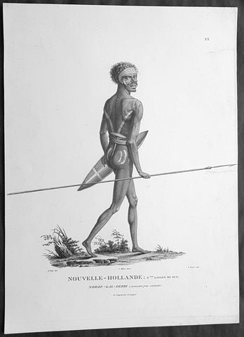
1807 Baudin & Petit Antique Print of a Sydney & Port Jackson Aboriginal Warrior
Antique Map
- Title : Nouvelle-Hollande. Nelle Galles Du Sud. Nourou-gal-derri & avancant pour combattre
- Size: 14in x 10in (355mm x 255mm)
- Condition: (A+) Fine Condition
- Date : 1807
- Ref #: 91240
Description:
This exquisite, rare original copper-plate engraved antique print of an Aboriginal warrior of Port Jackson carrying a spear & shield, was engraved by Barthélemy Roger, after the 1802 drawing by Nicolas-Martin Petit and was published by Francois Peron (1775 - 1810) in the 1st edition atlas of Nicolas Thomas Baudins expedition to Australia Voyage de découvertes aux Terres Australes in 1807.
This is a wonderful original stipple point engraving by Petit & Roger bringing to life this wonderful 1st Australian.
Nicholas Martin Petit sailed with Nicolas Baudin on the expedition of the Géographe and the Naturaliste in late 1800. The scientific field of anthropology was in its infancy – the French had founded the Society of the Observers of Man in 1799. Having embarked as a fourth-class gunner’s mate, Petit, who had had some graphic arts training, became one of the expeditions two illustrators when the official artists quit. From June to November 1802, the expedition was delayed in Sydney while its two ships were repaired. During this time Petit completed portraits of people of the Cadigal, Dharawal, Gweagal, Kurringai and Darug language groups of the Sydney Harbour region. While the sitters names appear to be noted on the works, it is possible that the inscriptions merely reflect French misinterpretation of the Aborigines communications with them.
The portrait of Nourou-gal-derri is pictured advancing for battle.
General Definitions:
Paper thickness and quality: - Heavy and stable
Paper color : - off white
Age of map color: -
Colors used: -
General color appearance: -
Paper size: - 14in x 10in (355mm x 255mm)
Plate size: - 12 1/2in x 9 1/2in (320mm x 240mm)
Margins: - Min 1/2in (12mm)
Imperfections:
Margins: - None
Plate area: - 2 small repair to left margin, no loss
Verso: - None
Background:
The Baudin Expedition of 1800 to 1803 was a French expedition to map the coast of New Holland, Australia. The expedition started with two ships, Géographe, captained by Baudin, and Naturaliste captained by Jacques Hamelin, and was accompanied by nine zoologists and botanists, including Jean-Baptiste Leschenault de la Tour, François Péron and Charles-Alexandre Lesueur as well as the geographer Pierre Faure.
The Baudin expedition departed Le Havre, France, on 19 October 1800. Because of delays in receiving his instructions and problems encountered in Isle de France (now Mauritius) they did not reach Cape Leeuwin on the south-west corner of Australia until May 1801. Upon rounding Cape Naturaliste, they entered Geographe Bay. They then sailed north, but the ships became separated and did not meet again until they reached Timor. On their journeys the Géographe and the Naturaliste surveyed large stretches of the north-western coast. The expedition was severely affected by dysentery and fever, but sailed from Timor on 13 November 1801, back down the north-west and west coast, then across the Great Australian Bight, reaching Tasmania on 13 January 1802. They charted the whole length of Tasmanias east coast and there were extensive interactions with the Indigenous Tasmanians, with whom they had peaceful relationships. They notably produced precious ethnological studies of Indigenous Tasmanians.
The expedition then began surveying the south coast of Australia, but then Captain Jacques Felix Emmanuel Hamelin in Naturaliste decided to make for Port Jackson (Sydney) as he was running short of food and water, and in need of anchors. En route, in April 1802, Hamelin explored the area of Western Port, Victoria, and gave names to places, a number of which have survived, for example, Ile des Français is now called French Island.
Meanwhile, Baudin in the Géographe continued westward, and in April 1802 encountered the British ship Investigator commanded by Matthew Flinders, also engaged in charting the coastline, at Encounter Bay in what is now South Australia. Flinders informed Baudin of his discovery of Kangaroo Island, St. Vincents and Spencers Gulfs. Baudin sailed on to the Nuyts Archipelago, the point reached by t Gulden Zeepaert in 1627 before heading for Port Jackson as well for supplies.
In late 1802 the expedition was at Port Jackson, where the government sold 60 casks of flour and 25 casks of salt meat to Baudin to resupply his two vessels. The supplies permitted Naturaliste to return to France and Géographe to continue her explorations of the Australian coast. Naturaliste took with her the Colonys staff surgeon, Mr. James Thomson, whom Governor Philip Gidley King had given permission to return to England.
Before resuming the voyage Baudin purchased a 30 ton schooner, which he named the Casuarina, a smaller vessel which could conduct close inshore survey work. He sent the larger Naturaliste under Hamelin back to France with all the specimens that had been collected by Baudin and his crew. As the voyage had progressed Louis de Freycinet, now a Lieutenant, had shown his talents as an officer and a hydrographer and so was given command of the Casuarina. The expedition then headed for Tasmania and conducted further charting of Bass Strait before sailing west, following the west coast northward, and after another visit to Timor, undertook further exploration along the north coast of Australia. Plagued by contrary winds, ill health, and because the quadrupeds and emus were very sick, it was decided on 7 July 1803 to return to France. On the return voyage, the ships stopped in Mauritius, where Baudin died of tuberculosis on 16 September 1803. The expedition finally reached France on 24 March 1804.
The scientific expedition was considered a great success, with more than 2500 new species discovered.
Nicolas-Martin Petit 1777 – 1804
Nicholas-Martin Petit was born in Paris, the son of a fan maker, and learned graphic art in the studio of Jacques Louis David. He avoided conscription into Napoleons armies, but wanting to travel, signed up with post Captain Nicholas Baudin on a voyage to the antipodes sponsored by the French government. Petit and fellow artist Charles-Alexandre Lesueur were enlisted directly by Baudin (as 4th class gunners mates) while the two official artists were hired by the organisers of the expedition. Baudin set off in two lavishly equipped vessels, the Géographe and the Naturaliste on 19 October 1800. By the time the expedition reached Mauritius the official artists had quit. Petit and Lesueur took over their duties, but as neither was trained in scientific method or presentation, the value of their work was primarily aesthetic. The French were at this time developing a new scientific field - anthropology. The Society of the Observers of Man was founded in 1799 for this purpose. The study of Man formed part of the background for Petits sensitive drawings and paintings of the indigenous people of Van Diemens Land, Port Jackson and Western Australia. Lesueur focused on the depiction of animals. The expedition charted the coast of Western Australia and Van Diemens land but was plagued by scurvy. On 20 June 1802 the two ships limped into Port Jackson and stayed for five months to refit, during which time Petit completed a number of portraits of Sydney Indigenous people, including the two images of the Eora men, Cour-rou-bari-gal and Y-erren-gou-la-ga. Petit eventually returned to France in 1804. However, before he was well enough to complete the drawings from the expedition he was hurt in a street accident, and he died at the age of 28. Petits unfinished work was first published in 1807 in the Atlas of the Voyage de découvertes aux terres australes and as discrete prints.
Baudin, Nicolas Thomas 1754 – 1803
Baudin was a French explorer, cartographer, naturalist and hydrographer. Born a commoner in Saint-Martin-de-Ré on the Île de Ré on 17 February 1754 Baudin joined the merchant navy at the age of 15 and the French East India Company at the age of 20.
Baudin then joined the La Marine Royale (French Navy) in 1774 and served in the Caribbean as an officier bleu during the American War of Independence of 1775–1783.
In 1785 Baudin and his brother Alexandre were respectively masters of the St Remy and Caroline, taking Acadian settlers from Nantes to La Nouvelle Orléans. In New Orleans local merchants contracted him to take a cargo of wood, salted meat, cod and flour to Isle de France (now Mauritius), which he did in Josephine (also called Pepita), departing New Orleans on 14 July 1786 and arriving at Isle de France on 27 March 1787. In the course of the voyage, Josephine had called at Cap‑Français in Haiti to make a contract to transport slaves there from Madagascar; while in Haiti he also encountered the Austrian botanist Franz Josef Maerter, who apparently informed him that another Austrian botanist, Franz Boos, was at the Cape of Good Hope awaiting a ship to take him to Mauritius. Josephine called at the Cape and took Boos on board. At Mauritius, Boos chartered Baudin to transport him and the collection of plant specimens he had gathered there and at the Cape back to Europe, which Baudin did, Josephine arriving at Trieste on 18 June 1788. The Imperial government in Vienna was contemplating organizing another natural-history expedition, to which Boos would be appointed, in which two ships would be sent to the Malabar and Coromandel coasts of India, the Persian Gulf, Bengal, Ceylon, Sumatra, Java, Borneo, Cochin China, Tongking, Japan and China. Baudin had been given reason to hope that he would be given command of the ships of this expedition.
Later in 1788 Baudin sailed on a commercial voyage from Trieste to Canton in Jardiniere. He apparently arrived at Canton from Mauritius under the flag of the United States of America, probably to avoid the possibility of having his ship seized by the Chinese for payment of the debts owed them by the Imperial Asiatic Company of Trieste. From there, he sent Jardiniere under her second captain on a fur-trading venture to the north-west coast of America, but the ship foundered off Asuncion Island in the Marianas in late 1789.
Baudin made his way to Mauritius, where he purchased a replacement ship, Jardiniere II, but this vessel was wrecked in a cyclone that struck Port Louis on 15 December 1789. Baudin embarked on the Spanish Royal Philippines Company ship, Placeres, which sailed from Port Louis for Cadiz in August 1790. Placeres called at the Cape of Good Hope where it took on board the large number of plant and animal specimens collected in South Africa for the Imperial palace at Schönbrunn by Georg Scholl, the assistant of Franz Boos. Because of the poor condition of the ship, Placeres had to put in at the island of Trinidad in the West Indies, where Scholls collection of specimens was deposited.
Baudin proceeded to Martinique, from where he addressed an offer to the Imperial government in Vienna to conduct to Canton commissioners who would be empowered to negotiate with the Chinese merchants there a settlement of the debts incurred by the Imperial Asiatic Company, which would enable the company to renew its trade with China. On its return voyage from Canton, the proposed expedition would call at the Cape of Good Hope to pick up Scholl and the remainder of his natural-history collection for conveyance to Schönbrunn.
After returning to Vienna in September 1791, Baudin continued to press his case for an expedition under the Imperial flag to the Indian Ocean and China, and in January 1792 he was granted a commission of captain in the Imperial navy for this purpose. A ship, called Jardiniere, was acquired and the botanists Franz Bredemeyer and Joseph van der Schot appointed to the expedition. After delays caused by the outbreak of war between France and Austria (April 1792), Jardiniere departed from the Spanish port of Málaga on 1 October 1792. From the Cape of Good Hope Jardiniere sailed across the Indian Ocean to the coast of New Holland (Australia), but two consecutive cyclones prevented the expedition from doing any work there and forced Baudin to take the ship to Bombay for repairs.
From Bombay the expedition proceeded to the Persian Gulf, the Red Sea and the east coast of Africa, where it gathered botanical and zoological collections. The expedition came to an abrupt end in June 1794 when Jardiniere went aground in a storm while attempting to enter Table Bay at the Cape of Good Hope. Baudin survived the wreck and made his way to the United States, from where he went to France. He managed to send Jardinieres cargo of natural history specimens to the island of Trinidad.
In Paris, Baudin visited Antoine de Jussieu at the Museum National dHistoire Naturelle in March 1796 to suggest a botanical voyage to the Caribbean, during which he would recover the collection of specimens he had left in Trinidad. The Museum and the French government accepted the proposal, and Baudin was appointed commander of an expedition in the ship Belle Angélique, with four assigned botanists: René Maugé, André Pierre Ledru, Anselme Riedlé and Stanislas Levillain. Belle Angélique cleared Le Havre on 30 September 1796 for the Canary Islands, where the ship was condemned as unseaworthy. The expedition sailed from the Canaries in a replacement vessel, Fanny, and reached Trinidad in April 1797. The British, who had just captured the island from the Spanish in February 1797, refused to allow Baudin to recover the collection of natural-history specimens. Baudin took Fanny to St. Thomas and St. Croix, and then to Puerto Rico, specimens being collected in all three islands. At St Croix, Fanny was replaced by a newly purchased ship, renamed Belle Angelique. The expedition returned to France in June 1798 with a large collection of plants, birds and insects, which was incorporated into Napoleon Bonapartes triumphal procession celebrating his recent Italian victories.
On 24 July 1798, at the suggestion of the Ministry of Marine, Baudin presented to the Assembly of Professors and Administrators of the National Museum of Natural History a plan for a hydrographic-survey expedition to the South Seas, which would include a search for fauna and flora that could be brought back for cultivation in France. The expedition would also have the aim of promoting the economic and commercial interests of France in the regions to be visited. The expedition would require two well-equipped ships, which would carry a team of astronomers, naturalists and scientific draughtsmen over whom Baudin as commander would have absolute authority. The first part of the voyage would be devoted to a thorough exploration of the coast of Chile and the collection of animal, bird and plant specimens suitable for acclimatization in France, followed by a survey of the coasts from Peru to Mexico. The expedition would then continue into the Pacific Ocean, including a visit to Tahiti and the Society Islands, and would be completed with a survey of the yet unexplored south-west coast of New Holland (Australia). After considering this extensive proposal, the French government decided to proceed with an expedition confined to a survey of western and southern New Holland (as Australia was called at the time).
In October 1800 Baudin was selected to lead what has become known as the Baudin expedition to map the coast of Australia (New Holland). He had two ships, Géographe and Naturaliste captained by Hamelin, and a suite of nine zoologists and botanists, including Jean Baptiste Leschenault de la Tour. He reached Australia in May 1801, and would explore and map the western coast and a part of the little-known southern coast of the continent. The scientific expedition proved a great success, with more than 2500 new species discovered. The French also met Aboriginal peoples and treated them with great respect.
In April 1802 Baudin met Matthew Flinders, also engaged in charting the coastline, in Encounter Bay in present-day South Australia. Baudin then stopped at the British colony at Sydney for supplies. In Sydney he bought a new ship — Casuarina — named after the wood it was made from. From there he sent home Naturaliste, which had on board all of the specimens that had been discovered by Baudin and his crew. He then headed for Tasmania, before continuing north to Timor. Baudin then sailed for home, stopping at Mauritius.
According to recent researches by academics from the University of Adelaide, during Baudins expedition, François Péron, who had become the chief zoologist and intellectual leader of the mission, wrote a report for Napoleon on ways to invade and capture the British colony at Sydney Cove.
Baudin died of tuberculosis at Mauritius on 16 September 1803, at the age of 49, apparently in the home of Madame Alexandrine Kerivel. Baudins exact resting place is not known, but the historian Auguste Toussaint believed that he was interred in the Kerivel family vault. However, the historian Edward Duyker likes to think that Baudin was buried in Le Cimetière de lOuest in the district of Port Louis just a few hundred metres from the explorers certain love: the sea.
Please note all items auctioned are genuine, we do not sell reproductions. A Certificate of Authenticity (COA) can be issued on request.
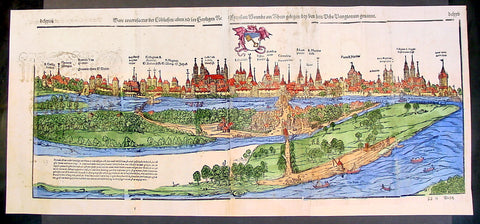
1574 Munster Large Antique Print View of The City of Wormbs, Germany
Antique Map
- Title : Die Statt Wormbs
- Ref #: 22670
- Size: 27in x 13in (685mm x 330mm)
- Date : 1574
- Condition: (A) Very Good Condition
Description:
This large folding original antique print a View of the important German city ofWormbs, south of Hamburg was published in the 1574 release of Sebastian MunstersCosmographia published by Sebastian Petri, Basle.
(This is a reasonably scarce map as the large fold out maps in Cosmographia were easily damaged and lost)
Background: For a variety of reasons town plans were comparatively latecomers in the long history of cartography. Few cities in Europe in the middle ages had more than 20,00 inhabitants and even London in the late Elizabethan period had only 100-150,000 people which in itself was probably 10 times that of any other English city. The Nuremberg Chronicle in 1493 included one of the first town views of Jerusalem, thereafter, for most of the sixteenth century, German cartographers led the way in producing town plans in a modern sense. In 1544 Sebastian Munster issued in Basle his Cosmographia containing roughly sixty-six plans and views, some in the plan form, but many in the old panorama or birds eye view. (Ref: Tooley; M&B)
General Description:
Paper thickness and quality: - Heavy and stable
Paper color: - off white
Age of map color: - Later
Colors used: - Green, blue, yellow, pink
General color appearance: - Authentic
Paper size: - 27in x 13in (685mm x 330mm)
Plate size: - 25in x 10in (635 x 255m)
Margins: - 1/2in (12mm)
Imperfections:
Margins: - Light soiling
Plate area: -Folds re-joined small loss, light soiling, light creasing
Verso: - Light soiling, colour show through, half the map backed in archival material
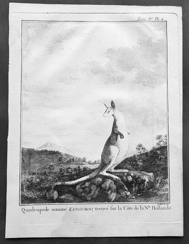
1774 Capt. Cook, S. Parkinson & G. Stubbs - Antique Print Australian Kangaroo in 1770
Antique Map
- Title : Quadrupede nomme Kanguroo trouve fur la Cote de la N.Hollande
[The Kanguroo, an Animal found on the Coast of New Holland] - Ref : 35016
- Size: 10in x 8in (255mm x 205mm)
- Date : 1774
- Condition: (A+) Fine Condition
Description:
This fine original copper-plate engraved antique print of a Kangaroo, first sketched by Sydney Parkinson onboard HMS Endeavour during Cooks first voyage in 1770, whilst laid up at Endeavour River in northern Queensland, was engraved by Robert Benard, after a painting by the famous English Artist George Stubbs in 1772. This original engraving was published in the 1774 French edition of Capt. James Cooks 1st Voyage of Discovery to the South Seas by John Hawkesworth in An Account of the Voyages Undertaken by the Order of His Present Majesty for Making Discoveries in the Southern Hemisphere and Successively Performed by Commodore Byron, Captain Wallis, Captain Carteret, and Captain Cook, in the Dolphin, the Swallow, and the Endeavor, Drawn Up from the Journals Which Were Kept by the Several Commanders, and from the Papers of Joseph Banks. Paris, 1774.
From Sydney Parkinsons Journal........soon after we arrived in the bay, we laid the ship on a steep bank, on the side of a river; set up tents on shore, unloaded her, carried all the cargo and provisions into them, and there lodged and accommodated our sick.
On the 22d, we examined the ship’s bottom, and found a large hole; through the planks into the hold, which had a piece of coral-rock, half a yard square, sticking in it: the same rock, therefore, that endangered us, yielded us the principal means of our redemption; for, had not this fragment intruded into the leak, in all probability the ship would have sunk.
We lost no time, but immediately set about repairing the ship’s bottom, and in a few days made it sound again. In the mean time, the boats were sent out, in search of another passage, which they found, and returned to the ship on the 3d of July.
On the 4th of July, the ship was carried to the other side of the river, and examined thoroughly; but, being found in good condition, she was soon placed in her former station; where she was loaded, and properly fitted to proceed on the voyage.
During the time we staid here, we picked up a great many natural curiosities from the reef we struck upon, consisting of a variety of curious shells, most of which were entirely new to Mr. Banks and Dr. Solander ...
Of quadrupeds, there are goats, wolves, a small red animal about the size of a squirrel; a spotted one of the viverra kind, and an animal of a kind nearly approaching the mus genus, about the size of a grey-hound, that had a head like a fawn’s; lips and ears, which it throws back, like a hare’s; on the upper jaw six large teeth; on the under one two only; with a short and small neck, near to which are the fore-feet, which have five toes each, and five hooked claws; the hinder legs are long, especially from the last joint, which, from the callosity below it, seems as if it lies flat on the ground when the animal descends any declivity; and each foot had four long toes, two of them behind, placed a great way back, the inner one of which has two claws; the two other toes were in the middle, and resembled a hoof, but one of them was much larger than the other. The tail, which is carried like a grey-hound’s, was almost as long as the body, and tapered gradually to the end. The chief bulk of this animal is behind; the belly being largest, and the back rising toward the posteriors. The whole body is covered with short ash-coloured hair; and the flesh of it tasted like a hare’s, but has a more agreeable flavour................
General Definitions:
Paper thickness and quality: - Heavy and stable
Paper color : - off white
Age of map color: -
Colors used: -
General color appearance: -
Paper size: - 10in x 8in (255mm x 205mm)
Plate size: - 9 1/2in x 7 1/4in (240mm x 185mm)
Margins: - Min 1/2in (12mm)
Imperfections:
Margins: - Light soiling in margins
Plate area: - None
Verso: - None
Background:
Sydney Parkinson 1745 – 71 was draughtsman to the botanist Sir Joseph Banks on James Cook’s first voyage to the Pacific in 1768. He died of dysentery in 1771, on the homeward voyage.
Parkinson was the first European artist to create drawings of Indigenous Australian, Maori & South Sea peoples, as well as landscapes, from direct observation. Hundreds of his original drawings survive in the British Museum. He is particularly remembered for his plant illustrations which were later used to create the lavish plates for Joseph Banks’ Florilegium.
When the Endeavour returned to England in 1772, a dispute arose between Joseph Banks and Sydney’s brother, Stanfield Parkinson. As his employer, Banks claimed rights to Sydney’s drawings, papers and collections made on the voyage. Stanfield claimed that Sydney had willed them to his family. Banks lent the Parkinson family Sydney’s journal and drawings with instructions that they were not to be published, however Stanfield disregarded this and arranged for A Journal of a voyage to the South Seas to be printed from Sydney’s account of the voyage.
Banks managed to suppress Stanfield’s publication until the official account of the voyage, edited by John Hawkesworth, appeared. In return for Parkinson’s papers, Banks paid Stanfield Parkinson 500 pounds for balance of wages due to Sydney, but the dispute did not end there. Stanfield further accused Banks of retaining items collected by Sydney which were intended for his relatives. Stanfield Parkinson was declared insane soon after the publication of Sydney Parkinson’s Journal and died in an asylum.
John Hawkesworth An English writer and journalist, Hawkesworth was commissioned by the British Admiralty to edit for publication the narratives of its officers’ circumnavigations. He was given full access to the journals of the commanders and the freedom to adapt and re-tell them in the first person. Cook was already on his way back from his second Pacific voyage, temporarily docked at Cape Town (South Africa), when he first saw the published volumes: he was mortified and furious to find that Hawkesworth claimed in the introduction that Cook had seen and blessed (with slight corrections) the resulting manuscript. (In his defense, Hawkesworth also had been a victim of misunderstanding.) Cook had trouble recognizing himself. Moreover, the work was full of errors and commentary introduced by Hawkesworth and, in Cook’s view, too full of Banks, who had promoted himself and the publication. Still, the work was popular; the first edition sold out in several months.
Robert Bénard 1734 – 1777 was an 18th-century French engraver.
Specialized in the technique of engraving, Robert Ménard is mainly famous for having supplied a significant amount of plates (at least 1,800) to the Encyclopédie by Diderot & d\'Alembert from 1751.
Later, publisher Charles-Joseph Panckoucke reused many of his productions to illustrate the works of his catalog.
George Stubbs ARA 1724 – 1806 was an English painter, best known for his paintings of horses. His most famous work is probably Whistlejacket, a painting of a prancing horse commissioned by the 2nd Marquess of Rockingham, which is now in the National Gallery in London. This and two other paintings carried out for Rockingham break with convention in having plain backgrounds. Throughout the 1760s he produced a wide range of individual and group portraits of horses, sometimes accompanied by hounds. He often painted horses with their grooms, whom he always painted as individuals. Meanwhile, he also continued to accept commissions for portraits of people, including some group portraits. From 1761 to 1776 he exhibited at the Society of Artists of Great Britain, but in 1775 he switched his allegiance to the recently founded but already more prestigious Royal Academy of Arts.
Stubbs also painted more exotic animals including lions, tigers, giraffes, monkeys, and rhinoceroses, which he was able to observe in private menageries. His painting of a kangaroo in 1772 after Cooks 1st Voyage to Australia, was the first glimpse of this animal for many 18th-century Britons
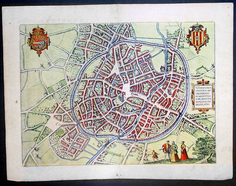
1575 Braun & Hogenberg Large Antique Print a View of Mechelen, Belgium
Antique Map
- Title : Mechelen - Nitidissimae Civitatis Mechlineensis in meditullio Brabantiae sitae, exactis: delineatio
- Ref #: 16247
- Size: 21in x 16in (535mm x 410mm)
- Date : 1575
- Condition: (A+) Fine Condition
Description:
This fine beautifully hand coloured original antique map a birds-eye view of the city of Mechelen in the Antwerp province of Flanders, Belgium was published by Georg Braun & Frans Hogenberg for the 1575 atlas of town plans Civiates Orbis Terrarum Vol II (1572-1612) intended as a companion to Abraham Ortelius's master Atlas Theatrum Orbis Terrarum published in 1570.
Franz Hogenberg's birthplace is illustrated twice. In the view presented in Volume I the cityscape is dominated by the massive tower belonging to the cathedral of Sint-Rombout, which measures almost 100 m in height. Behind the cathedral to the right lies the Onze-Lieve-Vrouwe church built in the Brabantine late Gothic style. In the present plate Mechelen is seen in a bird's-eye view from the northwest. Clearly apparent is the almost circular shape of the inner city, which has already spread beyond the bounds of the canal ringing the old city wall. In the Middle Ages staple rights and the cloth trade brought Mechelen great prosperity. In 1336 the city passed to the Duchy of Brabant, later to Burgundy, and developed into a highly regarded centre of commerce. The collapse of the cloth industry prompted the development of new areas of manufacturing, such as cannon and bell founding. In 1477 Mechelen passed to the Habsburgs and from 1507 to 1530, under the regency of Margaret of Austria, was capital of the Habsburg Netherlands. In 1559 Mechelen became an archbishopric and over the course of the Wars of Religion grew into a centre of the Counter-Reformation. For some time it was also the seat of the highest tribunal of the Habsburg Netherlands. (Taschen)
Background of Civitates Orbis Terrarum
The first volume of the Civitates Orbis Terrarum was published in Cologne in 1572. The sixth and the final volume appeared in 1617.
This great city atlas, edited by Georg Braun and largely engraved by Franz Hogenberg, eventually contained 546 prospects, bird-eye views and map views of cities from all over the world. Braun (1541-1622), a cleric of Cologne, was the principal editor of the work, and was greatly assisted in his project by the close, and continued interest of Abraham Ortelius, whose Theatrum Orbis Terrarum of 1570 was, as a systematic and comprehensive collection of maps of uniform style, the first true atlas.
For a variety of reasons town plans were comparatively latecomers in the long history of cartography. Few cities in Europe in the middle ages had more than 20,00 inhabitants and even London in the late Elizabethan period had only 100-150,000 people which in itself was probably 10 times that of any other English city. The Nuremberg Chronicle in 1493 included one of the first town views of Jerusalem, thereafter, for most of the sixteenth century, German cartographers led the way in producing town plans in a modern sense. In 1544 Sebastian Munster issued in Basle his Cosmographia containing roughly sixty-six plans and views, some in the plan form, but many in the old panorama or birds eye view. (Ref: Tooley; M&B)
Condition Report:
Paper thickness and quality: - Heavy and stable
Paper color: - off white
Age of map color: - Early
Colors used: - Green, blue, red, yellow
General color appearance: - Authentic
Paper size: - 21in x 16in (535mm x 410mm)
Plate size: - 18 1/2in x 13 1/2in (470mm x 345mm)
Margins: - Min 1in (25mm)
Imperfections:
Margins: - Light soiling in margins
Plate area: - None
Verso: - None
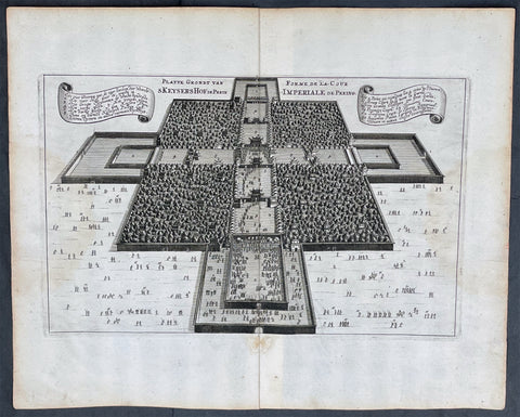
1665 Nieuhof Antique Print Imperial Palace Peking or the Forbidden City, Beijing
Antique Map
- Title : Platte Grondt van Skeyers Hof in Pekin; Forme de la Cour Imperiale de Peking
- Ref #: 17055
- Size: 15in x 12 1/2in (380mm x 310mm)
- Date : 1665
- Condition: (A+) Fine Condition
Description:
This original copper-plate engraved antique print a birds-eye view of the Imperial Palace & extensive gardens in Peking, now Beijing, or the Forbidden City by Johan Nieuhof was published by Jacob van Meurs in the 1665 edition of L’Ambassade de la Compagnie Orientale des Provinces Unies vers l’Empereur de la Chine, ou Grand Cam de Tartarie, faite par les sieurs Pierre de Goyer et Jacob de Keyser illustrée d’une très-exacte description des villes, bourgs, villages, ports de mer et autres lieux plus considérables de la Chine....1665. Title in English: An embassy from the East-India Company (1669).
General Definitions:
Paper thickness and quality: - Heavy and stable
Paper color : - off white
Age of map color: -
Colors used: -
General color appearance: -
Paper size: - 15in x 12 1/2in (380mm x 310mm)
Plate size: - 12 1/2in x 7 1/2in (310mm x 195mm)
Margins: - Min 1in (25mm)
Imperfections:
Margins: - None
Plate area: - None
Verso: - None
Background:
The Forbidden City is a palace complex in Dongcheng District, Beijing, China, at the center of the Imperial City of Beijing. It is surrounded by numerous opulent imperial gardens and temples including the 22-hectare Zhongshan Park, the sacrificial Imperial Ancestral Temple, the 69-hectare Beihai Park, and the 23-hectare Jingshan Park.
The Forbidden City was constructed from 1406 to 1420, and was the former Chinese imperial palace and winter residence of the Emperor of China from the Ming dynasty (since the Yongle Emperor) to the end of the Qing dynasty, between 1420 and 1924. The Forbidden City served as the home of Chinese emperors and their households and was the ceremonial and political center of the Chinese government for over 500 years. Since 1925, the Forbidden City has been under the charge of the Palace Museum, whose extensive collection of artwork and artifacts were built upon the imperial collections of the Ming and Qing dynasties. The Forbidden City was declared a World Heritage Site in 1987.
The complex consists of 980 buildings, encompassing 8,886 rooms and covering 720,000 square metres (72 hectares)/178 acres. The palace exemplifies the opulence of the residences of the Chinese emperor and the traditional Chinese palatial architecture, and has influenced cultural and architectural developments in East Asia and elsewhere. It is listed by UNESCO as the largest collection of preserved ancient wooden structures in the world. Since 2012, the Forbidden City has seen an average of 14 million visitors annually, and received more than 19 million visitors in 2019. In 2018, The Forbidden Citys market value has been estimated at US$70 billion, making it both the worlds most valuable palace and the most valuable piece of real estate anywhere in the world.
Some sources describe it as the largest palace in the world still in existence, but other Chinese imperial residences far exceed it in size, namely the 6.1 km2 (610 ha) Zhongnanhai which lies just west of the Forbidden City, the 2.9 km2 (290 ha) Summer Palace in Haidian District, Beijing, and the 5.6 km2 (560 ha) Chengde Mountain Resort in Chengde, Hebei Province.
The Forbidden City in Beijing is one of the largest and most well-preserved ancient wooden structures in the world. It is a national AAAAA-level tourist attraction in China. It was listed as the first batch of national key cultural relics in 1961 and listed as a world cultural heritage in 1987.
Nieuhof, Johan (1618 – 1672)
Nieuhof was a Dutch traveler who wrote about his journeys to Brazil, China and India. The most famous of these was a trip of 2,400 kilometers from Canton to Peking in 1655-1657, which enabled him to become an authoritative Western writer on China. He wrote An embassy from the East-India Company containing the written account of this journey.
Johan Nieuhof was born in Uelsen, a town in the county of Bentheim, Lower Saxony, sitting just across the Dutch-German border. His father (originally from Zwolle) was mayor of the town, and was later succeeded by one of Johans brothers and brother-in-law. By the grace of Cornelis Jan Witsen, a leading figure within the Dutch West India Company (or WIC), Nieuhof left for Dutch Brazil in 1640 as a reserve officer-candidate. From then on, barring two short family visits in 1658 and 1671, he spent all the rest of his life abroad.
Nieuhof was employed in Brazil to explore the regions between Maranhão and the São Francisco Rivers, made a particular study of the neighborhood of Pernambuco. He left Brazil in 1649, after the Portuguese victory in the Second Battle of Guararapes. Upon his return, Nieuhof joined the service of the Dutch East India Company (or VOC). In service of the VOC he resided several years in Batavia, and then was appointed in 1654 steward of an embassy to the relatively new Qing emperor China under Peter de Goyer and Jacob de Keyser, which aimed to gain trading rights on Chinas southern coast.
He remained in China until 1657. In 1663 he operated as an ambassador in Quilon, after the occupation of the Malabar Coast by Rijckloff van Goens. During this period he visited several chiefs of indigenous tribes in order to secure trade relations with them. Afterwards, he was offered a post on Ceylon where he was stationed between 1663 and 1667. He was imprisoned for seven months because of illegal trade in pearls. Nieuhof was sent to Batavia by Hendrik van Rheede and fired by the Dutch East India Company.
On returning to the Indies from a trip home in 1672, he stopped on the isle of Madagascar. On October 8 1672, Nieuhof traveled inland along with the first mate, in search of the local tribes in order to trade with them, as well as secure water for his crew. Upon hearing several gunshots, the captain sent a second ship towards the island in order to await Nieuhofs return. After three days of waiting, the captain presumed Nieuhof and his company to be murdered and sailed onwards towards Mauritius. On order of the governing council in Amsterdam, a ship was sent from the Cape of Good Hope to retrieve Nieuhof and his fellows, but no trace of them could be found.
In the first half of the 17th century, the VOC tried to break the Portuguese monopoly position on trade to Macau. When they did not succeed, they sent six embassies to Peking between 1655 and 1685. Their aim was to convince the Qing emperor to open up trade relations on the southern coast, in favor of the VOC, although they ultimately failed. Nieuhof was appointed to the position of steward on one of these embassies by Joan Maetsuycker, which traveled from Canton to Peking between 1655 and 1658. They were the second embassy to try and gain the emperors favor, the first was led by Zacharias Wagenaer. Nieuhofs duties as part of the embassy primarily consisted of ceremonial matters as well as securing lodgings. He was, however, specifically appointed to illustrate any and all of the cities, palaces, temples, rivers and other noteworthy buildings in their true to nature form.
On March 17 1656, after months of negotiations and discussions of tributes to be paid to the Chinese emperor and viceroy, the embassy left Canton by barge, to travel towards Peking. The embassy arrived at the emperors court in Peking on July 18 the same year. The hired the jesuit scholar Johann Adam Schall von Bell to be their translator, who warned them of the possible dangers and required ceremonies to approach the emperor. On September 24, the embassy was received by the Shunzhi Emperor. As dictated by their translator, the party performed the traditional kowtow, as failing to do so would most likely result in immediate refusal by the emperor. As a result, the emperor allowed Dutch embassies to visit the court once every eight years, in parties consisting of no more than 100 men. Any trading rights were not discussed nor granted at this point. On October 16 the embassy was asked to leave the city of Peking within two hours. Their return trip took three months; putting the entire length of the embassy at 20 months and 6 days.
At his homecoming in 1658, he had entrusted his notes and annotations to his brother Hendrik, whom Johan thanked when finally (in 1665) Hendrik produced an ample study of China, with many images, text and explanation of the latest events. The work was published by Jacob van Meurs in 1665, titled Het Gezandtschap der Neêrlandtsche Oost-Indische Compagnie, aan den grooten Tartarischen Cham, den tegenwoordigen Keizer van China: Waarin de gedenkwaerdigste Geschiedenissen, die onder het reizen door de Sineesche landtschappen, Quantung, Kiangsi, Nanking, Xantung en Peking, en aan het Keizerlijke Hof te Peking, sedert den jaren 1655 tot 1657 zijn voorgevallen, op het bondigste verhandelt worden. Beneffens een Naukeurige Beschrijvinge der Sineesche Steden, Dorpen, Regeering, Weetenschappen, Hantwerken, Zeden, Godsdiensten, Gebouwen, Drachten, Schepen, Bergen, Gewassen, Dieren, et cetera en oorlogen tegen de Tartar : verçiert men over de 150 afbeeltsels, nat leven in Sina getekent. Hendrik dedicated the work to Hendrik Spiegel and Cornelis Jan Witsen (Nicolaes Witsens father), administrators of the East and West India Companies respectively. Translations into French (1665), German (1666), Latin (1668) and English (1669) were also published, each going into at least two editions. More of Nieuhoffs material, on Chinese ships, appeared in Nicolaes Witsens Scheepsbouw (1671).
The reports from these embassies and the reports of the Jesuits formed the only reliable source of information on China available in Western Europe. As mentioned, being the purser of the VOC embassy to Peking, Johan Nieuhof in 1655 had special instructions to observe all farms, towns, palaces, rivers, ... [and other] buildings that he might pass by, drawing them in straight form and figure, as well as remains of the historical victory of the Tartars (Manchus) that brought an end to the reign of the Ming dynasty. The inclusion of approximately 150 illustrations in the book marked the first time that literature on China contained images that were true to nature. In previously published works, belonging to the imaginative fantastic tradition where fact and fiction were hardly discernible, the Chinese were depicted as creatures of fantasy. Nieuhofs illustrations, as opposed to these previous works, depicted the Chinese and their culture as they were observed by the illustrator himself, without fanciful additions.
The 150 illustrations of the Nieuhoffs book were one inspiration for chinoiserie, which became especially popular in the 18th century. Many artists and architects based their designs on the pictures in the book. The original drawings were rediscovered in 1984 in the collection of prince Roland Bonaparte, an anthropologist who collected material about Madagascar, Lapland and the Native Americans.
Publications:
- Johannes Nieuhof (1668), Legatio batavica ad magnum Tartariæ chamum Sungteium, modernum Sinæ imperatorem; Historiarum narratione, quæ legatis in provinciis Quantung, Kiangsi, Nanking, Xantung, Peking, & aula imperatoriâ ab anno 1665 ad annum 1657 obtigerunt ..., Amstelodami: Jacobum Meursium, OCLC 2134985, OL 23411529M
- Het gezantschap der Neêrlandtsche Oost-Indische Compagnie, aan den grooten Tartarischen Cham, den tegenwoordigen keizer van China : waar in de gedenkwaerdighste geschiedenissen, die onder het reizen door de Sineesche landtschappen, Quantung, Kiangsi, Nanking, Xantung en Peking, en aan het keizerlijke hof te Peking, sedert den jare 1655 tot 1657 zijn voorgevallen, op het bondigste verhandelt worden : befeffens een naukeurige Beschryving der Sineesche steden, dorpen, regeering, wetenschappen, hantwerken, zeden, godsdiensten, gebouwen, drachten, schepen, bergen, gewassen, dieren, &c. en oorlogen tegen de Tarters : verçiert men over de 150 afbeeltsels, nat leven in Sina getekent. Amsterdam: Jacob van Meurs, 1665. Title in English: An embassy from the East-India Company (1669).
- Zee- en Lant-Reise door verscheide Gewesten van Oostindien, behelzende veele zeldzaame en wonderlijke voorvallen en geschiedenissen. Beneffens een beschrijving van lantschappen, dieren, gewassen, draghten, zeden en godsdienst der inwoonders: En inzonderheit een wijtloopig verhael der Stad Batavia. Amsterdam: de Weduwe van Jacob van Meurs, 1682. Google books
- Gedenkweerdige Brasiliaense Zee- en Lant-Reise und Zee- en Lant-Reize door verscheide Gewesten van Oostindien. Amsterdam: de Weduwe van Jacob van Meurs, 1682.
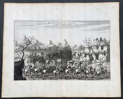
1665 Johan Nieuhof Large Antique Print of Chinese Mounted Cavalry, Archery
Antique Map
- Title : Kryghs-Ordre in Het Marseren; L Ordre de la Cavallerie en Marchant
- Ref #: 17056
- Size: 15in x 12 1/2in (380mm x 310mm)
- Date : 1665
- Condition: (A+) Fine Condition
Description:
This original copper-plate engraved antique print of Chinese Mounted Cavalry in formation by Johan Nieuhof was published by Jacob van Meurs in the 1665 edition of L’Ambassade de la Compagnie Orientale des Provinces Unies vers l’Empereur de la Chine, ou Grand Cam de Tartarie, faite par les sieurs Pierre de Goyer et Jacob de Keyser illustrée d’une très-exacte description des villes, bourgs, villages, ports de mer et autres lieux plus considérables de la Chine....1665. Title in English: An embassy from the East-India Company (1669).
General Definitions:
Paper thickness and quality: - Heavy and stable
Paper color : - off white
Age of map color: -
Colors used: -
General color appearance: -
Paper size: - 15in x 12 1/2in (380mm x 310mm)
Plate size: - 12 1/2in x 7 1/2in (310mm x 195mm)
Margins: - Min 1in (25mm)
Imperfections:
Margins: - None
Plate area: - None
Verso: - None
Background:
The vast, immediate success of the book which was published in Johan Nieuhof's name in 1665 in Dutch language was every publisher's dream. In this time and age, his report on his journey to China, compiled of the material he had sent to his brother, was a bestseller! In the 17th century alone, six Dutch editions were published. Within the same year of its release it was translated to French – the very same edition we have here – and shortly after it was also translated to German, Latin and English.
This huge interest in the book by the global public was not by chance! At the time, China was the dream country of every merchant and especially of every investor in Europe. China had the goods European markets were longing for. Firstly there was tea, but also the incredibly modern porcelain and the wonderfully soft silk. In addition, the spices and remedies from the Chinese market were promising great profit!
Since individual people of the 17th century could not finance successful trading companies of this size any longer, ambitious men had cooperated with the government and founded trading companies due to royal privileges. One can imagine a sort of incorporated company whose capital was provided by a market of investors. These resources were used to fit out fleets, establish local strongpoints and pay permanent employees whose work should bring investors great profit on their deposits.
The area called East India at the time was particularly popular for such investments. This wasn't just India and the Spice Islands, but also China and Japan. In 1600 the British founded their East India Company. In 1602 the Dutch East India Company followed, and Johan Nieuhof was allowed to accompany the imperial embassy. But other countries wanted to participate in the trade, too and founded companies: Denmark, Sweden, Portugal – and also France in 1665. Louis XIV had first privileged an East India Company on the initiative of his minister of finance Colbert, which competed for funds in 1665. Therefore Nieuhof's book was just in time!
What made Nieuhof's report especially interesting, were the 150 copper engravings that carried the reader off into the exotic worlds of the Far East. Nieuhof's book thus started the China-trend. There could be no rococo castle without a porcelain cabinet. No bourgeois household without chinoiseries. But Johan Nieuhof did not know which goods were desired by China in exchange. Consequently tea and silk had to be paid with silver. The negative trade balance was troubling to all European governments until the English had the delinquent idea to import opium on a large scale. It was only then that the trade balance turned around. But surely Johan Nieuhof cannot be made responsible for this.
Nieuhof, Johan (1618 – 1672)
Nieuhof was a Dutch traveler who wrote about his journeys to Brazil, China and India. The most famous of these was a trip of 2,400 kilometers from Canton to Peking in 1655-1657, which enabled him to become an authoritative Western writer on China. He wrote An embassy from the East-India Company containing the written account of this journey.
Johan Nieuhof was born in Uelsen, a town in the county of Bentheim, Lower Saxony, sitting just across the Dutch-German border. His father (originally from Zwolle) was mayor of the town, and was later succeeded by one of Johans brothers and brother-in-law. By the grace of Cornelis Jan Witsen, a leading figure within the Dutch West India Company (or WIC), Nieuhof left for Dutch Brazil in 1640 as a reserve officer-candidate. From then on, barring two short family visits in 1658 and 1671, he spent all the rest of his life abroad.
Nieuhof was employed in Brazil to explore the regions between Maranhão and the São Francisco Rivers, made a particular study of the neighborhood of Pernambuco. He left Brazil in 1649, after the Portuguese victory in the Second Battle of Guararapes. Upon his return, Nieuhof joined the service of the Dutch East India Company (or VOC). In service of the VOC he resided several years in Batavia, and then was appointed in 1654 steward of an embassy to the relatively new Qing emperor China under Peter de Goyer and Jacob de Keyser, which aimed to gain trading rights on Chinas southern coast.
He remained in China until 1657. In 1663 he operated as an ambassador in Quilon, after the occupation of the Malabar Coast by Rijckloff van Goens. During this period he visited several chiefs of indigenous tribes in order to secure trade relations with them. Afterwards, he was offered a post on Ceylon where he was stationed between 1663 and 1667. He was imprisoned for seven months because of illegal trade in pearls. Nieuhof was sent to Batavia by Hendrik van Rheede and fired by the Dutch East India Company.
On returning to the Indies from a trip home in 1672, he stopped on the isle of Madagascar. On October 8 1672, Nieuhof traveled inland along with the first mate, in search of the local tribes in order to trade with them, as well as secure water for his crew. Upon hearing several gunshots, the captain sent a second ship towards the island in order to await Nieuhofs return. After three days of waiting, the captain presumed Nieuhof and his company to be murdered and sailed onwards towards Mauritius. On order of the governing council in Amsterdam, a ship was sent from the Cape of Good Hope to retrieve Nieuhof and his fellows, but no trace of them could be found.
In the first half of the 17th century, the VOC tried to break the Portuguese monopoly position on trade to Macau. When they did not succeed, they sent six embassies to Peking between 1655 and 1685. Their aim was to convince the Qing emperor to open up trade relations on the southern coast, in favor of the VOC, although they ultimately failed. Nieuhof was appointed to the position of steward on one of these embassies by Joan Maetsuycker, which traveled from Canton to Peking between 1655 and 1658. They were the second embassy to try and gain the emperors favor, the first was led by Zacharias Wagenaer. Nieuhofs duties as part of the embassy primarily consisted of ceremonial matters as well as securing lodgings. He was, however, specifically appointed to illustrate any and all of the cities, palaces, temples, rivers and other noteworthy buildings in their true to nature form.
On March 17 1656, after months of negotiations and discussions of tributes to be paid to the Chinese emperor and viceroy, the embassy left Canton by barge, to travel towards Peking. The embassy arrived at the emperors court in Peking on July 18 the same year. The hired the jesuit scholar Johann Adam Schall von Bell to be their translator, who warned them of the possible dangers and required ceremonies to approach the emperor. On September 24, the embassy was received by the Shunzhi Emperor. As dictated by their translator, the party performed the traditional kowtow, as failing to do so would most likely result in immediate refusal by the emperor. As a result, the emperor allowed Dutch embassies to visit the court once every eight years, in parties consisting of no more than 100 men. Any trading rights were not discussed nor granted at this point. On October 16 the embassy was asked to leave the city of Peking within two hours. Their return trip took three months; putting the entire length of the embassy at 20 months and 6 days.
At his homecoming in 1658, he had entrusted his notes and annotations to his brother Hendrik, whom Johan thanked when finally (in 1665) Hendrik produced an ample study of China, with many images, text and explanation of the latest events. The work was published by Jacob van Meurs in 1665, titled Het Gezandtschap der Neêrlandtsche Oost-Indische Compagnie, aan den grooten Tartarischen Cham, den tegenwoordigen Keizer van China: Waarin de gedenkwaerdigste Geschiedenissen, die onder het reizen door de Sineesche landtschappen, Quantung, Kiangsi, Nanking, Xantung en Peking, en aan het Keizerlijke Hof te Peking, sedert den jaren 1655 tot 1657 zijn voorgevallen, op het bondigste verhandelt worden. Beneffens een Naukeurige Beschrijvinge der Sineesche Steden, Dorpen, Regeering, Weetenschappen, Hantwerken, Zeden, Godsdiensten, Gebouwen, Drachten, Schepen, Bergen, Gewassen, Dieren, et cetera en oorlogen tegen de Tartar : verçiert men over de 150 afbeeltsels, nat leven in Sina getekent. Hendrik dedicated the work to Hendrik Spiegel and Cornelis Jan Witsen (Nicolaes Witsens father), administrators of the East and West India Companies respectively. Translations into French (1665), German (1666), Latin (1668) and English (1669) were also published, each going into at least two editions. More of Nieuhoffs material, on Chinese ships, appeared in Nicolaes Witsens Scheepsbouw (1671).
The reports from these embassies and the reports of the Jesuits formed the only reliable source of information on China available in Western Europe. As mentioned, being the purser of the VOC embassy to Peking, Johan Nieuhof in 1655 had special instructions to observe all farms, towns, palaces, rivers, ... [and other] buildings that he might pass by, drawing them in straight form and figure, as well as remains of the historical victory of the Tartars (Manchus) that brought an end to the reign of the Ming dynasty. The inclusion of approximately 150 illustrations in the book marked the first time that literature on China contained images that were true to nature. In previously published works, belonging to the imaginative fantastic tradition where fact and fiction were hardly discernible, the Chinese were depicted as creatures of fantasy. Nieuhofs illustrations, as opposed to these previous works, depicted the Chinese and their culture as they were observed by the illustrator himself, without fanciful additions.
The 150 illustrations of the Nieuhoffs book were one inspiration for chinoiserie, which became especially popular in the 18th century. Many artists and architects based their designs on the pictures in the book. The original drawings were rediscovered in 1984 in the collection of prince Roland Bonaparte, an anthropologist who collected material about Madagascar, Lapland and the Native Americans.
Publications:
- Johannes Nieuhof (1668), Legatio batavica ad magnum Tartariæ chamum Sungteium, modernum Sinæ imperatorem; Historiarum narratione, quæ legatis in provinciis Quantung, Kiangsi, Nanking, Xantung, Peking, & aula imperatoriâ ab anno 1665 ad annum 1657 obtigerunt ..., Amstelodami: Jacobum Meursium, OCLC 2134985, OL 23411529M
- Het gezantschap der Neêrlandtsche Oost-Indische Compagnie, aan den grooten Tartarischen Cham, den tegenwoordigen keizer van China : waar in de gedenkwaerdighste geschiedenissen, die onder het reizen door de Sineesche landtschappen, Quantung, Kiangsi, Nanking, Xantung en Peking, en aan het keizerlijke hof te Peking, sedert den jare 1655 tot 1657 zijn voorgevallen, op het bondigste verhandelt worden : befeffens een naukeurige Beschryving der Sineesche steden, dorpen, regeering, wetenschappen, hantwerken, zeden, godsdiensten, gebouwen, drachten, schepen, bergen, gewassen, dieren, &c. en oorlogen tegen de Tarters : verçiert men over de 150 afbeeltsels, nat leven in Sina getekent. Amsterdam: Jacob van Meurs, 1665. Title in English: An embassy from the East-India Company (1669).
- Zee- en Lant-Reise door verscheide Gewesten van Oostindien, behelzende veele zeldzaame en wonderlijke voorvallen en geschiedenissen. Beneffens een beschrijving van lantschappen, dieren, gewassen, draghten, zeden en godsdienst der inwoonders: En inzonderheit een wijtloopig verhael der Stad Batavia. Amsterdam: de Weduwe van Jacob van Meurs, 1682. Google books
- Gedenkweerdige Brasiliaense Zee- en Lant-Reise und Zee- en Lant-Reize door verscheide Gewesten van Oostindien. Amsterdam: de Weduwe van Jacob van Meurs, 1682.
1862 John Gould Large Antique Print Birds of Great Britain - Pine Grosbeak
Antique Map
- Title : Pinicola Enucleator
- Ref #: 23486
- Size: 21 1/2in x 14in (545mm x 360mm)
- Date : 1862
- Condition: (A+) Fine Condition
Description:
This large original hand coloured antique lithograph of the male & female Pine Grosbeak or Pinicola Enucleator, found from Siberia to the United States, was published in the 1862-73 edition of John Goulds The Birds of Great Britain. Lithography by J Gould, HC Richter & Walter.
The University of Glasgow, which owns a copy of Birds of Great Britain, describes John Gould as the greatest figure in bird illustration after Audubon. Gould was not directly responsible for the illustrations himself, although he supervised their production closely. Auctioneers Sotherans describe the work as Goulds pride and joy.
Gould had already published some of the illustrations in Birds of Europe, but Birds of Great Britain represents a development of an aesthetic style in which illustrations of nests and young are added on a large scale.
Sotherans Co. reports that Gould published the book himself, producing 750 copies, which remain sought after both as complete volumes, and as individual plates, currently varying in price from £450 – £850. The University of Glasgow records that the volumes were issued in London in 25 parts, to make the complete set, between 1863 and 1873, and each set contained 367 coloured lithographs.
Gould undertook an ornithological tour of Scandinavia in 1856, in preparation for the work, taking with him the artist Henry Wolf who drew 57 of the plates from Goulds preparatory sketches. According to The University of Glasgow Goulds skill was in rapidly producing rough sketches from nature (a majority of the sketches were drawn from newly killed specimens) capturing the distinctiveness of each species. Gould then oversaw the process whereby his artists worked his sketches up into the finished drawings, which were made into coloured lithographs by engraver William Hart.
There were problems: the stone engraving of the snowy owl in volume I was dropped and broken at an early stage in the printing. Later issues of this plate show evidence of this damage and consequently the early issue – printed before the accident – are considered more desirable.
The lithographs were hand coloured. In the introduction for the work, Gould states every sky with its varied tints and every feather of each bird were coloured by hand; and when it is considered that nearly two hundred and eighty thousand illustrations in the present work have been so treated, it will most likely cause some astonishment to those who give the subject a thought.
The work has gathered critical acclaim: according to Mullens and Swann, Birds of Great Britain is the most sumptuous and costly of British bird books, whilst Wood describes it as a magnificent work. Isabella Tree writes that it was seen – perhaps partly because its subject was British, as the culmination of [his] ... genius.
General Definitions:
Paper thickness and quality: - Heavy and stable
Paper color : - off white
Age of map color: - Original
Colors used: - Yellow, green, blue, pink
General color appearance: - Authentic
Paper size: - 21 1/2in x 14in (545mm x 360mm)
Plate size: - 21 1/2in x 14in (545mm x 360mm)
Margins: - Min 1/2in (12mm)
Imperfections:
Margins: - Light matt line to border
Plate area: - None
Verso: - None
Background:
One of the great bird artists of all time, John Gould created over 3,000 plates of birds in over 40 volumes.
Around 1830, while working as taxidermist for the Zoological Society of London, he received a shipment of exotic bird skins from the Himalayas. Soon after, he published A Century of Birds from the Himalaya Mountains.
The success of this work, along with the Birds of Europe (1832-37) and a Monograph of the Ramphastidae [Toucans] allowed him to travel to Australia and New Guinea. Among Gould's better known works are the Birds of Australia (1849-69), the Birds of Asia (1850-83), and Birds of Great Britain (1862-73).
Though Gould himself sketched most of his plates, other artists such as his wife Elizabeth, Edward Lear, Joseph Wolf, William Hart and Henry C. Richter finished them. Gould's plates are highly esteemed for their composition, accurate detail, and coloring. (Ref: Methuen)
Please note all items auctioned are genuine, we do not sell reproductions. A Certificate of Authenticity (COA) can be issued on request.
1537 Large Vellum Latin Antiphonary Music Sheet Prayers to Dead & St Augustine
Antique Map
-
- Title : Desunctis Requiem, Sanctis Peanan Canemdum Coscripsi icopto, que pri edo, Tomo: Quem tibi, quandoquide robur, pia Virgo, dedisti Meq ipsu dono, cosecro, corde dico F.V.V.Z CICICXXXVII
- Ref #: 93521
- Size: 23 1/2in x 15 1/2in (595mm x 395mm)
- Date : 1537
- Condition: (A+) Fine Condition
Description:
This large beautifully hand written and hand coloured original antique vellum Latin Antiphonary Choro (choir) music sheet, with a separate chant on each side of the page. On the first side is the Prayer to the Dead and on the second side is a prayer to St Augustine. The page was hand scribed in 1537 and is dated, dates on these vellum Antiphonary Choro sheets was rarely done and is much sort after.
The two prayers set to music and sung as a Gregorian Chant, in part, translate as follows;
1. Requiem aeternam dona eis Domine; et lux perpetua luceat eis. Requiescant in pace. Amen.
(Eternal rest grant unto them, O Lord, and let perpetual light shine upon them. May they rest in peace. Amen)
2. Magne Pater Augustine, Preces nostras suscipe, Et per eas Conditori Nos placare satage, Atque rege gregem tuum Summum decus Praesulum
(Great Father Augustine, receive our prayers, and by them, seek thou to reconcile us to the Creator, and rule thy flock, o highest glory of bishops)
General Definitions:
Paper thickness and quality: - Heavy and stable
Paper color : - off white
Age of map color: - Original
Colors used: - Yellow, green, blue, pink
General color appearance: - Authentic
Paper size: - 23 1/2in x 15 1/2in (595mm x 395mm)
Plate size: - 23 1/2in x 15 1/2in (595mm x 395mm)
Margins: - Min 1/2in (12mm)
Imperfections:
Margins: - None
Plate area: - None
Verso: - None
Background:
Prayer for the dead is well documented within early Christianity, both among prominent Church Fathers and the Christian community in general. In Eastern Orthodoxy Christians pray for such souls as have departed with faith, but without having had time to bring forth fruits worthy of repentance. In the Catholic Church the assistance that the dead receive by prayer on their behalf is linked with the process of purification known as purgatory. While prayer for the dead continues in both these traditions and in those of Oriental Orthodoxy and of the Assyrian Church of the East, many Protestant groups reject the practice.
The tomb of the Christian Abercius of Hieropolis in Phrygia (latter part of the 2nd century) bears the inscription: Let every friend who observes this pray for me, i.e. Abercius, who throughout speaks in the first person.
The inscriptions in the Roman catacombs bear similar witness to the practice, by the occurrence of such phrases as:
Mayst thou live among the saints (3rd century);
May God refresh the soul of . . . ;
Peace be with them.
Among Church writers Tertullian († 230) is the first to mention prayers for the dead: The widow who does not pray for her dead husband has as good as divorced him. This passage occurs in one of his later writings, dating from the beginning of the 3rd century. Subsequent writers similarly make mention of the practice as prevalent, not as unlawful or even disputed (until Arius challenged it towards the end of the 4th century). The most famous instance is Saint Augustines prayer for his mother, Monica, at the end of the 9th book of his Confessions, written around 398.
An important element in the Christian liturgies both East and West consisted of the diptychs, or lists of names of living and dead commemorated at the Eucharist. To be inserted in these lists was a confirmation of ones orthodoxy, and out of the practice grew the official canonization of saints; on the other hand, removal of a name was a condemnation.
In the middle of the 3rd century, St. Cyprian enjoined that there should be no oblation or public prayer made for a deceased layman who had broken the Churchs rule by appointing a cleric trustee under his will: He ought not to be named in the priests prayer who has done his best to detain the clergy from the altar.
Although it is not possible, as a rule, to name dates for the exact words used in the ancient liturgies, yet the universal occurrence of these diptychs and of definite prayers for the dead in all parts of the Christian Church, East and West, in the 4th and 5th centuries shows how primitive such prayers were. The language used in the prayers for the departed is asking for rest and freedom from pain and sorrow. A passage from the Liturgy of St James reads:
Remember, O Lord, the God of Spirits and of all Flesh, those whom we have remembered and those whom we have not remembered, men of the true faith, from righteous Abel unto to-day; do thou thyself give them rest there in the land of the living, in thy kingdom, in the delight of Paradise, in the bosom of Abraham, Isaac and Jacob, our holy fathers, from whence pain and sorrow and sighing have fled away, where the light of thy countenance visiteth them and always shineth upon them.
Public prayers were only offered for those who were believed to have died as faithful members of the Church. But Saint Perpetua, who was martyred in 202, believed herself to have been encouraged in a vision to pray for her brother, who had died in his eighth year, almost certainly unbaptized; and a later vision assured her that her prayer was answered and he had been translated from punishment. St. Augustine thought it needful to point out that the narrative was not canonical Scripture, and contended that the child had perhaps been baptized.
Prayer to St Augustine: despite his overwhelming importance to Western theology, there was very little liturgical devotion to St Augustine in the Roman Rite during the first millenium. His feast does not appear in the majority of ancient liturgical books; his day was originally kept in Rome itself as that of an obscure martyr named Hermes, who is still celebrated as a commemoration on August 28th in the traditional rite. Towards the end of the eleventh century, however, as the great reform movement within the Western Church gained momentum, there emerged a huge number of new religious congregations of the sort which we now call canons regular, followed within a few generations by the mendicant friars. [1] Many of these, such as the Premonstratensians and Dominicans, took the Rule of St Augustine as their own, since it is very simple, and permitted a wide variety of adaptations and additional customs. Augustine himself then began to be honored in the liturgy as the great legislator of canonical life, just as St Benedict had long been honored as the great legislator of monastic life.
Sometime in the 12th century, a proper Office was composed for him, and widely adopted by many of the Augustinian orders in their various kinds. Here is the hymn which the Dominicans sing at Vespers and Matins, the Premonstratensians at Vespers and Lauds.
Antiphonary, Gregorian Choro
An Antiphonary is one of the liturgical books intended for use in choro (i.e. in the liturgical choir), and originally characterized, as its name implies, by the assignment to it principally of the antiphons used in various parts of the Roman liturgy.
Medieval antiphonaries varied with regional liturgical tradition. In 1570, following the Council of Trent, the Roman Antiphonary was declared universal. The Roman Antiphonary (Antiphonale Romanum) contains the chants for the Divine Office for the hours of Lauds, Prime, Terce, Sext, None, Vespers and Compline for every day of the year. The Vesperale Romanum is an excerpt of the Antiphonary containing the chants sung at Vespers. The music for use at the Mass is contained in the Roman Gradual (Graduale Romanum), the chants of the ordinary are also edited as an excerpt from the Gradual, the Kyriale Romanum. The Antiphonale Romanum was substantially revised in 1910/11 in the course of the reform of the Roman Breviary under Pope Pius X, notably restoring authentic Gregorian melodies. For the 1971 Liturgy of the Hours, there are two volumes, Antiphonale Romanum II and Liber Hymnarius.
The plainsong melodies found in the Roman antiphonary and the Graduale have received the general title of Gregorian Chant, in honour of pope Gregory the Great (r. 590–604), to whom a tradition, supported by internal and external evidence, ascribes the work of revising and collecting into the various texts and chants of the liturgy. Doubtless the ancient missal contained only those texts which were appointed for the celebrant, and did not include the texts which were to be chanted by the cantor and choir; and the Antiphonarium Missæ supplied the omitted texts for the choir as well as the chants in which the texts were to be sung. The importance of the Gregorian Antiphonary is found in the enduring stamp it impressed on the Roman liturgy.
Earlier popes had given, a medieval writer assures us, attention to the chants; and he specifies St. Damasus (d. 384), St. Leo (d. 461), St. Gelasius (d. 496), St. Symmachus (d. 514), St. John I (d. 526) and Boniface II (d. 532). It is true, also, that the chants used at Milan were styled, in honour of St. Ambrose (called the Father of Church Song), the Ambrosian Chant.
But it is not known whether any collection of the chants had been made before that of St. Gregory, concerning which his ninth-century biographer, John the Deacon, wrote: Antiphonarium centonem … compilavit. The authentic antiphonary mentioned by the biographer has not as yet been found. What was its character? What is meant by cento (patchwork)? In the century in which John the Deacon wrote his life of the Saint, a cento meant the literary feat of constructing a coherent poem out of scattered excerpts from an ancient author, in such wise, for example, as to make the verses of Virgil sing the mystery of the Epiphany. The work, then, of St. Gregory was a musical cento, a compilation (centonem ... compilavit) of pre-existing material into a coherent and well-ordered whole. This does not necessarily imply that the musical centonization of the melodies was the special and original work of the Saint, as the practice of constructing new melodies from separate portions of older ones had already been in vogue two or three centuries earlier than his day. But is it clear that the cento was one of melodies as well as of texts? In answer it might indeed by said that in the earliest ages of the Church the chants must have been so very simple in form that they could easily be committed to memory; and that most of the subsequently developed antiphonal melodies could be reduced to a much smaller number of types, or typical melodies, and could thus also be memorized.
And yet many say that it is scarcely credible that the developed melodies of St. Gregorys time had never possessed a musical notation, had never been committed to writing. What made his antiphonary so very useful to chanters (as John the Deacon esteemed it) was probably his careful presentation of a revised text with a revised melody, written either in the characters used by the ancient authors (as set down in Boethius) or in neumatic notation. We know that St. Augustine, sent to England by St. Gregory, carried with him a copy of the precious antiphonary, and founded at Canterbury a flourishing school of singing. That this antiphonary contained music we know from the decree of the Second Council of Cloveshoo (747) directing that the celebration of the feasts, in respect to baptism, Masses and music (in cantilenæ modo), should follow the method of the book which we received from the Roman Church. That this book was the Gregorian antiphonary is clear from the testimony of Egbert, Bishop of York (732-766), who in his De Institutione Catholica speaks of the Antiphonarium and Missale which the blessed Gregory … sent to us by our teacher, blessed Augustine.
It is impossible to trace here the progress of the Gregorian antiphonary throughout Europe, which resulted finally in the fact that the liturgy of Western Europe, with a very few exceptions, finds itself based fundamentally on the work of St. Gregory, whose labour comprised not merely the sacramentary, and the Antiphonarium Missæ, but extended also to the Divine Office. Briefly, the next highly important step in the history of the antiphonary was its introduction into some dioceses of France where the liturgy had been Gallican, with ceremonies related to those of Milan and with chants developed by newer melodies. From the year 754 may be dated the change in favour of the Roman liturgy. St. Chrodegang, Bishop of Metz, on his return from an embassy to Rome, introduced the Roman liturgy into his diocese and founded the Chant School of Metz. Subsequently, under Charlemagne, French monks went to Rome to study the Gregorian tradition there, and some Roman teachers visited France.
The interesting story of Ekkehard, concerning two monks, Petrus and Romanus, sent from Rome to teach chant, is not to be taken as historical. But a certain Petrus, according to Notker, was sent to Rome by Charlemagne and at the Abbey of St. Gall trained the monks in the Roman style. Besides Metz and St. Gall, other important schools of chant were founded at Rouen and Soissons. In the course of time new melodies were added, at first characterized by the simplicity of the older tradition, but gradually becoming more free in extended intervals. With respect to German manuscripts, the earliest are found in a style of neumatic notation different from that of St. Gall, while the St. Gall manuscripts are derived not directly from the Italian but from the Irish-Anglo-Saxon. It is probable that before the 10th and 11th centuries (at which period the St. Gall notation began to triumph in the German churches) the Irish and English missionaries brought with them the notation of the English antiphonary.
It would take too much space to record here the multiplication of antiphonaries and their gradual deterioration, both in text and in chant, from the Roman standard. The school of Metz began the process early. Commissioned by Louis the Pious to compile a Graduale and antiphonary, the priest Amalarius of Metz found a copy of the Roman antiphonary in the monastery of Corbie, and placed in his own compilation an M when he followed the Metz antiphonary, R when he followed the Roman, and an I C (asking Indulgence and Charity) when he followed his own ideas. His changes in the Graduale were few; in the antiphonary, many.
Part of the revision which, together with Elisagarus, he made in the responsories as against the Roman method, were finally adopted in the Roman antiphonary. In the 12th century, the commission established by St. Bernard to revise the antiphonaries of Citeaux criticized with undue severity the work of Amalarius and Elisagarus and withal produced a faulty antiphonary for the Cistercian Order. The multiplication of antiphonaries, the differences in style of notation, the variations in melody and occasionally in text, need not be further described here. In France especially, the multiplication of liturgies subsequently became so great, that when Dom Guéranger, in the middle of the 19th century, started introducing the Roman liturgy into that country, sixty out of eighty dioceses had their own local breviaries.
That the word antiphonarium is, or was, quite elastic in its application, is shown by the remark of Amalarius in his Liber de ordine Antiphonarii, written in the first half of the 9th century. The work which in Metz was called Antiphonarius was divided into three in Rome: What we call Graduale they style Cantatorius; and this, in accordance with their ancient custom, is still bound in a single volume in some of their churches. The remainder they divide into two parts: the one containing the responsories is called Responsoriale; while the other, containing antiphons, is called Antiphonarius. I have followed our custom, and have placed together (mixtim) the responsories and the antiphons according to the order of the seasons in which our feasts are celebrated (P. L., CV, 1245). The word cantatory explains itself as a volume containing chants; it was also called Graduale, because the chanter stood on a step (gradus) of the ambo or pulpit, while singing the response after the Epistle. Other ancient names for the antiphonary seem to have been Liber Officialis (Office Book) and Capitulare (a term sometimes used for the book containing the Epistles and Gospels).
Please note all items auctioned are genuine, we do not sell reproductions. A Certificate of Authenticity (COA) can be issued on request.
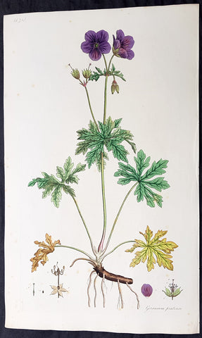
1777 W. Curtis Large Antique Botanical Print Geranium Pratense, Meadow Geranium
Antique Map
- Title : Geranium Pratense. Crowfoot-Leaved Cranes Bill
- Ref #: 93480
- Size: 19in x 11 1/2in (490mm x 295mm)
- Date : 1777 - 1798
- Condition: (A) Very Good Condition
Description:
This beautifully hand coloured original copper-plate engraved antique botanical print by William Curtis was published in his large 1st edition folio edition of his famous and most enduring 6 volumes of Flora Londinensis: or, plates and descriptions of such plants as grow wild in the environs of London: with their places of growth, and times of flowering, their several names according to Linnæus and other authors: with a particular description of each plant in Latin and English. To which are added, their several uses in medicine, agriculture, rural economy and other arts. published between 1777 & 1798.
Also accompanying the print is the original text page, giving an in-depth description of the plant and its attributes.
General Definitions:
Paper thickness and quality: - Heavy and stable
Paper color : - off white
Age of map color: - Original
Colors used: - Yellow, green, blue, pink
General color appearance: - Authentic
Paper size: - 19in x 11 1/2in (490mm x 295mm)
Plate size: - 9 1/2in x 6 1/2in (240mm x 165mm)
Margins: - Min 1in (25mm)
Imperfections:
Margins: - Light top left corner crease
Plate area: - Light spotting
Verso: - None
Background:
Flora Londinensis is a book that described the flora found in the London region of the mid 18th century. The Flora was published by William Curtis in six large volumes. The descriptions of the plants included hand-coloured copperplate plates by botanical artists such as James Sowerby, Sydenham Edwards and William Kilburn.
The full title is Flora Londinensis: or, plates and descriptions of such plants as grow wild in the environs of London: with their places of growth, and times of flowering, their several names according to Linnæus and other authors: with a particular description of each plant in Latin and English. To which are added, their several uses in medicine, agriculture, rural œconomy and other arts.
The first volume was produced in 1777 and the final one, containing a title and an index, was published in 1798. A binary name is given for each species in the survey; common and other names are also provided. Previous works on the flora of Britain had been intended for scientists, apothecaries, and herbalists, while Flora Londinensis was written for the general reader. The appealing plates also provided botanical details which could assist in the identification of a species.
Curtis was praefectus horti (Director, Society of Apothecaries) at the Chelsea Physic Garden and a botanist with a broad knowledge of exotic species. However, Flora Londinensis covered the territory most familiar to him -- the flowering species within a 10-mile radius of London. He commissioned several painters to produce hand-coloured copper engravings to accompany the pages. Curtis wrote the descriptions and managed the publishing and sales of the volumes, producing six fascicles of twelve issues, each containing six plates. The final survey eventually came to include many species found in southern England and a few others.
Despite praise for the volumes, no more than 300 copies were produced. Many other works were to be issued but it was not yet economical to produce a more affordable volume. Curtiss The Botanical Magazine would be a greater financial success. Sowerby, who helped to publish the volumes and give over seventy of the plates, went on to produce natural history publications in a similar format.
The work was enlarged by William J. Hooker, who published an edition with his own text in 1817 and 1828. This enlargement was even more comprehensive, by including species from the other British Isles.
Curtis, William 1746 - 1799
Curtis was an English botanist and entomologist, who was born at Alton, Hampshire, site of the Curtis Museum.
Curtis began as an apothecary, before turning his attention to botany and other natural history. The publications he prepared reached a wider audience than early works on the subject had intended. At the age of 25 he produced Instructions for collecting and preserving insects; particularly moths and butterflies.
Curtis was demonstrator of plants and Praefectus Horti at the Chelsea Physic Garden from 1771 to 1777. He established his own London Botanic Garden at Lambeth in 1779, moving to Brompton in 1789. He published Flora Londinensis (6 volumes, 1777–1798), a pioneering work in that it devoted itself to urban nature. Financial success was not found, but he went on the publish The Botanical Magazine in 1787, a work that would also feature hand coloured plates by artists such as James Sowerby and Sydenham Edwards. (William Kilburn is often erroneously cited as having contributed plates to Curtis\\\' Botanical Magazine. Though he did provide illustrations to Flora Londinensis, his association with Curtis seems to have ended by 1977, 10 years before the first publication of the Botanical Magazine)
Curtis was to gain wealth from the ventures into publishing, short sales on Londinensis were offset by over 3,000 copies of the magazine. Curtis said they had each brought \\\'pudding or praise\\\'.
The genus Curtisia is named in his honour. His publication was continued as the esteemed botanical publication, Curtis\\\'s Botanical Magazine. The noted natural history illustrators, James Sowerby and Sydenham Edwards both found a start with the eminent magazine.
He is commemorated in a stained glass window at St. Mary\\\'s Church, Battersea, as many of his samples were collected from the churchyard there.
This botanist is denoted by the author abbreviation Curtis when citing a botanical name.
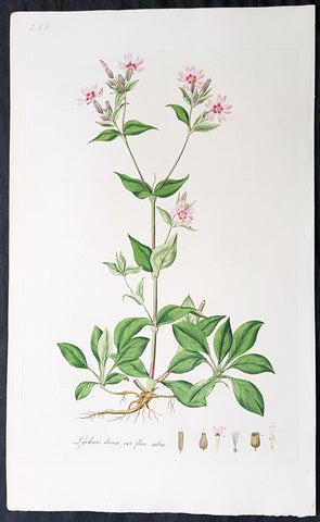
1777 W. Curtis Large Antique Botanical Print of Lychnis Dioica - Red Campion
Antique Map
- Title : Lychnis Dioica flore rubro. Red Campion
- Ref #: 93473
- Size: 19in x 11 1/2in (490mm x 295mm)
- Date : 1777 - 1798
- Condition: (A+) Fine Condition
Description:
This beautifully hand coloured original copper-plate engraved antique botanical print by William Curtis was published in his large 1st edition folio edition of his famous and most enduring 6 volumes of Flora Londinensis: or, plates and descriptions of such plants as grow wild in the environs of London: with their places of growth, and times of flowering, their several names according to Linnæus and other authors: with a particular description of each plant in Latin and English. To which are added, their several uses in medicine, agriculture, rural economy and other arts. published between 1777 & 1798.
Also accompanying the print is the original text page, giving an in-depth description of the plant and its attributes.
General Definitions:
Paper thickness and quality: - Heavy and stable
Paper color : - off white
Age of map color: - Original
Colors used: - Yellow, green, blue, pink
General color appearance: - Authentic
Paper size: - 19in x 11 1/2in (490mm x 295mm)
Plate size: - 9 1/2in x 6 1/2in (240mm x 165mm)
Margins: - Min 1in (25mm)
Imperfections:
Margins: - None
Plate area: - None
Verso: - None
Background:
Flora Londinensis is a book that described the flora found in the London region of the mid 18th century. The Flora was published by William Curtis in six large volumes. The descriptions of the plants included hand-coloured copperplate plates by botanical artists such as James Sowerby, Sydenham Edwards and William Kilburn.
The full title is Flora Londinensis: or, plates and descriptions of such plants as grow wild in the environs of London: with their places of growth, and times of flowering, their several names according to Linnæus and other authors: with a particular description of each plant in Latin and English. To which are added, their several uses in medicine, agriculture, rural œconomy and other arts.
The first volume was produced in 1777 and the final one, containing a title and an index, was published in 1798. A binary name is given for each species in the survey; common and other names are also provided. Previous works on the flora of Britain had been intended for scientists, apothecaries, and herbalists, while Flora Londinensis was written for the general reader. The appealing plates also provided botanical details which could assist in the identification of a species.
Curtis was praefectus horti (Director, Society of Apothecaries) at the Chelsea Physic Garden and a botanist with a broad knowledge of exotic species. However, Flora Londinensis covered the territory most familiar to him -- the flowering species within a 10-mile radius of London. He commissioned several painters to produce hand-coloured copper engravings to accompany the pages. Curtis wrote the descriptions and managed the publishing and sales of the volumes, producing six fascicles of twelve issues, each containing six plates. The final survey eventually came to include many species found in southern England and a few others.
Despite praise for the volumes, no more than 300 copies were produced. Many other works were to be issued but it was not yet economical to produce a more affordable volume. Curtiss The Botanical Magazine would be a greater financial success. Sowerby, who helped to publish the volumes and give over seventy of the plates, went on to produce natural history publications in a similar format.
The work was enlarged by William J. Hooker, who published an edition with his own text in 1817 and 1828. This enlargement was even more comprehensive, by including species from the other British Isles.
Curtis, William 1746 - 1799
Curtis was an English botanist and entomologist, who was born at Alton, Hampshire, site of the Curtis Museum.
Curtis began as an apothecary, before turning his attention to botany and other natural history. The publications he prepared reached a wider audience than early works on the subject had intended. At the age of 25 he produced Instructions for collecting and preserving insects; particularly moths and butterflies.
Curtis was demonstrator of plants and Praefectus Horti at the Chelsea Physic Garden from 1771 to 1777. He established his own London Botanic Garden at Lambeth in 1779, moving to Brompton in 1789. He published Flora Londinensis (6 volumes, 1777–1798), a pioneering work in that it devoted itself to urban nature. Financial success was not found, but he went on the publish The Botanical Magazine in 1787, a work that would also feature hand coloured plates by artists such as James Sowerby and Sydenham Edwards. (William Kilburn is often erroneously cited as having contributed plates to Curtis\\\' Botanical Magazine. Though he did provide illustrations to Flora Londinensis, his association with Curtis seems to have ended by 1977, 10 years before the first publication of the Botanical Magazine)
Curtis was to gain wealth from the ventures into publishing, short sales on Londinensis were offset by over 3,000 copies of the magazine. Curtis said they had each brought \\\'pudding or praise\\\'.
The genus Curtisia is named in his honour. His publication was continued as the esteemed botanical publication, Curtis\\\'s Botanical Magazine. The noted natural history illustrators, James Sowerby and Sydenham Edwards both found a start with the eminent magazine.
He is commemorated in a stained glass window at St. Mary\\\'s Church, Battersea, as many of his samples were collected from the churchyard there.
This botanist is denoted by the author abbreviation Curtis when citing a botanical name.
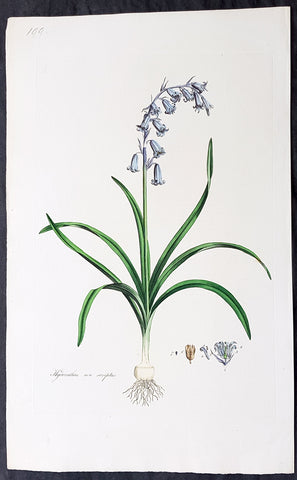
1777 W. Curtis Large Antique Botanical Print of Hyacinthus Non-Scriptus Bluebell
Antique Map
- Title : Hyacinthus Non-Scriptus. English Hyacinth or Harebell
- Ref #: 93476
- Size: 19in x 11 1/2in (490mm x 295mm)
- Date : 1777 - 1798
- Condition: (A+) Fine Condition
Description:
This beautifully hand coloured original copper-plate engraved antique botanical print by William Curtis was published in his large 1st edition folio edition of his famous and most enduring 6 volumes of Flora Londinensis: or, plates and descriptions of such plants as grow wild in the environs of London: with their places of growth, and times of flowering, their several names according to Linnæus and other authors: with a particular description of each plant in Latin and English. To which are added, their several uses in medicine, agriculture, rural economy and other arts. published between 1777 & 1798.
Also accompanying the print is the original text page, giving an in-depth description of the plant and its attributes.
General Definitions:
Paper thickness and quality: - Heavy and stable
Paper color : - off white
Age of map color: - Original
Colors used: - Yellow, green, blue, pink
General color appearance: - Authentic
Paper size: - 19in x 11 1/2in (490mm x 295mm)
Plate size: - 9 1/2in x 6 1/2in (240mm x 165mm)
Margins: - Min 1in (25mm)
Imperfections:
Margins: - None
Plate area: - None
Verso: - None
Background:
Flora Londinensis is a book that described the flora found in the London region of the mid 18th century. The Flora was published by William Curtis in six large volumes. The descriptions of the plants included hand-coloured copperplate plates by botanical artists such as James Sowerby, Sydenham Edwards and William Kilburn.
The full title is Flora Londinensis: or, plates and descriptions of such plants as grow wild in the environs of London: with their places of growth, and times of flowering, their several names according to Linnæus and other authors: with a particular description of each plant in Latin and English. To which are added, their several uses in medicine, agriculture, rural œconomy and other arts.
The first volume was produced in 1777 and the final one, containing a title and an index, was published in 1798. A binary name is given for each species in the survey; common and other names are also provided. Previous works on the flora of Britain had been intended for scientists, apothecaries, and herbalists, while Flora Londinensis was written for the general reader. The appealing plates also provided botanical details which could assist in the identification of a species.
Curtis was praefectus horti (Director, Society of Apothecaries) at the Chelsea Physic Garden and a botanist with a broad knowledge of exotic species. However, Flora Londinensis covered the territory most familiar to him -- the flowering species within a 10-mile radius of London. He commissioned several painters to produce hand-coloured copper engravings to accompany the pages. Curtis wrote the descriptions and managed the publishing and sales of the volumes, producing six fascicles of twelve issues, each containing six plates. The final survey eventually came to include many species found in southern England and a few others.
Despite praise for the volumes, no more than 300 copies were produced. Many other works were to be issued but it was not yet economical to produce a more affordable volume. Curtiss The Botanical Magazine would be a greater financial success. Sowerby, who helped to publish the volumes and give over seventy of the plates, went on to produce natural history publications in a similar format.
The work was enlarged by William J. Hooker, who published an edition with his own text in 1817 and 1828. This enlargement was even more comprehensive, by including species from the other British Isles.
Curtis, William 1746 - 1799
Curtis was an English botanist and entomologist, who was born at Alton, Hampshire, site of the Curtis Museum.
Curtis began as an apothecary, before turning his attention to botany and other natural history. The publications he prepared reached a wider audience than early works on the subject had intended. At the age of 25 he produced Instructions for collecting and preserving insects; particularly moths and butterflies.
Curtis was demonstrator of plants and Praefectus Horti at the Chelsea Physic Garden from 1771 to 1777. He established his own London Botanic Garden at Lambeth in 1779, moving to Brompton in 1789. He published Flora Londinensis (6 volumes, 1777–1798), a pioneering work in that it devoted itself to urban nature. Financial success was not found, but he went on the publish The Botanical Magazine in 1787, a work that would also feature hand coloured plates by artists such as James Sowerby and Sydenham Edwards. (William Kilburn is often erroneously cited as having contributed plates to Curtis\\\' Botanical Magazine. Though he did provide illustrations to Flora Londinensis, his association with Curtis seems to have ended by 1977, 10 years before the first publication of the Botanical Magazine)
Curtis was to gain wealth from the ventures into publishing, short sales on Londinensis were offset by over 3,000 copies of the magazine. Curtis said they had each brought \\\'pudding or praise\\\'.
The genus Curtisia is named in his honour. His publication was continued as the esteemed botanical publication, Curtis\\\'s Botanical Magazine. The noted natural history illustrators, James Sowerby and Sydenham Edwards both found a start with the eminent magazine.
He is commemorated in a stained glass window at St. Mary\\\'s Church, Battersea, as many of his samples were collected from the churchyard there.
This botanist is denoted by the author abbreviation Curtis when citing a botanical name.
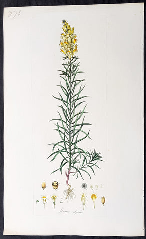
1777 W. Curtis Large Antique Botanical Print of Linaria Vulgaris Yellow Toadflax
Antique Map
- Title : Linaria Vulgaris. Yellow Toadflax
- Ref #: 93470
- Size: 19in x 11 1/2in (490mm x 295mm)
- Date : 1777 - 1798
- Condition: (A+) Fine Condition
Description:
This beautifully hand coloured original copper-plate engraved antique botanical print by William Curtis was published in his large 1st edition folio edition of his famous and most enduring 6 volumes of Flora Londinensis: or, plates and descriptions of such plants as grow wild in the environs of London: with their places of growth, and times of flowering, their several names according to Linnæus and other authors: with a particular description of each plant in Latin and English. To which are added, their several uses in medicine, agriculture, rural economy and other arts. published between 1777 & 1798.
Also accompanying the print is the original text page, giving an in-depth description of the plant and its attributes.
General Definitions:
Paper thickness and quality: - Heavy and stable
Paper color : - off white
Age of map color: - Original
Colors used: - Yellow, green, blue, pink
General color appearance: - Authentic
Paper size: - 19in x 11 1/2in (490mm x 295mm)
Plate size: - 9 1/2in x 6 1/2in (240mm x 165mm)
Margins: - Min 1in (25mm)
Imperfections:
Margins: - None
Plate area: - None
Verso: - None
Background:
Flora Londinensis is a book that described the flora found in the London region of the mid 18th century. The Flora was published by William Curtis in six large volumes. The descriptions of the plants included hand-coloured copperplate plates by botanical artists such as James Sowerby, Sydenham Edwards and William Kilburn.
The full title is Flora Londinensis: or, plates and descriptions of such plants as grow wild in the environs of London: with their places of growth, and times of flowering, their several names according to Linnæus and other authors: with a particular description of each plant in Latin and English. To which are added, their several uses in medicine, agriculture, rural œconomy and other arts.
The first volume was produced in 1777 and the final one, containing a title and an index, was published in 1798. A binary name is given for each species in the survey; common and other names are also provided. Previous works on the flora of Britain had been intended for scientists, apothecaries, and herbalists, while Flora Londinensis was written for the general reader. The appealing plates also provided botanical details which could assist in the identification of a species.
Curtis was praefectus horti (Director, Society of Apothecaries) at the Chelsea Physic Garden and a botanist with a broad knowledge of exotic species. However, Flora Londinensis covered the territory most familiar to him -- the flowering species within a 10-mile radius of London. He commissioned several painters to produce hand-coloured copper engravings to accompany the pages. Curtis wrote the descriptions and managed the publishing and sales of the volumes, producing six fascicles of twelve issues, each containing six plates. The final survey eventually came to include many species found in southern England and a few others.
Despite praise for the volumes, no more than 300 copies were produced. Many other works were to be issued but it was not yet economical to produce a more affordable volume. Curtiss The Botanical Magazine would be a greater financial success. Sowerby, who helped to publish the volumes and give over seventy of the plates, went on to produce natural history publications in a similar format.
The work was enlarged by William J. Hooker, who published an edition with his own text in 1817 and 1828. This enlargement was even more comprehensive, by including species from the other British Isles.
Curtis, William 1746 - 1799
Curtis was an English botanist and entomologist, who was born at Alton, Hampshire, site of the Curtis Museum.
Curtis began as an apothecary, before turning his attention to botany and other natural history. The publications he prepared reached a wider audience than early works on the subject had intended. At the age of 25 he produced Instructions for collecting and preserving insects; particularly moths and butterflies.
Curtis was demonstrator of plants and Praefectus Horti at the Chelsea Physic Garden from 1771 to 1777. He established his own London Botanic Garden at Lambeth in 1779, moving to Brompton in 1789. He published Flora Londinensis (6 volumes, 1777–1798), a pioneering work in that it devoted itself to urban nature. Financial success was not found, but he went on the publish The Botanical Magazine in 1787, a work that would also feature hand coloured plates by artists such as James Sowerby and Sydenham Edwards. (William Kilburn is often erroneously cited as having contributed plates to Curtis\\\' Botanical Magazine. Though he did provide illustrations to Flora Londinensis, his association with Curtis seems to have ended by 1977, 10 years before the first publication of the Botanical Magazine)
Curtis was to gain wealth from the ventures into publishing, short sales on Londinensis were offset by over 3,000 copies of the magazine. Curtis said they had each brought \\\'pudding or praise\\\'.
The genus Curtisia is named in his honour. His publication was continued as the esteemed botanical publication, Curtis\\\'s Botanical Magazine. The noted natural history illustrators, James Sowerby and Sydenham Edwards both found a start with the eminent magazine.
He is commemorated in a stained glass window at St. Mary\\\'s Church, Battersea, as many of his samples were collected from the churchyard there.
This botanist is denoted by the author abbreviation Curtis when citing a botanical name.
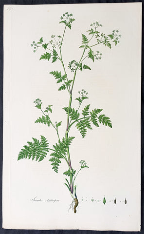
1777 W. Curtis Large Antique Botanical Print of Scandix Anthriscus Rough Chervil
Antique Map
- Title : Scandix Anthriscus. Rough Chervil
- Ref #: 93474
- Size: 19in x 11 1/2in (490mm x 295mm)
- Date : 1777 - 1798
- Condition: (A+) Fine Condition
Description:
This beautifully hand coloured original copper-plate engraved antique botanical print by William Curtis was published in his large 1st edition folio edition of his famous and most enduring 6 volumes of Flora Londinensis: or, plates and descriptions of such plants as grow wild in the environs of London: with their places of growth, and times of flowering, their several names according to Linnæus and other authors: with a particular description of each plant in Latin and English. To which are added, their several uses in medicine, agriculture, rural economy and other arts. published between 1777 & 1798.
Also accompanying the print is the original text page, giving an in-depth description of the plant and its attributes.
General Definitions:
Paper thickness and quality: - Heavy and stable
Paper color : - off white
Age of map color: - Original
Colors used: - Yellow, green, blue, pink
General color appearance: - Authentic
Paper size: - 19in x 11 1/2in (490mm x 295mm)
Plate size: - 9 1/2in x 6 1/2in (240mm x 165mm)
Margins: - Min 1in (25mm)
Imperfections:
Margins: - None
Plate area: - None
Verso: - None
Background:
Flora Londinensis is a book that described the flora found in the London region of the mid 18th century. The Flora was published by William Curtis in six large volumes. The descriptions of the plants included hand-coloured copperplate plates by botanical artists such as James Sowerby, Sydenham Edwards and William Kilburn.
The full title is Flora Londinensis: or, plates and descriptions of such plants as grow wild in the environs of London: with their places of growth, and times of flowering, their several names according to Linnæus and other authors: with a particular description of each plant in Latin and English. To which are added, their several uses in medicine, agriculture, rural œconomy and other arts.
The first volume was produced in 1777 and the final one, containing a title and an index, was published in 1798. A binary name is given for each species in the survey; common and other names are also provided. Previous works on the flora of Britain had been intended for scientists, apothecaries, and herbalists, while Flora Londinensis was written for the general reader. The appealing plates also provided botanical details which could assist in the identification of a species.
Curtis was praefectus horti (Director, Society of Apothecaries) at the Chelsea Physic Garden and a botanist with a broad knowledge of exotic species. However, Flora Londinensis covered the territory most familiar to him -- the flowering species within a 10-mile radius of London. He commissioned several painters to produce hand-coloured copper engravings to accompany the pages. Curtis wrote the descriptions and managed the publishing and sales of the volumes, producing six fascicles of twelve issues, each containing six plates. The final survey eventually came to include many species found in southern England and a few others.
Despite praise for the volumes, no more than 300 copies were produced. Many other works were to be issued but it was not yet economical to produce a more affordable volume. Curtiss The Botanical Magazine would be a greater financial success. Sowerby, who helped to publish the volumes and give over seventy of the plates, went on to produce natural history publications in a similar format.
The work was enlarged by William J. Hooker, who published an edition with his own text in 1817 and 1828. This enlargement was even more comprehensive, by including species from the other British Isles.
Curtis, William 1746 - 1799
Curtis was an English botanist and entomologist, who was born at Alton, Hampshire, site of the Curtis Museum.
Curtis began as an apothecary, before turning his attention to botany and other natural history. The publications he prepared reached a wider audience than early works on the subject had intended. At the age of 25 he produced Instructions for collecting and preserving insects; particularly moths and butterflies.
Curtis was demonstrator of plants and Praefectus Horti at the Chelsea Physic Garden from 1771 to 1777. He established his own London Botanic Garden at Lambeth in 1779, moving to Brompton in 1789. He published Flora Londinensis (6 volumes, 1777–1798), a pioneering work in that it devoted itself to urban nature. Financial success was not found, but he went on the publish The Botanical Magazine in 1787, a work that would also feature hand coloured plates by artists such as James Sowerby and Sydenham Edwards. (William Kilburn is often erroneously cited as having contributed plates to Curtis\\\' Botanical Magazine. Though he did provide illustrations to Flora Londinensis, his association with Curtis seems to have ended by 1977, 10 years before the first publication of the Botanical Magazine)
Curtis was to gain wealth from the ventures into publishing, short sales on Londinensis were offset by over 3,000 copies of the magazine. Curtis said they had each brought \\\'pudding or praise\\\'.
The genus Curtisia is named in his honour. His publication was continued as the esteemed botanical publication, Curtis\\\'s Botanical Magazine. The noted natural history illustrators, James Sowerby and Sydenham Edwards both found a start with the eminent magazine.
He is commemorated in a stained glass window at St. Mary\\\'s Church, Battersea, as many of his samples were collected from the churchyard there.
This botanist is denoted by the author abbreviation Curtis when citing a botanical name.
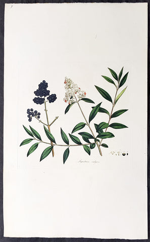
1777 W. Curtis Large Antique Botanical Print of Ligustrum vulgare or Privet Bush
Antique Map
- Title : Liustrum Vulgare. Privet, or Prim.
- Ref #: 93475
- Size: 19in x 11 1/2in (490mm x 295mm)
- Date : 1777 - 1798
- Condition: (A+) Fine Condition
Description:
This beautifully hand coloured original copper-plate engraved antique botanical print by William Curtis was published in his large 1st edition folio edition of his famous and most enduring 6 volumes of Flora Londinensis: or, plates and descriptions of such plants as grow wild in the environs of London: with their places of growth, and times of flowering, their several names according to Linnæus and other authors: with a particular description of each plant in Latin and English. To which are added, their several uses in medicine, agriculture, rural economy and other arts. published between 1777 & 1798.
Also accompanying the print is the original text page, giving an in-depth description of the plant and its attributes.
General Definitions:
Paper thickness and quality: - Heavy and stable
Paper color : - off white
Age of map color: - Original
Colors used: - Yellow, green, blue, pink
General color appearance: - Authentic
Paper size: - 19in x 11 1/2in (490mm x 295mm)
Plate size: - 9 1/2in x 6 1/2in (240mm x 165mm)
Margins: - Min 1in (25mm)
Imperfections:
Margins: - None
Plate area: - None
Verso: - None
Background:
Flora Londinensis is a book that described the flora found in the London region of the mid 18th century. The Flora was published by William Curtis in six large volumes. The descriptions of the plants included hand-coloured copperplate plates by botanical artists such as James Sowerby, Sydenham Edwards and William Kilburn.
The full title is Flora Londinensis: or, plates and descriptions of such plants as grow wild in the environs of London: with their places of growth, and times of flowering, their several names according to Linnæus and other authors: with a particular description of each plant in Latin and English. To which are added, their several uses in medicine, agriculture, rural œconomy and other arts.
The first volume was produced in 1777 and the final one, containing a title and an index, was published in 1798. A binary name is given for each species in the survey; common and other names are also provided. Previous works on the flora of Britain had been intended for scientists, apothecaries, and herbalists, while Flora Londinensis was written for the general reader. The appealing plates also provided botanical details which could assist in the identification of a species.
Curtis was praefectus horti (Director, Society of Apothecaries) at the Chelsea Physic Garden and a botanist with a broad knowledge of exotic species. However, Flora Londinensis covered the territory most familiar to him -- the flowering species within a 10-mile radius of London. He commissioned several painters to produce hand-coloured copper engravings to accompany the pages. Curtis wrote the descriptions and managed the publishing and sales of the volumes, producing six fascicles of twelve issues, each containing six plates. The final survey eventually came to include many species found in southern England and a few others.
Despite praise for the volumes, no more than 300 copies were produced. Many other works were to be issued but it was not yet economical to produce a more affordable volume. Curtiss The Botanical Magazine would be a greater financial success. Sowerby, who helped to publish the volumes and give over seventy of the plates, went on to produce natural history publications in a similar format.
The work was enlarged by William J. Hooker, who published an edition with his own text in 1817 and 1828. This enlargement was even more comprehensive, by including species from the other British Isles.
Curtis, William 1746 - 1799
Curtis was an English botanist and entomologist, who was born at Alton, Hampshire, site of the Curtis Museum.
Curtis began as an apothecary, before turning his attention to botany and other natural history. The publications he prepared reached a wider audience than early works on the subject had intended. At the age of 25 he produced Instructions for collecting and preserving insects; particularly moths and butterflies.
Curtis was demonstrator of plants and Praefectus Horti at the Chelsea Physic Garden from 1771 to 1777. He established his own London Botanic Garden at Lambeth in 1779, moving to Brompton in 1789. He published Flora Londinensis (6 volumes, 1777–1798), a pioneering work in that it devoted itself to urban nature. Financial success was not found, but he went on the publish The Botanical Magazine in 1787, a work that would also feature hand coloured plates by artists such as James Sowerby and Sydenham Edwards. (William Kilburn is often erroneously cited as having contributed plates to Curtis\\\' Botanical Magazine. Though he did provide illustrations to Flora Londinensis, his association with Curtis seems to have ended by 1977, 10 years before the first publication of the Botanical Magazine)
Curtis was to gain wealth from the ventures into publishing, short sales on Londinensis were offset by over 3,000 copies of the magazine. Curtis said they had each brought \\\'pudding or praise\\\'.
The genus Curtisia is named in his honour. His publication was continued as the esteemed botanical publication, Curtis\\\'s Botanical Magazine. The noted natural history illustrators, James Sowerby and Sydenham Edwards both found a start with the eminent magazine.
He is commemorated in a stained glass window at St. Mary\\\'s Church, Battersea, as many of his samples were collected from the churchyard there.
This botanist is denoted by the author abbreviation Curtis when citing a botanical name.
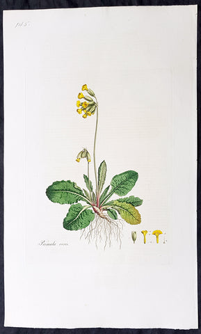
1777 W. Curtis Large Antique Botanical Print of Primula Veris,The Common Cowslip
Antique Map
- Title : Primula Veris. Cowslip
- Ref #: 93477
- Size: 19in x 11 1/2in (490mm x 295mm)
- Date : 1777 - 1798
- Condition: (A+) Fine Condition
Description:
This beautifully hand coloured original copper-plate engraved antique botanical print by William Curtis was published in his large 1st edition folio edition of his famous and most enduring 6 volumes of Flora Londinensis: or, plates and descriptions of such plants as grow wild in the environs of London: with their places of growth, and times of flowering, their several names according to Linnæus and other authors: with a particular description of each plant in Latin and English. To which are added, their several uses in medicine, agriculture, rural economy and other arts. published between 1777 & 1798.
Also accompanying the print is the original text page, giving an in-depth description of the plant and its attributes.
General Definitions:
Paper thickness and quality: - Heavy and stable
Paper color : - off white
Age of map color: - Original
Colors used: - Yellow, green, blue, pink
General color appearance: - Authentic
Paper size: - 19in x 11 1/2in (490mm x 295mm)
Plate size: - 9 1/2in x 6 1/2in (240mm x 165mm)
Margins: - Min 1in (25mm)
Imperfections:
Margins: - None
Plate area: - None
Verso: - None
Background:
Flora Londinensis is a book that described the flora found in the London region of the mid 18th century. The Flora was published by William Curtis in six large volumes. The descriptions of the plants included hand-coloured copperplate plates by botanical artists such as James Sowerby, Sydenham Edwards and William Kilburn.
The full title is Flora Londinensis: or, plates and descriptions of such plants as grow wild in the environs of London: with their places of growth, and times of flowering, their several names according to Linnæus and other authors: with a particular description of each plant in Latin and English. To which are added, their several uses in medicine, agriculture, rural œconomy and other arts.
The first volume was produced in 1777 and the final one, containing a title and an index, was published in 1798. A binary name is given for each species in the survey; common and other names are also provided. Previous works on the flora of Britain had been intended for scientists, apothecaries, and herbalists, while Flora Londinensis was written for the general reader. The appealing plates also provided botanical details which could assist in the identification of a species.
Curtis was praefectus horti (Director, Society of Apothecaries) at the Chelsea Physic Garden and a botanist with a broad knowledge of exotic species. However, Flora Londinensis covered the territory most familiar to him -- the flowering species within a 10-mile radius of London. He commissioned several painters to produce hand-coloured copper engravings to accompany the pages. Curtis wrote the descriptions and managed the publishing and sales of the volumes, producing six fascicles of twelve issues, each containing six plates. The final survey eventually came to include many species found in southern England and a few others.
Despite praise for the volumes, no more than 300 copies were produced. Many other works were to be issued but it was not yet economical to produce a more affordable volume. Curtiss The Botanical Magazine would be a greater financial success. Sowerby, who helped to publish the volumes and give over seventy of the plates, went on to produce natural history publications in a similar format.
The work was enlarged by William J. Hooker, who published an edition with his own text in 1817 and 1828. This enlargement was even more comprehensive, by including species from the other British Isles.
Curtis, William 1746 - 1799
Curtis was an English botanist and entomologist, who was born at Alton, Hampshire, site of the Curtis Museum.
Curtis began as an apothecary, before turning his attention to botany and other natural history. The publications he prepared reached a wider audience than early works on the subject had intended. At the age of 25 he produced Instructions for collecting and preserving insects; particularly moths and butterflies.
Curtis was demonstrator of plants and Praefectus Horti at the Chelsea Physic Garden from 1771 to 1777. He established his own London Botanic Garden at Lambeth in 1779, moving to Brompton in 1789. He published Flora Londinensis (6 volumes, 1777–1798), a pioneering work in that it devoted itself to urban nature. Financial success was not found, but he went on the publish The Botanical Magazine in 1787, a work that would also feature hand coloured plates by artists such as James Sowerby and Sydenham Edwards. (William Kilburn is often erroneously cited as having contributed plates to Curtis\\\' Botanical Magazine. Though he did provide illustrations to Flora Londinensis, his association with Curtis seems to have ended by 1977, 10 years before the first publication of the Botanical Magazine)
Curtis was to gain wealth from the ventures into publishing, short sales on Londinensis were offset by over 3,000 copies of the magazine. Curtis said they had each brought \\\'pudding or praise\\\'.
The genus Curtisia is named in his honour. His publication was continued as the esteemed botanical publication, Curtis\\\'s Botanical Magazine. The noted natural history illustrators, James Sowerby and Sydenham Edwards both found a start with the eminent magazine.
He is commemorated in a stained glass window at St. Mary\\\'s Church, Battersea, as many of his samples were collected from the churchyard there.
This botanist is denoted by the author abbreviation Curtis when citing a botanical name.
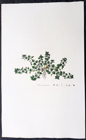
1777 William Curtis Large Antique Botanical Print of The Green Field-Speedwell
Antique Map
- Title : Veronica agrestis. Procumbent Speed. Well.
- Ref #: 93479
- Size: 19in x 11 1/2in (490mm x 295mm)
- Date : 1777 - 1798
- Condition: (A+) Fine Condition
Description:
This beautifully hand coloured original copper-plate engraved antique botanical print by William Curtis was published in his large 1st edition folio edition of his famous and most enduring 6 volumes of Flora Londinensis: or, plates and descriptions of such plants as grow wild in the environs of London: with their places of growth, and times of flowering, their several names according to Linnæus and other authors: with a particular description of each plant in Latin and English. To which are added, their several uses in medicine, agriculture, rural economy and other arts. published between 1777 & 1798.
Also accompanying the print is the original text page, giving an in-depth description of the plant and its attributes.
General Definitions:
Paper thickness and quality: - Heavy and stable
Paper color : - off white
Age of map color: - Original
Colors used: - Yellow, green, blue, pink
General color appearance: - Authentic
Paper size: - 19in x 11 1/2in (490mm x 295mm)
Plate size: - 9 1/2in x 6 1/2in (240mm x 165mm)
Margins: - Min 1in (25mm)
Imperfections:
Margins: - None
Plate area: - None
Verso: - None
Background:
Flora Londinensis is a book that described the flora found in the London region of the mid 18th century. The Flora was published by William Curtis in six large volumes. The descriptions of the plants included hand-coloured copperplate plates by botanical artists such as James Sowerby, Sydenham Edwards and William Kilburn.
The full title is Flora Londinensis: or, plates and descriptions of such plants as grow wild in the environs of London: with their places of growth, and times of flowering, their several names according to Linnæus and other authors: with a particular description of each plant in Latin and English. To which are added, their several uses in medicine, agriculture, rural œconomy and other arts.
The first volume was produced in 1777 and the final one, containing a title and an index, was published in 1798. A binary name is given for each species in the survey; common and other names are also provided. Previous works on the flora of Britain had been intended for scientists, apothecaries, and herbalists, while Flora Londinensis was written for the general reader. The appealing plates also provided botanical details which could assist in the identification of a species.
Curtis was praefectus horti (Director, Society of Apothecaries) at the Chelsea Physic Garden and a botanist with a broad knowledge of exotic species. However, Flora Londinensis covered the territory most familiar to him -- the flowering species within a 10-mile radius of London. He commissioned several painters to produce hand-coloured copper engravings to accompany the pages. Curtis wrote the descriptions and managed the publishing and sales of the volumes, producing six fascicles of twelve issues, each containing six plates. The final survey eventually came to include many species found in southern England and a few others.
Despite praise for the volumes, no more than 300 copies were produced. Many other works were to be issued but it was not yet economical to produce a more affordable volume. Curtiss The Botanical Magazine would be a greater financial success. Sowerby, who helped to publish the volumes and give over seventy of the plates, went on to produce natural history publications in a similar format.
The work was enlarged by William J. Hooker, who published an edition with his own text in 1817 and 1828. This enlargement was even more comprehensive, by including species from the other British Isles.
Curtis, William 1746 - 1799
Curtis was an English botanist and entomologist, who was born at Alton, Hampshire, site of the Curtis Museum.
Curtis began as an apothecary, before turning his attention to botany and other natural history. The publications he prepared reached a wider audience than early works on the subject had intended. At the age of 25 he produced Instructions for collecting and preserving insects; particularly moths and butterflies.
Curtis was demonstrator of plants and Praefectus Horti at the Chelsea Physic Garden from 1771 to 1777. He established his own London Botanic Garden at Lambeth in 1779, moving to Brompton in 1789. He published Flora Londinensis (6 volumes, 1777–1798), a pioneering work in that it devoted itself to urban nature. Financial success was not found, but he went on the publish The Botanical Magazine in 1787, a work that would also feature hand coloured plates by artists such as James Sowerby and Sydenham Edwards. (William Kilburn is often erroneously cited as having contributed plates to Curtis\\\' Botanical Magazine. Though he did provide illustrations to Flora Londinensis, his association with Curtis seems to have ended by 1977, 10 years before the first publication of the Botanical Magazine)
Curtis was to gain wealth from the ventures into publishing, short sales on Londinensis were offset by over 3,000 copies of the magazine. Curtis said they had each brought \\\'pudding or praise\\\'.
The genus Curtisia is named in his honour. His publication was continued as the esteemed botanical publication, Curtis\\\'s Botanical Magazine. The noted natural history illustrators, James Sowerby and Sydenham Edwards both found a start with the eminent magazine.
He is commemorated in a stained glass window at St. Mary\\\'s Church, Battersea, as many of his samples were collected from the churchyard there.
This botanist is denoted by the author abbreviation Curtis when citing a botanical name.
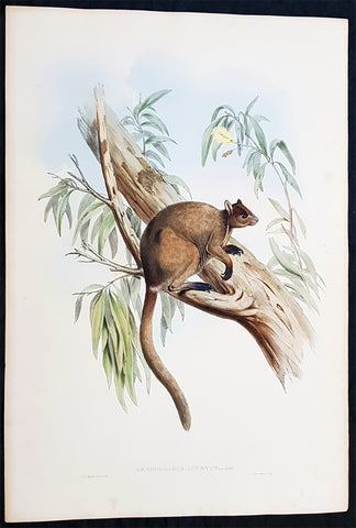
1845-63 John Gould Large Antique Print of Tree Kangaroo The Mammals of Australia
Antique Map
- Title : Dendrolagus Inustus, Mull....H C Richter del et lith....C Hullmandel Imp.
- Ref #: 93442
- Size: 22in x 15in (560mm x 385mm)
- Date : 1845–63
- Condition: (A+) Fine Condition
Description:
This large rare original hand coloured lithograph antique print of The Grizzled Tree Kangaroo, by the artist HC Richter was printed by Charles Joseph Hullmandel 1789 – 1850 in the famous Naturalists John Goulds The Mammals of Australiapublished between 1845–63.
General Definitions:
Paper thickness and quality: - Heavy and stable
Paper color : - off white
Age of map color: - Original
Colors used: - Blue, pink, red, green, yellow
General color appearance: - Authentic
Paper size: - 22in x 15in (560mm x 385mm)
Plate size: - 22in x 15in (560mm x 385mm)
Margins: - Min 1in (25mm)
Imperfections:
Margins: - Light age toning
Plate area: - None
Verso: - None
Background:
The Mammals of Australia is a three-volume work written and published by John Gould between 1845–63. It contains 182 illustrations by the author and its artist H. C. Richter. It was intended to be a complete survey of the novel species of mammals, such as the marsupials, discovered in the colonies of Australia.
The author, John Gould, best known for The Birds of Australia and other major works of ornithology, visited Australia in 1838. In his introduction, Gould says:.....It was not until I arrived in the country, and found myself surrounded by objects as strange as if I had been transported to another planet, that I conceived the idea of devoting a portion of my attention to the mammalian class of its extraordinary fauna......During his short stay he made observations on the natural history and employed his skills as a taxidermist to obtain specimens.
The publication of this major work by Gould followed his A Monograph of the Macropodidae or Family of Kangaroos in 1841. This work was the first comprehensive survey of Australian mammals, and gave an account of their classification and description. Gould also included the indigenous names for the species from the lists he made while in Australia. He used these names to make requests of the local peoples for his specimens, and recorded the regions where the names were used. This conserved a number of common names, such as dibbler (Parantechinus apicalis), which were later recommended by authorities.
The large lithographs reproduced the artwork of Richter, after the drawings and watercolours made in Australia by Gould and his wife, Elizabeth. (The contribution by Elizabeth Gould was uncredited). These were hand-coloured by a group of artists, led by Gabriel Bayfield, that required the completion of 26,572 plates. The illustrations produced during their visit to Australia were supplemented by the preserved specimens returned to England and detailed the characteristics of the species. These illustrations have become iconic images of the mammals of Australia. Among the best known of the illustrations from the work are the two of Thylacinus cynocephalus (Tasmanian tiger), copied since its publication and the most frequently reproduced, made more recognizable by Cascade Brewerys appropriation for its label in 1987. The government of Tasmania published a monochromatic reproduction of the same image in 1934, the author Louisa Anne Meredith also copied it for Tasmanian Friends and Foes (1881).
The Mammals of Australia was published by subscription in the format Imperial Folio; 13 parts in three volumes were issued from 1845 until 1863. To these the author added An Introduction to The Mammals of Australia (1863) in a separate work. This provided corrections and updates, a new preface, introduction, and a list of the mammals of the three volumes. The first two volumes were complete surveys of orders Marsupiata (marsupials), and, with Rodentia in the third, it formed the sum of known mammalian species of Australia. With the addition of those contained in the later Introduction the total of species described reached 166. The same work notes the exclusion of marine mammals such as whales from the volumes, but reprints a manuscript by Charles Coxen on the dugong.
Beyond the scientific value of this comprehensive survey, the document is cited in reference to its subjects conservation. Some of the species included in the work, such as Onychogalea lunata (crescent nailtail wallaby), have since succumbed to changes in land use since European colonisation.
The work was received with acclaim, but the high cost of production, especially of the coloured plates, reduced its accessibility. The original listed price was £41 for the complete set of volumes. The public curiosity for the unique fauna of Australia was met by this handsomely illustrated and comprehensive survey, and it spawned imitations in Australia. The curator of the Australian Museum, Gerard Krefft, produced the more affordable The Mammals of Australia (1871); intended for educational purposes and influenced by Goulds illustrations. Gracius Broinowskis abandoned work, Birds and Mammals of Australia (1884), so closely imitated the plates that an injunction was threatened by its publisher.
Gould, John FRS 1804 – 1881
Gould was an English ornithologist and bird artist. He published a number of monographs on birds, illustrated by plates that he produced with the assistance of his wife, Elizabeth Gould, and several other artists including Edward Lear, Henry Constantine Richter, Joseph Wolf and William Matthew Hart. He has been considered the father of bird study in Australia and the Gould League in Australia is named after him. His identification of the birds now nicknamed Darwins finches played a role in the inception of Darwins theory of evolution by natural selection. Goulds work is referenced in Charles Darwins book, On the Origin of Species.
Gould was born in Lyme Regis the first son of a gardener. He and the boy probably had a scanty education. Shortly afterwards his father obtained a position on an estate near Guildford, Surrey, and then in 1818 Gould became foreman in the Royal Gardens of Windsor. He was for some time under the care of J. T. Aiton, of the Royal Gardens of Windsor. The young Gould started training as a gardener, being employed under his father at Windsor from 1818 to 1824, and he was subsequently a gardener at Ripley Castle in Yorkshire. He became an expert in the art of taxidermy. In 1824 he set himself up in business in London as a taxidermist, and his skill helped him to become the first Curator and Preserver at the museum of the Zoological Society of London in 1827.
Goulds position brought him into contact with the countrys leading naturalists. This meant that he was often the first to see new collections of birds given to the Zoological Society of London. In 1830 a collection of birds arrived from the Himalayas, many not previously described. Gould published these birds in A Century of Birds from the Himalaya Mountains (1830–1832). The text was by Nicholas Aylward Vigors and the illustrations were drawn and lithographed by Goulds wife Elizabeth Coxen Gould. Most of Goulds work were rough sketches on paper from which other artists created the lithographic plates.
This work was followed by four more in the next seven years, including Birds of Europe in five volumes. It was completed in 1837; Gould wrote the text, and his clerk, Edwin Prince, did the editing. The plates were drawn and lithographed by Elizabeth Coxen Gould. A few of the illustrations were made by Edward Lear as part of his Illustrations of the Family of Psittacidae in 1832. Lear, however, was in financial difficulty, and he sold the entire set of lithographs to Gould. The books were published in a very large size, imperial folio, with magnificent coloured plates. Eventually 41 of these volumes were published, with about 3000 plates. They appeared in parts at £3 3s. a number, subscribed for in advance, and in spite of the heavy expense of preparing the plates, Gould succeeded in making his ventures pay, realising a fortune. This was a busy period for Gould who also published Icones Avium in two parts containing 18 leaves of bird studies on 54 cm plates as a supplement to his previous works. No further monographs were published as in 1838 he and his wife moved to Australia to work on the Birds of Australia. Shortly after their return to England, his wife died in 1841. Elizabeth Gould completed 84 plates for Birds of Australia before her death.
When Charles Darwin presented his mammal and bird specimens collected during the second voyage of HMS Beagle to the Zoological Society of London on 4 January 1837, the bird specimens were given to Gould for identification. He set aside his paying work and at the next meeting on 10 January reported that birds from the Galápagos Islands which Darwin had thought were blackbirds, gross-bills and finches were in fact a series of ground Finches which are so peculiar as to form an entirely new group, containing 12 species. This story made the newspapers. In March, Darwin met Gould again, learning that his Galápagos wren was another species of finch and the mockingbirds he had labelled by island were separate species rather than just varieties, with relatives on the South American mainland. Subsequently, Gould advised that the smaller southern Rhea specimen that had been rescued from a Christmas dinner was a separate species which he named Rhea darwinii, whose territory overlapped with the northern rheas. Darwin had not bothered to label his finches by island, but others on the expedition had taken more care. He now sought specimens collected by captain Robert FitzRoy and crewmen. From them he was able to establish that the species were unique to islands, an important step on the inception of his theory of evolution by natural selection. Goulds work on the birds was published between 1838 and 1842 in five numbers as Part 3 of Zoology of the Voyage of H.M.S. Beagle, edited by Charles Darwin. Elizabeth Gould illustrated all the plates for Part 3.
In 1838 the Goulds sailed to Australia, intending to study the birds of that country and be the first to produce a major work on the subject. They took with them the collector John Gilbert. They arrived in Tasmania in September, making the acquaintance of the governor Sir John Franklin and his wife. Gould and Gilbert collected on the island. In February 1839 Gould sailed to Sydney, leaving his pregnant wife with the Franklins. He travelled to his brother-in-laws station at Yarrundi, spending his time searching for bowerbirds in the Liverpool Range. In April he returned to Tasmania for the birth of his son. In May he sailed to Adelaide to meet Charles Sturt, who was preparing to lead an expedition to the Murray River. Gould collected in the Mount Lofty range, the Murray Scrubs and Kangaroo Island, returning again to Hobart in July. He then travelled with his wife to Yarrundi. They returned home to England in May 1840.
The result of the trip was The Birds of Australia (1840–48). It included a total of 600 plates in seven volumes; 328 of the species described were new to science and named by Gould. He also published A Monograph of the Macropodidae, or Family of Kangaroos (1841–1842) and the three volume work The Mammals of Australia (1849–1861).
Elizabeth died in 1841 after the birth of their eighth child, Sarah, and Goulds books subsequently used illustrations by a number of artists, including Henry Constantine Richter, William Matthew Hart and Joseph Wolf.
Throughout his professional life Gould had a strong interest in hummingbirds. He accumulated a collection of 320 species, which he exhibited at the Great Exhibition of 1851. Despite his interest, Gould had never seen a live hummingbird. In May 1857 he travelled to the United States with his second son, Charles. He arrived in New York too early in the season to see hummingbirds in that city, but on 21 May 1857, in Bartrams Gardens in Philadelphia, he finally saw his first live one, a ruby-throated hummingbird. He then continued to Washington D.C. where he saw large numbers in the gardens of the Capitol. Gould attempted to return to England with live specimens, but, as he was not aware of the conditions necessary to keep them, they only lived for two months at most.
Gould published: A Monograph of the Trochilidae or Humming Birds with 360 plates (1849–61); The Mammals of Australia (1845–63), Handbook to the Birds of Australia (1865), The Birds of Asia (1850–83), The Birds of Great Britain (1862–73) and The Birds of New Guinea and the adjacent Papuan Islands (1875–88).
The University of Glasgow, which owns a copy of Birds of Great Britain, describes John Gould as the greatest figure in bird illustration after Audubon, and auctioneers Sotherans describe the work as Goulds pride and joy.
Gould had already published some of the illustrations in Birds of Europe, but Birds of Great Britain represents a development of his aesthetic style in which he adds illustrations of nests and young on a large scale.
Sotherans Co. reports that Gould published the book himself, producing 750 copies, which remain sought after both as complete volumes, and as individual plates, currently varying in price from £450 – £850. The University of Glasgow records that the volumes were issued in London in 25 parts, to make the complete set, between 1863 and 1873, and each set contained 367 coloured lithographs.
Gould undertook an ornithological tour of Scandinavia in 1856, in preparation for the work, taking with him the artist Henry Wolf who drew 57 of the plates from Goulds preparatory sketches. According to The University of Glasgow Goulds skill was in rapidly producing rough sketches from nature (a majority of the sketches were drawn from newly killed specimens) capturing the distinctiveness of each species. Gould then oversaw the process whereby his artists worked his sketches up into the finished drawings, which were made into coloured lithographs by engraver William Hart.
There were problems: the stone engraving of the snowy owl in volume I was dropped and broken at an early stage in the printing. Later issues of this plate show evidence of this damage and consequently the early issue – printed before the accident – are considered more desirable.
The lithographs were hand coloured. In the introduction for the work, Gould states every sky with its varied tints and every feather of each bird were coloured by hand; and when it is considered that nearly two hundred and eighty thousand illustrations in the present work have been so treated, it will most likely cause some astonishment to those who give the subject a thought.
The work has gathered critical acclaim: according to Mullens and Swann, Birds of Great Britain is the most sumptuous and costly of British bird books, whilst Wood describes it as a magnificent work. Isabella Tree writes that it was seen – perhaps partly because its subject was British, as the culmination of [his] ... genius
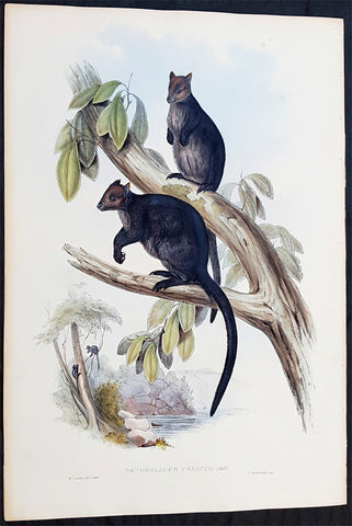
1845-63 John Gould Large Antique Print The Mammals of Australia - Tree Kangaroo
Antique Map
- Title : Dendrolagus Ursinus, Mull....H C Richter del et lith....C Hullmandel Imp.
- Ref #: 93441
- Size: 22in x 15in (560mm x 385mm)
- Date : 1845–63
- Condition: (A+) Fine Condition
Description:
This large rare original hand coloured lithograph antique print of The Ursine Tree Kangaroo, by the artist HC Richter was printed by Charles Joseph Hullmandel 1789 – 1850 in the famous Naturalists John Goulds The Mammals of Australiapublished between 1845–63.
General Definitions:
Paper thickness and quality: - Heavy and stable
Paper color : - off white
Age of map color: - Original
Colors used: - Blue, pink, red, green, yellow
General color appearance: - Authentic
Paper size: - 22in x 15in (560mm x 385mm)
Plate size: - 22in x 15in (560mm x 385mm)
Margins: - Min 1in (25mm)
Imperfections:
Margins: - Light age toning
Plate area: - None
Verso: - None
Background:
The Mammals of Australia is a three-volume work written and published by John Gould between 1845–63. It contains 182 illustrations by the author and its artist H. C. Richter. It was intended to be a complete survey of the novel species of mammals, such as the marsupials, discovered in the colonies of Australia.
The author, John Gould, best known for The Birds of Australia and other major works of ornithology, visited Australia in 1838. In his introduction, Gould says:.....It was not until I arrived in the country, and found myself surrounded by objects as strange as if I had been transported to another planet, that I conceived the idea of devoting a portion of my attention to the mammalian class of its extraordinary fauna......During his short stay he made observations on the natural history and employed his skills as a taxidermist to obtain specimens.
The publication of this major work by Gould followed his A Monograph of the Macropodidae or Family of Kangaroos in 1841. This work was the first comprehensive survey of Australian mammals, and gave an account of their classification and description. Gould also included the indigenous names for the species from the lists he made while in Australia. He used these names to make requests of the local peoples for his specimens, and recorded the regions where the names were used. This conserved a number of common names, such as dibbler (Parantechinus apicalis), which were later recommended by authorities.
The large lithographs reproduced the artwork of Richter, after the drawings and watercolours made in Australia by Gould and his wife, Elizabeth. (The contribution by Elizabeth Gould was uncredited). These were hand-coloured by a group of artists, led by Gabriel Bayfield, that required the completion of 26,572 plates. The illustrations produced during their visit to Australia were supplemented by the preserved specimens returned to England and detailed the characteristics of the species. These illustrations have become iconic images of the mammals of Australia. Among the best known of the illustrations from the work are the two of Thylacinus cynocephalus (Tasmanian tiger), copied since its publication and the most frequently reproduced, made more recognizable by Cascade Brewerys appropriation for its label in 1987. The government of Tasmania published a monochromatic reproduction of the same image in 1934, the author Louisa Anne Meredith also copied it for Tasmanian Friends and Foes (1881).
The Mammals of Australia was published by subscription in the format Imperial Folio; 13 parts in three volumes were issued from 1845 until 1863. To these the author added An Introduction to The Mammals of Australia (1863) in a separate work. This provided corrections and updates, a new preface, introduction, and a list of the mammals of the three volumes. The first two volumes were complete surveys of orders Marsupiata (marsupials), and, with Rodentia in the third, it formed the sum of known mammalian species of Australia. With the addition of those contained in the later Introduction the total of species described reached 166. The same work notes the exclusion of marine mammals such as whales from the volumes, but reprints a manuscript by Charles Coxen on the dugong.
Beyond the scientific value of this comprehensive survey, the document is cited in reference to its subjects conservation. Some of the species included in the work, such as Onychogalea lunata (crescent nailtail wallaby), have since succumbed to changes in land use since European colonisation.
The work was received with acclaim, but the high cost of production, especially of the coloured plates, reduced its accessibility. The original listed price was £41 for the complete set of volumes. The public curiosity for the unique fauna of Australia was met by this handsomely illustrated and comprehensive survey, and it spawned imitations in Australia. The curator of the Australian Museum, Gerard Krefft, produced the more affordable The Mammals of Australia (1871); intended for educational purposes and influenced by Goulds illustrations. Gracius Broinowskis abandoned work, Birds and Mammals of Australia (1884), so closely imitated the plates that an injunction was threatened by its publisher.
Gould, John FRS 1804 – 1881
Gould was an English ornithologist and bird artist. He published a number of monographs on birds, illustrated by plates that he produced with the assistance of his wife, Elizabeth Gould, and several other artists including Edward Lear, Henry Constantine Richter, Joseph Wolf and William Matthew Hart. He has been considered the father of bird study in Australia and the Gould League in Australia is named after him. His identification of the birds now nicknamed Darwins finches played a role in the inception of Darwins theory of evolution by natural selection. Goulds work is referenced in Charles Darwins book, On the Origin of Species.
Gould was born in Lyme Regis the first son of a gardener. He and the boy probably had a scanty education. Shortly afterwards his father obtained a position on an estate near Guildford, Surrey, and then in 1818 Gould became foreman in the Royal Gardens of Windsor. He was for some time under the care of J. T. Aiton, of the Royal Gardens of Windsor. The young Gould started training as a gardener, being employed under his father at Windsor from 1818 to 1824, and he was subsequently a gardener at Ripley Castle in Yorkshire. He became an expert in the art of taxidermy. In 1824 he set himself up in business in London as a taxidermist, and his skill helped him to become the first Curator and Preserver at the museum of the Zoological Society of London in 1827.
Goulds position brought him into contact with the countrys leading naturalists. This meant that he was often the first to see new collections of birds given to the Zoological Society of London. In 1830 a collection of birds arrived from the Himalayas, many not previously described. Gould published these birds in A Century of Birds from the Himalaya Mountains (1830–1832). The text was by Nicholas Aylward Vigors and the illustrations were drawn and lithographed by Goulds wife Elizabeth Coxen Gould. Most of Goulds work were rough sketches on paper from which other artists created the lithographic plates.
This work was followed by four more in the next seven years, including Birds of Europe in five volumes. It was completed in 1837; Gould wrote the text, and his clerk, Edwin Prince, did the editing. The plates were drawn and lithographed by Elizabeth Coxen Gould. A few of the illustrations were made by Edward Lear as part of his Illustrations of the Family of Psittacidae in 1832. Lear, however, was in financial difficulty, and he sold the entire set of lithographs to Gould. The books were published in a very large size, imperial folio, with magnificent coloured plates. Eventually 41 of these volumes were published, with about 3000 plates. They appeared in parts at £3 3s. a number, subscribed for in advance, and in spite of the heavy expense of preparing the plates, Gould succeeded in making his ventures pay, realising a fortune. This was a busy period for Gould who also published Icones Avium in two parts containing 18 leaves of bird studies on 54 cm plates as a supplement to his previous works. No further monographs were published as in 1838 he and his wife moved to Australia to work on the Birds of Australia. Shortly after their return to England, his wife died in 1841. Elizabeth Gould completed 84 plates for Birds of Australia before her death.
When Charles Darwin presented his mammal and bird specimens collected during the second voyage of HMS Beagle to the Zoological Society of London on 4 January 1837, the bird specimens were given to Gould for identification. He set aside his paying work and at the next meeting on 10 January reported that birds from the Galápagos Islands which Darwin had thought were blackbirds, gross-bills and finches were in fact a series of ground Finches which are so peculiar as to form an entirely new group, containing 12 species. This story made the newspapers. In March, Darwin met Gould again, learning that his Galápagos wren was another species of finch and the mockingbirds he had labelled by island were separate species rather than just varieties, with relatives on the South American mainland. Subsequently, Gould advised that the smaller southern Rhea specimen that had been rescued from a Christmas dinner was a separate species which he named Rhea darwinii, whose territory overlapped with the northern rheas. Darwin had not bothered to label his finches by island, but others on the expedition had taken more care. He now sought specimens collected by captain Robert FitzRoy and crewmen. From them he was able to establish that the species were unique to islands, an important step on the inception of his theory of evolution by natural selection. Goulds work on the birds was published between 1838 and 1842 in five numbers as Part 3 of Zoology of the Voyage of H.M.S. Beagle, edited by Charles Darwin. Elizabeth Gould illustrated all the plates for Part 3.
In 1838 the Goulds sailed to Australia, intending to study the birds of that country and be the first to produce a major work on the subject. They took with them the collector John Gilbert. They arrived in Tasmania in September, making the acquaintance of the governor Sir John Franklin and his wife. Gould and Gilbert collected on the island. In February 1839 Gould sailed to Sydney, leaving his pregnant wife with the Franklins. He travelled to his brother-in-laws station at Yarrundi, spending his time searching for bowerbirds in the Liverpool Range. In April he returned to Tasmania for the birth of his son. In May he sailed to Adelaide to meet Charles Sturt, who was preparing to lead an expedition to the Murray River. Gould collected in the Mount Lofty range, the Murray Scrubs and Kangaroo Island, returning again to Hobart in July. He then travelled with his wife to Yarrundi. They returned home to England in May 1840.
The result of the trip was The Birds of Australia (1840–48). It included a total of 600 plates in seven volumes; 328 of the species described were new to science and named by Gould. He also published A Monograph of the Macropodidae, or Family of Kangaroos (1841–1842) and the three volume work The Mammals of Australia (1849–1861).
Elizabeth died in 1841 after the birth of their eighth child, Sarah, and Goulds books subsequently used illustrations by a number of artists, including Henry Constantine Richter, William Matthew Hart and Joseph Wolf.
Throughout his professional life Gould had a strong interest in hummingbirds. He accumulated a collection of 320 species, which he exhibited at the Great Exhibition of 1851. Despite his interest, Gould had never seen a live hummingbird. In May 1857 he travelled to the United States with his second son, Charles. He arrived in New York too early in the season to see hummingbirds in that city, but on 21 May 1857, in Bartrams Gardens in Philadelphia, he finally saw his first live one, a ruby-throated hummingbird. He then continued to Washington D.C. where he saw large numbers in the gardens of the Capitol. Gould attempted to return to England with live specimens, but, as he was not aware of the conditions necessary to keep them, they only lived for two months at most.
Gould published: A Monograph of the Trochilidae or Humming Birds with 360 plates (1849–61); The Mammals of Australia (1845–63), Handbook to the Birds of Australia (1865), The Birds of Asia (1850–83), The Birds of Great Britain (1862–73) and The Birds of New Guinea and the adjacent Papuan Islands (1875–88).
The University of Glasgow, which owns a copy of Birds of Great Britain, describes John Gould as the greatest figure in bird illustration after Audubon, and auctioneers Sotherans describe the work as Goulds pride and joy.
Gould had already published some of the illustrations in Birds of Europe, but Birds of Great Britain represents a development of his aesthetic style in which he adds illustrations of nests and young on a large scale.
Sotherans Co. reports that Gould published the book himself, producing 750 copies, which remain sought after both as complete volumes, and as individual plates, currently varying in price from £450 – £850. The University of Glasgow records that the volumes were issued in London in 25 parts, to make the complete set, between 1863 and 1873, and each set contained 367 coloured lithographs.
Gould undertook an ornithological tour of Scandinavia in 1856, in preparation for the work, taking with him the artist Henry Wolf who drew 57 of the plates from Goulds preparatory sketches. According to The University of Glasgow Goulds skill was in rapidly producing rough sketches from nature (a majority of the sketches were drawn from newly killed specimens) capturing the distinctiveness of each species. Gould then oversaw the process whereby his artists worked his sketches up into the finished drawings, which were made into coloured lithographs by engraver William Hart.
There were problems: the stone engraving of the snowy owl in volume I was dropped and broken at an early stage in the printing. Later issues of this plate show evidence of this damage and consequently the early issue – printed before the accident – are considered more desirable.
The lithographs were hand coloured. In the introduction for the work, Gould states every sky with its varied tints and every feather of each bird were coloured by hand; and when it is considered that nearly two hundred and eighty thousand illustrations in the present work have been so treated, it will most likely cause some astonishment to those who give the subject a thought.
The work has gathered critical acclaim: according to Mullens and Swann, Birds of Great Britain is the most sumptuous and costly of British bird books, whilst Wood describes it as a magnificent work. Isabella Tree writes that it was seen – perhaps partly because its subject was British, as the culmination of [his] ... genius
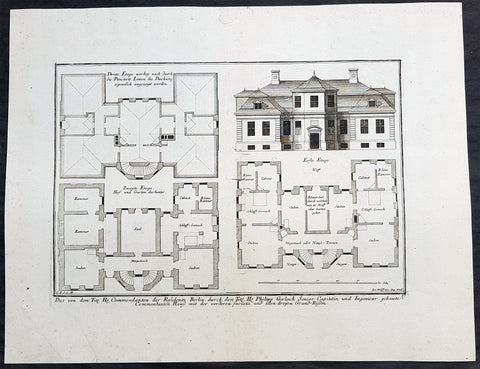
1740 Wolff & Corvinus Antique Arch Plan Officers Quarters, Royal Arsenal, Berlin
Antique Map
- Title : Das von dem Tit. H. Commendanten der Residentz Berlin, durch den Tit. H. Philipp Gerlach Senior Capitain und Ingenieur gebaute Commendaten Hauß mit der vorderen faciata und allen dreyen Grund-Rissen
- Ref #: 93449
- Size: 19 1/2in x 15in (495mm x 390mm)
- Date : 1740
- Condition: (A+) Fine Condition
Description:
This large rare, original copper-plate engraved antique architectural print, view & plan of officers quarters at the Royal Arsenal in Berlin - plate No.17 of 19 - by Johann August Corvinus 1683 - 1738, after Andreas Mayers 1716 - 1782, was published in Eigentliche Abbildung des Prächtigen Königl. Lust Schlosses Charlottenburg, eine Meile von Berlin, sambt dem darhinden im Walde gelegenen schönen Lust Garten
(Set of 16 numbered plates, the first with the title, with plans and views of the buildings and gardens at Charlottenburg, the palace of the King of Prussia on the outskirts of Berlin.) by Jeremias Wolff Erben in 1740.
General Definitions:
Paper thickness and quality: - Heavy and stable
Paper color : - off white
Age of map color: -
Colors used: -
General color appearance: -
Paper size: - 19in x 12 1/2in (490mm x 335mm)
Plate size: - 14 1/2in x 10 1/2in (370mm x 260mm)
Margins: - Min 1in (25mm)
Imperfections:
Margins: - None
Plate area: - None
Verso: - None
Background:
Berlin straddles the banks of the River Spree, which flows into the River Havel (a tributary of the River Elbe) in the western borough of Spandau. Among the citys main topographical features are the many lakes in the western and southeastern boroughs formed by the Spree, Havel, and Dahme rivers (the largest of which is Lake Müggelsee). Due to its location in the European Plain, Berlin is influenced by a temperate seasonal climate. About one-third of the citys area is composed of forests, parks, gardens, rivers, canals and lakes. The city lies in the Central German dialect area, the Berlin dialect being a variant of the Lusatian-New Marchian dialects.
First documented in the 13th century and situated at the crossing of two important historic trade routes, Berlin became the capital of the Margraviate of Brandenburg (1417–1701), the Kingdom of Prussia (1701–1918), the German Empire (1871–1918), the Weimar Republic (1919–1933), and the Third Reich (1933–1945). Berlin in the 1920s was the third-largest municipality in the world. After World War II and its subsequent occupation by the victorious countries, the city was divided; West Berlin became a de facto West German exclave, surrounded by the Berlin Wall (1961–1989) and East German territory. East Berlin was declared capital of East Germany, while Bonn became the West German capital. Following German reunification in 1990, Berlin once again became the capital of all of Germany.
The Thirty Years War between 1618 and 1648 devastated Berlin. One third of its houses were damaged or destroyed, and the city lost half of its population. Frederick William, known as the Great Elector, who had succeeded his father George William as ruler in 1640, initiated a policy of promoting immigration and religious tolerance. With the Edict of Potsdam in 1685, Frederick William offered asylum to the French Huguenots.
By 1700, approximately 30 percent of Berlins residents were French, because of the Huguenot immigration. Many other immigrants came from Bohemia, Poland, and Salzburg.
Since 1618, the Margraviate of Brandenburg had been in personal union with the Duchy of Prussia. In 1701, the dual state formed the Kingdom of Prussia, as Frederick III, Elector of Brandenburg, crowned himself as king Frederick I in Prussia. Berlin became the capital of the new Kingdom, replacing Königsberg. This was a successful attempt to centralise the capital in the very far-flung state, and it was the first time the city began to grow. In 1709, Berlin merged with the four cities of Cölln, Friedrichswerder, Friedrichstadt and Dorotheenstadt under the name Berlin, Haupt- und Residenzstadt Berlin.
In 1740, Frederick II, known as Frederick the Great (1740–1786), came to power. Under the rule of Frederick II, Berlin became a center of the Enlightenment, but also, was briefly occupied during the Seven Years War by the Russian army. Following Frances victory in the War of the Fourth Coalition, Napoleon Bonaparte marched into Berlin in 1806, but granted self-government to the city. In 1815, the city became part of the new Province of Brandenburg.
The Industrial Revolution transformed Berlin during the 19th century; the citys economy and population expanded dramatically, and it became the main railway hub and economic centre of Germany. Additional suburbs soon developed and increased the area and population of Berlin. In 1861, neighbouring suburbs including Wedding, Moabit and several others were incorporated into Berlin. In 1871, Berlin became capital of the newly founded German Empire. In 1881, it became a city district separate from Brandenburg.
Wolff, Jeremais 1663 - 1724
Wolff was an German engraver and publisher. Born in Augsburg, he originally trained as a clock and automat maker, later changing course and opening a small copperplate engraving shop. His success was impressive and became one of the largest European art, print & map publishers in the first half of the 18th century. Wolff employed some of the best engravers of the time and although not an engraver himself, only Wolffs name was recorded on the engravings. Many of his engravers went uncredited for their work. In 1710 Wolff was one of the founder member of the Empire State Academy of Arts in Augsburg.
After his death in 1724, Wolffs publishing business was inherited by his sons and son-in-law, Johann Balthasar Probst (1673–1750) a notable engraver at the time. The firm continued on in Augsburg under the name Jeremias Wolff Erben.
Together with the Nuremberg copperplate engraver Paul Decker , Wolff published a series of engravings showing the war successes of Prince Eugene of Savoy in Italy , southern Germany and the Spanish Netherlands, during the War of the Spanish Succession . The prints are exhibited in the Museum of Military History, in Vienna .
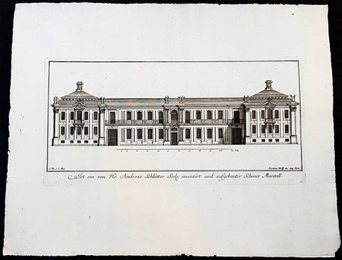
1740 Wolff & Corvinus Antique Arch Print of Charlottenburg Palace Stables Berlin
Antique Map
- Title : Ist ein von Hr. Andreas Schlütter Seel. inventirt und aufgebauer Schöner Marstall Datierung
- Ref #: 93447
- Size: 19in x 12 1/2in (490mm x 335mm)
- Date : 1740
- Condition: (A+) Fine Condition
Description:
This large rare, original copper-plate engraved antique architectural print, view of the facade of the Charlottenburg Palace stables in Berlin - plate No.15 of 16 - by Johann August Corvinus 1683 - 1738, after Andreas Mayers 1716 - 1782, was published in Eigentliche Abbildung des Prächtigen Königl. Lust Schlosses Charlottenburg, eine Meile von Berlin, sambt dem darhinden im Walde gelegenen schönen Lust Garten
(Set of 16 numbered plates, the first with the title, with plans and views of the buildings and gardens at Charlottenburg, the palace of the King of Prussia on the outskirts of Berlin.) by Jeremias Wolff Erben in 1740.
General Definitions:
Paper thickness and quality: - Heavy and stable
Paper color : - off white
Age of map color: -
Colors used: -
General color appearance: -
Paper size: - 19in x 12 1/2in (490mm x 335mm)
Plate size: - 14 1/2in x 10 1/2in (370mm x 260mm)
Margins: - Min 1in (25mm)
Imperfections:
Margins: - None
Plate area: - None
Verso: - None
Background:
Berlin straddles the banks of the River Spree, which flows into the River Havel (a tributary of the River Elbe) in the western borough of Spandau. Among the citys main topographical features are the many lakes in the western and southeastern boroughs formed by the Spree, Havel, and Dahme rivers (the largest of which is Lake Müggelsee). Due to its location in the European Plain, Berlin is influenced by a temperate seasonal climate. About one-third of the citys area is composed of forests, parks, gardens, rivers, canals and lakes. The city lies in the Central German dialect area, the Berlin dialect being a variant of the Lusatian-New Marchian dialects.
First documented in the 13th century and situated at the crossing of two important historic trade routes, Berlin became the capital of the Margraviate of Brandenburg (1417–1701), the Kingdom of Prussia (1701–1918), the German Empire (1871–1918), the Weimar Republic (1919–1933), and the Third Reich (1933–1945). Berlin in the 1920s was the third-largest municipality in the world. After World War II and its subsequent occupation by the victorious countries, the city was divided; West Berlin became a de facto West German exclave, surrounded by the Berlin Wall (1961–1989) and East German territory. East Berlin was declared capital of East Germany, while Bonn became the West German capital. Following German reunification in 1990, Berlin once again became the capital of all of Germany.
The Thirty Years War between 1618 and 1648 devastated Berlin. One third of its houses were damaged or destroyed, and the city lost half of its population. Frederick William, known as the Great Elector, who had succeeded his father George William as ruler in 1640, initiated a policy of promoting immigration and religious tolerance. With the Edict of Potsdam in 1685, Frederick William offered asylum to the French Huguenots.
By 1700, approximately 30 percent of Berlins residents were French, because of the Huguenot immigration. Many other immigrants came from Bohemia, Poland, and Salzburg.
Since 1618, the Margraviate of Brandenburg had been in personal union with the Duchy of Prussia. In 1701, the dual state formed the Kingdom of Prussia, as Frederick III, Elector of Brandenburg, crowned himself as king Frederick I in Prussia. Berlin became the capital of the new Kingdom, replacing Königsberg. This was a successful attempt to centralise the capital in the very far-flung state, and it was the first time the city began to grow. In 1709, Berlin merged with the four cities of Cölln, Friedrichswerder, Friedrichstadt and Dorotheenstadt under the name Berlin, Haupt- und Residenzstadt Berlin.
In 1740, Frederick II, known as Frederick the Great (1740–1786), came to power. Under the rule of Frederick II, Berlin became a center of the Enlightenment, but also, was briefly occupied during the Seven Years War by the Russian army. Following Frances victory in the War of the Fourth Coalition, Napoleon Bonaparte marched into Berlin in 1806, but granted self-government to the city. In 1815, the city became part of the new Province of Brandenburg.
The Industrial Revolution transformed Berlin during the 19th century; the citys economy and population expanded dramatically, and it became the main railway hub and economic centre of Germany. Additional suburbs soon developed and increased the area and population of Berlin. In 1861, neighbouring suburbs including Wedding, Moabit and several others were incorporated into Berlin. In 1871, Berlin became capital of the newly founded German Empire. In 1881, it became a city district separate from Brandenburg.
Wolff, Jeremais 1663 - 1724
Wolff was an German engraver and publisher. Born in Augsburg, he originally trained as a clock and automat maker, later changing course and opening a small copperplate engraving shop. His success was impressive and became one of the largest European art, print & map publishers in the first half of the 18th century. Wolff employed some of the best engravers of the time and although not an engraver himself, only Wolffs name was recorded on the engravings. Many of his engravers went uncredited for their work. In 1710 Wolff was one of the founder member of the Empire State Academy of Arts in Augsburg.
After his death in 1724, Wolffs publishing business was inherited by his sons and son-in-law, Johann Balthasar Probst (1673–1750) a notable engraver at the time. The firm continued on in Augsburg under the name Jeremias Wolff Erben.
Together with the Nuremberg copperplate engraver Paul Decker , Wolff published a series of engravings showing the war successes of Prince Eugene of Savoy in Italy , southern Germany and the Spanish Netherlands, during the War of the Spanish Succession . The prints are exhibited in the Museum of Military History, in Vienna .
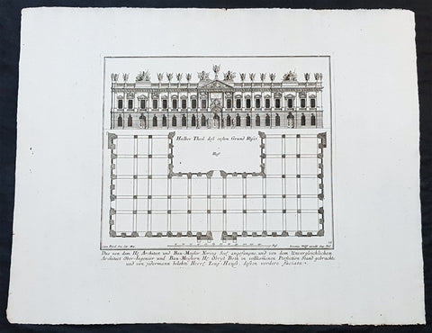
1740 Wolff & Corvinus Antique Arch Print of The Royal Arsenal in Berlin Germany
Antique Map
- Title : Das von dem H. Architect und Bau-Meister Nering Seel. angefangne, und von dem unvergleichlichen Architect Ober-Ingenier und Bau-Meistern H. Obrist Both in vollkommenen Perfection Stand gebrachte und von jedermann belobte Herr. Zeug-Haus, dessen vordere faciata
- Ref #: 93454
- Size: 19in x 12 1/2in (490mm x 335mm)
- Date : 1740
- Condition: (A+) Fine Condition
Description:
This large rare, original copper-plate engraved antique architectural print, view & plan of The Royal Arsenal in Berlin Houses - plate No.13 of 16 - by Johann August Corvinus 1683 - 1738, after Andreas Mayers 1716 - 1782, was published in Eigentliche Abbildung des Prächtigen Königl. Lust Schlosses Charlottenburg, eine Meile von Berlin, sambt dem darhinden im Walde gelegenen schönen Lust Garten
(Set of 16 numbered plates, the first with the title, with plans and views of the buildings and gardens at Charlottenburg, the palace of the King of Prussia on the outskirts of Berlin.) by Jeremias Wolff Erben in 1740.
General Definitions:
Paper thickness and quality: - Heavy and stable
Paper color : - off white
Age of map color: -
Colors used: -
General color appearance: -
Paper size: - 19in x 12 1/2in (490mm x 335mm)
Plate size: - 14 1/2in x 10 1/2in (370mm x 260mm)
Margins: - Min 1in (25mm)
Imperfections:
Margins: - None
Plate area: - None
Verso: - None
Background:
Berlin straddles the banks of the River Spree, which flows into the River Havel (a tributary of the River Elbe) in the western borough of Spandau. Among the citys main topographical features are the many lakes in the western and southeastern boroughs formed by the Spree, Havel, and Dahme rivers (the largest of which is Lake Müggelsee). Due to its location in the European Plain, Berlin is influenced by a temperate seasonal climate. About one-third of the citys area is composed of forests, parks, gardens, rivers, canals and lakes. The city lies in the Central German dialect area, the Berlin dialect being a variant of the Lusatian-New Marchian dialects.
First documented in the 13th century and situated at the crossing of two important historic trade routes, Berlin became the capital of the Margraviate of Brandenburg (1417–1701), the Kingdom of Prussia (1701–1918), the German Empire (1871–1918), the Weimar Republic (1919–1933), and the Third Reich (1933–1945). Berlin in the 1920s was the third-largest municipality in the world. After World War II and its subsequent occupation by the victorious countries, the city was divided; West Berlin became a de facto West German exclave, surrounded by the Berlin Wall (1961–1989) and East German territory. East Berlin was declared capital of East Germany, while Bonn became the West German capital. Following German reunification in 1990, Berlin once again became the capital of all of Germany.
The Thirty Years War between 1618 and 1648 devastated Berlin. One third of its houses were damaged or destroyed, and the city lost half of its population. Frederick William, known as the Great Elector, who had succeeded his father George William as ruler in 1640, initiated a policy of promoting immigration and religious tolerance. With the Edict of Potsdam in 1685, Frederick William offered asylum to the French Huguenots.
By 1700, approximately 30 percent of Berlins residents were French, because of the Huguenot immigration. Many other immigrants came from Bohemia, Poland, and Salzburg.
Since 1618, the Margraviate of Brandenburg had been in personal union with the Duchy of Prussia. In 1701, the dual state formed the Kingdom of Prussia, as Frederick III, Elector of Brandenburg, crowned himself as king Frederick I in Prussia. Berlin became the capital of the new Kingdom, replacing Königsberg. This was a successful attempt to centralise the capital in the very far-flung state, and it was the first time the city began to grow. In 1709, Berlin merged with the four cities of Cölln, Friedrichswerder, Friedrichstadt and Dorotheenstadt under the name Berlin, Haupt- und Residenzstadt Berlin.
In 1740, Frederick II, known as Frederick the Great (1740–1786), came to power. Under the rule of Frederick II, Berlin became a center of the Enlightenment, but also, was briefly occupied during the Seven Years War by the Russian army. Following Frances victory in the War of the Fourth Coalition, Napoleon Bonaparte marched into Berlin in 1806, but granted self-government to the city. In 1815, the city became part of the new Province of Brandenburg.
The Industrial Revolution transformed Berlin during the 19th century; the citys economy and population expanded dramatically, and it became the main railway hub and economic centre of Germany. Additional suburbs soon developed and increased the area and population of Berlin. In 1861, neighbouring suburbs including Wedding, Moabit and several others were incorporated into Berlin. In 1871, Berlin became capital of the newly founded German Empire. In 1881, it became a city district separate from Brandenburg.
Wolff, Jeremais 1663 - 1724
Wolff was an German engraver and publisher. Born in Augsburg, he originally trained as a clock and automat maker, later changing course and opening a small copperplate engraving shop. His success was impressive and became one of the largest European art, print & map publishers in the first half of the 18th century. Wolff employed some of the best engravers of the time and although not an engraver himself, only Wolffs name was recorded on the engravings. Many of his engravers went uncredited for their work. In 1710 Wolff was one of the founder member of the Empire State Academy of Arts in Augsburg.
After his death in 1724, Wolffs publishing business was inherited by his sons and son-in-law, Johann Balthasar Probst (1673–1750) a notable engraver at the time. The firm continued on in Augsburg under the name Jeremias Wolff Erben.
Together with the Nuremberg copperplate engraver Paul Decker , Wolff published a series of engravings showing the war successes of Prince Eugene of Savoy in Italy , southern Germany and the Spanish Netherlands, during the War of the Spanish Succession . The prints are exhibited in the Museum of Military History, in Vienna .
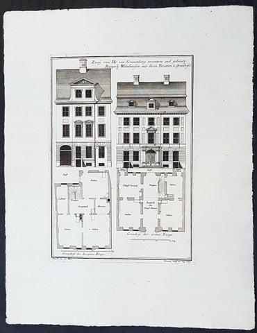
1740 Wolff & Corvinus Antique Arch Print Plans of Residential Houses in Berlin
Antique Map
- Title : Zwey von Hr. von Grünenberg inventirte und gebaute Burgerl. Wohnhäusser mit ihren Faciaten u. Grundrissen
- Ref #: 93450
- Size: 19in x 12 1/2in (490mm x 335mm)
- Date : 1740
- Condition: (A+) Fine Condition
Description:
This large rare, original copper-plate engraved antique architectural print plans of Berlin Houses - plate No. 12 of 16 - by Johann August Corvinus 1683 - 1738, after Andreas Mayers 1716 - 1782, was published in Eigentliche Abbildung des Prächtigen Königl. Lust Schlosses Charlottenburg, eine Meile von Berlin, sambt dem darhinden im Walde gelegenen schönen Lust Garten
(Set of 16 numbered plates, the first with the title, with plans and views of the buildings and gardens at Charlottenburg, the palace of the King of Prussia on the outskirts of Berlin.) by Jeremias Wolff Erben in 1740.
General Definitions:
Paper thickness and quality: - Heavy and stable
Paper color : - off white
Age of map color: -
Colors used: -
General color appearance: -
Paper size: - 19in x 12 1/2in (490mm x 335mm)
Plate size: - 14 1/2in x 10 1/2in (370mm x 260mm)
Margins: - Min 1in (25mm)
Imperfections:
Margins: - None
Plate area: - None
Verso: - None
Background:
Berlin straddles the banks of the River Spree, which flows into the River Havel (a tributary of the River Elbe) in the western borough of Spandau. Among the citys main topographical features are the many lakes in the western and southeastern boroughs formed by the Spree, Havel, and Dahme rivers (the largest of which is Lake Müggelsee). Due to its location in the European Plain, Berlin is influenced by a temperate seasonal climate. About one-third of the citys area is composed of forests, parks, gardens, rivers, canals and lakes. The city lies in the Central German dialect area, the Berlin dialect being a variant of the Lusatian-New Marchian dialects.
First documented in the 13th century and situated at the crossing of two important historic trade routes, Berlin became the capital of the Margraviate of Brandenburg (1417–1701), the Kingdom of Prussia (1701–1918), the German Empire (1871–1918), the Weimar Republic (1919–1933), and the Third Reich (1933–1945). Berlin in the 1920s was the third-largest municipality in the world. After World War II and its subsequent occupation by the victorious countries, the city was divided; West Berlin became a de facto West German exclave, surrounded by the Berlin Wall (1961–1989) and East German territory. East Berlin was declared capital of East Germany, while Bonn became the West German capital. Following German reunification in 1990, Berlin once again became the capital of all of Germany.
The Thirty Years War between 1618 and 1648 devastated Berlin. One third of its houses were damaged or destroyed, and the city lost half of its population. Frederick William, known as the Great Elector, who had succeeded his father George William as ruler in 1640, initiated a policy of promoting immigration and religious tolerance. With the Edict of Potsdam in 1685, Frederick William offered asylum to the French Huguenots.
By 1700, approximately 30 percent of Berlins residents were French, because of the Huguenot immigration. Many other immigrants came from Bohemia, Poland, and Salzburg.
Since 1618, the Margraviate of Brandenburg had been in personal union with the Duchy of Prussia. In 1701, the dual state formed the Kingdom of Prussia, as Frederick III, Elector of Brandenburg, crowned himself as king Frederick I in Prussia. Berlin became the capital of the new Kingdom, replacing Königsberg. This was a successful attempt to centralise the capital in the very far-flung state, and it was the first time the city began to grow. In 1709, Berlin merged with the four cities of Cölln, Friedrichswerder, Friedrichstadt and Dorotheenstadt under the name Berlin, Haupt- und Residenzstadt Berlin.
In 1740, Frederick II, known as Frederick the Great (1740–1786), came to power. Under the rule of Frederick II, Berlin became a center of the Enlightenment, but also, was briefly occupied during the Seven Years War by the Russian army. Following Frances victory in the War of the Fourth Coalition, Napoleon Bonaparte marched into Berlin in 1806, but granted self-government to the city. In 1815, the city became part of the new Province of Brandenburg.
The Industrial Revolution transformed Berlin during the 19th century; the citys economy and population expanded dramatically, and it became the main railway hub and economic centre of Germany. Additional suburbs soon developed and increased the area and population of Berlin. In 1861, neighbouring suburbs including Wedding, Moabit and several others were incorporated into Berlin. In 1871, Berlin became capital of the newly founded German Empire. In 1881, it became a city district separate from Brandenburg.
Wolff, Jeremais 1663 - 1724
Wolff was an German engraver and publisher. Born in Augsburg, he originally trained as a clock and automat maker, later changing course and opening a small copperplate engraving shop. His success was impressive and became one of the largest European art, print & map publishers in the first half of the 18th century. Wolff employed some of the best engravers of the time and although not an engraver himself, only Wolffs name was recorded on the engravings. Many of his engravers went uncredited for their work. In 1710 Wolff was one of the founder member of the Empire State Academy of Arts in Augsburg.
After his death in 1724, Wolffs publishing business was inherited by his sons and son-in-law, Johann Balthasar Probst (1673–1750) a notable engraver at the time. The firm continued on in Augsburg under the name Jeremias Wolff Erben.
Together with the Nuremberg copperplate engraver Paul Decker , Wolff published a series of engravings showing the war successes of Prince Eugene of Savoy in Italy , southern Germany and the Spanish Netherlands, during the War of the Spanish Succession . The prints are exhibited in the Museum of Military History, in Vienna .
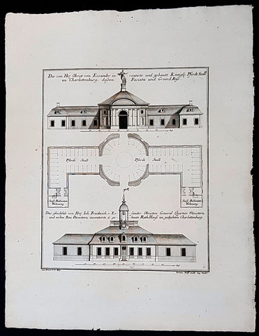
1740 Wolff & Corvinus Antique Arch Print of Charlottenburg Palace Stables Berlin
Antique Map
- Title : Der von Hr. Obrist von Eosander inventirte und gebaute Königl. Pferdt Stall zu Charlottenburg, dessen Faciata und Grund Riss. - Das gleichfals von Hr. Joh. Friederich v. Eosander Obristen General Quartier Meistern, und ersten Bau Directorn inventierte und gebaute Rath Hauss zu gedachten Charlottenburg
- Ref #: 93453
- Size: 19in x 12 1/2in (490mm x 335mm)
- Date : 1740
- Condition: (A+) Fine Condition
Description:
This large rare, original copper-plate engraved antique architectural print of the Royal Horse Stables at Charlottenburg Palace, Berlin - plate No. 11 of 16 - by Johann August Corvinus 1683 - 1738, after Andreas Mayers 1716 - 1782, was published in Eigentliche Abbildung des Prächtigen Königl. Lust Schlosses Charlottenburg, eine Meile von Berlin, sambt dem darhinden im Walde gelegenen schönen Lust Garten
(Set of 16 numbered plates, the first with the title, with plans and views of the buildings and gardens at Charlottenburg, the palace of the King of Prussia on the outskirts of Berlin.) by Jeremias Wolff Erben in 1740.
General Definitions:
Paper thickness and quality: - Heavy and stable
Paper color : - off white
Age of map color: -
Colors used: -
General color appearance: -
Paper size: - 19in x 12 1/2in (490mm x 335mm)
Plate size: - 14 1/2in x 10 1/2in (370mm x 260mm)
Margins: - Min 1in (25mm)
Imperfections:
Margins: - None
Plate area: - None
Verso: - None
Background:
Berlin straddles the banks of the River Spree, which flows into the River Havel (a tributary of the River Elbe) in the western borough of Spandau. Among the citys main topographical features are the many lakes in the western and southeastern boroughs formed by the Spree, Havel, and Dahme rivers (the largest of which is Lake Müggelsee). Due to its location in the European Plain, Berlin is influenced by a temperate seasonal climate. About one-third of the citys area is composed of forests, parks, gardens, rivers, canals and lakes. The city lies in the Central German dialect area, the Berlin dialect being a variant of the Lusatian-New Marchian dialects.
First documented in the 13th century and situated at the crossing of two important historic trade routes, Berlin became the capital of the Margraviate of Brandenburg (1417–1701), the Kingdom of Prussia (1701–1918), the German Empire (1871–1918), the Weimar Republic (1919–1933), and the Third Reich (1933–1945). Berlin in the 1920s was the third-largest municipality in the world. After World War II and its subsequent occupation by the victorious countries, the city was divided; West Berlin became a de facto West German exclave, surrounded by the Berlin Wall (1961–1989) and East German territory. East Berlin was declared capital of East Germany, while Bonn became the West German capital. Following German reunification in 1990, Berlin once again became the capital of all of Germany.
The Thirty Years War between 1618 and 1648 devastated Berlin. One third of its houses were damaged or destroyed, and the city lost half of its population. Frederick William, known as the Great Elector, who had succeeded his father George William as ruler in 1640, initiated a policy of promoting immigration and religious tolerance. With the Edict of Potsdam in 1685, Frederick William offered asylum to the French Huguenots.
By 1700, approximately 30 percent of Berlins residents were French, because of the Huguenot immigration. Many other immigrants came from Bohemia, Poland, and Salzburg.
Since 1618, the Margraviate of Brandenburg had been in personal union with the Duchy of Prussia. In 1701, the dual state formed the Kingdom of Prussia, as Frederick III, Elector of Brandenburg, crowned himself as king Frederick I in Prussia. Berlin became the capital of the new Kingdom, replacing Königsberg. This was a successful attempt to centralise the capital in the very far-flung state, and it was the first time the city began to grow. In 1709, Berlin merged with the four cities of Cölln, Friedrichswerder, Friedrichstadt and Dorotheenstadt under the name Berlin, Haupt- und Residenzstadt Berlin.
In 1740, Frederick II, known as Frederick the Great (1740–1786), came to power. Under the rule of Frederick II, Berlin became a center of the Enlightenment, but also, was briefly occupied during the Seven Years War by the Russian army. Following Frances victory in the War of the Fourth Coalition, Napoleon Bonaparte marched into Berlin in 1806, but granted self-government to the city. In 1815, the city became part of the new Province of Brandenburg.
The Industrial Revolution transformed Berlin during the 19th century; the citys economy and population expanded dramatically, and it became the main railway hub and economic centre of Germany. Additional suburbs soon developed and increased the area and population of Berlin. In 1861, neighbouring suburbs including Wedding, Moabit and several others were incorporated into Berlin. In 1871, Berlin became capital of the newly founded German Empire. In 1881, it became a city district separate from Brandenburg.
Wolff, Jeremais 1663 - 1724
Wolff was an German engraver and publisher. Born in Augsburg, he originally trained as a clock and automat maker, later changing course and opening a small copperplate engraving shop. His success was impressive and became one of the largest European art, print & map publishers in the first half of the 18th century. Wolff employed some of the best engravers of the time and although not an engraver himself, only Wolffs name was recorded on the engravings. Many of his engravers went uncredited for their work. In 1710 Wolff was one of the founder member of the Empire State Academy of Arts in Augsburg.
After his death in 1724, Wolffs publishing business was inherited by his sons and son-in-law, Johann Balthasar Probst (1673–1750) a notable engraver at the time. The firm continued on in Augsburg under the name Jeremias Wolff Erben.
Together with the Nuremberg copperplate engraver Paul Decker , Wolff published a series of engravings showing the war successes of Prince Eugene of Savoy in Italy , southern Germany and the Spanish Netherlands, during the War of the Spanish Succession . The prints are exhibited in the Museum of Military History, in Vienna .
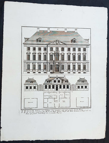
1740 Wolff & Corvinus Antique Arch Print of Berlin Mansions by A. von Schlütter
Antique Map
- Title : A. Ist ein von H. Andreas von Schlütter Seel. inventirt- und auff gebautes Landt-Hauss. B. Ist ein von dem renomirten Bau-Werck- und Raths Zimmer-Meister Joh. Mich. Kemmeter, in Riegel oder Holtz auff gebautes Land-Hauß oder so genandte Meyerey
- Ref #: 93445
- Size: 19in x 12 1/2in (490mm x 335mm)
- Date : 1740
- Condition: (A+) Fine Condition
Description:
This large rare, original copper-plate engraved antique architectural print of 18th century Mansions in Berlin designed by Andreas von Schlütter - plate No. 9 of 16 - by Johann August Corvinus 1683 - 1738, after Andreas Mayers 1716 - 1782, was published in Eigentliche Abbildung des Prächtigen Königl. Lust Schlosses Charlottenburg, eine Meile von Berlin, sambt dem darhinden im Walde gelegenen schönen Lust Garten
(Set of 16 numbered plates, the first with the title, with plans and views of the buildings and gardens at Charlottenburg, the palace of the King of Prussia on the outskirts of Berlin.) by Jeremias Wolff Erben in 1740.
General Definitions:
Paper thickness and quality: - Heavy and stable
Paper color : - off white
Age of map color: -
Colors used: -
General color appearance: -
Paper size: - 19in x 12 1/2in (490mm x 335mm)
Plate size: - 14 1/2in x 10 1/2in (370mm x 260mm)
Margins: - Min 1in (25mm)
Imperfections:
Margins: - None
Plate area: - None
Verso: - None
Background:
Berlin straddles the banks of the River Spree, which flows into the River Havel (a tributary of the River Elbe) in the western borough of Spandau. Among the citys main topographical features are the many lakes in the western and southeastern boroughs formed by the Spree, Havel, and Dahme rivers (the largest of which is Lake Müggelsee). Due to its location in the European Plain, Berlin is influenced by a temperate seasonal climate. About one-third of the citys area is composed of forests, parks, gardens, rivers, canals and lakes. The city lies in the Central German dialect area, the Berlin dialect being a variant of the Lusatian-New Marchian dialects.
First documented in the 13th century and situated at the crossing of two important historic trade routes, Berlin became the capital of the Margraviate of Brandenburg (1417–1701), the Kingdom of Prussia (1701–1918), the German Empire (1871–1918), the Weimar Republic (1919–1933), and the Third Reich (1933–1945). Berlin in the 1920s was the third-largest municipality in the world. After World War II and its subsequent occupation by the victorious countries, the city was divided; West Berlin became a de facto West German exclave, surrounded by the Berlin Wall (1961–1989) and East German territory. East Berlin was declared capital of East Germany, while Bonn became the West German capital. Following German reunification in 1990, Berlin once again became the capital of all of Germany.
The Thirty Years War between 1618 and 1648 devastated Berlin. One third of its houses were damaged or destroyed, and the city lost half of its population. Frederick William, known as the Great Elector, who had succeeded his father George William as ruler in 1640, initiated a policy of promoting immigration and religious tolerance. With the Edict of Potsdam in 1685, Frederick William offered asylum to the French Huguenots.
By 1700, approximately 30 percent of Berlins residents were French, because of the Huguenot immigration. Many other immigrants came from Bohemia, Poland, and Salzburg.
Since 1618, the Margraviate of Brandenburg had been in personal union with the Duchy of Prussia. In 1701, the dual state formed the Kingdom of Prussia, as Frederick III, Elector of Brandenburg, crowned himself as king Frederick I in Prussia. Berlin became the capital of the new Kingdom, replacing Königsberg. This was a successful attempt to centralise the capital in the very far-flung state, and it was the first time the city began to grow. In 1709, Berlin merged with the four cities of Cölln, Friedrichswerder, Friedrichstadt and Dorotheenstadt under the name Berlin, Haupt- und Residenzstadt Berlin.
In 1740, Frederick II, known as Frederick the Great (1740–1786), came to power. Under the rule of Frederick II, Berlin became a center of the Enlightenment, but also, was briefly occupied during the Seven Years War by the Russian army. Following Frances victory in the War of the Fourth Coalition, Napoleon Bonaparte marched into Berlin in 1806, but granted self-government to the city. In 1815, the city became part of the new Province of Brandenburg.
The Industrial Revolution transformed Berlin during the 19th century; the citys economy and population expanded dramatically, and it became the main railway hub and economic centre of Germany. Additional suburbs soon developed and increased the area and population of Berlin. In 1861, neighbouring suburbs including Wedding, Moabit and several others were incorporated into Berlin. In 1871, Berlin became capital of the newly founded German Empire. In 1881, it became a city district separate from Brandenburg.
Wolff, Jeremais 1663 - 1724
Wolff was an German engraver and publisher. Born in Augsburg, he originally trained as a clock and automat maker, later changing course and opening a small copperplate engraving shop. His success was impressive and became one of the largest European art, print & map publishers in the first half of the 18th century. Wolff employed some of the best engravers of the time and although not an engraver himself, only Wolffs name was recorded on the engravings. Many of his engravers went uncredited for their work. In 1710 Wolff was one of the founder member of the Empire State Academy of Arts in Augsburg.
After his death in 1724, Wolffs publishing business was inherited by his sons and son-in-law, Johann Balthasar Probst (1673–1750) a notable engraver at the time. The firm continued on in Augsburg under the name Jeremias Wolff Erben.
Together with the Nuremberg copperplate engraver Paul Decker , Wolff published a series of engravings showing the war successes of Prince Eugene of Savoy in Italy , southern Germany and the Spanish Netherlands, during the War of the Spanish Succession . The prints are exhibited in the Museum of Military History, in Vienna .
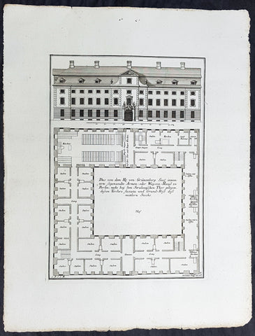
1740 Wolff & Corvinus Antique Arch Print of a Poorhouse near Stralau Gate Berlin
Antique Map
- Title : Das von dem H. von Grünenberg Seel. inventirte sogenandte Armen- oder Waysen-Hauss zu Berlin, nache bey dem Stralauischen Thor gelegen, ....
- Ref #: 93455
- Size: 19in x 12 1/2in (490mm x 335mm)
- Date : 1740
- Condition: (A+) Fine Condition
Description:
This large rare, original copper-plate engraved antique architectural print of the Poorhouse near the old Stralau Gate (Stralauer Tor) in Berlin - plate No. 8 of 16 - by Johann August Corvinus 1683 - 1738, after Andreas Mayers 1716 - 1782, was published in Eigentliche Abbildung des Prächtigen Königl. Lust Schlosses Charlottenburg, eine Meile von Berlin, sambt dem darhinden im Walde gelegenen schönen Lust Garten
(Set of 16 numbered plates, the first with the title, with plans and views of the buildings and gardens at Charlottenburg, the palace of the King of Prussia on the outskirts of Berlin.) by Jeremias Wolff Erben in 1740.
General Definitions:
Paper thickness and quality: - Heavy and stable
Paper color : - off white
Age of map color: -
Colors used: -
General color appearance: -
Paper size: - 19in x 12 1/2in (490mm x 335mm)
Plate size: - 14 1/2in x 10 1/2in (370mm x 260mm)
Margins: - Min 1in (25mm)
Imperfections:
Margins: - None
Plate area: - None
Verso: - None
Background:
Berlin straddles the banks of the River Spree, which flows into the River Havel (a tributary of the River Elbe) in the western borough of Spandau. Among the citys main topographical features are the many lakes in the western and southeastern boroughs formed by the Spree, Havel, and Dahme rivers (the largest of which is Lake Müggelsee). Due to its location in the European Plain, Berlin is influenced by a temperate seasonal climate. About one-third of the citys area is composed of forests, parks, gardens, rivers, canals and lakes. The city lies in the Central German dialect area, the Berlin dialect being a variant of the Lusatian-New Marchian dialects.
First documented in the 13th century and situated at the crossing of two important historic trade routes, Berlin became the capital of the Margraviate of Brandenburg (1417–1701), the Kingdom of Prussia (1701–1918), the German Empire (1871–1918), the Weimar Republic (1919–1933), and the Third Reich (1933–1945). Berlin in the 1920s was the third-largest municipality in the world. After World War II and its subsequent occupation by the victorious countries, the city was divided; West Berlin became a de facto West German exclave, surrounded by the Berlin Wall (1961–1989) and East German territory. East Berlin was declared capital of East Germany, while Bonn became the West German capital. Following German reunification in 1990, Berlin once again became the capital of all of Germany.
The Thirty Years War between 1618 and 1648 devastated Berlin. One third of its houses were damaged or destroyed, and the city lost half of its population. Frederick William, known as the Great Elector, who had succeeded his father George William as ruler in 1640, initiated a policy of promoting immigration and religious tolerance. With the Edict of Potsdam in 1685, Frederick William offered asylum to the French Huguenots.
By 1700, approximately 30 percent of Berlins residents were French, because of the Huguenot immigration. Many other immigrants came from Bohemia, Poland, and Salzburg.
Since 1618, the Margraviate of Brandenburg had been in personal union with the Duchy of Prussia. In 1701, the dual state formed the Kingdom of Prussia, as Frederick III, Elector of Brandenburg, crowned himself as king Frederick I in Prussia. Berlin became the capital of the new Kingdom, replacing Königsberg. This was a successful attempt to centralise the capital in the very far-flung state, and it was the first time the city began to grow. In 1709, Berlin merged with the four cities of Cölln, Friedrichswerder, Friedrichstadt and Dorotheenstadt under the name Berlin, Haupt- und Residenzstadt Berlin.
In 1740, Frederick II, known as Frederick the Great (1740–1786), came to power. Under the rule of Frederick II, Berlin became a center of the Enlightenment, but also, was briefly occupied during the Seven Years War by the Russian army. Following Frances victory in the War of the Fourth Coalition, Napoleon Bonaparte marched into Berlin in 1806, but granted self-government to the city. In 1815, the city became part of the new Province of Brandenburg.
The Industrial Revolution transformed Berlin during the 19th century; the citys economy and population expanded dramatically, and it became the main railway hub and economic centre of Germany. Additional suburbs soon developed and increased the area and population of Berlin. In 1861, neighbouring suburbs including Wedding, Moabit and several others were incorporated into Berlin. In 1871, Berlin became capital of the newly founded German Empire. In 1881, it became a city district separate from Brandenburg.
Wolff, Jeremais 1663 - 1724
Wolff was an German engraver and publisher. Born in Augsburg, he originally trained as a clock and automat maker, later changing course and opening a small copperplate engraving shop. His success was impressive and became one of the largest European art, print & map publishers in the first half of the 18th century. Wolff employed some of the best engravers of the time and although not an engraver himself, only Wolffs name was recorded on the engravings. Many of his engravers went uncredited for their work. In 1710 Wolff was one of the founder member of the Empire State Academy of Arts in Augsburg.
After his death in 1724, Wolffs publishing business was inherited by his sons and son-in-law, Johann Balthasar Probst (1673–1750) a notable engraver at the time. The firm continued on in Augsburg under the name Jeremias Wolff Erben.
Together with the Nuremberg copperplate engraver Paul Decker , Wolff published a series of engravings showing the war successes of Prince Eugene of Savoy in Italy , southern Germany and the Spanish Netherlands, during the War of the Spanish Succession . The prints are exhibited in the Museum of Military History, in Vienna .
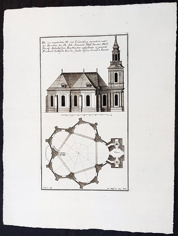
1740 Wolff & Corvinus Antique Arch. Print Jerusalem Church Friedrichstadt.Berlin
Antique Map
- Title : Die von vorgedachten Hr. von Grünenberg invendierte, unter der Direction des Hr. Ioh. Simonetti Hoff Stucator Hoch-Fürstl. Anhaltischen BauMeister aufgebaute so genande Friderich Stättische Kirche sampt dessen Grund u. Faciata.
- Ref #: 93458
- Size: 19in x 12 1/2in (490mm x 335mm)
- Date : 1740
- Condition: (A+) Fine Condition
Description:
This large rare, original copper-plate engraved antique architectural print of the Parochialkirche (literally the Reformed parochial church) in the Mitte suburb of Berlin - plate No. 7 of 16 - by Johann August Corvinus 1683 - 1738, after Andreas Mayers 1716 - 1782, was published in Eigentliche Abbildung des Prächtigen Königl. Lust Schlosses Charlottenburg, eine Meile von Berlin, sambt dem darhinden im Walde gelegenen schönen Lust Garten
(Set of 16 numbered plates, the first with the title, with plans and views of the buildings and gardens at Charlottenburg, the palace of the King of Prussia on the outskirts of Berlin.) by Jeremias Wolff Erben in 1740.
General Definitions:
Paper thickness and quality: - Heavy and stable
Paper color : - off white
Age of map color: -
Colors used: -
General color appearance: -
Paper size: - 19in x 12 1/2in (490mm x 335mm)
Plate size: - 14 1/2in x 10 1/2in (370mm x 260mm)
Margins: - Min 1in (25mm)
Imperfections:
Margins: - None
Plate area: - None
Verso: - None
Background:
Berlin straddles the banks of the River Spree, which flows into the River Havel (a tributary of the River Elbe) in the western borough of Spandau. Among the citys main topographical features are the many lakes in the western and southeastern boroughs formed by the Spree, Havel, and Dahme rivers (the largest of which is Lake Müggelsee). Due to its location in the European Plain, Berlin is influenced by a temperate seasonal climate. About one-third of the citys area is composed of forests, parks, gardens, rivers, canals and lakes. The city lies in the Central German dialect area, the Berlin dialect being a variant of the Lusatian-New Marchian dialects.
First documented in the 13th century and situated at the crossing of two important historic trade routes, Berlin became the capital of the Margraviate of Brandenburg (1417–1701), the Kingdom of Prussia (1701–1918), the German Empire (1871–1918), the Weimar Republic (1919–1933), and the Third Reich (1933–1945). Berlin in the 1920s was the third-largest municipality in the world. After World War II and its subsequent occupation by the victorious countries, the city was divided; West Berlin became a de facto West German exclave, surrounded by the Berlin Wall (1961–1989) and East German territory. East Berlin was declared capital of East Germany, while Bonn became the West German capital. Following German reunification in 1990, Berlin once again became the capital of all of Germany.
The Thirty Years War between 1618 and 1648 devastated Berlin. One third of its houses were damaged or destroyed, and the city lost half of its population. Frederick William, known as the Great Elector, who had succeeded his father George William as ruler in 1640, initiated a policy of promoting immigration and religious tolerance. With the Edict of Potsdam in 1685, Frederick William offered asylum to the French Huguenots.
By 1700, approximately 30 percent of Berlins residents were French, because of the Huguenot immigration. Many other immigrants came from Bohemia, Poland, and Salzburg.
Since 1618, the Margraviate of Brandenburg had been in personal union with the Duchy of Prussia. In 1701, the dual state formed the Kingdom of Prussia, as Frederick III, Elector of Brandenburg, crowned himself as king Frederick I in Prussia. Berlin became the capital of the new Kingdom, replacing Königsberg. This was a successful attempt to centralise the capital in the very far-flung state, and it was the first time the city began to grow. In 1709, Berlin merged with the four cities of Cölln, Friedrichswerder, Friedrichstadt and Dorotheenstadt under the name Berlin, Haupt- und Residenzstadt Berlin.
In 1740, Frederick II, known as Frederick the Great (1740–1786), came to power. Under the rule of Frederick II, Berlin became a center of the Enlightenment, but also, was briefly occupied during the Seven Years War by the Russian army. Following Frances victory in the War of the Fourth Coalition, Napoleon Bonaparte marched into Berlin in 1806, but granted self-government to the city. In 1815, the city became part of the new Province of Brandenburg.
The Industrial Revolution transformed Berlin during the 19th century; the citys economy and population expanded dramatically, and it became the main railway hub and economic centre of Germany. Additional suburbs soon developed and increased the area and population of Berlin. In 1861, neighbouring suburbs including Wedding, Moabit and several others were incorporated into Berlin. In 1871, Berlin became capital of the newly founded German Empire. In 1881, it became a city district separate from Brandenburg.
Wolff, Jeremais 1663 - 1724
Wolff was an German engraver and publisher. Born in Augsburg, he originally trained as a clock and automat maker, later changing course and opening a small copperplate engraving shop. His success was impressive and became one of the largest European art, print & map publishers in the first half of the 18th century. Wolff employed some of the best engravers of the time and although not an engraver himself, only Wolffs name was recorded on the engravings. Many of his engravers went uncredited for their work. In 1710 Wolff was one of the founder member of the Empire State Academy of Arts in Augsburg.
After his death in 1724, Wolffs publishing business was inherited by his sons and son-in-law, Johann Balthasar Probst (1673–1750) a notable engraver at the time. The firm continued on in Augsburg under the name Jeremias Wolff Erben.
Together with the Nuremberg copperplate engraver Paul Decker , Wolff published a series of engravings showing the war successes of Prince Eugene of Savoy in Italy , southern Germany and the Spanish Netherlands, during the War of the Spanish Succession . The prints are exhibited in the Museum of Military History, in Vienna .
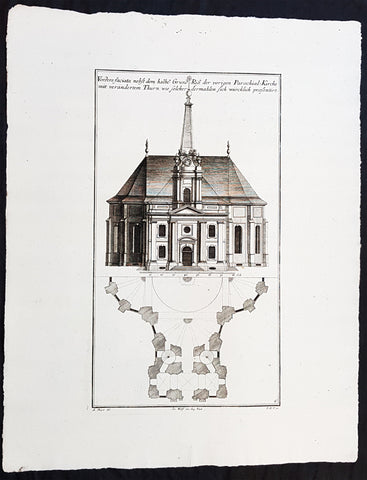
1740 Wolff & Corvinus Antique Arch. Print of the Parochialkirche in Mitte Berlin
Antique Map
- Title : Vordere faciata nebst dem halben Grund Riß der vorigen Parochial-Kirche mit verändertem Thurn wie solcher dermahlen sich würklich presentiert. Frontriß, darunter der halbe Grundriß.
- Ref #: 93459
- Size: 19in x 12 1/2in (490mm x 335mm)
- Date : 1740
- Condition: (A+) Fine Condition
Description:
This large rare, original copper-plate engraved antique architectural print of the Parochialkirche (literally the Reformed parochial church) in the Mitte suburb of Berlin - plate No. 6 of 16 - by Johann August Corvinus 1683 - 1738, after Andreas Mayers 1716 - 1782, was published in Eigentliche Abbildung des Prächtigen Königl. Lust Schlosses Charlottenburg, eine Meile von Berlin, sambt dem darhinden im Walde gelegenen schönen Lust Garten.
(Set of 16 numbered plates, the first with the title, with plans and views of the buildings and gardens at Charlottenburg, the palace of the King of Prussia on the outskirts of Berlin.) by Jeremias Wolff Erben in 1740.
General Definitions:
Paper thickness and quality: - Heavy and stable
Paper color : - off white
Age of map color: -
Colors used: -
General color appearance: -
Paper size: - 19in x 12 1/2in (490mm x 335mm)
Plate size: - 14 1/2in x 10 1/2in (370mm x 260mm)
Margins: - Min 1in (25mm)
Imperfections:
Margins: - None
Plate area: - None
Verso: - None
Background:
Berlin straddles the banks of the River Spree, which flows into the River Havel (a tributary of the River Elbe) in the western borough of Spandau. Among the citys main topographical features are the many lakes in the western and southeastern boroughs formed by the Spree, Havel, and Dahme rivers (the largest of which is Lake Müggelsee). Due to its location in the European Plain, Berlin is influenced by a temperate seasonal climate. About one-third of the citys area is composed of forests, parks, gardens, rivers, canals and lakes. The city lies in the Central German dialect area, the Berlin dialect being a variant of the Lusatian-New Marchian dialects.
First documented in the 13th century and situated at the crossing of two important historic trade routes, Berlin became the capital of the Margraviate of Brandenburg (1417–1701), the Kingdom of Prussia (1701–1918), the German Empire (1871–1918), the Weimar Republic (1919–1933), and the Third Reich (1933–1945). Berlin in the 1920s was the third-largest municipality in the world. After World War II and its subsequent occupation by the victorious countries, the city was divided; West Berlin became a de facto West German exclave, surrounded by the Berlin Wall (1961–1989) and East German territory. East Berlin was declared capital of East Germany, while Bonn became the West German capital. Following German reunification in 1990, Berlin once again became the capital of all of Germany.
The Thirty Years War between 1618 and 1648 devastated Berlin. One third of its houses were damaged or destroyed, and the city lost half of its population. Frederick William, known as the Great Elector, who had succeeded his father George William as ruler in 1640, initiated a policy of promoting immigration and religious tolerance. With the Edict of Potsdam in 1685, Frederick William offered asylum to the French Huguenots.
By 1700, approximately 30 percent of Berlins residents were French, because of the Huguenot immigration. Many other immigrants came from Bohemia, Poland, and Salzburg.
Since 1618, the Margraviate of Brandenburg had been in personal union with the Duchy of Prussia. In 1701, the dual state formed the Kingdom of Prussia, as Frederick III, Elector of Brandenburg, crowned himself as king Frederick I in Prussia. Berlin became the capital of the new Kingdom, replacing Königsberg. This was a successful attempt to centralise the capital in the very far-flung state, and it was the first time the city began to grow. In 1709, Berlin merged with the four cities of Cölln, Friedrichswerder, Friedrichstadt and Dorotheenstadt under the name Berlin, Haupt- und Residenzstadt Berlin.
In 1740, Frederick II, known as Frederick the Great (1740–1786), came to power. Under the rule of Frederick II, Berlin became a center of the Enlightenment, but also, was briefly occupied during the Seven Years War by the Russian army. Following Frances victory in the War of the Fourth Coalition, Napoleon Bonaparte marched into Berlin in 1806, but granted self-government to the city. In 1815, the city became part of the new Province of Brandenburg.
The Industrial Revolution transformed Berlin during the 19th century; the citys economy and population expanded dramatically, and it became the main railway hub and economic centre of Germany. Additional suburbs soon developed and increased the area and population of Berlin. In 1861, neighbouring suburbs including Wedding, Moabit and several others were incorporated into Berlin. In 1871, Berlin became capital of the newly founded German Empire. In 1881, it became a city district separate from Brandenburg.
Wolff, Jeremais 1663 - 1724
Wolff was an German engraver and publisher. Born in Augsburg, he originally trained as a clock and automat maker, later changing course and opening a small copperplate engraving shop. His success was impressive and became one of the largest European art, print & map publishers in the first half of the 18th century. Wolff employed some of the best engravers of the time and although not an engraver himself, only Wolffs name was recorded on the engravings. Many of his engravers went uncredited for their work. In 1710 Wolff was one of the founder member of the Empire State Academy of Arts in Augsburg.
After his death in 1724, Wolffs publishing business was inherited by his sons and son-in-law, Johann Balthasar Probst (1673–1750) a notable engraver at the time. The firm continued on in Augsburg under the name Jeremias Wolff Erben.
Together with the Nuremberg copperplate engraver Paul Decker , Wolff published a series of engravings showing the war successes of Prince Eugene of Savoy in Italy , southern Germany and the Spanish Netherlands, during the War of the Spanish Succession . The prints are exhibited in the Museum of Military History, in Vienna .