
Recent Acquisitions (4)
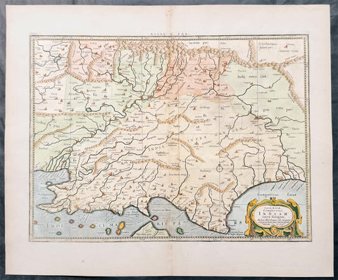
1695 Gerard Mercator Antique Ptolemy Map of India & Subcontinent
Antique Map
- Title : Asiae X Tab:
- Size: 21in x 17 1/2in (535mm x 445mm)
- Condition: (A+) Fine Condition
- Date : 1695
- Ref #: 51008
Description:
This original copper plate engraved hand coloured antique Ptolemy map of India & Subcontinent, after Claude Ptolemy's Geographia was published in the Helma Strick edition of Geographia in 1695.
These maps, after the 1st century text by Claude Ptolemy, were first published by Gerard Mercator in 1578 edition of Geographia by Gottfried von Kempen
General Definitions:
Paper thickness and quality: - Heavy and stable
Paper color : - off white
Age of map color: - Early
Colors used: - Yellow, green, blue, pink
General color appearance: - Authentic
Paper size: - 21 1/2in x 17 1/2in (545mm x 445mm)
Plate size: - 15 1/2in x 13 3/4in (395mm x 350mm)
Margins: - Min 1in (25mm)
Imperfections:
Margins: - Light age toning
Plate area: - None
Verso: - None
Background:
The Ptolemy maps were taken from the text of Claude Ptolemy (AD 87 - 150) a Greek mathematician, astronomer and geographer, living in Alexandria, assembled and codified his predecessors cartographic theories including those of Marinus of Tyre (c. AD 120). In about AD 150 he published his Geographia, a work in 8 volumes, supposedly illustrated with a world map, 26 regional maps and a profusion of smaller maps. Although the text of the Geographia survived, no maps older than about the twelfth century have come down to us and, in consequence, we have no means of knowing whether the 'Ptolemy' maps on which we set so much store were, in fact, drawn by him or were the interpretations of later map makers using his text as a basis. (Ref: Koeman; Norwich)
Background of Ptolemy's Geographia: The first published edition of Ptolemy's ‘Geographia’ with maps, engraved by Taddeo Crivelli, was issued in Bologna in 1477. Unusually, this edition contained 26 maps, with one of the Asia maps divided up among three neighbouring sheets. With the exception of Palestine, these are the first regional maps of any of these various countries.
Unfortunately for the undertakers, this atlas seems not to have been a commercial success, and today only twenty-six examples of the atlas are recorded, with all but one in institutional libraries.
One explanation of the failure is that the publishers do not seem to have been fully mastered the intricacies and problems of engraving, and printing from, copper-plates, an art, which, after all, was very new and experimental. These problems were more successfully addressed by a German printer, Conrad Sweynheym, who was working on an edition of Ptolemy in Rome in the same period. Unfortunately, he did not live to see the volume appear, but his successor, Arnold Buckinck, saw the atlas through the press, in 1478.
The Rome Ptolemy contained 27 maps, with the same geographical coverage as the 1477 Ptolemy. Of the engraved editions of Ptolemy’s ‘Cosmographia’ the maps in the Rome edition are the finest fifteenth century examples, and second only to Mercator’s maps, from his 1578 edition. One explanation for this was the use of individual punches to stamp letters onto the printing plates, rather than engraving them. This allowed much greater uniformity than lettering-engravers were able to achieve, and gives a very pleasing overall effect. The atlas proved popular, and three successive editions (to 1508) followed, although only about forty examples of the first edition are recorded today.
Claudius Ptolemy(90 A.D.-168 A.D.) was a celebrated astronomer, mathematician, and geographer who lived in Alexandria in the 2nd century AD. Although his thinking influenced contemporary Arab geographers, little was known of his work in the West until manuscripts from Constantinople reached Italy in about 1400. These manuscripts were written in Greek and contained the names of every city, island, mountain and river known to the many travellers interviewed by Ptolemy. In addition, the latitude and longitude of each of the resulting eight thousand locations were also recorded. They were translated into Latin by 1401 and appeared in print by 1475. The earliest Byzantine manuscript maps, drawn by analysing the Ptolemy figures, date from the twelfth century. A number of hand-drawn copies were made in Italy throughout the early fifteenth century to accompany Ptolemy's text.
Ptolemy stressed the importance of accurate observations in order to calculate latitude and longitude, and laid down the principals of systematic cartography that remain to this day. Obviously there are many errors in Ptolemy's maps, due to the limited extent of basic geographic information at that time and the lack of a method of determining accurate longitudes. Judged by modern standards, the basic shortcoming of the Ptolemy world map is the small area it portrays. The Mediterranean is fairly well depicted, but is greatly exaggerated in length (Longitudinally). The effect of this, combined with Ptolemy's disregard for Eratosthenes' extremely accurate estimate of the earth's circumference (c. 200 B.C.) and the use of a Posidonius' much smaller flawed estimate (c.50 B.C.) implied a much shorter distance across that part of the unknown earth's surface not drawn on the map. Columbus and his contemporaries based their exploratory ventures on Ptolemy's calculations and, like him, had no idea of the vast New World to the west, interposed between Europe and Asia.
Work on the first “printed” atlas from the text of Ptolemy was started in 1473 and finally published in 1478. A crude copy of this atlas was produced and published by some dissident workers in 1477 in order to be ‘first’. However, the plates for the 1478 were done prior to the pirated issue and thus the 1478 atlas holds the title of the first Atlas of the world. There are very few surviving examples of this atlas and individual maps. (Ref: Stevenson; Tooley; M&B)
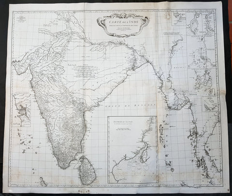
1752 D Anville Large Original Antique Map of India Sri Lanka Burma Siam - Scarce
Antique Map
- Title : Carte De L Inde Dressee Pour La Compagnie Des Indes...1752
- Size: 43in x 37 1/2in (1.1m x 950mm)
- Ref #: 92320
- Date : 1752
- Condition: (A) Very Good Condition
Description:
This large finely engraved scarce and highly detailed original antique map of India, Sri Lanka Burma & Thailand was engraved by Guillaume de la Haye in 1752 - dated in the tile cartouche - and was published in Jean-Baptiste Bourguinon D\'Anville\'s large elephant folio atlas Atlas Generale.
General Definitions:
Paper thickness and quality: - Heavy and stable
Paper color : - off white
Age of map color: -
Colors used: -
General color appearance: -
Paper size: - 43in x 37 1/2in (1.1m x 950mm)
Plate size: - 41in x 35in (1.04m x 890mm)
Margins: - Min 1in (25mm)
Imperfections:
Margins: - Spotting
Plate area: - Spotting, aging toning along folds as issued
Verso: - Spotting, aging toning along folds as issued
Background:
The map is drawn from numerous sources, including Ptolemy, Turkish and Indian geographies, and Jesuit surveys. More contemporary works by Bouchet in 1719 and Boudier in 1734 are seen both in the detail and inset river maps. The map reflects the level of knowledge of India & SE Asia at the time, especially of the interiors. The map has excellent detail of Southern India and coastlines were trade had been happening for centuries, but a conspicuous absence of detail of the northern interior
There are seven Inset maps that include the environs of Goa, entrance of the Ganges River and a wonderfully detailed depiction of the entrance to the Hugli River and other river tributes.
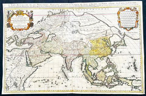
1696 Alexis Hubert Jaillot Large Antique Map of Asia - Saudi Arabia to Australia
Antique Map
- Title : L' Asie divisee en ses Principales Regions....Hubert Jaillot....1696
- Ref #: 17022
- Size: 35 1/2in x 23in (900mm x 585mm)
- Date : 1696
- Condition: (A) Very Good Condition
Description:
This very large original hand coloured antique map of Asia, from Arabia to the Gulf of Carpentaria, Australia, was engraved in 1696 - dated in title - and was published by Alexis Hubert Jaillot in his monumental Atlas Nouveau.
General Definitions:
Paper thickness and quality: - Heavy and stable
Paper color : - off white
Age of map color: - Original
Colors used: - Yellow, green, blue, pink
General color appearance: - Authentic
Paper size: - 35 1/2in x 23in (900mm x 585mm)
Plate size: - 34 1/2in x 22 1/2in (875mm x 570mm)
Margins: - Min 1/2in (15mm)
Imperfections:
Margins: - Light age toning in margin
Plate area: - Re-enforced along centerfold, light age toning, old ink text to bottom of map
Verso: - Soiling
Background:
The map include lines of latitude and longitude, some topographical details, location of settlements, rivers, and lakes (including the lakes Parime, thought to be where the fabulous El Dorado was located) as well as the boundaries of the possessions of the European claimants to South America.
Extremely decorative cartouche with dedication to Le Dauphin, and his coat of arms in top.
After Nicolas Sanson, Hubert Jaillot and Pierre Duval were the most important French cartographers of the seventeenth & eighteenth centuries. Jaillot, originally a sculptor, became interested in geography after his marriage to the daughter of Nicolas Berey (1606-65), a famous map colourist, and went into partnership in Paris with Sanson's sons. There, from about 1669, he undertook the re-engraving, enlarging and re-publishing of the Sanson maps in sheet form and in atlases, sparing no effort to fill the gap in the map trade left by the destruction of Blaeu's printing establishment in Amsterdam in 1672. Many of his maps were printed in Amsterdam (by Pierre Mortier) as well as in Paris. One of his most important works was a magnificent sea atlas, Le Neptune François, published in 1693 and compiled in co-operation with J D Cassini. This was re-published shortly afterwards by Pierre Mortier in Amsterdam with French, Dutch and English texts, the charts having been re-engraved. Eventually, after half a century, most of the plates were used again as the basis for a revised issue published by J N Bellin in 1753.(Ref: Tooley; M&B)
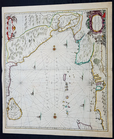
1650 Jan Jansson Large Rare Antique Map of India and The Bay of Bengal
Antique Map
- Title : Sinus Gangeticus Vulgo Golfo De Bengala
- Date : 1650
- Condition: (A+) Fine Condition
- Ref: 60604
- Size: 23 1/2in x 20in (600mm x 510mm)
Description:
This exceedingly impressive hand coloured original antique map of the Bay of Bengal, India - stretching from Sri Lanka to the west coast of Thailand - was published by Jan Jansson in the 1650 Edition of his "Water World" atlas Atlantis Majoris. There were far fewer editions of this atlas published than Janssons more prevalent Atlas Novus.
General Description:
Paper thickness and quality: - Heavy and stable
Paper color: - off white
Age of map color: - Original
Colors used: - Green, red, orange, yellow, blue
General color appearance: - Authentic
Paper size: - 23 1/2in x 20in (600mm x 510mm)
Plate size: - 21 1/2in x 19in (545mm x 485mm)
Margins: - Min 1/2in (12mm)
Imperfections:
Margins: - None
Plate area: - Very light spotting
Verso: - Very light spotting
Background:
Maps of India, much distorted in shape, appear in most world atlases from the time of Ptolemy, the earliest usually showing India as a relatively small extension of Southern Asia, dominated by the very large island of Taprobana (Ceylon). In later sixteenth-century maps de Jode, Ortelius and Mercator gave a much improved outline of both lands but India was still shown too small in relation to the whole continent. Most publishers in the seventeenth century continued to issue maps but with little improvement in detail until about 1719 when a French Jesuit priest, Father Jean Bouchet, compiled an accurate map of South India, subsequently used by G. Delisle (1723), Homann Heirs (1735) and by J. B. B. d'Anville, then the French East India Company's cartographer, as the basis for his greatly improved maps in 1737 and 1752.
In the next decade Alexander Dalrymple published a collection of newly surveyed coastal charts and plans of ports and, about the same time, in 1764, James Rennell, a young British Army officer who showed a remarkable aptitude for surveying, was appointed - at the age of 21- Surveyor General of Bengal; he immediately set in motion a comprehensive survey of the Company's lands, subsequently publishing maps of Bengal and other provinces which eventually formed The &ngal Atlas (1779). His other works included a Map of Hindoustan (1782-85) and The Provinces of Delhi, Agra etc and the Indian Peninsula (1788-94). These maps by Reunell provided the basis for a Trigonometrical Survey of India which was initiated in 1802 and for splendid maps published in London by Cary, the Arrowsmiths (1804-22) and the Wylds. (Ref: Tooley, M&B)


