Welcome to Classical Images!
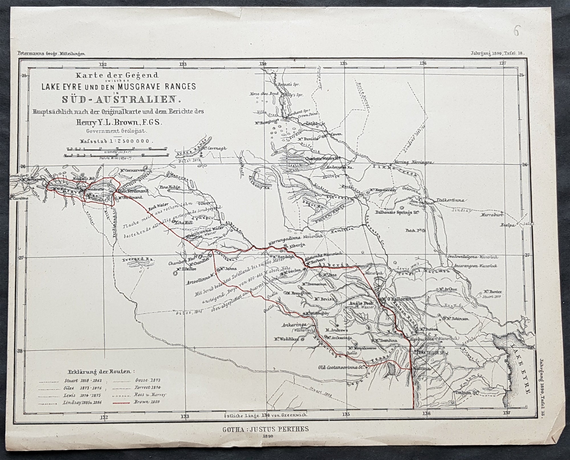
Description:This original antique lithograph map of the area between Lake Eyre the Musgrave ranges in South Australia - with the tracks of 8 explorers of the region - by Augustus Heinrich Petermann was engraved in 1890 - dated - and was published by Justus Perthes, Gotha Germany.
General Definitions:Paper thickness and quality: - Heavy and stablePaper color : - off whiteAge of map color: - OriginalColors used: - RedGeneral color appearance: - AuthenticPaper size: - 10 1/2in x 8 1/2in (265mm x 215mm)Plate size: - 10 1/2in x 8 1/2in (265mm x 215mm)Margins: - Min 1/2in (12mm)
Imperfections:Margins: - NonePlate area: - Folds as issuedVerso: - None
Background: The tracks of 8 different explorers are covered in this map. They are:1. Sturat 1858-622. Giles 1873 - 18763. Lewis 1874 - 18754. Lindsay 1885 & 865. Gosse 18726. Forrest 18747. Ross & Harvey8. Brown 1889