Welcome to Classical Images!
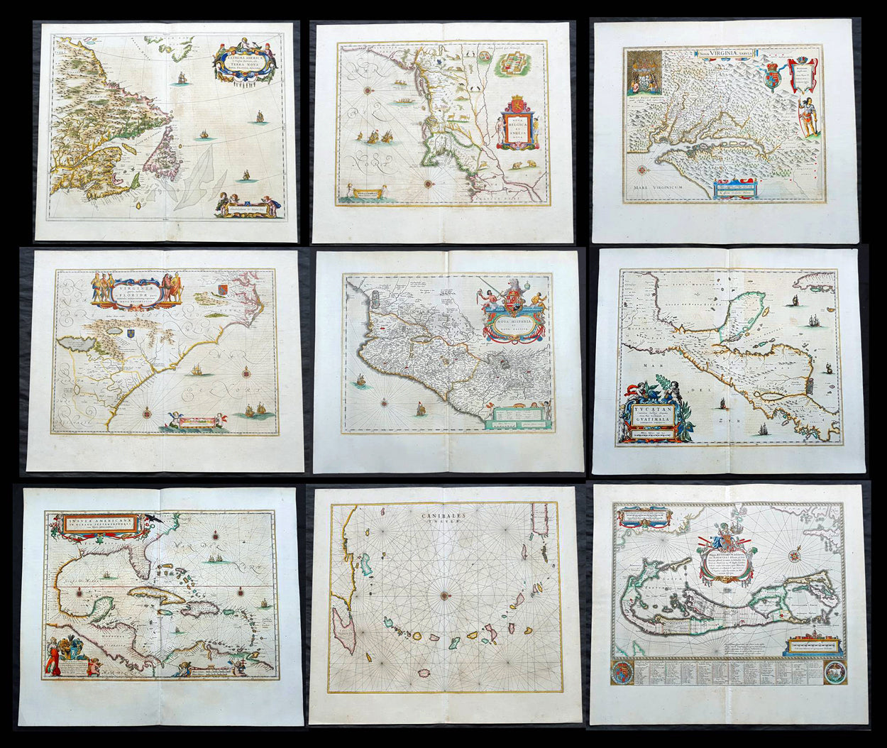
Description:This is a unique opportunity to acquire a complete set of 9 maps of North America published by Joan Blaeus in the monumental & rare 1st 1662 Latin edition of Atlas Major. The maps cover the geographical detail of Canada, North America, Mexico, The Caribbean & Central America. Please see the background section below for details of each map. All maps have wide original margins & colour on strong sturdy paper.Joan Blaeus 11 volumes of Atlas Major, is considered by many to be the greatest atlas set ever published. It excels in comprehensiveness, engraving, color, and overall production. The first edition was published in Latin in 1662 and was subsequently published in French, Dutch, German, and Spanish over the next 10 years.On the 23rd of February 1672, a fire broke out in central Amsterdam, that ended the reign of one of the greatest & most prolific publishers of printed maps and atlases in publishing history. The Blaeu family had reached its zenith 10 years previously, with the publication of its greatest achievement, the Atlas Major or Great Atlas, consisting of 11 volumes, with geographical detail reflecting many of the achievements of the Golden Age of the United Netherlands. Blaeus Atlas Major were the most expensive books printed in the 17th century.
General Definitions:Paper thickness and quality: - Heavy and stablePaper color : - off whiteAge of map color: - OriginalColors used: - Blue, pink, red, green, yellowGeneral color appearance: - AuthenticPaper size: - 24in x 20 1/2in (610mm x 520mm)Plate size: - Various, pls see belowMargins: - Min 1in (25mm) min
Imperfections:Margins: - Pls see belowPlate area: - Pls see belowVerso: - Pls see below
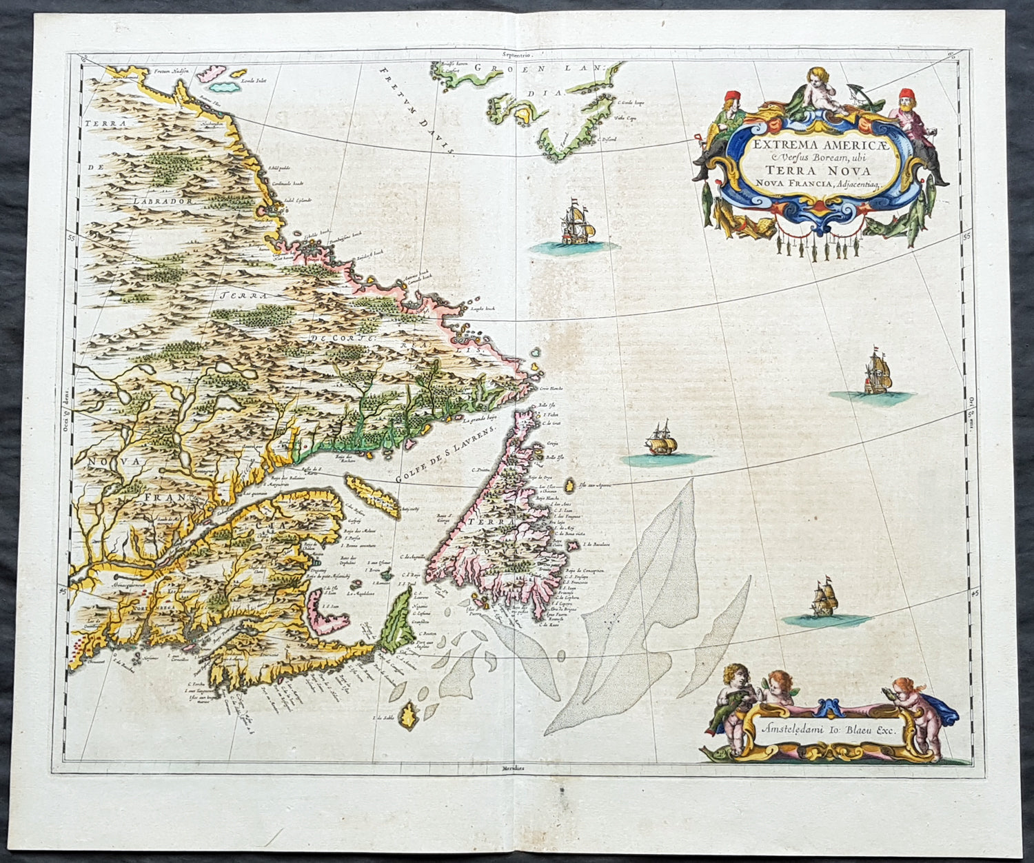
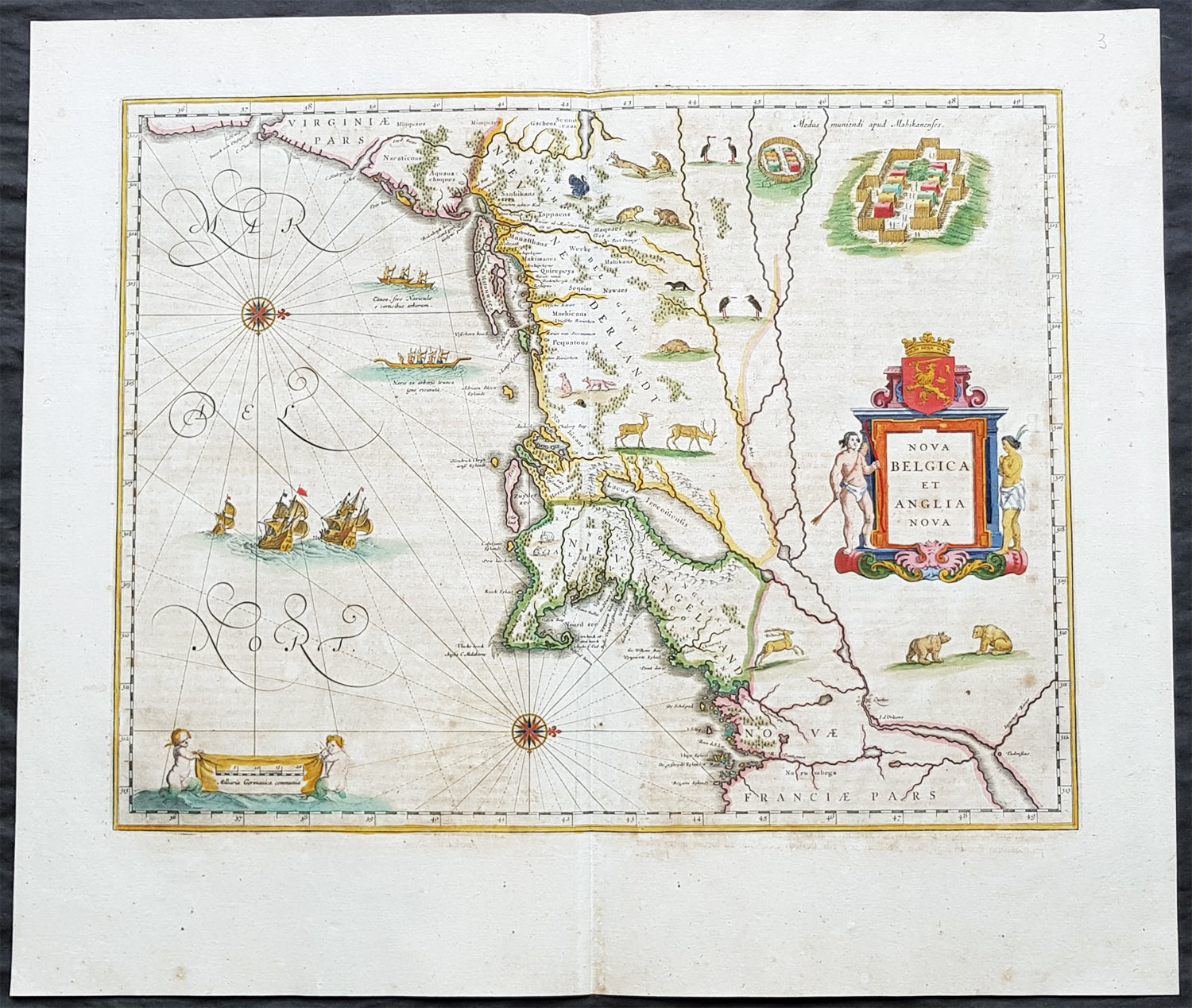
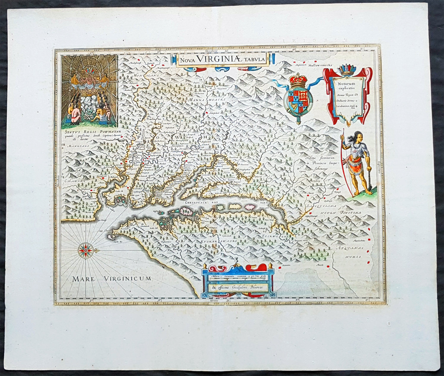
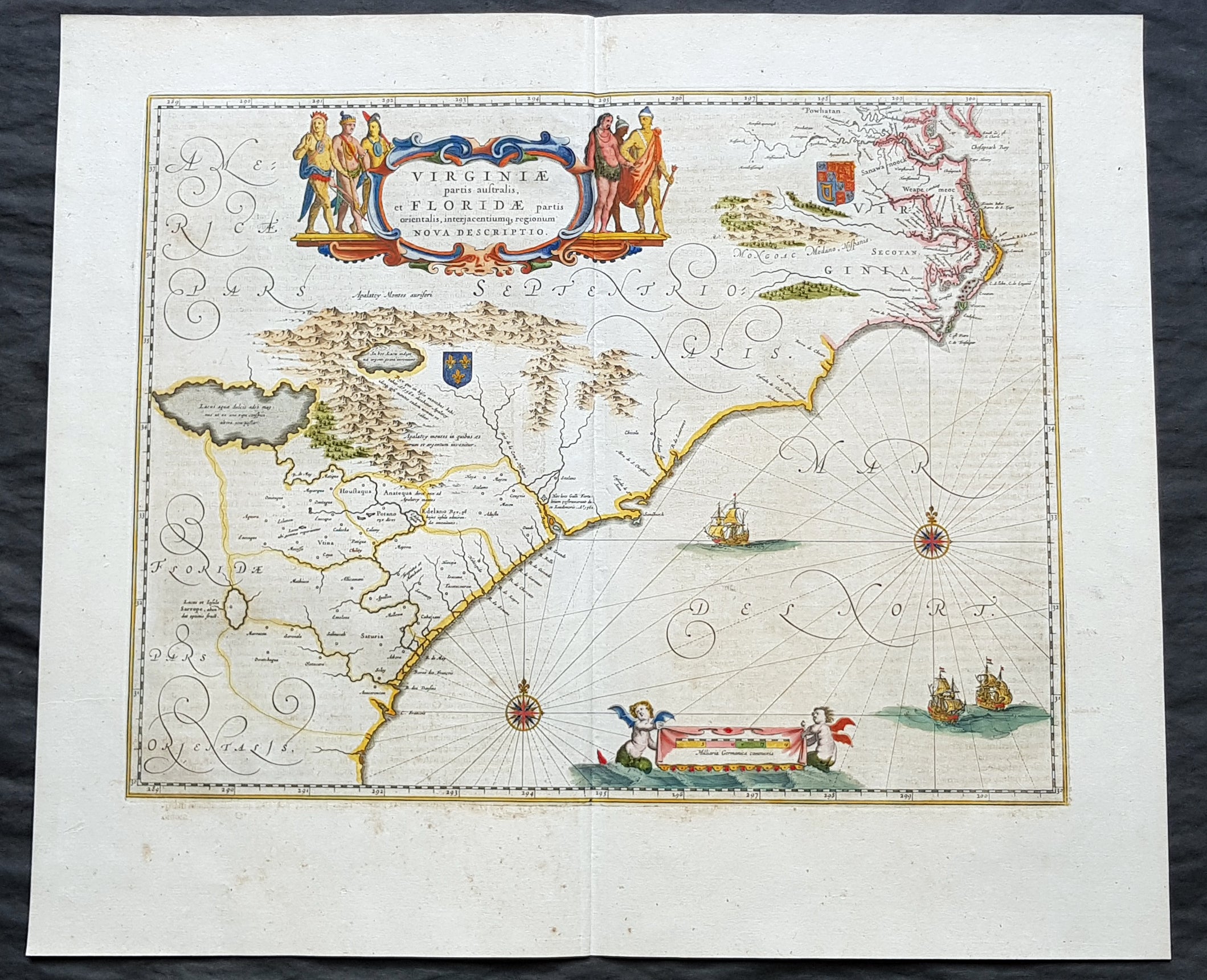
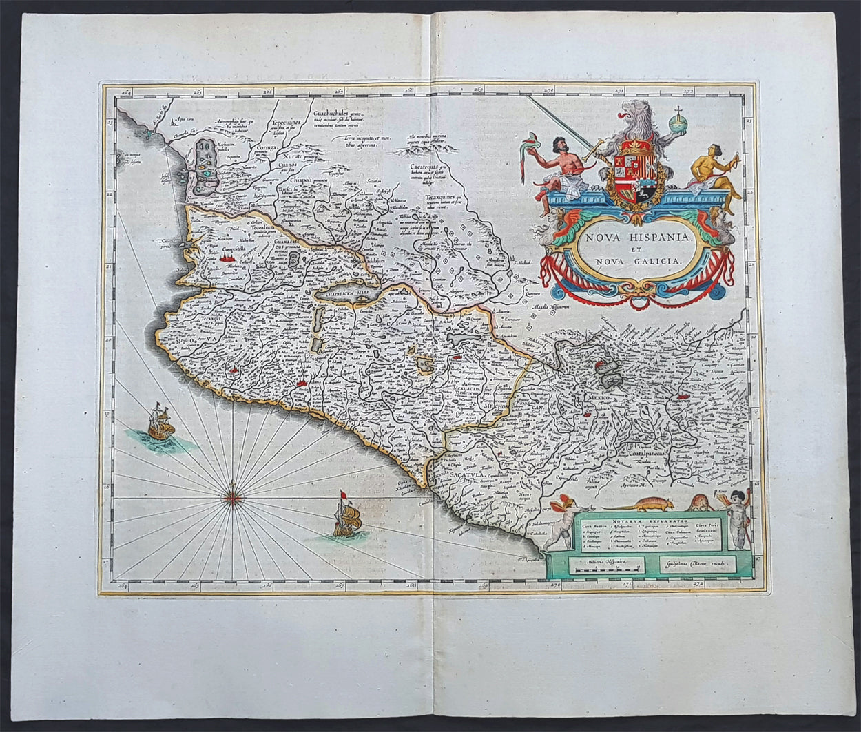
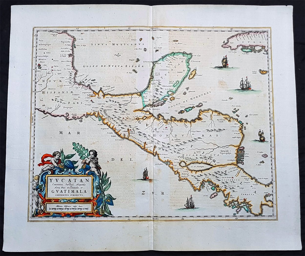
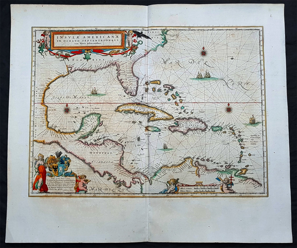
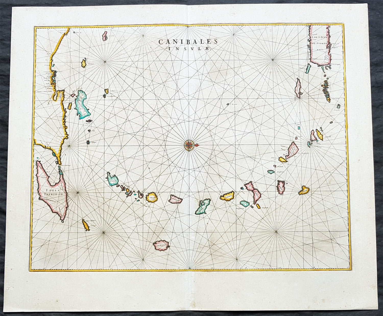
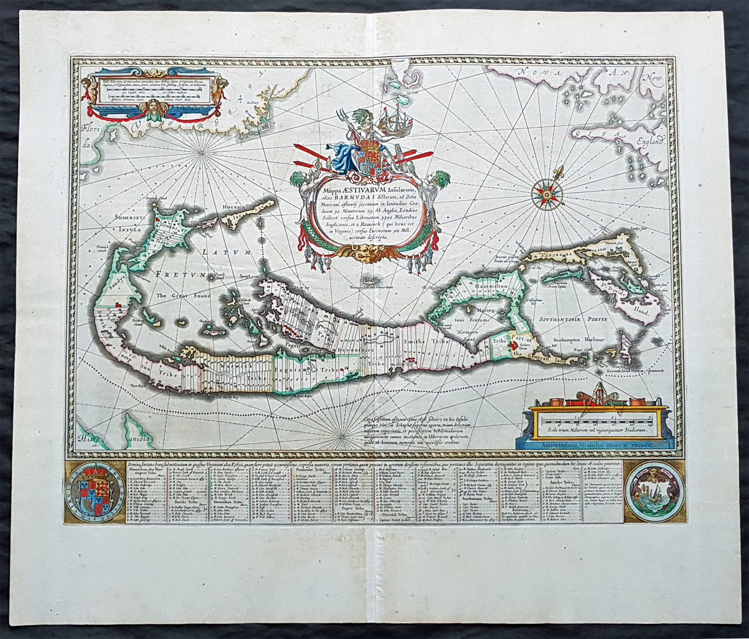
Background:1. Extrema Americae ( Eastern Canada) - Rare only published in Atlas Major. Derived mainly from the Samuel de Champlain Nouvelle France map of 1632, this map reflects the growing financial importance of the waters of New France to Europe.Plate: 22 1/2in x 17 3/4in.Condition: Age toning, text show-through & browning to image.2. Nova Belgica Et Anglia Nova (New England) - NE America, centering on New York and Manhattan from Virginia to the St Lawrence River. This map is noted for the fact that its primary source is the first manuscript figurative map of Adriaen Block from 1614. Indeed it is the first full representation of it in print. It is one of the earliest to name Nieu Amsterdam. Block, a Dutch fur trader, explored the area between Cape Cod and Manhattan, examining the bays and rivers along the way.Plate: 19 1/2in x 15 1/2inCondition: Age toning, text show-through & browning to image.3. Nova Virginiae Tabula (John Smiths Virginia & Chesapeake Bay) This map was printed from a plate engraved by Dirk Grijp from a previous plates by Henricus Hondius.Plate: 19in x 15inCondition: Light age toning4. Virginiae partis australis, et Floridae Virginia, the Carolinas & Georgia.Plate: 20in x 15inCondition: Light age toning5. Nova Hispania et Nova Galicia Western MexicoPlate: 19 1/2in x 15 1/2inCondition: Light age toning6. Yucatan...Guatimala (Yucatan, Central America) Rare only published in Atlas Major.Plate: 20 1/2in x 16 1/2inCondition: Light age toning7. Insulae Americana (GOM, Caribbean)Plate: 20 1/2in x 15inCondition: Light age toning8. Canibales Insulae (Lesser Antilles Islands) Rare, printed only in Atlas MajorPlate: 21in x 16 1/2inCondition: Age toning9. Mappa Aestivarum Insularum Alias Barmudas Dictarum Bermuda. Like all 17th century maps of Bermuda this map is based ultimately on the survey made by John Norwood, of the Bermuda Company, in 1618 in the form as published by the English map-maker John Speed in 1627.Plate: 21in x 16inCondition: Light age toning