Maps (31)
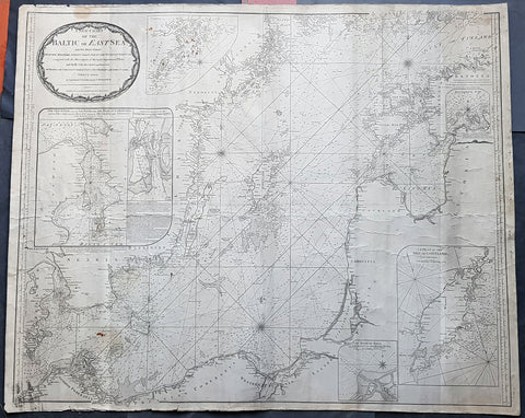
1794 Laurie & Whittle Large Very Rare Blueback Map, Sea Chart of The Baltic Sea
- Title : A New Chart of the Baltic or East Sea Drawn Principally from the Maritime Surveys Collected in the Russian Neptune compared with the Observations of the most experienceed Pilots, and Chiefly with the Charts and Draughts of Professor Christian Charles Lous, Nils Mareluis and James Schmid Published by Authority at Copenhagen, Stockholm and St Petersburg...London Published by Laurie & Whittle No 53 Fleet Street as the Act, 12th May, 1794
- Size: 48in x 39in (1.225m x 1.015mm)
- Condition: (A) Very Good Condition
- Date : 1794
- Ref #: 93046
Description:
This is a very large, extremely rare, copper-plate engraved and highly detailed working Blueback Nautical Chart or Maritime map of the Baltic or East Sea was engraved in 1794 and published by the Laurie & Whittle firm, London 1794. The details for this map have been collected from expeditions by the ship the Russian Neptune and Professor Christian Charles Lous, Nils Mareluis and James Schmid.
This rare Blueback map, a method of mounting working sea charts that was begun by Robert Sayer in the late 18th century. These working maps were extremely expensive to buy and labour intensive to put together so only a limited number were published and sold and even fewer have survived. I have found no other examples of this map either commercially or in other map collections.
The map depicts the Baltic Sea from Scandia Sweden & Pomeranian, Germany in the west to the Baltic States of Estonia and Latvia (Eastland, Livonia, Courland) & southern Finland in the east. The map is highly detailed with numerous cities are labelled, including Copenhagen, Stockholm (Christiana), Gdansk (Dazing), Tallinn (Revel), and Riga. Myriad depth soundings are indicated in the Baltic Sea and along the coastlines. Numerous inset maps are included, the first of Copenhagen and the Straits, the second of Stockholm and directions through the various channels and islands, the third inset is Rogerwick Bay, the fourth is the Island of Gottland and the fifth of Riga and Bay. Copious notes about sailing directions, channels, entrance to the Duna River.
General Definitions:
Paper thickness and quality: - Heavy and stable
Paper color : - off white
Age of map color: -
Colors used: -
General color appearance: -
Paper size: - 48in x 39in (1.225m x 1.015mm)
Plate size: - 48in x 39in (1.225m x 1.015mm)
Margins: - Min 1/2in (12mm)
Imperfections:
Margins: - Soiling, chipping to edges not affecting the image
Plate area: - Soiling, light brown spots top of map, light creasing
Verso: - Original Blueback
Background:
Blueback Charts
Blueback nautical charts began appearing in London in the late 18th century. Bluebacks, as they came to be called, were privately published large format nautical charts known for their distinctive blue paper backing. The backing, a commonly available blue manila paper traditionally used by publishers to warp unbound pamphlets, was adopted as a practical way to reinforce the low-quality paper used by private chart publishers in an effort to cut costs. The earliest known Blueback charts include a 1760 chart issued by Mount and Page, and a 1787 chart issued by Robert Sayer. The tradition took off in the early 19th century, when British publishers like John Hamilton Moore, Robert Blachford, James Imray, William Heather, John William Norie, Charles Wilson, David Steel, R. H. Laurie, and John Hobbs, among others, rose to dominate the chart trade. Bluebacks became so popular that the convention was embraced by chartmakerJacques Nicholas Bellins outside of England, including Americans Edmund March Blunt and George Eldridge, as well as Scandinavian, French, German, Russian, and Spanish chartmakers. Blueback charts remained popular until the late 19th century, when government subsidized organizations like the British Admiralty Hydrographic Office and the United States Coast Survey, began issuing their own superior charts on high quality paper that did not require reinforcement.
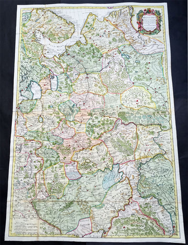
1712 Senex Very Large Antique Map of European Russia - Moscovy Corrected
Antique Map
- Title : Moscovy Corrected from ye Observations Communicated to the Royal Society of London and Paris By John Senex & John Maxwell. Sold by them at the Globe.....1712
- Ref #: 61030
- Size: 38in x 27in (990mm x 665mm)
- Date : 1712
- Condition: (A) Very Good Condition
Description:
This extraordinary, very large & beautifully hand coloured original antique map of European Russia - Moscovy - including parts of Scandinavia, the Baltic States & The Ukraine by John Senex & John Maxwell in 1712 - dated in title - and was published for Senex's large Elephant Folio General Atlas.
These large scale maps are scarce as damage and loss over time was frequent from both handling and difficulty storing safely.
General Description:
Paper thickness and quality: - Heavy and stable
Paper color: - white
Age of map color: - Original & later
Colors used: - Yellow, green, blue, red
General color appearance: - Authentic
Paper size: - 38in x 27in (990mm x 665mm)
Plate size: - 37in x 25in (930mm x 635mm)
Margins: - min. 1/2in (12mm)
Imperfections:
Margins: - None
Plate area: - Folds as issued
Verso: - Folds re-enforced on verso
Background: It is scarcely necessary to look at a map of Russia - with which we must include Siberia - to visualize the daunting task facing Russian map makers. Indeed, considering the vastness of their territory and the lack of skilled cartographers, it is surprising that relatively good maps were available for engraving and printing in most of the well known sixteenth and seventeenth century atlases. Generally, maps of that time were based on material brought back from Moscow by visitors from the West. (Ref: Tooley; M&B)
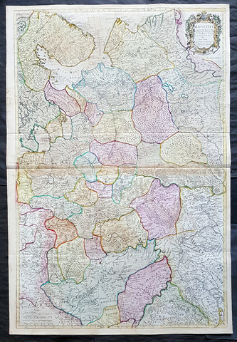
1712 Senex Large Original Antique Map of Europe Russia, Moscow - Finland to Azov
Antique Map
- Title : Moscovy Corrected from ye Observations Communicated to the Royal Society of London and Paris By John Senex & John Maxwell. Sold by them at the Globe.....1712
- Ref #: 82074
- Size: 39 1/2in x 26 1/2in (980mm x 675mm)
- Date : 1712
- Condition: (A) Very Good Condition
Description:
This extraordinary, very large & beautifully hand coloured original antique map of European Russia - Moscovy - including parts of Scandinavia, the Baltic States & The Ukraine by John Senex & John Maxwell in 1712 - dated in title - and was published for Senex's large Elephant Folio General Atlas.
These large scale maps are scarce as damage and loss over time was frequent from both handling and difficulty storing safely.
Background: It is scarcely necessary to look at a map of Russia - with which we must include Siberia - to visualize the daunting task facing Russian map makers. Indeed, considering the vastness of their territory and the lack of skilled cartographers, it is surprising that relatively good maps were available for engraving and printing in most of the well known sixteenth and seventeenth century atlases. Generally, maps of that time were based on material brought back from Moscow by visitors from the West. (Ref: Tooley; M&B)
General Description:
Paper thickness and quality: - Heavy and stable
Paper color: - white
Age of map color: - Original & later
Colors used: - Yellow, green, blue, red
General color appearance: - Authentic
Paper size: - 39 1/2in x 26 1/2in (980mm x 675mm)
Plate size: - 37in x 25in (930mm x 635mm)
Margins: - min. 1/2in (12mm)
Imperfections:
Margins: - None
Plate area: - Light age toning along centerfold & top of image
Verso: - Folds re-enforced on verso
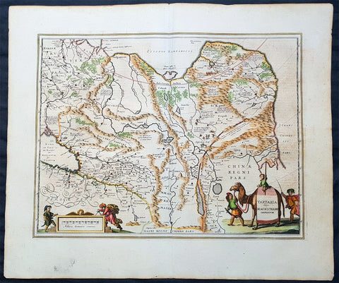
1652 Jan Jansson Antique Map of East & Central Asia, China to Russia - Tartary
Antique Map
- Title : Tartaria sive Magni Chami Imperium
- Date : 1652
- Size: 24in x 20in (610mm x 510mm)
- Ref #: 61166
- Condition: (A+) Fine Condition
Description:
This handsome beautifully hand coloured original antique map of huge region of east & central Asia from China, to Central Asia, The Caspian Sea & parts of European Russia was published by Jan Jansson in the 1652 French edition of Atlas Novus.
Background: This handsome map maps the whole of eastern Central Asia from the Caspian Sea to the Great Wall, Northern China and Manchuria.
This map is dated from a time when Tartaria vaguely meant those regions to the north of Persia, west of China & to the east of Russia. The name Siberia only began to be applied with the gradual eastward expansion of the Russian Cossacks into those areas hinted at in the accounts of Marco Polo from three centuries earlier.
The Mythical and legendary nature of the geography of this vast interior is emphasised by the inclusion of devils and dragons in the Desertum Lop to the left of the Great Wall.
The rest of the map is full of detail both real and myth, some of which is no doubt borrowed from the writings of Marco Polo considered at the time one of the foremost expert on China and Central Asia.
The newly discovered northern coastline of Nova Zembla is shown with a notation concerning the Dutch expedition led by Willem Barents in 1594-96. Interesting in Siberia, Ung quae Gog and Sumongul quae Mogog, which refers to the mythological lands of Gog and Magog. These lands, noted in the Bible as being situated in the remotest parts of the earth, were originally depicted on maps just north of Israel. The map extends west to include the Caspien Sea and Russia, but the primary focus of the map is Tartaria, Central Asia, China and Asiatic Russia. (Ref Tooley M&B)
General Description:
Paper thickness and quality: - Heavy and stable
Paper color: - off white
Age of map color: - Original
Colors used: - Green, red, orange, yellow, blue
General color appearance: - Authentic
Paper size: - 24in x 20in (610mm x 510mm)
Plate size: - 20in x 15 1/4in (510mm x 395mm)
Margins: - Min 1in (25mm)
Imperfections:
Margins: - None
Plate area: - None
Verso: - None
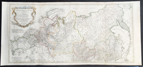
1762 D Anville Very Large Antique Map of Russia, Siberia, Mongolia, China, Japan
- Title : Troisieme Partie De La Carte D' Asia Contenant La Siberie...MDCCLII
- Ref #: 50604
- Size: 55in x 22 1/2in (1.25m x 570mm)
- Date : 1762
- Condition: (A+) Fine Condition
Description:
This very large beautifully engraved hand coloured original antique map of Russia, Siberia and Central Asia was engraved by Jean-Baptiste Bourguinon D'Anville in 1762 - the date is engraved in the title - and was published in the large elephant folio atlas Atlas Generale.
These maps are hard to find in such good condition and make fantastic historical reference tools due to the size and high level of detail as with all D'Anvilles work. (Ref: Tooley, M&B)
General Description:
Paper thickness and quality: - Heavy and stable
Paper color: - White
Age of map color: - Original
Colors used: - Yellow, pink, green
General color appearance: - Authentic
Paper size: - 55in x 22 1/2in (1.25m x 570mm)
Plate size: - 43in x 21in (1.10mm x 535mm)
Margins: - Min 1in (25mm)
Imperfections:
Margins: - None
Plate area: - Light creasing & soiling along L&R folds
Verso: - None
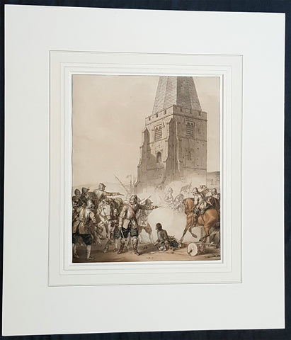
1810 John Augustus Atkinson Original Water Colour Art of an English War Skirmish
Antique Map
- Title : (A Civil War Skirmish)
- Ref #: 93444
- Size: 17in x 15in (430mm x 365mm)
- Date : 1810
- Condition: (A+) Fine Condition
Description:
This beautifully executed original pen, pencil and watercolour picture of an English Civil War battle scene was painted by John Augustus Atkinson in ca 1810.
Atkinson was known for his battle scene art works during his time at the St Petersburg Court in Russia as well as his Napoleonic battle scenes from the early 19th century.
Atkinson is held in high esteem as a watercolourist, and was elected as a member of the Society of Painters in Water Colours in 1808. He has works of art held at many prestigious museums in Russia, Europe and the UK, such as the Tate, Royal Watercolour Society, National Maritime Museum and many more listed below. He also sells on the open market with this piece last sold in 2004.
Professionally matted and can be easily removed if required.
General Definitions:
Paper thickness and quality: - Heavy and stable
Paper color : - off white
Age of map color: - Original
Colors used: - Blue, pink, red, green, yellow
General color appearance: - Authentic
Paper size: - 17in x 15in (430mm x 365mm)
Plate size: - 9 3/4in x 8in (247mm x 203mm)
Margins: - Min 0in (0mm)
Imperfections:
Margins: - None
Plate area: - None
Verso: - None
Background:
The English Civil War (1642–1651) was a series of civil wars and political machinations between Parliamentarians (Roundheads) and Royalists (Cavaliers) principally over the manner of Englands governance and part of the wider Wars of the Three Kingdoms. The first (1642–1646) and second (1648–1649) wars pitted the supporters of King Charles I against the supporters of the Long Parliament, while the third (1649–1651) saw fighting between supporters of King Charles II and supporters of the Rump Parliament. The war ended with Parliamentarian victory at the Battle of Worcester on 3 September 1651.
Unlike other civil wars in England, which were mainly fought over who should rule, these conflicts were also concerned with how the three kingdoms of England, Scotland, and Ireland were to be governed. The outcome was threefold: the trial and execution of Charles I (1649); the exile of his son, Charles II (1651); and the replacement of English monarchy with, at first, the Commonwealth of England (1649–1653) and then the Protectorate, which as the Commonwealth of England, Scotland, and Ireland unified the British Isles under the personal rule of Oliver Cromwell (1653–1658) and briefly his son Richard (1658–1659). The execution of Charles I was particularly notable given that an English king had never been executed before. In England, the monopoly of the Church of England on Christian worship was ended, while in Ireland the victors consolidated the established Protestant Ascendancy. Constitutionally, the wars established the precedent that an English monarch cannot govern without Parliaments consent, although the idea of Parliamentary sovereignty was only legally established as part of the Glorious Revolution in 1688.
Atkinson, John Augustus 1775 - 1830
Atkinson was an English artist, engraver and watercolourist.
He was born in London and at the age of 9, in 1784, went to live with his uncle, the famous engraver James Walker, in St Petersburg, Russia. Walker was engraver to the empress Catherine the Great 1729 - 1796 and encouraged Atkinson to study art, seeing a talent in him. Atkinson was well placed in St Petersburg to study art, being surrounded by the many collections of Catherine and the Russian Nobility, the richest in Europe. It is known that Atkinson was encouraged by Catherine herself along with and her son & later Emperor of Russia Paul I 1754 - 1801. Paul later commissioned Atkinson to paint large pieces from Russian history that can be seen in many Museums today around the world.
After the death of Paul in 1801, Atkinson returned to England and in 1803 published A Picturesque Representation of the Manners, Customs, and Amusements of the Russians, in 100 plates, drawn and etched by himself. He also painted in watercolours and in 1808 was elected to the Society of Painters in Water Colours. Many of his works, during the Napoleonic wars, were of naval subjects. He painted many battle scenes including a Battle of Waterloo, which was engraved by John Burnet.
His last contribution to the Royal Academy exhibition was in 1829. He died on 25 March 1830 in London.
Selected Works
• Carriage on Sledges 1803 Art Gallery of Greater Victoria, British Columbia
• A Russian Village 1804 Art Gallery of Greater Victoria, British Columbia
• Golubtza 1804 Art Gallery of Greater Victoria, British Columbia
• Village Amusements 1804 Art Gallery of Greater Victoria, British Columbia
• Scene from Tom Jones Courtauld Institute of Art, London
• The Slack Rope Courtauld Institute of Art, London
• A Belgian Waggon with Four Horses Tate Gallery, London
• Illustrations to Ossian The Huntington Library, California
• Heaving a Lead 1807 National Maritime Museum
• Greenwich Pensioners 1808 National Maritime Museum
• Skating, 1810 Tyne & Wear Museums, England
• Ships of the Reign of King Edward IV 1812 - Fine Arts Museums of San Francisco
• 42nd Highlanders at Waterloo Courtauld Institute of Art, London
• British Sailors Boarding a Man of War 1815 National Maritime Museum
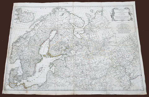
1758 D Anville Very Large Antique Map of Norway Sweden Iceland, Baltics & Russia
Antique Map
- Title : Seconde Partie de la Carte D Europe contenant Le Danemark et la Norwege, La Suede et la Russie....MDCCLVIII
- Size: 40 1/2in x 29 1/2in (1.02m x 760mm)
- Condition: (A) Very Good Condition
- Date : 1758
- Ref #: 92308
Description:
This scarce, very large (40in x 29in) highly detail map of Northern Europe Norway, Sweden, Lithuania, Baltic Countries and European Russia - was engraved in 1758 - dated in the title cartouche - by George De La Haye and was published by Jean Baptiste Bourguignon D\'Anville in his large elephant folio atlas Atlas Generale.
General Definitions:
Paper thickness and quality: - Heavy and stable
Paper color : - off white
Age of map color: - Original
Colors used: - Yellow, Green, pink
General color appearance: - Authentic
Paper size: - 40 1/2in x 29 1/2in (1.02m x 760mm)
Plate size: - 40in x 28 1/2in (1.0m x 725mm)
Margins: - Min 1/2in (12mm)
Imperfections:
Margins: - Light toning
Plate area: - Folds as issued, light separation at corners of folds
Verso: - Age toning
Background:
Before the fifteenth century the people of Southern Europe had little geographical knowledge of the Scandinavian World except from sketchy detail shown in the Catalan Atlas (1375) and on a number of portolani embracing Denmark and the southern tip of Norway. It was not until 1427 that a manuscript map prepared about that time by Claudius Clavus (b.1388) a Dane who spent some time in Rome, made available to scholars a tolerable outline of the northern countries and Greenland. That was to remain the best map available for the rest of the century and it was used as the basis for maps of Scandinavia in early printed editions of Ptolemy. Others by Nicolaus Cusanus (1491) and Ehrhard Etzlaub (c. 1492) followed but, needless to say, these are extremely rare; even the later maps by Olaus Magnus and Marcus Jordan, where they have survived at all , are known only by a very few examples. In fact, apart from the rare appearance of an early Ptolemy map, the oldest of Scandinavia which a collector is likely to find are those of Munster\'s Cosmograhy first published in 1544. In the following centuries the few maps and charts complied in Scandinavia were usually published in Amsterdam, Antwerp, Paris or Nuremberg, the most important maps often being incorporated in the major Dutch, French & German Atlases. (Ref: Tooley; M&B)
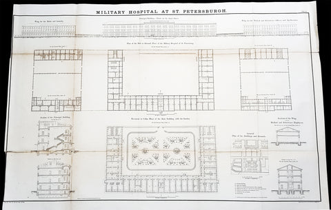
1856 Delafield Antique Architectural Plan SM Kirov Medical Academy St Petersburg
Antique Map
- Title : Military Hospital at St Petersburg
- Condition: (A+) Fine Condition
- Ref: 90139
- Size: 36in x 24in (915mm x 610mm)
Description:
This very large original lithograph print, an architectural plan of the S.M. Kirov Military Medical Academy in St Petersburg, Russia - during the time of the Crimean War and just prior to the American Civil War - was engraved by John T Bowen & co. of Philadelphia and was published in the 1856 edition of Captain Richard Delafields Report on the Art of War in Europe in 1854, 1855, and 1856.
In early 1855, Captain Richard Delafield was appointed by the Secretary of War, Jefferson Davis, a head of the board of officers, later called The Delafield Commission, and sent to Europe to study the European military. The board included Captain George B. McClellan and Major Alfred Mordecai. They inspected the state of the military in Great Britain, Germany, the Austrian Empire, France, Belgium, and Russia, and served as military observers during the Crimean War. After his return in April 1856, Delafield submitted a report which was later published as a book by Congress, Report on the Art of War in Europe in 1854, 1855, and 1856. The book was suppressed during the American Civil War due to fears that it would be instructive to Confederate engineers as it contained multiple drawings and descriptions of military fortifications.
General Definitions:
Paper thickness and quality: - Light and stable
Paper color : - off white
Age of map color: -
Colors used: -
General color appearance: -
Paper size: - 36in x 24in (915mm x 610mm)
Plate size: - 36in x 24in (915mm x 610mm)
Margins: - Min 1/2in (12mm)
Imperfections:
Margins: - None
Plate area: - Folds as issued
Verso: - Folds re-enforced with archival tape
Background:
The S. M. Kirov Military Medical Academy (Военно-медицинская академия имени С. М. Кирова) is the oldest school of military medicine in Saint Petersburg and the Russian Federation. Senior medical staff are trained for the Armed Forces and conduct research in military medical services.
The origins of S.M. Kirov Military Medical Academy go back to the years of Peter the Great. In 1715 by the Tsars order the Admiralty Hospital in the Vyborg Side of Saint Petersburg was founded. In 1717 next to in the Land Military Hospital was opened. Since 1773 surgical schools attached to both hospitals were operating. In 1786 those schools were consolidated into the Main Medical College. It became the principal training center for army and fleet physicians.
Unofficially, the year 1714 is considered the foundation year of the academy. The Medical and Surgical Academy was established by the order of Emperor Paul I of 18/29 December 1798 on the initiative of Baron Alexei Vasilyev, General Director of the Medical College. At the same time a Neoclassical building for the Academy was designed by Antonio Porta. It was decorated with a set of panel paintings by Giuseppe Bernasconi.
Ranked as one of the best educational institutions in the Russian Empire, it was known as the Imperial Medical and Surgical Academy from 1808. According to the order of Emperor Alexander I, a member of the Medical and Surgical Academy had the rights, liabilities, and benefits of a member of the Academy of Sciences.
Sir James Wylie, a Scottish baronet, managed the academy between 1808 and 1838. His contributions have been commemorated with a monument which stood in front of the academy until the October Revolution. The monument was designed in 1859 by David Jensen. It was later relocated and replaced with a statue of Hygieia.
In 19th century the Imperial Medical and Surgical Academy played a major role in the development of Russian natural science and medicine. In 1840 — 1856 one of its professors was Nikolay Pirogov, considered the founder of field surgery.
Since 1861 Sergey Botkin, one of Pirogovs disciples, worked at the Academy. He is considered one of the founders of modern Russian medical science and education. Botkin introduced triage, pathological anatomy, and post mortem diagnostics into Russian medical practice.
In 1881 the Academys official name was changed into the Imperial Military Medical Academy. In the late 19th century, its physiology laboratory, founded by Ivan Sechenov, was at the forefront of medical research. Ivan Romanovich Tarkhanov conducted some important experiments there.
In 1890 — 1901 the Academys President was Viktor Pashutin, one of the founders of the pathophysiologic school in Russia and of pathophysiology as an independent scientific discipline.
The Nobel-prize winning physiologist Ivan Pavlov graduated from the Academy in 1879 with Gold Medal award. Since 1895 he headed Department of Physiology at the Academy for three decades.
In 1904 — 1924 Nikolai Kravkov, the founder of Russian national school of pharmacologists, headed the Academys Department of Pharmacology.
In 1903 — 1936 one of the Academys professors was Sergey Fedorov, the founder of the largest national school of surgery and «the father of Russian urology».
The academy was also among the pioneers of medical education for women, launching the courses for nurse-midwives in 1872. Nadezhda Suslova, the first female physician in Russia, attended Sechenovs classes at the academy. A school of gymnastics (now the Military Institute of Physical Culture) was launched in 1909.
Delafield, Richard Major General 1798 - 1873
Delafield was a United States Army officer for 52 years. He served as superintendent of the United States Military Academy for 12 years. At the start of the American Civil War, then Colonel Delafield helped equip and send volunteers from New York to the Union Army. He also was in command of defences around New York harbor from 1861 to April 1864. On April 22, 1864, he was promoted to Brigadier General in the Regular Army of the United States and Chief of Engineers. On March 8, 1866, President Andrew Johnson nominated Delafield for appointment to the grade of brevet major general in the Regular Army, to rank from March 13, 1865, and the United States Senate confirmed the appointment on May 4, 1866, reconfirmed due to a technicality on July 14, 1866. He retired from the US Army on August 8, 1866. He later served on two commissions relating to improvements to Boston Harbor and to lighthouses. He also served as a regent of the Smithsonian Institution.
Delafield served as assistant engineer in the construction of Hampton Roads defences from 1819–1824 and was in charge of fortifications and surveys in the Mississippi River delta area in 1824-1832. While superintendent of repair work on the Cumberland Road east of the Ohio River, he designed and built Dunlaps Creek Bridge in Brownsville, Pennsylvania, the first cast-iron tubular-arch bridge in the United States. Commissioned a major of engineers in July 1838, he was appointed superintendent of the Military Academy after the fire of 1838 and served till 1845. He designed the new buildings and the new cadet uniform that first displayed the castle insignia. He superintended the construction of coast defences for New York Harbor from 1846 to 1855.
In the beginning of 1855, Delafield was appointed by the Secretary of War, Jefferson Davis a head of the board of officers, later called The Delafield Commission, and sent to Europe to study the European military. The board included Captain George B. McClellan and Major Alfred Mordecai. They inspected the state of the military in Great Britain, Germany, the Austrian Empire, France, Belgium, and Russia, and served as military observers during the Crimean War. After his return in April 1856, Delafield submitted a report which was later published as a book by Congress, Report on the Art of War in Europe in 1854, 1855, and 1856. The book was suppressed during the American Civil War due to fears that it would be instructive to Confederate engineers as it contained multiple drawings and descriptions of military fortifications.
Delafield served as superintendent of the Military Academy again in 1856-1861. In January 1861, he was succeeded by Captain Pierre G. T. Beauregard, who was dismissed shortly after Beauregards home state of Louisiana seceded from the Union, and Delafield returned as superintendent serving until March 1, 1861. In the beginning of the Civil War he advised the governor of New York Edwin D. Morgan during the volunteer force creation. Then, in 1861–1864, he was put in charge of New York Harbor defences, including Governors Island and Fort at Sandy Hook. On May 19, 1864, he was commissioned a brigadier-general after replacing Joseph Gilbert Totten, who had died, as the Chief of Engineers, United States Army Corps of Engineers, on April 22, 1864. He stayed in charge of the Bureau of Engineers of the War Department until his retirement on August 8, 1866. On March 8, 1866, President Andrew Johnson nominated Delafield for appointment to the grade of brevet major general in the Regular Army of the United States, to rank from March 13, 1865, and the United States Senate confirmed the appointment on May 4, 1866 and reconfirmed it due to a technicality on July 14, 1866.After retirement Delafield served as a regent of the Smithsonian Institution and a member of the Lighthouse Board. He died in Washington, D.C. on November 5, 1873.
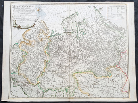
1757 Robert De Vaugondy Large Antique Map of the Russian Empire - Poland to Asia
- Title : Partie Occidentale De L Empire De Russie...Sr Robert De Vaugondy
- Size: 26in x 20in (660mm x 510mm)
- Condition: (A+) Fine Condition
- Date : 1757
- Ref #: 41592
Description:
This large magnificent hand coloured original copper-plate engraved antique map of The Russian Empire - stretching from Poland to Central Asia - by Robert De Vaugondy was published in the 1757 edition of De Vaugondys famous The Atlas Universel
General Definitions:
Paper thickness and quality: - Heavy and stable
Paper color : - off white
Age of map color: - Original & later
Colors used: - Blue, pink, red, green, yellow
General color appearance: - Authentic
Paper size: - 23 1/2in x 19 1/2in (600mm x 495mm)
Plate size: - 23in x 19 1/2in (585mm x 495mm)
Margins: - Min 1/4in (5mm)
Imperfections:
Margins: - None
Plate area: - None
Verso: - None
It is scarcely necessary to look at a map of Russia - with which we must include Siberia - to visualize the daunting task facing Russian map makers. Indeed, considering the vastness of their territory and the lack of skilled cartographers, it is surprising that relatively good maps were available for engraving and printing in most of the well known sixteenth and seventeenth century atlases. Generally, maps of that time were based on material brought back from Moscow by visitors from the West. (Ref Tooley M&B)
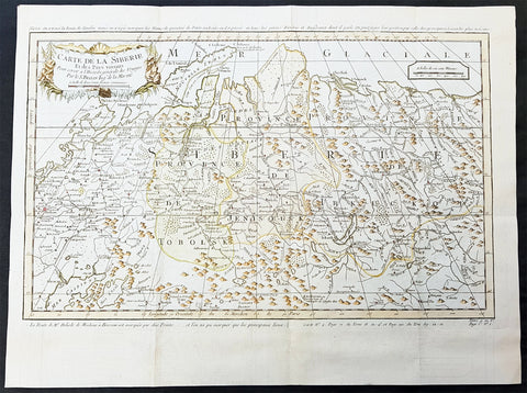
1754 Bellin & Delisle Original Antique Map of Siberia, Russia - after Delisle & Kirilov
- Title : Carte De La Siberie...S Bellin
- Date : 1755
- Ref # : 25538
- Size : 18 3/4in x 14in (480mm x 360mm)
- Condition: (A+) Fine Condition
Description:
This fine large, original copper-plate engraved antique map of Siberia, Eastern Russia by Jacques Nicolas Bellin in 1754 - after Joseph Nicolas Delisle - was published in Antoine François Prevosts 15 volumes of Histoire Generale des Voyages written by Prevost & other authors between 1746-1790.
This detailed map of Siberia, extends from the White & Caspian Seas in the west to Irkuckoi Province, Jakutky on the Lena River and regions just to the east. Centered on the Jenisi River.
The map also notes the trip taken by JN Delisle from Moscow to Beryozovo, in the Khanty-Mansi Autonomous Okrug region to observe the transit of Venus in 1740.
This map by Bellin was taken from JN Delsile, brother of Guillaume Delisle, responsible along with Russian Ivan Kirilov in surveying & publishing the first complete atlas of Russia, Atlas Russicus in 1745.
Jacques Nicolas Delisle was invited by Peter the Great to survey the vast empire of Imperial Russia. Initially accompanied by his step-brother Louis, in 1726 the two Parisians journeyed to Russia (now under the reign of Catherine I) to start their surveys.
At first, Delisle also worked with Ivan Kirilov, with whom he co-founded the St Petersburg Academy of Sciences. However, the two men did not always see eye to eye, and Kirilov went on to produce an incomplete atlas which was published in 1734, before the French team had finished their surveys. Kirilov died in 1737, eight years before the eventual publication of Delisle\'s atlas.
The Atlas Russicus is effectively in two parts: the first covering European Russia in 13 numbered maps (scale 1; 1.527.000), the second covering Siberia in six maps. scale (1: 3.360.000). On map 19 Ostium fluvii Amur the extreme point of Alaska and the Aleutian islands.
It is scarcely necessary to look at a map of Russia - with which we must include Siberia - to visualize the daunting task facing Russian map makers. Indeed, considering the vastness of their territory and the lack of skilled cartographers, it is surprising that relatively good maps were available for engraving and printing in most of the well known sixteenth and seventeenth century atlases. Generally, maps of that time were based on material brought back from Moscow by visitors from the West.
General Definitions:
Paper thickness and quality: - Heavy and stable
Paper color : - off white
Age of map color: - Early
Colors used: - Green, Yellow,
General color appearance: - Authentic
Paper size: - 18 3/4in x 14in (480mm x 360mm)
Plate size: - 18 1/2in x 11 3/4in (470mm x 300mm)
Margins: - Min 1/2in (6mm)
Imperfections:
Margins: - None
Plate area: - Folds as issued
Verso: - None
Background:
One of Antoine Francois Prevosts monumental undertakings was his history of exploration & discovery in 15 volumes titledHistoire Générale des Voyages written between 1746-1759 and was extended to 20 volumes after his death by various authors.
The 20 volumes cover the early explorations & discoveries on 3 continents: Africa (v. 1-5), Asia (v. 5-11), and America (v. 12-15) with material on the finding of the French, English, Dutch, and Portugese.
A number of notable cartographers and engravers contributed to the copper plate maps and views to the 20 volumes including Nicolas Bellin, Jan Schley, Chedel, Franc Aveline, Fessard, and many others.
The African volumes cover primarily coastal countries of West, Southern, and Eastern Africa, plus the Congo, Madagascar, Arabia and the Persian Gulf areas.
The Asian volumes cover China, Korea, Tibet, Japan, Philippines, and countries bordering the Indian Ocean.
Volume 11 includes Australia and Antarctica.
Volumes 12-15 cover voyages and discoveries in America, including the East Indies, South, Central and North America.
Volumes 16-20 include supplement volumes & tables along with continuation of voyages and discoveries in Russia, Northern Europe, America, Asia & Australia.
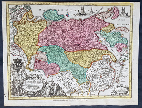
1744 Georg Mattaus Seutter Antique Map of The Russian Empire, China, Japan
- Title : Imperium Russiae Magnae........a Matth. Seutteri...T C Lotter, Geogr.
- Ref #: 93401
- Size: 11in x 8 1/2in (280mm x 215mm)
- Date : 1744
- Condition: (A+) Fine Condition
Description:
This beautifully hand coloured original copper-plate engraved antique map of The Russian Empire was engraved by Tobias Lotter and was published in the 1744 edition of GM Seutters Atlas Minor Prae cipua Orbis Terrarum Imperia Regna et Provincias...., Augsburg, Germany.
General Definitions:
Paper thickness and quality: - Heavy and stable
Paper color : - off white
Age of map color: - Original
Colors used: - Yellow, green, blue, pink
General color appearance: - Authentic
Paper size: - 11in x 8 1/2in (280mm x 215mm)
Plate size: - 10 1/2in x 8in (265mm x 205mm)
Margins: - Min 1/4in (5mm)
Imperfections:
Margins: - None
Plate area: - None
Verso: - None
Background:
Atlas Minor was a series of beautiful maps of all parts of the world. Georg Matthäus Seutter was one of the most and important of the German cartographers of the 18th century, being appointed as the Geographer to the Imperial Court. His son, Albrecht Carl, joined Matthäus and eventually inherited the business. The maps from Atlas Minor were drawn by the two Seutters and engraved by Tobias Conrad Lotte. These maps are highly detailed and engraved with a bold hand with equally strong original hand color in the body of the map as was the 18th century German style. The cartouches were left uncolored in order to emphasize the elaborately detailed illustrations for which German maps are especially prized. These are some of the most decorative and interesting maps of the eighteenth century.
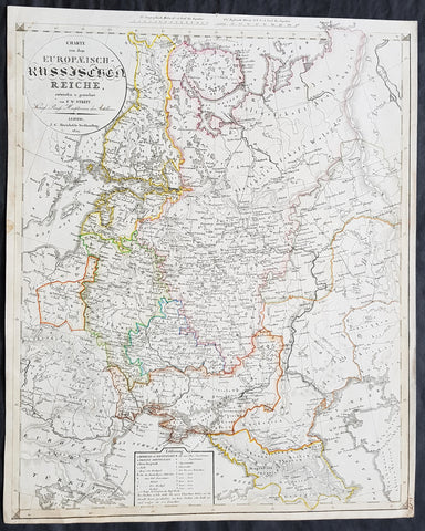
1829 Friedrich Wilhelm Streit Large Antique Map of European Russia
- Title : Charte von dem Europaeisch Russischen Reiche entworsen u. gezeichnet von FW Streit...Leipzig J C Hinrichssche...1829
- Ref #: 32211
- Size: 20in x 16 1/2in (510mm x 420mm)
- Date : 1829
- Condition: (A+) Fine Condition
Description:
This large beautifully hand coloured original copper-plate engraved antique map of the Russian Empire in Europe - from Finland to the Caspian Sea - by Friedrich Wilhelm Streit was published in 1829 by Johann Conrad Hinrichssche, dated in the title.
Friedrich Wilhelm Streit 1772 - 1839 was a Prussian cartographer., engineer and mathematician. He was a Prussian Army Major and member of the Academie of useful sciences, Erfurt and the society for geography, Berlin. From 1807 to 1808 he was director of the Geographical Institute in Weimar .(Ref: M&B; Tooley)
General Definitions:
Paper thickness and quality: - Heavy and stable
Paper color : - off white
Age of map color: - Original
Colors used: - Yellow, green, blue, pink
General color appearance: - Authentic
Paper size: - 20in x 16 1/2in (510mm x 420mm)
Plate size: - 20in x 16 1/2in (510mm x 420mm)
Margins: - Min 1/2in (12mm)
Imperfections:
Margins: - Light age toning in margins
Plate area: - None
Verso: - None
Background:
It is scarcely necessary to look at a map of Russia - with which we must include Siberia - to visualize the daunting task facing Russian map makers. Indeed, considering the vastness of their territory and the lack of skilled cartographers, it is surprising that relatively good maps were available for engraving and printing in most of the well known sixteenth and seventeenth century atlases. Generally, maps of that time were based on material brought back from Moscow by visitors from the West.
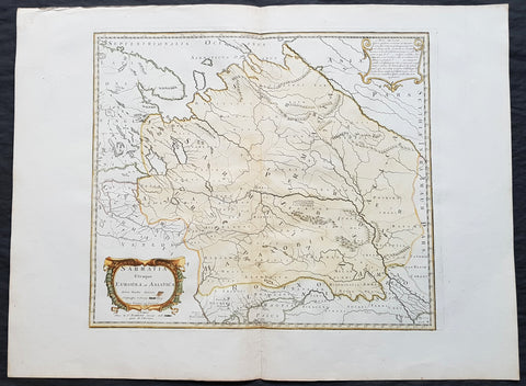
1741 Nicolas Sanson Large Antique Map of Sarmatia, Modern Day Russia & Ukraine
- Title : Sarmatia Utraque Europaea et Asiatica Autore Nicolas Sanson...1741
- Ref #: 50602
- Size: 27in x 20 1/4in (690mm x 515mm)
- Date : 1741
- Condition: (A+) Fine Condition
Description:
This fine original hand coloured copper-plate engraved antique map of the land of the Sarmatians - today stretching encompassing modern day European Russia and Ukraine and central Asia by Nicolas Sanson, was engraved in 1741 - dated in the cartouche - and was published by Robert De Vaugondy in a re-issue of Sansons atlas Cartes Generales de Toutes les Parties du Monde
General Definitions:
Paper thickness and quality: - Heavy and stable
Paper color : - off white
Age of map color: - Original & later
Colors used: - Yellow, green, blue, pink
General color appearance: - Authentic
Paper size: - 27in x 20 1/4in (690mm x 515mm)
Plate size: - 19in x 16 1/2in (485mm x 420mm)
Margins: - Min 2in (50mm)
Imperfections:
Margins: - None
Plate area: - None
Verso: - None
Background:
The Sarmatians were a large Iranian confederation that existed in classical antiquity, flourishing from about the 5th century BC to the 4th century AD.
Originating in the central parts of the Eurasian Steppe, the Sarmatians started migrating westward around the 4th and 3rd centuries BC, coming to dominate the closely related Scythians by 200 BC. At their greatest reported extent, around 1st century AD, these tribes ranged from the Vistula River to the mouth of the Danube and eastward to the Volga, bordering the shores of the Black and Caspian seas as well as the Caucasus to the south. Their territory, which was known as Sarmatia to Greco-Roman ethnographers, corresponded to the western part of greater Scythia (it included todays Central Ukraine, South-Eastern Ukraine, Southern Russia, Russian Volga and South-Ural regions, also to a smaller extent north-eastern Balkans and around Moldova). In the 1st century AD, the Sarmatians began encroaching upon the Roman Empire in alliance with Germanic tribes. In the 3rd century AD, their dominance of the Pontic Steppe was broken by the Germanic Goths. With the Hunnic invasions of the 4th century, many Sarmatians joined the Goths and other Germanic tribes (Vandals) in the settlement of the Western Roman Empire. Since large parts of todays Russia, actually the land between the Ural Mountains and the Don River, were controlled in the 5th century BC by the Sarmatians, Volga–Don and Ural steppes sometimes are also called Sarmatian Motherland.
The Sarmatians were eventually decisively assimilated (e.g. Slavicisation) and absorbed by the Proto-Slavic population of Eastern Europe.
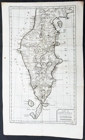
1760 Bellin Large Original Antique Map of Kamchatka Peninsula, in Eastern Russia
- Title : Carte Du Kamtschatka Dressee et Gravee par Laurent.
- Ref #: 60969
- Size: 23in x 14 1/2in (585mm x 370mm)
- Date : 1747
- Condition: (A+) Fine Condition
Description:
This fine, original copper-plate engraved antique map of Kamchatka Peninsula, in Eastern Russia by Jacques Nicolas Bellin in 1760 was published in Antoine François Prevosts 15 volumes of Histoire Generale des Voyages written by Prevost & other authors between 1746-1790.
General Definitions:
Paper thickness and quality: - Heavy and stable
Paper color : - off white
Age of map color: -
Colors used: -
General color appearance: -
Paper size: - 23in x 14 1/2in (585mm x 370mm)
Plate size: - 20 1/2in x 12 1/2in (520mm x 320mm)
Margins: - Min 1/2in (6mm)
Imperfections:
Margins: - None
Plate area: - Folds as issued
Verso: - None
Background:
One of Antoine Francois Prevosts monumental undertakings was his history of exploration & discovery in 15 volumes titledHistoire Générale des Voyages written between 1746-1759 and was extended to 20 volumes after his death by various authors.
The 20 volumes cover the early explorations & discoveries on 3 continents: Africa (v. 1-5), Asia (v. 5-11), and America (v. 12-15) with material on the finding of the French, English, Dutch, and Portugese.
A number of notable cartographers and engravers contributed to the copper plate maps and views to the 20 volumes including Nicolas Bellin, Jan Schley, Chedel, Franc Aveline, Fessard, and many others.
The African volumes cover primarily coastal countries of West, Southern, and Eastern Africa, plus the Congo, Madagascar, Arabia and the Persian Gulf areas.
The Asian volumes cover China, Korea, Tibet, Japan, Philippines, and countries bordering the Indian Ocean.
Volume 11 includes Australia and Antarctica.
Volumes 12-15 cover voyages and discoveries in America, including the East Indies, South, Central and North America.
Volumes 16-20 include supplement volumes & tables along with continuation of voyages and discoveries in Russia, Northern Europe, America, Asia & Australia.
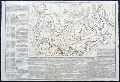
1812 Las Cases Large Original Antique Map of The Russian Empire, English Text
- Title : The Russian Empire with its gradual Acquisitions traced and Explained
- Size: 28in x 19in (710mm x 485mm)
- Ref #: 40259
- Date : 1812
- Condition: (A) Very Good Condition
Description:
This large original copper plate engraved antique map of Russia - within the geographical, political, economic, physical & historical text - was published in the 1812 English edition of Emmanuel Las Cases very large Elephant Folio size The Historical, Geographical & Genealogy Atlas
General Definitions:
Paper thickness and quality: - Heavy and stable
Paper color : - off white
Age of map color: -
Colors used: -
General color appearance: -
Paper size: - 28in x 19in (710mm x 485mm)
Plate size: - 21in x 13in (535mm x 33mm)
Margins: - Min 1/2in (12mm)
Imperfections:
Margins: - Light offsetting
Plate area: - Light offsetting
Verso: - Light age toning
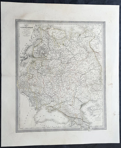
1824 Louis Vivien Large Antique Map of Russia in Europe
- Title : Carte La Russie D Europe...1824
- Size: 27 1/2in x 23in (700mm x 585mm)
- Condition: (A+) Fine Condition
- Date : 1824
- Ref #: 40704
Description:
This finely engraved original large antique map of Russia in Europe by Louis Vivien in his Elephant Folio atlas, Atlas Universal
General Definitions:
Paper thickness and quality: - Heavy and stable
Paper color : - off white
Age of map color: - Original
Colors used: - Blue, pink, yellow, green
General color appearance: - Authentic
Paper size: - 27 1/2in x 23in (700mm x 585mm)
Plate size: - 23in x 20in (585mm x 510mm)
Margins: - Min 2in (50mm)
Imperfections:
Margins: - Light soiling
Plate area: - None
Verso: - None
Background:
It is scarcely necessary to look at a map of Russia - with which we must include Siberia - to visualize the daunting task facing Russian map makers. Indeed, considering the vastness of their territory and the lack of skilled cartographers, it is surprising that relatively good maps were available for engraving and printing in most of the well known sixteenth and seventeenth century atlases. Generally, maps of that time were based on material brought back from Moscow by visitors from the West.
Vivien, Louis 1802 - 1896
Louis Vivien , or Vivien de Saint-Martin was a French geographer who was born in Saint-Martin-de-Fontenay and died in Versailles, France in 1896.
He settled in Paris under the Restoration, and became known with his publication of the Electoral and Administrative Map in 1823 and his comprehensive Universal Atlas in 1825, collaborating with Jacques Bibliomappe -Charles Bailleul from 1828. Vivien was foremost a geographer but was also a publisher of works in other fields, including historical books on the General History of the French Revolution and the History of Napoleon. He also translated various English works, such as the novels of Walter Scott .
He also wrote the New Annals of Travels between 1845 and 1854 and briefly the French Athenaeum between 1847 & 1848. He contributed to numerous periodicals such as Le Constitutionnel, Revue contemporaine, Revue germanique & La Presse. He also wrote L Année géographique between 1863 and 1875 before passing the baton to G. Maunoir and Henri Duveyrier.
He is mainly known though, for his three cartographical works, A History of Geographical Discoveries, A New Dictionary of Universal Geography and the Universal Atlas of Geography. The first of these publications he completed after the 1848 Revolution with the latter two completed by Louis Rousselet and Franz Schrader.
Vivien was Honorary President of the Geographical Society, of which he was one of the founder members. He also laureate of the Academy of Inscriptions and Belles-Lettres as well as a member of the Asian Society , the Society of Ethnology along with a large number of learned societies and European academies.
Main works of Vivien de Saint-Martin
- General History of the French Revolution, the Empire, the Restoration, the Monarchy of 1830, up to and including 1841 (4 volumes in 2 volumes), Paris, Pourrat Brothers, 1841-1842.
- History of Napoleon and the Empire (2 volumes), Paris, Pourrat brothers, 1844.
- History of geographical discoveries of European nations in various parts of the world (2 volumes), Paris, Arthus-Bertrand, 1845-1846.
- Research on primitive populations and the oldest traditions of the Caucasus , Paris, Arthus-Bertrand, 1847.
- Studies of Ancient Geography and Asian Ethnography (2 volumes), Paris, Arthus-Bertrand, 1850-1852.
- Historical and geographical description of Asia Minor (2 volumes), Paris, Arthus-Bertrand, 1852.
- Study on the Greek and Latin Geography of India , Paris, Imperial Printing, 1858.
- Study on the geography and the primitive populations of north-west India, according to the Vedic hymns , Paris, Imprimerie impériale, 1860.
- North Africa in Greek and Roman antiquity, historical and geographical study , Paris, Imprimerie impériale, 1863.
- History of geography and geographical discoveries from the earliest times to the present day , Paris, Hachette, 1873.
- With Franz Schrader : Universal Atlas of Geography built from the original sources and the most recent documents , Paris, Hachette, 1876-1915.
- With Louis Rousselet : New dictionary of universal geography (9 volumes), Paris, Hachette, 1879-1900.
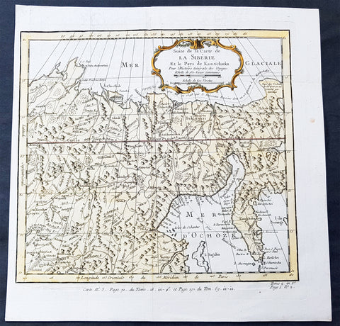
1758 Bellin Old, Antique Map of Eastern Siberia and the Kamchatka Peninsula Russia
- Title : Suite de la Carte de La Siberie et le Pays Kamtschatka
- Ref #: 60929
- Size: 11 3/4in x 11 3/4in (300mm x 300mm)
- Date : 1758
- Condition: (A+) Fine Condition
Description:
This fine, original copper-plate engraved antique map of Eastern Russia & Siberia including the Kamchatka Peninsular and south to northern China by Jacques Nicolas Bellin in 1750 was published in Antoine François Prevosts 15 volumes of Histoire Generale des Voyages written by Prevost & other authors between 1746-1790.
General Definitions:
Paper thickness and quality: - Heavy and stable
Paper color : - off white
Age of map color: - Early
Colors used: - Green, yellow, red
General color appearance: - Authentic
Paper size: - 12in x 12in (305mm x 305mm)
Plate size: - 10 1/2in x 9 1/2in (285mm x 245mm)
Margins: - Min 1/2in (6mm)
Imperfections:
Margins: - None
Plate area: - Folds as issued
Verso: - None
Background:
One of Antoine Francois Prevosts monumental undertakings was his history of exploration & discovery in 15 volumes titledHistoire Générale des Voyages written between 1746-1759 and was extended to 20 volumes after his death by various authors.
The 20 volumes cover the early explorations & discoveries on 3 continents: Africa (v. 1-5), Asia (v. 5-11), and America (v. 12-15) with material on the finding of the French, English, Dutch, and Portugese.
A number of notable cartographers and engravers contributed to the copper plate maps and views to the 20 volumes including Nicolas Bellin, Jan Schley, Chedel, Franc Aveline, Fessard, and many others.
The African volumes cover primarily coastal countries of West, Southern, and Eastern Africa, plus the Congo, Madagascar, Arabia and the Persian Gulf areas.
The Asian volumes cover China, Korea, Tibet, Japan, Philippines, and countries bordering the Indian Ocean.
Volume 11 includes Australia and Antarctica.
Volumes 12-15 cover voyages and discoveries in America, including the East Indies, South, Central and North America.
Volumes 16-20 include supplement volumes & tables along with continuation of voyages and discoveries in Russia, Northern Europe, America, Asia & Australia.
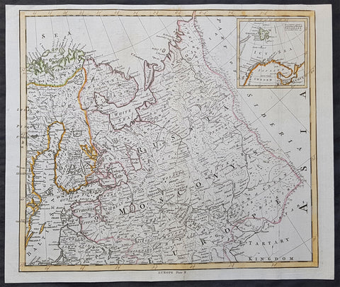
1765 T. Bowen & M Postlethweyt Antique Map of European Russia, Baltics, Lapland
- Title : Europe Plate II
- Date : 1765
- Size: 17 1/2in x 14 1/2in (445mm x 370mm)
- Condition: (A+) Fine Condition
- Ref: 01-1584
Description:
This wonderful large detailed original copper plate engraved antique map of European Russia, parts of Lapland, Sweden, Latvia & Lithuania by Thomas Bowen was published in the 1765 edition of Malachy Postlethweyts monumental 2 Volume tomes on Universal Dictionary of Trade & Commerce concentrating on various states of trade, including slavery, between England and America published between 1751 & 1774.
General Definitions:
Paper thickness and quality: - Heavy and stable
Paper color : - off white
Age of map color: - Original
Colors used: - Blue, orange, green
General color appearance: - Authentic
Paper size: - 17 1/2in x 14 1/2in (445mm x 370mm)
Plate size: - 17in x 14in (430mm x 355mm)
Margins: - Min 1/2in (8mm)
Imperfections:
Margins: - None
Plate area: - Light creasing
Verso: - None
Background:
It is scarcely necessary to look at a map of Russia - with which we must include Siberia - to visualize the daunting task facing Russian map makers. Indeed, considering the vastness of their territory and the lack of skilled cartographers, it is surprising that relatively good maps were available for engraving and printing in most of the well known sixteenth and seventeenth century atlases. Generally, maps of that time were based on material brought back from Moscow by visitors from the West.
Postlethweyt, Malachy 1707 – 1767
Malachy Postlethweyts Dictionary of Trade & Commerce:
A monumental dictionary of trade and commerce. It is based in part on the Dictionnaire universel de Commerce (Paris: 1723-30) of Jacques Savary de Bruslon, under whose name it is often catalogued, but has been adapted by Postlethwayt for a British audience, with substantial enlargements and improvements, and entirely new material relating to England and her colonies. Postlethwayt devoted twenty years to the preparation of the dictionary, which was first published in 1751-55 & includes a description of British affairs in North America since the peace of 1763.
As with his other works, the dictionary demonstrates Postlethway’s deep commitment to the expansion and strengthening of English trade. Included are entries for geographical locations (Africa, Antilles, Canada, Japan, Louisiana, &c.), products (brandy, cardamom, codfish, diamonds, sugar, &c.), trading companies (Dutch East India Company, English African Company, &c.), treaties of commerce, and a vast range of other information of value to merchants (bankruptcy, currency, bills of exchange, brokerage, exportation, landed interest, privateering, &c.). The Dictionary is also important for containing almost the whole substance of Richard Cantillon’s Essay on Commerce, its first appearance in print.
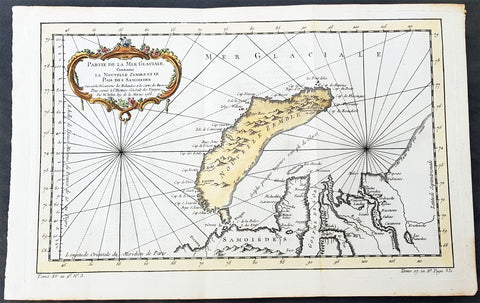
1758 Nicolas Bellin Original Antique Map of Russia The Island of Novaya Zemlya
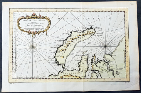
- Title : Partie De La Mer Glaciale Contenant La Nouvelle Zemle...M. Bellin...1758
- Ref #: 60968
- Size: 15 1/2in x 10in (380mm x 260mm)
- Date : 1758
- Condition: (A+) Fine Condition
Description:
This fine, original copper-plate engraved antique map of the Russian Island of Novaya Zemlya by Jacques Nicolas Bellin in 1758 was published in Antoine François Prevosts 15 volumes of Histoire Generale des Voyageswritten by Prevost & other authors between 1746-1790.
Novaya Zemlya also known as Nova Zembla (especially in Dutch), is an archipelago in the Arctic Ocean in northern Russia and the extreme northeast of Europe, the easternmost point of Europe lying at Cape Flissingsky on the Northern island. Novaya Zemlya is composed of two islands, the northern Severny Island and the southern Yuzhny Island, which are separated by Matochkin Strait.
The Russians knew of Novaya Zemlya from the 11th century, when hunters from Novgorod visited the area. For western Europeans, the search for the Northern Sea Route in the 16th century led to its exploration. The first visit from a west European was by Hugh Willoughby in 1553, and he met Russian ships from the already established hunting trade. Dutch explorer Willem Barentsz reached the west coast of Novaya Zemlya in 1594, and in a subsequent expedition of 1596 rounded the Northern point and wintered on the Northeast coast. (Barentsz died during the expedition, and may have been buried on the Northern island.) During a later voyage by Fyodor Litke in 1821–1824, the west coast was mapped. Henry Hudson was another explorer who passed through Novaya Zemlya while searching for the Northeast Passage.
General Definitions:
Paper thickness and quality: - Heavy and stable
Paper color : - off white
Age of map color: - Early
Colors used: - Green, yellow, red
General color appearance: - Authentic
Paper size: - 15 1/2in x 10in (395mm x 255mm)
Plate size: - 14in x 9in (355mm x 230mm)
Margins: - Min 1/2in (6mm)
Imperfections:
Margins: - None
Plate area: - Folds as issued
Verso: - None
Background:
One of Antoine Francois Prevosts monumental undertakings was his history of exploration & discovery in 15 volumes titledHistoire Générale des Voyages written between 1746-1759 and was extended to 20 volumes after his death by various authors.
The 20 volumes cover the early explorations & discoveries on 3 continents: Africa (v. 1-5), Asia (v. 5-11), and America (v. 12-15) with material on the finding of the French, English, Dutch, and Portugese.
A number of notable cartographers and engravers contributed to the copper plate maps and views to the 20 volumes including Nicolas Bellin, Jan Schley, Chedel, Franc Aveline, Fessard, and many others.
The African volumes cover primarily coastal countries of West, Southern, and Eastern Africa, plus the Congo, Madagascar, Arabia and the Persian Gulf areas.
The Asian volumes cover China, Korea, Tibet, Japan, Philippines, and countries bordering the Indian Ocean.
Volume 11 includes Australia and Antarctica.
Volumes 12-15 cover voyages and discoveries in America, including the East Indies, South, Central and North America.
Volumes 16-20 include supplement volumes & tables along with continuation of voyages and discoveries in Russia, Northern Europe, America, Asia & Australia.
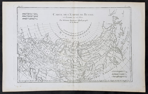
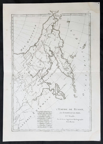
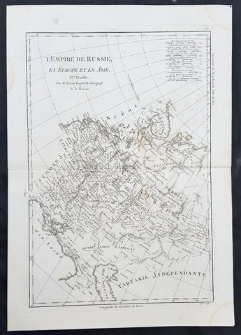
1780 Rigobert Bonne Original Antique Map of The Russian Empire
- Title : Carte De L Empire de Russie en Europe et en Asie...M Bonne
- Size: 15in x 10in (380mm x 255mm)
- Ref #: 31674
- Date : 1780
- Condition: (A+) Fine Condition
Description:
This original copper-plate engraved map was published in 1780 edition of Atllas des toutes les parties connues du globe terrestre by Rigobert Bonne & Guillaume Raynal.
General Definitions:
Paper thickness and quality: - Heavy and stable
Paper color : - off white
Age of map color: -
Colors used: -
General color appearance: -
Paper size: - 15in x 10in (380mm x 255mm)
Plate size: - 13in x 9in (330mm x 230mm)
Margins: - Min 1in (25mm)
Imperfections:
Margins: - None
Plate area: - None
Verso: - None
1760 Nicolas Bellin Original Antique Map of Novaya Zemlya & Barent Arctic Russia
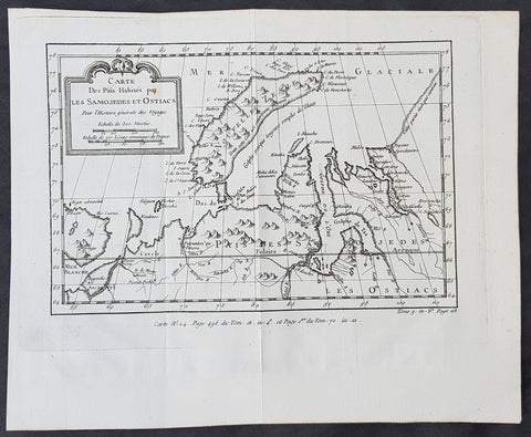
- Title : Carte des Pais Habites par Les Samojedes et Ostiacs...
- Size: 12in x 10in (305mm x 255mm)
- Ref #: 60930
- Date : 1760
- Condition: (A+) Fine Condition
Description:
This fine original copper-plate engraved antique map of Russian Island of Novaya Zemlya, parts of the Russian northern mainland region of Nenets and the environs of the Arctic Barents & Kara Sea by Jacques Nicolas Bellin was published in the 1760 edition of Antoine François Prevosts Histoire Generale des Voyages
General Definitions:
Paper thickness and quality: - Heavy and stable
Paper color : - off white
Age of map color: -
Colors used: -
General color appearance: -
Paper size: - 12in x 10in (305mm x 255mm)
Plate size: - 11in x 8 1/2in (280mm x 215mm)
Margins: - Min 1in (20mm)
Imperfections:
Margins: - None
Plate area: - Folds as issued
Verso: - None
Background:
One of Antoine Francois Prevosts monumental undertakings was his history of exploration & discovery in 15 volumes titledHistoire Générale des Voyages written between 1746-1759 and was extended to 20 volumes after his death by various authors.
The 20 volumes cover the early explorations & discoveries on 3 continents: Africa (v. 1-5), Asia (v. 5-11), and America (v. 12-15) with material on the finding of the French, English, Dutch, and Portugese.
A number of notable cartographers and engravers contributed to the copper plate maps and views to the 20 volumes including Nicolas Bellin, Jan Schley, Chedel, Franc Aveline, Fessard, and many others.
The African volumes cover primarily coastal countries of West, Southern, and Eastern Africa, plus the Congo, Madagascar, Arabia and the Persian Gulf areas.
The Asian volumes cover China, Korea, Tibet, Japan, Philippines, and countries bordering the Indian Ocean.
Volume 11 includes Australia and Antarctica.
Volumes 12-15 cover voyages and discoveries in America, including the East Indies, South, Central and North America.
Volumes 16-20 include supplement volumes & tables along with continuation of voyages and discoveries in Russia, Northern Europe, America, Asia & Australia.
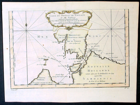
1758 Bellin Original Antique Map of Novaya Zemlya Nenets, Russia Willem Barentsz
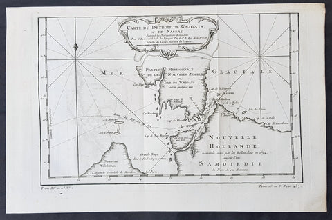
- Title : Carte Du Détroit De Weigats ou De Nassau, suivant les Navigateurs Hollandois Pour l Histoire Générale des Voyages.1758
- Size: 14 1/2in x 9 1/2in (370mm x 240mm)
- Ref #: 60965
- Date : 1758
- Condition: (A+) Fine Condition
Description:
This fine original copper-plate engraved antique map of Russian Island of Novaya Zemlya, with the Kara Straits and parts of the Russian northern mainland region of Nenets - here named New Holland by the Dutch explorer Willem Barentsz - by Jacques Nicolas Bellin was engraved in 1758 - dated - and was published in Antoine François Prevosts 15 volumes of Histoire Generale des Voyageswritten by Prevost & other authors between 1746-1790.
The map depicts the Détroit de Waeigats - currently the Kara Straits - that divides the island of Novaya Zemlya from the northern Russian mainland. Novaya Zemlya was also called \"Isle De Waeigats\" & the northern Russian coast was called \"Nouvelle Hollande\", by Willem Barentsz during the Dutch in a 1594 Arctic exploration.
Willem Barentsz 1550 – 1597 was a Dutch navigator, cartographer, and Arctic explorer. He went on three expeditions to the far north in search for a Northeast passage. During his third expedition, the crew was stranded on Novaya Zemlya for almost a year. Barentsz died on the return voyage in 1597. In the 19th century, the Barents Sea was named after him.
General Definitions:
Paper thickness and quality: - Heavy and stable
Paper color : - off white
Age of map color: -
Colors used: -
General color appearance: -
Paper size: - 14 1/2in x 9 1/2in (370mm x 240mm)
Plate size: - 12 1/2in x 8 1/2in (320mm x 215mm)
Margins: - Min 1/2in (12mm)
Imperfections:
Margins: - None
Plate area: - Folds as issued
Verso: - None
Background:
One of Antoine Francois Prevosts monumental undertakings was his history of exploration & discovery in 15 volumes titledHistoire Générale des Voyages written between 1746-1759 and was extended to 20 volumes after his death by various authors.
The 20 volumes cover the early explorations & discoveries on 3 continents: Africa (v. 1-5), Asia (v. 5-11), and America (v. 12-15) with material on the finding of the French, English, Dutch, and Portugese.
A number of notable cartographers and engravers contributed to the copper plate maps and views to the 20 volumes including Nicolas Bellin, Jan Schley, Chedel, Franc Aveline, Fessard, and many others.
The African volumes cover primarily coastal countries of West, Southern, and Eastern Africa, plus the Congo, Madagascar, Arabia and the Persian Gulf areas.
The Asian volumes cover China, Korea, Tibet, Japan, Philippines, and countries bordering the Indian Ocean.
Volume 11 includes Australia and Antarctica.
Volumes 12-15 cover voyages and discoveries in America, including the East Indies, South, Central and North America.
Volumes 16-20 include supplement volumes & tables along with continuation of voyages and discoveries in Russia, Northern Europe, America, Asia & Australia.
1758 Bellin Original Antique Map of Novaya Zemlya Nenets, Russia Willem Barentsz
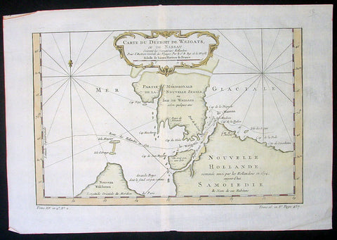
- Title : Carte Du Détroit De Weigats ou De Nassau, suivant les Navigateurs Hollandois Pour l Histoire Générale des Voyages.1758
- Size: 15in x 10in (380mm x 255mm)
- Ref #: 23311
- Date : 1758
- Condition: (A+) Fine Condition
Description:
This fine original copper-plate engraved antique map of Russian Island of Novaya Zemlya, with the Kara Straits and parts of the Russian northern mainland region of Nenets - here named New Holland by the Dutch explorer Willem Barentsz - by Jacques Nicolas Bellin was engraved in 1758 - dated - and was published in Antoine François Prevosts 15 volumes of Histoire Generale des Voyageswritten by Prevost & other authors between 1746-1790.
The map depicts the Détroit de Waeigats - currently the Kara Straits - that divides the island of Novaya Zemlya from the northern Russian mainland. Novaya Zemlya was also called \"Isle De Waeigats\" & the northern Russian coast was called \"Nouvelle Hollande\", by Willem Barentsz during the Dutch in a 1594 Arctic exploration.
Willem Barentsz 1550 – 1597 was a Dutch navigator, cartographer, and Arctic explorer. He went on three expeditions to the far north in search for a Northeast passage. During his third expedition, the crew was stranded on Novaya Zemlya for almost a year. Barentsz died on the return voyage in 1597. In the 19th century, the Barents Sea was named after him.
General Definitions:
Paper thickness and quality: - Heavy and stable
Paper color : - off white
Age of map color: - Early
Colors used: - Yellow, green, pink
General color appearance: - Authentic
Paper size: - 15in x 10in (380mm x 255mm)
Plate size: - 12 1/2in x 8 1/2in (320mm x 215mm)
Margins: - Min 1/2in (12mm)
Imperfections:
Margins: - None
Plate area: - Folds as issued
Verso: - None
Background:
One of Antoine Francois Prevosts monumental undertakings was his history of exploration & discovery in 15 volumes titledHistoire Générale des Voyages written between 1746-1759 and was extended to 20 volumes after his death by various authors.
The 20 volumes cover the early explorations & discoveries on 3 continents: Africa (v. 1-5), Asia (v. 5-11), and America (v. 12-15) with material on the finding of the French, English, Dutch, and Portugese.
A number of notable cartographers and engravers contributed to the copper plate maps and views to the 20 volumes including Nicolas Bellin, Jan Schley, Chedel, Franc Aveline, Fessard, and many others.
The African volumes cover primarily coastal countries of West, Southern, and Eastern Africa, plus the Congo, Madagascar, Arabia and the Persian Gulf areas.
The Asian volumes cover China, Korea, Tibet, Japan, Philippines, and countries bordering the Indian Ocean.
Volume 11 includes Australia and Antarctica.
Volumes 12-15 cover voyages and discoveries in America, including the East Indies, South, Central and North America.
Volumes 16-20 include supplement volumes & tables along with continuation of voyages and discoveries in Russia, Northern Europe, America, Asia & Australia.
1758 Nicolas Bellin Original Antique Map of Russia The Island of Novaya Zemlya
- Title : Partie De La Mer Glaciale Contenant La Nouvelle Zemle...M. Bellin...1758
- Ref #: 25638
- Size: 15 1/2in x 10in (380mm x 260mm)
- Date : 1758
- Condition: (A+) Fine Condition
Description:
This fine, original copper-plate engraved antique map of the Russian Island of Novaya Zemlya by Jacques Nicolas Bellin in 1758 was published in Antoine François Prevosts 15 volumes of Histoire Generale des Voyageswritten by Prevost & other authors between 1746-1790.
Novaya Zemlya also known as Nova Zembla (especially in Dutch), is an archipelago in the Arctic Ocean in northern Russia and the extreme northeast of Europe, the easternmost point of Europe lying at Cape Flissingsky on the Northern island. Novaya Zemlya is composed of two islands, the northern Severny Island and the southern Yuzhny Island, which are separated by Matochkin Strait.
The Russians knew of Novaya Zemlya from the 11th century, when hunters from Novgorod visited the area. For western Europeans, the search for the Northern Sea Route in the 16th century led to its exploration. The first visit from a west European was by Hugh Willoughby in 1553, and he met Russian ships from the already established hunting trade. Dutch explorer Willem Barentsz reached the west coast of Novaya Zemlya in 1594, and in a subsequent expedition of 1596 rounded the Northern point and wintered on the Northeast coast. (Barentsz died during the expedition, and may have been buried on the Northern island.) During a later voyage by Fyodor Litke in 1821–1824, the west coast was mapped. Henry Hudson was another explorer who passed through Novaya Zemlya while searching for the Northeast Passage.
General Definitions:
Paper thickness and quality: - Heavy and stable
Paper color : - off white
Age of map color: - Early
Colors used: - Green, yellow, red
General color appearance: - Authentic
Paper size: - 15 1/2in x 10in (395mm x 255mm)
Plate size: - 14in x 9in (355mm x 230mm)
Margins: - Min 1/2in (6mm)
Imperfections:
Margins: - None
Plate area: - Folds as issued
Verso: - None
Background:
One of Antoine Francois Prevosts monumental undertakings was his history of exploration & discovery in 15 volumes titledHistoire Générale des Voyages written between 1746-1759 and was extended to 20 volumes after his death by various authors.
The 20 volumes cover the early explorations & discoveries on 3 continents: Africa (v. 1-5), Asia (v. 5-11), and America (v. 12-15) with material on the finding of the French, English, Dutch, and Portugese.
A number of notable cartographers and engravers contributed to the copper plate maps and views to the 20 volumes including Nicolas Bellin, Jan Schley, Chedel, Franc Aveline, Fessard, and many others.
The African volumes cover primarily coastal countries of West, Southern, and Eastern Africa, plus the Congo, Madagascar, Arabia and the Persian Gulf areas.
The Asian volumes cover China, Korea, Tibet, Japan, Philippines, and countries bordering the Indian Ocean.
Volume 11 includes Australia and Antarctica.
Volumes 12-15 cover voyages and discoveries in America, including the East Indies, South, Central and North America.
Volumes 16-20 include supplement volumes & tables along with continuation of voyages and discoveries in Russia, Northern Europe, America, Asia & Australia.
1758 Bellin Original Antique Map of Novaya Zemlya Nenets, Russia Willem Barentsz
- Title : Carte Du Détroit De Weigats ou De Nassau, suivant les Navigateurs Hollandois Pour l Histoire Générale des Voyages.1758
- Size: 15in x 10in (380mm x 255mm)
- Ref #: 25639
- Date : 1758
- Condition: (A+) Fine Condition
Description:
This fine original copper-plate engraved antique map of Russian Island of Novaya Zemlya, with the Kara Straits and parts of the Russian northern mainland region of Nenets - here named New Holland by the Dutch explorer Willem Barentsz - by Jacques Nicolas Bellin was engraved in 1758 - dated - and was published in Antoine François Prevosts 15 volumes of Histoire Generale des Voyageswritten by Prevost & other authors between 1746-1790.
The map depicts the Détroit de Waeigats - currently the Kara Straits - that divides the island of Novaya Zemlya from the northern Russian mainland. Novaya Zemlya was also called \"Isle De Waeigats\" & the northern Russian coast was called \"Nouvelle Hollande\", by Willem Barentsz during the Dutch in a 1594 Arctic exploration.
Willem Barentsz 1550 – 1597 was a Dutch navigator, cartographer, and Arctic explorer. He went on three expeditions to the far north in search for a Northeast passage. During his third expedition, the crew was stranded on Novaya Zemlya for almost a year. Barentsz died on the return voyage in 1597. In the 19th century, the Barents Sea was named after him.
General Definitions:
Paper thickness and quality: - Heavy and stable
Paper color : - off white
Age of map color: - Early
Colors used: - Yellow, green, pink
General color appearance: - Authentic
Paper size: - 15in x 10in (380mm x 255mm)
Plate size: - 12 1/2in x 8 1/2in (320mm x 215mm)
Margins: - Min 1/2in (12mm)
Imperfections:
Margins: - None
Plate area: - Folds as issued
Verso: - None
Background:
One of Antoine Francois Prevosts monumental undertakings was his history of exploration & discovery in 15 volumes titledHistoire Générale des Voyages written between 1746-1759 and was extended to 20 volumes after his death by various authors.
The 20 volumes cover the early explorations & discoveries on 3 continents: Africa (v. 1-5), Asia (v. 5-11), and America (v. 12-15) with material on the finding of the French, English, Dutch, and Portugese.
A number of notable cartographers and engravers contributed to the copper plate maps and views to the 20 volumes including Nicolas Bellin, Jan Schley, Chedel, Franc Aveline, Fessard, and many others.
The African volumes cover primarily coastal countries of West, Southern, and Eastern Africa, plus the Congo, Madagascar, Arabia and the Persian Gulf areas.
The Asian volumes cover China, Korea, Tibet, Japan, Philippines, and countries bordering the Indian Ocean.
Volume 11 includes Australia and Antarctica.
Volumes 12-15 cover voyages and discoveries in America, including the East Indies, South, Central and North America.
Volumes 16-20 include supplement volumes & tables along with continuation of voyages and discoveries in Russia, Northern Europe, America, Asia & Australia.
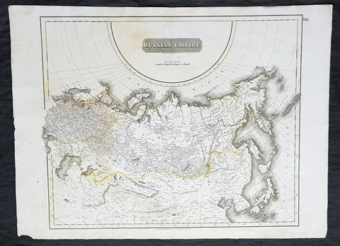
1814 John Thomson Large Antique Map of The Russian Empire
- Title : Russian Empire ...John Thomson....1814
- Size: 28 1/2in x 21in (720mm x 530mm)
- Condition: (A) Very Good Condition
- Date : 1814
- Ref #: 31910
Description:
This large beautifully hand coloured original antique map of The Russian Empire by John Thomson in 1814 - dated at the foot of the map - was published in the large 1817 edition of A New General Atlas of the World. (Ref Tooley M&B)
General Definitions:
Paper thickness and quality: - Heavy and stable
Paper color : - off white
Age of map color: - Original
Colors used: - Yellow, Green, pink
General color appearance: - Light
Paper size: - 28 1/2in x 21in (720mm x 530mm)
Plate size: - 24in x 20in (610mm x 510mm)
Margins: - Min 1in (25mm)
Imperfections:
Margins: - None
Plate area: - None
Verso: - Light soiling
Background:
It is scarcely necessary to look at a map of Russia - with which we must include Siberia - to visualize the daunting task facing Russian map makers. Indeed, considering the vastness of their territory and the lack of skilled cartographers, it is surprising that relatively good maps were available for engraving and printing in most of the well known sixteenth and seventeenth century atlases. Generally, maps of that time were based on material brought back from Moscow by visitors from the West.
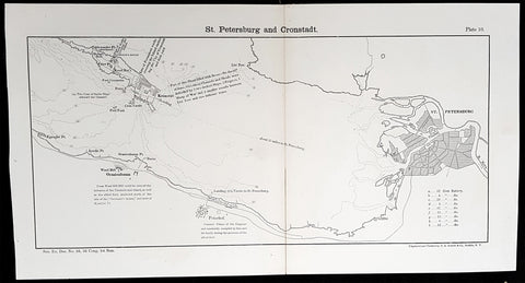
1856 Capt. Richard Delafield Antique Map of St Petersburg & Kronstadt Russia
Antique Map
- Title : St Petersburg and Cronstadt
- Ref #: 90174
- Size: 15 1/2in x 8 1/2in (385mm x 215mm)
- Date : 1856
- Condition: (A) Very Good Condition
Description:
This large original lithograph map of St Petersburg & Kronstadt Russia - during the Crimea War - was engraved by John T Bowen & co. of Philadelphia and was published in the 1856 edition of Captain Richard Delafields Report on the Art of War in Europe in 1854, 1855, and 1856.
In early 1855, Captain Richard Delafield was appointed by the Secretary of War, Jefferson Davis, a head of the board of officers, later called The Delafield Commission, and sent to Europe to study the European military. The board included Captain George B. McClellan and Major Alfred Mordecai. They inspected the state of the military in Great Britain, Germany, the Austrian Empire, France, Belgium, and Russia, and served as military observers during the Crimean War. After his return in April 1856, Delafield submitted a report which was later published as a book by Congress, Report on the Art of War in Europe in 1854, 1855, and 1856. The book was suppressed during the American Civil War due to fears that it would be instructive to Confederate engineers as it contained multiple drawings and descriptions of military fortifications.
Background:
Kronstadt was founded by Peter the Great, whose Imperial Russian forces took the island of Kotlin from the Swedes during the Great Northern War in 1703. The first fortifications were inaugurated on 18 May 1704. These fortifications, known as Kronshlot (Кроншлот), were constructed very quickly. During the winter the Gulf of Finland freezes over completely. Under the command of Governor-general Alexander Danilovich Menshikov, workers used thousands of frames (caissons) made of logs from evergreen trees filled with stones which were moved by horses across the frozen sea, and placed in cuttings made in the ice. Thus, several new small islands were created, and forts were erected on them, virtually closing access to Saint-Petersburg by sea. Only two narrow navigable channels remained, with forts guarding them.
One of the first governors of Kronstadt was a veteran of the Royal Scots Navy, Admiral Thomas Gordon who was a refugee in Russia from the Scottish union with England and became chief commander of the port of Kronstadt from 1727 to 1741.
Just as Kronstadt became populated and fortified, it attracted merchants from maritime powers most notably, the Dutch, the British and the Germans through the old Hanse connections. The community of British merchants or factors came to be known as the English Factory, despite the fact that many of them were Scots. They settled both in Kronstadt and in St Petersburg itself and for a time dominated both inward and outward trade, especially in the reign of Catherine the Great. They became an integral part of British trade and foreign policy through the Board of Trade in London. A number of the British settlers became naturalised Russians. Trading alliances were sharply interrupted by the outbreak of the Crimean War (1854).
Kronstadt was thoroughly refortified in the 19th century. The old three-decker forts, five in number, which formerly constituted the principal defences and had resisted the Anglo-French fleets during the Crimean War, became of secondary importance. From the plans of Eduard Totleben a new fort, Constantine, and four batteries were constructed (1856–1871) to defend the principal approach, and seven batteries to cover the shallower northern channel. All these fortifications were low and thickly armoured earthworks with heavy Krupp guns on their ramparts. The city is surrounded by an enceinte.
In summer 1891, the French fleet was officially received in Kronstadt. It was a first step towards the forthcoming Franco-Russian Alliance.
General Definitions:
Paper thickness and quality: - Light and stable
Paper color : - off white
Age of map color: -
Colors used: -
General color appearance: -
Paper size: - 15 1/2in x 8 1/2in (385mm x 215mm)
Plate size: - 15 1/2in x 8 1/2in (385mm x 215mm)
Margins: - Min 1/2in (12mm)
Imperfections:
Margins: - None
Plate area: - Llight age toning along folds as issued
Verso: - Folds re-enforced with archival tape
Delafield, Richard Major General 1798 - 1873
Delafield was a United States Army officer for 52 years. He served as superintendent of the United States Military Academy for 12 years. At the start of the American Civil War, then Colonel Delafield helped equip and send volunteers from New York to the Union Army. He also was in command of defences around New York harbor from 1861 to April 1864. On April 22, 1864, he was promoted to Brigadier General in the Regular Army of the United States and Chief of Engineers. On March 8, 1866, President Andrew Johnson nominated Delafield for appointment to the grade of brevet major general in the Regular Army, to rank from March 13, 1865, and the United States Senate confirmed the appointment on May 4, 1866, reconfirmed due to a technicality on July 14, 1866. He retired from the US Army on August 8, 1866. He later served on two commissions relating to improvements to Boston Harbor and to lighthouses. He also served as a regent of the Smithsonian Institution.
Delafield served as assistant engineer in the construction of Hampton Roads defences from 1819–1824 and was in charge of fortifications and surveys in the Mississippi River delta area in 1824-1832. While superintendent of repair work on the Cumberland Road east of the Ohio River, he designed and built Dunlaps Creek Bridge in Brownsville, Pennsylvania, the first cast-iron tubular-arch bridge in the United States. Commissioned a major of engineers in July 1838, he was appointed superintendent of the Military Academy after the fire of 1838 and served till 1845. He designed the new buildings and the new cadet uniform that first displayed the castle insignia. He superintended the construction of coast defences for New York Harbor from 1846 to 1855.
In the beginning of 1855, Delafield was appointed by the Secretary of War, Jefferson Davis a head of the board of officers, later called The Delafield Commission, and sent to Europe to study the European military. The board included Captain George B. McClellan and Major Alfred Mordecai. They inspected the state of the military in Great Britain, Germany, the Austrian Empire, France, Belgium, and Russia, and served as military observers during the Crimean War. After his return in April 1856, Delafield submitted a report which was later published as a book by Congress, Report on the Art of War in Europe in 1854, 1855, and 1856. The book was suppressed during the American Civil War due to fears that it would be instructive to Confederate engineers as it contained multiple drawings and descriptions of military fortifications.
Delafield served as superintendent of the Military Academy again in 1856-1861. In January 1861, he was succeeded by Captain Pierre G. T. Beauregard, who was dismissed shortly after Beauregards home state of Louisiana seceded from the Union, and Delafield returned as superintendent serving until March 1, 1861. In the beginning of the Civil War he advised the governor of New York Edwin D. Morgan during the volunteer force creation. Then, in 1861–1864, he was put in charge of New York Harbor defences, including Governors Island and Fort at Sandy Hook. On May 19, 1864, he was commissioned a brigadier-general after replacing Joseph Gilbert Totten, who had died, as the Chief of Engineers, United States Army Corps of Engineers, on April 22, 1864. He stayed in charge of the Bureau of Engineers of the War Department until his retirement on August 8, 1866. On March 8, 1866, President Andrew Johnson nominated Delafield for appointment to the grade of brevet major general in the Regular Army of the United States, to rank from March 13, 1865, and the United States Senate confirmed the appointment on May 4, 1866 and reconfirmed it due to a technicality on July 14, 1866.After retirement Delafield served as a regent of the Smithsonian Institution and a member of the Lighthouse Board. He died in Washington, D.C. on November 5, 1873.
1780 Bonne Original Antique Map of Scandinavia, Baltic States & European Russia
- Title : Le Nord De L Europe contenant Le Danemark La Norwege, La Suede et la Laponie avec la Majeure Partie de la Russie Europeenne Par M Bonne
- Size: 16in x 11in (405mm x 2805mm)
- Ref #: 31671
- Date : 1780
- Condition: (A+) Fine Condition
Description:
This fine original copper-plate engraved antique map of Scandinavia, The Baltic States & European Russia was published in 1780 edition of Atlas des toutes les parties connues du globe terrestre by Rigobert Bonne & Guillaume Raynal.
General Definitions:
Paper thickness and quality: - Heavy and stable
Paper color : - off white
Age of map color: -
Colors used: -
General color appearance: -
Paper size: - 16in x 11in (405mm x 2805mm)
Plate size: - 14in x 10in (355mm x 255mm)
Margins: - Min 1/2in (12mm)
Imperfections:
Margins: - None
Plate area: - None
Verso: - None
1780 Rigobert Bonne Original Antique Map of Eastern Russia, China
- Title : L Empire de Russie en Europe et an Asie...M Bonne
- Size: 15in x 10in (380mm x 255mm)
- Ref #: 40528
- Date : 1780
- Condition: (A+) Fine Condition
Description:
This original copper-plate engraved map was published in 1780 edition of Atllas des toutes les parties connues du globe terrestre by Rigobert Bonne & Guillaume Raynal.
General Definitions:
Paper thickness and quality: - Heavy and stable
Paper color : - off white
Age of map color: -
Colors used: -
General color appearance: -
Paper size: - 15in x 10in (380mm x 255mm)
Plate size: - 13in x 9in (330mm x 230mm)
Margins: - Min 1in (25mm)
Imperfections:
Margins: - None
Plate area: - None
Verso: - None
1780 Rigobert Bonne Original Antique Map of Western, European Russia, Poland
- Title : L Empire de Russie en Europe et an Asie...M Bonne
- Size: 15in x 10in (380mm x 255mm)
- Ref #: 40527
- Date : 1780
- Condition: (A+) Fine Condition
Description:
This original copper-plate engraved map was published in 1780 edition of Atllas des toutes les parties connues du globe terrestre by Rigobert Bonne & Guillaume Raynal.
General Definitions:
Paper thickness and quality: - Heavy and stable
Paper color : - off white
Age of map color: -
Colors used: -
General color appearance: -
Paper size: - 15in x 10in (380mm x 255mm)
Plate size: - 13in x 9in (330mm x 230mm)
Margins: - Min 1in (25mm)
Imperfections:
Margins: - None
Plate area: - None
Verso: - None
1853 - 1857 Elephant Folio Album w/ 328 Antique Maps & Prints of The Crimea War - Unique
Antique Map
- Title : Crimean War Maps, Prints & Views
- Date : 1853 - 57
- Size: 24in x 18in (610mm x 455mm) Elephant Folio
- Condition: (A) Very Good Condition
- Ref: 35600
Description:
This is a unique and very comprehensive visual record of the Crimean War (1853 - 1856 & 57) in a huge Elephant Folio Album.
The album consists of 163 double pages with 328 original maps, prints and views of the War tipped in chronological order. These are mainly from the Illustrated London News, from the Wars beginning in 1853 to its end in 1856 through to the Coronation of Alexander II in 1857 and some of the first recipients of the Victoria Cross.
My impression is that the album was professionally organised and assembled possibly by a political or historical organisation of the time, in the mid 19th century.
This album is extremely large measuring 28 inches x 18 inches (62cm x 46cm) when closed and weighs approx. 14 Kg.
The Album contains; (in more detail directly below)
- 71 views of various battles during the conflict.
- 94 Portraits & prints of the leaders, generals, & personnel who were in charge and soldiers, sailors who participated in the war.
- 47 views of various cities and towns from the participating countries England, Russia, Crimea, Turkey etc.
- 63 prints of naval fleets, battleships, sea battles, landings & evacuations..
- 15 Maps of various regions and conflicts
- 25 victory scenes in Britain
- 39 prints of portraits and views of the Coronation of Alexander II
- 4 Pages of recipients from both Army & Navy, of the first Victoria Cross.
Battle Views (Battle of Kars, Kinburn, Sebastopol, Malakoff, Tchernaya, Sveaborg, Gheisk, Hango-Head, Narva, Balaclava, Inkerman, Charge of Light Cavalry Balaclava, Alma, Odessa, Crondstat, Citate, Oltenitza, Kalafat)
Prints of leaders, generals and soldiers (British, Russian, Turkish, Greek, French, Austrian, Peace Talks Paris, Congress of Vienna, Allied Naval Command, Marshall Pelissier, Wounded, Hospitals, Sir De Lacy Evans, Nicolas Emperor of Russia, Royal Marines, Lord Raglan, Napoleon III, Commanders of Allied Armies in the East, Sultan of Turkey, Marshal St Arnaud, French Cavalry, French Infantry, British Infantry, British Navy, Sir Charles Napier, Rear Admiral Corry, & Plumridge, British Cavalry & Artillery Officers, Scots Guards, Royal marines, British Cavalry, Coldstream Guards, Grenadier Guards, Omer Pacha, General Prim)
Views of cities & towns (Balaclava, Kars, Sebastopol, Sveaborg, Helsingborg, Kiel, Copenhagen, Crondstat, St Petersberg, Kerch, Inkermann, Eupatoria, Alma, Coast of Crimea, Varna Bay, Odessa and Coast, Constantinople, Oltenitza, Sinope)
Fleets, battleships & sea battles (HMS Wellington, Steamers, British Fleet, Baltic Fleet, Gun Boats, Nystad, Sebastopol, Spithead, Portsmouth, Flying Squadron, Trafalgar and Resolution, landing French Troops at Gallipoli, Duke of Wellingtons Flagship, Turkish Fleet in Biospheres, English & French Fleet in Besika Bay, HMS Neptune)
Maps (Crimea & Black Sea region, Russia-Turkey, Constantinople, Austria-Russia, Spithead review of Fleet, Sea of Azoff, Kerch, River Alma to Balaklava, Plan of Sebastopol, Seat of War in the Crimea, Sebastopol & Balaklava, Picturesque map of the seat of war, Battle of Alma, The Ottoman Empire)
Florence Nightingale (Treating wounded, visiting wounded Balaclava)
Victory Scenes in England (illuminations, Parades, Queen, Brighton, Hyde Park, Awarding Medals, The Guards, Fireworks, Landing in Kalamita Bay)
The Album is huge Elephant Folio measuring 24in x 18in (610mm x 455mm) and weighing about 13kg (29lbs) The contemporary half morocco boards are worn, rubbed and detached from the internals that on the whole are clean and tight with occasional spotting and repairs with no loss.
Also included with the album is the following loose prints, maps and newspaper clippings;
- 47 prints and views from ILN on the British Expedition into Abyssinia in 1868.
- 39 prints, views and maps from the ILN and The Graphic on the 1882 Anglo-Egyptian War.
- 60 Newspaper clipping from 1882 of The Times, Evening Standard, Daily News and other papers again on the Anglo Egyptian War.
General Definitions:
Paper thickness and quality: - Heavy and stable.
Paper color : - off white
Age of map color: -
Colors used: -
General color appearance: -
Paper size: - 24in x 18in (610mm x 455mm) each
Plate size: - 24in x 18in (610mm x 455mm) each
Margins: - Min 1in (25mm)
Imperfections:
External Boards: - Worn, slit spine, scuffing detached from internals
Internal pages: - Overall clean, some spotting, light offsetting to some pages, several small repairs without loss
Background: The Crimean War was fought from October 1853 to February 1856 between the Russian Empire and an ultimately victorious alliance of the Ottoman Empire, France, the United Kingdom, and Sardinia-Piedmont.
Geopolitical causes of the war included the decline of the Ottoman Empire (the "Eastern Question"), the expansion of the Russian Empire in the preceding Russo-Turkish Wars, and the British and French preference to preserve the Ottoman Empire to maintain the balance of power in the Concert of Europe. The flashpoint was a disagreement over the rights of Christian minorities in Palestine, then part of the Ottoman Empire, with the French promoting the rights of Roman Catholics, and Russia promoting those of the Eastern Orthodox Church.
The churches worked out their differences with the Ottomans and came to an agreement, but both the French Emperor Napoleon III and the Russian Tsar Nicholas I refused to back down. Nicholas issued an ultimatum that demanded the Orthodox subjects of the Ottoman Empire be placed under his protection. Britain attempted to mediate and arranged a compromise to which Nicholas agreed. When the Ottomans demanded changes to the agreement, Nicholas recanted and prepared for war.
In July 1853, Russian troops occupied the Danubian Principalities (now part of Romania but then under Ottoman suzerainty). On 16 October 1853, having obtained promises of support from France and Britain, the Ottomans declared war on Russia. Led by Omar Pasha, the Ottomans fought a strong defensive campaign and stopped the Russian advance at Silistra (now in Bulgaria). A separate action on the fort town of Kars, in the Ottoman Empire, led to a siege, and an Ottoman attempt to reinforce the garrison was destroyed by a Russian fleet at the Battle of Sinop in November 1853.
Fearing the growth of influence of the Russian Empire, the British and French fleets entered the Black Sea in January 1854. They moved north to Varna in June 1854 and arrived just in time for the Russians to abandon Silistra. In the Baltic, near the Russian capital of Saint Petersburg, an Anglo-French fleet instituted a naval blockade and bottled up the outnumbered Russian Baltic Fleet, causing economic damage to Russia by blockading trade while also forcing the Russians to keep a large army guarding St. Petersburg from a potential allied attack.
After a minor skirmish at Köstence (now Constanța), the allied commanders decided to attack Russia's main naval base in the Black Sea, Sevastopol, in Crimea. After extended preparations, allied forces landed on the peninsula in September 1854 and marched their way to a point south of Sevastopol after they had won the Battle of the Alma on 20 September 1854. The Russians counterattacked on 25 October in what became the Battle of Balaclava and were repulsed, but the British Army's forces were seriously depleted as a result. A second Russian counterattack at Inkerman ended in a stalemate.
By 1855, the Italian Kingdom of Sardinia sent an expeditionary force to Crimea, siding with France, Britain and the Ottoman Empire. The front settled into the Siege of Sevastopol, involving brutal conditions for troops on both sides. Smaller military actions took place in the Caucasus (1853–1855), the White Sea (July–August 1854) and the North Pacific (1854–1855).
Sevastopol finally fell after eleven months, after the French assaulted Fort Malakoff. Isolated and facing a bleak prospect of invasion by the West if the war continued, Russia sued for peace in March 1856. France and Britain welcomed the development, owing to the conflict's domestic unpopularity. The Treaty of Paris, signed on 30 March 1856, ended the war. It forbade Russia to base warships in the Black Sea. The Ottoman vassal states of Wallachia and Moldavia became largely independent. Christians in the Ottoman Empire gained a degree of official equality, and the Orthodox Church regained control of the Christian churches in dispute.
The Crimean War was one of the first conflicts in which military forces used modern technologies such as explosive naval shells, railways and telegraphs. The war was also one of the first to be documented extensively in written reports and in photographs. The war quickly became a symbol of logistical, medical and tactical failures and of mismanagement. The reaction in Britain led to a demand for the professionalisation of medicine, most famously achieved by Florence Nightingale, who gained worldwide attention for pioneering modern nursing while she treated the wounded.
The Crimean War marked a turning point for the Russian Empire. The war weakened the Imperial Russian Army, drained the treasury and undermined Russia's influence in Europe. The empire would take decades to recover. Russia's humiliation forced its educated elites to identify its problems and recognise the need for fundamental reforms. They saw rapid modernisation as the sole way to recover the empire's status as a European power. The war thus became a catalyst for reforms of Russia's social institutions, including the abolition of serfdom and overhauls in the justice system, local self-government, education and military service. (Ref: Tooley; M&B)
The Illustrated London News (ILN)
In 1842, Herbert Ingram, a young printer and newsagent from Nottingham, arrived in London. As a newsagent he noticed that when on the rare occasions that newspapers included woodcuts, their sales increased. He therefore came to the conclusion that it would be possible to make a good profit from a magazine that included a large number of illustrations.
Herbert Ingram discussed the proposal with his friend, Mark Lemon, the editor of Punch magazine. With Lemon as his chief adviser, the first edition of the Illustrated London News appeared on 14th May 1842. Costing sixpence, the magazine had sixteen pages and thirty-two woodcuts. The first edition included pictures of the war in Afghanistan, a train crash in France, a steamboat explosion in Canada and a fancy dress ball at Buckingham Palace.
Ingram was a staunch Liberal who favored social reform. He announced in the London Illustrated News that the concern of the magazine would be \\\"with the English poor\\\" and the \\\"three essential elements of discussion with us will be the poor laws, the factory laws, and the working of the mining system\\\". Later Herbert Ingram was to become MP for Boston and until his death in 1860 continued his campaign for social reform in the House of Commons.
The London Illustrated News was an immediate success and the first edition sold 26,000 copies. Within a few months it was selling over 65,000 copies a week. Special events were important to the success of the London Illustrated News. The magazine did very well during the Exhibition 1851 and over 150,000 copies were sold of the edition that reported the funeral of the Duke of Wellington. The Crimean War caused a further boast to sales and by 1863 it was selling over 300,000 copies a week. This was far higher than other journals. For example, newspapers such as the Daily News only sold 6,000 copies at this time, and even the largest selling newspaper, The Times only sold 70,000 copies. In the Christmas Number of The Illustrated London News, 1855, the first pictures in color were published.
In the year 1879, The ILLUSTRATED LONDON NEWS claimed to be the fastest woodcut-printing establishment in the world. The Ingram Rotary machine had been invented. It printed both sides of the paper at once and turned out 6,500 copies per hour. It required only four men to operate it, whereas thirty men and five machines were needed previously
 The ILN held a commanding position in the market place. It was seriously challenged by The GRAPHIC in 1870. Although it never reached the circulation of the ILN. it did take a good market share until the turn of the century.
Please note all items auctioned are genuine, we do not sell reproductions. A Certificate of Authenticity (COA) can be issued on request.

