Welcome to Classical Images!
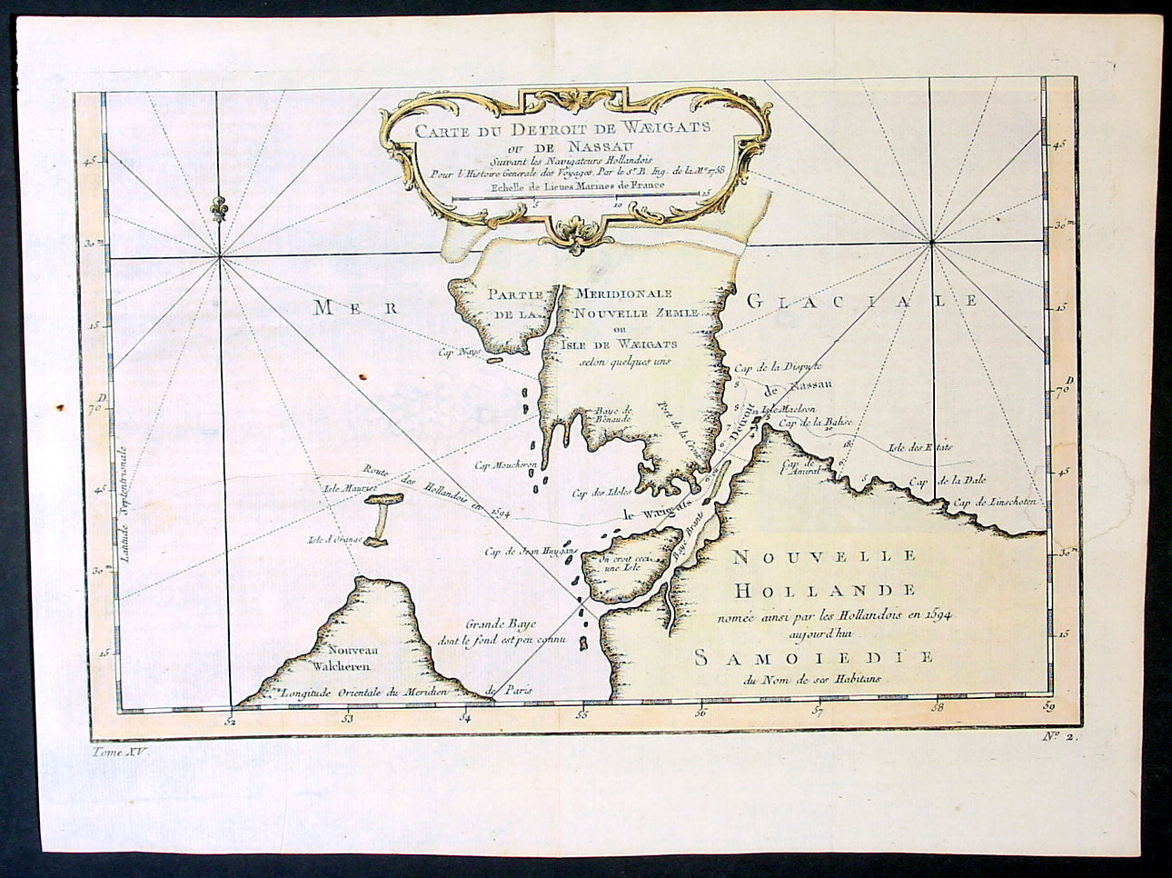
Description:This fine original copper-plate engraved antique map of Russian Island of Novaya Zemlya, with the Kara Straits and parts of the Russian northern mainland region of Nenets - here named New Holland by the Dutch explorer Willem Barentsz - by Jacques Nicolas Bellin was engraved in 1758 - dated - and was published in Antoine François Prevosts 15 volumes of Histoire Generale des Voyageswritten by Prevost & other authors between 1746-1790.The map depicts the Détroit de Waeigats - currently the Kara Straits - that divides the island of Novaya Zemlya from the northern Russian mainland. Novaya Zemlya was also called \"Isle De Waeigats\" & the northern Russian coast was called \"Nouvelle Hollande\", by Willem Barentsz during the Dutch in a 1594 Arctic exploration.Willem Barentsz 1550 – 1597 was a Dutch navigator, cartographer, and Arctic explorer. He went on three expeditions to the far north in search for a Northeast passage. During his third expedition, the crew was stranded on Novaya Zemlya for almost a year. Barentsz died on the return voyage in 1597. In the 19th century, the Barents Sea was named after him.
General Definitions:Paper thickness and quality: - Heavy and stablePaper color : - off whiteAge of map color: - EarlyColors used: - Yellow, green, pinkGeneral color appearance: - AuthenticPaper size: - 15in x 10in (380mm x 255mm)Plate size: - 12 1/2in x 8 1/2in (320mm x 215mm)Margins: - Min 1/2in (12mm)
Imperfections:Margins: - NonePlate area: - Folds as issuedVerso: - None
Background: One of Antoine Francois Prevosts monumental undertakings was his history of exploration & discovery in 15 volumes titledHistoire Générale des Voyages written between 1746-1759 and was extended to 20 volumes after his death by various authors.The 20 volumes cover the early explorations & discoveries on 3 continents: Africa (v. 1-5), Asia (v. 5-11), and America (v. 12-15) with material on the finding of the French, English, Dutch, and Portugese.A number of notable cartographers and engravers contributed to the copper plate maps and views to the 20 volumes including Nicolas Bellin, Jan Schley, Chedel, Franc Aveline, Fessard, and many others.The African volumes cover primarily coastal countries of West, Southern, and Eastern Africa, plus the Congo, Madagascar, Arabia and the Persian Gulf areas.The Asian volumes cover China, Korea, Tibet, Japan, Philippines, and countries bordering the Indian Ocean.Volume 11 includes Australia and Antarctica.Volumes 12-15 cover voyages and discoveries in America, including the East Indies, South, Central and North America.Volumes 16-20 include supplement volumes & tables along with continuation of voyages and discoveries in Russia, Northern Europe, America, Asia & Australia.