
Maps (3)
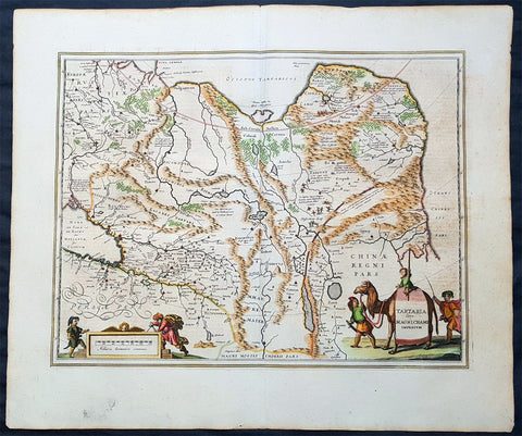
1652 Jan Jansson Antique Map of East & Central Asia, China to Russia - Tartary
Antique Map
- Title : Tartaria sive Magni Chami Imperium
- Date : 1652
- Size: 24in x 20in (610mm x 510mm)
- Ref #: 61166
- Condition: (A+) Fine Condition
Description:
This handsome beautifully hand coloured original antique map of huge region of east & central Asia from China, to Central Asia, The Caspian Sea & parts of European Russia was published by Jan Jansson in the 1652 French edition of Atlas Novus.
Background: This handsome map maps the whole of eastern Central Asia from the Caspian Sea to the Great Wall, Northern China and Manchuria.
This map is dated from a time when Tartaria vaguely meant those regions to the north of Persia, west of China & to the east of Russia. The name Siberia only began to be applied with the gradual eastward expansion of the Russian Cossacks into those areas hinted at in the accounts of Marco Polo from three centuries earlier.
The Mythical and legendary nature of the geography of this vast interior is emphasised by the inclusion of devils and dragons in the Desertum Lop to the left of the Great Wall.
The rest of the map is full of detail both real and myth, some of which is no doubt borrowed from the writings of Marco Polo considered at the time one of the foremost expert on China and Central Asia.
The newly discovered northern coastline of Nova Zembla is shown with a notation concerning the Dutch expedition led by Willem Barents in 1594-96. Interesting in Siberia, Ung quae Gog and Sumongul quae Mogog, which refers to the mythological lands of Gog and Magog. These lands, noted in the Bible as being situated in the remotest parts of the earth, were originally depicted on maps just north of Israel. The map extends west to include the Caspien Sea and Russia, but the primary focus of the map is Tartaria, Central Asia, China and Asiatic Russia. (Ref Tooley M&B)
General Description:
Paper thickness and quality: - Heavy and stable
Paper color: - off white
Age of map color: - Original
Colors used: - Green, red, orange, yellow, blue
General color appearance: - Authentic
Paper size: - 24in x 20in (610mm x 510mm)
Plate size: - 20in x 15 1/4in (510mm x 395mm)
Margins: - Min 1in (25mm)
Imperfections:
Margins: - None
Plate area: - None
Verso: - None
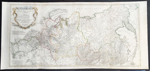
1762 D Anville Very Large Antique Map of Russia, Siberia, Mongolia, China, Japan
- Title : Troisieme Partie De La Carte D' Asia Contenant La Siberie...MDCCLII
- Ref #: 50604
- Size: 55in x 22 1/2in (1.25m x 570mm)
- Date : 1762
- Condition: (A+) Fine Condition
Description:
This very large beautifully engraved hand coloured original antique map of Russia, Siberia and Central Asia was engraved by Jean-Baptiste Bourguinon D'Anville in 1762 - the date is engraved in the title - and was published in the large elephant folio atlas Atlas Generale.
These maps are hard to find in such good condition and make fantastic historical reference tools due to the size and high level of detail as with all D'Anvilles work. (Ref: Tooley, M&B)
General Description:
Paper thickness and quality: - Heavy and stable
Paper color: - White
Age of map color: - Original
Colors used: - Yellow, pink, green
General color appearance: - Authentic
Paper size: - 55in x 22 1/2in (1.25m x 570mm)
Plate size: - 43in x 21in (1.10mm x 535mm)
Margins: - Min 1in (25mm)
Imperfections:
Margins: - None
Plate area: - Light creasing & soiling along L&R folds
Verso: - None
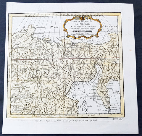
1758 Bellin Old, Antique Map of Eastern Siberia and the Kamchatka Peninsula Russia
- Title : Suite de la Carte de La Siberie et le Pays Kamtschatka
- Ref #: 60929
- Size: 11 3/4in x 11 3/4in (300mm x 300mm)
- Date : 1758
- Condition: (A+) Fine Condition
Description:
This fine, original copper-plate engraved antique map of Eastern Russia & Siberia including the Kamchatka Peninsular and south to northern China by Jacques Nicolas Bellin in 1750 was published in Antoine François Prevosts 15 volumes of Histoire Generale des Voyages written by Prevost & other authors between 1746-1790.
General Definitions:
Paper thickness and quality: - Heavy and stable
Paper color : - off white
Age of map color: - Early
Colors used: - Green, yellow, red
General color appearance: - Authentic
Paper size: - 12in x 12in (305mm x 305mm)
Plate size: - 10 1/2in x 9 1/2in (285mm x 245mm)
Margins: - Min 1/2in (6mm)
Imperfections:
Margins: - None
Plate area: - Folds as issued
Verso: - None
Background:
One of Antoine Francois Prevosts monumental undertakings was his history of exploration & discovery in 15 volumes titledHistoire Générale des Voyages written between 1746-1759 and was extended to 20 volumes after his death by various authors.
The 20 volumes cover the early explorations & discoveries on 3 continents: Africa (v. 1-5), Asia (v. 5-11), and America (v. 12-15) with material on the finding of the French, English, Dutch, and Portugese.
A number of notable cartographers and engravers contributed to the copper plate maps and views to the 20 volumes including Nicolas Bellin, Jan Schley, Chedel, Franc Aveline, Fessard, and many others.
The African volumes cover primarily coastal countries of West, Southern, and Eastern Africa, plus the Congo, Madagascar, Arabia and the Persian Gulf areas.
The Asian volumes cover China, Korea, Tibet, Japan, Philippines, and countries bordering the Indian Ocean.
Volume 11 includes Australia and Antarctica.
Volumes 12-15 cover voyages and discoveries in America, including the East Indies, South, Central and North America.
Volumes 16-20 include supplement volumes & tables along with continuation of voyages and discoveries in Russia, Northern Europe, America, Asia & Australia.


