Welcome to Classical Images!
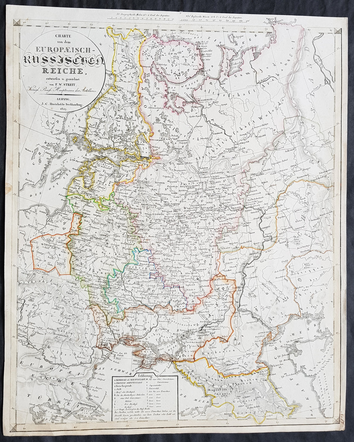
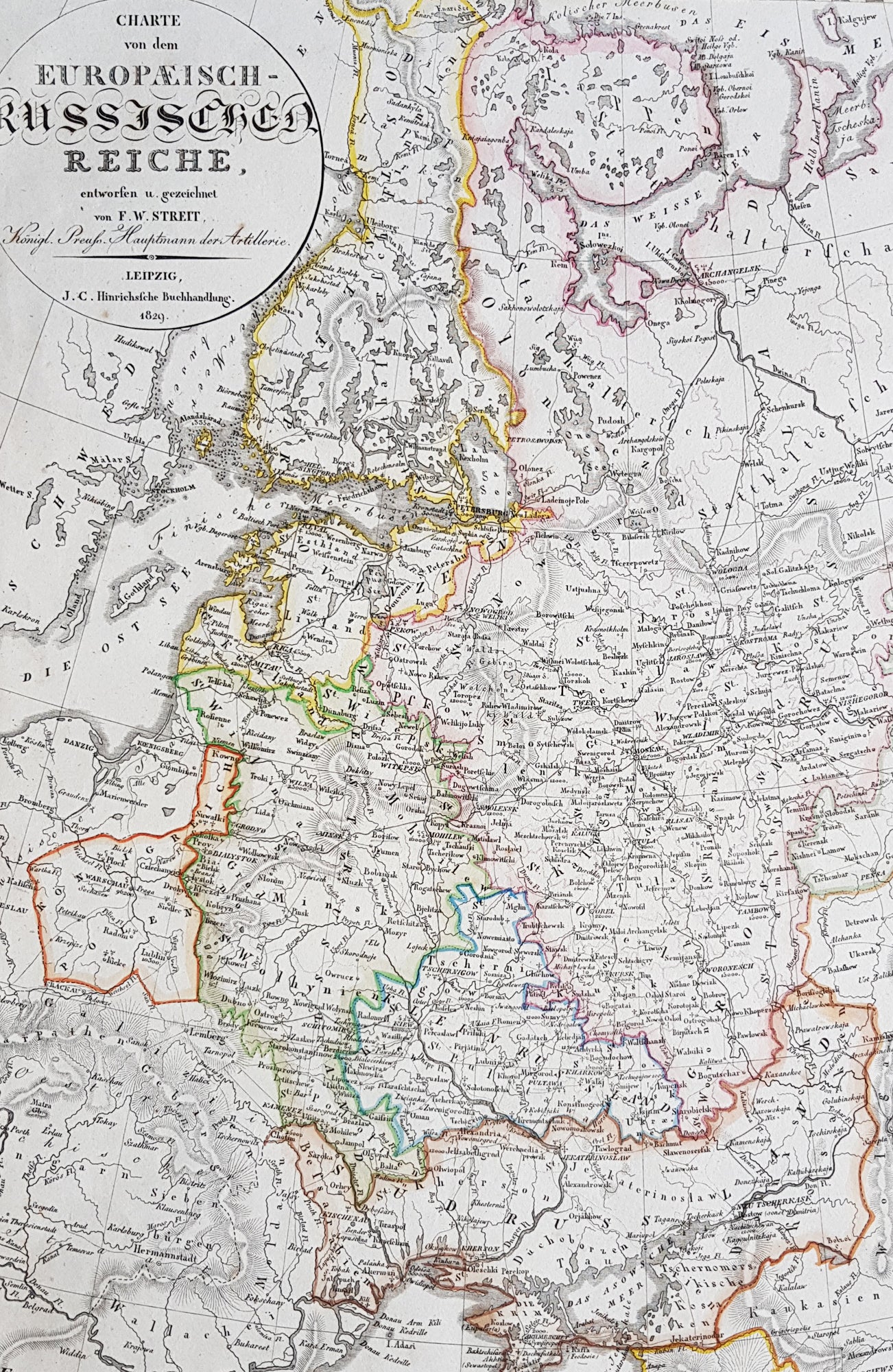
Description:This large beautifully hand coloured original copper-plate engraved antique map of the Russian Empire in Europe - from Finland to the Caspian Sea - by Friedrich Wilhelm Streit was published in 1829 by Johann Conrad Hinrichssche, dated in the title.Friedrich Wilhelm Streit 1772 - 1839 was a Prussian cartographer., engineer and mathematician. He was a Prussian Army Major and member of the Academie of useful sciences, Erfurt and the society for geography, Berlin. From 1807 to 1808 he was director of the Geographical Institute in Weimar .(Ref: M&B; Tooley)
General Definitions:Paper thickness and quality: - Heavy and stablePaper color : - off whiteAge of map color: - OriginalColors used: - Yellow, green, blue, pinkGeneral color appearance: - AuthenticPaper size: - 20in x 16 1/2in (510mm x 420mm)Plate size: - 20in x 16 1/2in (510mm x 420mm)Margins: - Min 1/2in (12mm)
Imperfections:Margins: - Light age toning in marginsPlate area: - NoneVerso: - None
Background: It is scarcely necessary to look at a map of Russia - with which we must include Siberia - to visualize the daunting task facing Russian map makers. Indeed, considering the vastness of their territory and the lack of skilled cartographers, it is surprising that relatively good maps were available for engraving and printing in most of the well known sixteenth and seventeenth century atlases. Generally, maps of that time were based on material brought back from Moscow by visitors from the West.