Welcome to Classical Images!
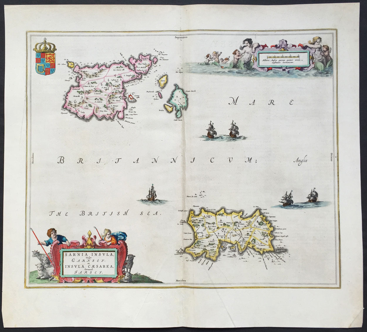
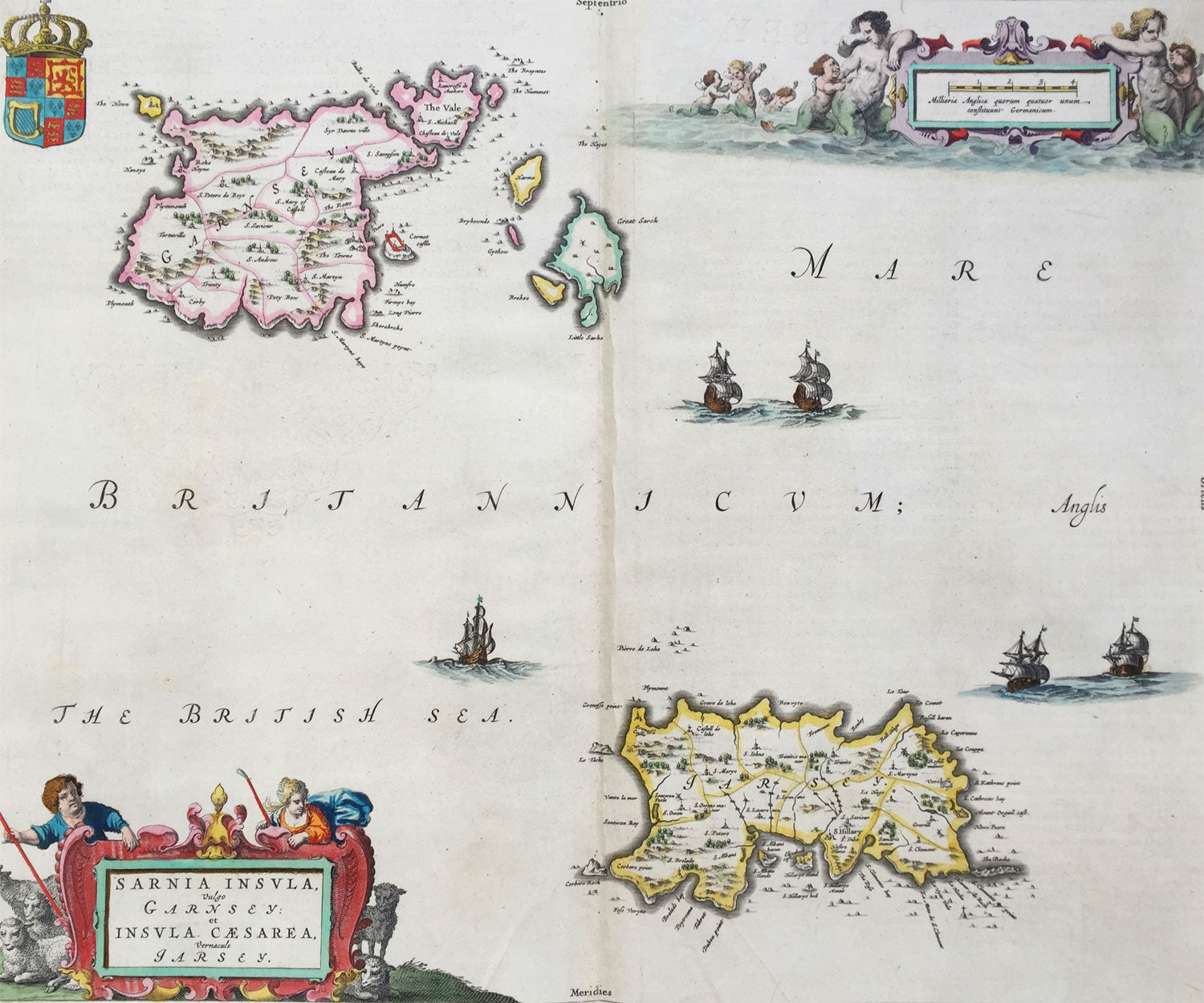
Description:This original large hand coloured copper plate engraved antique map of the Channel Islands Jersey and Guernsey and smaller islands was published in the 1659 Spanish edition of Joan Blaeu's Atlas Novus. This map is in beautiful condition, large margins, strong sturdy clean paper and bright fresh original colouring.
Condition Report: Paper thickness and quality: - Heavy and stable Paper color: - off white Age of map color: - Original Colors used: - Yellow, pink, red, blue, green General color appearance: - Authentic Paper size: - 21in x 19in (535mm x 480mm) Plate size: - 18 1/2in x 15 1/2in (480mm x 400mm) Margins: - Min 1in (25mm)
Imperfections: Margins: - None Plate area: - Very light crease along centerfold Verso: - None
Background: The Channel Islands (Norman: Îles d'la Manche, French: Îles Anglo-Normandes orÎles de la Manche) are an archipelago of British Crown Dependencies in the English Channel, off the French coast of Normandy. They include two separate bailiwicks: the Bailiwick of Jersey and the Bailiwick of Guernsey. They are considered the remnants of the Duchy of Normandy, and are not part of the United Kingdom. They have a total population of about 168,000 and their respective capitals, Saint Helier and Saint Peter Port, have populations of 33,500 and 16,488, respectively. The total area of the islands is 194 km. Both Bailiwicks have been administered separately since the late 13th century; each has its own independent laws, elections, and representative bodies (although in modern times, politicians from the islands' legislatures are in regular contact). Any institution common to both is the exception rather than the rule.
Blaeu is one of the most revered map makers of all time and it is easy to see why in this beautiful original map. The high level of the topographical detail, the quality of the paper, the artistic professionalism of the engraving and the beauty of the original hand colouring combine to produce a work of art that is both functional and of exceptional beauty. (Ref: Koeman; M&B)