Welcome to Classical Images!
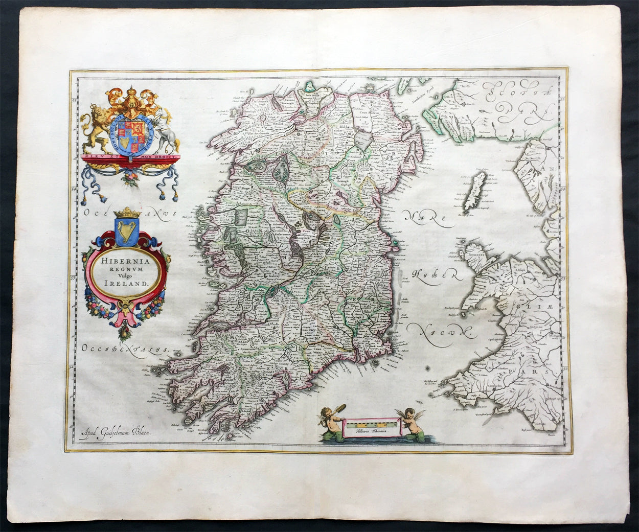
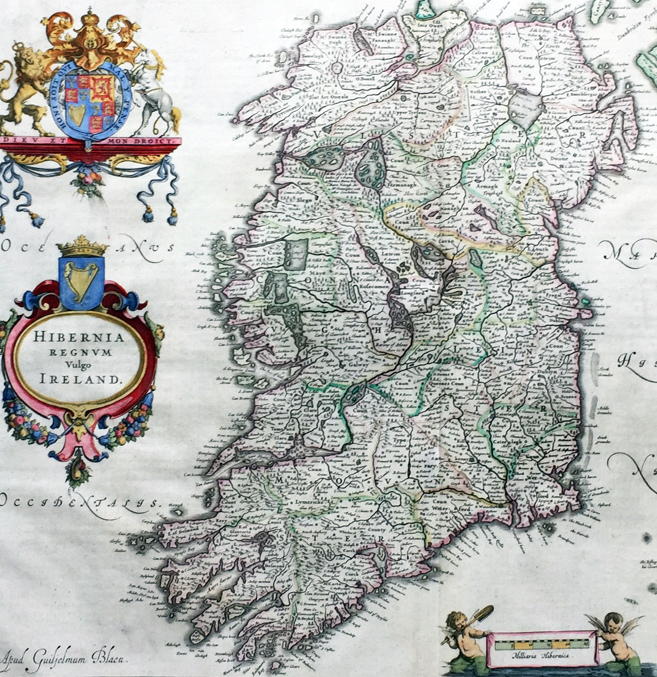
Description:This superbly hand coloured original antique map of Ireland - Hibernia - was published in the 1646 Dutch edition of Joan Blaeu's Atlas Novus.One of the best I have seen to date, the original colouring is superb and the paper is heavy and stable with original margins.
General Description:Paper thickness and quality: - HeavyPaper color: - WhiteAge of map color: - OriginalColors used: - Yellow, pink, red, blue, greenGeneral color appearance: - AuthenticPaper size: - 23 1/2in x 20in (600mm x 510mm)Plate size: - 19 3/4in x 15 1/4in (505mm x 385mm)Margins: - Min 2in (50mm)Imperfections:Margins: - Very bottom of margin re-joined, not affecting imagePlate area: - NoneVerso: - None
Background: This is Willem Blaeu's highly decorative general map of Ireland and is coloured to show in outline the ancient provinces of Connaught, Leinster, Munster and Ulster each of which together with the map of Carlow, was given a separate map in a section at the end of the atlas volume devoted to Scotland.The map, which Blaeu first issued in 1635 (twenty years prior to the publication of the Scotland and Ireland volume) was based on that published by John Speed in 1611 in his Theatre of the Empire of Great Briatine. In its turn Speed's map was copied Hondius and Blaeu's great rival Jan Jansson. It was the latter version that Willem Blaeu used. His beautifully balanced design is complemented by the Royal arms and the relatively simple title cartouche at the left hand side. (Ref: Koeman; Tooley; M&B)