Welcome to Classical Images!
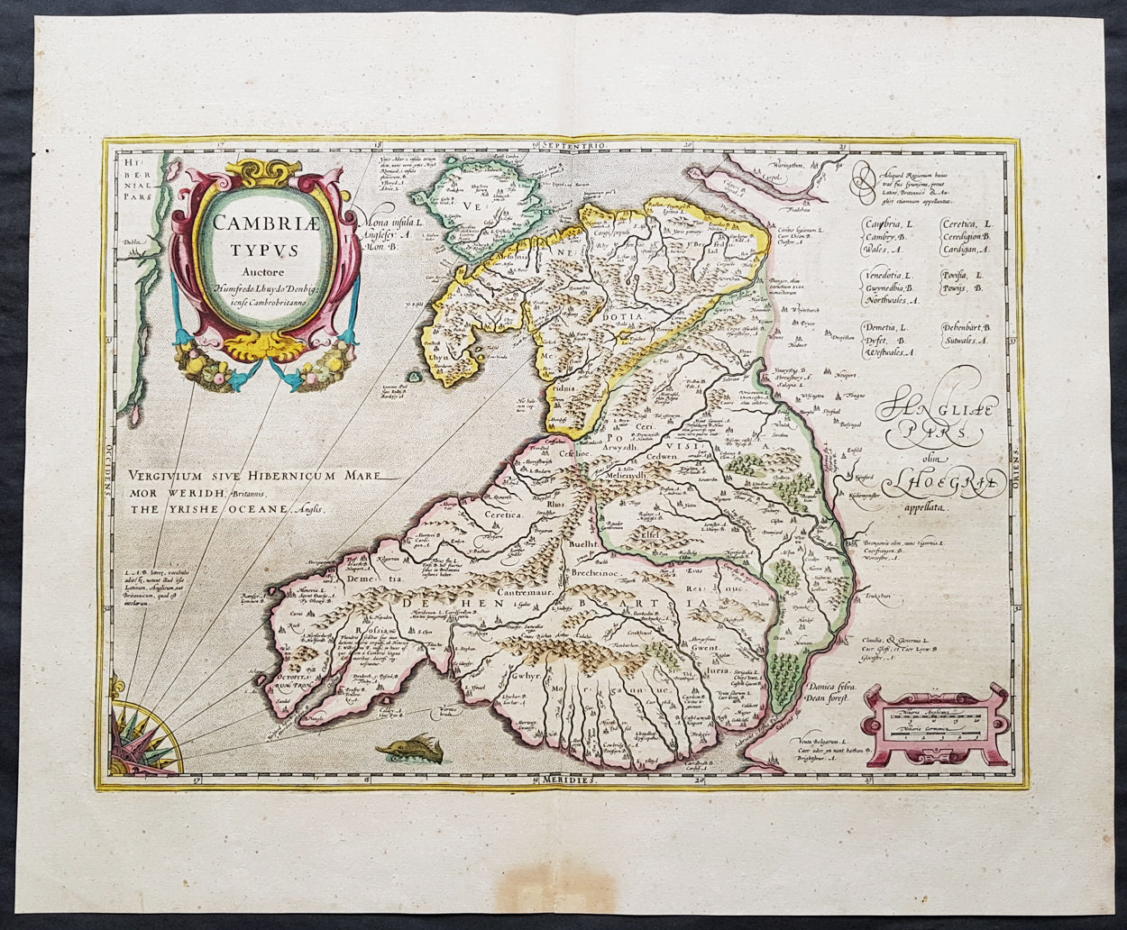
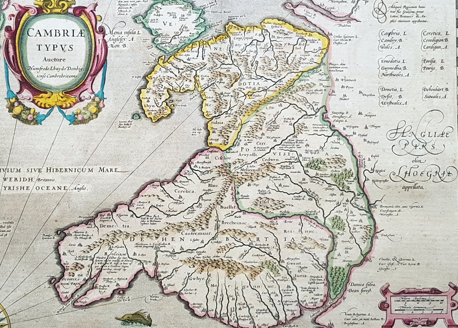
Description:This beautifully hand coloured original antique map of Wales - dedicated to its original creator the Welsh cartographer Lhuyd Humphrey - by Gerard Mercator was published by Jodocus Hondius in the 1639 French edition of Mercators Atlas. One of the best examples I seen of this map to date, beautiful original hand colour with strong sturdy paper with a deep strong impression.
Humphrey Llwyd (also spelled Lhuyd) (1527–1568) was a Welsh cartographer , author, antiquary and Member of Parliament. He was a leading member of the Renaissance period in Wales along with other such men as Thomas Salisbury and William Morgan. Llwyd was born in Denbigh, the county seat of the then county of Denbighshire at Foxhall, his family's estate. His father, Robert Llwyd, was descended from Harry Rossendale, henchman and grantee of the Earl of Lincoln. The first of the family that came to Wales from England appears to have been Foulk Rosindale, from whom Foxhall, or Foulk's Hall, was called. He married into the family of the Llwyd's of Aston, and probably from where his descendants derived their name, as well as their extraction from Einion Evell of the 12th Century. Einion Evell, Lord of part of Cynllaith, resided at Llwyn y Macn, in the parish of Oswestry. He and his twin brother, Cynwrig Evell, Lord of Y Glwyegl in Maelor Gymraeg, were the illegitimate sons of Madog ab Maredydd, Prince of Powys, by Eva, daughter of Madog (ab Einion Hael) ab Urien of Macn Gwynedd, ab Eginirab Lies ab Idnerth Benvras, Lord of Maesbrwg. As a young man, he was educated at Brasenose College, Oxford and fared so well in the sciences and engineering that he was given a position as a physician to the Earl of Arundel during the Earl's tenure as Chancellor of the university. He was MP for East Grinstead during Elizabeth I's first parliament (1559). In 1563, Llwyd returned to Denbigh and lived at Denbigh Castle at the permission of Sir John Salusbury who was then the Lord of the Manor of Denbigh. That year, he was elected MP for Denbigh Boroughs during Elizabeth's second Parliament where he promoted an act allowing the translation of the Bible into Welsh. From 1566 he toured Europe, including Brussels, Augsburg, Milan, Padua and Venice. In Antwerp, he learnt from, and collaborated with, map maker Abraham Ortelius. In 1567, when Llwyd returned to Denbigh, he was given a stipend from the Crown to create the first printed map of Wales. Llwyd died in 1568 and is buried in Whitchurch, a small chapel on the outskirts of Denbigh
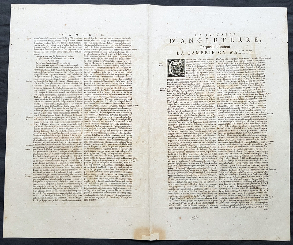
Jodocus Hondius (1563 - 1612), one of the most notable engravers of his time, is known for his work in association with many of the cartographers and publishers prominent at the end of the sixteenth and the beginning of the seventeenth century. In 1604 Hondius bought the plates of Mercator's Atlas which, in spite of its excellence, had not competed successfully with the continuing demand of the Ortelius Theatrum Orbis Terrarum. To meet this competition Hondius added about 40 maps to Mercator's original number and from 1606 published enlarged editions in many languages, still under Mercator's name but with his own name as publisher. These atlases have become known as the Mercator/Hondius series. The following year the maps were re-engraved in miniature form and issued as a pocket Atlas Minor. After the death of Jodocus Hondius the Elder in 1612, work on the two atlases, folio and miniature, was carried on by his widow and sons, Jodocus II and Henricus, and eventually in conjunction with Jan Jansson in Amsterdam. In all, from 1606 onwards, nearly 50 editions with increasing numbers of maps with texts in the main European languages were printed. (Ref: Koeman; M&B; Tooley)
Condition Report: Paper thickness and quality: - Heavy & stable Paper color: - off white Age of map color: - Original Colors used: - Yellow, pink, green, blue General color appearance: - Authentic Paper size: - 23in x 19in (590mm x 485mm) Plate size: - 19 1/2in x 14in (500mm x 360mm) Margins: - Min 1in (25mm)
Imperfections: Margins: - Light toning to bottom of margin Plate area: - None Verso: - None