Welcome to Classical Images!
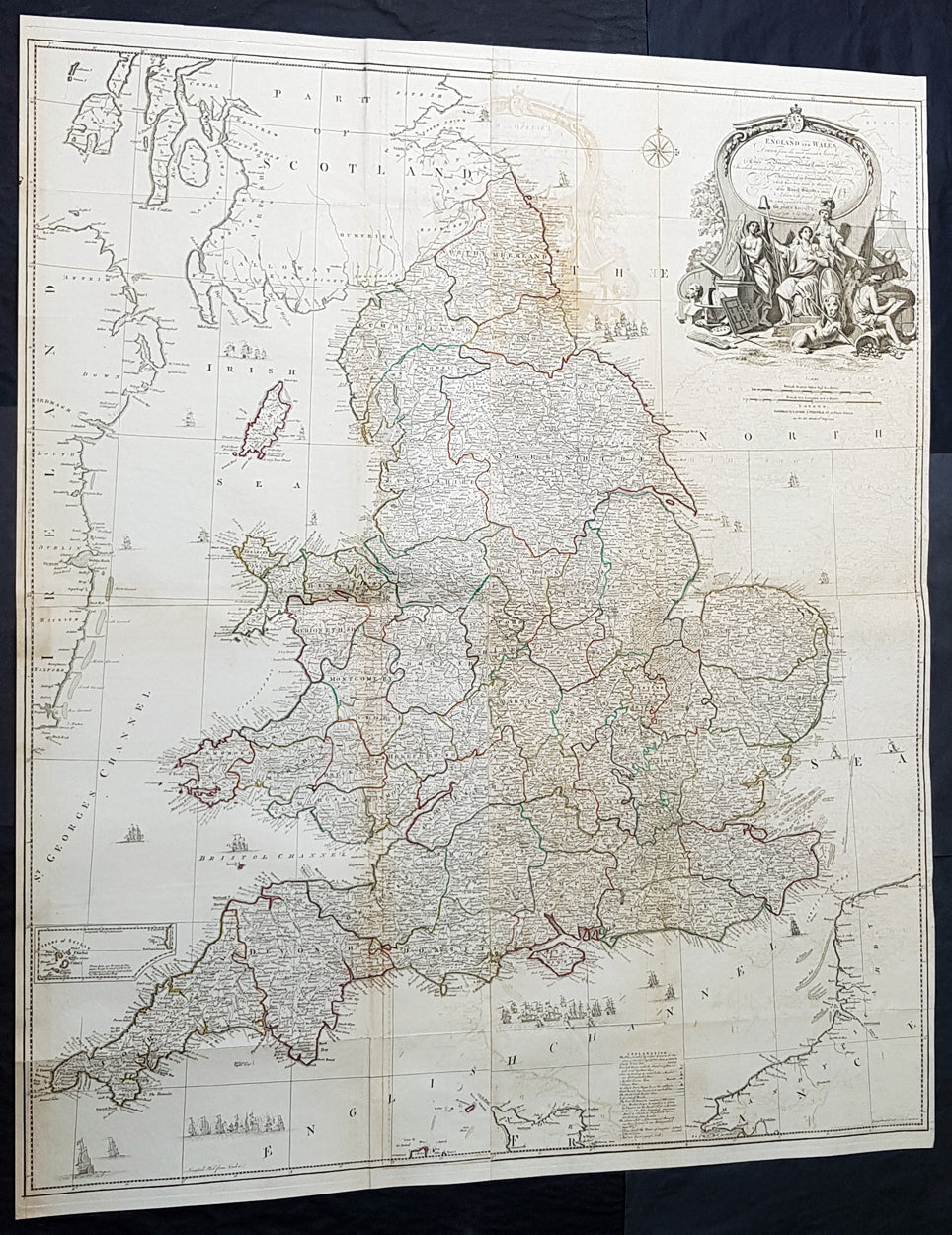
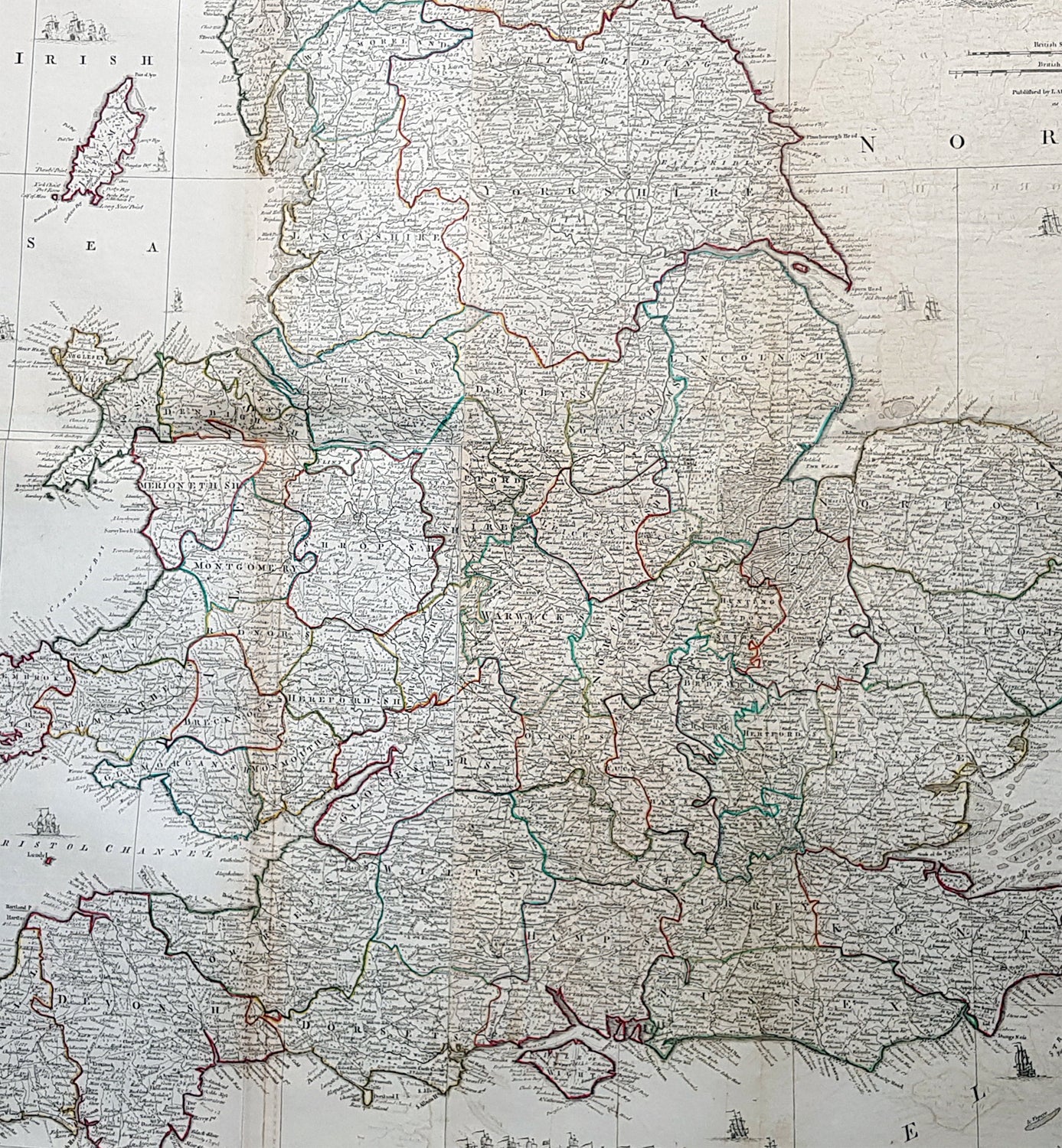
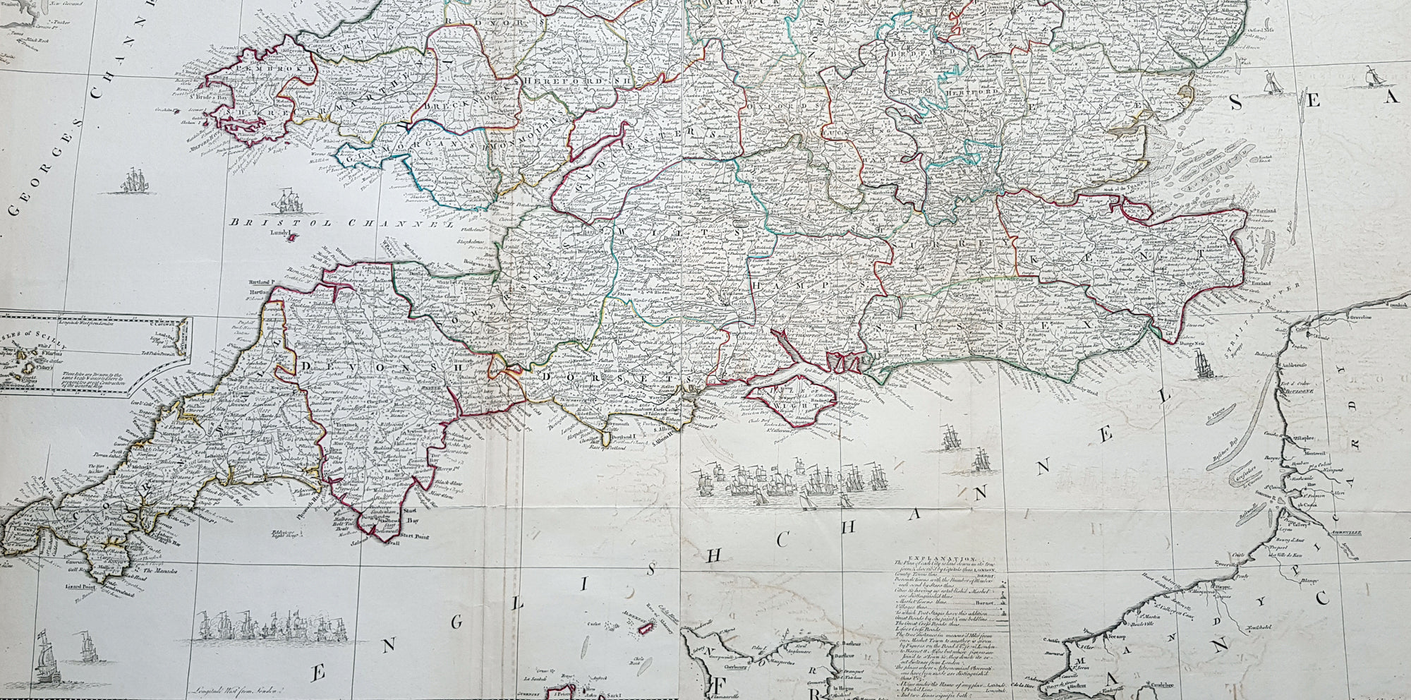
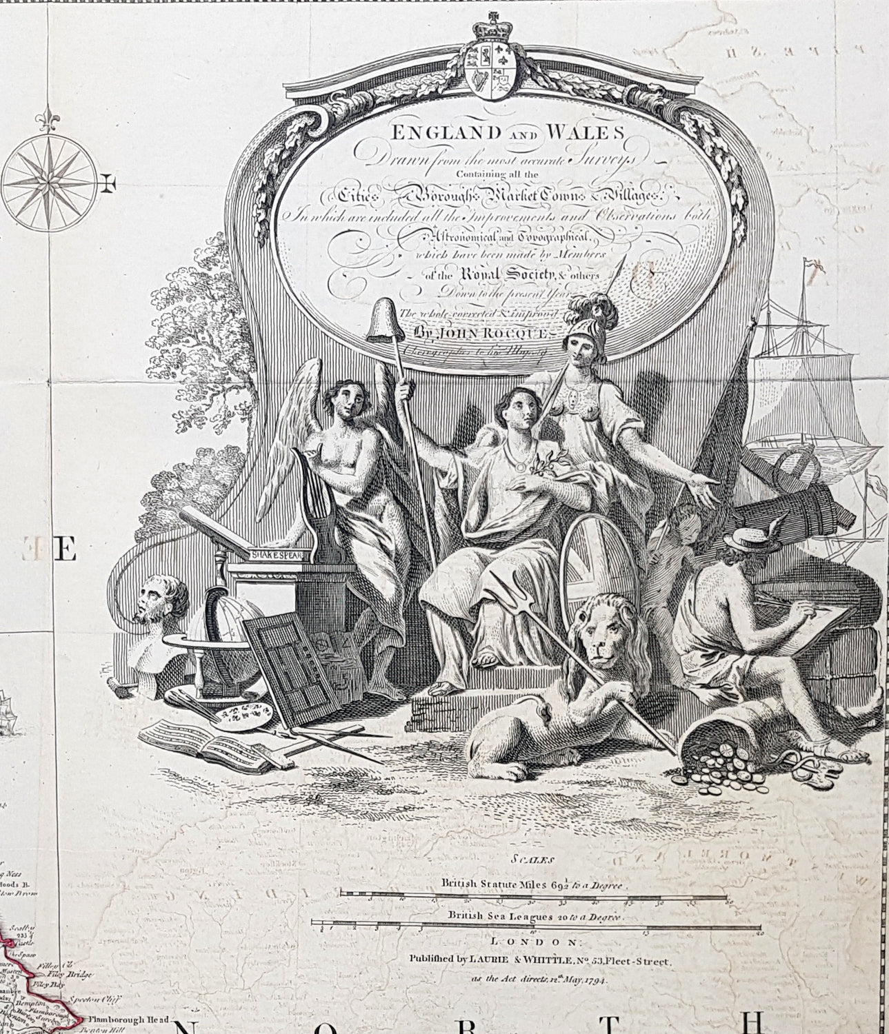
Description:This very large - 4 sheet joined - famous mid 18th century original hand coloured copper-plate engraved antique map of England and Wales, by John Rocque, was published by Laurie & Whittle in the large 1794 - dated - of A General Atlas Describing the Whole Universe.
General Definitions:Paper thickness and quality: - Heavy and stablePaper color : - off whiteAge of map color: - OriginalColors used: - Yellow, green, blue, pinkGeneral color appearance: - AuthenticPaper size: - 47 1/2in x 39 1/2in (1.21m x 1.050m)Plate size: - 47 1/2in x 39 1/2in (1.21m x 1.050m)Margins: - Min 1/2in (10mm)
Imperfections:Margins: - NonePlate area: - Folds as issued, offsetting, uplift and creasing along some foldsVerso: - Folds as issued
Background:The map exemplifies the strong graphic presence of Rocques signature topographic detail as well as an elaborate cartouche, here uncolored as issued. Rocque is recognized as an innovator of the British town plan and a master of large-scale cartographic style. The map of England and Wales was conceived during the high point of the map makers career and seems to have been completed as a part of a series of four-sheet British Isles maps.A wonderfully detailed four-sheet map with title contained within a large decorative allegorical cartouche depicting the artistic, scientific, and commercial accomplishments of the English. Abbeys and castles are duly noted. Small inset of the Isles of Scilly. Tall ships sailing solo and as part of fleets decorate the seas around the islands.