Europe (304)
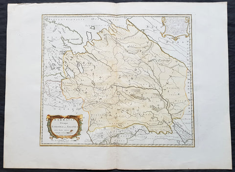
1741 Nicolas Sanson Large Antique Map of Sarmatia, Modern Day Russia & Ukraine
- Title : Sarmatia Utraque Europaea et Asiatica Autore Nicolas Sanson...1741
- Ref #: 50602
- Size: 27in x 20 1/4in (690mm x 515mm)
- Date : 1741
- Condition: (A+) Fine Condition
Description:
This fine original hand coloured copper-plate engraved antique map of the land of the Sarmatians - today stretching encompassing modern day European Russia and Ukraine and central Asia by Nicolas Sanson, was engraved in 1741 - dated in the cartouche - and was published by Robert De Vaugondy in a re-issue of Sansons atlas Cartes Generales de Toutes les Parties du Monde
General Definitions:
Paper thickness and quality: - Heavy and stable
Paper color : - off white
Age of map color: - Original & later
Colors used: - Yellow, green, blue, pink
General color appearance: - Authentic
Paper size: - 27in x 20 1/4in (690mm x 515mm)
Plate size: - 19in x 16 1/2in (485mm x 420mm)
Margins: - Min 2in (50mm)
Imperfections:
Margins: - None
Plate area: - None
Verso: - None
Background:
The Sarmatians were a large Iranian confederation that existed in classical antiquity, flourishing from about the 5th century BC to the 4th century AD.
Originating in the central parts of the Eurasian Steppe, the Sarmatians started migrating westward around the 4th and 3rd centuries BC, coming to dominate the closely related Scythians by 200 BC. At their greatest reported extent, around 1st century AD, these tribes ranged from the Vistula River to the mouth of the Danube and eastward to the Volga, bordering the shores of the Black and Caspian seas as well as the Caucasus to the south. Their territory, which was known as Sarmatia to Greco-Roman ethnographers, corresponded to the western part of greater Scythia (it included todays Central Ukraine, South-Eastern Ukraine, Southern Russia, Russian Volga and South-Ural regions, also to a smaller extent north-eastern Balkans and around Moldova). In the 1st century AD, the Sarmatians began encroaching upon the Roman Empire in alliance with Germanic tribes. In the 3rd century AD, their dominance of the Pontic Steppe was broken by the Germanic Goths. With the Hunnic invasions of the 4th century, many Sarmatians joined the Goths and other Germanic tribes (Vandals) in the settlement of the Western Roman Empire. Since large parts of todays Russia, actually the land between the Ural Mountains and the Don River, were controlled in the 5th century BC by the Sarmatians, Volga–Don and Ural steppes sometimes are also called Sarmatian Motherland.
The Sarmatians were eventually decisively assimilated (e.g. Slavicisation) and absorbed by the Proto-Slavic population of Eastern Europe.
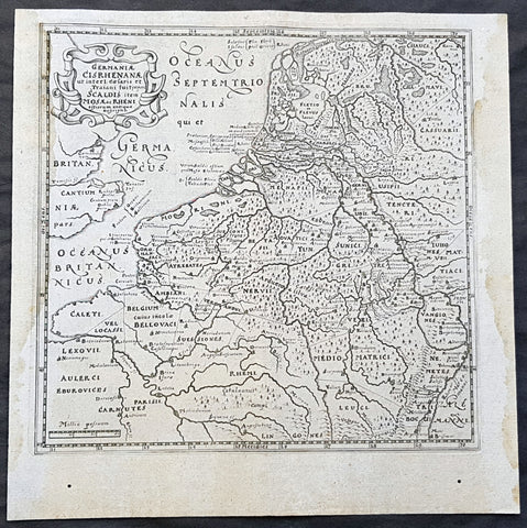
1611 Philipp Cluver Antique Map The Netherlands, Belgium, parts France & Germany
- Title : Germaniae Cisrhenanae ut interl. caesaris et Traiani suit imperii Scaldis item Mosae ac Rheni ostiorum antiqua Descriptio
- Size: 11 1/2in x 11 1/2in (295mm x 295mm)
- Condition: (A+) Fine Condition
- Date : 1611
- Ref #: 23967
Description:
This fine original wood-block engraved antique map of The Netherlands, Belgium, Northern France and parts of Western Germany was published in the 1611 edition of Philip Cluvers first publication Commentarius de tribus Rheni alveis, et ostiis; item. De Quinque populis quondam accolis; scilicet de Toxandris, Batavis, Caninefatibus, Frisiis, ac Marsacis. (Ref: King; Tooley; M&B)
General Definitions:
Paper thickness and quality: - Heavy and stable
Paper color : - off white
Age of map color: -
Colors used: -
General color appearance: -
Paper size: - 11 1/2in x 11 1/2in (295mm x 295mm)
Plate size: - 10in x 10in (255mm x 255mm)
Margins: - Min 1/2in (12mm)
Imperfections:
Margins: - Light age toning to left & right margins
Plate area: - None
Verso: - None
Background:
Clüver was an antiquary, who was given a special appointment at Leiden as geographer and put in charge of the university\'s library, but his lifes project, it developed, was a general study of the geography of Antiquity, based not only on classical literary sources, but — and this was his contribution — supplemented by wide travels and local inspections. He became virtually the founder of historical geography.
Clüvers first work, in 1611, concerning the lower reaches of the Rhine and its tribal inhabitants in Roman times (Commentarius de tribus Rheni alveis, et ostiis; item. De Quinque populis quondam accolis; scilicet de Toxandris, Batavis, Caninefatibus, Frisiis, ac Marsacis) touched a source of national pride among the Seventeen Provinces, for the Dutch were enjoying a twelve years truce in their Eighty Years War of liberation.
Cluver, Philipp 1580 – 1622
Clüver - also Klüwer, Cluwer, or Cluvier, Latinized as Philippus Cluverius and Philippi Cluverii) - was an Early Modern German geographer and historian.
Clüver was born in Danzig (Gdańsk), in Royal Prussia, a province of the Kingdom of Poland. After spending some time at the Polish court of Sigismund III Vasa, he began the study of law at the University of Leiden (Dutch Republic), but soon he turned his attention to history and geography, which were then taught there by Joseph Scaliger.
Clüver received science education from his father, who was Münzmeister at Danzig (coin master), but when Clüver went into different studies, his father stopped supporting his studies. He therefore travelled from Leiden across Hungary to Bohemia, where he did military service for a few years. While in Bohemia, he translated into Latin a defense by Baron Popel Lobkowitz, who was imprisoned. Upon his return to Leiden, he faced sanctions by the imperial (Habsburg) authorities for this, which however he could avoid with the help of his Leiden friends.
Clüver also travelled in England, Scotland, and France. He did all travel on foot, finally returning to Leiden, where (after 1616) he received a regular pension from the university. He died in Leiden.
Clüver was an antiquary, who was given a special appointment at Leiden as geographer and put in charge of the university\\\'s library, but his lifes project, it developed, was a general study of the geography of Antiquity, based not only on classical literary sources, but — and this was his contribution — supplemented by wide travels and local inspections. He became virtually the founder of historical geography.
Clüver\\\'s first work, in 1611, concerning the lower reaches of the Rhine and its tribal inhabitants in Roman times (Commentarius de tribus Rheni alveis, et ostiis; item. De Quinque populis quondam accolis; scilicet de Toxandris, Batavis, Caninefatibus, Frisiis, ac Marsacis) touched a source of national pride among the Seventeen Provinces, for the Dutch were enjoying a twelve years\\\' truce in their Eighty Years War of liberation.
Clüvers Germaniae antiquae libri tres (Leiden, 1616) depends on Tacitus and other Latin authors. A volume on the antiquities of Sicily, with notes on Sardinia and Corsica (Sicilia Antiqua cum minoribus insulis ei adjacentibus item Sardinia et Corsica), published at Leiden by Louis Elsevier in 1619, is a useful source, with many reference from writers of Antiquity and maps that are often detached and sold to map collectors. His Introductio in universam geographiam, totally 6 parts, (published posthumously from 1624) was the first comprehensive modern geography, and became a standard geographical textbook.
Clüver was also a prolific a writer on mathematical and theological subjects. He is remembered by collectors and historians of cartography for his edition of Ptolemys Geographia (based on Mercators edition of 1578) and for miniature atlases that were reprinted for most of the 17th century. Many of his maps were etched for him by Petrus Bertius.
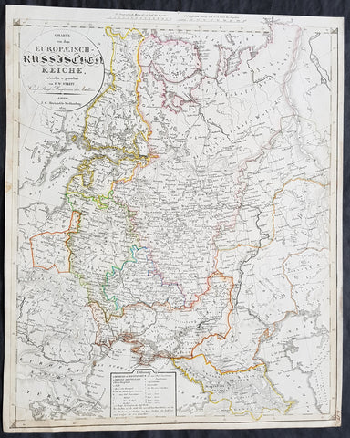
1829 Friedrich Wilhelm Streit Large Antique Map of European Russia
- Title : Charte von dem Europaeisch Russischen Reiche entworsen u. gezeichnet von FW Streit...Leipzig J C Hinrichssche...1829
- Ref #: 32211
- Size: 20in x 16 1/2in (510mm x 420mm)
- Date : 1829
- Condition: (A+) Fine Condition
Description:
This large beautifully hand coloured original copper-plate engraved antique map of the Russian Empire in Europe - from Finland to the Caspian Sea - by Friedrich Wilhelm Streit was published in 1829 by Johann Conrad Hinrichssche, dated in the title.
Friedrich Wilhelm Streit 1772 - 1839 was a Prussian cartographer., engineer and mathematician. He was a Prussian Army Major and member of the Academie of useful sciences, Erfurt and the society for geography, Berlin. From 1807 to 1808 he was director of the Geographical Institute in Weimar .(Ref: M&B; Tooley)
General Definitions:
Paper thickness and quality: - Heavy and stable
Paper color : - off white
Age of map color: - Original
Colors used: - Yellow, green, blue, pink
General color appearance: - Authentic
Paper size: - 20in x 16 1/2in (510mm x 420mm)
Plate size: - 20in x 16 1/2in (510mm x 420mm)
Margins: - Min 1/2in (12mm)
Imperfections:
Margins: - Light age toning in margins
Plate area: - None
Verso: - None
Background:
It is scarcely necessary to look at a map of Russia - with which we must include Siberia - to visualize the daunting task facing Russian map makers. Indeed, considering the vastness of their territory and the lack of skilled cartographers, it is surprising that relatively good maps were available for engraving and printing in most of the well known sixteenth and seventeenth century atlases. Generally, maps of that time were based on material brought back from Moscow by visitors from the West.

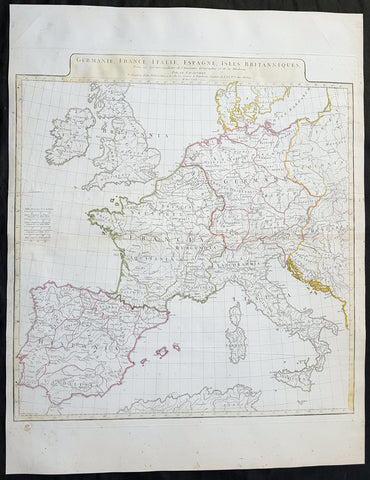
1782 J B D Anville Large Antique Map of Western Roman Europe, Britain to Italy
- Title : Germanie, France, Italie, Espagne, Isles Britanniques...Par Le Sr D Anville...MDCCLXXXII
- Size: 27in x 20in (585mm x 510mm)
- Condition: (A) Very Good Condition
- Date : 1782
- Ref #: 92646
Description:
This large hand coloured original copper-plate engraved antique map of Western Roman Britain by Jean Baptiste Bourguignon D\'Anville was engraved in 1782 - dated in the tile cartouche - and was published in Jean-Baptiste Bourguinon D\'Anvilles large elephant folio atlas Atlas Generale. (Ref: Tooley, M&B)
General Definitions:
Paper thickness and quality: - Heavy and stable
Paper color : - off white
Age of map color: -
Colors used: -
General color appearance: -
Paper size: - 27in x 20in (585mm x 510mm)
Plate size: - 21in x 19 1/2in (535mm x 495mm)
Margins: - Min 1in (25mm)
Imperfections:
Margins: - None
Plate area: - Vertical & horizontal folds
Verso: - None
Background:
The Roman Empire was the post-Roman Republic period of the ancient Roman civilization, with a government headed by emperors and large territorial holdings around the Mediterranean Sea in Europe, Africa and Asia. The city of Rome was the largest city in the world c. 100 BC – c. AD 400, with Constantinople (New Rome) becoming the largest around AD 500, and the Empire\'s population grew to an estimated 50 to 90 million inhabitants (roughly 20% of the world\'s population at the time) The 500-year-old republic which preceded it had been severely destabilized in a series of civil wars and political conflict, during which Julius Caesar was appointed as perpetual dictator and then assassinated in 44 BC. Civil wars and executions continued, culminating in the victory of Octavian, Caesar\'s adopted son, over Mark Antony and Cleopatra at the Battle of Actium in 31 BC and the annexation of Egypt. Octavian\'s power was then unassailable and in 27 BC the Roman Senate formally granted him overarching power and the new title Augustus, effectively marking the end of the Roman Republic.
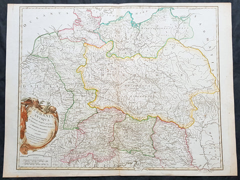
1757 Robert De Vaugondy Large Antique Map of Germania, Germany During Roman Era
- Title : Germania Antiqua in quatuor magnos populos...Autore Robert De Vaugondy
- Size: 26in x 19 1/2in (660mm x 495mm)
- Condition: (A+) Fine Condition
- Date : 1757
- Ref #: 41548
Description:
This large magnificent hand coloured original copper-plate engraved antique map of Ancient Germania, Germany, during the Roman Era by Robert De Vaugondy was published in the 1757 edition of De Vaugondys famous The Atlas Universel
General Definitions:
Paper thickness and quality: - Heavy and stable
Paper color : - off white
Age of map color: - Original & later
Colors used: - Blue, pink, red, green, yellow
General color appearance: - Authentic
Paper size: - 26in x 19 1/2in (660mm x 495mm)
Plate size: - 22 1/2in x 19 1/2in (570mm x 495mm)
Margins: - Min 1/4in (5mm)
Imperfections:
Margins: - None
Plate area: - None
Verso: - None
Background:
Germania was the Roman term for the geographical region in north-central Europe inhabited mainly by Germanic peoples.
It extended from the Danube in the south to the Baltic Sea, and from the Rhine in the west to the Vistula. The Roman portions formed two provinces of the Empire, Germania Inferior to the north (present-day southern Netherlands, Belgium, and western Germany), and Germania Superior to the south (Switzerland, southwestern Germany, and eastern France).
Germania was inhabited mostly by Germanic tribes, but also Celts, Balts, Scythians and later on Early Slavs. The population mix changed over time by assimilation, and especially by migration. The ancient Greeks were the first to mention the tribes in the area. Later, Julius Caesar wrote about warlike Germanic tribesmen and their threat to Roman Gaul, and there were military clashes between the Romans and the indigenous tribes. Tacitus wrote the most complete account of Germania that still survives.
The origin of the term Germania is uncertain, but was known by Caesar\'s time, and may be Gaulish in origin.
Germania was inhabited by different tribes, most of them Germanic but also some Celtic, proto-Slavic, Baltic and Scythian peoples. The tribal and ethnic makeup changed over the centuries as a result of assimilation and, most importantly, migrations. The Germanic people spoke several different dialects.
Classical records show little about the people who inhabited the north of Europe before the 2nd century BC. In the 5th century BC, the Greeks were aware of a group they called Celts (Keltoi). Herodotus also mentioned the Scythians but no other tribes. At around 320 BC, Pytheas of Massalia sailed around Britain and along the northern coast of Europe, and what he found on his journeys was so strange that later writers refused to believe him. He may have been the first Mediterranean to distinguish the Germanic people from the Celts. Contact between German tribes and the Roman Empire did take place and was not always hostile. Recent excavations of the Waldgirmes Forum show signs that a civilian Roman town was established there, which has been interpreted to mean that Romans and Germanic tribesmen were living in peace, at least for a while.
Caesar described the cultural differences between the Germanic tribesmen, the Romans, and the Gauls in his book Commentarii de Bello Gallico, where he recalls his defeat of the Suebi tribes at the Battle of Vosges. He describes them at length at the beginning of Book IV and the middle of Book VI. He states that the Gauls, although warlike, had a functional society and could be civilized, but that the Germanic tribesmen were far more savage and were a threat to Roman Gaul and Rome itself. Caesar said the Germanic tribes were nomadic, with no notable settlements and a primitive culture. He used this as one of his justifications for why they had to be conquered. His accounts of barbaric northern tribes could be described as an expression of the superiority of Rome, including Roman Gaul.
Caesars accounts portray the Roman fear of the Germanic tribes and the threat they posed. The perceived menace of the Germanic tribesmen proved accurate. The most complete account of Germania that has been preserved from Roman times is Tacitus Germania.
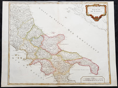
1757 Robert De Vaugondy Large Antique Map Southern Italy Mezzogiorno, 2 Sicilies
- Title : Partie Septentrionale Du Royaume De Naples
- Size: 26in x 19 1/2in (660mm x 495mm)
- Condition: (A+) Fine Condition
- Date : 1757
- Ref #: 92771
Description:
This magnificent hand coloured original copper-plate engraved antique map of Southern Italy in the mid to late 18th century by Robert De Vaugondy was published in the 1757 edition of De Vaugondys famous The Atlas Universel
General Definitions:
Paper thickness and quality: - Heavy and stable
Paper color : - off white
Age of map color: - Original & later
Colors used: - Blue, pink, red, green, yellow
General color appearance: - Authentic
Paper size: - 26in x 19 1/2in (660mm x 495mm)
Plate size: - 24 1/2in x 19 1/2in (620mm x 495mm)
Margins: - Min 1/4in (5mm)
Imperfections:
Margins: - None
Plate area: - None
Verso: - None
Background:
Southern Italy or Mezzogiorno is a macroregion of Italy traditionally encompassing the territories of the former Kingdom of the two Sicilies (all the southern section of the Italian Peninsula and Sicily), with the frequent addition of the island of Sardinia.
In 1442, however, Alfonso V conquered the Kingdom of Naples and unified Sicily and Naples once again as dependencies of the Crown of Aragon. At his death in 1458, the kingdom was again separated and Naples was inherited by Ferrante, Alfonso\'s illegitimate son. When Ferrante died in 1494, Charles VIII of France invaded Italy, using the Angevin claim to the throne of Naples, which his father had inherited on the death of King René\'s nephew in 1481, as a pretext, thus beginning the Italian Wars. Charles VIII expelled Alfonso II of Naples from Naples in 1495, but was soon forced to withdraw due to the support of Ferdinand II of Aragon for his cousin, Alfonso IIs son Ferrantino. Ferrantino was restored to the throne, but died in 1496, and was succeeded by his uncle, Frederick IV. The French, however, did not give up their claim, and in 1501 agreed to a partition of the kingdom with Ferdinand of Aragon, who abandoned his cousin King Frederick. The deal soon fell through, however, and the Crown of Aragon and France resumed their war over the kingdom, ultimately resulting in an Aragonese victory leaving Ferdinand in control of the kingdom by 1504.
The kingdom continued to be a focus of dispute between France and Spain for the next several decades, but French efforts to gain control of it became feebler as the decades went on, and Spanish control was never genuinely endangered. The French finally abandoned their claims to the kingdom by the Treaty of Cateau-Cambrésis in 1559. With the Treaty of London (1557) the new client state of Stato dei Presidi (State of Presidi) was established and governed directly by Spain, as part of the Kingdom of Naples.
The administration of the Kingdom of Naples and Sicily, as well as the Duchy of Milan, was then run by the Council of Italy, while Sardinia kept being an integral part of the Council of Aragon until the first years of the XVIII° century, when it was ceded to Austria and eventually Savoy.
After the War of the Spanish Succession in the early 18th century, possession of the kingdom again changed hands. Under the terms of the Treaty of Utrecht in 1713, Naples was given to Charles VI, the Holy Roman Emperor. He also gained control of Sicily in 1720, but Austrian rule did not last long. Both Naples and Sicily were conquered by a Spanish army during the War of the Polish Succession in 1734, and Charles, Duke of Parma, a younger son of King Philip V of Spain was installed as King of Naples and Sicily from 1735. When Charles inherited the Spanish throne from his older half-brother in 1759, he left Naples and Sicily to his younger son, Ferdinand IV. Despite the two kingdoms being in a personal union under the House of Bourbon from 1735 onwards, they remained constitutionally separated.
Being a member of the House of Bourbon, King Ferdinand IV was a natural opponent of the French Revolution and Napoleon. In January 1799, Napoleon Bonaparte, in the name of the French Republic, captured Naples and proclaimed the Parthenopaean Republic, a French client state, as successor to the kingdom. King Ferdinand fled from Naples to Sicily until June of that year. In 1806, Bonaparte, by then French Emperor, again dethroned King Ferdinand and appointed his brother, Joseph Bonaparte, as King of Naples. In the Edict of Bayonne of 1808, Napoleon removed Joseph to Spain and appointed his brother-in-law, Joachim Murat, as King of the Two Sicilies, though this meant control only of the mainland portion of the kingdom. Throughout this Napoleonic interruption, King Ferdinand remained in Sicily, with Palermo as his capital.
After Napoleon\'s defeat, King Ferdinand IV was restored by the Congress of Vienna of 1815 as Ferdinand I of the Two Sicilies. He established a concordat with the Papal States, which previously had a claim to the land. There were several rebellions on the island of Sicily against the King Ferdinand II but the end of the kingdom was only brought about by the Expedition of the Thousand in 1860, led by Garibaldi, an icon of the Italian unification, with the support of the House of Savoy and their Kingdom of Sardinia. The expedition resulted in a striking series of defeats for the Sicilian armies against the growing troops of Garibaldi. After the capture of Palermo and Sicily, he disembarked in Calabria and moved towards Naples, while in the meantime the Piedmontese also invaded the Kingdom from the Marche. The last battles fought were that of the Volturnus in 1860 and the siege of Gaeta, where King Francis II had sought shelter, hoping for French help, which never came. The last towns to resist Garibaldi\'s expedition were Messina (which capitulated on 13 March 1861) and Civitella del Tronto (which capitulated on 20 March 1861). The Kingdom of the Two Sicilies was dissolved and annexed to the new Kingdom of Italy, founded in the same year. (Ref: Tooley; M&B)
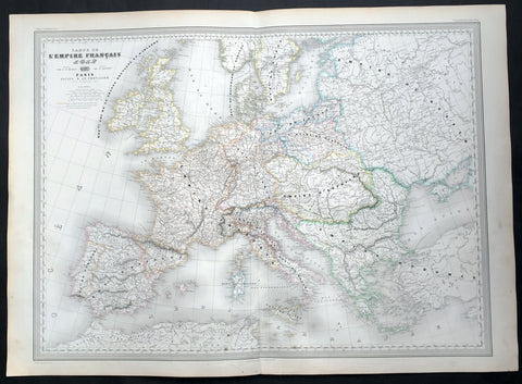
1856 A H Dufour Very Large Antique Map of The Different Empires of Europe
- Title : Carte De L Empire Francais par A H Dufour Gravee CH Dyonnet..1856
- Ref #: 61027
- Size: 33in x 24in (840mm x 610mm)
- Date : 1856
- Condition: (A+) Fine Condition
Description:
This very large, magnificent hand coloured original copper plate antique map of the political borders of Europe and the various Empires that ruled the continent at the time French, Austrian, Rhine Conference, Italian States, Russian, Ottoman etc by Adolphe Hippolyte Dufour was engraved by Charles Dyonnet in 1856 - dated in the title - for Dufours 1860 edition of his monumental elephant folio Atlas Physique, Historique et Politique Geographie Moderne published by Pauline Et La Chevalier, Paris.
The 19th century French cartographer Auguste-Henri Dufour began publishing the dramatic elephant folio Atlas Universel, also occasionally titled Grand Atlas Universal, around 1855. Several editions appeared between its initial publication in the 1850s and a final run c. 1870. The 1863 and 1864 editions in particular are highly desirable among collectors because the United States and North America maps illustrate the proposed, but unrealized, state of Corona (roughly modern day Utah). The atlas contained roughly 40 maps, most of which were engraved by Louis Antoine (the maps) and Deletre (typography) under the supervision of Charles Dyonnet, official engraver of the Depot de la Marine. The Atlas Universal was published in Paris and edited by the firm of Paulin et le Chevalier, 60 Rue Richelieu.
General Definitions:
Paper thickness and quality: - Heavy and stable
Paper color : - off white
Age of map color: - Original
Colors used: - Yellow, green, blue, pink
General color appearance: - Authentic
Paper size: - 33in x 24in (840mm x 610mm)
Plate size: - 33in x 24in (840mm x 610mm)
Margins: - Min 1in (25mm)
Imperfections:
Margins: - Light age toning in margins
Plate area: - None
Verso: - None
Background:
Charles Dyonnet 1822 - 1880 was an extremely active Paris based engraver working in the mid to late 19th century. From his offices at 220 Rue St. Jacques, Paris, Dyonnet engraved numerous maps for many of the most prominent 19th French cartographic publishers including Vuillemin, Dufour, Fremin and Duvotenay. From 1850-1861, he held the coveted position of Graveur du Dépot de la Marine, and in this position engraved numerous French naval and military maps. Dyonnet had a detail oriented and aesthetically minded hand and is responsible from some of the most beautiful French maps to emerge during the 19th century. (Ref: M&B; Tooley)

1856 A H Dufour Very Large Antique Political map of Europe - Mountains
- Title : Carte Generale L Europe Actuelle Dressee A H Dufour Gravee CH Dyonnet..1856
- Ref #: 61020
- Size: 33in x 24in (840mm x 610mm)
- Date : 1856
- Condition: (A+) Fine Condition
Description:
This very large, magnificent hand coloured original copper plate antique map of the political borders of Europe in the mid 19th century - with a list of European mountains at the bottom of the map - by Adolphe Hippolyte Dufour was engraved by Charles Dyonnet in 1856 - dated in the title - for Dufours 1860 edition of his monumental elephant folio Atlas Physique, Historique et Politique Geographie Moderne published by Pauline Et La Chevalier, Paris.
The 19th century French cartographer Auguste-Henri Dufour began publishing the dramatic elephant folio Atlas Universel, also occasionally titled Grand Atlas Universal, around 1855. Several editions appeared between its initial publication in the 1850s and a final run c. 1870. The 1863 and 1864 editions in particular are highly desirable among collectors because the United States and North America maps illustrate the proposed, but unrealized, state of Corona (roughly modern day Utah). The atlas contained roughly 40 maps, most of which were engraved by Louis Antoine (the maps) and Deletre (typography) under the supervision of Charles Dyonnet, official engraver of the Depot de la Marine. The Atlas Universal was published in Paris and edited by the firm of Paulin et le Chevalier, 60 Rue Richelieu.
General Definitions:
Paper thickness and quality: - Heavy and stable
Paper color : - off white
Age of map color: - Original
Colors used: - Yellow, green, blue, pink
General color appearance: - Authentic
Paper size: - 33in x 24in (840mm x 610mm)
Plate size: - 33in x 24in (840mm x 610mm)
Margins: - Min 1in (25mm)
Imperfections:
Margins: - Light age toning in margins
Plate area: - None
Verso: - None
Background:
Charles Dyonnet 1822 - 1880 was an extremely active Paris based engraver working in the mid to late 19th century. From his offices at 220 Rue St. Jacques, Paris, Dyonnet engraved numerous maps for many of the most prominent 19th French cartographic publishers including Vuillemin, Dufour, Fremin and Duvotenay. From 1850-1861, he held the coveted position of Graveur du Dépot de la Marine, and in this position engraved numerous French naval and military maps. Dyonnet had a detail oriented and aesthetically minded hand and is responsible from some of the most beautiful French maps to emerge during the 19th century. (Ref: M&B; Tooley)
1771 J B D Anville Large Original Antique Map of Western Europe & Britain
- Title : Germanie, France, Italie, Espagne, Isles Britanniques...MDCCLXXI
- Size: 25 1/2in x 20in (650mm x 525mm)
- Ref #: 92305
- Date : 1771
- Condition: (A) Very Good Condition
Description:
This large finely engraved and highly detailed original antique map of Western Europe and The British Isles by Jean Baptiste Bourguignon D\'Anville was engraved in 1771 - dated in the tile cartouche - and was published in Jean-Baptiste Bourguinon D\'Anville\'s large elephant folio atlas Atlas Generale.
General Definitions:
Paper thickness and quality: - Heavy and stable
Paper color : - off white
Age of map color: - Original
Colors used: - Yellow
General color appearance: - Authentic
Paper size: - 25 1/2in x 20in (650mm x 525mm)
Plate size: - 21in x 19 1/2in (535mm x 495mm)
Margins: - Min 1/2in (12mm)
Imperfections:
Margins: - Creasing along centerfold
Plate area: - Creasing along centerfold
Verso: - Creasing along centerfold
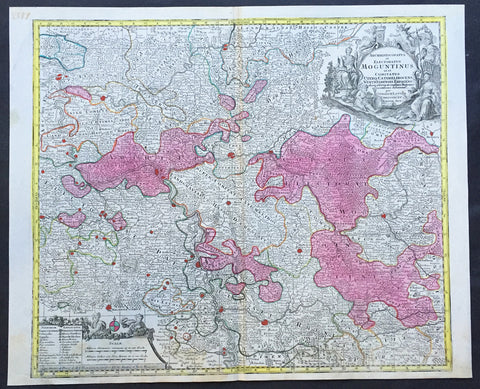
1756 Lotter Large Antique Map of Rhine Koblenz, Germany
- Title : Archiepiscopatus et Electoratus Moguntinus...
- Ref #: 50169
- Size: 25in x 20in (635mm x 510mm)
- Date : 1756
- Condition: (A+) Fine Condition
Description:
This large beautiful hand coloured original antique map of the Rhine River region of central western Germany was engraved by Tobias Conrad Lotter in 1756.
The map centres on the city of Frankfurt stretches along the Rhine River from Koblenz in the North to Speir in the South. Wertheim in the east to Kern in the west (Ref: Tooley, M&B)
General Description:
Paper thickness and quality: - Heavy and stable
Paper color: - off white
Age of map color: - Original
Colors used: - Pink, green, yellow, blue
General color appearance: - Authentic
Paper size: - 25in x 20in (635mm x 510mm)
Plate size: - 22 ½in x 19 ½in (570mm x 495mm)
Margins: - Min 1/2in (12mm)
Imperfections:
Margins: - None
Plate area: - None
Verso: - None
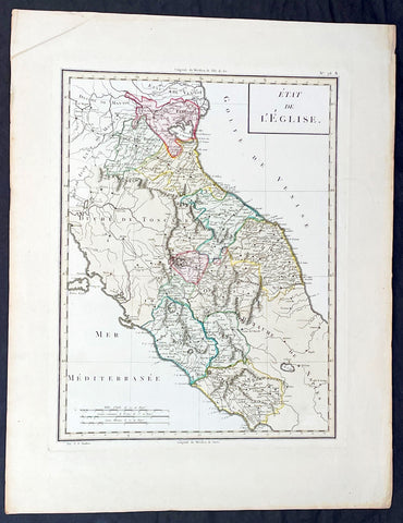
1765 Tardieu Large Antique Map Catholic States of Italy
- Title : Etat de L Eglise
- Ref #: 92787
- Size: 23in x 17 1/2in (585mm x 445mm)
- Date : 1765
- Condition: (A+) Fine Condition
Description:
This large beautifully hand coloured original antique map of the Catholic States of Italy waspublished by the famous French publisher Pierre Francois Tardieu (famous for publishing Diderots Encyclopedie in 1779) in 1765. (Ref: M&B;Tooley)
General Description:
Paper thickness and quality: - Heavy & stable
Paper color: - White
Age of map color: - Original
Colors used: - Pink, green, yellow
General color appearance: - Authentic
Paper size: - 23in x 17 1/2in (585mm x 445mm)
Paper size: - 18in x 13 1/2in (460mm x 340mm)
Margins: - Min 1in (25mm)
Imperfections:
Margins: - None
Plate area: - None
Verso: - None

1649 Blaeu Antique Map View of Thérouanne, Tarwanna or Tervanna Northern France
- Title : Teroana morinorum metropolis olim, diruta a Carolo V. Anno 1553
- Ref #: Tav
- Size: 21 1/2in x 13in (545mm x 330mm)
- Date : 1649
- Condition: (A+) Fine Condition
Description:
This beautifully hand coloured original antique map a view of the city of Tarwanna or Tervanna (today the town of Thérouanne, France) the capital of the ancient Belgian tribe of the Morini, was published in the 1649 edition of John Blaeus Toonneel der Steeden (Views of Dutch Cities)
General Definitions:
Paper thickness and quality: - Heavy and stable
Paper color : - off white
Age of map color: - Original
Colors used: - Blue, pink, red, green, yellow
General color appearance: - Authentic
Paper size: - 21 1/2in x 13in (545mm x 330mm)
Plate size: - 10 1/2in x 7 1/2in (270mm x 190mm)
Margins: - Min 1in (25mm)
Imperfections:
Margins: - None
Plate area: - None
Verso: - None
Thérouanne is a commune in the Pas-de-Calais department in the Nord-Pas-de-Calais region of France. At the time of the Gauls, Tarwanna or Tervanna was the capital of the Belgian tribe of the Morini. After the Romans conquered Gaul, they too made the city the capital of the Civitas Morinorum district.
In the 7th century, probably around 639, Saint Audomar (Saint Omer) established the bishopric of Terwaan or Terenburg, the diocese of Thérouanne, which during the Middle Ages controlled a large part of the left bank of the river Scheldt. Territorially it was part of the county of Artois which belonged to the county of Flanders.
Thanks to that ecclesiastical control of some of the most prosperous cities north of the Alps, like Arras and Ypres, the bishopric was able to build a cathedral which was at the time the largest in France.
The town was captured by the Emperor Maximilian and Henry VIII from the French in 1513 after the battle of the Spurs. In 1553 Charles V besieged Thérouanne, then a French enclave in the Holy Roman Empire, in revenge for a defeat by the French at the siege of Metz. After he captured the city he ordered it to be razed, the roads to be broken up, and the area to be ploughed and salted Only a small commune which lay outside the city walls, then named Saint-Martin-Outre-Eaux, was left standing, and later (probably around 1800) took over the name Thérouanne. (Ref: Koeman; M&B)
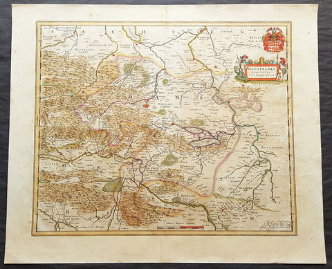
1662 Joan Blaeu Antique Map of Mansfeld Land, in SW Saxony-Anhalt, Germany
- Title : Mansfelda Comitatus Auctore Tilemanno Stella Sig.
- Ref #: 50180
- Size: 23 1/2in x 19 1/2in (600mm x 495mm)
- Date : 1662
- Condition: (A) Very Good Condition
Description:
This beautifully hand coloured original copper-plate engraved antique map of the ancient region of Mansfeld Land located in the in southwestern region of Saxony-Anhalt, Germany - centering on the city of Mansfeld - by was published in the 1662 Latin edition edition of Joan Blaeus Atlas Major.
General Definitions:
Paper thickness and quality: - Heavy and stable
Paper color : - off white
Age of map color: - Original
Colors used: - Blue, pink, red, green, yellow
General color appearance: - Authentic
Paper size: - 23 1/2in x 19 1/2in (600mm x 495mm)
Plate size: - 19 1/2in x 16 1/2in (495mm x 420mm)
Margins: - Min 1in (25mm)
Imperfections:
Margins: - Light age toning
Plate area: - Light age toning
Verso: - Light age toning
Background:
Mansfeld Land is a region in the southwestern corner of the German state of Saxony-Anhalt. The region derives its name from the counts of Mansfeld, who ruled this region for about 1,000 years.
The House of Mansfeld, whose members belonged to the Saxon nobility and served as counts in the Hassegau, was first documented in a 973 deed. The counts built Mansfeld Castle, whose foundations date back to the late 11th century, when one Hoyer of Mansfeld served as field marshal to Emperor Henry V. The first reference of the fortress coincides with the extinction of the elder line in 1229. The estates were inherited by the Lords of Querfurt, who also adopted the comital title, calling themselves Counts of Mansfeld from that time on.
The settlement of Mansfeld received town privileges in 1400, and grew through the development of copper and silver mining, an activity in which Hans Luder from Möhra, father to Martin Luther and Mansfeld citizen from 1484, was employed as a master smelter. Luthers family had arrived into a modest prosperity, he himself attended the local school between 1488 and 1496. The building known as Luther\'s School had to be torn down and rebuilt in 2000 due to structural problems. His parents house is preserved and today a museum. Luther also acted as an altar server at the St George parish church.
The Counts of Mansfeld had already lost Imperial immediacy in 1580. When the comital line finally became extinct in 1780, the estates around Mansfeld were incorporated into the Prussian Duchy of Magdeburg. The town retained the status of an independent city (Immediatstadt), it was temporarily part of the Napoleonic Kingdom of Westphalia and after the 1815 Congress of Vienna belonged to the Prussian Province of Saxony.
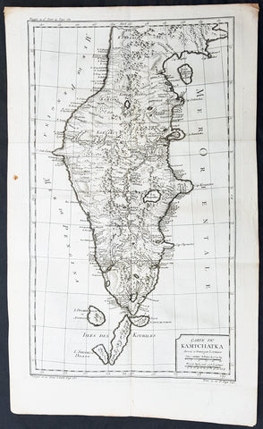
1760 Bellin Large Original Antique Map of Kamchatka Peninsula, in Eastern Russia
- Title : Carte Du Kamtschatka Dressee et Gravee par Laurent.
- Ref #: 60969
- Size: 23in x 14 1/2in (585mm x 370mm)
- Date : 1747
- Condition: (A+) Fine Condition
Description:
This fine, original copper-plate engraved antique map of Kamchatka Peninsula, in Eastern Russia by Jacques Nicolas Bellin in 1760 was published in Antoine François Prevosts 15 volumes of Histoire Generale des Voyages written by Prevost & other authors between 1746-1790.
General Definitions:
Paper thickness and quality: - Heavy and stable
Paper color : - off white
Age of map color: -
Colors used: -
General color appearance: -
Paper size: - 23in x 14 1/2in (585mm x 370mm)
Plate size: - 20 1/2in x 12 1/2in (520mm x 320mm)
Margins: - Min 1/2in (6mm)
Imperfections:
Margins: - None
Plate area: - Folds as issued
Verso: - None
Background:
One of Antoine Francois Prevosts monumental undertakings was his history of exploration & discovery in 15 volumes titledHistoire Générale des Voyages written between 1746-1759 and was extended to 20 volumes after his death by various authors.
The 20 volumes cover the early explorations & discoveries on 3 continents: Africa (v. 1-5), Asia (v. 5-11), and America (v. 12-15) with material on the finding of the French, English, Dutch, and Portugese.
A number of notable cartographers and engravers contributed to the copper plate maps and views to the 20 volumes including Nicolas Bellin, Jan Schley, Chedel, Franc Aveline, Fessard, and many others.
The African volumes cover primarily coastal countries of West, Southern, and Eastern Africa, plus the Congo, Madagascar, Arabia and the Persian Gulf areas.
The Asian volumes cover China, Korea, Tibet, Japan, Philippines, and countries bordering the Indian Ocean.
Volume 11 includes Australia and Antarctica.
Volumes 12-15 cover voyages and discoveries in America, including the East Indies, South, Central and North America.
Volumes 16-20 include supplement volumes & tables along with continuation of voyages and discoveries in Russia, Northern Europe, America, Asia & Australia.
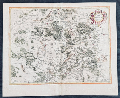
1628 Gerard Mercator Antique Map Lotharingia Region - Netherlands Germany France
Antique Map
- Title : Lotharingia Ducatus...Per Geradum Mercatorem Cum Privilegio
- Size: 21in x 17in (530mm x 430mm)
- Condition: (A) Very Good Condition
- Date : 1628
- Ref #: 26141
Description:
This original copper plate engraved hand coloured antique map of the historical region of Lotharingia region of present-day Netherlands, Belgium, Luxembourg, North Rhine-Westphalia (Germany), Rhineland-Palatinate (Germany), Saarland (Germany), and Lorraine (France) by Gerard Mercator was published by Henricus Hondius in the early 1628 French edition of Gerard Mercators Atlas.
These maps, published in the early editions of Mercators atlas, are the original maps drawn and engraved by Gerald Mercator in the mid to late 16th century, published by his son Rumold as an atlas, after his death, in 1595. After two editions the plates were purchased by Jodocus Hondius in 1604 and continued to be published until the mid 1630\\\'s when the plates were re-engraved and updated by Jan Jansson and Henricus Hondius.
General Definitions:
Paper thickness and quality: - Heavy and stable
Paper color : - off white
Age of map color: - Later
Colors used: - Green, yellow, pink, brown
General color appearance: - Authentic
Paper size: - 21in x 17in (530mm x 430mm)
Plate size: - 20in x 15in (510mm x 380mm)
Margins: - Min 1/2in (12mm)
Imperfections:
Margins: - Age toning
Plate area: - Age toning, light creasing
Verso: - Age toning
Background:
Lotharingia was a medieval successor kingdom of the Carolingian Empire, comprising the present-day Netherlands, Belgium, Luxembourg, North Rhine-Westphalia (Germany), Rhineland-Palatinate (Germany), Saarland (Germany), and Lorraine (France). It was named after King Lothair II who received this territory after the kingdom of Middle Francia of his father Lothair I was divided among his sons in 855.
Lotharingia was born out of the tripartite division in 855 of the kingdom of Middle Francia, which itself was formed after the threefold division of the Carolingian Empire by the Treaty of Verdun of 843. Conflict between East and West Francia over Lotharingia was based on the fact that these were the old Frankish homelands of Austrasia, so possession of them was of great prestige.
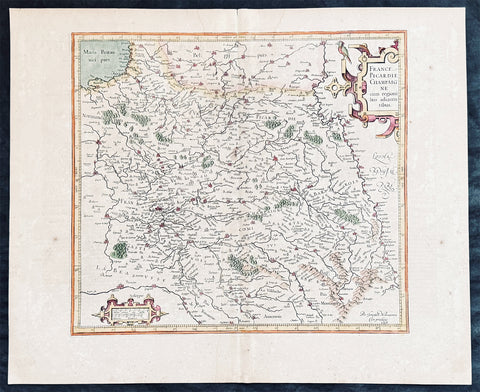
1628 Gerard Mercator & Henricus Hondius Antique Map the Picardy Region of France
- Title : France Picardie Champagne cum regionibus adiacentibus
- Size: 21in x 17in (530mm x 430mm)
- Condition: (A) Very Good Condition
- Date : 1628
- Ref #: 26131
Description:
This original copper plate engraved hand coloured antique map of the French region of Picardy or Picardie by Gerard Mercator was published by Henricus Hondius in the early 1628 French edition of Gerard Mercators Atlas.
These maps, published in the early editions of Mercators atlas, are the original maps drawn and engraved by Gerald Mercator in the mid to late 16th century, published by his son Rumold as an atlas, after his death, in 1595. After two editions the plates were purchased by Jodocus Hondius in 1604, and continued to be published until the end of the 1630s by Henricus Hondius, when some of the plates were re-engraved and updated with the help of Jan Jansson.
General Definitions:
Paper thickness and quality: - Heavy and stable
Paper color : - off white
Age of map color: -
Colors used: -
General color appearance: -
Paper size: - 21in x 17in (530mm x 430mm)
Plate size: - 18 1/2in x 14in (475mm x 350mm)
Margins: - Min 1/2in (12mm)
Imperfections:
Margins: - Light age toning
Plate area: - Light toning along centerfold
Verso: - Light age toning
Background:
Picardy is a historical territory and a former administrative region of Northern France and now part of the new region Nord-Pas-de-Calais-Picardie.
From the 5th century the area was part of the Frankish Empire, and in the feudal period it encompassed the six countships of Boulogne, Montreuil, Ponthieu, Amiénois,Vermandois, and Laonnois. According to the 843 Treaty of Verdun the region became part of West Francia, the later Kingdom of France.
The name Picardy (which may have referred to a Frankish tribe of picards or pike-bearers) was not used until the 12th or 13th century. During this time, the name applied to all lands where the Picard language was spoken, which included all the territories from Paris to the Netherlands. In the Latin Quarter of Paris, people identified a Picard Nation (Nation Picarde) of students at Sorbonne University, most of whom actually came from Flanders. During the Hundred Years\\\' War, Picardy was the centre of the Jacquerie peasant revolt in 1358.
From 1419 onwards, the Picardy counties (Boulogne, Ponthieu, Amiens, Vermandois) were gradually acquired by the Burgundian duke Philip the Good, confirmed by King Charles VII of France at the 1435 Congress of Arras. In 1477, King Louis XI of France led an army and occupied key towns in Picardy. By the end of 1477, Louis would control all of Picardy and most of Artois.
In the 16th century, the government (military region) of Picardy was created. This became a new administrative region of France, separate from what was historically defined as Picardy. The new Picardy included the Somme département, the northern half of the Aisne département, and a small fringe in the north of the Oise département.
In 1557, Picardy was invaded by Hapbsburg forces under the command of Emmanuel Philibert, Duke of Savoy. After a seventeen-day siege, St. Quentin would be ransacked while Noyon would be burned by the Habsburg army.
In the 17th century, an infectious disease similar to English sweat originated from the region and spread across France. It was called Suette des picards or Picardy sweat.
Sugar beet was introduced by Napoleon I during the Napoleonic Wars in the 19th century, in order to counter the United Kingdom, which had seized the sugar islands possessed by France in the Caribbean. The sugar industry has continued to play a prominent role in the economy of the region.
One of the most significant historical events to occur in Picardy was the series of battles fought along the Somme during World War I. From September 1914 to August 1918, four major battles, including the Battle of the Somme, were fought by British, French, and German forces in the fields of Northern Picardy. (Ref: Koeman; M&B; Tooley)
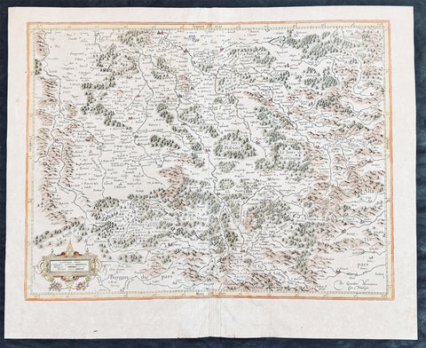
1628 Gerard Mercator Antique Map the Southern Lorraine Region of France
Antique Map
- Title : La Partie Meridionale de Lorraine...Per Geradum Mercatorem Cum Privilegio
- Size: 21in x 17in (530mm x 430mm)
- Condition: (B) Good Condition
- Date : 1628
- Ref #: 26142
Description:
This original copper plate engraved hand coloured antique map ancient region of southern Lorraine, France by Gerard Mercator was published by Henricus Hondius in the early 1628 French edition of Gerard Mercators Atlas.
These maps, published in the early editions of Mercators atlas, are the original maps drawn and engraved by Gerald Mercator in the mid to late 16th century, published by his son Rumold as an atlas, after his death, in 1595. After two editions the plates were purchased by Jodocus Hondius in 1604 and continued to be published until the mid 1630\\\'s when the plates were re-engraved and updated by Jan Jansson and Henricus Hondius.
General Definitions:
Paper thickness and quality: - Heavy and stable
Paper color : - off white
Age of map color: - Later
Colors used: - Green, yellow, pink, blue
General color appearance: - Authentic
Paper size: - 21in x 17in (530mm x 430mm)
Plate size: - 20in x 15in (510mm x 380mm)
Margins: - Min 1/2in (12mm)
Imperfections:
Margins: - Age toning, creasing
Plate area: - Age toning, creasing
Verso: - Age toning, creasing
Background:
Lorraine is a cultural and historical region in north-eastern France, now located in the administrative region of Grand Est. Lorraines name stems from the medieval kingdom of Lotharingia, which in turn was named for either Emperor Lothair I or King Lothair II. It later was ruled as the Duchy of Lorraine before the Kingdom of France annexed it in 1766.
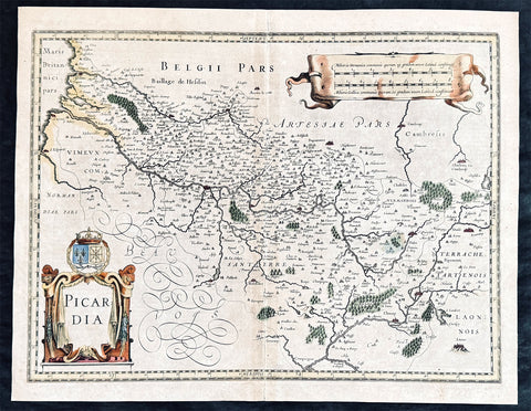
1628 Jan Jansson Antique Map of the Picardy or Picardie Region of France
- Title : Picardia
- Size: 22in x 17in (560mm x 430mm)
- Condition: (A) Very Good Condition
- Date : 1628
- Ref #: 26133
Description:
This original copper plate engraved hand coloured antique map of the French region of Picardy or Picardie by Jan Jansson was published in the early 1628 French edition of Janssons Atlas.
General Definitions:
Paper thickness and quality: - Heavy and stable
Paper color : - off white
Age of map color: - Later
Colors used: - Green, yellow, brown, blue, pink
General color appearance: - Authentic
Paper size: - 22in x 17in (560mm x 430mm)
Plate size: - 20in x 15in (510mm x 380mm)
Margins: - Min 1/2in (12mm)
Imperfections:
Margins: - Age toning
Plate area: - Age toning
Verso: - Age toning
Background:
Picardy is a historical territory and a former administrative region of Northern France and now part of the new region Nord-Pas-de-Calais-Picardie.
From the 5th century the area was part of the Frankish Empire, and in the feudal period it encompassed the six countships of Boulogne, Montreuil, Ponthieu, Amiénois,Vermandois, and Laonnois. According to the 843 Treaty of Verdun the region became part of West Francia, the later Kingdom of France.
The name Picardy (which may have referred to a Frankish tribe of picards or pike-bearers) was not used until the 12th or 13th century. During this time, the name applied to all lands where the Picard language was spoken, which included all the territories from Paris to the Netherlands. In the Latin Quarter of Paris, people identified a Picard Nation (Nation Picarde) of students at Sorbonne University, most of whom actually came from Flanders. During the Hundred Years\\\\\\\' War, Picardy was the centre of the Jacquerie peasant revolt in 1358.
From 1419 onwards, the Picardy counties (Boulogne, Ponthieu, Amiens, Vermandois) were gradually acquired by the Burgundian duke Philip the Good, confirmed by King Charles VII of France at the 1435 Congress of Arras. In 1477, King Louis XI of France led an army and occupied key towns in Picardy. By the end of 1477, Louis would control all of Picardy and most of Artois.
In the 16th century, the government (military region) of Picardy was created. This became a new administrative region of France, separate from what was historically defined as Picardy. The new Picardy included the Somme département, the northern half of the Aisne département, and a small fringe in the north of the Oise département.
In 1557, Picardy was invaded by Hapbsburg forces under the command of Emmanuel Philibert, Duke of Savoy. After a seventeen-day siege, St. Quentin would be ransacked while Noyon would be burned by the Habsburg army.
In the 17th century, an infectious disease similar to English sweat originated from the region and spread across France. It was called Suette des picards or Picardy sweat.
Sugar beet was introduced by Napoleon I during the Napoleonic Wars in the 19th century, in order to counter the United Kingdom, which had seized the sugar islands possessed by France in the Caribbean. The sugar industry has continued to play a prominent role in the economy of the region.
One of the most significant historical events to occur in Picardy was the series of battles fought along the Somme during World War I. From September 1914 to August 1918, four major battles, including the Battle of the Somme, were fought by British, French, and German forces in the fields of Northern Picardy. (Ref: Koeman; M&B; Tooley)
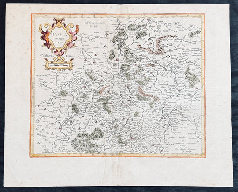
1628 Gerard Mercator & Henricus Hondius Antique Map State of Hesse, Germany
- Title : Hassia landtgrauiatus...Per Geradum Mercatorem Cum Privilego
- Size: 21in x 17in (530mm x 430mm)
- Condition: (A) Very Good Condition
- Date : 1628
- Ref #: 26107
Description:
This original copper plate engraved hand coloured antique map of the State of Hesse or Hessia, in central Germany, by Gerard Mercator was published by Henricus Hondius in the early 1628 French edition of Gerard Mercators Atlas.
These maps, published in the early editions of Mercators atlas, are the original maps drawn and engraved by Gerald Mercator in the mid to late 16th century, published by his son Rumold as an atlas, after his death, in 1595. After two editions the plates were purchased by Jodocus Hondius in 1604 and continued to be published until the mid 1630s by Henricus, when some of the plates were re-engraved and updated by Jan Jansson and Henricus Hondius.
General Definitions:
Paper thickness and quality: - Heavy and stable
Paper color : - off white
Age of map color: - Later
Colors used: - Green, yellow, brown, blue, pink
General color appearance: - Authentic
Paper size: - 21in x 17in (530mm x 430mm)
Plate size: - 18 1/2in x 14in (475mm x 350mm)
Margins: - Min 1/2in (12mm)
Imperfections:
Margins: - Light age toning
Plate area: - Light toning along centerfold
Verso: - Light age toning
Background:
Hesse officially the State of Hesse, is a federal state (Land) of the Federal Republic of Germany, with just over six million inhabitants. The state capital is Wiesbaden; the largest city is Frankfurt am Main.
In the 12th century, Hessengau was passed to Thuringia. In the War of the Thuringian Succession (1247–1264), Hesse gained independence and became a Landgraviate within the Holy Roman Empire. It shortly rose to primary importance under Landgrave Philip the Magnanimous, who was one of the leaders of German Protestantism. After Philips death in 1567, the territory was divided among his four sons from his first marriage (Philip was a bigamist) into four lines: Hesse-Kassel (or Hesse-Cassel), Hesse-Darmstadt, Hesse-Rheinfels, and the also previously existing Hesse-Marburg. As the latter two lines died out quite soon (1583 and 1605, respectively), Hesse-Kassel and Hesse-Darmstadt were the two core states within the Hessian lands. Several collateral lines split off during the centuries, such as in 1622, when Hesse-Homburg split off from Hesse-Darmstadt. In the late 16th century, Kassel adopted Calvinism, while Darmstadt remained Lutheran and subsequently the two lines often found themselves on different sides of a conflict, most notably in the disputes over Hesse-Marburg and in the Thirty Years War, when Darmstadt fought on the side of the Emperor, while Kassel sided with Sweden and France.
The Landgrave Frederick II (1720–1785) ruled as a benevolent despot, from 1760 to 1785. He combined Enlightenment ideas with Christian values, cameralist plans for central control of the economy, and a militaristic approach toward diplomacy.[16] He funded the depleted treasury of the poor nation by loaning 19,000 soldiers in complete military formations to Great Britain to fight in North America during the American Revolutionary War, 1776–1783. These soldiers, commonly known as Hessians, fought under the British flag. The British used the Hessians in several conflicts, including in the Irish Rebellion of 1798. For further revenue, the soldiers were loaned to other places as well. Most were conscripted, with their pay going to the Landgrave.
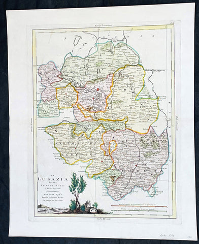
1780 Antonio Zatta Antique Map of The Lusatia Region Germany, Poland & Czech Rep
Antique Map
- Title : La Lusazia divisa ne suoi stati di nuova projezione
- Ref #: 35638
-
Condition: (A+) Fine Condition
- Size: 19in x 15 1/2in (485mm x 395mm)
- Date : 1780
- Price: $149US
Description:
This original hand coloured copper plate engraved antique map of the ancient central European region of Lusatia in between Poland and Germany, and in the south, the Czech Republic by Antonio Zatta (fl. 1775-97) in 1780 - dated - was published in his Atlas Atlante Novissimo
General Definitions:
Paper thickness and quality: - Heavy and stable
Paper color : - off white
Age of map color: - Original
Colors used: - Yellow, green, blue, pink
General color appearance: - Authentic
Paper size: - 19in x 15 1/2in (485mm x 395mm)
Plate size: - 16in x 12 1/2in (405mm x 315mm)
Margins: - Min 1in (25mm)
Imperfections:
Margins: - None
Plate area: - None
Verso: - None
Background:
Lusatia is a historical region in Central Europe, split between Germany and Poland. Lusatia stretches from the Bóbr and Kwisa rivers in the east to the Pulsnitz and Black Elster rivers in the west, and is located within the German states of Saxony and Brandenburg as well as in the Polish voivodeships of Lower Silesia and Lubusz. Lusatia's central rivers are the Spree and the Lusatian Neisse, which constitutes the border between Germany and Poland since 1945 (Oder–Neisse line). The Lusatian Mountains (part of the Sudetes), separate Lusatia from Bohemia (Czech Republic) in the south. Lusatia is traditionally divided into Upper Lusatia (the hilly southern part) and Lower Lusatia (the flat northern part).
Please note all items auctioned are genuine, we do not sell reproductions. A Certificate of Authenticity (COA) can be issued on request.
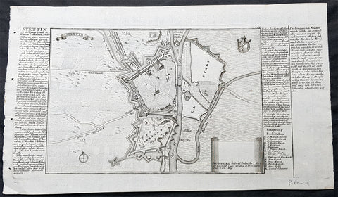
1725 Gabriel Bodenehr Antique Map Birds Eye View of Szczecin or Stettin, Poland
Antique Map
- Title : Stettin
- Ref #: 93494
- Size: 13 1/2in x 8in (335mm x 205mm)
- Date : 1725
- Condition: (A+) Fine Condition
Description:
This fine original copper plate engraved antique map, a birds eye view of the city of Szczecin or Stettin, Poland along with descriptive text was published in Gabriel Bodenehrs Force d Europe in 1725.
Bodenehr a copper engraver and publisher, bought the numerous copper plates of Johann Stridbeck (1640 – 1716) and revised them and along with his own maps, views and plans published them in several works with different titles.
General Definitions:
Paper thickness and quality: - Heavy and stable
Paper color : - off white
Age of map color: -
Colors used: -
General color appearance: -
Paper size: - 13 1/2in x 8in (335mm x 205mm)
Plate size: - 13in x 6 1/2in (330mm x 165mm)
Margins: - Min 1/4in (5mm)
Imperfections:
Margins: - None
Plate area: - None
Verso: - None
Background:
Szczecin/Stettin is the capital and largest city of the West Pomeranian Voivodeship in northwestern Poland. Located near the Baltic Sea and the German border, it is a major seaport and Polands seventh-largest city.
Szczecin is located on the river Oder, south of the Szczecin Lagoon and the Bay of Pomerania. The city is situated along the southwestern shore of Dąbie Lake, on both sides of the Oder and on several large islands between the western and eastern branches of the river. Szczecin is adjacent to the town of Police and is the urban centre of the Szczecin agglomeration, an extended metropolitan area that includes communities in the German states of Brandenburg and Mecklenburg-Vorpommern.
The cities recorded history began in the 8th century as a Lechitic Pomeranian stronghold, built at the site of the Ducal castle. In the 12th century, when Szczecin had become one of Pomeranias main urban centres, it lost its independence to Piast Poland, the Duchy of Saxony, the Holy Roman Empire and Denmark. At the same time, the House of Griffins established themselves as local rulers and the population was Christianized. After the Treaty of Stettin in 1630, the town came under the control of the Swedish Empire and became in 1648 the Capital of Swedish Pomerania until 1720, when it was acquired by the Kingdom of Prussia and then the German Empire. Following World War II Stettin became part of Poland in accordance with the Potsdam Agreement, resulting in the almost complete expulsion of the pre-war German population.
Bodenehr, Gabriel I fl 1673-1765
Engraver and mapmaker of Augsburg, from a family dynasty of engravers and publishers. Son of Johann Georg Bodenehr (1631-1704), father of Gabriel II (whose work is difficult to distinguish) and brother of Georg Conrad. In 1717 the family took over the Augsburg publishing house of Stridbeck. His works include Atlas Curieux (1704), Curioser Staats und Kriegs Theatrum (1715), and Europens Pracht und Macht (c.1720).
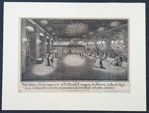
1735 Schubler & Steidlin Antique Baroque Print Musical Ball Regensburg Ger. 1717
Antique Map
- Title : Bal, welche den 26. Sept: 1717 in Sr Durchl: Eminens des Herrn Cardinals residens zu Regensburg, in dem so genamten Lowen-Saal, gehalten worden....NB das Bal Zimmer war mit rohten Tuch belegt
- Ref #: 93443
- Size: 19in x 13 1/2in (490mm x 345mm)
- Date : 1735
- Condition: (A) Very Good Condition
Description:
This large original Baroque copper plate engraved antique print, numbered three of three, of an early 18th century Ball, part of the celebrations at the Royal Court in the Cardinal Castle of Regensburg, on September 26, 1717, by Johann Schubler, was engraved by Johann Matthias Steidlin or Steudlin 1717-1754 and published by the Jeremias Wolff Erben in 1735.
A wonderful piece of Baroque art, engraved and published by some of the foremost art engravers and publishers at the beginning of the 18th century.
Professionally matted and can be easily removed if required.
General Definitions:
Paper thickness and quality: - Heavy and stable
Paper color : - off white
Age of map color: -
Colors used: -
General color appearance: -
Paper size: - 19in x 13 1/2in (490mm x 345mm)
Plate size: - 19in x 13 1/2in (490mm x 345mm)
Margins: - Min 1/2in (12mm)
Imperfections:
Margins: - Small repair bottom right signature
Plate area: - Folds as issued
Verso: - None
Background:
In 1245 Regensburg became a Free Imperial City and was a trade centre before the shifting of trade routes in the late Middle Ages. In 1486, Regensburg became part of the Duchy of Bavaria, but its independence was restored by the Holy Roman Emperor ten years later. In the city took place the Diet of 1541, was adopted the Protestant Reformation in 1542 and its Town Council remained entirely Lutheran. From 1663 to 1806, the city was the permanent seat of the Imperial Diet of the Holy Roman Empire, which became known as the Perpetual Diet of Regensburg. Thus, Regensburg was one of the central towns of the Empire, attracting visitors in large numbers.
A minority of the population remained Roman Catholic, and Roman Catholics were denied civic rights (Bürgerrecht). Although the Imperial city had adopted the Reformation, the town remained the seat of a Roman Catholic bishop and several abbeys. Three of these, St. Emmeram, Niedermünster and Obermünster, were free imperial estates within the Holy Roman Empire, meaning that they were granted a seat and a vote at the Imperial Diet (Reichstag). So there was the unique situation that the town of Regensburg comprised five independent states (in terms of the Holy Roman Empire): the Protestant city itself, the Roman Catholic bishopric, and the three monasteries. In addition, it was seen as the traditional capital of the region Bavaria (not the state), acted as functional co-capital of the Empire (second to the Emperors court at Vienna) due to the presence of the Perpetual Diet, and it was the residence of the Emperors Commissary-Principal to the same diet, who with one very brief exception was a prince himself (for many years the Prince of Thurn and Taxis, still resident in the town).
Schübler, Johann Jacob 1689 - 1741
Schübler was born in Nuremberg as was known as a versatile German baroque master builder , architectural theorist and writer and mathematician.
Schüblers father Johann Jacob was a braid maker and language teacher, and he also had medical knowledge, which he also used for a fee. He came to Nuremberg from Strasbourg and became resident there by marrying Maria Elisabeth Hengel, the daughter of an independent braid maker. The later master builder Johann Jacob Schübler was the fourth of the couples eight children. Through his father and private tutors, he received careful training, mainly in artistic subjects as well as in old and new languages. Architectural painter Johann Andreas Graff gave him his first drawing lessons . In 1698 he began his apprenticeship as a draftsman in the studio of the portraitist, engraver and art dealerJacob von Sandrart (1630-1708), in addition he was taught by Georg Christoph Eimmart (1638-1705), the long-time director of the important Nuremberg Academy of Painters , a representative of the mathematically oriented artists of the time and founder of the observatory at the Nuremberg castle .
At that time, extensive study trips were common for aspiring artists to complete their training. Between 1705 and 1713, Schüblers years of traveling took him through Germany, Denmark and Norway, the Netherlands and France - with a stopover in 1711 with his parents in Nuremberg. The time around 1700 in Europe was particularly intensive secular and church building activity, numerous elaborate, representative buildings. Schüblers travel destinations were primarily places where the current building activity was concentrated. However, Italy was missing from this program. He made longer stays for scholarly studies in Leipzig and Copenhagen .
After his return in 1713, Schübler remained settled in Nuremberg. Prominent colleagues such as Balthasar Neumann (1687–1753) visited him and he corresponded with well-known artists and scientists. He rejected various offers from foreign employers because they did not seem attractive enough to him. In 1717 he received the order for a gate of honor, which was built to celebrate a princely wedding in the main square of the residential city of Sulzbach . Schübler had an expansive triumphal arch with three stacked columns and niches for allegorical figures built, which was generally praised. A permanent position at the court of the Sulzbach Palatinate Countshowever, did not result from this. So he remained the prevented Builder. Great vocations only reached him towards the end of his life. In 1740 the Danish king invited him to Copenhagen, in 1741 negotiations for a move to Berlin followed to the court of the Prussian king Friedrich II. Both offers came too late for Schübler. He died in September 1741 from a clock-like illness.
Schübler only started his own family at an advanced age. In 1727 he married Margareta Maria Hemme, the daughter of a respected art dealer. At around 40, the bride was even a little older than Schübler herself; she died two years after the marriage, the marriage remained childless. In 1733 Schübler had a second marriage to 26-year-old Margaretha Setzmair. She also came from a long-established, wealthy middle-class family. The couple had two daughters, one of whom died very early, and a son who was born several months after Schüblers death.
In 1734 Schübler was accepted as an external member of the Prussian Academy of Sciences in Berlin. The small Schüblerstrasse in Nuremberg reminds him of him.
Schüblers actual lifes work consisted of a large number of writings, the publication of which he began around 1715. With his later works in particular, he pursued the intention of scientifically examining the questions of the building industry based on proportion and perspective, thereby making them teachable and learnable for building theorists and practitioners of his time.
Initially, Schübler published smaller masterpieces that appeared in deliveries of six to twelve engravings and contained hardly any text. In it he showed architectural details (e.g. fireplaces , mansard windows , pulpits, altars, confessionals), furniture (beds, desks, clocks, night chairs) and technical objects such as pumping stations and fountains. He drew the originals himself, often with a light color, but hardly ever took over the transfer to the printing plates, even though he knew this technique. For this, he employed a large number of engravers, among them Johann August Corvinus, Johann Matthias Steidlin, Georg Lichtensteger and his own brother Georg Andreas. The objects depicted often appear grotesquely overloaded with decorative elements such as flower threads, sphinxes and the like, but were also not intended for direct implementation. Rather, the executing tradesmen were able to take very different suggestions from a single template. The templates appeared in the publisher Jeremias Wolff in Augsburg, which is renowned throughout Europe .
Schüblers more scientific and literary works were mostly published by Johann Christoph Weigel in Nuremberg. In 1719/20 Perspectiva Pes Picturae was published in two parts , a large-format work of art intended to provide the basis for architectural painting . 1723/24, again in two parts, came out a textbook on the column orders with practical aids for difficult problems, which was reprinted several times. This was followed by publications on the art of sundial (1726) and on the wood-fired parlor ovens(1728). Schüblers main works then appeared within five years. With them he wanted to provide a new, in-depth representation of the entire architecture, with the main areas of the Architectura Civilis and the Architectura Militaris . From the years 1732-35 are the five illustrated volumes of a Synopsis Architecturae Civilis eclecticae , to which the content of the theoretical work Ars inveniendi from 1734 on civil architecture can be assigned. The two volumes of carpentry (Ars Tignaria) date from 1731 and 1736 . The main works include Perspectiva Geometrica Practica .
Schüblers works were widespread, and individual writings had up to 20 editions. The last known new edition dates from 1786. The popularity of his practically applicable proposals ended with the domination of baroque and rococo in architecture. The new general artist lexicon by art historian Georg Kaspar Nagler (1801–1866) already discusses Schüblers works as examples of the aesthetic aberrations of an era that has been overcome and describes them as senseless outbursts of an unregulated imagination.
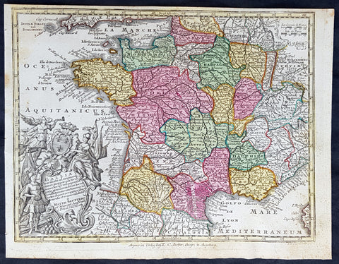
1744 Georg Mattaus Seutter Antique Map of France
Antique Map
- Title : Gallia....a Matth. Seuttero...T C Lotter, Geogr.
- Ref #: 93393
- Size: 11in x 8 1/2in (280mm x 215mm)
- Date : 1744
- Condition: (A+) Fine Condition
Description:
This beautifully hand coloured original copper-plate engraved antique map of France was engraved by Tobias Lotter and was published in the 1744 edition of GM Seutters Atlas Minor Prae cipua Orbis Terrarum Imperia Regna et Provincias...., Augsburg, Germany.
General Definitions:
Paper thickness and quality: - Heavy and stable
Paper color : - off white
Age of map color: - Original
Colors used: - Yellow, green, blue, pink
General color appearance: - Authentic
Paper size: - 11in x 8 1/2in (280mm x 215mm)
Plate size: - 10 1/2in x 8in (265mm x 205mm)
Margins: - Min 1/4in (5mm)
Imperfections:
Margins: - Light age toning
Plate area: - Light age toning
Verso: - None
Background:
Atlas Minor was a series of beautiful maps of all parts of the world. Georg Matthäus Seutter was one of the most and important of the German cartographers of the 18th century, being appointed as the Geographer to the Imperial Court. His son, Albrecht Carl, joined Matthäus and eventually inherited the business. The maps from Atlas Minor were drawn by the two Seutters and engraved by Tobias Conrad Lotte. These maps are highly detailed and engraved with a bold hand with equally strong original hand color in the body of the map as was the 18th century German style. The cartouches were left uncolored in order to emphasize the elaborately detailed illustrations for which German maps are especially prized. These are some of the most decorative and interesting maps of the eighteenth century.
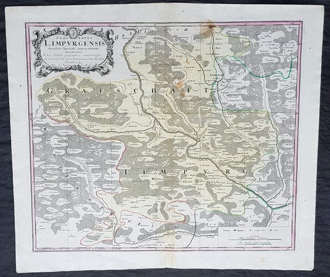
1749 Homann Antique Map Limpurg County, Schwabisch-Hall Baden-Wurtemberg Germany
- Title : Comitatus Limpurgensis Mandato Speciali imperantium mensuratus & hac Tabula geographica comprehensus / In lucem prodit Curis Homannianorum Heredum / Norimb 1749
- Date : 1749
- Condition: (A+) Fine Condition
- Ref: 20428
- Size: 23 1/2in x 20in (595mm x 510mm)
Description:
This large original copper-plate engraved antique map of Limpurg County in the district of Schwäbisch-Hallin in the state of Baden-Wurtemberg, SW Germany by the Homann Heirs was engraved in 1749 - dated in cartouche - and published in the Homanns 1750 German Atlas.
Limpurg is situated in the present-day district of Schwäbisch-Hall or Ostalbkreis between Schwäbisch-Hall, Schwäbisch Gmünd, Aalen and Ellwangen.
The map centers on the river Kocher, with towns marked such as Schwäbisch-Hall (Comburg), Gaildorf, Abstgemünd and Bühlertann.
General Definitions:
Paper thickness and quality: - Heavy and stable
Paper color : - off white
Age of map color: - Original
Colors used: - Yellow, Green, pink
General color appearance: - Authentic
Paper size: - 23 1/2in x 20in (595mm x 510mm)
Plate size: - 21in x 18in (535mm x 460mm)
Margins: - Min 1/4in (5mm)
Imperfections:
Margins: - None
Plate area: - Light soiling
Verso: - None
Background:
Baden-Württemberg is formed from the historical territories of Baden, Prussian Hohenzollern, and Württemberg, and also parts of Swabia.
In 100 AD, the Roman Empire invaded and occupied Württemberg, constructing a limes (fortified boundary zone) along its northern borders. Over the course of the third century AD, the Alemanni forced the Romans to retreat west beyond the Rhine and Danube rivers. In 496 AD the Alemanni were defeated by a Frankish invasion led by Clovis I.
The Holy Roman Empire was later established. The majority of people in this region continued to be Roman Catholics, even after the Protestant Reformation influenced populations in northern Germany. In the late-nineteenth and early-twentieth centuries, numerous people emigrated from this mostly rural area to the United States for economic reasons.
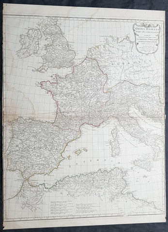
1764 D Anville Large Antique Map of the Western Roman Empire Dalmatia to Britain
- Title : Orbis Romani Pars Occidentalis...Auctor D Anville...MDCCLXIV (1763)
- Size: 29in x 22in (740mm x 560mm)
- Condition: (A) Very Good Condition
- Date : 1763
- Ref #: 92294
Description:
This large hand coloured original copper-plate engraved antique map of the Western part of the post Roman Empire, from Eastern Europe to Britain by Jean Baptiste Bourguignon D Anville was engraved in 1764 - dated in the tile cartouche - and was published in Jean-Baptiste Bourguinon D Anvilles large elephant folio atlas Atlas Generale. (Ref: Tooley, M&B)
General Definitions:
Paper thickness and quality: - Heavy and stable
Paper color : - off white
Age of map color: - Original
Colors used: - Yellow, Green, pink
General color appearance: - Authentic
Paper size: - 29in x 22in (740mm x 560mm)
Plate size: - 28in x 22in (730mm x 560mm)
Margins: - Min 1/4in (3mm)
Imperfections:
Margins: - Soiling in margins, L&R margins cropped close to border
Plate area: - Soiling bottom & top left
Verso: - Soiling
Background:
The Roman Empire was the post-Roman Republic period of the ancient Roman civilization, with a government headed by emperors and large territorial holdings around the Mediterranean Sea in Europe, Africa and Asia. The city of Rome was the largest city in the world c. 100 BC – c. AD 400, with Constantinople (New Rome) becoming the largest around AD 500, and the Empire\\\'s population grew to an estimated 50 to 90 million inhabitants (roughly 20% of the world\\\'s population at the time) The 500-year-old republic which preceded it had been severely destabilized in a series of civil wars and political conflict, during which Julius Caesar was appointed as perpetual dictator and then assassinated in 44 BC. Civil wars and executions continued, culminating in the victory of Octavian, Caesar\\\'s adopted son, over Mark Antony and Cleopatra at the Battle of Actium in 31 BC and the annexation of Egypt. Octavian\\\'s power was then unassailable and in 27 BC the Roman Senate formally granted him overarching power and the new title Augustus, effectively marking the end of the Roman Republic.
1824 Louis Vivien Large Antique Map of Russia in Europe
- Title : Carte La Russie D Europe...1824
- Size: 27 1/2in x 23in (700mm x 585mm)
- Condition: (A+) Fine Condition
- Date : 1824
- Ref #: 40704
Description:
This finely engraved original large antique map of Russia in Europe by Louis Vivien in his Elephant Folio atlas, Atlas Universal
General Definitions:
Paper thickness and quality: - Heavy and stable
Paper color : - off white
Age of map color: - Original
Colors used: - Blue, pink, yellow, green
General color appearance: - Authentic
Paper size: - 27 1/2in x 23in (700mm x 585mm)
Plate size: - 23in x 20in (585mm x 510mm)
Margins: - Min 2in (50mm)
Imperfections:
Margins: - Light soiling
Plate area: - None
Verso: - None
Background:
It is scarcely necessary to look at a map of Russia - with which we must include Siberia - to visualize the daunting task facing Russian map makers. Indeed, considering the vastness of their territory and the lack of skilled cartographers, it is surprising that relatively good maps were available for engraving and printing in most of the well known sixteenth and seventeenth century atlases. Generally, maps of that time were based on material brought back from Moscow by visitors from the West.
Vivien, Louis 1802 - 1896
Louis Vivien , or Vivien de Saint-Martin was a French geographer who was born in Saint-Martin-de-Fontenay and died in Versailles, France in 1896.
He settled in Paris under the Restoration, and became known with his publication of the Electoral and Administrative Map in 1823 and his comprehensive Universal Atlas in 1825, collaborating with Jacques Bibliomappe -Charles Bailleul from 1828. Vivien was foremost a geographer but was also a publisher of works in other fields, including historical books on the General History of the French Revolution and the History of Napoleon. He also translated various English works, such as the novels of Walter Scott .
He also wrote the New Annals of Travels between 1845 and 1854 and briefly the French Athenaeum between 1847 & 1848. He contributed to numerous periodicals such as Le Constitutionnel, Revue contemporaine, Revue germanique & La Presse. He also wrote L Année géographique between 1863 and 1875 before passing the baton to G. Maunoir and Henri Duveyrier.
He is mainly known though, for his three cartographical works, A History of Geographical Discoveries, A New Dictionary of Universal Geography and the Universal Atlas of Geography. The first of these publications he completed after the 1848 Revolution with the latter two completed by Louis Rousselet and Franz Schrader.
Vivien was Honorary President of the Geographical Society, of which he was one of the founder members. He also laureate of the Academy of Inscriptions and Belles-Lettres as well as a member of the Asian Society , the Society of Ethnology along with a large number of learned societies and European academies.
Main works of Vivien de Saint-Martin
- General History of the French Revolution, the Empire, the Restoration, the Monarchy of 1830, up to and including 1841 (4 volumes in 2 volumes), Paris, Pourrat Brothers, 1841-1842.
- History of Napoleon and the Empire (2 volumes), Paris, Pourrat brothers, 1844.
- History of geographical discoveries of European nations in various parts of the world (2 volumes), Paris, Arthus-Bertrand, 1845-1846.
- Research on primitive populations and the oldest traditions of the Caucasus , Paris, Arthus-Bertrand, 1847.
- Studies of Ancient Geography and Asian Ethnography (2 volumes), Paris, Arthus-Bertrand, 1850-1852.
- Historical and geographical description of Asia Minor (2 volumes), Paris, Arthus-Bertrand, 1852.
- Study on the Greek and Latin Geography of India , Paris, Imperial Printing, 1858.
- Study on the geography and the primitive populations of north-west India, according to the Vedic hymns , Paris, Imprimerie impériale, 1860.
- North Africa in Greek and Roman antiquity, historical and geographical study , Paris, Imprimerie impériale, 1863.
- History of geography and geographical discoveries from the earliest times to the present day , Paris, Hachette, 1873.
- With Franz Schrader : Universal Atlas of Geography built from the original sources and the most recent documents , Paris, Hachette, 1876-1915.
- With Louis Rousselet : New dictionary of universal geography (9 volumes), Paris, Hachette, 1879-1900.
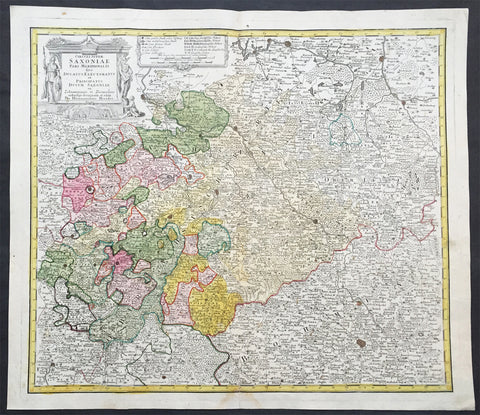
1735 J B Homann Large Antique Map of Old Saxony, Germany - Berlin to Prague
- Title : Circuli Super Saxoniae pars Meridionalis sive Ducatus...Homannianos
- Date : 1735
- Condition: (A+) Fine Condition
- Ref # : 30832
- Size : 23in x 19in (600mm x 520mm)
Description:
This large original hand coloured copper plate engraved antique map of the Saxony region of central Germany. The map stretches from Berlin in the north to Prague in the Czech Republic to the south, by J B Homann was published by the Homann Heirs firm in 1735. (Ref: Tooley; M&B)
General Definitions:
Paper thickness and quality: - Heavy and stable
Paper color : - off white
Age of map color: - Original
Colors used: - Blue, pink, red, green, yellow
General color appearance: - Authentic
Paper size: - 23in x 19in (600mm x 520mm)
Plate size: - 24in x 19 1/2in (565mm x 495mm)
Margins: - Min 1in (25mm)
Imperfections:
Margins: - None
Plate area: - None
Verso: - None
Background:
Saxony is a landlocked federal state of Germany, bordering the federal states of Brandenburg, Saxony Anhalt, Thuringia, and Bavaria, as well as the countries of Poland and the Czech Republic.
The history of the state of Saxony spans more than a millennium. It has been a medieval duchy, an electorate of the Holy Roman Empire, a kingdom, and twice a republic.
The area of the modern state of Saxony should not be confused with Old Saxony, the area inhabited by Saxons. Old Saxony corresponds roughly to the modern German states of Lower Saxony, Saxony-Anhalt, and the Westphalian part of North Rhine-Westphalia.
The territory of the Free State of Saxony became part of the Holy Roman Empire by the 10th century, when the dukes of Saxony were also kings (or emperors) of the Holy Roman Empire, comprising the Ottonian, or Saxon, Dynasty. Around this time, the Billungs, a Saxon noble family, received extensive fields in Saxony. The emperor eventually gave them the title of dukes of Saxony. After Duke Magnus died in 1106, causing the extinction of the male line of Billungs, oversight of the duchy was given to Lothar of Supplinburg, who also became emperor for a short time.
In 1137, control of Saxony passed to the Guelph dynasty, descendants of Wulfhild Billung, eldest daughter of the last Billung duke, and the daughter of Lothar of Supplinburg. In 1180 large portions west of the Weser were ceded to the Bishops of Cologne, while some central parts between the Weser and the Elbe remained with the Guelphs, becoming later the Duchy of Brunswick-Lüneburg. The remaining eastern lands, together with the title of Duke of Saxony, passed to an Ascanian dynasty (descended from Eilika Billung, Wulfhild\\\\\\\'s younger sister) and were divided in 1260 into the two small states of Saxe-Lauenburg and Saxe-Wittenberg. The former state was also named Lower Saxony, the latter Upper Saxony, thence the later names of the two Imperial Circles Saxe-Lauenburg and Saxe-Wittenberg. Both claimed the Saxon electoral privilege for themselves, but the Golden Bull of 1356 accepted only Wittenberg\\\\\\\'s claim, with Lauenburg nevertheless continuing to maintain its claim. In 1422, when the Saxon electoral line of the Ascanians became extinct, the Ascanian Eric V of Saxe-Lauenburg tried to reunite the Saxon duchies.
However, Sigismund, King of the Romans, had already granted Margrave Frederick IV the Warlike of Meissen (House of Wettin) an expectancy of the Saxon electorate in order to remunerate his military support. On 1 August 1425 Sigismund enfeoffed the Wettinian Frederick as Prince-Elector of Saxony, despite the protests of Eric V. Thus the Saxon territories remained permanently separated. The Electorate of Saxony was then merged with the much bigger Wettinian Margraviate of Meissen, however using the higher-ranking name Electorate of Saxony and even the Ascanian coat-of-arms for the entire monarchy. Thus Saxony came to include Dresden and Meissen. In the 18th and 19th centuries Saxe-Lauenburg was colloquially called the Duchy of Lauenburg, which in 1876 merged with Prussia as the Duchy of Lauenburg district.
Saxony-Wittenberg, in modern Saxony-Anhalt, became subject to the margravate of Meissen, ruled by the Wettin dynasty in 1423. This established a new and powerful state, occupying large portions of the present Free State of Saxony, Thuringia, Saxony-Anhalt and Bavaria (Coburg and its environs). Although the centre of this state was far to the southeast of the former Saxony, it came to be referred to as Upper Saxony and then simply Saxony, while the former Saxon territories were now known as Lower Saxony.
In 1485, Saxony was split. A collateral line of the Wettin princes received what later became Thuringia and founded several small states there (see Ernestine duchies). The remaining Saxon state became still more powerful and was known in the 18th century for its cultural achievements, although it was politically weaker than Prussia and Austria, states which oppressed Saxony from the north and south, respectively.
Between 1697 and 1763, the Electors of Saxony were also elected Kings of Poland in personal union.
In 1756, Saxony joined a coalition of Austria, France and Russia against Prussia. Frederick II of Prussia chose to attack preemptively and invaded Saxony in August 1756, precipitating the Third Silesian War (part of the Seven Years\\\\\\\' War). The Prussians quickly defeated Saxony and incorporated the Saxon army into the Prussian army. At the end of the Seven Years\\\\\\\' War, Saxony recovered its independence in the 1763 Treaty of Hubertusburg.
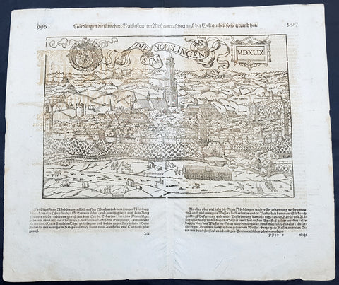
1628 Sebastian Munster & RMD Antique Map View Nordlingen Swabia, Bavaria Germany
- Title : Die Statt Nordlingen
- Ref #: 33587
- Size: 17in x 15in (435mm x 380mm)
- Date : 1628
- Condition: (A+) Fine Condition
Description:
This fine original wood block engraved antique map a birds eye view of the German town of Nördlingen in the Donau-Ries district, in Swabia, Bavaria,, was engraved by Hans Rudolf Manuel Deutsch (RMD) in 1549 - dated - and published in the German Section of Sebastian Munsters 1628 edition of Cosmographia, Das ist: Beschreibung der gantzen Welt, Darinnen Aller Monarchien Keyserthumben, Königreichen, Fürstenthumben, Graff- und Herrschafften, Länderen, Stätten und Gemeinden.Ursprung (Cosmographia, that is: description of the whole world, in it all monarchies Keyser thumben, kingdoms, prince thumben, graff and herrschafften, countries, places and municipalities.)
Hans Rudolf Manuel Deutsch (1525–1571) was a Swiss artist. He made several of the woodcuts for De re metallica (the metals and mining treatise by Georgius Agricola, the father of mineralogy) and for Sebastian Münsters Cosmographia.
Deutschs father, Niklaus Manuel Deutsch (the Elder), and Deutsch\'s brother, Niklaus Manuel Deutsch the Younger, were also artists. The elder Niklaus had taken the last name Manuel, but all three also commonly used Deutsch as part of their names and signed their paintings with initials ending in D.
Nördlingen is a town in the Donau-Ries district, in Swabia, Bavaria, Germany. The town was the location of two battles during the Thirty Years\' War, which took place between 1618–1648. Today it is one of only three towns in Germany that still has a completely established city wall, the other two being Rothenburg ob der Tauber and Dinkelsbühl.
General Definitions:
Paper thickness and quality: - Heavy and stable
Paper color : - off white
Age of map color: -
Colors used: -
General color appearance: -
Paper size: - 17in x 15in (435mm x 380mm)
Plate size: - 17in x 15in (435mm x 380mm)
Margins: - Min 1/2in (10mm)
Imperfections:
Margins: - Light offsetting
Plate area: - Light offsetting
Verso: - Light offsetting
Background:
Cosmographia, Das ist: Beschreibung der gantzen Welt, Darinnen Aller Monarchien Keyserthumben, Königreichen, Fürstenthumben, Graff- und Herrschafften, Länderen, Stätten und Gemeinden.Ursprung, Regiment, Reichthumb, Gewalt und.Beschaffenheit. Dessgleichen Aller deren, beyder Ständen, Regenten: Keysern, Königen, Bäpsten, Bischoffen.Genealogien und Stammbäumen.zusammen getragen. by Sebastian Münster was first published in 1544 and is the earliest German-language description of the world. It had numerous editions in different languages including Latin, French (translated by François de Belleforest), Italian, English, and Czech. The last German edition was published in 1628, long after Munsters death. The Cosmographia was one of the most successful and popular books of the 16th century. It passed through 24 editions in 100 years. This success was due to the notable woodcuts (some by Hans Holbein the Younger, Urs Graf, Hans Rudolph Manuel Deutsch, and David Kandel). It was most important in reviving geography in 16th-century Europe. Among the notable maps within Cosmographia is the map Tabula novarum insularum, which is credited as the first map to show the American continents as geographically discrete.
Munsters earlier geographic works were Germania descriptio (1530) and Mappa Europae (1536). In 1540, he published a Latin edition of Ptolemys Geographia with illustrations.
1777 F. Santini Antique Map Flanders Artois Hainaut Picardy Regions of Belgium
- Title : Carte Des Gouvernements de Flandre Francois d Artois de Picardie et du Boulenois...P Santini...1777
- Size: 30in x 21in (760mm x 535mm)
- Condition: (A+) Fine Condition
- Date : 1777
- Ref #: 50219
Description:
This large magnificent original copper-plate engraved antique map of Belgium and parts of Northern France made up of the provinces of Flanders, Artois, Hainaut, Picardy was engraved in 1777 - the date is engraved in the title cartouche - after Rigobert Bonne in 1771 and was published by Francois Santini (active 1776-84) in his 2 volume edition of Atlas Universal 1776-84.. (Ref: Tooley; M&B)
General Definitions:
Paper thickness and quality: - Heavy and stable
Paper color : - off white
Age of map color: - Original
Colors used: - Blue, pink, red, green, yellow
General color appearance: - Authentic
Paper size: - 30in x 21in (760mm x 535mm)
Plate size: - 23in x 18in (585mm x 460mm)
Margins: - Min 2in (50mm)
Imperfections:
Margins: - None
Plate area: - None
Verso: - None
Background:
Belgium officially the Kingdom of Belgium, is a country in Western Europe bordered by France, the Netherlands, Germany and Luxembourg.
Historically, Belgium was part of an area known as the Low Countries, a somewhat larger region than the current Benelux group of states that also included parts of northern France and western Germany. Its name is derived from the Latin word Belgica, after the Roman province of Gallia Belgica. From the end of the Middle Ages until the 17th century, the area of Belgium was a prosperous and cosmopolitan centre of commerce and culture. Between the 16th and early 19th centuries, Belgium served as the battleground between many European powers, earning the moniker the Battlefield of Europe, a reputation strengthened by both world wars. The country emerged in 1830 following the Belgian Revolution when it seceded from the Netherlands.
The Eighty Years War (1568–1648) divided the Low Countries into the northern United Provinces (Belgica Foederata in Latin, the Federated Netherlands) and the Southern Netherlands (Belgica Regia, the Royal Netherlands). The latter were ruled successively by the Spanish (Spanish Netherlands) and the Austrian Habsburgs (Austrian Netherlands) and comprised most of modern Belgium. This was the theatre of most Franco-Spanish and Franco-Austrian wars during the 17th and 18th centuries.
Following the campaigns of 1794 in the French Revolutionary Wars, the Low Countries—including territories that were never nominally under Habsburg rule, such as the Prince-Bishopric of Liège—were annexed by the French First Republic, ending Austrian rule in the region. The reunification of the Low Countries as the United Kingdom of the Netherlands occurred at the dissolution of the First French Empire in 1815, after the defeat of Napoleon.
1777 F. Santini Antique Map Flanders Artois Hainaut Picardy Regions of Belgium
- Title : Carte Des Gouvernements de Flandre Francois d Artois de Picardie et du Boulenois...P Santini...1777
- Size: 30in x 21in (760mm x 535mm)
- Condition: (A+) Fine Condition
- Date : 1777
- Ref #: 50221
Description:
This large magnificent original copper-plate engraved antique map of Belgium and parts of Northern France made up of the provinces of Flanders, Artois, Hainaut, Picardy was engraved in 1777 - the date is engraved in the title cartouche - after Rigobert Bonne in 1771 and was published by Francois Santini (active 1776-84) in his 2 volume edition of Atlas Universal 1776-84.. (Ref: Tooley; M&B)
General Definitions:
Paper thickness and quality: - Heavy and stable
Paper color : - off white
Age of map color: - Original
Colors used: - Blue, pink, red, green, yellow
General color appearance: - Authentic
Paper size: - 30in x 21in (760mm x 535mm)
Plate size: - 23in x 18in (585mm x 460mm)
Margins: - Min 2in (50mm)
Imperfections:
Margins: - None
Plate area: - None
Verso: - None
Background:
Belgium officially the Kingdom of Belgium, is a country in Western Europe bordered by France, the Netherlands, Germany and Luxembourg.
Historically, Belgium was part of an area known as the Low Countries, a somewhat larger region than the current Benelux group of states that also included parts of northern France and western Germany. Its name is derived from the Latin word Belgica, after the Roman province of Gallia Belgica. From the end of the Middle Ages until the 17th century, the area of Belgium was a prosperous and cosmopolitan centre of commerce and culture. Between the 16th and early 19th centuries, Belgium served as the battleground between many European powers, earning the moniker the Battlefield of Europe, a reputation strengthened by both world wars. The country emerged in 1830 following the Belgian Revolution when it seceded from the Netherlands.
The Eighty Years War (1568–1648) divided the Low Countries into the northern United Provinces (Belgica Foederata in Latin, the Federated Netherlands) and the Southern Netherlands (Belgica Regia, the Royal Netherlands). The latter were ruled successively by the Spanish (Spanish Netherlands) and the Austrian Habsburgs (Austrian Netherlands) and comprised most of modern Belgium. This was the theatre of most Franco-Spanish and Franco-Austrian wars during the 17th and 18th centuries.
Following the campaigns of 1794 in the French Revolutionary Wars, the Low Countries—including territories that were never nominally under Habsburg rule, such as the Prince-Bishopric of Liège—were annexed by the French First Republic, ending Austrian rule in the region. The reunification of the Low Countries as the United Kingdom of the Netherlands occurred at the dissolution of the First French Empire in 1815, after the defeat of Napoleon.
1757 Robert De Vaugondy Large Antique Map The County of Hainaut Belgium & France
- Title : Comte De Hainaut et de Cambres.......Par Le Sr. Robert
- Size: 23in x 19 1/2in (585mm x 495mm)
- Condition: (A+) Fine Condition
- Date : 1757
- Ref #: 41564
Description:
This large magnificent hand coloured original copper-plate engraved antique map of the Hainaut region of Belgium - centering on the city of Mons - by Robert De Vaugondy was published in the 1757 edition of De Vaugondys famous The Atlas Universel
General Definitions:
Paper thickness and quality: - Heavy and stable
Paper color : - off white
Age of map color: - Original & later
Colors used: - Blue, pink, red, green, yellow
General color appearance: - Authentic
Paper size: - 23in x 19 1/2in (585mm x 495mm)
Plate size: - 23in x 19 1/2in (585mm x 495mm)
Margins: - Min 1/4in (6mm)
Imperfections:
Margins: - None
Plate area: - None
Verso: - None
Background:
The County of Hainaut sometimes given the spelling Hainault, was a historical lordship within the medieval Holy Roman Empire with its capital eventually established at Mons (Dutch: Bergen), and named after the river Haine, both now in Belgium. Besides Mons, it included the city of Valenciennes, now in France. It consisted of what is now the Belgian province of Hainaut and the eastern part of the French département of Nord.
Originally a gau of Lotharingia, Hainaut was briefly a part of West Francia (911–25) before becoming definitively attached to Germany. The county was divided in 958 and only emerged in its more or less final form in 1071. Hainaut was culturally and linguistically French. In 1432, Hainaut was acquired by the House of Valois-Burgundy and in 1477 passed to the Habsburgs with the rest of the Burgundian Netherlands and became part of the Burgundian Circle in 1512. It was ruled by the Spanish branch of the Habsburgs from 1555 to 1714. In 1659 and 1678 southern Hainaut was acquired by France, and in 1797 the rest of the county was ceded to France by the Emperor Francis II, who was also count of Hainaut.
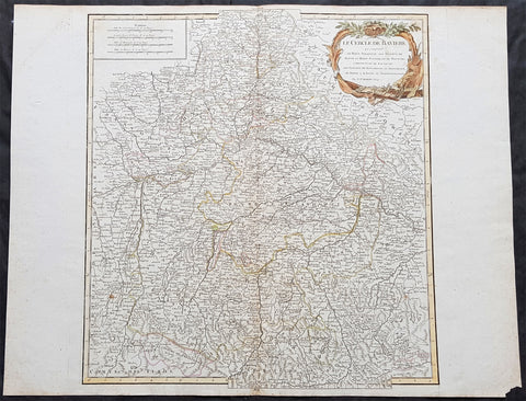
1757 Robert De Vaugondy Large Antique Map of Bavaria & River Danube, Germany
- Title : Le Cercle De Baviere.......Par Le Sr. Robert
- Size: 26in x 20in (660mm x 510mm)
- Condition: (A+) Fine Condition
- Date : 1757
- Ref #: 41577
Description:
This large magnificent hand coloured original copper-plate engraved antique map of Bavaria, Germany - centering on the River Danube - by Robert De Vaugondy was published in the 1757 edition of De Vaugondys famous The Atlas Universel
General Definitions:
Paper thickness and quality: - Heavy and stable
Paper color : - off white
Age of map color: - Original & later
Colors used: - Blue, pink, red, green, yellow
General color appearance: - Authentic
Paper size: - 26in x 20in (660mm x 510mm)
Plate size: - 20in x 19 1/2in (510mm x 495mm)
Margins: - Min 1/2in (10mm)
Imperfections:
Margins: - None
Plate area: - None
Verso: - None
Background:
Bavaria officially the Free State of Bavaria is a landlocked federal state of Germany, occupying its southeastern corner. With an area of 70,550.19 square kilometres, Bavaria is the largest German state by land area. Its territory comprises roughly a fifth of the total land area of Germany. With 12.9 million inhabitants, it is Germany\'s second-most-populous state after North Rhine-Westphalia. Bavaria\'s capital and largest city, Munich, is the third-largest city in Germany.
The history of Bavaria stretches from its earliest settlement and formation as a duchy in the 6th century CE through the Holy Roman Empire to becoming an independent kingdom and a state of the Federal Republic of Germany.
The Duchy of Bavaria dates back to the year 555. In the 17th century CE, the Duke of Bavaria became a Prince-elector of the Holy Roman Empire. The Kingdom of Bavaria existed from 1806 to 1918, when Bavaria became a republic. In 1946, the Free State of Bavaria re-organised itself on democratic lines after the Second World War.
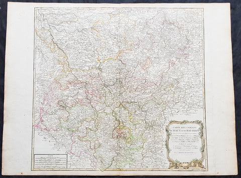
1757 Robert De Vaugondy Large Antique Map of North Rhine-Westphalia Bonn Cologne
- Title : Carte Des Cercles Du Haut et du Bas Rhin.....Par Le Sr. Robert
- Size: 26 1/2in x 19 3/4in (670mm x 505mm)
- Condition: (A+) Fine Condition
- Date : 1757
- Ref #: 41574
Description:
This large magnificent hand coloured original copper-plate engraved antique map of part of Western Germany centering on the Rhine River and the cities of Bonn & Cologne, today the North Rhine-Westphalia by Robert De Vaugondy was published in the 1757 edition of De Vaugondys famous The Atlas Universel
General Definitions:
Paper thickness and quality: - Heavy and stable
Paper color : - off white
Age of map color: - Original & later
Colors used: - Blue, pink, red, green, yellow
General color appearance: - Authentic
Paper size: - 26 1/2in x 19 3/4in (670mm x 505mm)
Plate size: - 21 1/2in x 19in (550mm x 480mm)
Margins: - Min 1/2in (10mm)
Imperfections:
Margins: - None
Plate area: - None
Verso: - None
Background:
North Rhine-Westphalia is located in western Germany covering an area of 34,084 square kilometres and a population of 17.6 million, the most populous and the most densely populated German state apart from the city-states of Berlin, Bremen, and Hamburg, and the fourth-largest by area. Düsseldorf is the state capital and Cologne is the largest city. North Rhine-Westphalia features four of Germany\'s 10 largest cities: Düsseldorf, Cologne, Dortmund, and Essen, and the Rhine-Ruhr metropolitan area, the largest in Germany and the third-largest on the European continent.
Around AD 1, numerous incursions occurred through Westphalia and perhaps even some permanent Roman or Romanized settlements. The Battle of Teutoburg Forest took place near Osnabrück (as mentioned, whether this is in Westphalia is disputed) and some of the Germanic tribes who fought at this battle came from the area of Westphalia. Charlemagne is thought to have spent considerable time in Paderborn and nearby parts. His Saxon Wars also partly took place in what is thought of as Westphalia today. Popular legends link his adversary Widukind to places near Detmold, Bielefeld, Lemgo, Osnabrück, and other places in Westphalia. Widukind was buried in Enger, which is also a subject of a legend.
Along with Eastphalia and Engern, Westphalia (Westfalahi) was originally a district of the Duchy of Saxony. In 1180, Westphalia was elevated to the rank of a duchy by Emperor Barbarossa. The Duchy of Westphalia comprised only a small area south of the Lippe River.
Parts of Westphalia came under Brandenburg-Prussian control during the 17th and 18th centuries, but most of it remained divided duchies and other feudal areas of power. The Peace of Westphalia of 1648, signed in Münster and Osnabrück, ended the Thirty Years\' War. The concept of nation-state sovereignty resulting from the treaty became known as Westphalian sovereignty.
As a result of the Protestant Reformation, there is no dominant religion in Westphalia. Roman Catholicism and Lutheranism are on relatively equal footing. Lutheranism is strong in the eastern and northern parts with numerous free churches. Münster and especially Paderborn are thought of as Catholic. Osnabrück is divided almost equally between Catholicism and Protestantism.
After the defeat of the Prussian Army at the Battle of Jena-Auerstedt, the Treaty of Tilsit in 1807 made the Westphalian territories part of the Kingdom of Westphalia from 1807 to 1813. It was founded by Napoleon and was a French vassal state. This state only shared the name with the historical region; it contained only a relatively small part of Westphalia, consisting instead mostly of Hessian and Eastphalian regions.
After the Congress of Vienna, the Kingdom of Prussia received a large amount of territory in the Westphalian region and created the province of Westphalia in 1815. The northernmost portions of the former kingdom, including the town of Osnabrück, had become part of the states of Hanover and Oldenburg.
The state of North Rhine-Westphalia was established by the British military administration\'s \"Operation Marriage\" on 23 August 1946, by merging the province of Westphalia and the northern parts of the Rhine Province, both being political divisions of the former state of Prussia within the German Reich. On 21 January 1947, the former state of Lippe was merged with North Rhine-Westphalia. The constitution of North Rhine-Westphalia was then ratified through a referendum.
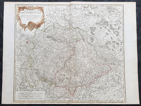
1757 Robert De Vaugondy Large Antique Map of Saxony, Meissen, Thuringia, Leipzig
- Title : Partie Meridionale Du Cercle De Haute Saxe...Par Le Sr. Robert
- Size: 26in x 20in (660mm x 510mm)
- Condition: (A+) Fine Condition
- Date : 1757
- Ref #: 41573
Description:
This large magnificent hand coloured original copper-plate engraved antique map of part of the Saxony region of Germany, centering on the district of Meissen & Thuringia and the city of Leipzig, by Robert De Vaugondy was published in the 1757 edition of De Vaugondys famous The Atlas Universel
General Definitions:
Paper thickness and quality: - Heavy and stable
Paper color : - off white
Age of map color: - Original & later
Colors used: - Blue, pink, red, green, yellow
General color appearance: - Authentic
Paper size: - 26in x 20in (660mm x 510mm)
Plate size: - 22in x 19 1/2in (560mm x 495mm)
Margins: - Min 1/2in (10mm)
Imperfections:
Margins: - None
Plate area: - None
Verso: - None
Background:
Saxony is a landlocked federal state of Germany, bordering the federal states of Brandenburg, Saxony Anhalt, Thuringia, and Bavaria, as well as the countries of Poland and the Czech Republic. Its capital is Dresden, and its largest city is Leipzig.
Saxony is the 10th-largest of Germany\'s 16 states, with an area of 18,413 square kilometres (7,109 sq mi), and the sixth-most populous, with 4 million people.
The history of the state of Saxony spans more than a millennium. It has been a medieval duchy, an electorate of the Holy Roman Empire, a kingdom, and twice a republic.
The area of the modern state of Saxony should not be confused with Old Saxony, the area inhabited by Saxons. Old Saxony corresponds roughly to the modern German states of Lower Saxony, Saxony-Anhalt, and the Westphalian part of North Rhine-Westphalia.
The territory of the Free State of Saxony became part of the Holy Roman Empire by the 10th century, when the dukes of Saxony were also kings (or emperors) of the Holy Roman Empire, comprising the Ottonian, or Saxon, Dynasty. Around this time, the Billungs, a Saxon noble family, received extensive fields in Saxony. The emperor eventually gave them the title of dukes of Saxony. After Duke Magnus died in 1106, causing the extinction of the male line of Billungs, oversight of the duchy was given to Lothar of Supplinburg, who also became emperor for a short time.
In 1137, control of Saxony passed to the Guelph dynasty, descendants of Wulfhild Billung, eldest daughter of the last Billung duke, and the daughter of Lothar of Supplinburg. In 1180 large portions west of the Weser were ceded to the Bishops of Cologne, while some central parts between the Weser and the Elbe remained with the Guelphs, becoming later the Duchy of Brunswick-Lüneburg. The remaining eastern lands, together with the title of Duke of Saxony, passed to an Ascanian dynasty (descended from Eilika Billung, Wulfhild\'s younger sister) and were divided in 1260 into the two small states of Saxe-Lauenburg and Saxe-Wittenberg. The former state was also named Lower Saxony, the latter Upper Saxony, thence the later names of the two Imperial Circles Saxe-Lauenburg and Saxe-Wittenberg. Both claimed the Saxon electoral privilege for themselves, but the Golden Bull of 1356 accepted only Wittenberg\'s claim, with Lauenburg nevertheless continuing to maintain its claim. In 1422, when the Saxon electoral line of the Ascanians became extinct, the Ascanian Eric V of Saxe-Lauenburg tried to reunite the Saxon duchies.
However, Sigismund, King of the Romans, had already granted Margrave Frederick IV the Warlike of Meissen (House of Wettin) an expectancy of the Saxon electorate in order to remunerate his military support. On 1 August 1425 Sigismund enfeoffed the Wettinian Frederick as Prince-Elector of Saxony, despite the protests of Eric V. Thus the Saxon territories remained permanently separated. The Electorate of Saxony was then merged with the much bigger Wettinian Margraviate of Meissen, however using the higher-ranking name Electorate of Saxony and even the Ascanian coat-of-arms for the entire monarchy. Thus Saxony came to include Dresden and Meissen. In the 18th and 19th centuries Saxe-Lauenburg was colloquially called the Duchy of Lauenburg, which in 1876 merged with Prussia as the Duchy of Lauenburg district.
Saxony-Wittenberg, in modern Saxony-Anhalt, became subject to the margravate of Meissen, ruled by the Wettin dynasty in 1423. This established a new and powerful state, occupying large portions of the present Free State of Saxony, Thuringia, Saxony-Anhalt and Bavaria (Coburg and its environs). Although the centre of this state was far to the southeast of the former Saxony, it came to be referred to as Upper Saxony and then simply Saxony, while the former Saxon territories were now known as Lower Saxony.
In 1485, Saxony was split. A collateral line of the Wettin princes received what later became Thuringia and founded several small states there (see Ernestine duchies). The remaining Saxon state became still more powerful and was known in the 18th century for its cultural achievements, although it was politically weaker than Prussia and Austria, states which oppressed Saxony from the north and south, respectively.
Between 1697 and 1763, the Electors of Saxony were also elected Kings of Poland in personal union.
In 1756, Saxony joined a coalition of Austria, France and Russia against Prussia. Frederick II of Prussia chose to attack preemptively and invaded Saxony in August 1756, precipitating the Third Silesian War (part of the Seven Years\' War). The Prussians quickly defeated Saxony and incorporated the Saxon army into the Prussian army. At the end of the Seven Years\' War, Saxony recovered its independence in the 1763 Treaty of Hubertusburg.
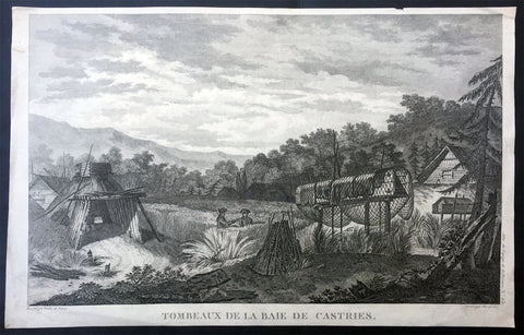
1797 Laperouse Antique Print View De Kastri Bay, Ulchsky Khabarovsk Kai, Russia
- Title : Tombeaux de la Baie de Castries
- Ref : 21436
- Size: 17in x 11in (435mm x 280mm)
- Date : 1797
- Condition: (A+) Fine Condition
Description:
This large original copper plate engraved antique print, a view of the very early settlement at De Kastri Bay, in the Ulchsky District of Khabarovsk Kai, Eastern Russia - opposite the Sakhalin Islands - by Jean-François de Galaup, Comte de la Pérouse was published in the 1st edition of the Atlas du voyage de La Perouse, Paris 1797.
General Definitions:
Paper thickness and quality: - Heavy and stable
Paper color : - off white
Age of map color: -
Colors used: -
General color appearance: -
Paper size: - 17in x 11in (435mm x 280mm)
Plate size: - 17in x 11in (435mm x 280mm)
Margins: - Min 1/2in (12mm)
Imperfections:
Margins: - Small repairs to margins, no loss
Plate area: - None
Verso: - None
Background:
De-Kastri was named for the former name of the bay on which it stands. The bay was discovered by La Pérouse on July 25, 1787 and named after the sponsor of the expedition—the then Secretary of State of the French Navy, the Marquis de Castries. The bay is a convenient natural refuge for vessels, giving it strategic importance from a military viewpoint.
The settlement was officially founded in 1853, although the land where it was situated would not officially be Russian territory until the signing of the Treaty of Aigun five years later.
In 1854, the difficult task of defending Petropavlovsk-Kamchatsky when it came under siege from the British and French forces during the Crimean War brought to attention the difficulties of supply and defense of the Kamchatka Peninsula, where a large section of the Russian Pacific Fleet was based. It was decided to move the port from Kamchatka without waiting for another attack. In the spring of 1855, the Russian navy\'s weapons and sailors under the leadership of Rear Admiral Vasily Zavoyko headed toward the mouth of the Amur River; however, the river mouth was still covered with ice. It was decided to wait for the break-up, hiding in the Bay of de Castries from the superior forces of French and English. Russian ships were discovered there, but managed to escape to the Amur River in the Strait of Tartary before the arrival of enemy reinforcements. The British and French did not know that Sakhalin was an island, and spent the later years of the war waiting in vain for the Russian fleet at its southern coast.
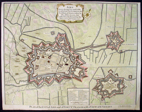
1745 Tindal Original Antique Map of Aire-sur-la-Lys, Fort St Francis & St Venant, France
-
Title : Plan of the City of Aire and Fort of St. Francis with a view of St.Venant
Sep. 28, 1708 - Size: 19 1/2in x 15 1/2in (495mm x 395mm)
- Ref #: 22218
- Date : 1745
- Condition: (A+) Fine Condition
Description:
This beautifully hand coloured original copper-plate engraved antique map, plan & birds eye view of the French city of Aire-sur-la-Lys, a commune in the Pas-de-Calais department in northern France along with Fort St Francis and Fort St Venant - used by Lord Marlborough during the Spanish War of Succession (1701-13) - was engraved by John Basire and was published in the 1745 edition of Nicholas Tindals Continuation of Mr. Rapin\'s History of England.
General Definitions:
Paper thickness and quality: - Heavy and stable
Paper color : - off white
Age of map color: - Early
Colors used: - Pink, blue, green, yellow
General color appearance: - Authentic
Paper size: - 19 1/2in x 15 1/2in (495mm x 395mm)
Plate size: - 19 1/2in x 15 1/2in (495mm x 395mm)
Margins: - Min 1/2in (12mm)
Imperfections:
Margins: - None
Plate area: - Folds as issued
Verso: - None
Background:
Aire-sur-la-Lys is located 10 miles (16 km) southeast of Saint-Omer, by the banks of the Leie and the Laquette rivers.
It is mentioned for the first time in 857 and developed around a fort or castrum built by Baldwin II, Count of Flanders in response to the Norman invasions. More growth followed with the establishment of the Collegiate church of Saint-Pierre by Baldwin V, Count of Flanders.
The town was laid siege ten times between 1127 and 1710. It was separated from the County of Flanders and attached to the County of Artois in 1196. Subsequently ruled by the Burgundians then by the Spanish.
The town was besieged in 1676 by Vauban and retaken for France, although it remained a Spanish possession until 14 April 1713, when, by the Treaty of Utrecht, it finally became a part of France.
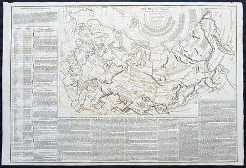
1812 Las Cases Large Original Antique Map of The Russian Empire, English Text
- Title : The Russian Empire with its gradual Acquisitions traced and Explained
- Size: 28in x 19in (710mm x 485mm)
- Ref #: 40259
- Date : 1812
- Condition: (A) Very Good Condition
Description:
This large original copper plate engraved antique map of Russia - within the geographical, political, economic, physical & historical text - was published in the 1812 English edition of Emmanuel Las Cases very large Elephant Folio size The Historical, Geographical & Genealogy Atlas
General Definitions:
Paper thickness and quality: - Heavy and stable
Paper color : - off white
Age of map color: -
Colors used: -
General color appearance: -
Paper size: - 28in x 19in (710mm x 485mm)
Plate size: - 21in x 13in (535mm x 33mm)
Margins: - Min 1/2in (12mm)
Imperfections:
Margins: - Light offsetting
Plate area: - Light offsetting
Verso: - Light age toning
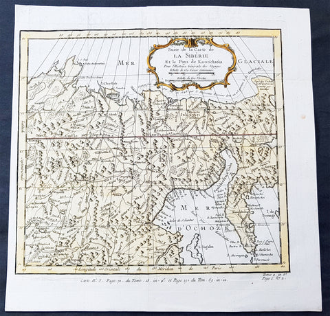
1758 Bellin Old, Antique Map of Eastern Siberia and the Kamchatka Peninsula Russia
- Title : Suite de la Carte de La Siberie et le Pays Kamtschatka
- Ref #: 60929
- Size: 11 3/4in x 11 3/4in (300mm x 300mm)
- Date : 1758
- Condition: (A+) Fine Condition
Description:
This fine, original copper-plate engraved antique map of Eastern Russia & Siberia including the Kamchatka Peninsular and south to northern China by Jacques Nicolas Bellin in 1750 was published in Antoine François Prevosts 15 volumes of Histoire Generale des Voyages written by Prevost & other authors between 1746-1790.
General Definitions:
Paper thickness and quality: - Heavy and stable
Paper color : - off white
Age of map color: - Early
Colors used: - Green, yellow, red
General color appearance: - Authentic
Paper size: - 12in x 12in (305mm x 305mm)
Plate size: - 10 1/2in x 9 1/2in (285mm x 245mm)
Margins: - Min 1/2in (6mm)
Imperfections:
Margins: - None
Plate area: - Folds as issued
Verso: - None
Background:
One of Antoine Francois Prevosts monumental undertakings was his history of exploration & discovery in 15 volumes titledHistoire Générale des Voyages written between 1746-1759 and was extended to 20 volumes after his death by various authors.
The 20 volumes cover the early explorations & discoveries on 3 continents: Africa (v. 1-5), Asia (v. 5-11), and America (v. 12-15) with material on the finding of the French, English, Dutch, and Portugese.
A number of notable cartographers and engravers contributed to the copper plate maps and views to the 20 volumes including Nicolas Bellin, Jan Schley, Chedel, Franc Aveline, Fessard, and many others.
The African volumes cover primarily coastal countries of West, Southern, and Eastern Africa, plus the Congo, Madagascar, Arabia and the Persian Gulf areas.
The Asian volumes cover China, Korea, Tibet, Japan, Philippines, and countries bordering the Indian Ocean.
Volume 11 includes Australia and Antarctica.
Volumes 12-15 cover voyages and discoveries in America, including the East Indies, South, Central and North America.
Volumes 16-20 include supplement volumes & tables along with continuation of voyages and discoveries in Russia, Northern Europe, America, Asia & Australia.
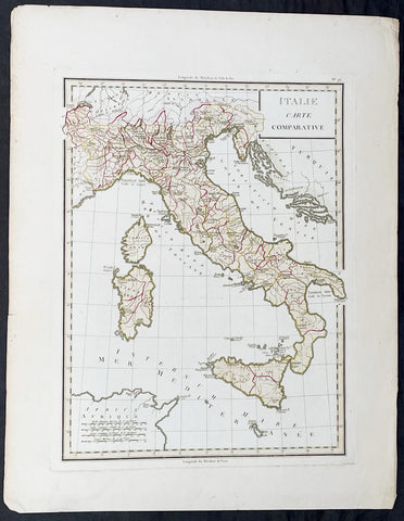
1765 Tardieu Large Antique Map of Italy
- Title : Italie Carte Comparative
- Date : 1765
- Condition: (A+) Fine Condition
- Ref: 92789
- Size: 23in x 17 1/2in (585mm x 445mm)
Description:
This large beautifully hand coloured original antique map of Italy was published by the famous French publisher Pierre Francois Tardieu (famous for publishing Diderots Encyclopedie in 1779) in 1765. (Ref: M&B; Tooley)
General Description:
Paper thickness and quality: - Heavy & stable
Paper color: - White
Age of map color: - Original
Colors used: - Pink, green, yellow
General color appearance: - Authentic
Paper size: - 23in x 17 1/2in (585mm x 445mm)
Paper size: - 18in x 13 1/2in (460mm x 340mm)
Margins: - Min 1in (25mm)
Imperfections:
Margins: - None
Plate area: - None
Verso: - None

1682 Merian Antique Map Birds Eye View of the Siege of Szczecin, Stettin Poland
Antique Map
- Title : Abbildung der voortrefflichen Langwerenden Belägerung der Statt und Vöstung Alt Stettin . Im Jahr 1677
- Ref #: 93495
- Size: 15 1/2in x 13 1/2in (395mm x 345mm)
- Date : 1682
- Condition: (A+) Fine Condition
Description:
This original copper-plate engraved antique map a birds-eye view of the siege of Szczecin or Stettin, Poland in 1677 by Matthaus Merian was published in the 1682 edition of Theatrum Europaeum
During the Thirty Years War, Stettin refused to accept German imperial armies, instead the Pomeranian dukes allied with Sweden. After the Treaty of Stettin (1630) manifested Swedish occupation, Stettin was fortified by the Swedish Empire. After the death of the last Pomeranian duke, Boguslaw XIV, Stettin was awarded to Sweden with the western part of the duchy in the Peace of Westphalia (1648), but remained part of the Holy Roman Empire. The Swedish-Brandenburgian border was settled in the Treaty of Stettin (1653). The King of Sweden became Duke of Pomerania and as such held a seat in the Imperial Diet of the Holy Roman Empire. The city was cut off from its main trading area, and was besieged in several wars with Brandenburg which shattered the citys economy, which fell in prolonged economic decline.
In 1654 the last Pomeranian duke Boguslaw XIV was buried in the Ducal Castle.
General Definitions:
Paper thickness and quality: - Heavy and stable
Paper color : - off white
Age of map color: -
Colors used: -
General color appearance: -
Paper size: - 15 1/2in x 13 1/2in (395mm x 345mm)
Plate size: - 11in x 10in (280mm x 255mm)
Margins: - Min 1/2in (12mm)
Imperfections:
Margins: - None
Plate area: - None
Verso: - None
Background:
Szczecin/Stettin is the capital and largest city of the West Pomeranian Voivodeship in northwestern Poland. Located near the Baltic Sea and the German border, it is a major seaport and Polands seventh-largest city.
Szczecin is located on the river Oder, south of the Szczecin Lagoon and the Bay of Pomerania. The city is situated along the southwestern shore of Dąbie Lake, on both sides of the Oder and on several large islands between the western and eastern branches of the river. Szczecin is adjacent to the town of Police and is the urban centre of the Szczecin agglomeration, an extended metropolitan area that includes communities in the German states of Brandenburg and Mecklenburg-Vorpommern.
The cities recorded history began in the 8th century as a Lechitic Pomeranian stronghold, built at the site of the Ducal castle. In the 12th century, when Szczecin had become one of Pomeranias main urban centres, it lost its independence to Piast Poland, the Duchy of Saxony, the Holy Roman Empire and Denmark. At the same time, the House of Griffins established themselves as local rulers and the population was Christianized. After the Treaty of Stettin in 1630, the town came under the control of the Swedish Empire and became in 1648 the Capital of Swedish Pomerania until 1720, when it was acquired by the Kingdom of Prussia and then the German Empire. Following World War II Stettin became part of Poland in accordance with the Potsdam Agreement, resulting in the almost complete expulsion of the pre-war German population.
Merian, Matthaus 1593 - 1650
Merian was a Swiss-born engraver who worked in Frankfurt for most of his career, where he also ran a publishing house. He was a member of the patrician Basel Merian family.
Born in Basel, Merian learned the art of copperplate engraving in Zürich. He next worked and studied in Strasbourg, Nancy, and Paris, before returning to Basel in 1615. The following year he moved to Frankfurt, Germany where he worked for the publisher Johann Theodor de Bry, who was the son of renowned engraver and traveler Theodor de Bry.
In 1617, Merian married Maria Magdalena de Bry, daughter of the publisher, and was for a time associated with the de Bry publishing house. In 1620 they moved back to Basel, but three years later returned to Frankfurt. They had four daughters and three sons, including Matthäus Merian the Younger. Maria Magdalena de Bry died in 1645 and the following year Matthäus married Johanna Catharina Hein. Five years later, Matthäus died, leaving his wife with two small children, Anna Maria Sibylla Merian (born 1647) who later became a pioneering naturalist and illustrator and a son, Maximilian, who died before his third birthday.
In 1623 Merian took over the publishing house of his father-in-law after de Brys death. In 1626 he became a citizen of Frankfurt and could henceforth work as an independent publisher. He spent most of his working life in Frankfurt.
Early in his life, he had created detailed town plans in his unique style, e.g. a plan of Basel (1615) and a plan of Paris (1615). With Martin Zeiler (1589 - 1661), a German geographer, and later (circa 1640) with his own son, Matthäus Merian (der Jüngere, i.e.the Younger or Jr.) (1621 - 1687), he produced a series of Topographia. The 21-volume set was collectively known as the Topographia Germaniae. It includes numerous town plans and views, as well as maps of most countries and a World Map—it was such a popular work that it was re-issued in many editions. He also took over and completed the later parts and editions of the Grand Voyages and Petits Voyages, originally started by de Bry in 1590.
Merians work inspired the Suecia Antiqua et Hodierna by Erik Dahlberg. The German travel magazine Merian is named after him.
He was also noted for the finesse of his alchemical illustrations, in books such as the Musaeum Hermeticum (1678) and Atalanta Fugiens (1618).
Matthäus Merian died after several years of illness in 1650 in Langenschwalbach, near Wiesbaden.
After his death, his sons Matthäus Jr. and Caspar took over the publishing house. They continued publishing the Topographia Germaniae and the Theatrum Europaeum under the name Merian Erben (i.e. Merian Heirs).
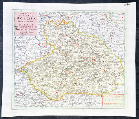
1740 Isaac Tirion Antique Map of Bohemia, Silesia, Moravia - Germany, Poland
Antique Map
- Title : Nuova Carta del Regno di Boemia Ducato Di Slesia, Marches Ato Di Moravia e lusazia in Amsterdam da Isac Tirion
- Ref #: 35636
-
Condition: (A+) Fine Condition
- Size: 14 1/2in x 12 1/2in (365mm x 315mm)
- Date : 1740
- Price: $149US
Description:
This original hand coloured copper plate engraved antique map of the central European countries of the Kingdom of Bohemia, Duchy of Silesia, Marquisate of Moravia, and Lusatia by Isaac Tirion, was published in 1740 in Amsterdam.
General Definitions:
Paper thickness and quality: - Heavy and stable
Paper color : - off white
Age of map color: - Original
Colors used: - Yellow, green, blue, pink
General color appearance: - Authentic
Paper size: - 14 1/2in x 12 1/2in (365mm x 315mm)
Plate size: - 12 1/2in x 10 1/2in (315mm x 265mm)
Margins: - Min 1in (25mm)
Imperfections:
Margins: - None
Plate area: - None
Verso: - None
Background:
Bohemia is the westernmost and largest historical region of the Czech Republic. Bohemia can also refer to a wider area consisting of the historical Lands of the Bohemian Crown ruled by the Bohemian kings, including Moravia and Czech Silesia, in which case the smaller region is referred to as Bohemia proper as a means of distinction
Please note all items auctioned are genuine, we do not sell reproductions. A Certificate of Authenticity (COA) can be issued on request.
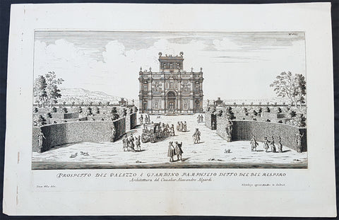
1685 G B Falda & Sandrart Antique Print Villa Gardens Doria Pamphili, Rome Italy
Antique Map
- Title : Prospecto Del Palazzo & Giardino Pamphilio Detto Del Bel Respiro...Architettura del Caualier Alessandro Algardi...Simon Felice delin....Norimburga appresso Gioni. Gac. de Sandart
- Ref #: 93463
- Size: 19in x 12 1/2in (490mm x 335mm)
- Date : 1685
- Condition: (A+) Fine Condition
Description:
This fine original copper plate engraved antique print of the Villa & Gardens of Doria Pamphili, Rome was engraved by Simone Felice for the 1685 edition of Giovanni Battista Faldas Li giardini di Roma, disegnati da Giovanni Battista Falda nuovamente dati alle stampe con direttione di Giov. Giacomo de Sandrart (The gardens of Rome, designed by Giovanni Battista Falda again printed with the direction of Giov. Giacomo de Sandrart) published in Nuremberg by Johann von Sandrart.
The work is based on the original series edited by Gian Giacomo de Rossi a few years earlier (the first edition was certainly published after 1677 but before 1683) which included 19 tables of plants and perspective views of the most famous Roman gardens, 14 of which were engraved by GB Falda and 5 by Simon Felice.
General Definitions:
Paper thickness and quality: - Heavy and stable
Paper color : - off white
Age of map color: -
Colors used: -
General color appearance: -
Paper size: - 19in x 12 1/2in (490mm x 335mm)
Plate size: - 16in x 9 1/2in (400mm x 250mm)
Margins: - Min 1in (25mm)
Imperfections:
Margins: - None
Plate area: - None
Verso: - None
Background:
The Villa Doria Pamphili is a seventeenth-century villa with what is today the largest landscaped public park in Rome, Italy. It is located in the quarter of Monteverde, on the Gianicolo (or the Roman Janiculum), just outside the Porta San Pancrazio in the ancient walls of Rome where the ancient road of the Via Aurelia commences.
It began as a villa for the Pamphili family and when the line died out in the eighteenth century, it passed to Prince Giovanni Andrea IV Doria, and has been known as the Villa Doria Pamphili since.
The nucleus of the villa property, the Villa Vecchia or old villa, already existed before 1630, when it was bought by Pamfilio Pamfili, who had married the heiress Olimpia Maidalchini, to enjoy as a suburban villa. Thereafter he set about buying up neighbouring vineyards to accumulate a much larger holding, which was often known as the Bel Respiro or beautiful breath as it stood on high ground, above the malarial areas of Rome, and offered spectacular views which were a desirable feature of Baroque villa settings.
In 1644 Cardinal Giambattista Pamphili became elected to the papacy and took the name of Innocent X. In accordance with this change in status, the Pamphili aspired to a grander and more expansively sited new villa. Early designs were made, possibly by Virgilio Spada rather than the traditional attribution to Borromini, but these were rejected. Instead the project was placed in the hands of the Bolognese sculptor Alessandro Algardi in 1644, assisted by Giovanni Francesco Grimaldi.
The initial design had a central casino (not the modern usage as a gambling establishment) with wings, but only the central block was built. There is uncertainty as to who the architect was; Algardi was not an architect, and it may be that he had help from Carlo Rainaldi and that the construction was supervised by Grimaldi. The layout has a central circular room around which the other rooms were arranged. Construction began in 1645 and was complete by 1647 although embellishments and the garden layouts were not finished until 1653. The casino, sometimes known as the Casino del Bel Respiro, was designed as a complement to the Pamphili collection of sculptures both ancient and modern, and other Roman antiquities such as vases, sarcophagi and inscriptions; it was only ever intended for display of the collection and the family and guests resided in the older Vecchia Vigna.
As a show case for sculpture, the somewhat crowded Casino facades have rhythmically alternating windows with niches which were elaborately adorned with sculptures, both antique and modern, with busts in hollowed roundels, with panels of bas-reliefs, and reliefs.
The exterior containing statues gives a rich allure that was architecturally somewhat conservative for its date, looking back towards the Villa Medici or the Casina Pio IV, and rather more Mannerist than Baroque. It offered a foretaste of the richly stuccoed and frescoed interiors, where the iconographic program set out to establish the antiquity of the Pamphili, a family then somewhat parvenu in Rome, with origins in Gubbio. Inside, Algardi provided further bas-reliefs and stucco framing for the heroic frescoes drawn from Roman history painted by Grimaldi.
The casino is set into the hill slope such that the main entrance on the north side is at a level above the giardino segreto or secret garden enclosure on its south side, a parterre garden with low clipped hedges. The gardens on the sloping site were laid out from around 1650 by Innocents nephew, Camillo Pamphili, formalizing the slope as a sequence from the parterres that flank the Casino, to a lower level below, framed by the boschi or formalized woodlands that rose above clipped hedges, and eventually arriving at a rusticated grotto in the form of an exedra, from which sculptured figures emerge from the rockwork. The exedra, now grassed, formerly enframed a Fountain of Venus by Algardi, which is preserved in the Villa Vecchia, together with Algardis bas-reliefs of putti representing Love and the Arts that were formerly here. The fountain spilled into a small cascade that let into a short length of formal canal, which was intended to remind the viewer of the similar Canopus at Hadrians Villa— another programmatic connection of the Pamphili with Antiquity.
When Girolamo Pamphili died in 1760 without male heirs, the disputes which broke out among the possible heirs were settled in 1763 when Pope Clement XIII Rezzonico granted to Prince Giovanni Andrea IV Doria the right to take the surname, the arms and the vast properties of the Pamphili; the Princes claim was based on the marriage between Giovanni Andrea III Doria and Anna Pamphili. Since then, the villa has been known as the Villa Doria Pamphili.
Throughout the 18th century, features were regularly added such as fountains and gateways by Gabriele Valvassori and other architects retained by the Pamphili and their heirs. After the Napoleonic era, more sweeping changes were made. The parterres that were formal extensions of the casino were retained but replanted with the patterned planting of colourful carpet bedding supplied from greenhouses by the old villa. (Today the parterres have been replanted in 16th-century style, with panels of scrolling designs in close-clipped greens set in wide gravel walks.) In the sloping outer gardens the changes were more extensive, recasting them in the naturalistic manner of English landscape gardens. The grounds, filled with many surprise features and picturesque incidents, swept down to a small lake at the bottom, which already had an air of atmospheric maturity when it was painted in the 1830s by Alexandre-Gabriel Decamps. In the wooded, natural-appearing landscapes with clumps of characteristic umbrella-like stone pines along horizons stand statues and vases, which evoke a nostalgic antiquity. The 18th-century English landscape gardens such as Stowe and Stourhead that were the inspiration for this style aimed to bring to life the Italian landscapes with Roman ruins painted by Claude and Poussin. A notable difference is that at the Villa Doria Pamphilis giardino inglese the Roman remains are likely to be genuine. The site of the villa contained several Roman tombs that yielded vases, sarcophagi and inscriptions that were added to the Pamphili collection.
Falda, Giovanni Battista 1643 – 1678
Falda was an Italian architect, engraver and artist. He is known for his engravings of both contemporary and antique structures of Rome.
Falda was sent as a boy to Rome, to work in the studio of Bernini, and his draughtsmanship caught the eye of the publisher Giovanni Giacomo de Rossi. He engraved for Le fontane di Roma (Fountains in Rome) and for Palazzi di Roma (Palaces of Rome). The former books was expanded after Faldas death with engravings by Francesco Venturini. The latter was published in 1655 in collaboration with Pietro Ferrerio. He is sometimes known as Falda da Valduggia because of his birthplace.
His works became particularly popular with the first waves of Grand Tour participants during the latter parts of the 17th century and Falda became a commercial success as a result. His works appealed to tourists keen to retain a detailed and accurate representation of those parts of Rome they had visited.
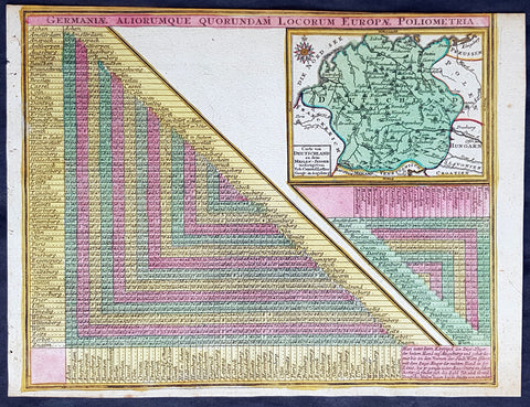
1744 Georg Mattaus Seutter Antique Map of Germany w/ European City Mileage Chart
Antique Map
- Title : Germaniae Aliorumque Quorundam Locorum Europae Poliometria....Cart von Deutsschland...Tob. Conrad Lotter Geogr.
- Ref #: 93404
- Size: 11in x 8 1/2in (280mm x 215mm)
- Date : 1744
- Condition: (A+) Fine Condition
Description:
This beautifully hand coloured original copper-plate engraved antique map of Germany, with a mileage index chart with all the major cities of Europe, was engraved by Tobias Lotter and was published in the 1744 edition of GM Seutters Atlas Minor Prae cipua Orbis Terrarum Imperia Regna et Provincias...., Augsburg, Germany.
General Definitions:
Paper thickness and quality: - Heavy and stable
Paper color : - off white
Age of map color: - Original
Colors used: - Yellow, green, blue, pink
General color appearance: - Authentic
Paper size: - 11in x 8 1/2in (280mm x 215mm)
Plate size: - 10 1/2in x 8in (265mm x 205mm)
Margins: - Min 1/4in (5mm)
Imperfections:
Margins: - Light age toning
Plate area: - Light age toning
Verso: - None
Background:
Atlas Minor was a series of beautiful maps of all parts of the world. Georg Matthäus Seutter was one of the most and important of the German cartographers of the 18th century, being appointed as the Geographer to the Imperial Court. His son, Albrecht Carl, joined Matthäus and eventually inherited the business. The maps from Atlas Minor were drawn by the two Seutters and engraved by Tobias Conrad Lotte. These maps are highly detailed and engraved with a bold hand with equally strong original hand color in the body of the map as was the 18th century German style. The cartouches were left uncolored in order to emphasize the elaborately detailed illustrations for which German maps are especially prized. These are some of the most decorative and interesting maps of the eighteenth century.
1856 Delafield Antique Architectural Plan SM Kirov Medical Academy St Petersburg
Antique Map
- Title : Military Hospital at St Petersburg
- Condition: (A+) Fine Condition
- Ref: 90139
- Size: 36in x 24in (915mm x 610mm)
Description:
This very large original lithograph print, an architectural plan of the S.M. Kirov Military Medical Academy in St Petersburg, Russia - during the time of the Crimean War and just prior to the American Civil War - was engraved by John T Bowen & co. of Philadelphia and was published in the 1856 edition of Captain Richard Delafields Report on the Art of War in Europe in 1854, 1855, and 1856.
In early 1855, Captain Richard Delafield was appointed by the Secretary of War, Jefferson Davis, a head of the board of officers, later called The Delafield Commission, and sent to Europe to study the European military. The board included Captain George B. McClellan and Major Alfred Mordecai. They inspected the state of the military in Great Britain, Germany, the Austrian Empire, France, Belgium, and Russia, and served as military observers during the Crimean War. After his return in April 1856, Delafield submitted a report which was later published as a book by Congress, Report on the Art of War in Europe in 1854, 1855, and 1856. The book was suppressed during the American Civil War due to fears that it would be instructive to Confederate engineers as it contained multiple drawings and descriptions of military fortifications.
General Definitions:
Paper thickness and quality: - Light and stable
Paper color : - off white
Age of map color: -
Colors used: -
General color appearance: -
Paper size: - 36in x 24in (915mm x 610mm)
Plate size: - 36in x 24in (915mm x 610mm)
Margins: - Min 1/2in (12mm)
Imperfections:
Margins: - None
Plate area: - Folds as issued
Verso: - Folds re-enforced with archival tape
Background:
The S. M. Kirov Military Medical Academy (Военно-медицинская академия имени С. М. Кирова) is the oldest school of military medicine in Saint Petersburg and the Russian Federation. Senior medical staff are trained for the Armed Forces and conduct research in military medical services.
The origins of S.M. Kirov Military Medical Academy go back to the years of Peter the Great. In 1715 by the Tsars order the Admiralty Hospital in the Vyborg Side of Saint Petersburg was founded. In 1717 next to in the Land Military Hospital was opened. Since 1773 surgical schools attached to both hospitals were operating. In 1786 those schools were consolidated into the Main Medical College. It became the principal training center for army and fleet physicians.
Unofficially, the year 1714 is considered the foundation year of the academy. The Medical and Surgical Academy was established by the order of Emperor Paul I of 18/29 December 1798 on the initiative of Baron Alexei Vasilyev, General Director of the Medical College. At the same time a Neoclassical building for the Academy was designed by Antonio Porta. It was decorated with a set of panel paintings by Giuseppe Bernasconi.
Ranked as one of the best educational institutions in the Russian Empire, it was known as the Imperial Medical and Surgical Academy from 1808. According to the order of Emperor Alexander I, a member of the Medical and Surgical Academy had the rights, liabilities, and benefits of a member of the Academy of Sciences.
Sir James Wylie, a Scottish baronet, managed the academy between 1808 and 1838. His contributions have been commemorated with a monument which stood in front of the academy until the October Revolution. The monument was designed in 1859 by David Jensen. It was later relocated and replaced with a statue of Hygieia.
In 19th century the Imperial Medical and Surgical Academy played a major role in the development of Russian natural science and medicine. In 1840 — 1856 one of its professors was Nikolay Pirogov, considered the founder of field surgery.
Since 1861 Sergey Botkin, one of Pirogovs disciples, worked at the Academy. He is considered one of the founders of modern Russian medical science and education. Botkin introduced triage, pathological anatomy, and post mortem diagnostics into Russian medical practice.
In 1881 the Academys official name was changed into the Imperial Military Medical Academy. In the late 19th century, its physiology laboratory, founded by Ivan Sechenov, was at the forefront of medical research. Ivan Romanovich Tarkhanov conducted some important experiments there.
In 1890 — 1901 the Academys President was Viktor Pashutin, one of the founders of the pathophysiologic school in Russia and of pathophysiology as an independent scientific discipline.
The Nobel-prize winning physiologist Ivan Pavlov graduated from the Academy in 1879 with Gold Medal award. Since 1895 he headed Department of Physiology at the Academy for three decades.
In 1904 — 1924 Nikolai Kravkov, the founder of Russian national school of pharmacologists, headed the Academys Department of Pharmacology.
In 1903 — 1936 one of the Academys professors was Sergey Fedorov, the founder of the largest national school of surgery and «the father of Russian urology».
The academy was also among the pioneers of medical education for women, launching the courses for nurse-midwives in 1872. Nadezhda Suslova, the first female physician in Russia, attended Sechenovs classes at the academy. A school of gymnastics (now the Military Institute of Physical Culture) was launched in 1909.
Delafield, Richard Major General 1798 - 1873
Delafield was a United States Army officer for 52 years. He served as superintendent of the United States Military Academy for 12 years. At the start of the American Civil War, then Colonel Delafield helped equip and send volunteers from New York to the Union Army. He also was in command of defences around New York harbor from 1861 to April 1864. On April 22, 1864, he was promoted to Brigadier General in the Regular Army of the United States and Chief of Engineers. On March 8, 1866, President Andrew Johnson nominated Delafield for appointment to the grade of brevet major general in the Regular Army, to rank from March 13, 1865, and the United States Senate confirmed the appointment on May 4, 1866, reconfirmed due to a technicality on July 14, 1866. He retired from the US Army on August 8, 1866. He later served on two commissions relating to improvements to Boston Harbor and to lighthouses. He also served as a regent of the Smithsonian Institution.
Delafield served as assistant engineer in the construction of Hampton Roads defences from 1819–1824 and was in charge of fortifications and surveys in the Mississippi River delta area in 1824-1832. While superintendent of repair work on the Cumberland Road east of the Ohio River, he designed and built Dunlaps Creek Bridge in Brownsville, Pennsylvania, the first cast-iron tubular-arch bridge in the United States. Commissioned a major of engineers in July 1838, he was appointed superintendent of the Military Academy after the fire of 1838 and served till 1845. He designed the new buildings and the new cadet uniform that first displayed the castle insignia. He superintended the construction of coast defences for New York Harbor from 1846 to 1855.
In the beginning of 1855, Delafield was appointed by the Secretary of War, Jefferson Davis a head of the board of officers, later called The Delafield Commission, and sent to Europe to study the European military. The board included Captain George B. McClellan and Major Alfred Mordecai. They inspected the state of the military in Great Britain, Germany, the Austrian Empire, France, Belgium, and Russia, and served as military observers during the Crimean War. After his return in April 1856, Delafield submitted a report which was later published as a book by Congress, Report on the Art of War in Europe in 1854, 1855, and 1856. The book was suppressed during the American Civil War due to fears that it would be instructive to Confederate engineers as it contained multiple drawings and descriptions of military fortifications.
Delafield served as superintendent of the Military Academy again in 1856-1861. In January 1861, he was succeeded by Captain Pierre G. T. Beauregard, who was dismissed shortly after Beauregards home state of Louisiana seceded from the Union, and Delafield returned as superintendent serving until March 1, 1861. In the beginning of the Civil War he advised the governor of New York Edwin D. Morgan during the volunteer force creation. Then, in 1861–1864, he was put in charge of New York Harbor defences, including Governors Island and Fort at Sandy Hook. On May 19, 1864, he was commissioned a brigadier-general after replacing Joseph Gilbert Totten, who had died, as the Chief of Engineers, United States Army Corps of Engineers, on April 22, 1864. He stayed in charge of the Bureau of Engineers of the War Department until his retirement on August 8, 1866. On March 8, 1866, President Andrew Johnson nominated Delafield for appointment to the grade of brevet major general in the Regular Army of the United States, to rank from March 13, 1865, and the United States Senate confirmed the appointment on May 4, 1866 and reconfirmed it due to a technicality on July 14, 1866.After retirement Delafield served as a regent of the Smithsonian Institution and a member of the Lighthouse Board. He died in Washington, D.C. on November 5, 1873.
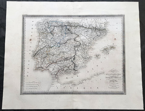
1824 Louis Vivien Large Antique Map of Spain & Portugal
- Title : Carte De La Peninsule Hispanique...1824
- Size: 29in x 23in (740mm x 585mm)
- Condition: (A+) Fine Condition
- Date : 1824
- Ref #: 40717
Description:
This finely engraved original large antique map of Spain & Portugal by Louis Vivien in his Elephant Folio atlas, Atlas Universal
General Definitions:
Paper thickness and quality: - Heavy and stable
Paper color : - off white
Age of map color: - Original
Colors used: - Blue, pink, yellow, green
General color appearance: - Authentic
Paper size: - 29in x 23in (740mm x 585mm)
Plate size: - 25in x 19in (635mm x 485mm)
Margins: - Min 2in (50mm)
Imperfections:
Margins: - Light soiling
Plate area: - Light soiling
Verso: - Light soiling
Background:
Many of the original charts and maps drawn by the first Portuguese and Spanish navigators have survived for the very good reason that, on completion of their voyages, pilots were obliged to hand over their manuscript notes to the Casa da India (founded 1504) in Lisbon or to the equivalent Casa de Contrataci6n de las Indias (founded 1504) in Seville. The clear intention was to maintain secrecy over new discoveries and control over the distribution of cartographic material, not always successfully, as it happened; pilots and navigators seem to have changed allegiance with impunity and, in consequence, many of the earliest and most informative charts were compiled as far away as Genoa, Venice, Florence and Ancona, presumably from sources outside the Portuguese and Spanish Casas. It is apparent that few manuscripts reached the printing stage and, indeed, are so rare that any study of them must be regarded as a specialist subject. (Ref Tooley M&B)
Vivien, Louis 1802 - 1896
Louis Vivien , or Vivien de Saint-Martin was a French geographer who was born in Saint-Martin-de-Fontenay and died in Versailles, France in 1896.
He settled in Paris under the Restoration, and became known with his publication of the Electoral and Administrative Map in 1823 and his comprehensive Universal Atlas in 1825, collaborating with Jacques Bibliomappe -Charles Bailleul from 1828. Vivien was foremost a geographer but was also a publisher of works in other fields, including historical books on the General History of the French Revolution and the History of Napoleon. He also translated various English works, such as the novels of Walter Scott .
He also wrote the New Annals of Travels between 1845 and 1854 and briefly the French Athenaeum between 1847 & 1848. He contributed to numerous periodicals such as Le Constitutionnel, Revue contemporaine, Revue germanique & La Presse. He also wrote L Année géographique between 1863 and 1875 before passing the baton to G. Maunoir and Henri Duveyrier.
He is mainly known though, for his three cartographical works, A History of Geographical Discoveries, A New Dictionary of Universal Geography and the Universal Atlas of Geography. The first of these publications he completed after the 1848 Revolution with the latter two completed by Louis Rousselet and Franz Schrader.
Vivien was Honorary President of the Geographical Society, of which he was one of the founder members. He also laureate of the Academy of Inscriptions and Belles-Lettres as well as a member of the Asian Society , the Society of Ethnology along with a large number of learned societies and European academies.
Main works of Vivien de Saint-Martin
- General History of the French Revolution, the Empire, the Restoration, the Monarchy of 1830, up to and including 1841 (4 volumes in 2 volumes), Paris, Pourrat Brothers, 1841-1842.
- History of Napoleon and the Empire (2 volumes), Paris, Pourrat brothers, 1844.
- History of geographical discoveries of European nations in various parts of the world (2 volumes), Paris, Arthus-Bertrand, 1845-1846.
- Research on primitive populations and the oldest traditions of the Caucasus , Paris, Arthus-Bertrand, 1847.
- Studies of Ancient Geography and Asian Ethnography (2 volumes), Paris, Arthus-Bertrand, 1850-1852.
- Historical and geographical description of Asia Minor (2 volumes), Paris, Arthus-Bertrand, 1852.
- Study on the Greek and Latin Geography of India , Paris, Imperial Printing, 1858.
- Study on the geography and the primitive populations of north-west India, according to the Vedic hymns , Paris, Imprimerie impériale, 1860.
- North Africa in Greek and Roman antiquity, historical and geographical study , Paris, Imprimerie impériale, 1863.
- History of geography and geographical discoveries from the earliest times to the present day , Paris, Hachette, 1873.
- With Franz Schrader : Universal Atlas of Geography built from the original sources and the most recent documents , Paris, Hachette, 1876-1915.
- With Louis Rousselet : New dictionary of universal geography (9 volumes), Paris, Hachette, 1879-1900.
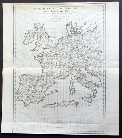
1789 John Harrison Large Antique Map of Western Europe - Italy to Germania to UK
- Title : Germanie, France, Italie, Espange, Isles Britanniques Dans un Age intermediare de L Ancienne Geographie et de la Moderne Drawn & engraved from D Anvilles Atlas for John Harrison...1789
- Date : 1789
- Size: 19in x 16 1/2in (480mm x 420mm)
- Condition: (A+) Fine Condition
- Ref: 15645
Description:
This large magnificent original copper-plate engraved antique map of Western Europe, after J B D Anville, was engraved in 1789 - dated in the title - and was published for John Harrisons Ancient & Modern Atlas
General Definitions:
Paper thickness and quality: - Heavy and stable
Paper color : - off white
Age of map color: -
Colors used: -
General color appearance: -
Paper size: - 19in x 16 1/2in (480mm x 420mm)
Plate size: - 19in x 14in (480mm x 355mm)
Margins: - Min 1/2in (8mm)
Imperfections:
Margins: - None
Plate area: - Folds as issued
Verso: - None
Background:
The Roman Empire was the post-Roman Republic period of the ancient Roman civilization, with a government headed by emperors and large territorial holdings around the Mediterranean Sea in Europe, Africa and Asia. The city of Rome was the largest city in the world c. 100 BC – c. AD 400, with Constantinople (New Rome) becoming the largest around AD 500, and the Empire\\\'s population grew to an estimated 50 to 90 million inhabitants (roughly 20% of the world\\\'s population at the time) The 500-year-old republic which preceded it had been severely destabilized in a series of civil wars and political conflict, during which Julius Caesar was appointed as perpetual dictator and then assassinated in 44 BC. Civil wars and executions continued, culminating in the victory of Octavian, Caesar\\\'s adopted son, over Mark Antony and Cleopatra at the Battle of Actium in 31 BC and the annexation of Egypt. Octavian\\\'s power was then unassailable and in 27 BC the Roman Senate formally granted him overarching power and the new title Augustus, effectively marking the end of the Roman Republic.
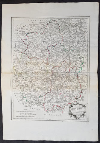
1777 Santini Antique Map French Provinces, Bourges Nevers Guéret Moulins Limoges
- Title : Carte Des Gouvernements du Berri, du Nivernois, de la Marche, du Bourbonnois, du Limosim et de L Auvergne...Par M Bonne 1771....A Venise...P Santini...1777
- Date : 1777
- Condition: (A+) Fine Condition
- Ref: 50197
- Size: 30in x 21in (760mm x 535mm)
Description:
This large magnificent original copper-plate engraved antique map of French Provinces of Berry (Bourges) Nivernais (Nevers) Marche (Guéret) Bourbonnais (Moulins) Limousin (Limoges) & Auvergne (Clermont-Ferrand) was engraved in 1777 - the date is engraved in the title cartouche - after Robert Bonne and was published by Francois Santini (active 1776-84) in his 2 volume edition of Atlas Universal 1776-84. (Ref: Tooley; M&B)
General Definitions:
Paper thickness and quality: - Heavy and stable
Paper color : - off white
Age of map color: - Original
Colors used: - Blue, pink, red, green, yellow
General color appearance: - Authentic
Paper size: - 30in x 21in (760mm x 535mm)
Plate size: - 23in x 17in (595mm x 430mm)
Margins: - Min 1in (25mm)
Imperfections:
Margins: - None
Plate area: - None
Verso: - Light age toning
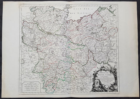
1778 Santini Antique Map Lower Saxon Circle Germany, Holstien Bremen Mecklenburg
- Title : Cercle de Basse Saxe on sont distingues Les Etats de Brunswich Les Duches De Holstien...Par L Sr Robert....A Venise...P Santini...1778
- Date : 1778
- Condition: (A+) Fine Condition
- Ref: 50203
- Size: 30in x 21in (760mm x 535mm)
Description:
This large magnificent original copper-plate engraved antique map of The Lower Saxon Circle of Northern Germany, was engraved in 1778 - the date is engraved in the title cartouche - after Robert De Vaugondy and was published by Francois Santini (active 1776-84) in his 2 volume edition of Atlas Universal 1776-84. (Ref: Tooley; M&B)
General Definitions:
Paper thickness and quality: - Heavy and stable
Paper color : - off white
Age of map color: - Original
Colors used: - Blue, pink, red, green, yellow
General color appearance: - Authentic
Paper size: - 30in x 21in (760mm x 535mm)
Plate size: - 22in x 19 1/2in (560mm x 495mm)
Margins: - Min 1in (25mm)
Imperfections:
Margins: - None
Plate area: - None
Verso: - None
Background:
The Lower Saxon Circle was an Imperial Circle of the Holy Roman Empire. It covered much of the territory of the medieval Duchy of Saxony (except for Westphalia), and was originally called the Saxon Circle (German: Sächsischer Kreis) before later being better differentiated from the Upper Saxon Circle by the more specific name.
An unusual aspect of this circle was that, at various times, the kings of Denmark (in Holstein), Great Britain (in Hanover) and Sweden (in Bremen) were all Princes of a number of Imperial States.
The Lower Saxon Circle included the easternmost part of current Lower Saxony, the northernmost part of Saxony-Anhalt (excluding the Altmark), Mecklenburg, Holstein (excluding Dithmarschen), Hamburg, Bremen, in addition to small areas in Brandenburg and Thuringia. For the most part it was a continuous territory with the exception of small enclaves like Halle and Jüterbog. Nordhausen and Mühlhausen were also areas outside the continuous portion of the imperial circle. Within the circle was the Archbishopric of Verden, which was in personal union with the Archbishopric of Bremen since 1502. The Counties of Schaumburg and Spiegelberg were also part of the personal union, but they were not a part of the Lower Saxon Circle.
By the downfall of the Holy Roman Empire, the circle was 1 240 square miles large, with 2 120 000 inhabitants. With respect to religion, almost all the citizens were Protestant. The exception was the partially Catholic Bishopric of Hildesheim.
During the Early Modern period the Holy Roman Empire was divided into Imperial Circles administrative groupings whose primary purposes were the organization of common defensive structure and the collection of imperial taxes. They were also used as a means of organization within the Imperial Diet and the Imperial Chamber Court. Each circle had a Circle Diet, although not every member of the Circle Diet would hold membership of the Imperial Diet as well.
Six Imperial Circles were introduced at the Diet of Augsburg in 1500. In 1512, three more circles were added, and the large Saxon Circle was split into two, so that from 1512 until the collapse of the Holy Roman Empire in the Napoleonic era, there were ten Imperial Circles. The Crown of Bohemia, the Swiss Confederacy and Italy remained unencircled, as did various minor territories which held imperial immediacy.