Welcome to Classical Images!
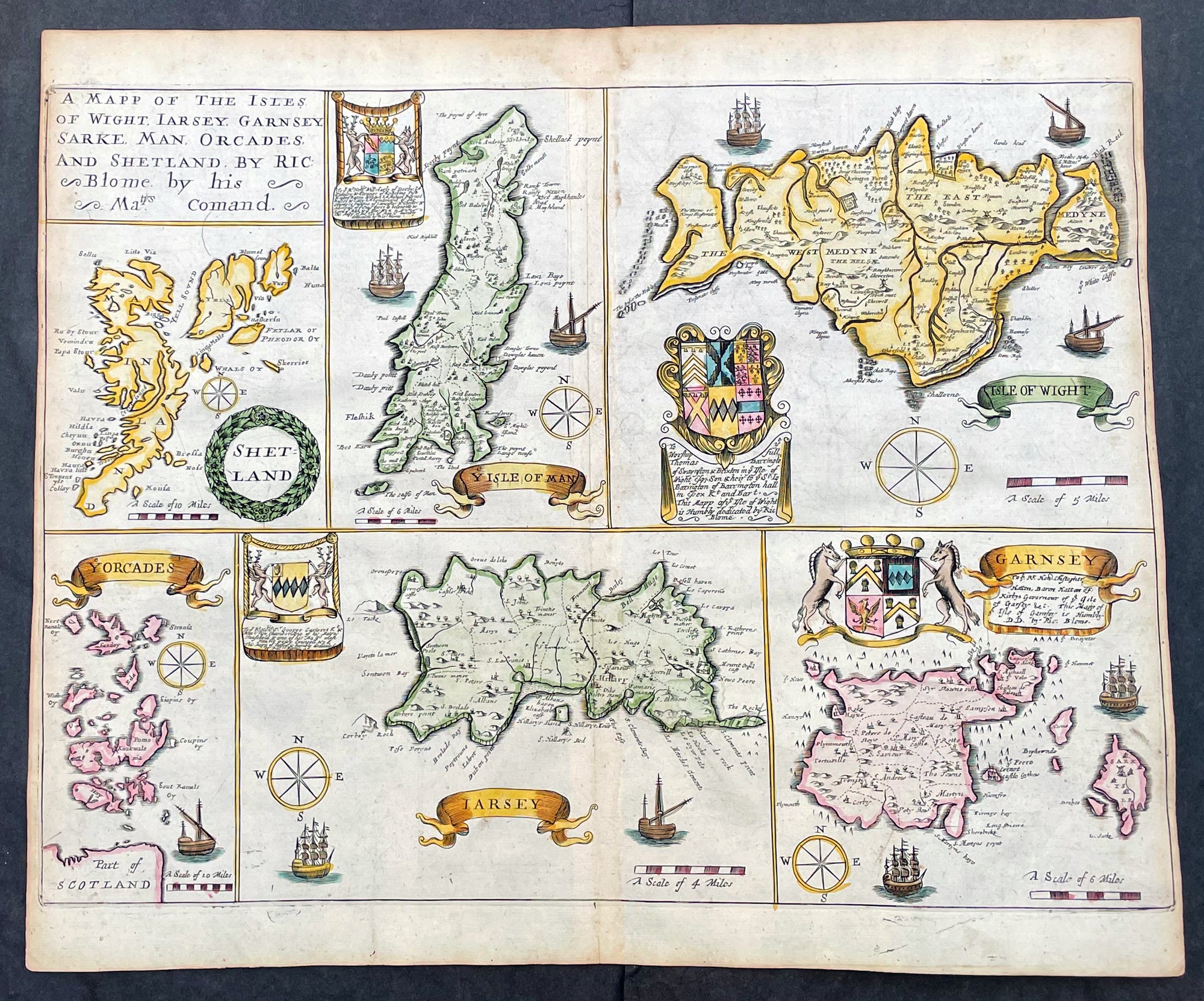
Description:This original hand coloured, copper plate engraved antique map of the Islands of Great Britain - Shetlands, Man, Wight, Orkenys, Jersey, Guernsey & Sark (Channel Islands) - was published by Richard Blome in the 1673 edition of Britannia: or, A Geographical Description of the Kingdoms of England, Scotland, and Ireland, with the Isles and Terrotories thereto belonging.
General Definitions:Paper thickness and quality: - Heavy and stablePaper color : - off whiteAge of map color: - EarlyColors used: - Yellow, green, blue, pinkGeneral color appearance: - AuthenticPaper size: - 15in x 12 1/2in (380mm x 320mm)Plate size: - 14 1/2in x 11in (370mm x 280mm)Margins: - Min 1/8in (5mm)
Imperfections:Margins: - Light age toning in marginsPlate area: - NoneVerso: - None
Please note all items auctioned are genuine, we do not sell reproductions. A Certificate of Authenticity (COA) can be issued on request.