
Recent Acquisitions (307)
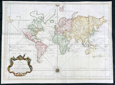
1748 J N Bellin Large Antique World Map on Mercators Projection - 27007
Antique Map
- Title : Essay d une Carte Reduite Contenant les parties connuees Du Globe Terrestre...1748
- Date : 1748
- Size: 28 1/2in x 21in (725mm x 535mm)
- Condition: (A) Very Good Condition
- Ref: 27007
Description:
This large original hand coloured copper-plate engraved antique World Map, on Mercators Projection was engraved in 1748 by Jacques Nicolas Bellin - dated in the title.
General Definitions:
Paper thickness and quality: - Heavy and stable
Paper color : - off white
Age of map color: - Early
Colors used: - Blue, yellow, green, pink
General color appearance: - Authentic
Paper size: - 28 1/2in x 21in (725mm x 535mm)
Plate size: - 26in x 20 1/2in (710mm x 520mm)
Margins: - Min 1/4in (5mm)
Imperfections:
Margins: - Bottom left margin extended from plate -mark
Plate area: - Folds as issued
Verso: - Folds as issued
Background:
First edition of Bellins large mid-18th century world map, published in Paris. This map pre-dates the major world discoveries of the late 18th century including the North West coast of America, the Sandwich Islands, and the Voyages of Capt Cook soon to map the East Coast of Australia & NZ.
This edition is most noteworthy for its marvelous early projection of Australia and New Zealand, each with largely speculative coastlines. Australia is still attached to New Guinea and has several notes of early exploration shown. New Zealand is barely known and with only a portion of its western coastline.
No sign of Antarctica and the NW Coast of America includes the first notes of Russian exploration.
In North America Bellin identifies the semi-mythical civilizations of Quivira and Teguayo, both associated with legends of the Seven Cities of Gold, in what is modern day Utah, California, and Nevada. Along the western coast the strait discovered by Martin Aguilar is noted. Further north still the River of the West (Fl. de l’Ouest) extends from the west coast to the Lake of the Woods (Lac de Bois) and thence via additional waterways to the Great Lakes and the Atlantic. The River of the West appeared in many 18th century maps of the Americas and is reflective of French hopes for a water route from their colonies in Canada and Louisiana to the Pacific. Still further north the coastline becomes extremely vague, in places vanishing altogether. The Aleutians are vaguely rendered according to various sightings by Vitus Jonassen Bering and Aleksei Chirikov in the 1740s and identified as the “Archipel de Nord”.
In the Pacific, various Polynesian Island groups are noted though many are slightly or significantly misplaced. The Solomon Islands are vastly oversized referencing the early 17th claims of Quiros. The other lands discovered and erroneously mapped by Quiros in 1606 and Davis in 1686 during their search of the great southern continent are also noted. Hawaii, as yet undiscovered, is absent. New Zealand is rendered twice though is accurate in its form and position. Australia, here labelled “Nouvelle Holland”, has part of its southern coastline ghosted in and Van Diemen’s Land (Tasmania) is attached to the mainland. The southern coast of New Guinea is similarly ghosted in, suggesting its unexplored state. (Ref: Tooley; M&B)
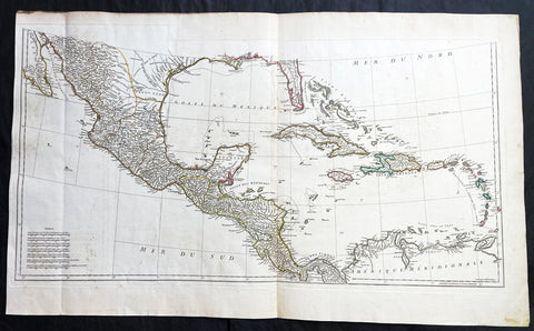
1756 J B D Anville Large Antique Bottom Map Texas, Mexico, Central America - 93518
Antique Map
- Title : (Amerique Septentrionale Publiee sous les Auspices de Monseigneur le Duc d Orleans.. Par Le Snr. D Anville MDCCXLVI)
- Date : 1756
- Size: 36in x 22in (915mm x 560mm)
- Condition: (A+) Fine Condition
- Ref: 93518
Description:
This large important original copper plate engraved antique map, bottom sheets of 4 sheets, of North America was engraved in 1746 and was published by Jean-Baptiste Bourguinon D Anville in his Elephant Folio Atlas Generale. (I have included an image of the map of the map when it is complete)
This map was instrumental in instructing the European Colonial powers of the time, England France & Spain the importance of dominating the New World, that ultimately led to the French and Indian War of 1754–63. This conflict determined the political direction of North America leading to the American War of Independence in 1775 and ultimately the formation of The United States of America.
To illustrate the importance of cartography in the mid eighteenth century, especially that of North America, a J B D Anville map is essential. D Anville dominated 18th century European cartography with many of his cartographical achievements, especially in North America, copied by many of his contemporaries such as Kitchen, Sayer, Homann, Seutter, Mitchell and others .
He was one of the first to leave blank spaces in his maps, where knowledge was scant or insufficient. His representation of the great lakes is superior to that of his contemporary John Mitchell, responsible for publishing one of the most famous mid 18th century maps of North America, A Map of the British and French Dominions in North America on 8 sheets in 1755 and remained the standard map of North America up until the end of the 18th century. (Ref: Tooley, Printed maps of America, 104; The Mapping of America 316)
General Definitions:
Paper thickness and quality: - Heavy and stable
Paper color : - off white
Age of map color: - Original
Colors used: - Yellow, green, blue, pink
General color appearance: - Authentic
Paper size: - 36in x 22in (915mm x 560mm)
Plate size: - 34 1/2in x 17in (880mm x 430mm)
Margins: - Min 1/2in (12mm)
Imperfections:
Margins: - Small right side of margin & border restored
Plate area: - Folds as issued, small dis-colouration to bottom centerfold
Verso: - Folds as issued, several small repairs not affecting image
Background:
The French and Indian War (1754–63) comprised the North American theatre of the worldwide Seven Years War of 1756–63. It pitted the colonies of British America against those of New France. Both sides were supported by military units from their parent countries, as well as by American Indian allies. At the start of the war, the French North American colonies had a population of roughly 60,000 settlers, compared with 2 million in the British North American colonies. The outnumbered French particularly depended on the Indians. The European nations declared war on one another in 1756 following months of localized conflict, escalating the war from a regional affair into an intercontinental conflict.
The name French and Indian War is used mainly in the United States. It refers to the two enemies of the British colonists, the royal French forces and their various American Indian allies. The British colonists were supported at various times by the Iroquois, Catawba, and Cherokee, and the French colonists were supported by Wabanaki Confederacy members Abenaki and Mikmaq, and Algonquin, Lenape, Ojibwa, Ottawa, Shawnee, and Wyandot.
British and other European historians use the term the Seven Years War, as do English-speaking Canadians. French Canadians call it La guerre de la Conquête (the War of the Conquest) or (rarely) the Fourth Intercolonial War.
Fighting took place primarily along the frontiers between New France and the British colonies, from Virginia in the south to Newfoundland in the north. It began with a dispute over control of the confluence of the Allegheny River and Monongahela River called the Forks of the Ohio, and the site of the French Fort Duquesne in Pittsburgh, Pennsylvania. The dispute erupted into violence in the Battle of Jumonville Glen in May 1754, during which Virginia militiamen under the command of 22-year-old George Washington ambushed a French patrol.
In 1755, six colonial governors in North America met with General Edward Braddock, the newly arrived British Army commander, and planned a four-way attack on the French. None succeeded, and the main effort by Braddock proved a disaster; he lost the Battle of the Monongahela on July 9, 1755 and died a few days later. British operations failed in the frontier areas of Pennsylvania and New York during 1755–57 due to a combination of poor management, internal divisions, effective Canadian scouts, French regular forces, and Indian warrior allies. In 1755, the British captured Fort Beauséjour on the border separating Nova Scotia from Acadia, and they ordered the expulsion of the Acadians (1755–64) soon afterwards. Orders for the deportation were given by William Shirley, Commander-in-Chief, North America, without direction from Great Britain. The Acadians were expelled, both those captured in arms and those who had sworn the loyalty oath to His Britannic Majesty. Indians likewise were driven off the land to make way for settlers from New England.
The British colonial government fell in the region of modern Nova Scotia after several disastrous campaigns in 1757, including a failed expedition against Louisbourg and the Siege of Fort William Henry; this last was followed by Indians torturing and massacring their British victims. William Pitt came to power and significantly increased British military resources in the colonies at a time when France was unwilling to risk large convoys to aid the limited forces that they had in New France, preferring to concentrate their forces against Prussia and its allies in the European theater of the war. Between 1758 and 1760, the British military launched a campaign to capture the Colony of Canada (part of New France). They succeeded in capturing territory in surrounding colonies and ultimately the city of Quebec (1759). The British later lost the Battle of Sainte-Foy west of Quebec (1760), but the French ceded Canada in accordance with the Treaty of Paris (1763).
The outcome was one of the most significant developments in a century of Anglo-French conflict. France ceded to Great Britain its territory east of the Mississippi. It ceded French Louisiana west of the Mississippi River (including New Orleans) to its ally Spain in compensation for Spains loss to Britain of Florida. (Spain had ceded Florida to Britain in exchange for the return of Havana, Cuba.) Frances colonial presence north of the Caribbean was reduced to the islands of Saint Pierre and Miquelon, confirming Great Britains position as the dominant colonial power in eastern North America.
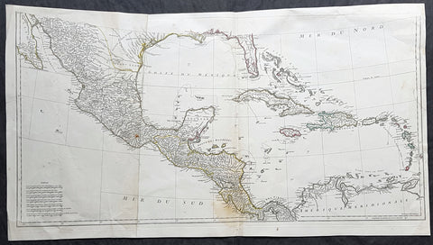
1756 J B D' Anville Large Antique Bottom Map Texas, Mexico, Central America, GOM
Antique Map
- Title : (Amerique Septentrionale Publiee sous les Auspices de Monseigneur le Duc d Orleans.. Par Le Snr. D Anville MDCCXLVI)
- Date : 1756
- Size: 35in x 19in (890mm x 485mm)
- Condition: (A) Very Good Condition
- Ref: 61147
Description:
This large important original copper plate engraved antique map, bottom sheets of 4 sheets, of North America was engraved in 1746 and was published by Jean-Baptiste Bourguinon D Anville in his Elephant Folio Atlas Generale. (I have included an image of the map of the map when it is complete)
This map was instrumental in instructing the European Colonial powers of the time, England France & Spain the importance of dominating the New World, that ultimately led to the French and Indian War of 1754–63. This conflict determined the political direction of North America leading to the American War of Independence in 1775 and ultimately the formation of The United States of America.
To illustrate the importance of cartography in the mid eighteenth century, especially that of North America, a J B D Anville map is essential. D Anville dominated 18th century European cartography with many of his cartographical achievements, especially in North America, copied by many of his contemporaries such as Kitchen, Sayer, Homann, Seutter, Mitchell and others .
He was one of the first to leave blank spaces in his maps, where knowledge was scant or insufficient. His representation of the great lakes is superior to that of his contemporary John Mitchell, responsible for publishing one of the most famous mid 18th century maps of North America, A Map of the British and French Dominions in North America on 8 sheets in 1755 and remained the standard map of North America up until the end of the 18th century. (Ref: Tooley, Printed maps of America, 104; The Mapping of America 316)
General Definitions:
Paper thickness and quality: - Heavy and stable
Paper color : - off white
Age of map color: - Original
Colors used: - Yellow, green, blue, pink
General color appearance: - Authentic
Paper size: - 35in x 19in (890mm x 485mm)
Plate size: - 34 1/2in x 17in (880mm x 430mm)
Margins: - Min 1/2in (12mm)
Imperfections:
Margins: - Small right side of margin & border restored
Plate area: - Folds as issued, small dis-colouration to bottom centerfold
Verso: - Folds as issued, several small repairs not affecting image
Background:
The French and Indian War (1754–63) comprised the North American theatre of the worldwide Seven Years War of 1756–63. It pitted the colonies of British America against those of New France. Both sides were supported by military units from their parent countries, as well as by American Indian allies. At the start of the war, the French North American colonies had a population of roughly 60,000 settlers, compared with 2 million in the British North American colonies. The outnumbered French particularly depended on the Indians. The European nations declared war on one another in 1756 following months of localized conflict, escalating the war from a regional affair into an intercontinental conflict.
The name French and Indian War is used mainly in the United States. It refers to the two enemies of the British colonists, the royal French forces and their various American Indian allies. The British colonists were supported at various times by the Iroquois, Catawba, and Cherokee, and the French colonists were supported by Wabanaki Confederacy members Abenaki and Mikmaq, and Algonquin, Lenape, Ojibwa, Ottawa, Shawnee, and Wyandot.
British and other European historians use the term the Seven Years War, as do English-speaking Canadians. French Canadians call it La guerre de la Conquête (the War of the Conquest) or (rarely) the Fourth Intercolonial War.
Fighting took place primarily along the frontiers between New France and the British colonies, from Virginia in the south to Newfoundland in the north. It began with a dispute over control of the confluence of the Allegheny River and Monongahela River called the Forks of the Ohio, and the site of the French Fort Duquesne in Pittsburgh, Pennsylvania. The dispute erupted into violence in the Battle of Jumonville Glen in May 1754, during which Virginia militiamen under the command of 22-year-old George Washington ambushed a French patrol.
In 1755, six colonial governors in North America met with General Edward Braddock, the newly arrived British Army commander, and planned a four-way attack on the French. None succeeded, and the main effort by Braddock proved a disaster; he lost the Battle of the Monongahela on July 9, 1755 and died a few days later. British operations failed in the frontier areas of Pennsylvania and New York during 1755–57 due to a combination of poor management, internal divisions, effective Canadian scouts, French regular forces, and Indian warrior allies. In 1755, the British captured Fort Beauséjour on the border separating Nova Scotia from Acadia, and they ordered the expulsion of the Acadians (1755–64) soon afterwards. Orders for the deportation were given by William Shirley, Commander-in-Chief, North America, without direction from Great Britain. The Acadians were expelled, both those captured in arms and those who had sworn the loyalty oath to His Britannic Majesty. Indians likewise were driven off the land to make way for settlers from New England.
The British colonial government fell in the region of modern Nova Scotia after several disastrous campaigns in 1757, including a failed expedition against Louisbourg and the Siege of Fort William Henry; this last was followed by Indians torturing and massacring their British victims. William Pitt came to power and significantly increased British military resources in the colonies at a time when France was unwilling to risk large convoys to aid the limited forces that they had in New France, preferring to concentrate their forces against Prussia and its allies in the European theater of the war. Between 1758 and 1760, the British military launched a campaign to capture the Colony of Canada (part of New France). They succeeded in capturing territory in surrounding colonies and ultimately the city of Quebec (1759). The British later lost the Battle of Sainte-Foy west of Quebec (1760), but the French ceded Canada in accordance with the Treaty of Paris (1763).
The outcome was one of the most significant developments in a century of Anglo-French conflict. France ceded to Great Britain its territory east of the Mississippi. It ceded French Louisiana west of the Mississippi River (including New Orleans) to its ally Spain in compensation for Spains loss to Britain of Florida. (Spain had ceded Florida to Britain in exchange for the return of Havana, Cuba.) Frances colonial presence north of the Caribbean was reduced to the islands of Saint Pierre and Miquelon, confirming Great Britains position as the dominant colonial power in eastern North America.
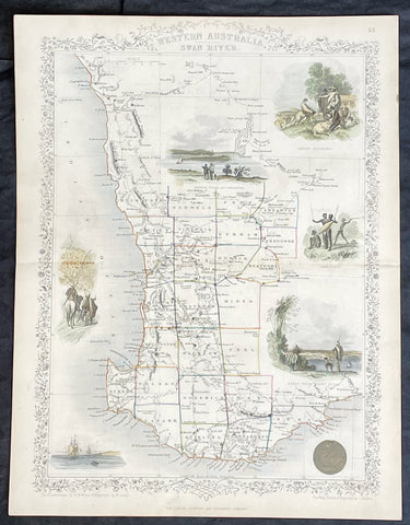
1851 John Tallis Antique Map of Western Australia or The Swan River Settlement
Antique Map
- Title : Western Australia Swan River
- Date : 1851
- Size: 14in x 11in (355mm x 280mm)
- Condition: (A+) Fine Condition
- Ref: 35523
Description:
This original hand coloured, steel plate engraved antique map of Western Australia or The Swan River Settlement, Australia with vignettes of Perth, Fremantle, Aboriginals and settlers was engraved by John Rapkin and published by John Tallis in 1851.
General Definitions:
Paper thickness and quality: - Heavy and stable
Paper color : - off white
Age of map color: - Original
Colors used: - Blue
General color appearance: - Authentic
Paper size: - 14in x 11in (355mm x 280mm)
Plate size: - 14in x 11in (355mm x 280mm)
Margins: - Min 1/2in (12mm)
Imperfections:
Margins: - None
Plate area: - None
Verso: - None
Background:
The firm of Tallis & Company flourished from 1835 to 1860 with varying imprints. Their illustrated Atlas of 1850-51 was one of the last decorative atlases, all the maps being engraved on steel and all adorned with small vignettes. (Ref: Tooley; M&B)
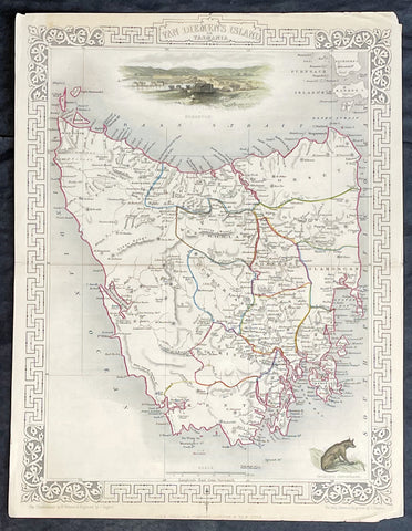
1851 John Tallis Antique Map of Van Diemens Land or Tasmania, Australia
Antique Map
- Title : Van Diemens Land or Tasmania
- Date : 1851
- Size: 14in x 11in (355mm x 280mm)
- Condition: (A+) Fine Condition
- Ref: 35519
Description:
This original hand coloured, steel plate engraved antique map of Tasmania, Australia with vignettes of Hobart and Tasmanian Tiger was engraved by John Rapkin and published by John Tallis in 1851.
General Definitions:
Paper thickness and quality: - Heavy and stable
Paper color : - off white
Age of map color: - Original
Colors used: - Blue
General color appearance: - Authentic
Paper size: - 14in x 11in (355mm x 280mm)
Plate size: - 14in x 11in (355mm x 280mm)
Margins: - Min 1/2in (12mm)
Imperfections:
Margins: - None
Plate area: - None
Verso: - None
Background:
The firm of Tallis & Company flourished from 1835 to 1860 with varying imprints. Their illustrated Atlas of 1850-51 was one of the last decorative atlases, all the maps being engraved on steel and all adorned with small vignettes. (Ref: Tooley; M&B)
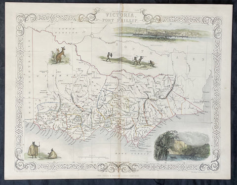
1851 John Tallis Antique Map of Victoria or Port Phillip, Australia
Antique Map
- Title : Victoria or Port Phillip
- Date : 1851
- Size: 14in x 11in (355mm x 280mm)
- Condition: (A+) Fine Condition
- Ref: 35503
Description:
This original hand coloured, steel plate engraved antique map of Victoria, Australia with vignettes of Glenelg River, Aboriginals and Kangaroos was engraved by John Rapkin and published by John Tallis in 1851.
General Definitions:
Paper thickness and quality: - Heavy and stable
Paper color : - off white
Age of map color: - Original
Colors used: - Blue
General color appearance: - Authentic
Paper size: - 14in x 11in (355mm x 280mm)
Plate size: - 14in x 11in (355mm x 280mm)
Margins: - Min 1/2in (12mm)
Imperfections:
Margins: - None
Plate area: - None
Verso: - None
Background:
The firm of Tallis & Company flourished from 1835 to 1860 with varying imprints. Their illustrated Atlas of 1850-51 was one of the last decorative atlases, all the maps being engraved on steel and all adorned with small vignettes. (Ref: Tooley; M&B)
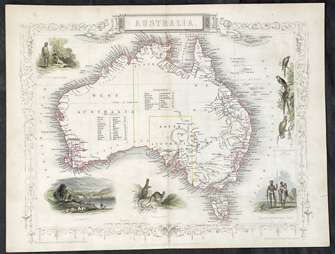
1851 John Tallis Antique Map of Australia
Antique Map
- Title : Australia
- Date : 1851
- Size: 14in x 11in (355mm x 280mm)
- Condition: (A+) Fine Condition
- Ref: 35511
Description:
This original hand coloured, steel plate engraved antique map of Australia with vignettes of Sydney Harbour, Aboriginals, Parrots and Kangaroos was engraved by John Rapkin and published by John Tallis in 1851.
General Definitions:
Paper thickness and quality: - Heavy and stable
Paper color : - off white
Age of map color: - Original
Colors used: - Blue
General color appearance: - Authentic
Paper size: - 14in x 11in (355mm x 280mm)
Plate size: - 14in x 11in (355mm x 280mm)
Margins: - Min 1/2in (12mm)
Imperfections:
Margins: - None
Plate area: - None
Verso: - None
Background:
The firm of Tallis & Company flourished from 1835 to 1860 with varying imprints. Their illustrated Atlas of 1850-51 was one of the last decorative atlases, all the maps being engraved on steel and all adorned with small vignettes. (Ref: Tooley; M&B)
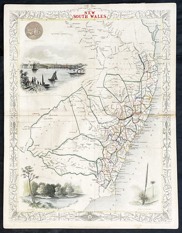
1851 John Tallis Antique Map of New South Wales, Australia
Antique Map
- Title : New South Wales
- Date : 1851
- Size: 14in x 11in (355mm x 280mm)
- Condition: (A+) Fine Condition
- Ref: 1554
Description:
This original hand coloured, steel plate engraved antique map of New South Wales, Australia with vignettes of Sydney Harbour and The Murray was engraved by John Rapkin and published by John Tallis in 1851.
General Definitions:
Paper thickness and quality: - Heavy and stable
Paper color : - off white
Age of map color: - Original
Colors used: - Blue
General color appearance: - Authentic
Paper size: - 14in x 11in (355mm x 280mm)
Plate size: - 14in x 11in (355mm x 280mm)
Margins: - Min 1/2in (12mm)
Imperfections:
Margins: - None
Plate area: - None
Verso: - None
Background:
The firm of Tallis & Company flourished from 1835 to 1860 with varying imprints. Their illustrated Atlas of 1850-51 was one of the last decorative atlases, all the maps being engraved on steel and all adorned with small vignettes. (Ref: Tooley; M&B)
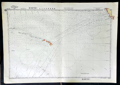
1939 Japanese Safety Agency Large Antique Map of Hawaii, Pacific - Pearl Harbor
Antique Map
- Title : North Pacific Ocean Southern Portion Eastern Sheet, Compiled from the United States and the British Charts to 1939
- Date : 1939
- Size: 43in x 30in (1.090m x 760mm)
- Condition: (A+) Fine Condition
- Ref: 27101
Description:
This original very large lithograph map, a sea chart, with depth soundings, of The Central Pacific, centering on the Hawaiian Islands was complied by the Maritime Safety Agency Japan (MSAJ) from American & British charts. The maps centers on the Hawaiian Islands east to California and south to the Christmas Islands.
The importance of this map cannot be overstated in the context of time and would have no doubt been used by the Japanese carrier group and their attack on Pearl Harbour in 1941.
General Definitions:
Paper thickness and quality: - Heavy and stable
Paper color : - off white
Age of map color: - Original
Colors used: - Blue
General color appearance: - Authentic
Paper size: - 43in x 30in (1.090m x 760mm)
Plate size: - 43in x 30in (1.090m x 760mm)
Margins: - Min 1in (25mm)
Imperfections:
Margins: - None
Plate area: - None
Verso: - None
Background:
The attack on Pearl Harbor was a surprise military strike by the Imperial Japanese Navy Air Service upon the United States against the U.S. naval base at Pearl Harbor in Honolulu, Hawaii, just before 8:00 a.m. (local time) on Sunday, December 7, 1941. The United States was a neutral country at the time; the attack led to its formal entry into World War II on the side of the Allies the next day. The Japanese military leadership referred to the attack as the Hawaii Operation and Operation AI, and as Operation Z during its planning.
The attack was preceded by months of negotiations between the U.S. and Japan over the future of the Pacific. Japanese demands included that the U.S. end its sanctions against Japan, cease aiding China in the Second Sino-Japanese war, and allow Japan to access the resources of the Dutch East Indies. Anticipating a negative response from the US, Japan sent out its naval attack groups in November 1941 just prior to receiving the Hull note—the U.S. demand that Japan withdraw from China and French Indochina.
Japan intended the attack as a preventive action. Its aim was to prevent the United States Pacific Fleet from interfering with its planned military actions in Southeast Asia against overseas territories of the United Kingdom, the Netherlands, and those of the United States. Over the course of seven hours there were coordinated Japanese attacks on the U.S.-held Philippines, Guam, and Wake Island and on the British Empire in Malaya, Singapore, and Hong Kong.
The attack commenced at 7:48 a.m. Hawaiian Time (6:18 p.m. GMT). The base was attacked by 353 Imperial Japanese aircraft (including fighters, level and dive bombers, and torpedo bombers) in two waves, launched from six aircraft carriers. Of the eight U.S. Navy battleships present, all were damaged, with four sunk. All but USS Arizona were later raised, and six were returned to service and went on to fight in the war. The Japanese also sank or damaged three cruisers, three destroyers, an anti-aircraft training ship, and one minelayer. More than 180 US aircraft were destroyed. A total of 2,403 Americans were killed and 1,178 others were wounded, making it the deadliest event ever recorded in Hawaii. Important base installations such as the power station, dry dock, shipyard, maintenance, and fuel and torpedo storage facilities, as well as the submarine piers and headquarters building (also home of the intelligence section) were not attacked. Japanese losses were light: 29 aircraft and five midget submarines lost, and 64 servicemen killed. Kazuo Sakamaki, the commanding officer of one of the submarines, was captured.
Japan announced declarations of war on the United States and the British Empire later that day (December 8 in Tokyo), but the declarations were not delivered until the following day. The British government declared war on Japan immediately after learning that their territory had also been attacked, while the following day (December 8) the United States Congress declared war on Japan. On December 11, though they had no formal obligation to do so under the Tripartite Pact with Japan, Germany and Italy each declared war on the U.S., which responded with a declaration of war against Germany and Italy. There were numerous historical precedents for the unannounced military action by Japan, but the lack of any formal warning (required by part III of the Hague Convention of 1907), particularly while negotiations were still apparently ongoing, led President Franklin D. Roosevelt to proclaim December 7, 1941, a date which will live in infamy. Because the attack happened without a declaration of war and without explicit warning, the attack on Pearl Harbor was later judged in the Tokyo Trials to be a war crime.
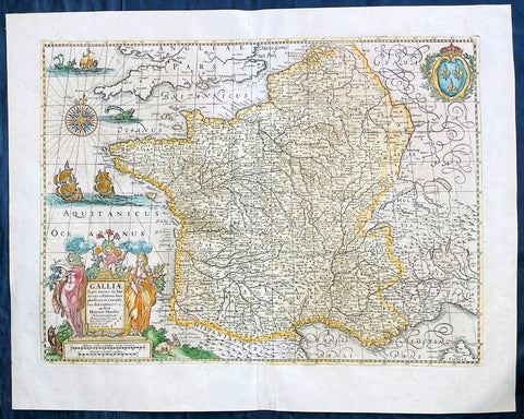
1639 Henricus Hondius Antique Map of France
Antique Map
- Title : Galliae supera omnes in hac...auctore Henrico Hondio
- Date : 1639
- Size: 22 1/2in x 18in (570mm x 455mm)
- Condition: (A+) Fine Condition
- Ref: 17039
Description:
This original hand coloured copper plate engraved antique map of France was published by Henricus Hondius & Jan Jansson in the 1639 French edition of Gerard Mercators Atlas.
General Definitions:
Paper thickness and quality: - Heavy and stable
Paper color : - off white
Age of map color: - Original
Colors used: - Pink, blue, green, yellow
General color appearance: - Authentic
Paper size: - 22 1/2in x 18in (570mm x 455mm)
Plate size: - 19 1/2in x 14 1/2in (500mm x 375mm)
Margins: - Min 1in (25mm)
Imperfections:
Margins: - None
Plate area: - None
Verso: - None
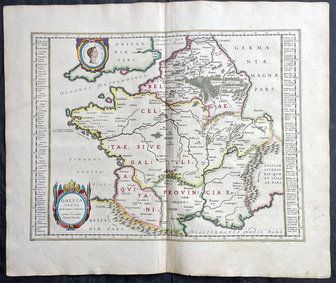
1638 Joan Blaeu & Abraham Ortelius Antique Map of France
Antique Map
- Title : Gallia Vetus...Abrah Ortelii
- Date : 1638
- Size: 23in x 20in (585mm x 510mm)
- Condition: (A+) Fine Condition
- Ref: 70606
Description:
This original beautifully hand coloured copper-plate engraved antique map of France, after Abraham Ortelius, was published by Joan Blaeu in the 1638 French edition of Atlas Nouvs,.
General Definitions:
Paper thickness and quality: - Heavy and stable
Paper color : - off white
Age of map color: - Original
Colors used: - Pink, blue, green, yellow
General color appearance: - Authentic
Paper size: - 23in x 20in (585mm x 510mm)
Plate size: - 19 1/2in x 15in (500mm x 380mm)
Margins: - Min 1in (25mm)
Imperfections:
Margins: - None
Plate area: - None
Verso: - None
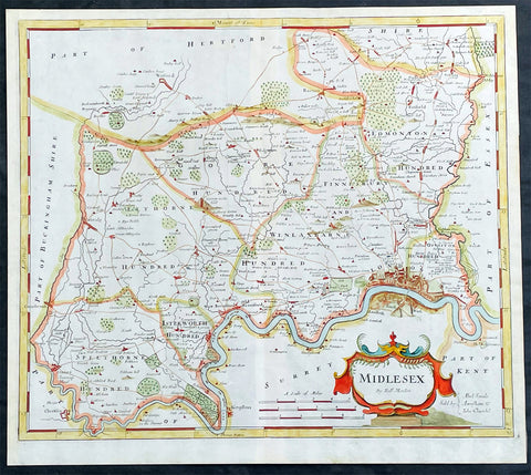
1722 Robert Morden Antique Map of The English County of Middlesex, London
Antique Map
- Title : Midlesex
- Date : 1722
- Size: 17 1/2in x 15 1/2in (445mm x 395mm)
- Condition: (A+) Fine Condition
- Ref: 35603
Description:
This original hand coloured copper-plate engraved antique map of the county of Middlesex and London by Robert Morden was published in the 1722 edition of Camdens Britannia.
General Definitions:
Paper thickness and quality: - Heavy and stable
Paper color : - off white
Age of map color: - Original
Colors used: - Pink, blue, green, yellow
General color appearance: - Authentic
Paper size: - 17 1/2in x 15 1/2in (445mm x 395mm)
Plate size: - 17 1/2in x 15 1/2in (445mm x 395mm)
Margins: - Min 1/2in (12mm)
Imperfections:
Margins: - None
Plate area: - None
Verso: - None
Background:
These maps are the first county maps to show roads (based on Ogilby’s road maps) and show three scales representing great, middle and small miles as different scales were used in different parts of the country. Morden was employed to replace the outdated maps by Saxton, engraved by Kip and Hole. He based his maps on manuscript sources plus the surveys of Ogilby and Morgan, Seller, Palmer and the coastal charts of Captain Grenville Collins. One innovation was the showing of longitudes measured from the meridian of St. Paul's Cathedral given in the form of time in minutes at the top of the map in Roman numerals and at the bottom in degrees. This was done to clarify local times that were taken from the sun as there was no national standard time. Gibson said:' Where actual Surveys could be had, they were purchased at any rate; and for the rest, one of the best Copies extanct was sent to some of the most knowing Gentlemen in each County; with a request to supply the defects, rectified the positions, and correct the false spellings. And that nothing might be wanting to render them as complete and accurate as might be, this whole business was commited to Mr Robert Morden, a person of know abilities in these matters'..from the Preface of the Britannia.

1879 Lorenz Large Antique Map Coal Seams Schuylkill County, Pennsylvania Reading
Antique Map
- Title : Map Showing Coal Laterals of the Philadelphia & Reading Rail Raod company William Lorenz Chief Eng. 1879
- Date : 1879
- Size: 29in x 19 1/2in (735mm x 495mm)
- Condition: (A) Very Good Condition
- Ref: 93520
Description:
This original, large folding rare lithograph map of the Coal Fields of Schuylkill County, Pennsylvania, owned at the time by the Pennsylvania & Reading Railroad Company by William Lorenz was engraved and published in 1879 - dated.
The Definition of a Coalseam lateral is any system of development in coal seams or thick orebodies in which headings are driven horizontally across the coal or ore and connected to main haulage drifts, entries, or shafts. There are many variations and modifications depending on the thickness, shape, and inclination of the deposit.(Ref Tooley M&B)
General Definitions:
Paper thickness and quality: - Heavy and stable
Paper color : - off white
Age of map color: - Original
Colors used: - Pink, blue
General color appearance: - Authentic
Paper size: - 29in x 19 1/2in (735mm x 495mm)
Plate size: - 29in x 19 1/2in (735mm x 495mm)
Margins: - Min 1/2in (12mm)
Imperfections:
Margins: - Chipping to map edges not affecting the image
Plate area: - Light wear along sectioned edges
Verso: - Backed in linen
Background:
Schuylkill is a county in the Commonwealth of Pennsylvania. It is located in the heart of Pennsylvanias Coal Region and is part of Northeastern Pennsylvania. As of the 2020 census, the population was 143,049. The county seat is Pottsville.
The county was created on March 1, 1811, from parts of Berks and Northampton counties and named for the Schuylkill River, which originates in the county. On March 3, 1818, additional territory in its northeast was added from Columbia and Luzerne counties. The county is part of the Pottsville, Pennsylvania Micropolitan Statistical Area.
The lands that today constitute Schuylkill County were acquired by William Penns proprietors by treaty executed August 22, 1749, with representatives of the Six Nations and the Delaware, Shamokin and Shawnee, who received 500 pounds lawful money of Pennsylvania. The territory described included all of Schuylkill County except the northern part of Union Township, which was included in the purchase of 1768.
In the year 1754, the area that would become Schuylkill County along with the areas that today are Berks, Dauphin, Lebanon, and Lehigh counties were settled by German immigrants. The earliest settlers in southeastern Schuylkill County, which was then part of Northampton County, were primarily Moravian missionaries from Saxony. Other early settlers in southern Schuylkill County were German Palatines.
An early mill in the county was built in 1744 by John Finscher, but it later burned down. The first log church in the county was built in 1755. Native American massacres were commonplace in Schuylkill County between 1755 and 1765. Warrant for tracts of land in the vicinity of McKeansburg were in existence as early as 1750. Found by Sammy Hepler in 1789.
Anthracite coal (then called stone coal) was discovered by Necho Allen near the area where Pottsville was ultimately developed in 1790. In 1795, a blacksmith in Schuylkill County named Whetstone learned how to use the coal successfully for smithing purposes. In 1806 coal was found while the tail-race was cut of the Valley (Iron) Forge, on the Schuylkill. Daniel Berlin, another blacksmith, also used it successfully, and smiths in the neighborhood adopted using the coal.
Schuylkill County was created via an Act of Assembly on March 1, 1811, from portions of Berks and Northampton counties. More land was added to the county in 1818, from Columbia and Luzerne counties. At the time of its creation, the county had a population of about 6,000. An early book of Schuylkill County history was written by Daniel Deibert in 1802.
Orwisgsburg was the first community in Schuylkill County to be laid out. During the early years of Schuylkill County, there was an attempt to make McKeansburg the county seat; Orwigsburg was also a contender. Orwigsburg was agreed upon to be the county seat, as it was deemed to be well-suited for industries. Beginning in 1831, sentiment began to rise for moving the county seat to Pottsville. In 1846, the Legislature passed an Act that was approved by Governor Francis R. Shunk on March 13, submitting the question to the voters. The change was desired principally because the railroad and canal connections with Orwigsburg were problematic to transport the public to that town without losing valuable time while Pottsville had such facilities and was within easy access from all parts of the county.
In 1812, George Shoemaker who, with Necho Allen, had discovered stone coal at Centerville in Schuylkill County, personally delivered some coal to Philadelphia. He gave away most of the coal, intending to encourage individuals to find ways to use it. Most of the experiments failed and though Shoemaker was nearly run out of town and called an imposter, Mellon and Bishop of Delaware County successfully used it in their rolling mill. When other rolling mills also adopted the fuel, a large industrial market and demand developed.
The Schuylkill Navigation Company was chartered in 1815 to build a series of navigation improvements in the Schuylkill River. This was during a period when the much larger Erie Canal along the Mohawk River in New York also was being developed. It was well ahead of other key canals fueling the Industrial Revolution, such as the Delaware and Hudson, the Lehigh, the Chesapeake and Ohio, Delaware and Raritan, and Morris canals. The originators of the project did not count upon the coal trade to promote the success of the undertaking. They looked forward mainly to transporting the agricultural products being produced below the mountains, the lumber of Schuylkill County, and the grain and other products of the counties between the Susquehanna and Schuylkill rivers. The first shipments of coal by canal were made in 1822 when 1,480 tons were sent down the line.
With a regular supply of anthracite coal ensured, the southern anthracite coal field in Schuylkill County attracted speculators and fortune hunters. They were inspired by dreams of becoming millionaires. This was the first speculative era of the Schuylkill coal trade. Pottsville became the center of the movement. The more successful explorers revealed numerous veins of coal, extending over a vast stretch of county and with a seemingly inexhaustible quantity of coal. These discoveries brought excitement and speculation; lands were bought (and sold); roads were laid out in the forest, mines were opened and railroads projected, and innumerable town plots planned. The demand for houses was so great that the lumber for many was framed in Philadelphia and sent by canal to the burgeoning coal region.
At this stage, coal-mining firms were small and family owned. The residents and entrepreneurs of the Schuylkill region opposed the entry here of incorporated coal companies. In these years, coal mining operations in the Schuylkill region were conducted with economy, and relatively little capital was required. As the workings were all above the water level, no machinery was required for water drainage or for hoisting coal to the surface. Coal breakers and other expensive fixtures and appliances for the preparation of coal had not then been introduced. Numerous operators produced from five to six thousand tons for market annually (which was then considered a respectable business), who had never committed thousands of dollars to their enterprises, including their first land purchases of coal mines. It was commonly asserted that coal land could be bought and mines opened for less capital than the purchase and stocking of a decent farm. Such mines could be worked for less capital than that required to establish a line of stagecoaches or transportation wagons.
Eventually, railroads replaced the canals as the primary means of transporting coal to markets. Mining was taken over by major corporate business, especially after the Civil War. As a result, the Middle Coal Field was developed in the 1860s and the Philadelphia and Reading Railroad created a subsidiary (Philadelphia and Reading Coal and Iron Company) to buy or lease, and develop the expanding industrial coal trade. Consumption of coal along the Schuylkill above Philadelphia in 1839 was 30,290 tons when the Pioneer at Pottsville, the first anthracite furnace in the United States, became operational. By 1849, consumption had increased to 239,290 tons, to 554,774 tons in 1859, and to 1,787,205 tons in 1873.
The numerous jobs in the mining industry comprised a catalyst for mass immigration to Schuylkill County from the British Isles and Europe in the 19th and 20th centuries. As mines became more numerous (by 1846 there were 110 operators in the region and 142 collieries in Schuylkill County) and more complex (in 1846 there were 35 collieries below water level), mechanical breakers, steam locomotive, it became more labor-intensive both for accomplishing mining tasks and supporting minings peripheral industries. Such industries included manufacturing of explosives, metal screens, pump components, piping, and timber for support. This led to an influx of population into Schuylkill and other anthracite counties to fill these jobs. Beginning with the Irish immigration in the 1840s (fueled by the Great Famine), after the Civil War, beginning in the 1870s, newcomers arrived from Eastern Europe. Poles, Hungarians, Lithuanians, Slovaks, Rusyns and Ukrainians (Ruthenians), often from the Austro-Hungarian monarchy settled in the villages of Schuylkill County and took their place among the laborers in the coal mines. By the 1880s and 1890s, thousands of Italians immigrated for jobs related to mining.
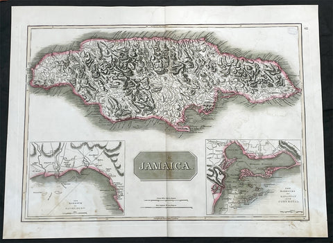
1817 John Thompson Large Antique Map of the Caribbean Island of Jamaica
Antique Map
- Title : Jamaica
- Date : 1817
- Size: 27in x 21in (685mm x 535mm)
- Condition: (A) Very Good Condition
- Ref: 35605
Description:
This large original, beautifully hand coloured copper plate engraved antique map of the Caribbean Islands was published by John Thomson in his large elephant folio 1817 edition of A New General Atlas of the World. (Ref Tooley M&B)
General Definitions:
Paper thickness and quality: - Heavy and stable
Paper color : - off white
Age of map color: - Original
Colors used: - Yellow, green, blue, pink
General color appearance: - Authentic
Paper size: - 27in x 21in (685mm x 535mm)
Plate size: - 27in x 21in (685mm x 535mm)
Margins: - Min 1/2in (12mm)
Imperfections:
Margins: - Light age toning
Plate area: - Light age toning, small library stamp to right
Verso: - Age toning
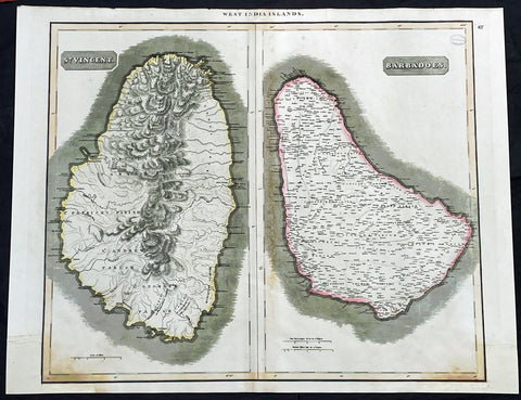
1817 John Thompson Large Antique Map Caribbean Islands of St Vincent & Barbados
Antique Map
- Title : West India Islands: St Vincent; Barbados
- Date : 1817
- Size: 27in x 21in (685mm x 535mm)
- Condition: (A) Very Good Condition
- Ref: 35610
Description:
This large original, beautifully hand coloured copper plate engraved antique map of the Caribbean Islands was published by John Thomson in his large elephant folio 1817 edition of A New General Atlas of the World. (Ref Tooley M&B)
General Definitions:
Paper thickness and quality: - Heavy and stable
Paper color : - off white
Age of map color: - Original
Colors used: - Yellow, green, blue, pink
General color appearance: - Authentic
Paper size: - 27in x 21in (685mm x 535mm)
Plate size: - 27in x 21in (685mm x 535mm)
Margins: - Min 1/2in (12mm)
Imperfections:
Margins: - Bottom L&R margins extended from borders, not affecting the image
Plate area: - Light age toning, small library stamp to right
Verso: - Age toning
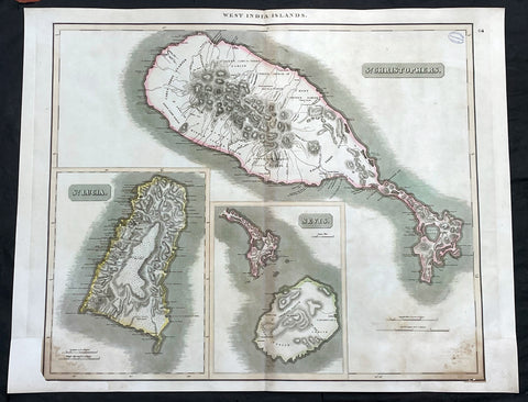
1817 John Thompson Large Antique Map Caribbean Is. St Christopher St Lucia Nevis
Antique Map
- Title : West India Islands: St Christopher; St Lucia; Nevis
- Date : 1817
- Size: 27in x 21in (685mm x 535mm)
- Condition: (A) Very Good Condition
- Ref: 35609
Description:
This large original, beautifully hand coloured copper plate engraved antique map of the Caribbean Islands was published by John Thomson in his large elephant folio 1817 edition of A New General Atlas of the World. (Ref Tooley M&B)
General Definitions:
Paper thickness and quality: - Heavy and stable
Paper color : - off white
Age of map color: - Original
Colors used: - Yellow, green, blue, pink
General color appearance: - Authentic
Paper size: - 27in x 21in (685mm x 535mm)
Plate size: - 27in x 21in (685mm x 535mm)
Margins: - Min 1/2in (12mm)
Imperfections:
Margins: - Bottom L&R margins extended from borders, not affecting the image
Plate area: - Light age toning, small library stamp to right
Verso: - Age toning
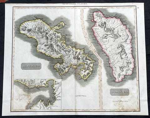
1817 John Thompson Large Antique Map Caribbean Islands of Martinique & Dominica
Antique Map
- Title : West India Islands: Martinico (Cul de Sac Royal); Dominica
- Date : 1817
- Size: 27in x 21in (685mm x 535mm)
- Condition: (A) Very Good Condition
- Ref: 35606
Description:
This large original, beautifully hand coloured copper plate engraved antique map of the Caribbean Islands of Martinique and Dominica was published by John Thomson in his large elephant folio 1817 edition of A New General Atlas of the World. (Ref Tooley M&B)
General Definitions:
Paper thickness and quality: - Heavy and stable
Paper color : - off white
Age of map color: - Original
Colors used: - Yellow, green, blue, pink
General color appearance: - Authentic
Paper size: - 27in x 21in (685mm x 535mm)
Plate size: - 27in x 21in (685mm x 535mm)
Margins: - Min 1/2in (12mm)
Imperfections:
Margins: - Bottom L&R margins extended from borders, not affecting the image
Plate area: - Light age toning
Verso: - Age toning
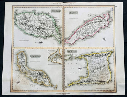
1816 John Thompson Large Antique Map Grenada, Tobago, Curacao Trinidad Caribbean
Antique Map
- Title : West India Islands: Grenada; Tobago; Curacao; Trinadad.
- Date : 1816
- Size: 27in x 21in (685mm x 535mm)
- Condition: (A) Very Good Condition
- Ref: 35612
Description:
This large original, beautifully hand coloured copper plate engraved antique map of the Caribbean Islands Grenada, Tobago, Curacao & Trinidad was published by John Thomson in his large elephant folio 1817 edition of A New General Atlas of the World. (Ref Tooley M&B)
General Definitions:
Paper thickness and quality: - Heavy and stable
Paper color : - off white
Age of map color: - Original
Colors used: - Yellow, green, blue, pink
General color appearance: - Authentic
Paper size: - 27in x 21in (685mm x 535mm)
Plate size: - 27in x 21in (685mm x 535mm)
Margins: - Min 1/2in (12mm)
Imperfections:
Margins: - Bottom L&R margins extended from borders, not affecting the image
Plate area: - Light age toning, small library stamp to right
Verso: - Age toning
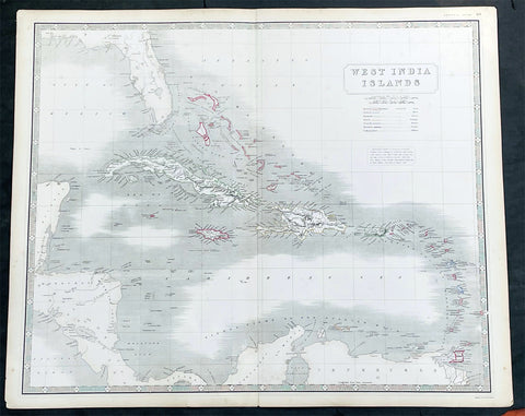
1845 Johnston Large Antique Map Florida, Caribbean, Cuba, Haiti, Central America
Antique Map
- Title : West India Islands
- Date : 1845
- Size: 25in x 21in (635mm x 535mm)
- Condition: (A+) Fine Condition
- Ref: 35619
Description:
This large original hand coloured steel plate engraved antique map of West Indian, Caribbean Islands, was published by W & AK Johnston in his General Atlas, 1845.
General Definitions:
Paper thickness and quality: - Heavy and stable
Paper color : - off white
Age of map color: - Original
Colors used: - Yellow, green, blue, pink
General color appearance: - Authentic
Paper size: - 25in x 21in (635mm x 535mm)
Plate size: - 25in x 21in (635mm x 535mm)
Margins: - Min 1/2in (12mm)
Imperfections:
Margins: - None
Plate area: - None
Verso: - None
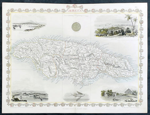
1851 John Tallis Antique map of the Island of Jamaica
Antique Map
- Title : Jamaica
- Date : 1851
- Size: 15in x 11in (380mm x 280mm)
- Condition: (A+) Fine Condition
- Ref: 35616
Description:
This original hand coloured copper plate engraved antique map of Jamaica, with decorative vignettes of Kingston, Port Antonio, Port Royal, a sugar mill and a flying fish, was published by John Tallis in 1851.
General Definitions:
Paper thickness and quality: - Heavy and stable
Paper color : - off white
Age of map color: - Original
Colors used: - Yellow, green, blue, pink
General color appearance: - Authentic
Paper size: - 15in x 11in (380mm x 280mm)
Plate size: - 15in x 10in (380mm x 255mm)
Margins: - Min 1/2in (12mm)
Imperfections:
Margins: - None
Plate area: - Light crease left side of image
Verso: - None
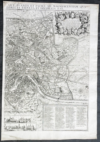
1679 Jacob von Sandrart & Giovanni Battista Falda Large Left Hand Sheet of Rome
Antique Map
- Title : Recentis Romae Ichnographia et Hypsographia Sive Planta et Faies Ad Magnificentiam Qua Prioribus Annis Urbs Ipsa Directa Exculta et Decorata Est.
- Date : 1679
- Size: 26 3/4in x 18 3/4in (680mm x 475mm)
- Condition: (A+) Fine Condition
- Ref: 43188
Description:
This large, original copper plate engraved scarce left hand section of the map of Rome by Jacob Von Sandrart, after Giovanni Battista Falda map, was published in 1679.
This map is based on Giovanni Battista Falda's 12-sheet view of Rome, Nuova Pianta et alzata della citta di Roma, first published in 1676.
Sandrart's view of Rome is rare, we are aware of only 2 examples appearing at auction during the last 25 years.
General Definitions:
Paper thickness and quality: - Heavy and stable
Paper color : - off white
Age of map color: -
Colors used: -
General color appearance: -
Paper size: - 26 3/4in x 18 3/4in (680mm x 475mm)
Plate size: - 25in x 17in (635mm x 430mm)
Margins: - Min 1/2in (12mm)
Imperfections:
Margins: - None
Plate area: - Light creasing along centerfold
Verso: - None
Background:
Jacob von Sandrart's rare and exquisitely engraved view of Rome, one of the finest impressions of the 'Eternal City' made during the great Baroque Era of Art and Architecture.
This finely engraved and lavishly decorative view of Rome takes in all of the 'Eternal City', as it was encompassed by its ancient Aurelian Walls, built during the 2nd Century A.D., on the banks of the River Tiber. Numerous monuments and sites, all of which are still present today, can be seem on the view, including the Coliseum, the Pantheon, the Piazza del Popolo, the Church of San Giovanni Laterno, the Baths of Diocletian, and the Vatican, which is dominated by the Dome of St. Peter's Basilica and the Castel Sant'Angelo. Most notable is the great oval Colonnade that lines the square in front of St. Peter's, which had only been completed in 1666 by the Gianlorenzo Bernini, one of the towering figures of the Baroque Era. The quality of the engraving is exceptionally high, as is the composition of the view, which grants the observer a panoptic view over Rome, while the specific details of the cityscape remain sharply distinguishable.
In the upper left, the title cartouche is surmounted by a portrait of Pope Innocent XI (reigned 1676-89), considered to be a leader of great learning and political acumen. In the upper right corner is a montage featuring the shields of the 14 traditional districts (wards) of Rome. Flowing through the view itself, the River Tiber has its orgins in an allegorical personification of its springs.
In the lower left, a table, 'Index Aedium Antiquitatarum' identifies an amazing 253 ancient buildings and ruins throughout the city. The 'Index Ecclesiarium' in the lower right identifies an incredible 178 churches, although it is not surprising that Rome had by far more houses of worship than any other city in Europe.
In the lower center of the plan are seven views of some of the city's most prominent churches, including St. Peter's Basilica (Vatican), St. Paul's Basilica, San Sebastian Church, San Giovanni Laterno, Sacred Cross of Jerusalem Church, Basilica of St. Lawrence Outside the Walls and the Basilica of Santa Maria Maggiore.
At the time that this view was issued, Rome was enjoying a period of prosperity, and the city's population had reached over 120,000, making it one of the 10 largest cities in Europe. The Roman Catholic Church was on a high, having largely succeeded in driving the Counterreformation, and revenues were pouring in to the Vatican from around the world. This funded the great flourishing of art and architecture in Baroque Rome.
The map was engraved by Jacob von Sandrart (1630-1708), one of the leading fine art engravers of the 17th Century. Born in Frankfurt-am-Main, he apprenticed under his famous uncle Joachim von Sandrart in Amsterdam. He worked in Danzing and Regensburg, and by 1656 had established himself in Nuremberg, where he remained for the rest of his life. Sandrart was highly productive, as over 400 different engravings from his burin are known to survive, although the high quality of his work never wavered. Along with his maps, he is especially well-known for his portraits. Sandrart was the founder and first director of the Nuremberg Academy of Fine Arts (chartered 1662).
Sandrart, Jacob von 1630 - 1708
Jacob von Sandrart was a German engraver primarily active in Nuremberg.
At age ten Sandrart obtained his artistic training from his better-known uncle Joachim von Sandrart in Amsterdam. After spending time in Danzig and Regensburg, he married Regina Christina Eimart, daughter of the engraver Georg Christoph Eimart the elder, on 10 June 1654. The couple settled in Nuremberg in 1656 and remained there for the rest of their lives. His daughter Susanne Maria von Sandrart was also an artist and engraver.
Sandrart was a very prolific artist; over 400 engravings from his hand are extant. He was best known as a portraitist of prominent contemporary citizens of Nuremberg, as an engraver of maps, and as an illustrator of the literary works of Nuremberg writers, especially Sigmund von Birken. Today Sandrart is best remembered as the founder and first director of the Nuremberg Academy of Fine Arts (est. 1662).
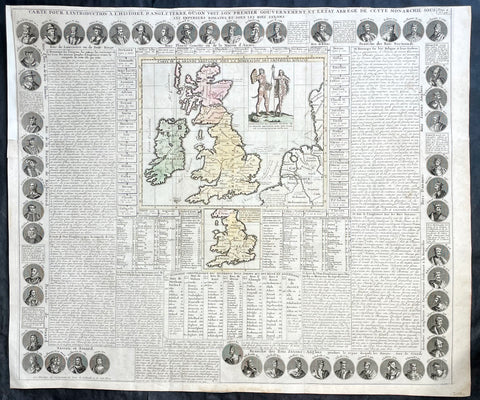
1719 Chatelain Antique Map Great Britain & Ireland Royalty Egbert to Queen Anne
Antique Map
- Title : Carte Pour L Introduction a L Historire S Angleteerre...
- Date : 1719
- Size: 25in x 21in (635mm x 535mm)
- Condition: (A+) Fine Condition
- Ref: 93426
Description:
This large beautifully hand coloured original antique map and illustration of Great Britain and Ireland, with text and pictorial representations of all the Kings and Queens from Egbert in 801 to Queen Anne in 1701, was published by Henri Abraham Chatelain in 1719, in his famous Atlas Historique.
General Definitions:
Paper thickness and quality: - Heavy and stable
Paper color : - off white
Age of map color: - Early
Colors used: - Yellow, pink, blue, green
General color appearance: - Authentic
Paper size: - 25in x 21in (635mm x 535mm)
Plate size: - 25in x 21in (635mm x 535mm)
Margins: - Min 1/4in (6mm)
Imperfections:
Margins: - Top left margin extended
Plate area: - None
Verso: - None
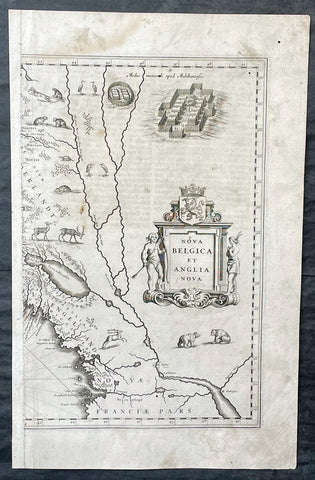
1635 Joan Blaeu Antique Half Page Map of New England, Nova Belgica et Anglia
Antique Map
- Title : Nova Belgica Et Anglia Nova
- Date : 1635
- Size: 18 1/2in x 12in (470mm x 305mm)
- Condition: (A) Good Condition
- Ref: 16385
Description:
This original copper-plate engraved antique half right hand page map of New England & NE America by Joan Blaeu was published in the 1635 German edition of Atlas Novus.
This is the right hand, cartouche title section of this important map.
General Definitions:
Paper thickness and quality: - Heavy and stable
Paper color : - off white
Age of map color: -
Colors used: -
General color appearance: -
Paper size: - 18 1/2in x 12in (470mm x 305mm)
Plate size: - 15 1/2in x 10in (395mm x 255mm)
Margins: - Min 1/2in (12mm)
Imperfections:
Margins: - Soiling, small worm hole top right margin
Plate area: - Light soiling, 4 small worm holes
Verso: - Light soiling
Background:
This important map was one of the most attractive of the Americas published at the time. It is noted for the fact that its primary source is the first manuscript figurative map of Adriaen Block from 1614. Indeed it is the first full representation of it in print. It is one of the earliest to name Nieu Amsterdam. Block, a Dutch fur trader, explored the area between Cape Cod and Manhattan, examining the bays and rivers along the way. This helped to create an accurate picture of the longitudinal scale of the coastline. His manuscript map is the first document to delineate an insular Manhattan; it also provides the earliest appearance of Manhates and Niev Nederland.
It has been noted that the time difference between 1614, the date of the manuscript, and Blaeus map whose first appearance is in 1635, appears long for such an important advance. It would seem highly feasible that Blaeu, who published many separately issued maps, would have wanted to produce one like this sooner. However, evidence points to the fact that it could not have been made before 1630. The Stokes Collection in New York possesses an example of the map on thicker paper without text on the reverse which could well be a proof issue of some kind.
There are features on Blaeus map that differ from the Block chart. Some of these could be accounted for by the fact that the surviving figurative map is not the original, and that the copyist omitted some place names that are referred to in the text of de Laets work. Block drew on Champlains map of 1612 for the depiction of the lake named after him, but it is here called Lacus Irocoisiensis. … The lack of interrelation between the Dutch or English colonies and the French, led for some time to the eastward displacement of this lake when its true position would be north of the Hudson River.
Some nomenclature has its origins in Blaeus second Paskaert of c.1630, and others, such as Manatthans, in de Laet. The colony of Nieu Pleimonth is identified. This and other English names along that part of the coast are largely derived from Smith\\\'s New England, 1616. Cape Cod is here improved over the Block manuscript by being reconnected to the mainland, the narrow strait having been removed. The coastline between here and Narragansett Bay, which can be clearly recognized, is not so accurate. Adriaen Blocx Eylandt leads us to the Versche Rivier, or Connecticut River, which Block ascended as far as was possible. t Lange Eyland is named; however, it is incorrectly too far east, being applied to what is possibly Fishers Island. De Groote bay marks Long Island Sound. The Hudson River is still not named as such, but is littered with Dutch settlements, and the failed Fort Nassau is here depicted renamed as Fort Orange. He does, however, improve on the direction of its flow. Blaeu separates the sources of the Hudson and Delaware Rivers which had been causing some confusion. Nieu Amsterdam is correctly marked as a fort at the tip of an island separated on the east side by Hellegat, or the East River. The coastline south of Sandy Hook also shows signs of improvement.
The whole map is adorned by deer, foxes, bears, egrets, rabbits, cranes and turkeys. Beavers, polecats and otters appear on a printed map for the first time. The Mohawk Indian village top right is derived from the de Bry-White engravings.

1855 John Bartholomew Large Antique Goldfields Map of Victoria, Australia
Antique Map
- Title : Victoria The Gold Districts are coloured (sic yellow)
- Date : 1855
- Size: 17 1/2in x 12 1/2in (445mm x 320mm)
- Condition: (A+) Fine Condition
- Ref: 27096
Description:
This large hand coloured & scarce antique lithograph Goldfields Map of Victoria, Australia (with an inset map of the Mt Alexander & Castlemaine regions) by John Bartholomew was published in the 1855 edition of A & C Blacks General Atlas of The World
General Definitions:
Paper thickness and quality: - Heavy and stable
Paper color : - off white
Age of map color: - Original
Colors used: - Green, yellow, pink
General color appearance: - Authentic
Paper size: - 17 1/2in x 12 1/2in (445mm x 320mm)
Plate size: - 17 1/2in x 12 1/2in (445mm x 320mm)
Margins: - Min 1/2in (12mm)
Imperfections:
Margins: - None
Plate area: - None
Verso: - None
Background:
The first gold rush in Australia began in May 1851 after prospector Edward Hargraves claimed to have discovered payable gold near Orange, at a site he called Ophir. Hargraves had been to the Californian goldfields and had learned new gold prospecting techniques such as panning and cradling. Hargraves was offered rewards by the Colony of New South Wales and the Colony of Victoria. Before the end of the year, the gold rush had spread to many other parts of the state where gold had been found, not just to the west, but also to the south and north of Sydney.
The Australian gold rushes changed the convict colonies into more progressive cities with the influx of free immigrants. These hopefuls, termed diggers, brought new skills and professions, contributing to a burgeoning economy. The mateship that evolved between these diggers and their collective resistance to authority led to the emergence of a unique national identity. Although not all diggers found riches on the goldfields, many decided to stay and integrate into these communities.
In July 1851, Victoria\'s first gold rush began on the Clunes goldfield. In August, the gold rush had spread to include the goldfield at Buninyong (today a suburb of Ballarat) 45 km (28 m) away and, by early September 1851, to the nearby goldfield at Ballarat (then also known as Yuille\'s Diggings) followed in early September to the goldfield at Castlemaine (then known as Forest Creek and the Mount Alexander Goldfield) and the goldfield at Bendigo (then known as Bendigo Creek) in November 1851. Gold, just as in New South Wales, was also found in many other parts of the state. The Victorian Gold Discovery Committee wrote in 1854:
The discovery of the Victorian Goldfields has converted a remote dependency into a country of world wide fame; it has attracted a population, extraordinary in number, with unprecedented rapidity; it has enhanced the value of property to an enormous extent; it has made this the richest country in the world; and, in less than three years, it has done for this colony the work of an age, and made its impulses felt in the most distant regions of the earth.
When the rush began at Ballarat, diggers discovered it was a prosperous goldfield. Lieutenant-Governor, Charles La Trobe visited the site and watched five men uncover 136 ounces of gold in one day. Mount Alexander was even richer than Ballarat. With gold sitting just under the surface, the shallowness allowed diggers to easily unearth gold nuggets. In 7 months, 2.4 million pounds of gold was transported from Mount Alexander to nearby capital cities.
The gold rushes caused a huge influx of people from overseas. Australia\'s total population more than tripled from 430,000 in 1851 to 1.7 million in 1871. Australia first became a multicultural society during the gold rush period. Between 1852 and 1860, 290,000 people migrated to Victoria from the British Isles, 15,000 came from other European countries, and 18,000 emigrated from the United States. Non-European immigrants, however, were unwelcome, especially the Chinese.
The Chinese were particularly industrious, with techniques that differed widely from the Europeans. This and their physical appearance and fear of the unknown led to them to being persecuted in a racist way that would be regarded as untenable today.
In 1855, 11,493 Chinese arrived in Melbourne. Chinese travelling outside of New South Wales had to obtain special re-entry certificates. In 1855, Victoria enacted the Chinese Immigration Act 1855, severely limiting the number of Chinese passengers permitted on an arriving vessel. To evade the new law, many Chinese were landed in the south-east of South Australia and travelled more than 400 km across country to the Victorian goldfields, along tracks which are still evident today.
In 1885, following a call by the Western Australian government for a reward for the first find of payable gold, a discovery was made at Halls Creek, sparking a gold rush in that state.

1855 John Bartholomew Large Antique Goldfields Map of South Eastern Australia
Antique Map
- Title : Victoria. New South Wales and South Australia...Gold Deposits..
- Date : 1855
- Size: 17 1/2in x 12 1/2in (445mm x 320mm)
- Condition: (A+) Fine Condition
- Ref: 27097
Description:
This large hand coloured & scarce antique lithograph Goldfields Map of South Eastern Australia by John Bartholomew was published in the 1855 edition of A & C Blacks General Atlas of The World
General Definitions:
Paper thickness and quality: - Heavy and stable
Paper color : - off white
Age of map color: - Original
Colors used: - Green, yellow, pink
General color appearance: - Authentic
Paper size: - 17 1/2in x 12 1/2in (445mm x 320mm)
Plate size: - 17 1/2in x 12 1/2in (445mm x 320mm)
Margins: - Min 1/2in (12mm)
Imperfections:
Margins: - None
Plate area: - None
Verso: - None
Background:
The first gold rush in Australia began in May 1851 after prospector Edward Hargraves claimed to have discovered payable gold near Orange, at a site he called Ophir. Hargraves had been to the Californian goldfields and had learned new gold prospecting techniques such as panning and cradling. Hargraves was offered rewards by the Colony of New South Wales and the Colony of Victoria. Before the end of the year, the gold rush had spread to many other parts of the state where gold had been found, not just to the west, but also to the south and north of Sydney.
The Australian gold rushes changed the convict colonies into more progressive cities with the influx of free immigrants. These hopefuls, termed diggers, brought new skills and professions, contributing to a burgeoning economy. The mateship that evolved between these diggers and their collective resistance to authority led to the emergence of a unique national identity. Although not all diggers found riches on the goldfields, many decided to stay and integrate into these communities.
In July 1851, Victoria\'s first gold rush began on the Clunes goldfield. In August, the gold rush had spread to include the goldfield at Buninyong (today a suburb of Ballarat) 45 km (28 m) away and, by early September 1851, to the nearby goldfield at Ballarat (then also known as Yuille\'s Diggings) followed in early September to the goldfield at Castlemaine (then known as Forest Creek and the Mount Alexander Goldfield) and the goldfield at Bendigo (then known as Bendigo Creek) in November 1851. Gold, just as in New South Wales, was also found in many other parts of the state. The Victorian Gold Discovery Committee wrote in 1854:
The discovery of the Victorian Goldfields has converted a remote dependency into a country of world wide fame; it has attracted a population, extraordinary in number, with unprecedented rapidity; it has enhanced the value of property to an enormous extent; it has made this the richest country in the world; and, in less than three years, it has done for this colony the work of an age, and made its impulses felt in the most distant regions of the earth.
When the rush began at Ballarat, diggers discovered it was a prosperous goldfield. Lieutenant-Governor, Charles La Trobe visited the site and watched five men uncover 136 ounces of gold in one day. Mount Alexander was even richer than Ballarat. With gold sitting just under the surface, the shallowness allowed diggers to easily unearth gold nuggets. In 7 months, 2.4 million pounds of gold was transported from Mount Alexander to nearby capital cities.
The gold rushes caused a huge influx of people from overseas. Australia\'s total population more than tripled from 430,000 in 1851 to 1.7 million in 1871. Australia first became a multicultural society during the gold rush period. Between 1852 and 1860, 290,000 people migrated to Victoria from the British Isles, 15,000 came from other European countries, and 18,000 emigrated from the United States. Non-European immigrants, however, were unwelcome, especially the Chinese.
The Chinese were particularly industrious, with techniques that differed widely from the Europeans. This and their physical appearance and fear of the unknown led to them to being persecuted in a racist way that would be regarded as untenable today.
In 1855, 11,493 Chinese arrived in Melbourne. Chinese travelling outside of New South Wales had to obtain special re-entry certificates. In 1855, Victoria enacted the Chinese Immigration Act 1855, severely limiting the number of Chinese passengers permitted on an arriving vessel. To evade the new law, many Chinese were landed in the south-east of South Australia and travelled more than 400 km across country to the Victorian goldfields, along tracks which are still evident today.
In 1885, following a call by the Western Australian government for a reward for the first find of payable gold, a discovery was made at Halls Creek, sparking a gold rush in that state.

1855 John Bartholomew Large Antique Goldfields Map of Australia
Antique Map
- Title : Australia...Gold Areas marked thus....
- Date : 1855
- Size: 24in x 17 1/2in (610mm x 445mm)
- Condition: (A+) Fine Condition
- Ref: 50227
Description:
This large hand coloured & scarce antique lithograph Goldfields Map of Australia by John Bartholomew was published in the 1855 edition of A & C Blacks General Atlas of The World
General Definitions:
Paper thickness and quality: - Heavy and stable
Paper color : - off white
Age of map color: - Original
Colors used: - Green, yellow, pink
General color appearance: - Authentic
Paper size: - 24in x 17 1/2in (610mm x 445mm)
Plate size: - 24in x 17 1/2in (610mm x 445mm)
Margins: - Min 1/2in (12mm)
Imperfections:
Margins: - None
Plate area: - None
Verso: - None
Background:
The first gold rush in Australia began in May 1851 after prospector Edward Hargraves claimed to have discovered payable gold near Orange, at a site he called Ophir. Hargraves had been to the Californian goldfields and had learned new gold prospecting techniques such as panning and cradling. Hargraves was offered rewards by the Colony of New South Wales and the Colony of Victoria. Before the end of the year, the gold rush had spread to many other parts of the state where gold had been found, not just to the west, but also to the south and north of Sydney.
The Australian gold rushes changed the convict colonies into more progressive cities with the influx of free immigrants. These hopefuls, termed diggers, brought new skills and professions, contributing to a burgeoning economy. The mateship that evolved between these diggers and their collective resistance to authority led to the emergence of a unique national identity. Although not all diggers found riches on the goldfields, many decided to stay and integrate into these communities.
In July 1851, Victoria\'s first gold rush began on the Clunes goldfield. In August, the gold rush had spread to include the goldfield at Buninyong (today a suburb of Ballarat) 45 km (28 m) away and, by early September 1851, to the nearby goldfield at Ballarat (then also known as Yuille\'s Diggings) followed in early September to the goldfield at Castlemaine (then known as Forest Creek and the Mount Alexander Goldfield) and the goldfield at Bendigo (then known as Bendigo Creek) in November 1851. Gold, just as in New South Wales, was also found in many other parts of the state. The Victorian Gold Discovery Committee wrote in 1854:
The discovery of the Victorian Goldfields has converted a remote dependency into a country of world wide fame; it has attracted a population, extraordinary in number, with unprecedented rapidity; it has enhanced the value of property to an enormous extent; it has made this the richest country in the world; and, in less than three years, it has done for this colony the work of an age, and made its impulses felt in the most distant regions of the earth.
When the rush began at Ballarat, diggers discovered it was a prosperous goldfield. Lieutenant-Governor, Charles La Trobe visited the site and watched five men uncover 136 ounces of gold in one day. Mount Alexander was even richer than Ballarat. With gold sitting just under the surface, the shallowness allowed diggers to easily unearth gold nuggets. In 7 months, 2.4 million pounds of gold was transported from Mount Alexander to nearby capital cities.
The gold rushes caused a huge influx of people from overseas. Australia\'s total population more than tripled from 430,000 in 1851 to 1.7 million in 1871. Australia first became a multicultural society during the gold rush period. Between 1852 and 1860, 290,000 people migrated to Victoria from the British Isles, 15,000 came from other European countries, and 18,000 emigrated from the United States. Non-European immigrants, however, were unwelcome, especially the Chinese.
The Chinese were particularly industrious, with techniques that differed widely from the Europeans. This and their physical appearance and fear of the unknown led to them to being persecuted in a racist way that would be regarded as untenable today.
In 1855, 11,493 Chinese arrived in Melbourne. Chinese travelling outside of New South Wales had to obtain special re-entry certificates. In 1855, Victoria enacted the Chinese Immigration Act 1855, severely limiting the number of Chinese passengers permitted on an arriving vessel. To evade the new law, many Chinese were landed in the south-east of South Australia and travelled more than 400 km across country to the Victorian goldfields, along tracks which are still evident today.
In 1885, following a call by the Western Australian government for a reward for the first find of payable gold, a discovery was made at Halls Creek, sparking a gold rush in that state.
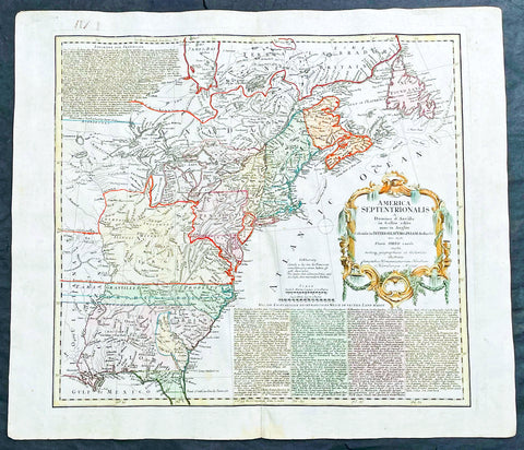
1756 Homann Antique Map Colonial United States North America French Indian War
Antique Map
- Title : America Septentrionalis a domino d Anville in Galiis edita nunc in Anglia coloniis in interiorem Virginiam deductis nec non fluvii Ohio cursu aucta notisq geographicis et historicis illustrata.....1756
- Ref #: 27018
- Size: 24in x 21in (610mm x 535mm)
- Date : 1756
- Condition: (A) Very Good Condition
Description:
This original hand coloured copper-plate engraved antique 1st edition map of the Colonial United States, at the beginning of the French-Indian war, was engraved in 1756 - dated in cartouche - by the Homann firm, Germany.
This map has original margins and colour on heavy clean sturdy paper.
First edition Homann map of the English Colonies in North America prior to the start of the French and Indian War. The map stretches just west of the Mississippi River to the east and from James Bay through the Great Lakes to the Gulf of Mexico. Although most of the text is in German, there is also much in English, including numerous place named annotations associated the French and Indian War, such as the locations of Fort Duquesne and Fort Necessity, both taken by the French in 1754. Thus although the cartographer credits D Anville for the basic cartography, it is clear he is drawing from English, not French, sources. Bottom right and upper left are notes offering the history of North America.
General Definitions:
Paper thickness and quality: - Heavy and stable
Paper color : - off white
Age of map color: - Original & later
Colors used: - Yellow, green, blue, pink
General color appearance: - Authentic
Paper size: - 24in x 21in (610mm x 535mm)
Plate size: - 21in x 19in (535mm x 480mm)
Margins: - Min 1/2in (12mm)
Imperfections:
Margins: - Light staining in lower margins, bottom margin centerfold rejoined with transparent archival tape
Plate area: - Light age toning along centerfold
Verso: - None
Background:
The French and Indian War (1754–63) comprised the North American theatre of the worldwide Seven Years War of 1756–63. It pitted the colonies of British America against those of New France. Both sides were supported by military units from their parent countries, as well as by American Indian allies. At the start of the war, the French North American colonies had a population of roughly 60,000 settlers, compared with 2 million in the British North American colonies. The outnumbered French particularly depended on the Indians. The European nations declared war on one another in 1756 following months of localized conflict, escalating the war from a regional affair into an intercontinental conflict.
The name French and Indian War is used mainly in the United States. It refers to the two enemies of the British colonists, the royal French forces and their various American Indian allies. The British colonists were supported at various times by the Iroquois, Catawba, and Cherokee, and the French colonists were supported by Wabanaki Confederacy members Abenaki and Mikmaq, and Algonquin, Lenape, Ojibwa, Ottawa, Shawnee, and Wyandot.
British and other European historians use the term the Seven Years War, as do English-speaking Canadians. French Canadians call it La guerre de la Conquête (the War of the Conquest) or (rarely) the Fourth Intercolonial War.
Fighting took place primarily along the frontiers between New France and the British colonies, from Virginia in the south to Newfoundland in the north. It began with a dispute over control of the confluence of the Allegheny River and Monongahela River called the Forks of the Ohio, and the site of the French Fort Duquesne in Pittsburgh, Pennsylvania. The dispute erupted into violence in the Battle of Jumonville Glen in May 1754, during which Virginia militiamen under the command of 22-year-old George Washington ambushed a French patrol.
In 1755, six colonial governors in North America met with General Edward Braddock, the newly arrived British Army commander, and planned a four-way attack on the French. None succeeded, and the main effort by Braddock proved a disaster; he lost the Battle of the Monongahela on July 9, 1755 and died a few days later. British operations failed in the frontier areas of Pennsylvania and New York during 1755–57 due to a combination of poor management, internal divisions, effective Canadian scouts, French regular forces, and Indian warrior allies. In 1755, the British captured Fort Beauséjour on the border separating Nova Scotia from Acadia, and they ordered the expulsion of the Acadians (1755–64) soon afterwards. Orders for the deportation were given by William Shirley, Commander-in-Chief, North America, without direction from Great Britain. The Acadians were expelled, both those captured in arms and those who had sworn the loyalty oath to His Britannic Majesty. Indians likewise were driven off the land to make way for settlers from New England.
The British colonial government fell in the region of modern Nova Scotia after several disastrous campaigns in 1757, including a failed expedition against Louisbourg and the Siege of Fort William Henry; this last was followed by Indians torturing and massacring their British victims. William Pitt came to power and significantly increased British military resources in the colonies at a time when France was unwilling to risk large convoys to aid the limited forces that they had in New France, preferring to concentrate their forces against Prussia and its allies in the European theater of the war. Between 1758 and 1760, the British military launched a campaign to capture the Colony of Canada (part of New France). They succeeded in capturing territory in surrounding colonies and ultimately the city of Quebec (1759). The British later lost the Battle of Sainte-Foy west of Quebec (1760), but the French ceded Canada in accordance with the Treaty of Paris (1763).
The outcome was one of the most significant developments in a century of Anglo-French conflict. France ceded to Great Britain its territory east of the Mississippi. It ceded French Louisiana west of the Mississippi River (including New Orleans) to its ally Spain in compensation for Spains loss to Britain of Florida. (Spain had ceded Florida to Britain in exchange for the return of Havana, Cuba.) Frances colonial presence north of the Caribbean was reduced to the islands of Saint Pierre and Miquelon, confirming Great Britains position as the dominant colonial power in eastern North America.
Please note all items auctioned are genuine, we do not sell reproductions. A Certificate of Authenticity (COA) can be issued on request.
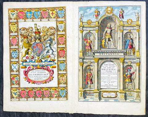
1676 John Speed Antique Atlas Title Pages x 2 Empire of Great Britaine & World
Antique Map
- Title : The Theatre of the Empire of Great Britaine, A Prospect of the most famous Parts of the World by John Speed...London Thomas Bassett and Richard Chiswell 1676; The Achievement of our Soveraigne King Charles the 11D.
- Date : 1676
- Size: 22 1/2in x 17 1/2in (570mm x 445mm)
- Ref #: 42005/42006
- Condition: (A+) Fine Condition
- Price: $1250.00US
Description:
This original beautifully hand coloured, copper plate engraved antique Title and Dedication Pages was published for the 1676 edition of John Speeds double atlas The Theatre of the Empire of Great Britaine & Atlas A Prospect of the most Famous Parts of the World printed by Thomas Bassett and Richard Chiswell, London.
General Definitions:
Paper thickness and quality: - Heavy and stable
Paper color : - off white
Age of map color: - Later
Colors used: - Yellow, green, blue, pink
General color appearance: - Authentic
Paper size: - 22 1/2in x 17 1/2in (570mm x 445mm)
Plate size: - 15 1/4in x 9 3/4in (385mm x 250mm) each
Margins: - Min 1/2in (12mm)
Imperfections:
Margins: - Light age toning
Plate area: - Light age toning
Verso: - Light age toning
Background:
John Speeds The Theatre of the Empire of Great Britaine was published in 1610/11 by John Sudbury and George Humble, and contained the first set of individual county maps of England and Wales besides maps of Ireland and a general map of Scotland. Most, but not all, of the county maps have town plans on them; those showing a Scale of Passes being the places he had mapped himself. The county maps were the first consistent attempt to show territorial divisions, such as boundaries of hundreds, but it was Speed’s town plans that were a major innovation and probably his greatest contribution to British cartography. The Theatre was an immediate success: the first print run of around 500 copies must have sold quickly because many editions followed. Sudbury and Humble realized, given the increasing popularity of both county and world atlases and in the light of the success of Abraham Ortelius’s Theatrum Orbis Terrarum, the potential demand for an English world atlas.
In 1627, two years before his death, Speed published Prospect of the Most Famous Parts of the World with 21 finely engraved maps, which was the first world atlas produced by an Englishman. There is a fascinating text describing the areas shown on the back of the maps in English, although a rare edition of 1616 of the British maps has a Latin text – this is believed to have been produced for the Continental market. Its maps are famous for their bordering panels of national characters in local costume and panoramic views depicting the areas of major towns and cities. Much of the engraving was done in Amsterdam at the workshop of Jodocus Hondius. The maps of the world and America show California as an island and are amongst the earliest ever printed to depict this seventeenth-century cartographic myth.
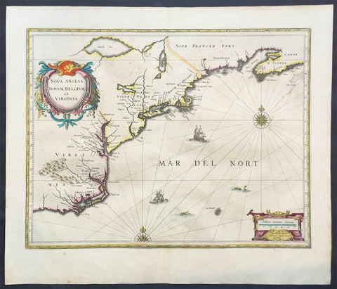
1639 Jan Jansson Antique Map of North America Virginia to New York to New England
Antique Map
- Title : Nova Anglia Novvm Belgium et Virginia
- Date : 1639
- Condition: (A+) Fine Good Condition
- Ref: 43134
- Size: 22 1/2in x 19 1/2in (570mm x 495mm)
Description:
This beautifully hand coloured, important original antique map of the north east regions of the United States from Virginia, Chesapeake Bay, to New York & New England by Jan Jansson was published in the 1639 French edition of the Jansson, Hondius Atlas.
A beautiful map with sturdy, clean paper original wide margins and beautiful original hand colouring.
General Definitions:
Paper thickness and quality: - Heavy and stable
Paper color : - off white
Age of map color: - Original
Colors used: - Blue, pink, red, green, yellow
General color appearance: - Authentic
Paper size: - 22 1/2in x 19 1/2in (570mm x 495mm)
Plate size: - 20in x 15 1/2in (535mm x 395mm)
Margins: - Min 1in (25mm)
Imperfections:
Margins: - Light toning on margin edges
Plate area: - Very light offsetting
Verso: - None
Background:
A beautiful original 17th map of Virginia, New York and New England which was derived from the less well circulated Johannes de Laet map of 1630. This version is enlarged and expanded to the north and slightly east, with de Laets narrative on the verso (De Laets map is one of extreme importance, being the first printed to use the namesManbattes (Manhattan) and N. Amsterdam)
The nomenclature on this map is virtually identical to the De Laet map, with the few minor differences most likely owing to the engravers error. C of Feare is still depicted over 2° too far south. This is not Cape Fear we know of today but actually Cape lookout.
During the fiercely competitive decade of the 1630's the families of Blaeu and Jansson produced maps drawn directly from one another. Here, however, Jansson produces one that was not followed by Blaeu, relying upon the more restricted map of Nova Belgica to represent the land north of Chesapeake Bay. A sign of the Dutch influence here is that both atlas producers largely declined to include the advanced cartography of Champlain, thereby relegating it altogether.
There are three know states of this map, the first one published in 1636 - entitled Nova Anglia Novvm Belgium et Virginia.
The second edition in which the title of the map was changed to Nova Belgium et Anglia Nova (to give more weight to Dutch claims in North America) within a new square cartouche was first published in 1647.
State 3 was published in 1694 by Schenk & Valk which included new regional demarcation and a latitude and longitude grid. (Ref: Koeman; M&B; Tooley; Burden; AMPR)
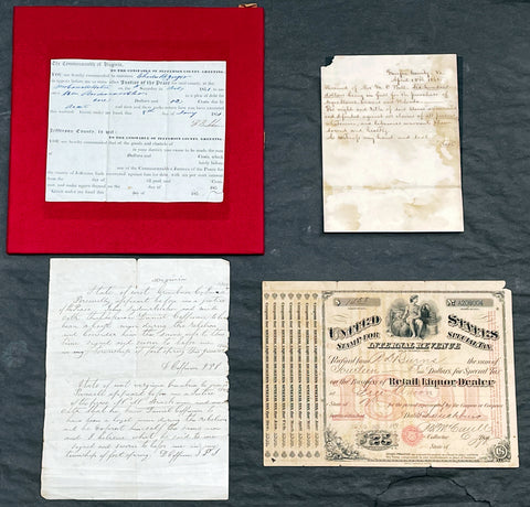
1851-1891 Original Antique Virginian American Civil War Documents F. Beckham, M D Ball, D Coffman
Antique Map
-
Title :
1. The Commonwealth of Virginia
2. Fairfax County Va April 15th 1861.
3. State of West Virginia Green brier co. June 11th 1866.
4. United States Stamp for Special Tax Internal Revenue. - Date : 1851-1891
- Size: Please view description below
- Condition: (A) Good Condition
- Ref: 27090
Description:
We have on offer a group of 4 original antique documents, three of which relate directly to Virginia and the American Civil War dated 1851,1861, 1866. The first two documents concern Fontaine Beckham & Mottrom Dulany Ball with the third relating to Daniel Coffman. These three are very interesting and scarce items.
The fourth document relates to the Internal Revenue Service in 1891. Details, descriptions and conditions below.
1. Printed court summons signed by Fontaine Beckham (1788-1859) as justice of the peace, Jefferson County, Virginia, 8 January 1851. Printed sheet completed in manuscript, signed 'F Beckham'.
Fontaine Beckham was mayor of Harpers Ferry during the raid by John Brown in 1859 with Beckham infamously shot and killed during the raid, making him possibly one of the first casualties of the American Civil War.
Condition: Mounted on red-velvet-covered thick card mount, sheet torn at lower right-hand corner not affecting text. Condition Good. - 7in x 53/4in (18 x 14.6 cm)
Fontaine Beckham (1788-1859) was mayor of Harpers Ferry, Virginia, and local agent for the Baltimore and Ohio Railroad. He was shot and killed in the famous raid on the small outpost by abolitionist John Brown, today seen as a major event in the build-up to the American Civil War.
...... Beckham was the most prominent man killed during John Brown's raid on Harpers Ferry, being the town's mayor, a county magistrate (in which capacity he signs this document), and a station agent for the B & O Railroad. Despite being a slave owner himself, Beckham was quite well-liked and considered by most to be a friend and benefactor of black men. He maintained a close friendship with his former slave Heyward Shepard, who also died during the raid.. After Shepard's death, some accounts state the mayor exposed himself to fire due to his clouded judgment. After Beckham's death, the infuriated town's people seized one of John Brown's imprisoned men, riddling his body with bullets. Yet Beckham's death also resulted in the only lasting freeing of slaves accomplished by the raid, as his will stipulated the freeing of five of his slaves......)
2. Manuscript receipt for the purchase of 'negro slaves Dennis and Belinda', Fairfax County, Virginia, signed by a member of a prominent local family, Mrs. M C(sic) Ball, dated 15 April 1861. We believe this to a transaction by Mary Ball, the mother of the first Governor of Alaska, Mottrom Dulany Ball, who at the time was have been fighting for the confederacy. The verso of the receipt is marked for Dulany, (as he was sometimes known) who would have been considered the head of the family after the death of his farther in 1859. Single bifolium of heavy woven paper, 10 lines, written on one side only, conjugate leaf docketed 'Dulany'
Condition: Damp-stained, creased from folding, loss to upper inner corner. Although stained the parchment is stable and heavy. Condition Good.
- 7 1/2in x 53/4in (18.2 x 13.8 cm)
Mottrom Dulany Ball, of Fairfax County, Fairfax Court House, and Alexandria, Virginia, was a musician, poet, teacher, lawyer, soldier and a founding father of the State of Alaska. Mottrom Dulany Ball, who was known variously as Mott, M.Dulany, or M.D., was born at Oak Mount, the home of his grandfather, Daniel French Dulany, in Fairfax County, Virginia on June 23, 1835.
Mott was the son of Spencer Mottrom Ball and Mary L. Dulany. Both parents were from prominent Virginia families. President George Washington is included among their many distinguished relatives. Mott’s early years were spent at his grandfather, Mottrom Ball’s, plantation, Woodberry, near Lewinsville, Fairfax County, Virginia. The elder Mottrom Ball was a physician who was educated at the University of Glasgow, in Scotland. TheBall family estate, Woodberry, consisted of 1,200 acres of land, rectangular in shape, extending north from the Lewinsville Presbyterian Church all the way to the to the Potomac River. 2, 3 The extensive plantation included a grist mill, Ball’s Mill, which stood on Scott’s Run. The location is today known as Swink’s Mill.4 Modern day Ball’s Hill Road traces the path of a farm road which ran through the center of Woodberry ending at the family home, Elmwood, on Ball’s Hill, also known as Prospect Hill, just south of Georgetown Pike.5 Politically, Mott’s father, Spencer Mottrom Ball, was an Anti-Jacksonian. As the name implies, this party was opposed to the authoritarian policies of President Andrew Jackson and his Democratic party. Several anti-Jacksonian factions came together to form the Whig party in 1834. Whigs supported the supremacy of Congress over the presidency.....)
3. Contemporary manuscript copy of two affidavits, one the same sheet, confirming Daniel Coffman to have been a loyal man during the rebelion [sic]', Greenbrier County, West Virginia, 1866.
Single sheet of lined paper written recto only, small embossed stamp depicting the Capitol Building and with text 'Congress' various inconsistencies in spelling.
Condition: Old folds, central fold just splitting at head, nicked along inner edge. Condition Good.
- 9in x 7in (23.5 x 17.8 cm)
First affidavit.
State of West Virginia Greenbrier Co. June 1866.
Personelly (sic) apparent before me a justice of the Peace John Sydenrtrleker (sic) and made oath that he knew Daniel Coffman to have been a loyal man during the rebellion and consider him the same use (sic) to this time Signed and sworn to before me in my township of fort spring this june 11th 1866...D Coffman JPS.....
Second affidavit.
State of West Virginia Greenbrier Co. June 1866.
Personell (sic) apparent before me a justice of the Peace H H Brackman and made oath that he knew Daniel Coffman to have been a loyal man during the rebellion and he invest (sic) himself the same now and I believe what he said to me
Signed and sworn to befor (sic) me in my township of fort spring...D Coffman JPS.....
The Coffman family have lived in Greenbrier county since the Rev Isaac Coffman 1741 - 1824, buried in the Coffman Cemetery, Ronceverte, West Virginia.
4. Internal Revenue receipt 'for special tax on the business of retail liquor dealer', paid by R. D. Burns of Lynchburg, Virginia, 9 December 1891 Engraved receipt in red and black, completed in manuscript.
Condition: Aged, small hole to lower left, upper right corner chipped. Condition Good. - 9 3/4in x 7 1/4in (24.5 x 18 cm)
General Definitions:
Please view description above
Imperfections:
Please view description above

1751 D Anville Very Large Antique Map The West Coast of Africa, Slave Coast
Antique Map
- Title : Carte Particuliere De La Cote Occidentale De L'Afrique Depusi le Cap Blanc jusqu'au Cap De Verga et du Cours Des Rivieres De Senega et de Gambie . .MDCCLI
- Ref #: 22009
- Size: 42in x 33in (1.07m x 840mm)
- Date : 1751
- Condition: (A+) Fine Condition
Description:
This very large finely engraved, highly detailed original antique map of of the west coast of Africa covering Gambia and Senegal was engraved in 1751 - dated in the tile cartouche - and was published in Jean-Baptiste Bourguinon D'Anville's large elephant folio atlas Atlas Generale.
Description: D' Anville's maps have a clarity and a directness that is very 'modern'. He incorporated as much known information into his maps as he could. Map extent is from Cap Blanc in the north to Cap de Verga in the south.
Being part of the Mediterranean world, the northern coasts of the African continent as far as the Straits of Gibraltar and even round to the area of the Fortunate Isles (the Canaries) were reasonably well known and quite accurately mapped from ancient times. In particular, Egypt and the Nile Valley were well defined and the Nile itself was, of course, one of the rivers separating the continents in medieval T-O maps. Through Arab traders the shape of the east coast, down the Red Sea as far as the equator, was also known but detail shown in the interior faded into deserts with occasional mountain ranges and mythical rivers. The southern part of the continent, in the Ptolemaic tradition, was assumed to curve to the east to form a land-locked Indian Ocean. The voyages of the Portuguese, organized by Henry the Navigator in the fifteenth century, completely changed the picture and by the end of the century Vasco da Gama had rounded the Cape enabling cartographers to draw a quite presentable coastal outline of the whole continent, even if the interior was to remain largely unknown for the next two or three centuries.
The first separately printed map of Africa (as with the other known continents) appeared in Munster's Geographia from 1540 onwards and the first atlas devoted to Africa only was published in 1588 in Venice by Livio Sanuto, but the finest individual map of the century was that engraved on 8 sheets by Gastaldi, published in Venice in 1564. Apart from maps in sixteenth-century atlases generally there were also magnificent marine maps of 1596 by Jan van Linschoten (engraved by van Langrens) of the southern half of the continent with highly imaginative and decorative detail in the interior. In the next century there were many attractive maps including those of Mercator/Hondius (1606), Speed (1627), Blaeu (1 630), Visscher (1636), de Wit (c. 1670), all embellished with vignettes of harbours and principal towns and bordered with elaborate and colourful figures of their inhabitants, but the interior remained uncharted with the exception of that part of the continent known as Ethiopia, the name which was applied to a wide area including present-day Abyssinia. Here the legends of Prester John lingered on and, as so often happened in other remote parts of the world, the only certain knowledge of the region was provided by Jesuit missionaries. Among these was Father Geronimo Lobo (1595-1678), whose work A Voyage to Abyssinia was used as the basis for a remarkably accurate map published by a German scholar, Hiob Ludolf in 1683. Despite the formidable problems which faced them, the French cartographers G. Delisle (c. 1700-22), J. B. B. d'Anville (1727-49) and N. Bellin (1754) greatly improved the standards of mapping of the continent, improvements which were usually, although not always, maintained by Homann, Seutter, de Ia Rochette, Bowen, Faden and many others in the later years of the century. (Ref: Tooley, M&B)
General Description:
Paper thickness and quality: - Heavy and stable
Paper color: - White
Age of map color: -
Colors used: -
General color appearance: -
Paper size: - 42in x 33in (1.07m x 840mm)
Plate size: - 40 1/2in x 28in (1.02m x 710mm)
Margins: - Min 1in (25mm)
Imperfections:
Margins: - None
Plate area: - Light text offsetting
Verso: - None
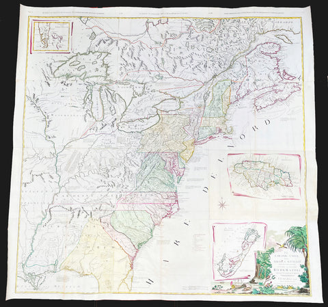
1778 John Mitchell & Antonio Zatta 12 Sheet Antique Map of North America - Rare
Antique Map
- Title : Le Colonie Unite dell' America Settentrle. di Nuova Projezione Ass. Ee. Li Signori Riformatori dello Studio di Padova. Venezia 1778, Presso Antonio Zatta, con Privilegio dell' Eccellentissimo Senato.
- Ref #: 93528
-
Condition: (A+) Fine Condition
- Size: 52 1/2in x 51in (1.33m x 1.30m)
- Date : 1778
Description:
This impressive very large twelve-sheet joined, original hand coloured important antique map is Antonio Zattas version of John Mitchells 1755 landmark map of North America, published first in 1778. This map is one of a few to be released during the late 18th century copying Mitchells map, in an effort to explain the rapidly changing political & economic situation in North America. Zatta has included many additional notes relating to both the Treaty of 1763 and events in the Revolutionary War. Most importantly, it is the first printed map devoted to the thirteen states, and to use the a name distinguishing them from their previous status as British Colonies. The name United Colonies was used in the Declaration of Independence and was not officially replaced until the Articles of Confederation adopted the name The United States of America.
This is an incredibly important and rare map, especially joined, in excellent condition with original colour. With John Mitchells map is now almost now impossible to find, with the last known sale in 2011 of $175,000US, this map is now one of the few, of that period, that is avaialble.
Zatta published these twelve separate sheets of Mitchells Map of North America, plus three other maps: Il Canada, Le Isole di Terra Nuova e Capo Breton, and La Baja D Hudson in the atlas Atlante Novissimo published from 1779-1785, with a second edition of the Zatta/Mitchell map published in 1791. Zattas version does not cover the far western portions of Mitchells map stretching to the Mississippi. An image of Mitchells map has been included as a point of reference.
Because Mitchells map was immediately recognized as seminal, it was exceedingly popular. Events leading up to the American Revolution only increased that demand. During the midst of the colonists on-going struggle for liberation from England, Zatta published this version which included some additional place names and information on early battles of the American Revolution.
The maps of Venetian publisher Antonio Zatta are noteworthy for their fine craftsmanship and high aesthetics. He was probably the most important Italian map publisher of the late eighteenth century and is responsible for a large number of atlases and single maps of considerable aesthetic and scientific merit.
General Definitions:
Paper thickness and quality: - Heavy and stable
Paper color : - off white
Age of map color: - Original
Colors used: - Yellow, green, blue, pink
General color appearance: - Authentic
Paper size: - 52 1/2in x 51in (1.33m x 1.30m)
Plate size: - 49 1/2in x 49 1/4in (1.26m x 1.25m)
Margins: - Min 1in (25mm)
Imperfections:
Margins: - Light creasing
Plate area: - Light creasing
Verso: - Light creasing
Background:
A Map of the British and French Dominions in North America by John Mitchell Map is a landmark map by John Mitchell (1711–1768), which was reprinted several times during the second half of the 18th century, in France, Italy & Germany. The Mitchell Map was used as a primary map source during the Treaty of Paris for defining the boundaries of the newly independent United Colonies. The Mitchell Map is the most comprehensive map of eastern North America made during the colonial era, measuring 6.5 feet (2.0 m) wide by 4.5 feet (1.4 m) high.
Mitchell started compiling a first draught map in 1750 from information acquired in London, both in official & private archives. This proved to be inadequate & George Montagu-Dunk, 2nd Earl of Halifax, accordingly ordered the governors of the 13 British colonies to survey and compile new maps, which most did. These became the basis, along with cartographical information of the French geographer Guillaume Delisle, of his landmark map. Late in 1754, Halifax was using one manuscript copy of Mitchells second map to successfully promote his political position (no compromise with the French) within the British cabinet in the build-up to the Seven Years War, also know as the French and Indian War. Halifax also permitted Mitchell to have the map published: it appeared in April 1755, engraved by Thomas Kitchin and published by Andrew Millar.
The published map bore the title A Map of the British and French Dominions in North America. It bore the copyright date of 13 February 1755, but the map was probably not sold to the public until April or even May. Minor corrections to the maps printing plates were made probably during the printing process (for example, the name and address of the publisher were corrected).
The geographer John Green criticized Mitchell and his map soon after it appeared, emphasizing two failings with respect to Nova Scotia (an area of particular dispute with the French). Mitchell, Green noted, had used neither the astronomical observations for latitude and longitude made by Marquis Joseph Bernard de Chabert in the 1740s nor a 1715 chart of the Nova Scotia coast. In response, Mitchell released a new version of his map, now with two large blocks of text that described all of his data sources; the new version of the map also adjusted the coastline in line with Chaberts work but rejected the 1715 chart as deeply flawed. This version of the map, which Mitchell referred to as the second edition, is commonly thought to have appeared sometime in 1757, but advertisements in the (London) Public Advertiser and Gazetteer and London Daily Advertiser on 23 April 1756 clearly indicate that this new map appeared at that time.
Mitchells map was printed in eight sheets; when assembled, it measures 136 cm by 195 cm (4 feet 6 inches by 6 feet 5 inches; height x width). The initial impressions printed in 1755 have a consistent coloring outlining British colonial claims. Mitchell extended the southern colonies across the entire continent, even over established Spanish territory west of the Mississippi. Mitchell divided up the Iroquois territories (as he understood them, reaching from Lake Champlain [Lac Irocoisia] to the Mississippi, and north of Lake Superior) between Virginia and New York, leaving only a much-reduced territory to the French.
Mitchells map was expensive but it spawned many cheaper variants that trumpeted Halifax and Mitchells powerful colonial vision to the British public. One of these, published in December 1755 by a Society of Anti-Gallicans, restricted the French even further just to Quebec.
The map is liberally sprinkled with text describing and explaining various features, especially in regions that were relatively unknown or which were subject to political dispute. Many notes describe the natural resources and potential for settlement of frontier regions. Others describe Indian tribes. Many Indian settlements are shown, along with important Indian trails.
Since Mitchells main objective was to show the French threat to the British colonies, there is a very strong pro-British bias in the map, especially with regard to the Iroquois. The map makes clear that the Iroquois were not just allies of Britain, but subjects, and that all Iroquois land was therefore British territory. Huge parts of the continent are noted as being British due to Iroquois conquest of one tribe or another. French activity within the Iroquois claimed lands is noted, explicitly or implicitly, as illegal.
In cases where the imperial claims of Britain and France were questionable, Mitchell always takes the British side. Thus many of his notes and boundaries seem like political propaganda today. Some of the claims seem to be outright falsehoods.
The Mitchell Map remained the most detailed map of North America available in the later eighteenth century. Various impressions (and also French copies) were used to establish the boundaries of the new United States of America by diplomats at the 1783 Treaty of Paris that ended the American Revolutionary War. The maps inaccuracies subsequently led to a number of border disputes, such as in Maine.[clarification needed] Its supposition that the Mississippi River extended north to the 50th parallel (into British territory) resulted in the treaty using it as a landmark for a geographically impossible definition of the border in that region. It was not until 1842, when the Webster-Ashburton Treaty resolved these inconsistencies with fixes such as the one that created Minnesotas Northwest Angle, that the U.S.–Canada border was clearly drawn from Maine to the Oregon Country.
Similarly, during the drafting of the Northwest Ordinance, the maps inaccuracy in depicting where an east–west line drawn through the southernmost point of Lake Michigan would intersect Lake Erie led to a long dispute over the Ohio–Michigan border that culminated in the Toledo War.
Zatta, Antonio fl. 1757-1797
Antonio Zatta was a prominent Italian editor, cartographer, and publisher. Little is known about his life beyond his many surviving published works. It is possible that he was born as early as 1722 and lived as late as 1804. He lived in Venice and his work flourished between 1757 and 1797. He is best known for his atlas, Atlante Novissimo (1779-1785), and for his prolific output of prints and books that were both precisely made and aesthetically pleasing. Zatta clearly had a large network from which to draw information; this is how he was able to publish the first glimpse of the islands visited by Captain Cook in the Atlante Novissimo.
Zattas maps are noteworthy for their fine craftsmanship and high aesthetics. His re-engraving and publication of John Mitchells famous map of North America A Map of the British and French Dominions in North America in 1778, is considered one of the best re-issues of this seminal, landmark map .
......He was probably the most important Italian map publisher of the late eighteenth century and is responsible for a large number of atlases and single maps of considerable aesthetic and scientific merit.... (Portinaro & Knirsch, The Cartography of North America, 1500-1800, p. 319).
Zatta was among the leaders in the eighteenth-century revival of fine printing in Italy and his choice of the text of Raynal to support his re-issue of Mitchells Map, is not surprising. Anne Palms Chalmers describes Zatta as a sardonic writer with the focus of a certain amount of political controversy (Venetian Book Design in the Eighteenth Century, The Metropolitan Museum of Art Bulletin, New Series, Vol. 29, No. 5, January 1971, pp. 226-235). Chalmers describes Zattas printing and design as harmonious in composition with ornament unified by style, quality of line, and tone of printing.
Please note all items auctioned are genuine, we do not sell reproductions. A Certificate of Authenticity (COA) can be issued on request.
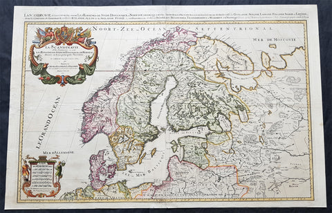
1696 Jaillot Large Antique Map Norway Sweden Finland Denmark - Latvia & Estonia
Antique Map
- Title : La Scandinavie...Hubert Jaillot 1696
- Size: 37in x 24in (940mm x 610mm)
- Condition: (A) Very Good Condition
- Date : 1696
- Ref #: 70329
Description:
This very large, beautifully hand coloured original copper-plate engraved antique map of Scandinavia, Norway, Sweden, Finland, Denmark along with Latvia & Estonia was engraved in 1696 - dated in cartouche - and was published by Alexis Hubert Jaillot in his monumental Atlas Nouveau.
General Definitions:
Paper thickness and quality: - Heavy and stable
Paper color : - off white
Age of map color: - Original
Colors used: - Yellow, pink, green, blue
General color appearance: - Authentic
Paper size: - 37in x 24in (940mm x 610mm)
Plate size: - 35in x 23in (890mm x 585mm)
Margins: - Min 1in (25mm)
Imperfections:
Margins: - Several small repairs to margins, no loss
Plate area: - Horizontal fold, light soiling and creasing
Verso: - Light soiling
Background:
Before the fifteenth century the people of Southern Europe had little geographical knowledge of the Scandinavian World except from sketchy detail shown in the Catalan Atlas (1375) and on a number of \" portolani\" embracing Denmark and the southern tip of Norway. It was not until 1427 that a manuscript map prepared about that time by Claudius Clavus (b.1388) a Dane who spent some time in Rome, made available to scholars a tolerable outline of the northern countries and Greenland. That was to remain the best map available for the rest of the century and it was used as the basis for maps of Scandinavia in early printed editions of Ptolemy. Others by Nicolaus Cusanus (1491) and Ehrhard Etzlaub (c. 1492) followed but, needless to say, these are extremely rare; even the later maps by Olaus Magnus and Marcus Jordan, where they have survived at all , are known only by a very few examples. In fact, apart from the rare appearance of an early Ptolemy map, the oldest of Scandinavia which a collector is likely to find are those of Munster\'s Cosmograhy first published in 1544. In the following centuries the few maps and charts complied in Scandinavia were usually published in Amsterdam, Antwerp, Paris or Nuremberg, the most important maps often being incorporated in the major Dutch, French & German Atlases. (Ref: Tooley; M&B)
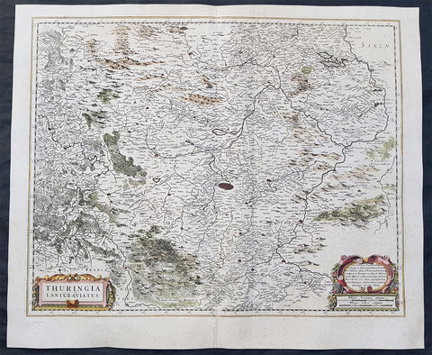
1639 Henricus Hondius Original Antique Map of the German State of Thuringia
Antique Map
- Title : Thuringia Lantgraviatus
- Date : 1639
- Size: 22 1/2in x 19in (570mm x 485mm)
- Ref #: 23434
- Condition: (A) Very Good Condition
Description:
This fine original antique map of the German State of Thuringia or Thüringen in central Germany was published by Henricus Hondius in the 1639 edition of Mercators Atlas.
The map centers on the city of Erfurt and alos includes major cities of Gotha, Weimar, Schwartzburg, Halle, Jena, Mulhausen and others
General Definitions:
Paper thickness and quality: - Heavy and stable
Paper color : - off white
Age of map color: - Original
Colors used: - Yellow, green, blue, pink
General color appearance: - Authentic
Paper size: - 22 1/2in x 19in (570mm x 485mm)
Plate size: - 20 1/2in x 16 1/2in (520mm x 420mm)
Margins: - Min 1in (25mm)
Imperfections:
Margins: - None
Plate area: - Light creasing along centerfold,
Verso: - Small repair to bottom left margin
Background:
Named after the Thuringii tribe who occupied it around AD 300, Thuringia came under Frankish domination in the 6th century.
Thuringia became a landgraviate in 1130 AD. After the extinction of the reigning Ludowingian line of counts and landgraves in 1247 and the War of the Thuringian Succession (1247–1264), the western half became independent under the name of \"Hesse\", never to become a part of Thuringia again. Most of the remaining Thuringia came under the rule of the Wettin dynasty of the nearby Margraviate of Meissen, the nucleus of the later Electorate and Kingdom of Saxony. With the division of the house of Wettin in 1485, Thuringia went to the senior Ernestine branch of the family, which subsequently subdivided the area into a number of smaller states, according to the Saxon tradition of dividing inheritance amongst male heirs. These were the \"Saxon duchies\", consisting, among others, of the states of Saxe-Weimar, Saxe-Eisenach, Saxe-Jena, Saxe-Meiningen, Saxe-Altenburg, Saxe-Coburg, and Saxe-Gotha; Thuringia became merely a geographical concept.
Thuringia generally accepted the Protestant Reformation, and Roman Catholicism was suppressed as early as 1520; priests who remained loyal to it were driven away and churches and monasteries were largely destroyed, especially during the German Peasants\' War of 1525. In Mühlhausen and elsewhere, the Anabaptists found many adherents. Thomas Müntzer, a leader of some non-peaceful groups of this sect, was active in this city. Within the borders of modern Thuringia the Roman Catholic faith only survived in the Eichsfeld district, which was ruled by the Archbishop of Mainz, and to a small degree in Erfurt and its immediate vicinity.
1632 Henricus David Large Antique Portrait of Cartographer Giovanni A Magini
Antique Map
- Title : Io. Antonius Maginus Pat. Mathemat. In Bonon. Gymn. Profess
- Date : 1632
- Condition: (A+) Fine Condition
- Ref: 80766
- Size: 17 1/2in x 11in (445mm x 280mm)
Description:
This fine beautifully hand coloured original antique portrait of the Italian Cartographer Giovanni Antonio Magini was engraved by Henricus David in 1632 - date is engraved below portrait.
Giovanni Antonio Magini (1555-1617) was an Italian mathematician, cartographer and Professor of Astronomy in Bologna. He is responsible for publishing an edition ofPtolemy's Geographia in 1596 that contained 27 maps of the ancient world drawn from the text of Claude Ptolemy, along with 27 contemporary or modern maps. His maps were used by Blaeu in 1640. (Ref: Tooley; M&B)
General Description:
Paper thickness and quality: - Heavy and stable
Paper color: - off white
Age of map color: - Original
Colors used: - Yellow, green, red, brown.
General color appearance: - Fresh
Paper size: - 17 1/2in x 11in (445mm x 280mm)
Plate size: - 12n x 8 1/2in (305mm x 215mm)
Margins: - Min 1in (25mm)
Imperfections:
Margins: - Light dis-colouration in top margin
Plate area: - None
Verso: - None
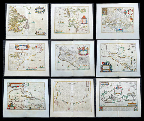
1662 Joan Blaeu Complete Set of 9 Antique Maps of North America from Atlas Major, 1st Edition
Antique Map
- Titles:
1. Extrema Americae....Terra Nova Francia;
2. Nova Belgica Et Anglia Nova;
3. Nova Virginiae Tabula;
4. Virginiae partis australis, et Floridae;
5. Nova Hispania;
6. Yucatan...Guatimala;
7. Insulae Americanae;
8. Canibales Insulae;
9. Mappa Aestivarum Insularum Alias Barmudas - Sizes: 24in x 20 1/2in (610mm x 520mm)ea
- Condition: (A+) Fine Condition
- Date: 1662
- Ref #: BlaeuNA 1662
Description:
This is a unique opportunity to acquire a complete set of 9 maps of North America published by Joan Blaeus in the monumental & rare 1st 1662 Latin edition of Atlas Major. The maps cover the geographical detail of Canada, North America, Mexico, The Caribbean & Central America. Please see the background section below for details of each map. All maps have wide original margins & colour on strong sturdy paper.
Joan Blaeus 11 volumes of Atlas Major, is considered by many to be the greatest atlas set ever published. It excels in comprehensiveness, engraving, color, and overall production. The first edition was published in Latin in 1662 and was subsequently published in French, Dutch, German, and Spanish over the next 10 years.
On the 23rd of February 1672, a fire broke out in central Amsterdam, that ended the reign of one of the greatest & most prolific publishers of printed maps and atlases in publishing history. The Blaeu family had reached its zenith 10 years previously, with the publication of its greatest achievement, the Atlas Major or Great Atlas, consisting of 11 volumes, with geographical detail reflecting many of the achievements of the Golden Age of the United Netherlands. Blaeus Atlas Major were the most expensive books printed in the 17th century.
General Definitions:
Paper thickness and quality: - Heavy and stable
Paper color : - off white
Age of map color: - Original
Colors used: - Blue, pink, red, green, yellow
General color appearance: - Authentic
Paper size: - 24in x 20 1/2in (610mm x 520mm)
Plate size: - Various, pls see below
Margins: - Min 1in (25mm) min
Imperfections:
Margins: - Pls see below
Plate area: - Pls see below
Verso: - Pls see below
Background:
1. Extrema Americae ( Eastern Canada) - Rare only published in Atlas Major. Derived mainly from the Samuel de Champlain Nouvelle France map of 1632, this map reflects the growing financial importance of the waters of New France to Europe.
Plate: 22 1/2in x 17 3/4in.
Condition: Age toning, text show-through & browning to image.
2. Nova Belgica Et Anglia Nova (New England) - NE America, centering on New York and Manhattan from Virginia to the St Lawrence River. This map is noted for the fact that its primary source is the first manuscript figurative map of Adriaen Block from 1614. Indeed it is the first full representation of it in print. It is one of the earliest to name Nieu Amsterdam. Block, a Dutch fur trader, explored the area between Cape Cod and Manhattan, examining the bays and rivers along the way.
Plate: 19 1/2in x 15 1/2in
Condition: Age toning, text show-through & browning to image.
3. Nova Virginiae Tabula (John Smiths Virginia & Chesapeake Bay) This map was printed from a plate engraved by Dirk Grijp from a previous plates by Henricus Hondius.
Plate: 19in x 15in
Condition: Light age toning
4. Virginiae partis australis, et Floridae Virginia, the Carolinas & Georgia.
Plate: 20in x 15in
Condition: Light age toning
5. Nova Hispania et Nova Galicia Western Mexico
Plate: 19 1/2in x 15 1/2in
Condition: Light age toning
6. Yucatan...Guatimala (Yucatan, Central America) Rare only published in Atlas Major.
Plate: 20 1/2in x 16 1/2in
Condition: Light age toning
7. Insulae Americana (GOM, Caribbean)
Plate: 20 1/2in x 15in
Condition: Light age toning
8. Canibales Insulae (Lesser Antilles Islands) Rare, printed only in Atlas Major
Plate: 21in x 16 1/2in
Condition: Age toning
9. Mappa Aestivarum Insularum Alias Barmudas Dictarum Bermuda. Like all 17th century maps of Bermuda this map is based ultimately on the survey made by John Norwood, of the Bermuda Company, in 1618 in the form as published by the English map-maker John Speed in 1627.
Plate: 21in x 16in
Condition: Light age toning
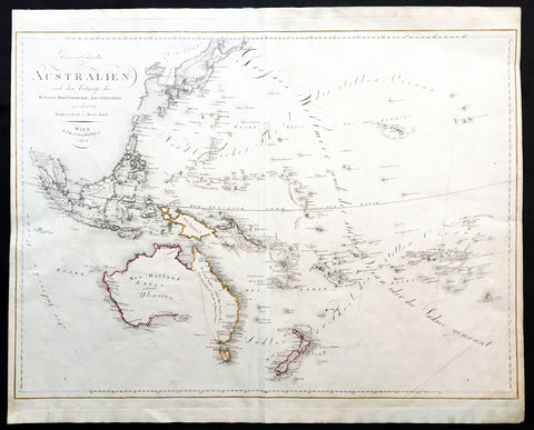
1815 Swoboda & Hartl Antique Early Map of New Holland Australia, Ulimaroa Scarce
Antique Map
- Title : Generalcharte von Australien nach dem entwurfe des H.Joseph Marx Freiherrn v. Liechtenstern
- Date : 1815
- Condition: (A+) Fine Condition
- Ref: 16258
- Size: 27 1/4in x 22in (695mm x 560mm)
Description:
This large beautifully hand coloured original & scarce antique map of New Holland also named Ulimaroa, New Zealand and the South Pacific by Franz Swoboda and Martin Hartl was published in Vienna in 1815 - dated.
General Description:
Paper thickness and quality: - Heavy & stable
Paper color: - White
Age of map color: - Original
Colors used: - Red, yellow
General color appearance: - Authentic
Paper size: - 27 1/4in x 22in (695mm x 560mm)
Paper size: - 27in x 20 3/4in (685mm x 525mm)
Margins: - Min 1/4in (7mm)
Imperfections:
Margins: - None
Plate area: - Vertical crease right image
Verso: - None
This map is typical of the affect of Cooks discoveries on European cartography. Australia regularly became a focus on regional maps. The name "Ulimaroa" was often used, mainly by German & Austrian cartographers, at this time. It was term Cook learned from the New Zealand Maoris before discovering the east coast of Australia during his first voyage of discovery. When this map was printed there was a strong belief that the Australian continent was possibly divided by an internal sea strait, separating the east from the west coasts. It was explorers such as Flinders and Baudin who set out to find this elusive passage and if so the possible point at which a ship could enter.
Only a few years before in 1798 Flinders and Bass had proved that there was a strait dividing Van Diemen’s Land (Tasmania) from the rest of the continent so now the race was on to find the other passage. On Swoboda’s map a line has been drawn from the bottom of Carpentaria to the eastern part of present day Victoria. This line represented two things, the potential shape of the eastern landmass split by the sea and the extent to English territory in the newly settled colonies, only 17 years old. The Southern Coastline is not shown as even though Flinders had by 1803 mapped the entire region he was in 1805 still under house arrest on the islands of Mauritius by the French, he would not publish his discoveries until 1814. Therefore this map shows Australia at a pivotal point in its history when most of the continent was still open for settlement by other nations and the coastlines and mysteries were still to be confirmed. (Ref: Clancy; M&B; Tooley)
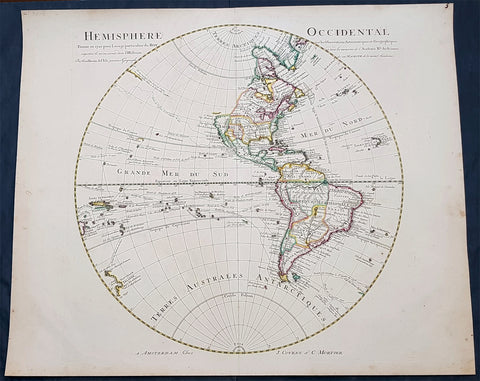
1720 Guillaume Delisle Large Antique Map of America, New Zealand, Pacific Ocean
Antique Map
- Title : Hemisphere Occidental Dresse en 1720 pour l usage
- Date : 1720
- Condition: (A+) Fine Condition
- Ref: 93081
- Size: 25in x 21in (635mm x 535mm)
Description:
This very large 1st edition beautifully hand coloured original antique Map of America by Guillaume Delisle, was engraved by J De la Haye in 1720, dated, and was was published in the Atlas Nouveau.
General Definitions:
Paper thickness and quality: - Heavy and stable
Paper color : - off white
Age of map color: - Original
Colors used: - Blue, pink, red, green, yellow
General color appearance: - Authentic
Paper size: - 25in x 21in (635mm x 535mm)
Plate size: - 19 1/2in x 19in (490mm x 485mm)
Margins: - Min 1/2in (12mm)
Imperfections:
Margins: - Uniform age toning
Plate area: - Uniform age toning
Verso: - Uniform age toning
Background:
Guillaume de L isle was responsible for some of the most accurate maps of America avaialble in the early 18th century. Delisle did away with most of the speculative cartography especially of North America and researched his information in finite detail. This can be seen in many ways. The most oblivious is showing California as a Peninsular - which some cartographers did not believe until the 1740\'s - and the NW region has been left blank, free of speculation. Another noticeable difference is the accurate depiction of the Great Lakes.
As with all Delisle\'s map this is finely engraved with amazing detail and hand colour. The map includes the tracks of many explorers up until 1710. These include Magellan 1520, Halley 1700, de Quiros 1605, de Mendana 1595, de la Maire 1616, Tasman, Halley and others. (Ref: M&B; Tooley)
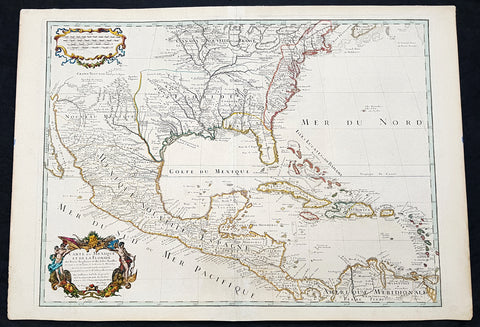
1708 Guillaume Delisle Large Antique Map of North America - 4th State, rare
Antique Map
- Title : Carte Du Mexique et de la Floride des Terres Angloises et des Isles Antilles du Cours et des Environs de la Riviere Mississipi . . .Chez L Auteur sue le Quaide de l Horlage Privilege du Roy po. 20 ana 1703
- Date : 1708
- Condition: (A+) Fine Condition
- Ref: 93525
- Size: 29 1/4in x 20 1/2in (750mm x 520mm)
Description:
In the world of early 18th century American cartography, no one published as many landmark maps of North America as the French family firm of Delisle. This large original copper-plate engraved scarce map of North America became one of the most copied map of the next 100 years by the likes of Homann, Seutter, Lotter, Sanson and many others. Engraved by Charles Simoneau, this map is the 4th state of seven (identified with the date 1703 in the cartouche with Delisles address in Paris erased) was published by Guillaume Delisle in the <i>Atlas Nouveau.</i>
The 7 states outlined by Tooley are:
- State 1 (1703): De LIsles first address on Rue Des Canettes.
- State 2 (1703): address changed to Quai de lHorloge Couronne de Diamans and the imprint of Renard.
- State 3 (1708): Couronne de Diamans is erased and <i>se trouve a Amsterdam chez L. Renard Libraire prez de la Bourse</i> is added
- State 4 (1708): <i>A Paris Chez L Auteur sur le Quai de l Horloge</i> is added and <i>Couronne de Diamans and Renards</i> imprint are removed and the engravers name (Simoneau) appears below the cartouche.
- State 5 (1722): <i>A Amsterdam Chez Jean Covens & Corneille Mortier avec Privilege 1722</i> Re-engraved and published by Covens & Mortier in Atlas Nouveau
- State 6 (1745): Philippe Buache imprint added below neatline at right.
- State 7 (1783): Title altered to Carte du Mexique et des Etas Unis dAmerique, Partie Meridionale, issued by Dezauche, showing US States and boundaries.
General Definitions:
Paper thickness and quality: - Heavy and stable
Paper color : - off white
Age of map color: - Original & later
Colors used: - Yellow, green, blue, pink
General color appearance: - Authentic
Paper size: - 29 1/4in x 20 1/2in (750mm x 520mm)
Plate size: - 26in x 19 1/2in (660mm x 495mm)
Margins: - Min 1in (20mm)
Imperfections:
Margins: - None
Plate area: - None
Verso: - None
Background:
This map, which is one of the three great maps of regional North America conceived by Delisle during the first quarter of the eighteenth century, identifies the colonial affiliations that defined the destiny of North America by the end of the century. As is often the case, the British North American Colonies are shown hemmed in by the Appalachians and crowding the Atlantic coast. The status of present-day South Carolina is dubious, the coloring implying that it may belong to Spain. To the north and west of New England, Canada confines the British colonies even further. In the Southwest, French Floride extends to the Rio Grande and south to present-day Brownsville. The northern boundary of Floride is indicated, except that it abuts Canada, thereby giving France possession of the entire middle part of the continent. Various remarks and locations for Native American tribes are shown, indicating, for example, the locations of the Apache Vaqueros, the Apache Navaio, and the Tiguas. In the French possessions many tribes and their villages are indicated, for example, the famous Cenis in Texas, the Apalache in Georgia and Florida, and the Kicapou near the Great Lakes (their original location before they were pushed all the way to Mexico). Delisles debts to Ibervilles explorations are frequently shown on this map.
The map was compiled from the reports brought back to France from the survivors of the La Salle expedition into the interior of North America and from the information derived from the explorations of Bienville and dIberville. In the year preceding the publication of the map, De LIsle utilized his position with the King of France to gain access to the best available information from the new world. During this time period he assiduously compiled the geographical data from the reports of the French Jesuit Missionaries and Explorers in North America, along with Spanish manuscript maps (often copied by the Missionaries while they were acting in the service of the Spanish as spiritual guides and gaining their confidence).
The result of this work were a series of landmark maps of the North America, including his map of North America ( LAmerique Septentrionale, 1700), Canada and the Great Lakes ( Carte du Canada ou de la Nouvelle France 1703), and the Mississippi Valley & Gulf Coast ( Carte de la Louisiane et du Cours du Mississipi 1708).
The map has been a towering landmark along the path of Western cartographic development. De LIsles map also includes greater accuracy in the Great Lakes region and in its depiction of English settlements along the East Coast. Excellent detail of the Indian villages in East Texas, based upon the reports of dIberville and the Spanish missionaries. The best depiction of the Southwest to date, with early trails & Indian tribes. Cumming described the map as profoundly influential.
Many have suggested that Claude Delisle, father of Guillaume, was the one who conducted the research on the maps, whereas Guillaume was the one who actually drew the maps and engraved the plates. Obviously the maps were a collaborative effort of the Delisle firm.
1812 Conrad Malte Brun Large Quatro Antique World Atlas with 75 Maps
Antique Map
- Title : Atlas Complet du précis de la Geographie universelle. Dressé conformément au Texte de cet Ouvrage et sous les Yeux de L'Auteur, par M. Lapie. (Cet Atlas est formé de 75 Cartes)
- Size: Large Quarto - 14 1/2in x 11in (370mm x 280mm)
- Condition: (A+) Fine Condition
- Date : 1812
- Ref #: 31573
Description:
This original large quatro, antique 1st edition atlas by Conrad Matle-Brun Atlas Complet du précis de la Geographie universelle containing 75 hand coloured maps, as called for, was published by Francois Buisson in 1812.
This fine world atlas contains 3 double page and 72 single page maps with original hand colouring on clean heavy paper with a heavy impression. The binding & spine is tight, with worn boards. A beautiful intact clean atlas, now how to find.
General Definitions:
Paper thickness and quality: - Heavy and stable
Paper color : - off white
Age of map color: - Original
Colors used: - Yellow, green, blue, pink
General color appearance: - Authentic
Paper size: - 20in x 14in (510mm x 355mm) double page maps
Plate size: - 14in x 10in (355mm x 255mm) single page maps
Margins: - Min 1in (25mm)
Imperfections:
Margins: - None
Plate area: - None
Verso: - None
Malte-Brun, Conrad 1775 - 1826
Malte-Brun was born Malthe Conrad Bruun - sometimes referred to simply as Malte-Brun - was a Dano-French geographer and journalist. His second son, Victor Adolphe Malte-Brun, was also a geographer. Today he is perhaps best remembered for coining the name for the geographic region Oceania (French Oceanie) around 1812.
Born in Thisted to an administrator of Danish crown lands, Malte-Brun was originally destined for a career as a pastor, but chose instead to attend classes at the University of Copenhagen, and became a supporter of the French Revolution and an activist in favor of freedom of the press. Following the harsh censorship laws instituted by the Danish ruler crown prince Frederick in September 1799, he was indicted because of his many pamphlets which contained outright criticism of the government, which the new censorship laws forbade. A particular cause for offence was a pamphlet he published in 1795 entitled Catechism of the Aristocrat.
The case of Peter Andreas Heiberg, who for similar crimes had been sentenced to exile at Christmas of 1799, did not make Malte-Brun optimistic about his prospects. He had already left the country prior to the court sentence (which was first carried late 1800) and had settled first in Sweden, later in the Free City of Hamburg.
At some point during his exile, he started using his Danish first name, Malthe, as part of his surname, Bruun.
Malte-Brun arrived in France in November 1799, and began work on a geography treatise meant as a gift to his adoptive country. A poem on the death of Andreas Peter Bernstorff which he published during his exile procured for him permission to return to Denmark. But another pamphlet against the aristocracy subjected him to a new prosecution, and he left his country, and finally took up his residence in Paris. In December 1800, the Danish courts pronounced sentence of perpetual banishment against him, which was rescinded about the time of his death. Malte-Brun\'s geography treatise was written with the help of Edme Mentelle, a professor at the Ale Normale; together, they produced Gaographie mathamatique, physique et politique de toutes les parties du monde (6 vols., published between 1803 and 1812).
He was a regular contributor to Journal des dabats. At first opposed the consular government, but subsequently became a zealous imperialist, and after the fall of Napoleon an equally zealous monarchist, publishing in 1824 Traita de la lagitimita considae comme base du droit public de l Europe chratienne.
Aside from his political writings, he devoted himself especially to geographical studies. He was the founder of Les Annales des Voyages (in 1807) and Les Annales des Voyages, de la Gaographie et de l Histoire (in 1819), which encouraged observations and reports as a basis for research. He became well known after contributing Tableau de la Pologne, a treatise on the geography of Poland (in 1807) as the First Empire troops established French tutelage in the region). In 1822-1824, he served as the first general secretary of the newly founded Sociata de Gaographie. Malte-Brun was the first person to suggest importing camels into Australia. See Australian feral camel.
He died in Paris in 1826 as he was drafting the final version of his major work, the Pracis de Gaographie Universelle ou Description de toutes les parties du monde. This appeared in eight volumes (1810 - 29), the last two volumes being by Huot. Malte-Bruns name was given to streets in both Paris (20th arrondissement) and Thisted.
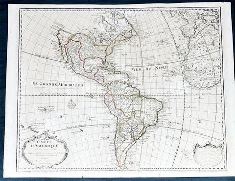
1722 Guillaume Delisle Large Antique Map of America, 1st Edition 2nd State
Antique Map
- Title : Carte D Amerique...1722
- Size: 26 1/2in x 20 1/2in (675mm x 520mm)
- Condition: (A+) Fine Condition
- Date : 1722
- Ref #: 93338
Description:
This large original copper plate engraved hand coloured antique, true first edition 2nd state, map of America was published by Guillaume Delisle in 1722.
Even though this map was published for the better part of the 18th century, the date 1722 in the cartouche, was not updated or removed in most instances. This makes identification of the true 1st editions complicated, but not impossible. The design of the cartouche itself is the defining evidence. I have included an image of the 4 different cartouche designs, from Tooleys The Mapping of America that define the different editions. This map is the first edition, state 2, illustrated in the image as No.2.
This landmark map and one of the most important maps of America published in the early 18th century. So detailed was it, for its day, that it was copied many times over the next 100 years.
General Definitions:
Paper thickness and quality: - Heavy and stable
Paper color : - off white
Age of map color: - Original
Colors used: - Yellow, Green, pink
General color appearance: - Authentic
Paper size: - 26 1/2in x 20 1/2in (675mm x 520mm)
Plate size: - 24 1/2in x 19 1/2in (620mm x 495mm)
Margins: - Min 1/2in (12mm)
Imperfections:
Margins: - Light age toning
Plate area: - Light age toning
Verso: - Light age toning
Background:
Detailed map of America, showing a blank coastline above Cap Blanc and the mythical entry of D\'Aguilar. The map shows tremendous detail throughout. Nice detail in California and the Southwest. The course of the Mississippi si pushed considerably west of its true location, but the Missouri River is shown in a remarkably accurate fashion, with headwaters in the Northern Rocky Mountains. The map is rich with Indian and other early American details. Decorative cartouche, compass rose and extensive notes throughout the map. First edition, 2nd State of the map. A bit of minor soiling, some lifting at the centerfold near the bottom of the map and a bit of wear at the lower centerfold, but generally a fine dark impression of this important early map.
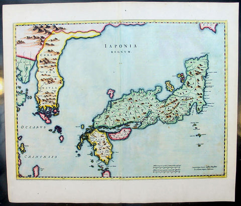
1655 Joan Blaeu Antique Map of Japan, Korea & parts of China - Beautiful
Antique Map
- Title : Japonia Regnum
- Date : 1655
- Condition: (A+) Fine Condition
- Ref: 92811
- Size: 24in x 21in (610mm x 535mm)
Description:
This fine beautifully hand coloured original antique map of Japan & Korea - the seventeenth and last of the maps provided by the Jesuit priest Martino Martini to Joan Blaeu - was published by Joan Blaeu in his 1665 edition of Atlas Simenis.
Martinis map was to provide the most accurate depiction of the general outlines of the principle islands of Japan - Honshu, Kyushu and Shikoku - for more than a century. The map was copied extensively by other mapmakers throughout the remainder of the seventeenth century and was replaced during the eighteenth century by maps that were in nearly all respects considerably inferior, albeit rather more flamboyant in design. Martinis first hand knowledge of the Chinese mainland enabled him to draw Korea correctly, for the first time on a printed map, as a peninsular even though little interior detail is shown. However what lay to the north of Japan was a mystery, not only Europeans, but also to the Japanese and Chinese as well. Even as early as 1613, William Adams, an Englishman living in Japan for many years, had written back to England recommending Japan as a base for "discouerie to the northward...never hath bin better menes to discouer". As with his general map of China, Martini here provides information on the internal administrative divisions in Japan; each of the feudal fiefdoms is shown, with the chief town in each, while some evidence of the activity of Jesuit missions, since the arrival of Francis Xavier in 1549, can be gathered from the town symbols surmounted by a small cross. This is one of the finest maps of Japan ever published, the engraving is strong, paper excellent and clean with beautiful original hand colour. (Ref: Koeman; M&B)
General Description:
Paper thickness and quality: - Heavy and stable
Paper color: - White
Age of map color: - Early color
Colors used: - Pink, green, yellow, blue
General color appearance: - Authentic & beautiful
Paper size: - 24in x 21in (610mm x 535mm)
Plate size: - 22 1/2in x 16 3/4in (570mm x 425mm)
Margins: - Min 1in (25mm)
Imperfections:
Margins: - Light age toning
Plate area: - None
Verso: - None
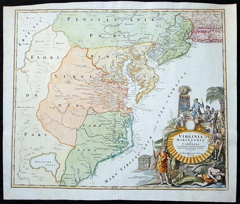
1715 J B Homann Large Antique Map of North America Virginia Chesapeake Bay NJ, NY
Antique Map
- Title : Virginia Marylandia et Carolina in America Septentrionali Britannorum industria excultae"...Homann
- Date : 1715
- Condition: (A+) Fine Condition
- Ref: 82002
- Size: 24 1/2in x 21 1/4in (625mm x 540mm)
Description:
This large finely engraved beautifully hand coloured original antique map of Virginia, Chesapeake Bay, Maryland, the Carolina's, New Jersey, Pennsylvania, Maryland, New York and parts west of the Apalchians, was published by J.B Homann in 1715.
An exceptionally beautiful example of J. B. Homann's 1715 map of Virginia, Carolina, Maryland, and New Jersey; considered one of the most important and decorative maps of is region to appear in the 18th century. This fine decorative map covers from New York City and Long Island south along the Atlantic Cost as far as modern day Georgia, and as far west as Lake Erie.
General Description:
Paper thickness and quality: - Heavy and stable
Paper color: - off white
Age of map color: - Original & later
Colors used: - Yellow, green, blue, pink
General color appearance: - Authentic
Paper size: - 24 1/2in x 21 1/4in (625mm x 540mm)
Plate size: - 23in x 19 1/2in (580mm x 490mm)
Margins: - Min 1/2in (12mm)
Imperfections:
Margins: - None
Plate area: - None
Verso: - None
Background:
Homann drew this map in response to Virginia Lieutenant-Governor Alexander Spotswood's plan to settled the little known interior of Virginia with German immigrants. Shown here is the first mapping of Germantown Teutsche Statt on the Rappahanock River and Fort Christanna (Christ Anna Fort) on the Makharing River. Fort Christanna was built with the intention of defending the region against incursions from hostile American Indian groups such as the Tuscarora to the west. Christanna also acted as the headquarters of the Virginia Indian Company, a stock venture founded in 1714 with the intention of trading with indigenous groups in the interior.Though Homann's remarkable representation of Spottswood's plan is extraordinarily up-to-date considering that Fort Christana was founded in the same year that this map was initially published, the remainder of the map embraces a number of common misconceptions and cartographic inaccuracies common to the region. Probably the most notable of these is his inclusion of Apalache Lacus. This fictional lake, the source of the May River, appeared on maps of this region since the mid 16th century Le Moyne-De Bry map and was popularized by Mercator and Hondius in 1606.
It would remain on maps well into the mid 18th century before exploration and settlement finally disproved the theory. Further north Lake Erie and been expanded dramatically and shifted somewhat to the south where it takes on the appearance of a vast inland sea occupying the entire northwestern quadrant of the map. This region, west of the English colonies and north as far as Pennsylvana, Homann attaches to the Spanish claims in Florida.
Homann's also offers a wealth of detail along the Atlantic coast, where most of the European colonization efforts were focused. From Long Island, about two-thirds of which is shown, south to Craven County, Carolina, countless towns and cities are identified. New York City is mapped on the southern tip of Manhattan Island, but is not specifically labeled. New Jersey is divided into the colonial provinces of East New Jersey and West New Jersey. Curiously Homann maps a large inland lake "Zuyd Lac" straddling the New Jersey - Pennsylvania border. This is no doubt a early misinterpretation of the natural widening of the Delaware River at the Delaware Water Gap. Heading south along the Delaware River Philadelphia is identified and beautifully rendered as a grid embraced in four quadrants. Both the Delaware Bay and the Chesapeake Bay are rendered in full and even include a number of undersea notations and depth soundings. In Virginia and Carolina the river systems are surprisingly well mapped and a primitive county structure is beginning to emerge.
The early Virginia counties of Rappahannock, Henrico, City, Isle of Wright, Nansemond, Northumberland, Middlesex, Gloster and Corotvk are noted. Similarly in Carolina a number of counties are named, most of which refer to the Lords Proprietors, including Albemarle, Clarenden, and Craven. Cape Fear, Cape Lookout, and Cape Hattaras are noted and a number of anchorages, reefs, and depth sounding are noted along the entire coastline. The lower right quadrant of this map is occupied by a fabulous decorative title cartouche. Centered on an enormous scallop shell bearing the map's title and Homann's Privilege, the cartouche features a number of stylized American Indians trading with European merchants.
The wealth of the region is expressed by an abundance of fish, game, and other trade products. Curling behind the scallop shell is a gigantic stylized alligator looking like nothing so much as a mediaeval dragon. The inclusion of Homann's Provildge in the title cartouche helps us to date this map to about 1715, when Homann was granted the right to add this royal distinction to his maps. (Ref: Tooley; M&B)
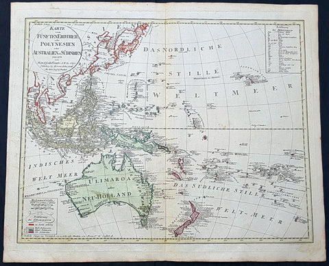
1795 (1806) Canzler Large Antique Map Australia, Ulimaroa, New Zealand SE Asia
Antique Map
- Title : Karte vom Funften Erdtheil oder Polynaesien-Inselwelt oder Australien oder Sudindien (Map of the fifth earth or Polynesia or Australia or South India.)
- Size: 24 1/4in x 20 1/2in (615mm x 520mm)
- Condition: (A+) Fine Condition
- Date : 1795 (1806)
- Ref #: 93121
Description:
This large original hand coloured copper-plate engraved, antique map of Australia, New Zealand and SE Asia by Friedrich Gottlieb Canzler in 1795, was published by the Homann Firm in 1806.
A distinct map with the short lived alternative name of Ulimaroa for New Holland, given by Canzler after Daniel Djurberg mistakenly interperated the New Zealand Maori word, Olhemaroa, from Cooks diary, for Australia. The real interpretation being Long Hand, the Maori name for New Caledonia.
There are two records in Cooks diary relating to Ulimaroa....
5th Feb 1769....This place we concluded to be the land difcovered by Tafman, which he called Cape Maria Van Diemen, and finding thefe people fo intelligent, we inquired farther, if they knew of any country befides their own: they anfwered, that they never had vifisted any other, but that their anceftors had told them, that to the N.W. by N., or N.N.W. there was a country of great extent, called Ulimaroa, which people had failed in a very large canoe
5th Feb 1770.....When we were under fail, our old man aTopaa came on board to take his leave of us, and as we were ftill defirous of making farther enquiries whether any memory of Tafman had been preferved among thefe people, Tupia was directed to afk him whether he had ever heard that fuch a veffel as ours had vifited the country. To this he replied in the negative, but faid, that his anceftors had told him there had once come to this place a fmall veffel, from a distant country, called Ulimaroa, in which were four men, who, upon coming on fhore, were all killed: upon being afked where this diftant land lay, he pointed to the northward. Of Ulimaroa we had heard fome-thing before, from people about the Bay of Iflands, who faid that their anceftors had vifisted it; and Tupia had alfo talked to us of Ulimaroa.
General Definitions:
Paper thickness and quality: - Heavy and stable
Paper color : - off white
Age of map color: - Original
Colors used: - Yellow, green, blue, pink
General color appearance: - Authentic
Paper size: - 24 1/4in x 20 1/2in (615mm x 520mm)
Plate size: - 24 1/2in x 19in (620mm x 490mm)
Margins: - Min 1in (25mm)
Imperfections:
Margins: - Light age toning
Plate area: - None
Verso: - None
Background:
Ulimaroa was a name given to Australia by the Swedish geographer and cartographer Daniel Djurberg in 1776. Djurberg adapted the name from Olhemaroa, a Māori word found in Hawkesworths edition of Captain James Cook and Sir Joseph Banks journals which is thought to have been a misunderstood translation — the Māori were actually referring to Grand Terre, the largest island of New Caledonia. Djurberg believed the name meant something like big red land, whereas modern linguists believe it meant long hand — echoing the geography of Grand Terre. The spurious name continued to be reproduced on certain European maps, particularly some Austrian, Czech, German and Swedish maps, until around 1820, including in Carl Almqvists 1817 novel Parjumouf Saga ifrån Nya Holland (Stockholm, 1817).
Canzler, Friedrich Gottlieb 1764-1811
Friedrich Gottlieb Canzler was born in Wolgast, Sweden in 1764. He graduated from the school in his hometown and from 1781 to 1783 the Sundische Gymnasium in Stralsund . He then studied history , geography , statistics and the Swedish language at the University of Göttingen . After completing his studies, he also received his doctorate and habilitation in Göttingen, and worked as a Privatdozent for history, geography, statistics and cameralistics .
In addition, he published in Göttingen from July 1789 to February 1791 the General Political State Newspaper for all Stands, for which he ran his own university and newspaper printing plant, and founded in 1797 an Academic Reading Museum. Two years later he was appointed Professor of Statistics, State Economics, Cameral, Financial and Commerz Sciences at the University of Greifswald where he worked until his death in 1811.
Selected Works:
- New magazine for recent history, Earth and ethnology. Leipzig 1790
- English language teaching for Germans. Göttingen 1796
- General Litteraturarchiv for history, geography and statistics. Leipzig 1792-1798 (as publisher)
- Map of the fifth earth or Polynesia or Australia or South India. Nuremberg 1795, 1805 and 1806 (as well as 1813 with corrections by Christian Gottlieb Reichard)
- Front India or Hindostan or East India on the side of the Ganges. Nuremberg 1804
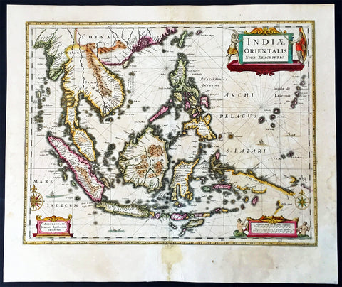
1639 Jan Jansson Antique Map of East Indies, Australia - Voyage of Dufken, Spice Islands
Antique Map
- Title : Indiae Orientalis Nova Descriptio
- Ref #: 43144
- Size: 22 1/2in x 19in (570mm x 485mm)
- Date : 1639
- Condition: (A) Very Good Condition
Description:
This beautiful, very significant original antique map of SE Asia, the East Indies PNG and significantly a small portion of the west coast of Australia's Cape York Peninsular was published in the 1639 French edition of Mercator's Atlas published by Henricus Hondius and Jan Jansson.
Condition Report:
Paper thickness and quality: - Heavy and stable
Paper color: - off white
Age of map color: - Later
Colors used: - Yellow, pink, green
General color appearance: - Authentic
Paper size: - 22 1/2in x 19in (570mm x 485mm)
Plate size: - 20in x 15 1/2in (510mm x 395mm)
Margins: - Min 1in (25mm)
Imperfections:
Margins: - Uniform age toning, bottom centerfold restored
Plate area: - Uniform age toning, centerfold re-joined
Verso: - Uniform age toning
Background: This landmark map is the first published record of the discoveries made by the Dutch ship Dufken on route to Cape York in Australia. New Guinea ("Landt vande Papuos") is marked the (Is)land next to it is called ÔNieu ZeelandtÕ and the island Duyfkens is named after the ship Duyfken.
With the first publication of this map 27 years had passed since the voyage of the Dufken and its discoveries of PNG and NW Australia had been completed. The Dutch East India Company had suppressed the discoveries until it was sure how profitable or not Australia would be.
Jansson & Hondius were the first to published this map in 1630 and it is believed the information was leaked from the Blaeu firm - the official cartographers to the Dutch East India Company. Surprisingly Blaeu did not publish a similar map for another two years. It must have been incredibly galling for Blaeu to have known of the discoveries for nearly thirty years and then to have been beaten to publication by his fiercest rival Jansson & Hondius.
Given this information this is an incredibly significant map of this imporatant region being the first map published with concrete first hand knowledge of the area which prior had been mapped based mainly on speculation or second hand knowledge.
The text running for two pages on the back of the map generally describes the region or country name, history (as it was), temperature, seasons, soil and agricultural productivity. Also described is the topography, wildlife, local inhabitants their culture and religion, as well as a description of major European and local towns and cities. This text makes extremely enjoyable reading and a very good insight not only into the area described but the general European attitudes towards alien countries and cultures. (Ref: Suraz; Koeman; M&B; Tooley)
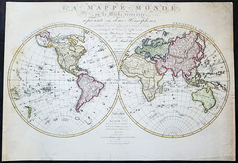
1827 Herisson Large Rare Original Antique Twin Hemisphere World Map, Capt J Cook
Antique Map
- Title : La mappe-monde ou le globe terrestre, représenté en deux hemisphères, l'un oriental l'autre occidental, où sont marquées les découvertes les plus récentes, faites par Mackenzie, Vancouver, La Pérouse, Bruce, Renell, Mungo Park, Joub [sic] Barrow, Franklin et Parry. Dressée par Hérisson, élève de Mr. Bonne / Indication des trois voyages de Cook et de celui de La Pérouse … … À Paris : chez Basset, 1827
- Date : 1827
- Size: 31in x 22in (790mm x 560mm)
- Ref #: 70815
- Condition: (A) Very Good Condition
Description:
This impressive scarce & large scale double hemisphere original antique map, by the French cartographer Eustache Herisson, was published in 1827, dated in text.
The main feature of the map is the illustration of the tracks taken by most recent explorers of the time. From Captain James Cook, to George Vancouver in Canada, Jean-Francois la Perouse in the Pacific, Alexander Humboldt in America, John Franklin and William Parry in Canada.
General Definitions:
Paper thickness and quality: - Heavy and stable
Paper color : - off white
Age of map color: - Original
Colors used: - Yellow, green, blue, pink
General color appearance: - Authentic
Paper size: - 31in x 22in (790mm x 560mm)
Plate size: - 31in x 22in (790mm x 560mm)
Margins: - Min 1/2in (12mm)
Imperfections:
Margins: - Several small repairs to margin not affecting the image, age toning
Plate area: - Age toning
Verso: - Age toning, repairs as noted
Background:
With the exception of the Arctic region of North America, which shows a land bridge connecting Greenland with Alaska and an inland polar sea, the landmasses are drawn with contemporary accuracy. Politically the world was a very different place. North America was still divided by the Old World major powers, Britain, France & Spain. As already noted northern Canada was still to be fully mapped, the interior of Africa was still largely unexplored by Europeans. The European settlement of Australia & New Zealand was still in its infancy Australia and the Antarctic region was still only known by the voyage of Cook some 40 years earlier. The explorers noted below were some of the 18th century adventurers responsible for filling in the cartographically unknown
Captain James Cook FRS 1728 – 1779 was a British explorer, navigator, cartographer, and captain in the Royal Navy. Cook made detailed maps of Newfoundland prior to making three voyages to the Pacific Ocean, during which he achieved the first recorded European contact with the eastern coastline of Australia and the Hawaiian Islands, and the first recorded circumnavigation of New Zealand.
Cook joined the British merchant navy as a teenager and joined the Royal Navy in 1755. He saw action in the Seven Years\' War, and subsequently surveyed and mapped much of the entrance to the Saint Lawrence River during the siege of Quebec. This helped bring Cook to the attention of the Admiralty and Royal Society. This notice came at a crucial moment in both Cook\'s career and the direction of British overseas exploration, and led to his commission in 1766 as commander of HM Bark Endeavour for the first of three Pacific voyages.
In three voyages Cook sailed thousands of miles across largely uncharted areas of the globe. He mapped lands from New Zealand to Hawaii in the Pacific Ocean in greater detail and on a scale not previously achieved. As he progressed on his voyages of discovery he surveyed and named features, and recorded islands and coastlines on European maps for the first time. He displayed a combination of seamanship, superior surveying and cartographic skills, physical courage and an ability to lead men in adverse conditions.
Cook was attacked and killed while attempting to kidnap Kalaniʻōpuʻu, a Hawaiian chief, during his third exploratory voyage in the Pacific in 1779. He left a legacy of scientific and geographical knowledge which was to influence his successors well into the 20th century, and numerous memorials worldwide have been dedicated to him.
Captain George Vancouver 1757 – 1798 was a British officer of the Royal Navy, best known for his 1791–95 expedition, which explored and charted North America\'s north-western Pacific Coast regions, including the coasts of contemporary Alaska, British Columbia, Washington, and Oregon. He also explored the Hawaiian Islands and the southwest coast of Australia.
In Canada, Vancouver Island and the city of Vancouver are named after him, as are Vancouver, Washington, in the United States, Mount Vancouver on the Yukon/Alaska border, and New Zealand\'s sixth highest mountain
Jean François de Galaup, comte de La Perouse 1741 – 1788 was a French Naval officer and explorer whose expedition vanished in Oceania after the French government decided to complete the work of Captain james Cook.
Alexander Humboldt 1769 – 1859 was a Prussian geographer, naturalist, explorer, and influential proponent of Romantic philosophy and science. He was the younger brother of the Prussian minister, philosopher, and linguist Wilhelm von Humboldt (1767–1835). Humboldt\'s quantitative work on botanical geography laid the foundation for the field of biogeography. Humboldt\'s advocacy of long-term systematic geophysical measurement laid the foundation for modern geomagnetic and meteorological monitoring.
Between 1799 and 1804, Humboldt travelled extensively in Latin America, exploring and describing it for the first time from a modern scientific point of view. His description of the journey was written up and published in an enormous set of volumes over 21 years. Humboldt was one of the first people to propose that the lands bordering the Atlantic Ocean were once joined (South America and Africa in particular). Humboldt resurrected the use of the word cosmos from the ancient Greek and assigned it to his multi-volume treatise, Kosmos, in which he sought to unify diverse branches of scientific knowledge and culture. This important work also motivated a holistic perception of the universe as one interacting entity. He was the first person to describe the phenomenon and cause of human-induced climate change, in 1800 and again in 1831, based on observations generated during his travels.
Rear-Admiral Sir John Franklin 1786 –1847 was an English Royal Navy officer and explorer of the Arctic. Franklin also served as Lieutenant-Governor of Van Diemen\'s Land (now Tasmania) from 1837 to 1843. He disappeared on his last expedition, attempting to chart and navigate a section of the Northwest Passage in the Canadian Arctic. The icebound ships were abandoned and the entire crew perished from starvation, hypothermia, tuberculosis, lead poisoning and scurvy.
Rear Admiral Sir William Edward Parry, RN, FRS 1790 - 1855 was an English rear-admiral and Arctic explorer. His 1819 voyage through the Parry Channel was probably the most successful in the long quest for the Northwest Passage. In 1827 he attempted one of the earliest expeditions to the North Pole. He reached 82°45′ North latitude, setting the record for human exploration farthest North that stood for nearly five decades before being surpassed at 83°20′26″ by Albert Hastings Markham in 1875–1876.
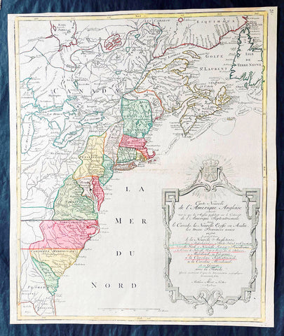
1776 Tobias Lotter Large Antique Post Revolutionary North America Map 13 Colonies
Antique Map
- Title : Carte Nouvelle de l Amerique Angloise Contenant Tout ce que les Anglois Possedent sur le Continent de l'Amerique Septentrionale Savior le Canada, la Nouvelle Ecosse ou Acadie, les Treize Provinces Unies ... avec la Floride
- Ref #: 27009
-
Condition: (A+) Fine Condition
- Size: 25in x 21 1/2in (635mm x 545mm)
- Date : 1776
Description:
This is possibly one of the last significant maps, of the original 13 American colonies, published prior to the American Revolution for Independence from Britain, beginning in 1763 and ending with the signing of the Declaration of Independence in 1776.
Published in Augsberg, Germany in 1776 by Conrad Tobias Lotter, this large original antique map reflects both the French & German interests in North America just prior to the outbreak of hostilities.
The map covers the area from the James Bay to the Gulf of Mexico and west to Lake Michigan. It shows provinces, towns and cities, some forts and trails, as well as Indian villages and tribal territory. (Ref: Tooley, M&B)
General Definitions:
Paper thickness and quality: - Heavy and stable
Paper color : - off white
Age of map color: - Original & later
Colors used: - Yellow, green, blue, pink
General color appearance: - Authentic
Paper size: - 25in x 21 1/2in (635mm x 545mm)
Plate size: - 24in x 19 1/2in (610mm x 495mm)
Margins: - Min 1/2in (12mm)
Imperfections:
Margins: - None
Plate area: - None
Verso: - None
Background:
Each of the thirteen Colonies is identified by name both on the map, and in the title. The title is placed within an attractive decorative border surmounted by the British Royal arms. The French title and nomenclature indicates that Lotter, a leading German mapmaker, intended this for the French market, as does the fact that he limits the claims of the British to the regions east of the Appalachian Mountains. The delineation of the thirteen Provinces unies is generally well done (although Maryland and Georgia are both strangely shaped): a number of locations are named in the Ohio Valley, including Logs Town, Twictwees, Ft. Du Quesne, Allegheny, Vinango, Buffaloons, Sandoski and Mingos. Some interesting details are also shown in the region of the Great Lakes.
Please note all items auctioned are genuine, we do not sell reproductions. A Certificate of Authenticity (COA) can be issued on request.
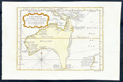
1753 Bellin Antique Map of Australia & New Zealand - Carte Reduite.....Australes
Antique Map
- Title : Carte Reduite des Terres Australes pour Servir a l'Histoire des Voyages...1753
- Ref #: 17040
- Size: 15in x 10in (380mm x 255mm)
- Date : 1753
- Condition: (A+) Fine Condition
Description:
This original beautifully hand coloured copper plate engraved antique map of Australia - one of the earliest, near complete maps, dedicated to the Island Continent - was engraved in 1753 by Jacques Nicolas Bellin - date engraved in the title -and was published in the 1753 edition of Prevosts Histoire Generale Des Voyages.
Background: This is one of the few 18th century maps to focus on the Australian continent prior to Cook's famous first voyage from 1768-1771. Mainland Australia is connected to both Tasmania (Terre de Van Diemen) and Papua New Guinea (Nouv. Guinee). Along the imaginary eastern coastline is a note that reads: "I suppose that the land of Diemen can join with the land of the Holy Ghost, but this is without proof." A partial coastline of New Zealand is shown peeking out of the corner of the map, with a note that it was discovered by Abel Tasman in 1642 and speculation that it might be part of a great southern continent. This is an important map of Australia depicting the interesting theories made prior to exploration of the region later in the 18th century. (Ref: Tooley; M&B)
General Description:
Paper thickness and quality: - Heavy and stable
Paper color: - off white
Age of map color: - Early
Colors used: - Yellow, green, red, brown.
General color appearance: - Authentic and fresh
Paper size: - 15in x 10in (380mm x 255mm)
Plate size: - 11 1/2in x 8 1/2in (295mm x 215mm)
Margins: - Min 1in (25mm)
Imperfections:
Margins: - None
Plate area: - Folds as issued
Verso: - None


