Welcome to Classical Images!
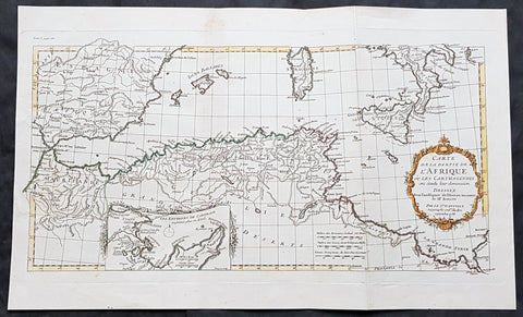
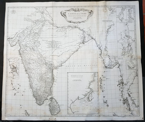
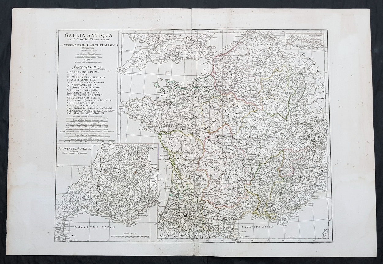
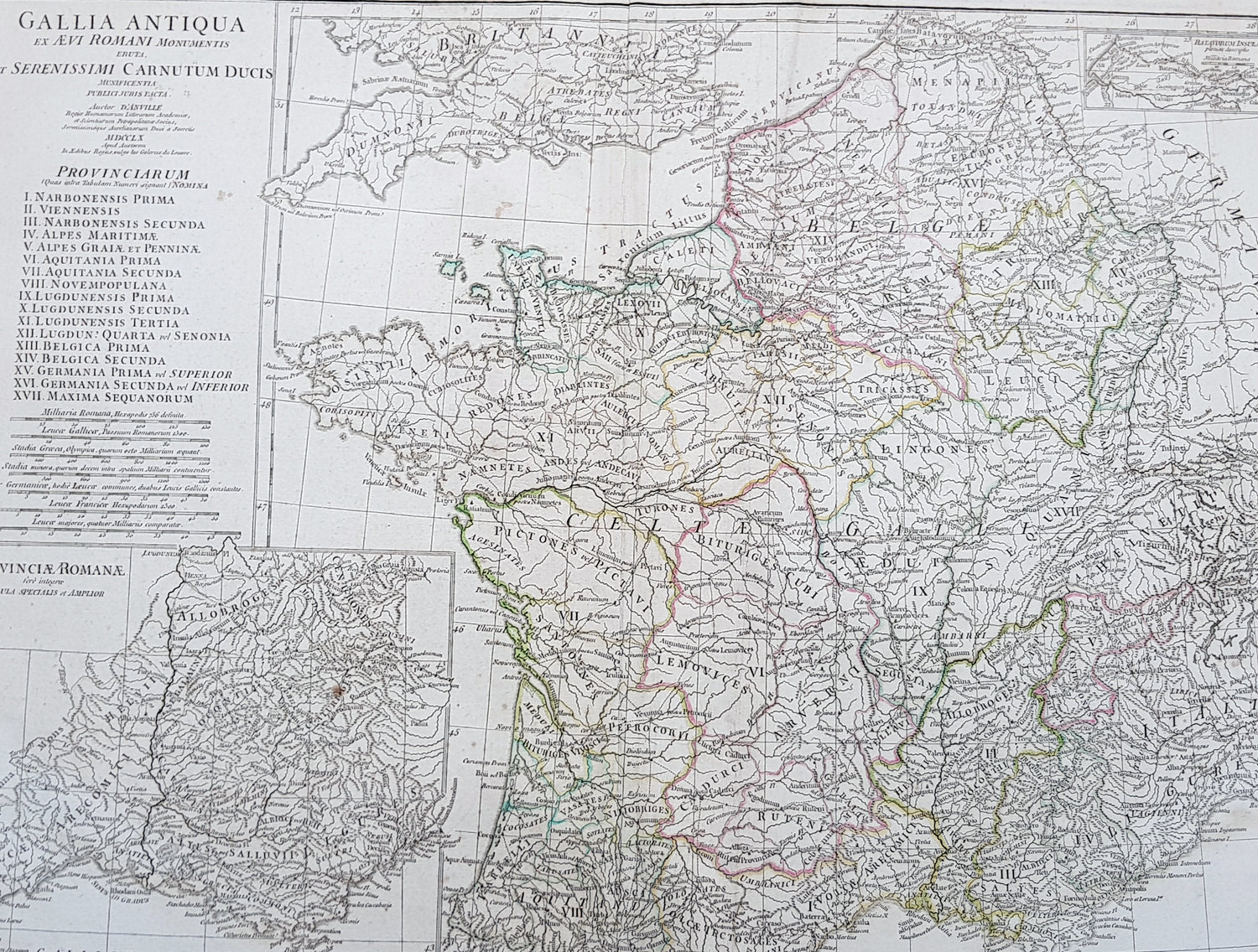
Description:This large original copper plate engraved antique map of Roman France was engraved in 1760 - dated in the tile cartouche - and was published in Jean-Baptiste Bourguinon D Anvilles large elephant folio atlas Atlas Generale.
General Definitions:Paper thickness and quality: - Heavy and stablePaper color : - off whiteAge of map color: - OriginalColors used: - Yellow, Green, pinkGeneral color appearance: - AuthenticPaper size: - 30in x 21in (760mm x 535mm)Plate size: - 23 1/2in x 18 1/4in (595mm x 465mm)Margins: - Min 1/2in (12mm)
Imperfections:Margins: - Creasing, light age toningPlate area: - CreasingVerso: - Creasing, light age toning
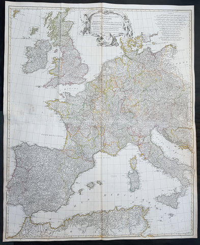
Background: In 600 BC, Ionian Greeks, originating from Phocaea, founded the colony of Massalia (present-day Marseille), on the shores of the Mediterranean Sea. This makes it Frances oldest city. At the same time, some Gallic Celtic tribes penetrated parts of the current territory of France, and this occupation spread to the rest of France between the 5th and 3rd century BC.The concept of Gaul emerged at that time; it corresponds to the territories of Celtic settlement ranging between the Rhine, the Atlantic Ocean, the Pyrenees and the Mediterranean. The borders of modern France are roughly the same as those of ancient Gaul, which was inhabited by Celtic Gauls. Gaul was then a prosperous country, of which the southernmost part was heavily subject to Greek and Roman cultural and economic influences.Around 390 BC the Gallic chieftain Brennus and his troops made their way to Italy through the Alps, defeated the Romans in the Battle of the Allia, and besieged and ransomed Rome. The Gallic invasion left Rome weakened, and the Gauls continued to harass the region until 345 BC when they entered into a formal peace treaty with Rome. But the Romans and the Gauls would remain adversaries for the next centuries, and the Gauls would continue to be a threat in Italy.Around 125 BC, the south of Gaul was conquered by the Romans, who called this region Provincia Nostra (Our Province), which over time evolved into the name Provence in French. Julius Caesar conquered the remainder of Gaul and overcame a revolt carried out by the Gallic chieftain Vercingetorix in 52 BC. According to Plutarch and the writings of scholar Brendan Woods, the Gallic Wars resulted in 800 conquered cities, 300 subdued tribes, one million men sold into slavery, and another three million dead in battle.Gaul was divided by Augustus into Roman provinces. Many cities were founded during the Gallo-Roman period, including Lugdunum (present-day Lyon), which is considered the capital of the Gauls. These cities were built in traditional Roman style, with a forum, a theatre, a circus, an amphitheatre and thermal baths. The Gauls mixed with Roman settlers and eventually adopted Roman culture and Roman speech (Latin, from which the French language evolved). The Roman polytheism merged with the Gallic paganism into the same syncretism.From the 250s to the 280s AD, Roman Gaul suffered a serious crisis with its fortified borders being attacked on several occasions by barbarians. Nevertheless, the situation improved in the first half of the 4th century, which was a period of revival and prosperity for Roman Gaul. In 312, Emperor Constantin I converted to Christianity. Subsequently, Christians, who had been persecuted until then, increased rapidly across the entire Roman Empire. But, from the beginning of the 5th century, the Barbarian Invasions resumed. Teutonic tribes invaded the region from present-day Germany, the Visigoths settling in the southwest, the Burgundians along the Rhine River Valley, and the Franks (from whom the French take their name) in the north.