Welcome to Classical Images!
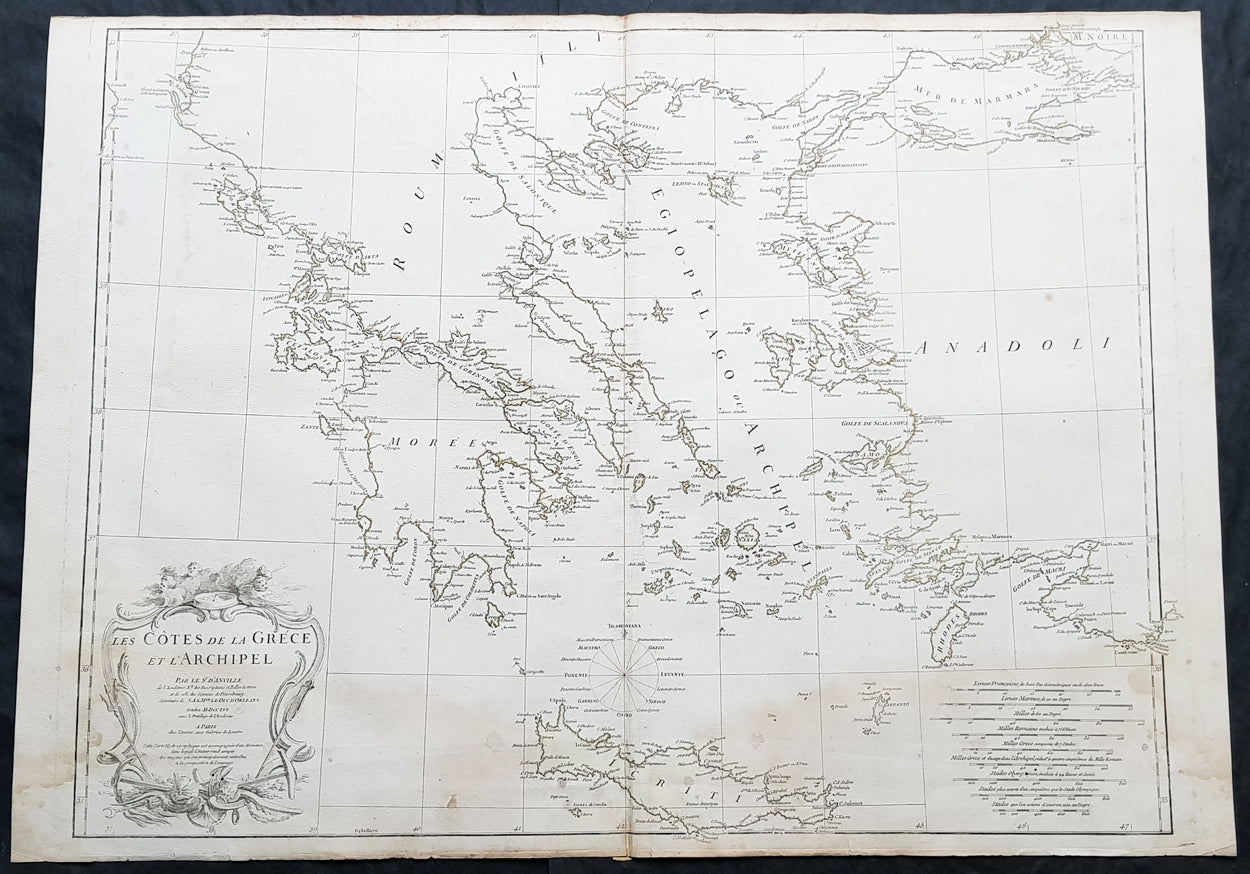
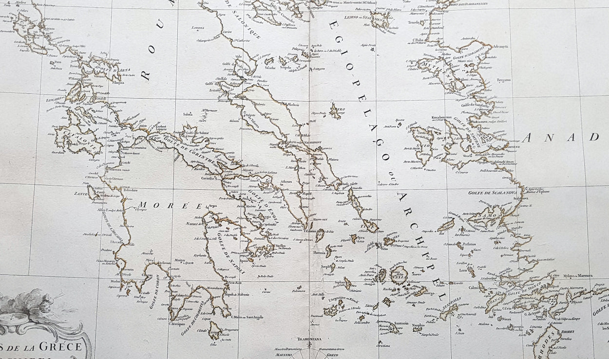
Description:This large hand coloured original copper-plate engraved antique map of the Aegean Islands of Greece, south to Crete by Jean Baptiste Bourguignon D Anville was engraved in 1756 - dated in the tile cartouche - and was published in Jean-Baptiste Bourguinon D Anvilles large elephant folio atlas Atlas Generale. (Ref: Tooley, M&B)
General Definitions:Paper thickness and quality: - Heavy and stablePaper color : - off whiteAge of map color: -Colors used: -General color appearance: -Paper size: - 31in x 24in (790mm x 610mm)Plate size: - 29in x 24in (770mm x 610mm)Margins: - Min 1/2in (12mm)
Imperfections:Margins: - Soiling in marginsPlate area: - Soiling bottom of imageVerso: - Soiling
Background: The Aegean Islands are the group of islands in the Aegean Sea, with mainland Greece to the west and north and Turkey to the east; the island of Crete delimits the sea to the south, those of Rhodes, Karpathos and Kasos to the southeast. The ancient Greek name of the Aegean Sea, Archipelago (ἀρχιπέλαγος, archipelagos) was later applied to the islands it contains and is now used more generally, to refer to any island group.The vast majority of the Aegean Islands belong to Greece, being split among nine administrative regions. The only sizable possessions of Turkey in the Aegean Sea are Imbros (Gökçeada) and Tenedos (Bozcaada), in the northeastern part of the Sea. Various smaller islets off Turkeys western coast are also under Turkish sovereignty.