Welcome to Classical Images!
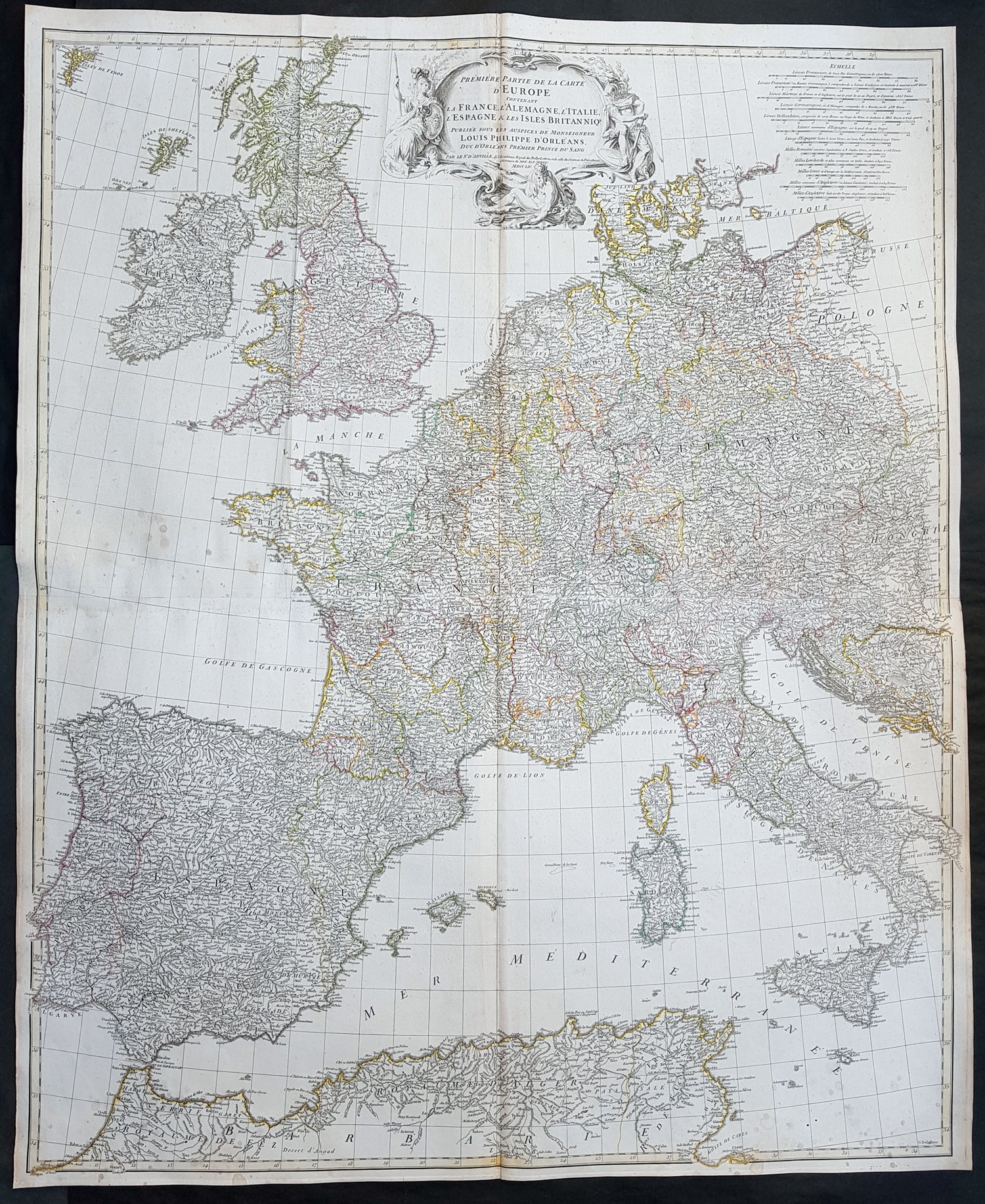
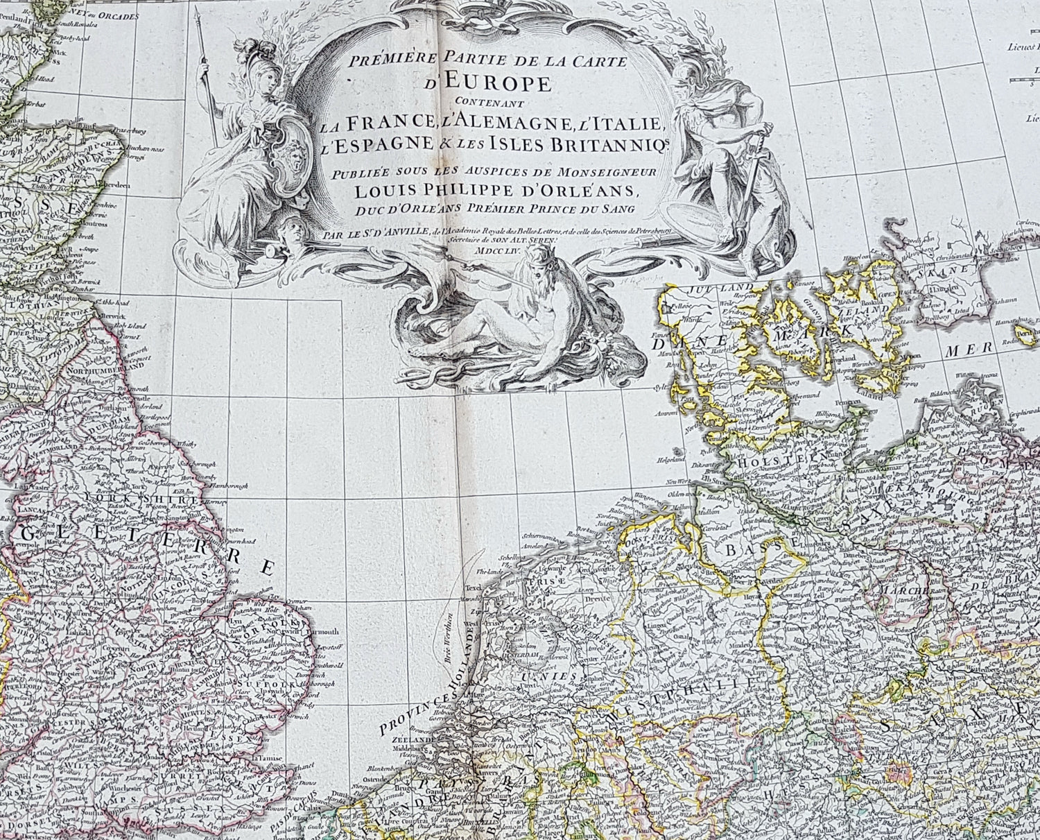
Description:This large finely engraved scarce and highly detailed original antique map of contemporary Western Europe and the British Isles was engraved by Guillaume de la Haye in 1754 - dated in the tile cartouche - and was published in Jean-Baptiste Bourguinon D\'Anville\'s large elephant folio atlas Atlas Generale.
General Definitions:Paper thickness and quality: - Heavy and stablePaper color : - off whiteAge of map color: - OriginalColors used: - Pink, yellow, green, blueGeneral color appearance: - AuthenticPaper size: - 39 1/2in x 33in (1.03m x 840mm)Plate size: - 38in x 32in (970mm x 815mm)Margins: - Min 1/2in (12mm)
Imperfections:Margins: - NonePlate area: - Light spotting, folds as issuedVerso: - Light spotting, folds as issued
Background: Fantastic historical map showing the fragmented political borders,hand coloured, of Western Europe in the mid 18th century from Poland to France and North Africa, including the British Isles.