Welcome to Classical Images!
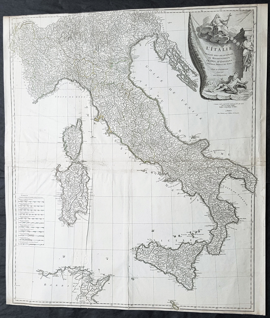
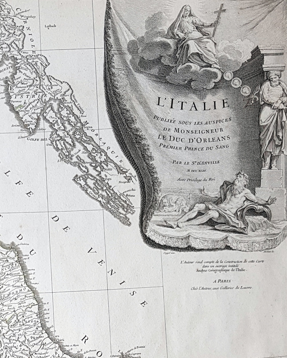
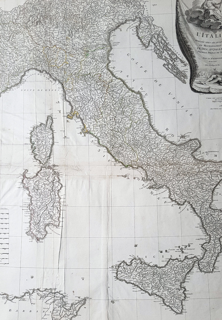
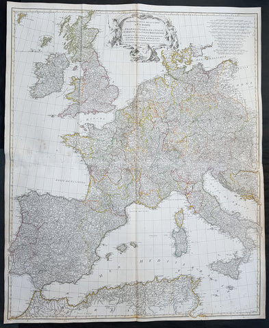
Description:This large scarce original copper-plate engraved antique map of contemporary Italy, Sicily, Sardinia, Corsica & Malta by Charles-Antoine Coypel was engraved by Pierre-Alexandre Aveline (1702–1760) (both names engraved under cartouche) in 1743 - dated in cartouche - and was published by Jean-Baptiste Bourguinon D Anvilles in his large elephant folio atlas Atlas Generale.A scarce and hard to find map with two famous names Charles-Antoine Coypel & Pierre-Alexandre Aveline engraved below the cartouche, I am assuming as both drawer & engraver.
General Definitions:Paper thickness and quality: - Heavy and stablePaper color : - off whiteAge of map color: -Colors used: -General color appearance: -Paper size: - 32in x 28in (820mm x 710mm)Plate size: - 31 1/2in x 27in (810mm x 690mm)Margins: - Min 1/8in (2mm)
Imperfections:Margins: - Top margin cropped to borderPlate area: - Light creasingVerso: - Creasing
Background: Since classical times the countries bordering the enclosed waters of the Mediterranean had been well versed in the use of maps and sea charts and in Italy, more than anywhere else, the traditional knowledge was kept alive during the many hundreds of years following the collapse of the Roman Empire. By the thirteenth and fourteenth centuries the seamen of Venice, Genoa and Amalfi traded to far countries, from the Black Sea ports and the coasts of Palestine and Egypt in the East to Flanders and the southern coasts of England and Ireland in the West, their voyages guided by portulan charts and the use of the newly invented compass. For a time Italian supremacy in cartography passed to Aragon and the Catalan map makers based on Majorca, but by the year 1400 the power and wealth of the city states of Venice, Genoa, Florence and Milan surpassed any in Europe. Florence, especially, under the rule of the Medici family, became not only a great trading and financial centre but also the focal point of the rediscovery of the arts and learning of the ancient world. In this milieu a number of manuscript world maps were produced, of which one by Fra Mauro (c. 1459) is the most notable, but the event of the greatest importance in the history of cartography occurred in the year 1400 when a Florentine, Palla Strozzi, brought from Constantinople a Greek manuscript copy of Claudius Ptolemy\\\'s Geographia, which, 1,250 years after its compilation, came as a revelation to scholars in Western Europe. In the following fifty years or so manuscript copies, translated into Latin and other languages, became available in limited numbers but the invention of movable-type printing transformed the scene: the first copy without maps being printed in 1475 followed by many with copper-engraved maps, at Bologna in 1477, Rome 1478, 1490, 1507 and 1508, and Florence 1482.About the year 1485 the first book of sea charts, compiled by Bartolommeo dalli Sonetti, was printed in Venice and in the first part of the sixteenth century a number of world maps were published, among them one compiled in 1506 by Giovanni Contarini, engraved by Francesco Rosselli, which was the first printed map to show the discoveries in the New World. In the following years there were many attractive and unusual maps of Islands (Isolano) by Bordone, Camocio and Porcacchi, but more important was the work of Giacomo (Jacopo) Gastaldi, a native of Piedmont who started life as an engineer in the service of the Venetian Republic before turning to cartography as a profession. His maps, produced in great variety and quantity, were beautifully drawn copperplate engravings and his style and techniques were widely copied by his contemporaries. From about 1550 to 1580 many of Gastaldi\\\'s maps appeared in the collections of maps known as Lafreri \\\'atlases\\\', a term applied to groups of maps by different cartographers brought together in one binding. As the contents of such collections varied considerably they were no doubt assembled at the special request of wealthy patrons and are now very rare indeed.About this time, for a variety of historical and commercial reasons, Italy\\\'s position as the leading trading and financial nation rapidly declined and with it her superiority in cartography was lost to the vigorous new states in the Low Countries. That is not to say, of course, that Italian skills as map makers were lost entirely for it was not until 1620 that the first printed maps of Italy by an Italian, Giovanni Magini, appeared, and much later in the century there were fine maps by Giacomo de Rossi and Vincenzo Coronelli, the latter leading a revival of interest in cartography at the end of the century. Coronelli was also famous for the construction of magnificent large-size globes and for the foundation in Venice in 1680 of the first geographical society.In the eighteenth century the best-known names are Antonio Zatta, Rizzi-Zannoni and Giovanni Cassini.We ought to mention the work of Baptista Boazio who drew a series of maps in A Summarie and True Discourse of Sir Francis Drake\\\'s West Indian Voyage, published in 1588-89, and who is especially noted for a very fine map of Ireland printed in 1599 which was incorporated in the later editions of the Ortelius atlases. It is perhaps appropriate also to refer to two English map makers who spent many years in exile in Italy: the first, George Lily, famous for the splendid map of the British Isles issued in Rome in 1546, and the second, Robert Dudley, who exactly one hundred years later was responsible for the finest sea atlas of the day, Dell\\\' Arcano del Mare, published in Florence. Both of these are described in greater detail elsewhere in this handbook. (Ref: Tooley, Koeman)