Welcome to Classical Images!
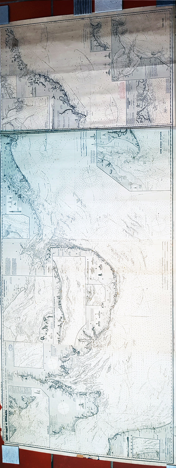
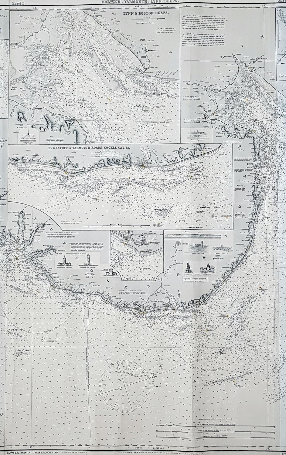
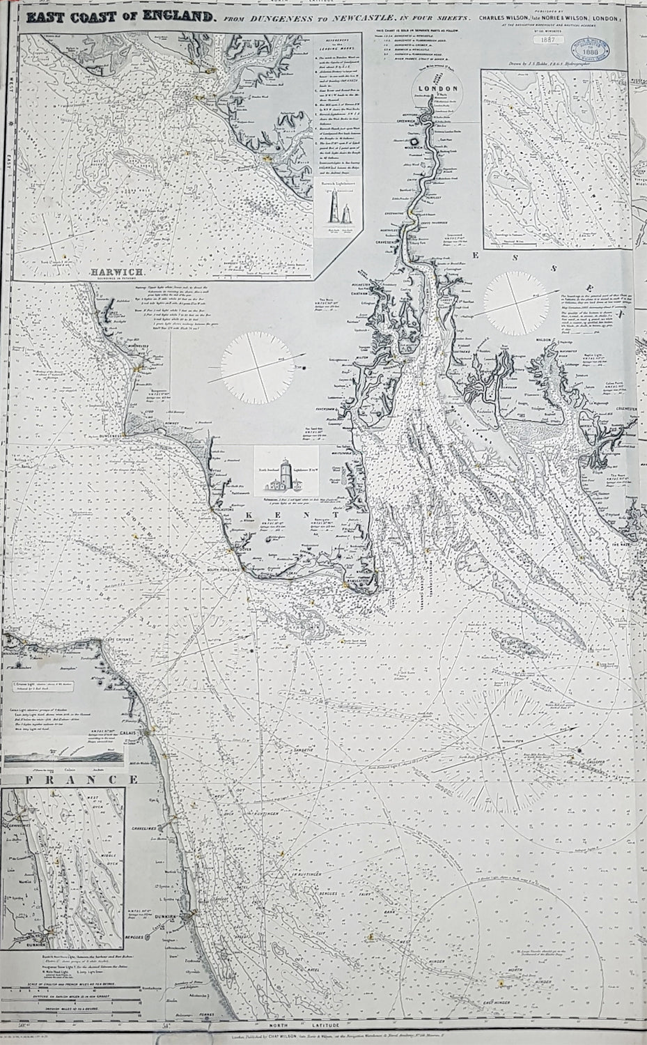
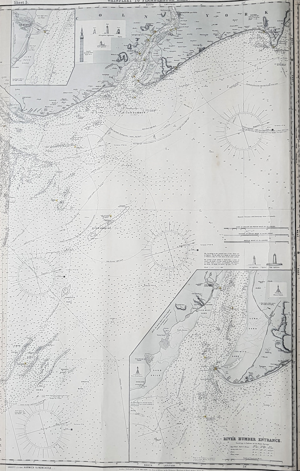
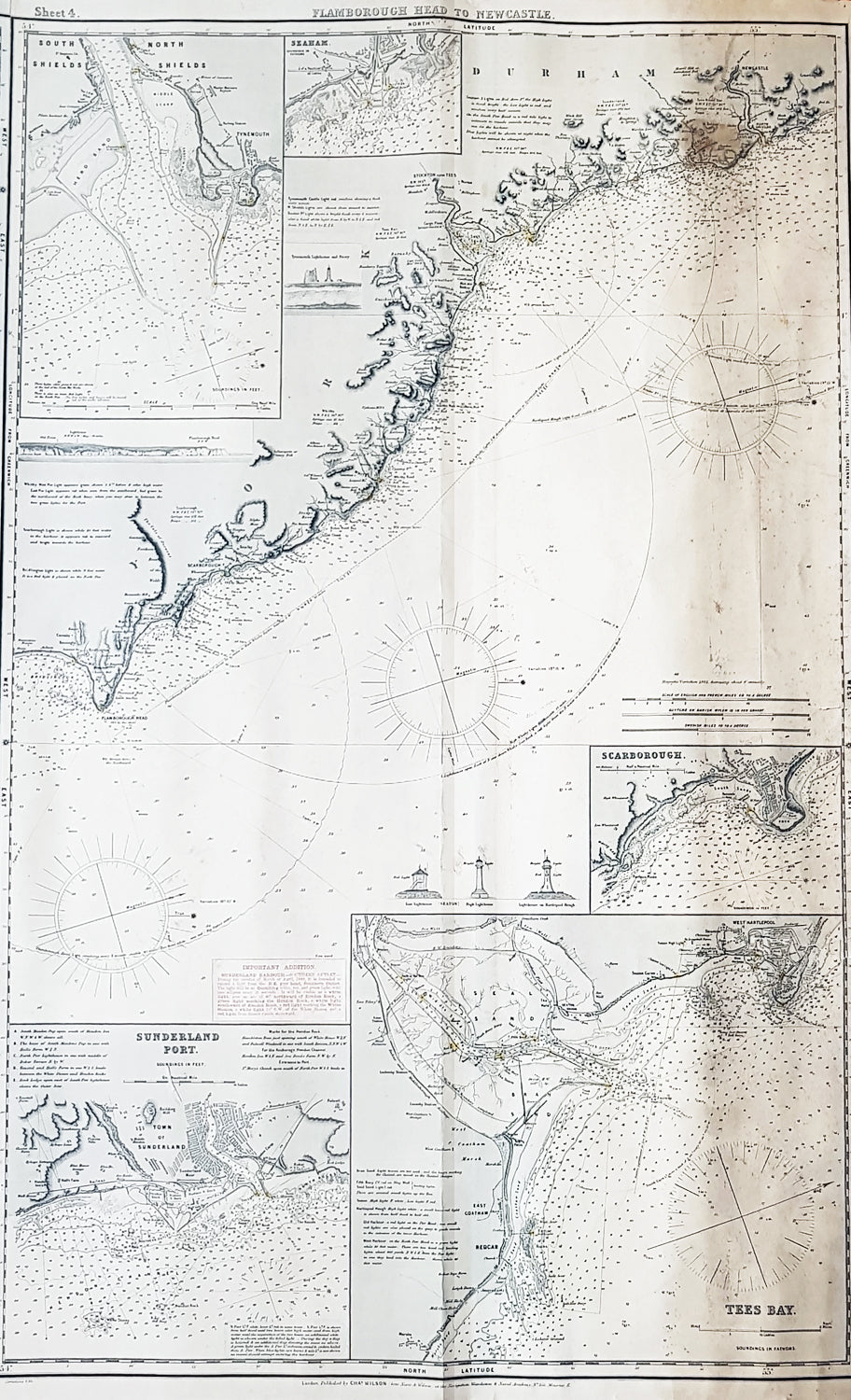
Description:This is a very large, extremely rare, blueback Nautical Map a chart of the East Coast of England, in 4 sheets joined, from Hastings in Kent to Newcastle, Durham was published by Norie & Wilson in 1887, with updates to 1888.This extremely large blueback working map is extremely detailed with much detail of the Thames Estuary to London, with depth soundings, detailed surveys and many insert maps of Harwich, Lynn & Boston, France & Calais, Lowestaff & Yarmouth Roads, River Humber Entrance, South & North Shields, Seaham, Scarborough, Tees Bay & Sunderland Port. As stated these original blueback working maps are rare and scarce to the market. I have been unable to find this map available to purchase.This rare Blueback map, a method of mounting working sea charts that was begun by Robert Sayer in the late 18th century. These working maps were extremely expensive to buy and labour intensive to put together so only a limited number were published and sold and even fewer have survived. I have found no other examples of this map either commercially or in other map collections.
General Definitions:Paper thickness and quality: - Heavy and stablePaper color : - off whiteAge of map color: -Colors used: -General color appearance: -Paper size: - 94in x 34 1/2in (2.39m x 875mm)Plate size: - 94in x 34 1/2in (2.39m x 875mm)Margins: - Min 1/2in (12mm)
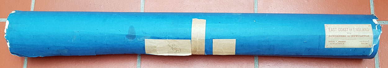
Imperfections:Margins: - Small uplift off the blue back, not affecting the mapPlate area: - NoneVerso: - Small repair right end of blueback
Background: Blueback nautical charts began appearing in London in the late 18th century. Bluebacks, as they came to be called, were privately published large format nautical charts known for their distinctive blue paper backing. The backing, a commonly available blue manila paper traditionally used by publishers to warp unbound pamphlets, was adopted as a practical way to reinforce the low-quality paper used by private chart publishers in an effort to cut costs. The earliest known Blueback charts include a 1760 chart issued by Mount and Page, and a 1787 chart issued by Robert Sayer. The tradition took off in the early 19th century, when British publishers like John Hamilton Moore, Robert Blachford, James Imray, William Heather, John William Norie, Charles Wilson, David Steel, R. H. Laurie, and John Hobbs, among others, rose to dominate the chart trade. Bluebacks became so popular that the convention was embraced by chartmakers outside of England, including Americans Edmund March Blunt and George Eldridge, as well as Scandinavian, French, German, Russian, and Spanish chartmakers. Blueback charts remained popular until the late 19th century, when government subsidized organizations like the British Admiralty Hydrographic Office and the United States Coast Survey, began issuing their own superior charts on high quality paper that did not require reinforcement.
Norie, John William 1772–1843John William Norie was an important hydrographer, chartmaker and publisher, as also a writer on navigation and publisher of nautical manuals, as well as selling globes and all manner of nautical instruments. He was agent for the sale of Admiralty charts, and chart seller to the East India Company and Trinity House. He was born in London of Scottish parent, and apprenticed to William Heather, a noted chartmaker, as a draughtsman, and his first charts appear under the Heather imprint from 1795 onwards.In 1813 he bought William Heathers business, in partnership with Charles Wilson; the partnership lasted until 1840, when Heather sold his share of the business to Wilson and retired. Wilson continued to trade as Norie and Wilson; the firm merged with J. Imray and Son in 1899, and survives to the present as Imray, Laurie, Norie and Wilson Ltd.Norie had a prolific output of charts, reissuing Heathers stock and adding new charts of his own making of all parts of the world, these too many to list. Important publications include his A new and complete epitome of practical navigation (1805); A complete pilot for the south coasts of England and Ireland (1817); The new Mediterranean pilot, containing sailing directions for the coasts of France, Spain, and Portugal, from Ushant to Gibraltar (1817) and Nories set of celestial maps for finding the principal stars in the heavens (1825).