Welcome to Classical Images!
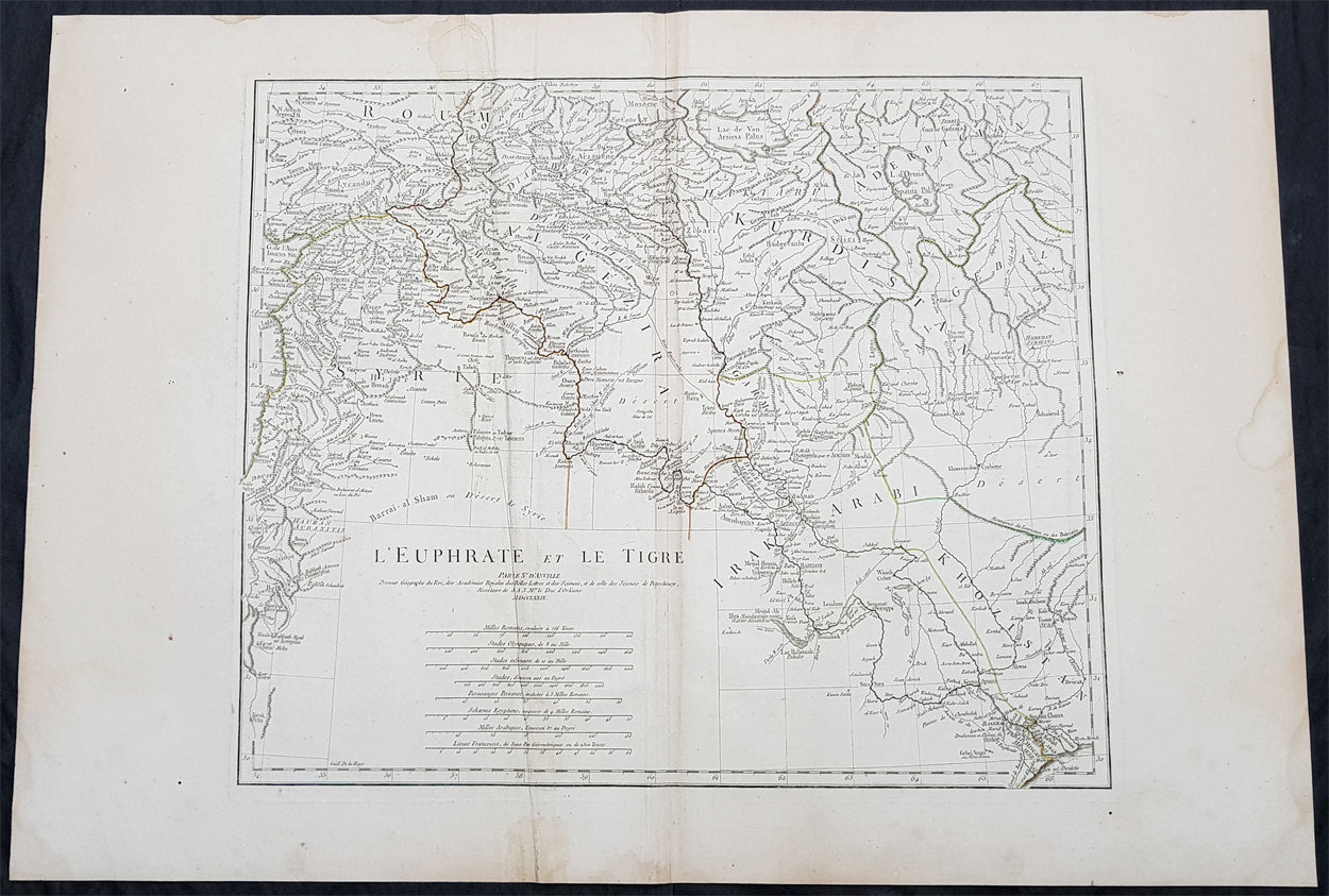
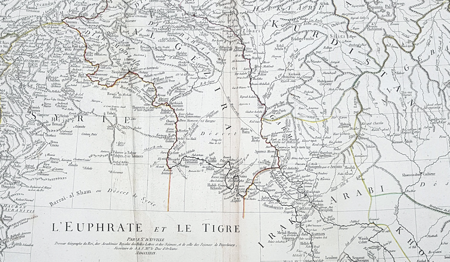
Description:This large original copper plate engraved antique map of the Tigris–Euphrates river system was engraved in 1779 - dated in the tile cartouche - and was published in Jean-Baptiste Bourguinon D Anvilles large elephant folio atlas Atlas Generale.
General Definitions:Paper thickness and quality: - Heavy and stablePaper color : - off whiteAge of map color: - OriginalColors used: - Yellow, Green, pinkGeneral color appearance: - AuthenticPaper size: - 30in x 21in (760mm x 535mm)Plate size: - 21in x 17 1/2in (535mm x 430mm)Margins: - Min 1/2in (12mm)
Imperfections:Margins: - Creasing, light age toningPlate area: - CreasingVerso: - Creasing, light age toning
Background: The Tigris and Euphrates, with their tributaries, form a major river system in Western Asia. From sources originating in eastern Turkey, they flow by/through Syria through Iraq into the Persian Gulf. The system is part of the Palearctic Tigris–Euphrates ecoregion, which includes Iraq and parts of Turkey, Syria, Iran, Saudi Arabia, Kuwait, and Jordan.From their sources and upper courses in the mountains of eastern Anatolia, the rivers descend through valleys and gorges to the uplands of Syria and northern Iraq and then to the alluvial plain of central Iraq. The rivers flow in a south-easterly direction through the central plain and combine at Al-Qurnah to form the Shatt al-Arab and discharge into the Persian Gulf.The region has historical importance as part of the Fertile Crescent region, in which civilization is believed to have first emerged.