Products
1789 Jean Baptiste Lamarck Antique Concology Print, Surf Clam Shells - Pl 252
- Title : Mactre, Mactra
- Size: 11in x 8in (280mm x 205mm)
- Condition: (A+) Fine Condition
- Date : 1789
- Ref #: 23883
Description:
This fine original copper-plate engraved antique Conchology or Shell print by Jean Baptiste Lamarck was drawn by Henri Joseph Redoute (1766 - 1852) - younger brother of the famous illustrator P J Redoute - engraved by Robert Benard and published in the 1789 edition of Tableau encyclopédique et méthodique des trois règnes de la nature(1782-1832) by the French publisher Charles Joseph Panckoucke.
General Definitions:
Paper thickness and quality: - Heavy and stable
Paper color : - Off white
Age of map color: - Original
Colors used: - Yellow, Green, pink
General color appearance: - Authentic
Paper size: - 11in x 8in (280mm x 205mm)
Plate size: - 10in x 7in (255mm x 180mm)
Margins: - Min 1/2in (12mm)
Imperfections:
Margins: - None
Plate area: - None
Verso: - None
Background:
Tableau encyclopédique et méthodique des trois regnes de la nature was an illustrated encyclopedia of plants, animals and minerals, notable for including the first scientific descriptions of many species, and for its attractive engravings. It was published in Paris by Charles Joseph Panckoucke, from 1788 on. Although its several volumes can be considered a part of the greater Encyclopédie méthodique, they were titled and issued separately.
Encyclopédie méthodique par ordre des matières (Methodical Encyclopedia by Order of Subject Matter) was published between 1782 and 1832 by the French publisher Charles Joseph Panckoucke, his son-in-law Henri Agasse, and the latter´s wife, Thérèse-Charlotte Agasse. Arranged by disciplines, it was a revised and much expanded version, in roughly 210 to 216 volumes (different sets were bound differently), of the alphabetically arranged Encyclopédie, edited by Denis Diderot and Jean le Rond d Alembert.
Two sets of Diderots Encyclopédie and its supplements were cut up into articles. Each subject category was entrusted to a specialized editor, whose job was to collect all articles relating to his subject and exclude those belonging to others. Great care was to be taken of those articles that were of a doubtful nature, which were not to be omitted. For certain topics, such as air (which belonged equally to chemistry, physics and medicine), the methodical arrangement had the unexpected effect of breaking up a single article into several parts. Each volume was to have its own introduction, a table of contents, and a history of the Encyclopédie. The whole work was to be linked together by a Vocabulaire universel (Vol. 1 – 4), with references to all locations where each word appears.
The prospectus, issued early in 1782, proposed three editions, each with seven volumes of 250 to 300 plates:
84 volumes;
43 volumes, with 3 columns per page; and
53 volumes of about 100 sheets, with 2 columns per page.
The publication was continued by Henri Agasse, Panckouckes son-in-law, from 1794 to 1813, and then by the latters widow, Mme Agasse, until 1832, when it was completed in 102 livraisons or 337 parts, forming roughly 166½ volumes of text (depending on how the parts were bound) as well as 51 illustrated parts containing 6,439 plates. The number of pages totalled 124,210 pages, of which 5,458 pages were plates. To save money, the plates belonging to architecture were not published. Pharmacy (separated from chemistry), minerals, education, Ponts et chausses were not published as had been announced.
Many dictionaries have a classed index of articles. The one in Oeconomie politique is an excellent example, giving the contents of each article, so that any passage can be found easily.
When completed, the encyclopedia suffered at least one great weakness. As the Vocabulaire Universel, the key and index to the entire work, was not published, it was difficult to carry out any research or to find all the articles on any particular subject. The original parts had often been subdivided, and had been so added onto by other dictionaries, supplements, and appendices that an exact account could not be given of the work, which contained 88 alphabets, 83 indexes, 166 introductions, discourses, prefaces, etc. Overall, probably no more an unmanageable body of dictionaries has ever been published, except Jacques Paul Mignes Encyclopédie théologique, Paris, 1844–1875, with 168 volumes, 101 dictionaries, and 119,059 pages.
The Encyclopédie méthodique par ordre des matières occupied a thousand workers in production, and 2,250 contributors.
Lamarck, Jean-Baptiste Pierre Antoine de Monet, Chevalier de1744 – 1829
Lamarck was a pioneer French biologist, who is best known for his idea that acquired characters are inheritable, an idea known as Lamarckism, which is controverted by modern evolutionary theorygenetics.
Lamarck was the youngest of 11 children in a family of the lesser nobility. His family intended him for the priesthood, but, after the death of his father and the expulsion of the Jesuits from France, Lamarck embarked on a military career in 1761. As a soldier garrisoned in the south of France, he became interested in collecting plants. An injury forced him to resign in 1768, but his fascination for botany endured, and it was as a botanist that he first built his scientific reputation.
Lamarck gained attention among the naturalists in Paris at the Jardin et Cabinet du Roi (the kings garden and natural history collection, known informally as the Jardin du Roi) by claiming he could create a system for identifying the plants of France that would be more efficient than any system currently in existence, including that of the great Swedish naturalist Carolus Linnaeus. This project appealed to Georges-Louis Leclerc, comte de Buffon, who was the director of the Jardin du Roi and Linnaeuss greatest rival. Buffon arranged to have Lamarcks work published at government expense, and Lamarck received the proceeds from the sales. The work appeared in three volumes under the title Flore française (1778; French Flora). Lamarck designed the Flore française specifically for the task of plant identification and used dichotomous keys, which are classification tools that allow the user to choose between opposing pairs of morphological characters (see taxonomy: The objectives of biological classification) to achieve this end.
With Buffons support, Lamarck was elected to the Academy of Sciences in 1779. Two years later Buffon named Lamarck correspondent of the Jardin du Roi, evidently to give Lamarck additional status while he escorted Buffons son on a scientific tour of Europe. This provided Lamarck with his first official connection, albeit an unsalaried one, with the Jardin du Roi. Shortly after Buffons death in 1788, his successor, Flahault de la Billarderie, created a salaried position for Lamarck with the title of botanist of the King and keeper of the Kings herbaria.
Between 1783 and 1792 Lamarck published three large botanical volumes for the Encyclopédie méthodique (Methodical Encyclopaedia) , a massive publishing enterprise begun by French publisher Charles-Joseph Panckoucke in the late 18th century. Lamarck also published botanical papers in the Mémoires of the Academy of Sciences. In 1792 he cofounded and coedited a short-lived journal of natural history, the Journal dhistoire naturelle.
Lamarcks career changed dramatically in 1793 when the former Jardin du Roi was transformed into the Muséum National dHistoire Naturelle (National Museum of Natural History). In the changeover, all 12 of the scientists who had been officers of the previous establishment were named as professors and coadministrators of the new institution; however, only two professorships of botany were created. The botanists Antoine-Laurent de Jussieu and René Desfontaines held greater claims to these positions, and Lamarck, in a striking shift of responsibilities, was made professor of the insects, worms, and microscopic animals. Although this change of focus was remarkable, it was not wholly unjustified, as Lamarck was an ardent shell collector. Lamarck then set out to classify this large and poorly analyzed expanse of the animal kingdom. Later he would name this group animals without vertebrae and invent the term invertebrate. By 1802 Lamarck had also introduced the term biology.
This challenge would have been enough to occupy the energies of most naturalists; however, Lamarcks intellectual aspirations ran well beyond that of reforming invertebrate classification. In the 1790s he began promoting the broad theories of physics, chemistry, and meteorology that he had been nurturing for almost two decades. He also began thinking about Earths geologic history and developed notions that he would eventually publish under the title of Hydrogéologie (1802). In his physico-chemical writings, he advanced an old-fashioned, four-element theory that was self-consciously at odds with the revolutionary advances of the emerging pneumatic chemistry of Antoine-Laurent Lavoisier. His colleagues at the Institute of France (the successor to the Academy of Sciences) saw Lamarcks broad theorizing as unscientific system building. Lamarck in turn became increasingly scornful of scientists who preferred small facts to larger, more important ones. He began to characterize himself as a naturalist-philosopher, a person more concerned with the broader processes of nature than the details of the chemists laboratory or naturalists closet.
In 1800 Lamarck first set forth the revolutionary notion of species mutability during a lecture to students in his invertebrate zoology class at the National Museum of Natural History. By 1802 the general outlines of his broad theory of organic transformation had taken shape. He presented the theory successively in his Recherches sur lorganisation des corps vivans (1802; Research on the Organization of Living Bodies), his Philosophie zoologique (1809; Zoological Philosophy), and the introduction to his great multivolume work on invertebrate classification, Histoire naturelle des animaux sans vertèbres (1815–22; Natural History of Invertebrate Animals) . Lamarcks theory of organic development included the idea that the very simplest forms of plant and animal life were the result of spontaneous generation. Life became successively diversified, he claimed, as the result of two very different sorts of causes. He called the first the power of life, or the cause that tends to make organization increasingly complex, whereas he classified the second as the modifying influence of particular circumstances (that is, the effects of the environment). He explained this in his Philosophie zoologique : The state in which we now see all the animals is on the one hand the product of the increasing composition of organization, which tends to form a regular gradation, and on the other hand that of the influences of a multitude of very different circumstances that continually tend to destroy the regularity in the gradation of the increasing composition of organization.
With this theory, Lamarck offered much more than an account of how species change. He also explained what he understood to be the shape of a truly natural system of classification of the animal kingdom. The primary feature of this system was a single scale of increasing complexity composed of all the different classes of animals, starting with the simplest microscopic organisms, or infusorians, and rising up to the mammals. The species, however, could not be arranged in a simple series. Lamarck described them as forming lateral ramifications with respect to the general masses of organization represented by the classes. Lateral ramifications in species resulted when they underwent transformations that reflected the diverse, particular environments to which they had been exposed.
By Lamarcks account, animals, in responding to different environments, adopted new habits. Their new habits caused them to use some organs more and some organs less, which resulted in the strengthening of the former and the weakening of the latter. New characters thus acquired by organisms over the course of their lives were passed on to the next generation (provided, in the case of sexual reproduction, that both of the parents of the offspring had undergone the same changes). Small changes that accumulated over great periods of time produced major differences. Lamarck thus explained how the shapes of giraffes, snakes, storks, swans, and numerous other creatures were a consequence of long-maintained habits. The basic idea of the inheritance of acquired characters had originated with Anaxagoras, Hippocrates, and others, but Lamarck was essentially the first naturalist to argue at length that the long-term operation of this process could result in species change.
Later in the century, after English naturalist Charles Darwin advanced his theory of evolution by natural selection, the idea of the inheritance of acquired characters came to be identified as a distinctively Lamarckian view of organic change (though Darwin himself also believed that acquired characters could be inherited). The idea was not seriously challenged in biology until the German biologist August Weismann did so in the 1880s. In the 20th century, since Lamarcks idea failed to be confirmed experimentally and the evidence commonly cited in its favour was given different interpretations, it became thoroughly discredited. Epigenetics, the study of the chemical modification of genes and gene-associated proteins, has since offered an explanation for how certain traits developed during an organisms lifetime can be passed along to its offspring.
Lamarck made his most important contributions to science as a botanical and zoological systematist, as a founder of invertebrate paleontology, and as an evolutionary theorist. In his own day, his theory of evolution was generally rejected as implausible, unsubstantiated, or heretical. Today he is primarily remembered for his notion of the inheritance of acquired characteristics. Nonetheless, Lamarck stands out in the history of biology as the first writer to set forth—both systematically and in detail—a comprehensive theory of organic evolution that accounted for the successive production of all the different forms of life on Earth.
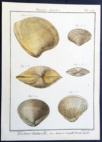
1789 Jean Baptiste Lamarck Antique Concology Print, Surf Clam Shells - Pl 255
- Title : Mactre, Mactra
- Size: 11in x 8in (280mm x 205mm)
- Condition: (A+) Fine Condition
- Date : 1789
- Ref #: 23886-1
Description:
This fine original copper-plate engraved antique Conchology or Shell print by Jean Baptiste Lamarck was drawn by Henri Joseph Redoute (1766 - 1852) - younger brother of the famous illustrator P J Redoute - engraved by Robert Benard and published in the 1789 edition of Tableau encyclopédique et méthodique des trois règnes de la nature(1782-1832) by the French publisher Charles Joseph Panckoucke.
General Definitions:
Paper thickness and quality: - Heavy and stable
Paper color : - Off white
Age of map color: - Original
Colors used: - Yellow, Green, pink
General color appearance: - Authentic
Paper size: - 11in x 8in (280mm x 205mm)
Plate size: - 10in x 7in (255mm x 180mm)
Margins: - Min 1/2in (12mm)
Imperfections:
Margins: - None
Plate area: - None
Verso: - None
Background:
Tableau encyclopédique et méthodique des trois regnes de la nature was an illustrated encyclopedia of plants, animals and minerals, notable for including the first scientific descriptions of many species, and for its attractive engravings. It was published in Paris by Charles Joseph Panckoucke, from 1788 on. Although its several volumes can be considered a part of the greater Encyclopédie méthodique, they were titled and issued separately.
Encyclopédie méthodique par ordre des matières (Methodical Encyclopedia by Order of Subject Matter) was published between 1782 and 1832 by the French publisher Charles Joseph Panckoucke, his son-in-law Henri Agasse, and the latter´s wife, Thérèse-Charlotte Agasse. Arranged by disciplines, it was a revised and much expanded version, in roughly 210 to 216 volumes (different sets were bound differently), of the alphabetically arranged Encyclopédie, edited by Denis Diderot and Jean le Rond d Alembert.
Two sets of Diderots Encyclopédie and its supplements were cut up into articles. Each subject category was entrusted to a specialized editor, whose job was to collect all articles relating to his subject and exclude those belonging to others. Great care was to be taken of those articles that were of a doubtful nature, which were not to be omitted. For certain topics, such as air (which belonged equally to chemistry, physics and medicine), the methodical arrangement had the unexpected effect of breaking up a single article into several parts. Each volume was to have its own introduction, a table of contents, and a history of the Encyclopédie. The whole work was to be linked together by a Vocabulaire universel (Vol. 1 – 4), with references to all locations where each word appears.
The prospectus, issued early in 1782, proposed three editions, each with seven volumes of 250 to 300 plates:
84 volumes;
43 volumes, with 3 columns per page; and
53 volumes of about 100 sheets, with 2 columns per page.
The publication was continued by Henri Agasse, Panckouckes son-in-law, from 1794 to 1813, and then by the latters widow, Mme Agasse, until 1832, when it was completed in 102 livraisons or 337 parts, forming roughly 166½ volumes of text (depending on how the parts were bound) as well as 51 illustrated parts containing 6,439 plates. The number of pages totalled 124,210 pages, of which 5,458 pages were plates. To save money, the plates belonging to architecture were not published. Pharmacy (separated from chemistry), minerals, education, Ponts et chausses were not published as had been announced.
Many dictionaries have a classed index of articles. The one in Oeconomie politique is an excellent example, giving the contents of each article, so that any passage can be found easily.
When completed, the encyclopedia suffered at least one great weakness. As the Vocabulaire Universel, the key and index to the entire work, was not published, it was difficult to carry out any research or to find all the articles on any particular subject. The original parts had often been subdivided, and had been so added onto by other dictionaries, supplements, and appendices that an exact account could not be given of the work, which contained 88 alphabets, 83 indexes, 166 introductions, discourses, prefaces, etc. Overall, probably no more an unmanageable body of dictionaries has ever been published, except Jacques Paul Mignes Encyclopédie théologique, Paris, 1844–1875, with 168 volumes, 101 dictionaries, and 119,059 pages.
The Encyclopédie méthodique par ordre des matières occupied a thousand workers in production, and 2,250 contributors.
Lamarck, Jean-Baptiste Pierre Antoine de Monet, Chevalier de1744 – 1829
Lamarck was a pioneer French biologist, who is best known for his idea that acquired characters are inheritable, an idea known as Lamarckism, which is controverted by modern evolutionary theorygenetics.
Lamarck was the youngest of 11 children in a family of the lesser nobility. His family intended him for the priesthood, but, after the death of his father and the expulsion of the Jesuits from France, Lamarck embarked on a military career in 1761. As a soldier garrisoned in the south of France, he became interested in collecting plants. An injury forced him to resign in 1768, but his fascination for botany endured, and it was as a botanist that he first built his scientific reputation.
Lamarck gained attention among the naturalists in Paris at the Jardin et Cabinet du Roi (the kings garden and natural history collection, known informally as the Jardin du Roi) by claiming he could create a system for identifying the plants of France that would be more efficient than any system currently in existence, including that of the great Swedish naturalist Carolus Linnaeus. This project appealed to Georges-Louis Leclerc, comte de Buffon, who was the director of the Jardin du Roi and Linnaeuss greatest rival. Buffon arranged to have Lamarcks work published at government expense, and Lamarck received the proceeds from the sales. The work appeared in three volumes under the title Flore française (1778; French Flora). Lamarck designed the Flore française specifically for the task of plant identification and used dichotomous keys, which are classification tools that allow the user to choose between opposing pairs of morphological characters (see taxonomy: The objectives of biological classification) to achieve this end.
With Buffons support, Lamarck was elected to the Academy of Sciences in 1779. Two years later Buffon named Lamarck correspondent of the Jardin du Roi, evidently to give Lamarck additional status while he escorted Buffons son on a scientific tour of Europe. This provided Lamarck with his first official connection, albeit an unsalaried one, with the Jardin du Roi. Shortly after Buffons death in 1788, his successor, Flahault de la Billarderie, created a salaried position for Lamarck with the title of botanist of the King and keeper of the Kings herbaria.
Between 1783 and 1792 Lamarck published three large botanical volumes for the Encyclopédie méthodique (Methodical Encyclopaedia) , a massive publishing enterprise begun by French publisher Charles-Joseph Panckoucke in the late 18th century. Lamarck also published botanical papers in the Mémoires of the Academy of Sciences. In 1792 he cofounded and coedited a short-lived journal of natural history, the Journal dhistoire naturelle.
Lamarcks career changed dramatically in 1793 when the former Jardin du Roi was transformed into the Muséum National dHistoire Naturelle (National Museum of Natural History). In the changeover, all 12 of the scientists who had been officers of the previous establishment were named as professors and coadministrators of the new institution; however, only two professorships of botany were created. The botanists Antoine-Laurent de Jussieu and René Desfontaines held greater claims to these positions, and Lamarck, in a striking shift of responsibilities, was made professor of the insects, worms, and microscopic animals. Although this change of focus was remarkable, it was not wholly unjustified, as Lamarck was an ardent shell collector. Lamarck then set out to classify this large and poorly analyzed expanse of the animal kingdom. Later he would name this group animals without vertebrae and invent the term invertebrate. By 1802 Lamarck had also introduced the term biology.
This challenge would have been enough to occupy the energies of most naturalists; however, Lamarcks intellectual aspirations ran well beyond that of reforming invertebrate classification. In the 1790s he began promoting the broad theories of physics, chemistry, and meteorology that he had been nurturing for almost two decades. He also began thinking about Earths geologic history and developed notions that he would eventually publish under the title of Hydrogéologie (1802). In his physico-chemical writings, he advanced an old-fashioned, four-element theory that was self-consciously at odds with the revolutionary advances of the emerging pneumatic chemistry of Antoine-Laurent Lavoisier. His colleagues at the Institute of France (the successor to the Academy of Sciences) saw Lamarcks broad theorizing as unscientific system building. Lamarck in turn became increasingly scornful of scientists who preferred small facts to larger, more important ones. He began to characterize himself as a naturalist-philosopher, a person more concerned with the broader processes of nature than the details of the chemists laboratory or naturalists closet.
In 1800 Lamarck first set forth the revolutionary notion of species mutability during a lecture to students in his invertebrate zoology class at the National Museum of Natural History. By 1802 the general outlines of his broad theory of organic transformation had taken shape. He presented the theory successively in his Recherches sur lorganisation des corps vivans (1802; Research on the Organization of Living Bodies), his Philosophie zoologique (1809; Zoological Philosophy), and the introduction to his great multivolume work on invertebrate classification, Histoire naturelle des animaux sans vertèbres (1815–22; Natural History of Invertebrate Animals) . Lamarcks theory of organic development included the idea that the very simplest forms of plant and animal life were the result of spontaneous generation. Life became successively diversified, he claimed, as the result of two very different sorts of causes. He called the first the power of life, or the cause that tends to make organization increasingly complex, whereas he classified the second as the modifying influence of particular circumstances (that is, the effects of the environment). He explained this in his Philosophie zoologique : The state in which we now see all the animals is on the one hand the product of the increasing composition of organization, which tends to form a regular gradation, and on the other hand that of the influences of a multitude of very different circumstances that continually tend to destroy the regularity in the gradation of the increasing composition of organization.
With this theory, Lamarck offered much more than an account of how species change. He also explained what he understood to be the shape of a truly natural system of classification of the animal kingdom. The primary feature of this system was a single scale of increasing complexity composed of all the different classes of animals, starting with the simplest microscopic organisms, or infusorians, and rising up to the mammals. The species, however, could not be arranged in a simple series. Lamarck described them as forming lateral ramifications with respect to the general masses of organization represented by the classes. Lateral ramifications in species resulted when they underwent transformations that reflected the diverse, particular environments to which they had been exposed.
By Lamarcks account, animals, in responding to different environments, adopted new habits. Their new habits caused them to use some organs more and some organs less, which resulted in the strengthening of the former and the weakening of the latter. New characters thus acquired by organisms over the course of their lives were passed on to the next generation (provided, in the case of sexual reproduction, that both of the parents of the offspring had undergone the same changes). Small changes that accumulated over great periods of time produced major differences. Lamarck thus explained how the shapes of giraffes, snakes, storks, swans, and numerous other creatures were a consequence of long-maintained habits. The basic idea of the inheritance of acquired characters had originated with Anaxagoras, Hippocrates, and others, but Lamarck was essentially the first naturalist to argue at length that the long-term operation of this process could result in species change.
Later in the century, after English naturalist Charles Darwin advanced his theory of evolution by natural selection, the idea of the inheritance of acquired characters came to be identified as a distinctively Lamarckian view of organic change (though Darwin himself also believed that acquired characters could be inherited). The idea was not seriously challenged in biology until the German biologist August Weismann did so in the 1880s. In the 20th century, since Lamarcks idea failed to be confirmed experimentally and the evidence commonly cited in its favour was given different interpretations, it became thoroughly discredited. Epigenetics, the study of the chemical modification of genes and gene-associated proteins, has since offered an explanation for how certain traits developed during an organisms lifetime can be passed along to its offspring.
Lamarck made his most important contributions to science as a botanical and zoological systematist, as a founder of invertebrate paleontology, and as an evolutionary theorist. In his own day, his theory of evolution was generally rejected as implausible, unsubstantiated, or heretical. Today he is primarily remembered for his notion of the inheritance of acquired characteristics. Nonetheless, Lamarck stands out in the history of biology as the first writer to set forth—both systematically and in detail—a comprehensive theory of organic evolution that accounted for the successive production of all the different forms of life on Earth.
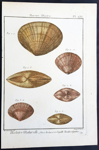
1789 Jean Baptiste Lamarck Antique Concology Print, Surf Clam Shells - Pl 256
-
Title : Mactre, Mactra
Size: 11in x 8in (280mm x 205mm) - Condition: (A+) Fine Condition
- Date : 1789
- Ref #: 23887
Description:
This fine original copper-plate engraved antique Conchology or Shell print by Jean Baptiste Lamarck was drawn by Henri Joseph Redoute (1766 - 1852) - younger brother of the famous illustrator P J Redoute - engraved by Robert Benard and published in the 1789 edition of Tableau encyclopédique et méthodique des trois règnes de la nature(1782-1832) by the French publisher Charles Joseph Panckoucke.
General Definitions:
Paper thickness and quality: - Heavy and stable
Paper color : - Off white
Age of map color: - Original
Colors used: - Yellow, Green, pink
General color appearance: - Authentic
Paper size: - 11in x 8in (280mm x 205mm)
Plate size: - 10in x 7in (255mm x 180mm)
Margins: - Min 1/2in (12mm)
Imperfections:
Margins: - None
Plate area: - None
Verso: - None
Background:
Tableau encyclopédique et méthodique des trois regnes de la nature was an illustrated encyclopedia of plants, animals and minerals, notable for including the first scientific descriptions of many species, and for its attractive engravings. It was published in Paris by Charles Joseph Panckoucke, from 1788 on. Although its several volumes can be considered a part of the greater Encyclopédie méthodique, they were titled and issued separately.
Encyclopédie méthodique par ordre des matières (Methodical Encyclopedia by Order of Subject Matter) was published between 1782 and 1832 by the French publisher Charles Joseph Panckoucke, his son-in-law Henri Agasse, and the latter´s wife, Thérèse-Charlotte Agasse. Arranged by disciplines, it was a revised and much expanded version, in roughly 210 to 216 volumes (different sets were bound differently), of the alphabetically arranged Encyclopédie, edited by Denis Diderot and Jean le Rond d Alembert.
Two sets of Diderots Encyclopédie and its supplements were cut up into articles. Each subject category was entrusted to a specialized editor, whose job was to collect all articles relating to his subject and exclude those belonging to others. Great care was to be taken of those articles that were of a doubtful nature, which were not to be omitted. For certain topics, such as air (which belonged equally to chemistry, physics and medicine), the methodical arrangement had the unexpected effect of breaking up a single article into several parts. Each volume was to have its own introduction, a table of contents, and a history of the Encyclopédie. The whole work was to be linked together by a Vocabulaire universel (Vol. 1 – 4), with references to all locations where each word appears.
The prospectus, issued early in 1782, proposed three editions, each with seven volumes of 250 to 300 plates:
84 volumes;
43 volumes, with 3 columns per page; and
53 volumes of about 100 sheets, with 2 columns per page.
The publication was continued by Henri Agasse, Panckouckes son-in-law, from 1794 to 1813, and then by the latters widow, Mme Agasse, until 1832, when it was completed in 102 livraisons or 337 parts, forming roughly 166½ volumes of text (depending on how the parts were bound) as well as 51 illustrated parts containing 6,439 plates. The number of pages totalled 124,210 pages, of which 5,458 pages were plates. To save money, the plates belonging to architecture were not published. Pharmacy (separated from chemistry), minerals, education, Ponts et chausses were not published as had been announced.
Many dictionaries have a classed index of articles. The one in Oeconomie politique is an excellent example, giving the contents of each article, so that any passage can be found easily.
When completed, the encyclopedia suffered at least one great weakness. As the Vocabulaire Universel, the key and index to the entire work, was not published, it was difficult to carry out any research or to find all the articles on any particular subject. The original parts had often been subdivided, and had been so added onto by other dictionaries, supplements, and appendices that an exact account could not be given of the work, which contained 88 alphabets, 83 indexes, 166 introductions, discourses, prefaces, etc. Overall, probably no more an unmanageable body of dictionaries has ever been published, except Jacques Paul Mignes Encyclopédie théologique, Paris, 1844–1875, with 168 volumes, 101 dictionaries, and 119,059 pages.
The Encyclopédie méthodique par ordre des matières occupied a thousand workers in production, and 2,250 contributors.
Lamarck, Jean-Baptiste Pierre Antoine de Monet, Chevalier de1744 – 1829
Lamarck was a pioneer French biologist, who is best known for his idea that acquired characters are inheritable, an idea known as Lamarckism, which is controverted by modern evolutionary theorygenetics.
Lamarck was the youngest of 11 children in a family of the lesser nobility. His family intended him for the priesthood, but, after the death of his father and the expulsion of the Jesuits from France, Lamarck embarked on a military career in 1761. As a soldier garrisoned in the south of France, he became interested in collecting plants. An injury forced him to resign in 1768, but his fascination for botany endured, and it was as a botanist that he first built his scientific reputation.
Lamarck gained attention among the naturalists in Paris at the Jardin et Cabinet du Roi (the kings garden and natural history collection, known informally as the Jardin du Roi) by claiming he could create a system for identifying the plants of France that would be more efficient than any system currently in existence, including that of the great Swedish naturalist Carolus Linnaeus. This project appealed to Georges-Louis Leclerc, comte de Buffon, who was the director of the Jardin du Roi and Linnaeuss greatest rival. Buffon arranged to have Lamarcks work published at government expense, and Lamarck received the proceeds from the sales. The work appeared in three volumes under the title Flore française (1778; French Flora). Lamarck designed the Flore française specifically for the task of plant identification and used dichotomous keys, which are classification tools that allow the user to choose between opposing pairs of morphological characters (see taxonomy: The objectives of biological classification) to achieve this end.
With Buffons support, Lamarck was elected to the Academy of Sciences in 1779. Two years later Buffon named Lamarck correspondent of the Jardin du Roi, evidently to give Lamarck additional status while he escorted Buffons son on a scientific tour of Europe. This provided Lamarck with his first official connection, albeit an unsalaried one, with the Jardin du Roi. Shortly after Buffons death in 1788, his successor, Flahault de la Billarderie, created a salaried position for Lamarck with the title of botanist of the King and keeper of the Kings herbaria.
Between 1783 and 1792 Lamarck published three large botanical volumes for the Encyclopédie méthodique (Methodical Encyclopaedia) , a massive publishing enterprise begun by French publisher Charles-Joseph Panckoucke in the late 18th century. Lamarck also published botanical papers in the Mémoires of the Academy of Sciences. In 1792 he cofounded and coedited a short-lived journal of natural history, the Journal dhistoire naturelle.
Lamarcks career changed dramatically in 1793 when the former Jardin du Roi was transformed into the Muséum National dHistoire Naturelle (National Museum of Natural History). In the changeover, all 12 of the scientists who had been officers of the previous establishment were named as professors and coadministrators of the new institution; however, only two professorships of botany were created. The botanists Antoine-Laurent de Jussieu and René Desfontaines held greater claims to these positions, and Lamarck, in a striking shift of responsibilities, was made professor of the insects, worms, and microscopic animals. Although this change of focus was remarkable, it was not wholly unjustified, as Lamarck was an ardent shell collector. Lamarck then set out to classify this large and poorly analyzed expanse of the animal kingdom. Later he would name this group animals without vertebrae and invent the term invertebrate. By 1802 Lamarck had also introduced the term biology.
This challenge would have been enough to occupy the energies of most naturalists; however, Lamarcks intellectual aspirations ran well beyond that of reforming invertebrate classification. In the 1790s he began promoting the broad theories of physics, chemistry, and meteorology that he had been nurturing for almost two decades. He also began thinking about Earths geologic history and developed notions that he would eventually publish under the title of Hydrogéologie (1802). In his physico-chemical writings, he advanced an old-fashioned, four-element theory that was self-consciously at odds with the revolutionary advances of the emerging pneumatic chemistry of Antoine-Laurent Lavoisier. His colleagues at the Institute of France (the successor to the Academy of Sciences) saw Lamarcks broad theorizing as unscientific system building. Lamarck in turn became increasingly scornful of scientists who preferred small facts to larger, more important ones. He began to characterize himself as a naturalist-philosopher, a person more concerned with the broader processes of nature than the details of the chemists laboratory or naturalists closet.
In 1800 Lamarck first set forth the revolutionary notion of species mutability during a lecture to students in his invertebrate zoology class at the National Museum of Natural History. By 1802 the general outlines of his broad theory of organic transformation had taken shape. He presented the theory successively in his Recherches sur lorganisation des corps vivans (1802; Research on the Organization of Living Bodies), his Philosophie zoologique (1809; Zoological Philosophy), and the introduction to his great multivolume work on invertebrate classification, Histoire naturelle des animaux sans vertèbres (1815–22; Natural History of Invertebrate Animals) . Lamarcks theory of organic development included the idea that the very simplest forms of plant and animal life were the result of spontaneous generation. Life became successively diversified, he claimed, as the result of two very different sorts of causes. He called the first the power of life, or the cause that tends to make organization increasingly complex, whereas he classified the second as the modifying influence of particular circumstances (that is, the effects of the environment). He explained this in his Philosophie zoologique : The state in which we now see all the animals is on the one hand the product of the increasing composition of organization, which tends to form a regular gradation, and on the other hand that of the influences of a multitude of very different circumstances that continually tend to destroy the regularity in the gradation of the increasing composition of organization.
With this theory, Lamarck offered much more than an account of how species change. He also explained what he understood to be the shape of a truly natural system of classification of the animal kingdom. The primary feature of this system was a single scale of increasing complexity composed of all the different classes of animals, starting with the simplest microscopic organisms, or infusorians, and rising up to the mammals. The species, however, could not be arranged in a simple series. Lamarck described them as forming lateral ramifications with respect to the general masses of organization represented by the classes. Lateral ramifications in species resulted when they underwent transformations that reflected the diverse, particular environments to which they had been exposed.
By Lamarcks account, animals, in responding to different environments, adopted new habits. Their new habits caused them to use some organs more and some organs less, which resulted in the strengthening of the former and the weakening of the latter. New characters thus acquired by organisms over the course of their lives were passed on to the next generation (provided, in the case of sexual reproduction, that both of the parents of the offspring had undergone the same changes). Small changes that accumulated over great periods of time produced major differences. Lamarck thus explained how the shapes of giraffes, snakes, storks, swans, and numerous other creatures were a consequence of long-maintained habits. The basic idea of the inheritance of acquired characters had originated with Anaxagoras, Hippocrates, and others, but Lamarck was essentially the first naturalist to argue at length that the long-term operation of this process could result in species change.
Later in the century, after English naturalist Charles Darwin advanced his theory of evolution by natural selection, the idea of the inheritance of acquired characters came to be identified as a distinctively Lamarckian view of organic change (though Darwin himself also believed that acquired characters could be inherited). The idea was not seriously challenged in biology until the German biologist August Weismann did so in the 1880s. In the 20th century, since Lamarcks idea failed to be confirmed experimentally and the evidence commonly cited in its favour was given different interpretations, it became thoroughly discredited. Epigenetics, the study of the chemical modification of genes and gene-associated proteins, has since offered an explanation for how certain traits developed during an organisms lifetime can be passed along to its offspring.
Lamarck made his most important contributions to science as a botanical and zoological systematist, as a founder of invertebrate paleontology, and as an evolutionary theorist. In his own day, his theory of evolution was generally rejected as implausible, unsubstantiated, or heretical. Today he is primarily remembered for his notion of the inheritance of acquired characteristics. Nonetheless, Lamarck stands out in the history of biology as the first writer to set forth—both systematically and in detail—a comprehensive theory of organic evolution that accounted for the successive production of all the different forms of life on Earth.
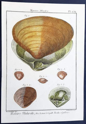
1789 Jean Baptiste Lamarck Antique Concology Print, Surf Clam Shells - Pl 259
- Title : Mactre, Mactra
- Size: 11in x 8in (280mm x 205mm)
- Condition: (A+) Fine Condition
- Date : 1789
- Ref #: 23890
Description:
This fine original copper-plate engraved antique Conchology or Shell print by Jean Baptiste Lamarck was drawn by Henri Joseph Redoute (1766 - 1852) - younger brother of the famous illustrator P J Redoute - engraved by Robert Benard and published in the 1789 edition of Tableau encyclopédique et méthodique des trois règnes de la nature(1782-1832) by the French publisher Charles Joseph Panckoucke.
General Definitions:
Paper thickness and quality: - Heavy and stable
Paper color : - Off white
Age of map color: - Original
Colors used: - Yellow, Green, pink
General color appearance: - Authentic
Paper size: - 11in x 8in (280mm x 205mm)
Plate size: - 10in x 7in (255mm x 180mm)
Margins: - Min 1/2in (12mm)
Imperfections:
Margins: - None
Plate area: - None
Verso: - None
Background:
Tableau encyclopédique et méthodique des trois regnes de la nature was an illustrated encyclopedia of plants, animals and minerals, notable for including the first scientific descriptions of many species, and for its attractive engravings. It was published in Paris by Charles Joseph Panckoucke, from 1788 on. Although its several volumes can be considered a part of the greater Encyclopédie méthodique, they were titled and issued separately.
Encyclopédie méthodique par ordre des matières (Methodical Encyclopedia by Order of Subject Matter) was published between 1782 and 1832 by the French publisher Charles Joseph Panckoucke, his son-in-law Henri Agasse, and the latter´s wife, Thérèse-Charlotte Agasse. Arranged by disciplines, it was a revised and much expanded version, in roughly 210 to 216 volumes (different sets were bound differently), of the alphabetically arranged Encyclopédie, edited by Denis Diderot and Jean le Rond d Alembert.
Two sets of Diderots Encyclopédie and its supplements were cut up into articles. Each subject category was entrusted to a specialized editor, whose job was to collect all articles relating to his subject and exclude those belonging to others. Great care was to be taken of those articles that were of a doubtful nature, which were not to be omitted. For certain topics, such as air (which belonged equally to chemistry, physics and medicine), the methodical arrangement had the unexpected effect of breaking up a single article into several parts. Each volume was to have its own introduction, a table of contents, and a history of the Encyclopédie. The whole work was to be linked together by a Vocabulaire universel (Vol. 1 – 4), with references to all locations where each word appears.
The prospectus, issued early in 1782, proposed three editions, each with seven volumes of 250 to 300 plates:
84 volumes;
43 volumes, with 3 columns per page; and
53 volumes of about 100 sheets, with 2 columns per page.
The publication was continued by Henri Agasse, Panckouckes son-in-law, from 1794 to 1813, and then by the latters widow, Mme Agasse, until 1832, when it was completed in 102 livraisons or 337 parts, forming roughly 166½ volumes of text (depending on how the parts were bound) as well as 51 illustrated parts containing 6,439 plates. The number of pages totalled 124,210 pages, of which 5,458 pages were plates. To save money, the plates belonging to architecture were not published. Pharmacy (separated from chemistry), minerals, education, Ponts et chausses were not published as had been announced.
Many dictionaries have a classed index of articles. The one in Oeconomie politique is an excellent example, giving the contents of each article, so that any passage can be found easily.
When completed, the encyclopedia suffered at least one great weakness. As the Vocabulaire Universel, the key and index to the entire work, was not published, it was difficult to carry out any research or to find all the articles on any particular subject. The original parts had often been subdivided, and had been so added onto by other dictionaries, supplements, and appendices that an exact account could not be given of the work, which contained 88 alphabets, 83 indexes, 166 introductions, discourses, prefaces, etc. Overall, probably no more an unmanageable body of dictionaries has ever been published, except Jacques Paul Mignes Encyclopédie théologique, Paris, 1844–1875, with 168 volumes, 101 dictionaries, and 119,059 pages.
The Encyclopédie méthodique par ordre des matières occupied a thousand workers in production, and 2,250 contributors.
Lamarck, Jean-Baptiste Pierre Antoine de Monet, Chevalier de1744 – 1829
Lamarck was a pioneer French biologist, who is best known for his idea that acquired characters are inheritable, an idea known as Lamarckism, which is controverted by modern evolutionary theorygenetics.
Lamarck was the youngest of 11 children in a family of the lesser nobility. His family intended him for the priesthood, but, after the death of his father and the expulsion of the Jesuits from France, Lamarck embarked on a military career in 1761. As a soldier garrisoned in the south of France, he became interested in collecting plants. An injury forced him to resign in 1768, but his fascination for botany endured, and it was as a botanist that he first built his scientific reputation.
Lamarck gained attention among the naturalists in Paris at the Jardin et Cabinet du Roi (the kings garden and natural history collection, known informally as the Jardin du Roi) by claiming he could create a system for identifying the plants of France that would be more efficient than any system currently in existence, including that of the great Swedish naturalist Carolus Linnaeus. This project appealed to Georges-Louis Leclerc, comte de Buffon, who was the director of the Jardin du Roi and Linnaeuss greatest rival. Buffon arranged to have Lamarcks work published at government expense, and Lamarck received the proceeds from the sales. The work appeared in three volumes under the title Flore française (1778; French Flora). Lamarck designed the Flore française specifically for the task of plant identification and used dichotomous keys, which are classification tools that allow the user to choose between opposing pairs of morphological characters (see taxonomy: The objectives of biological classification) to achieve this end.
With Buffons support, Lamarck was elected to the Academy of Sciences in 1779. Two years later Buffon named Lamarck correspondent of the Jardin du Roi, evidently to give Lamarck additional status while he escorted Buffons son on a scientific tour of Europe. This provided Lamarck with his first official connection, albeit an unsalaried one, with the Jardin du Roi. Shortly after Buffons death in 1788, his successor, Flahault de la Billarderie, created a salaried position for Lamarck with the title of botanist of the King and keeper of the Kings herbaria.
Between 1783 and 1792 Lamarck published three large botanical volumes for the Encyclopédie méthodique (Methodical Encyclopaedia) , a massive publishing enterprise begun by French publisher Charles-Joseph Panckoucke in the late 18th century. Lamarck also published botanical papers in the Mémoires of the Academy of Sciences. In 1792 he cofounded and coedited a short-lived journal of natural history, the Journal dhistoire naturelle.
Lamarcks career changed dramatically in 1793 when the former Jardin du Roi was transformed into the Muséum National dHistoire Naturelle (National Museum of Natural History). In the changeover, all 12 of the scientists who had been officers of the previous establishment were named as professors and coadministrators of the new institution; however, only two professorships of botany were created. The botanists Antoine-Laurent de Jussieu and René Desfontaines held greater claims to these positions, and Lamarck, in a striking shift of responsibilities, was made professor of the insects, worms, and microscopic animals. Although this change of focus was remarkable, it was not wholly unjustified, as Lamarck was an ardent shell collector. Lamarck then set out to classify this large and poorly analyzed expanse of the animal kingdom. Later he would name this group animals without vertebrae and invent the term invertebrate. By 1802 Lamarck had also introduced the term biology.
This challenge would have been enough to occupy the energies of most naturalists; however, Lamarcks intellectual aspirations ran well beyond that of reforming invertebrate classification. In the 1790s he began promoting the broad theories of physics, chemistry, and meteorology that he had been nurturing for almost two decades. He also began thinking about Earths geologic history and developed notions that he would eventually publish under the title of Hydrogéologie (1802). In his physico-chemical writings, he advanced an old-fashioned, four-element theory that was self-consciously at odds with the revolutionary advances of the emerging pneumatic chemistry of Antoine-Laurent Lavoisier. His colleagues at the Institute of France (the successor to the Academy of Sciences) saw Lamarcks broad theorizing as unscientific system building. Lamarck in turn became increasingly scornful of scientists who preferred small facts to larger, more important ones. He began to characterize himself as a naturalist-philosopher, a person more concerned with the broader processes of nature than the details of the chemists laboratory or naturalists closet.
In 1800 Lamarck first set forth the revolutionary notion of species mutability during a lecture to students in his invertebrate zoology class at the National Museum of Natural History. By 1802 the general outlines of his broad theory of organic transformation had taken shape. He presented the theory successively in his Recherches sur lorganisation des corps vivans (1802; Research on the Organization of Living Bodies), his Philosophie zoologique (1809; Zoological Philosophy), and the introduction to his great multivolume work on invertebrate classification, Histoire naturelle des animaux sans vertèbres (1815–22; Natural History of Invertebrate Animals) . Lamarcks theory of organic development included the idea that the very simplest forms of plant and animal life were the result of spontaneous generation. Life became successively diversified, he claimed, as the result of two very different sorts of causes. He called the first the power of life, or the cause that tends to make organization increasingly complex, whereas he classified the second as the modifying influence of particular circumstances (that is, the effects of the environment). He explained this in his Philosophie zoologique : The state in which we now see all the animals is on the one hand the product of the increasing composition of organization, which tends to form a regular gradation, and on the other hand that of the influences of a multitude of very different circumstances that continually tend to destroy the regularity in the gradation of the increasing composition of organization.
With this theory, Lamarck offered much more than an account of how species change. He also explained what he understood to be the shape of a truly natural system of classification of the animal kingdom. The primary feature of this system was a single scale of increasing complexity composed of all the different classes of animals, starting with the simplest microscopic organisms, or infusorians, and rising up to the mammals. The species, however, could not be arranged in a simple series. Lamarck described them as forming lateral ramifications with respect to the general masses of organization represented by the classes. Lateral ramifications in species resulted when they underwent transformations that reflected the diverse, particular environments to which they had been exposed.
By Lamarcks account, animals, in responding to different environments, adopted new habits. Their new habits caused them to use some organs more and some organs less, which resulted in the strengthening of the former and the weakening of the latter. New characters thus acquired by organisms over the course of their lives were passed on to the next generation (provided, in the case of sexual reproduction, that both of the parents of the offspring had undergone the same changes). Small changes that accumulated over great periods of time produced major differences. Lamarck thus explained how the shapes of giraffes, snakes, storks, swans, and numerous other creatures were a consequence of long-maintained habits. The basic idea of the inheritance of acquired characters had originated with Anaxagoras, Hippocrates, and others, but Lamarck was essentially the first naturalist to argue at length that the long-term operation of this process could result in species change.
Later in the century, after English naturalist Charles Darwin advanced his theory of evolution by natural selection, the idea of the inheritance of acquired characters came to be identified as a distinctively Lamarckian view of organic change (though Darwin himself also believed that acquired characters could be inherited). The idea was not seriously challenged in biology until the German biologist August Weismann did so in the 1880s. In the 20th century, since Lamarcks idea failed to be confirmed experimentally and the evidence commonly cited in its favour was given different interpretations, it became thoroughly discredited. Epigenetics, the study of the chemical modification of genes and gene-associated proteins, has since offered an explanation for how certain traits developed during an organisms lifetime can be passed along to its offspring.
Lamarck made his most important contributions to science as a botanical and zoological systematist, as a founder of invertebrate paleontology, and as an evolutionary theorist. In his own day, his theory of evolution was generally rejected as implausible, unsubstantiated, or heretical. Today he is primarily remembered for his notion of the inheritance of acquired characteristics. Nonetheless, Lamarck stands out in the history of biology as the first writer to set forth—both systematically and in detail—a comprehensive theory of organic evolution that accounted for the successive production of all the different forms of life on Earth.
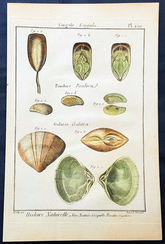
1789 Jean Baptiste Lamarck Antique Concology Print, Surf Clam Shells Plate 250
- Title : Mactre, Mactra
- Size: 11in x 8in (280mm x 200mm)
- Condition: (A+) Fine Condition
- Date : 1789
- Ref #: 23881
Description:
This fine original copper-plate engraved antique Conchology or Shell print by Jean Baptiste Lamarck was drawn by Henri Joseph Redoute (1766 - 1852) - younger brother of the famous illustrator P J Redoute - engraved by Robert Benard and published in the 1789 edition of Tableau encyclopédique et méthodique des trois règnes de la nature(1782-1832) by the French publisher Charles Joseph Panckoucke.
General Definitions:
Paper thickness and quality: - Heavy and stable
Paper color : - Off white
Age of map color: - Original
Colors used: - Yellow, Green, pink
General color appearance: - Authentic
Paper size: - 11in x 8in (280mm x 200mm)
Plate size: - 10in x 7in (255mm x 180mm)
Margins: - Min 1/2in (12mm)
Imperfections:
Margins: - None
Plate area: - None
Verso: - None
Background:
Tableau encyclopédique et méthodique des trois regnes de la nature was an illustrated encyclopedia of plants, animals and minerals, notable for including the first scientific descriptions of many species, and for its attractive engravings. It was published in Paris by Charles Joseph Panckoucke, from 1788 on. Although its several volumes can be considered a part of the greater Encyclopédie méthodique, they were titled and issued separately.
Encyclopédie méthodique par ordre des matières (Methodical Encyclopedia by Order of Subject Matter) was published between 1782 and 1832 by the French publisher Charles Joseph Panckoucke, his son-in-law Henri Agasse, and the latter´s wife, Thérèse-Charlotte Agasse. Arranged by disciplines, it was a revised and much expanded version, in roughly 210 to 216 volumes (different sets were bound differently), of the alphabetically arranged Encyclopédie, edited by Denis Diderot and Jean le Rond d Alembert.
Two sets of Diderots Encyclopédie and its supplements were cut up into articles. Each subject category was entrusted to a specialized editor, whose job was to collect all articles relating to his subject and exclude those belonging to others. Great care was to be taken of those articles that were of a doubtful nature, which were not to be omitted. For certain topics, such as air (which belonged equally to chemistry, physics and medicine), the methodical arrangement had the unexpected effect of breaking up a single article into several parts. Each volume was to have its own introduction, a table of contents, and a history of the Encyclopédie. The whole work was to be linked together by a Vocabulaire universel (Vol. 1 – 4), with references to all locations where each word appears.
The prospectus, issued early in 1782, proposed three editions, each with seven volumes of 250 to 300 plates:
84 volumes;
43 volumes, with 3 columns per page; and
53 volumes of about 100 sheets, with 2 columns per page.
The publication was continued by Henri Agasse, Panckouckes son-in-law, from 1794 to 1813, and then by the latters widow, Mme Agasse, until 1832, when it was completed in 102 livraisons or 337 parts, forming roughly 166½ volumes of text (depending on how the parts were bound) as well as 51 illustrated parts containing 6,439 plates. The number of pages totalled 124,210 pages, of which 5,458 pages were plates. To save money, the plates belonging to architecture were not published. Pharmacy (separated from chemistry), minerals, education, Ponts et chausses were not published as had been announced.
Many dictionaries have a classed index of articles. The one in Oeconomie politique is an excellent example, giving the contents of each article, so that any passage can be found easily.
When completed, the encyclopedia suffered at least one great weakness. As the Vocabulaire Universel, the key and index to the entire work, was not published, it was difficult to carry out any research or to find all the articles on any particular subject. The original parts had often been subdivided, and had been so added onto by other dictionaries, supplements, and appendices that an exact account could not be given of the work, which contained 88 alphabets, 83 indexes, 166 introductions, discourses, prefaces, etc. Overall, probably no more an unmanageable body of dictionaries has ever been published, except Jacques Paul Mignes Encyclopédie théologique, Paris, 1844–1875, with 168 volumes, 101 dictionaries, and 119,059 pages.
The Encyclopédie méthodique par ordre des matières occupied a thousand workers in production, and 2,250 contributors.
Lamarck, Jean-Baptiste Pierre Antoine de Monet, Chevalier de1744 – 1829
Lamarck was a pioneer French biologist, who is best known for his idea that acquired characters are inheritable, an idea known as Lamarckism, which is controverted by modern evolutionary theorygenetics.
Lamarck was the youngest of 11 children in a family of the lesser nobility. His family intended him for the priesthood, but, after the death of his father and the expulsion of the Jesuits from France, Lamarck embarked on a military career in 1761. As a soldier garrisoned in the south of France, he became interested in collecting plants. An injury forced him to resign in 1768, but his fascination for botany endured, and it was as a botanist that he first built his scientific reputation.
Lamarck gained attention among the naturalists in Paris at the Jardin et Cabinet du Roi (the kings garden and natural history collection, known informally as the Jardin du Roi) by claiming he could create a system for identifying the plants of France that would be more efficient than any system currently in existence, including that of the great Swedish naturalist Carolus Linnaeus. This project appealed to Georges-Louis Leclerc, comte de Buffon, who was the director of the Jardin du Roi and Linnaeuss greatest rival. Buffon arranged to have Lamarcks work published at government expense, and Lamarck received the proceeds from the sales. The work appeared in three volumes under the title Flore française (1778; French Flora). Lamarck designed the Flore française specifically for the task of plant identification and used dichotomous keys, which are classification tools that allow the user to choose between opposing pairs of morphological characters (see taxonomy: The objectives of biological classification) to achieve this end.
With Buffons support, Lamarck was elected to the Academy of Sciences in 1779. Two years later Buffon named Lamarck correspondent of the Jardin du Roi, evidently to give Lamarck additional status while he escorted Buffons son on a scientific tour of Europe. This provided Lamarck with his first official connection, albeit an unsalaried one, with the Jardin du Roi. Shortly after Buffons death in 1788, his successor, Flahault de la Billarderie, created a salaried position for Lamarck with the title of botanist of the King and keeper of the Kings herbaria.
Between 1783 and 1792 Lamarck published three large botanical volumes for the Encyclopédie méthodique (Methodical Encyclopaedia) , a massive publishing enterprise begun by French publisher Charles-Joseph Panckoucke in the late 18th century. Lamarck also published botanical papers in the Mémoires of the Academy of Sciences. In 1792 he cofounded and coedited a short-lived journal of natural history, the Journal dhistoire naturelle.
Lamarcks career changed dramatically in 1793 when the former Jardin du Roi was transformed into the Muséum National dHistoire Naturelle (National Museum of Natural History). In the changeover, all 12 of the scientists who had been officers of the previous establishment were named as professors and coadministrators of the new institution; however, only two professorships of botany were created. The botanists Antoine-Laurent de Jussieu and René Desfontaines held greater claims to these positions, and Lamarck, in a striking shift of responsibilities, was made professor of the insects, worms, and microscopic animals. Although this change of focus was remarkable, it was not wholly unjustified, as Lamarck was an ardent shell collector. Lamarck then set out to classify this large and poorly analyzed expanse of the animal kingdom. Later he would name this group animals without vertebrae and invent the term invertebrate. By 1802 Lamarck had also introduced the term biology.
This challenge would have been enough to occupy the energies of most naturalists; however, Lamarcks intellectual aspirations ran well beyond that of reforming invertebrate classification. In the 1790s he began promoting the broad theories of physics, chemistry, and meteorology that he had been nurturing for almost two decades. He also began thinking about Earths geologic history and developed notions that he would eventually publish under the title of Hydrogéologie (1802). In his physico-chemical writings, he advanced an old-fashioned, four-element theory that was self-consciously at odds with the revolutionary advances of the emerging pneumatic chemistry of Antoine-Laurent Lavoisier. His colleagues at the Institute of France (the successor to the Academy of Sciences) saw Lamarcks broad theorizing as unscientific system building. Lamarck in turn became increasingly scornful of scientists who preferred small facts to larger, more important ones. He began to characterize himself as a naturalist-philosopher, a person more concerned with the broader processes of nature than the details of the chemists laboratory or naturalists closet.
In 1800 Lamarck first set forth the revolutionary notion of species mutability during a lecture to students in his invertebrate zoology class at the National Museum of Natural History. By 1802 the general outlines of his broad theory of organic transformation had taken shape. He presented the theory successively in his Recherches sur lorganisation des corps vivans (1802; Research on the Organization of Living Bodies), his Philosophie zoologique (1809; Zoological Philosophy), and the introduction to his great multivolume work on invertebrate classification, Histoire naturelle des animaux sans vertèbres (1815–22; Natural History of Invertebrate Animals) . Lamarcks theory of organic development included the idea that the very simplest forms of plant and animal life were the result of spontaneous generation. Life became successively diversified, he claimed, as the result of two very different sorts of causes. He called the first the power of life, or the cause that tends to make organization increasingly complex, whereas he classified the second as the modifying influence of particular circumstances (that is, the effects of the environment). He explained this in his Philosophie zoologique : The state in which we now see all the animals is on the one hand the product of the increasing composition of organization, which tends to form a regular gradation, and on the other hand that of the influences of a multitude of very different circumstances that continually tend to destroy the regularity in the gradation of the increasing composition of organization.
With this theory, Lamarck offered much more than an account of how species change. He also explained what he understood to be the shape of a truly natural system of classification of the animal kingdom. The primary feature of this system was a single scale of increasing complexity composed of all the different classes of animals, starting with the simplest microscopic organisms, or infusorians, and rising up to the mammals. The species, however, could not be arranged in a simple series. Lamarck described them as forming lateral ramifications with respect to the general masses of organization represented by the classes. Lateral ramifications in species resulted when they underwent transformations that reflected the diverse, particular environments to which they had been exposed.
By Lamarcks account, animals, in responding to different environments, adopted new habits. Their new habits caused them to use some organs more and some organs less, which resulted in the strengthening of the former and the weakening of the latter. New characters thus acquired by organisms over the course of their lives were passed on to the next generation (provided, in the case of sexual reproduction, that both of the parents of the offspring had undergone the same changes). Small changes that accumulated over great periods of time produced major differences. Lamarck thus explained how the shapes of giraffes, snakes, storks, swans, and numerous other creatures were a consequence of long-maintained habits. The basic idea of the inheritance of acquired characters had originated with Anaxagoras, Hippocrates, and others, but Lamarck was essentially the first naturalist to argue at length that the long-term operation of this process could result in species change.
Later in the century, after English naturalist Charles Darwin advanced his theory of evolution by natural selection, the idea of the inheritance of acquired characters came to be identified as a distinctively Lamarckian view of organic change (though Darwin himself also believed that acquired characters could be inherited). The idea was not seriously challenged in biology until the German biologist August Weismann did so in the 1880s. In the 20th century, since Lamarcks idea failed to be confirmed experimentally and the evidence commonly cited in its favour was given different interpretations, it became thoroughly discredited. Epigenetics, the study of the chemical modification of genes and gene-associated proteins, has since offered an explanation for how certain traits developed during an organisms lifetime can be passed along to its offspring.
Lamarck made his most important contributions to science as a botanical and zoological systematist, as a founder of invertebrate paleontology, and as an evolutionary theorist. In his own day, his theory of evolution was generally rejected as implausible, unsubstantiated, or heretical. Today he is primarily remembered for his notion of the inheritance of acquired characteristics. Nonetheless, Lamarck stands out in the history of biology as the first writer to set forth—both systematically and in detail—a comprehensive theory of organic evolution that accounted for the successive production of all the different forms of life on Earth.
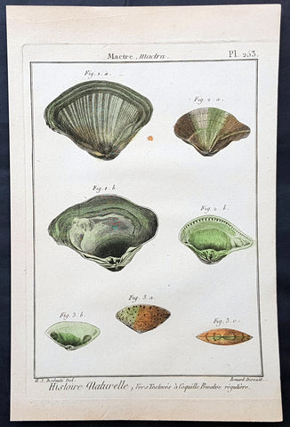
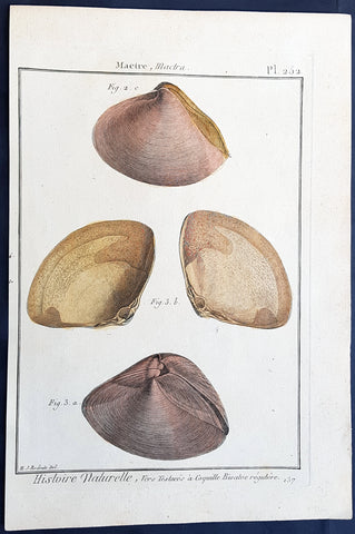
1789 Jean Baptiste Lamarck Antique Concology Print, Surf Clam Shells Plate 253
- Title : Moule, Mytilus
- Size: 11in x 8in (280mm x 200mm)
- Condition: (A+) Fine Condition
- Date : 1789
- Ref #: 23884
Description:
This fine original copper-plate engraved antique Conchology or Shell print by Jean Baptiste Lamarck was drawn by Henri Joseph Redoute (1766 - 1852) - younger brother of the famous illustrator P J Redoute - engraved by Robert Benard and published in the 1789 edition of Tableau encyclopédique et méthodique des trois règnes de la nature(1782-1832) by the French publisher Charles Joseph Panckoucke.
General Definitions:
Paper thickness and quality: - Heavy and stable
Paper color : - Off white
Age of map color: - Original
Colors used: - Yellow, Green, pink
General color appearance: - Authentic
Paper size: - 11in x 8in (280mm x 200mm)
Plate size: - 10in x 7in (255mm x 180mm)
Margins: - Min 1/2in (12mm)
Imperfections:
Margins: - None
Plate area: - None
Verso: - None
Background:
Tableau encyclopédique et méthodique des trois regnes de la nature was an illustrated encyclopedia of plants, animals and minerals, notable for including the first scientific descriptions of many species, and for its attractive engravings. It was published in Paris by Charles Joseph Panckoucke, from 1788 on. Although its several volumes can be considered a part of the greater Encyclopédie méthodique, they were titled and issued separately.
Encyclopédie méthodique par ordre des matières (Methodical Encyclopedia by Order of Subject Matter) was published between 1782 and 1832 by the French publisher Charles Joseph Panckoucke, his son-in-law Henri Agasse, and the latter´s wife, Thérèse-Charlotte Agasse. Arranged by disciplines, it was a revised and much expanded version, in roughly 210 to 216 volumes (different sets were bound differently), of the alphabetically arranged Encyclopédie, edited by Denis Diderot and Jean le Rond d Alembert.
Two sets of Diderots Encyclopédie and its supplements were cut up into articles. Each subject category was entrusted to a specialized editor, whose job was to collect all articles relating to his subject and exclude those belonging to others. Great care was to be taken of those articles that were of a doubtful nature, which were not to be omitted. For certain topics, such as air (which belonged equally to chemistry, physics and medicine), the methodical arrangement had the unexpected effect of breaking up a single article into several parts. Each volume was to have its own introduction, a table of contents, and a history of the Encyclopédie. The whole work was to be linked together by a Vocabulaire universel (Vol. 1 – 4), with references to all locations where each word appears.
The prospectus, issued early in 1782, proposed three editions, each with seven volumes of 250 to 300 plates:
84 volumes;
43 volumes, with 3 columns per page; and
53 volumes of about 100 sheets, with 2 columns per page.
The publication was continued by Henri Agasse, Panckouckes son-in-law, from 1794 to 1813, and then by the latters widow, Mme Agasse, until 1832, when it was completed in 102 livraisons or 337 parts, forming roughly 166½ volumes of text (depending on how the parts were bound) as well as 51 illustrated parts containing 6,439 plates. The number of pages totalled 124,210 pages, of which 5,458 pages were plates. To save money, the plates belonging to architecture were not published. Pharmacy (separated from chemistry), minerals, education, Ponts et chausses were not published as had been announced.
Many dictionaries have a classed index of articles. The one in Oeconomie politique is an excellent example, giving the contents of each article, so that any passage can be found easily.
When completed, the encyclopedia suffered at least one great weakness. As the Vocabulaire Universel, the key and index to the entire work, was not published, it was difficult to carry out any research or to find all the articles on any particular subject. The original parts had often been subdivided, and had been so added onto by other dictionaries, supplements, and appendices that an exact account could not be given of the work, which contained 88 alphabets, 83 indexes, 166 introductions, discourses, prefaces, etc. Overall, probably no more an unmanageable body of dictionaries has ever been published, except Jacques Paul Mignes Encyclopédie théologique, Paris, 1844–1875, with 168 volumes, 101 dictionaries, and 119,059 pages.
The Encyclopédie méthodique par ordre des matières occupied a thousand workers in production, and 2,250 contributors.
Lamarck, Jean-Baptiste Pierre Antoine de Monet, Chevalier de1744 – 1829
Lamarck was a pioneer French biologist, who is best known for his idea that acquired characters are inheritable, an idea known as Lamarckism, which is controverted by modern evolutionary theorygenetics.
Lamarck was the youngest of 11 children in a family of the lesser nobility. His family intended him for the priesthood, but, after the death of his father and the expulsion of the Jesuits from France, Lamarck embarked on a military career in 1761. As a soldier garrisoned in the south of France, he became interested in collecting plants. An injury forced him to resign in 1768, but his fascination for botany endured, and it was as a botanist that he first built his scientific reputation.
Lamarck gained attention among the naturalists in Paris at the Jardin et Cabinet du Roi (the kings garden and natural history collection, known informally as the Jardin du Roi) by claiming he could create a system for identifying the plants of France that would be more efficient than any system currently in existence, including that of the great Swedish naturalist Carolus Linnaeus. This project appealed to Georges-Louis Leclerc, comte de Buffon, who was the director of the Jardin du Roi and Linnaeuss greatest rival. Buffon arranged to have Lamarcks work published at government expense, and Lamarck received the proceeds from the sales. The work appeared in three volumes under the title Flore française (1778; French Flora). Lamarck designed the Flore française specifically for the task of plant identification and used dichotomous keys, which are classification tools that allow the user to choose between opposing pairs of morphological characters (see taxonomy: The objectives of biological classification) to achieve this end.
With Buffons support, Lamarck was elected to the Academy of Sciences in 1779. Two years later Buffon named Lamarck correspondent of the Jardin du Roi, evidently to give Lamarck additional status while he escorted Buffons son on a scientific tour of Europe. This provided Lamarck with his first official connection, albeit an unsalaried one, with the Jardin du Roi. Shortly after Buffons death in 1788, his successor, Flahault de la Billarderie, created a salaried position for Lamarck with the title of botanist of the King and keeper of the Kings herbaria.
Between 1783 and 1792 Lamarck published three large botanical volumes for the Encyclopédie méthodique (Methodical Encyclopaedia) , a massive publishing enterprise begun by French publisher Charles-Joseph Panckoucke in the late 18th century. Lamarck also published botanical papers in the Mémoires of the Academy of Sciences. In 1792 he cofounded and coedited a short-lived journal of natural history, the Journal dhistoire naturelle.
Lamarcks career changed dramatically in 1793 when the former Jardin du Roi was transformed into the Muséum National dHistoire Naturelle (National Museum of Natural History). In the changeover, all 12 of the scientists who had been officers of the previous establishment were named as professors and coadministrators of the new institution; however, only two professorships of botany were created. The botanists Antoine-Laurent de Jussieu and René Desfontaines held greater claims to these positions, and Lamarck, in a striking shift of responsibilities, was made professor of the insects, worms, and microscopic animals. Although this change of focus was remarkable, it was not wholly unjustified, as Lamarck was an ardent shell collector. Lamarck then set out to classify this large and poorly analyzed expanse of the animal kingdom. Later he would name this group animals without vertebrae and invent the term invertebrate. By 1802 Lamarck had also introduced the term biology.
This challenge would have been enough to occupy the energies of most naturalists; however, Lamarcks intellectual aspirations ran well beyond that of reforming invertebrate classification. In the 1790s he began promoting the broad theories of physics, chemistry, and meteorology that he had been nurturing for almost two decades. He also began thinking about Earths geologic history and developed notions that he would eventually publish under the title of Hydrogéologie (1802). In his physico-chemical writings, he advanced an old-fashioned, four-element theory that was self-consciously at odds with the revolutionary advances of the emerging pneumatic chemistry of Antoine-Laurent Lavoisier. His colleagues at the Institute of France (the successor to the Academy of Sciences) saw Lamarcks broad theorizing as unscientific system building. Lamarck in turn became increasingly scornful of scientists who preferred small facts to larger, more important ones. He began to characterize himself as a naturalist-philosopher, a person more concerned with the broader processes of nature than the details of the chemists laboratory or naturalists closet.
In 1800 Lamarck first set forth the revolutionary notion of species mutability during a lecture to students in his invertebrate zoology class at the National Museum of Natural History. By 1802 the general outlines of his broad theory of organic transformation had taken shape. He presented the theory successively in his Recherches sur lorganisation des corps vivans (1802; Research on the Organization of Living Bodies), his Philosophie zoologique (1809; Zoological Philosophy), and the introduction to his great multivolume work on invertebrate classification, Histoire naturelle des animaux sans vertèbres (1815–22; Natural History of Invertebrate Animals) . Lamarcks theory of organic development included the idea that the very simplest forms of plant and animal life were the result of spontaneous generation. Life became successively diversified, he claimed, as the result of two very different sorts of causes. He called the first the power of life, or the cause that tends to make organization increasingly complex, whereas he classified the second as the modifying influence of particular circumstances (that is, the effects of the environment). He explained this in his Philosophie zoologique : The state in which we now see all the animals is on the one hand the product of the increasing composition of organization, which tends to form a regular gradation, and on the other hand that of the influences of a multitude of very different circumstances that continually tend to destroy the regularity in the gradation of the increasing composition of organization.
With this theory, Lamarck offered much more than an account of how species change. He also explained what he understood to be the shape of a truly natural system of classification of the animal kingdom. The primary feature of this system was a single scale of increasing complexity composed of all the different classes of animals, starting with the simplest microscopic organisms, or infusorians, and rising up to the mammals. The species, however, could not be arranged in a simple series. Lamarck described them as forming lateral ramifications with respect to the general masses of organization represented by the classes. Lateral ramifications in species resulted when they underwent transformations that reflected the diverse, particular environments to which they had been exposed.
By Lamarcks account, animals, in responding to different environments, adopted new habits. Their new habits caused them to use some organs more and some organs less, which resulted in the strengthening of the former and the weakening of the latter. New characters thus acquired by organisms over the course of their lives were passed on to the next generation (provided, in the case of sexual reproduction, that both of the parents of the offspring had undergone the same changes). Small changes that accumulated over great periods of time produced major differences. Lamarck thus explained how the shapes of giraffes, snakes, storks, swans, and numerous other creatures were a consequence of long-maintained habits. The basic idea of the inheritance of acquired characters had originated with Anaxagoras, Hippocrates, and others, but Lamarck was essentially the first naturalist to argue at length that the long-term operation of this process could result in species change.
Later in the century, after English naturalist Charles Darwin advanced his theory of evolution by natural selection, the idea of the inheritance of acquired characters came to be identified as a distinctively Lamarckian view of organic change (though Darwin himself also believed that acquired characters could be inherited). The idea was not seriously challenged in biology until the German biologist August Weismann did so in the 1880s. In the 20th century, since Lamarcks idea failed to be confirmed experimentally and the evidence commonly cited in its favour was given different interpretations, it became thoroughly discredited. Epigenetics, the study of the chemical modification of genes and gene-associated proteins, has since offered an explanation for how certain traits developed during an organisms lifetime can be passed along to its offspring.
Lamarck made his most important contributions to science as a botanical and zoological systematist, as a founder of invertebrate paleontology, and as an evolutionary theorist. In his own day, his theory of evolution was generally rejected as implausible, unsubstantiated, or heretical. Today he is primarily remembered for his notion of the inheritance of acquired characteristics. Nonetheless, Lamarck stands out in the history of biology as the first writer to set forth—both systematically and in detail—a comprehensive theory of organic evolution that accounted for the successive production of all the different forms of life on Earth.
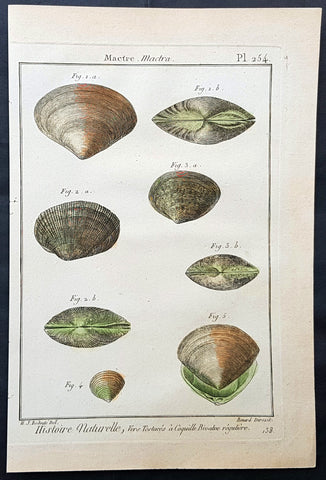
1789 Jean Baptiste Lamarck Antique Concology Print, Surf Clam Shells Plate 254
- Title : Mactre, Mactra
- Size: 11in x 8in (280mm x 200mm)
- Condition: (A+) Fine Condition
- Date : 1789
- Ref #: 23885
Description:
This fine original copper-plate engraved antique Conchology or Shell print by Jean Baptiste Lamarck was drawn by Henri Joseph Redoute (1766 - 1852) - younger brother of the famous illustrator P J Redoute - engraved by Robert Benard and published in the 1789 edition of Tableau encyclopédique et méthodique des trois règnes de la nature(1782-1832) by the French publisher Charles Joseph Panckoucke.
General Definitions:
Paper thickness and quality: - Heavy and stable
Paper color : - Off white
Age of map color: - Original
Colors used: - Yellow, Green, pink
General color appearance: - Authentic
Paper size: - 11in x 8in (280mm x 200mm)
Plate size: - 10in x 7in (255mm x 180mm)
Margins: - Min 1/2in (12mm)
Imperfections:
Margins: - None
Plate area: - None
Verso: - None
Background:
Tableau encyclopédique et méthodique des trois regnes de la nature was an illustrated encyclopedia of plants, animals and minerals, notable for including the first scientific descriptions of many species, and for its attractive engravings. It was published in Paris by Charles Joseph Panckoucke, from 1788 on. Although its several volumes can be considered a part of the greater Encyclopédie méthodique, they were titled and issued separately.
Encyclopédie méthodique par ordre des matières (Methodical Encyclopedia by Order of Subject Matter) was published between 1782 and 1832 by the French publisher Charles Joseph Panckoucke, his son-in-law Henri Agasse, and the latter´s wife, Thérèse-Charlotte Agasse. Arranged by disciplines, it was a revised and much expanded version, in roughly 210 to 216 volumes (different sets were bound differently), of the alphabetically arranged Encyclopédie, edited by Denis Diderot and Jean le Rond d Alembert.
Two sets of Diderots Encyclopédie and its supplements were cut up into articles. Each subject category was entrusted to a specialized editor, whose job was to collect all articles relating to his subject and exclude those belonging to others. Great care was to be taken of those articles that were of a doubtful nature, which were not to be omitted. For certain topics, such as air (which belonged equally to chemistry, physics and medicine), the methodical arrangement had the unexpected effect of breaking up a single article into several parts. Each volume was to have its own introduction, a table of contents, and a history of the Encyclopédie. The whole work was to be linked together by a Vocabulaire universel (Vol. 1 – 4), with references to all locations where each word appears.
The prospectus, issued early in 1782, proposed three editions, each with seven volumes of 250 to 300 plates:
84 volumes;
43 volumes, with 3 columns per page; and
53 volumes of about 100 sheets, with 2 columns per page.
The publication was continued by Henri Agasse, Panckouckes son-in-law, from 1794 to 1813, and then by the latters widow, Mme Agasse, until 1832, when it was completed in 102 livraisons or 337 parts, forming roughly 166½ volumes of text (depending on how the parts were bound) as well as 51 illustrated parts containing 6,439 plates. The number of pages totalled 124,210 pages, of which 5,458 pages were plates. To save money, the plates belonging to architecture were not published. Pharmacy (separated from chemistry), minerals, education, Ponts et chausses were not published as had been announced.
Many dictionaries have a classed index of articles. The one in Oeconomie politique is an excellent example, giving the contents of each article, so that any passage can be found easily.
When completed, the encyclopedia suffered at least one great weakness. As the Vocabulaire Universel, the key and index to the entire work, was not published, it was difficult to carry out any research or to find all the articles on any particular subject. The original parts had often been subdivided, and had been so added onto by other dictionaries, supplements, and appendices that an exact account could not be given of the work, which contained 88 alphabets, 83 indexes, 166 introductions, discourses, prefaces, etc. Overall, probably no more an unmanageable body of dictionaries has ever been published, except Jacques Paul Mignes Encyclopédie théologique, Paris, 1844–1875, with 168 volumes, 101 dictionaries, and 119,059 pages.
The Encyclopédie méthodique par ordre des matières occupied a thousand workers in production, and 2,250 contributors.
Lamarck, Jean-Baptiste Pierre Antoine de Monet, Chevalier de1744 – 1829
Lamarck was a pioneer French biologist, who is best known for his idea that acquired characters are inheritable, an idea known as Lamarckism, which is controverted by modern evolutionary theorygenetics.
Lamarck was the youngest of 11 children in a family of the lesser nobility. His family intended him for the priesthood, but, after the death of his father and the expulsion of the Jesuits from France, Lamarck embarked on a military career in 1761. As a soldier garrisoned in the south of France, he became interested in collecting plants. An injury forced him to resign in 1768, but his fascination for botany endured, and it was as a botanist that he first built his scientific reputation.
Lamarck gained attention among the naturalists in Paris at the Jardin et Cabinet du Roi (the kings garden and natural history collection, known informally as the Jardin du Roi) by claiming he could create a system for identifying the plants of France that would be more efficient than any system currently in existence, including that of the great Swedish naturalist Carolus Linnaeus. This project appealed to Georges-Louis Leclerc, comte de Buffon, who was the director of the Jardin du Roi and Linnaeuss greatest rival. Buffon arranged to have Lamarcks work published at government expense, and Lamarck received the proceeds from the sales. The work appeared in three volumes under the title Flore française (1778; French Flora). Lamarck designed the Flore française specifically for the task of plant identification and used dichotomous keys, which are classification tools that allow the user to choose between opposing pairs of morphological characters (see taxonomy: The objectives of biological classification) to achieve this end.
With Buffons support, Lamarck was elected to the Academy of Sciences in 1779. Two years later Buffon named Lamarck correspondent of the Jardin du Roi, evidently to give Lamarck additional status while he escorted Buffons son on a scientific tour of Europe. This provided Lamarck with his first official connection, albeit an unsalaried one, with the Jardin du Roi. Shortly after Buffons death in 1788, his successor, Flahault de la Billarderie, created a salaried position for Lamarck with the title of botanist of the King and keeper of the Kings herbaria.
Between 1783 and 1792 Lamarck published three large botanical volumes for the Encyclopédie méthodique (Methodical Encyclopaedia) , a massive publishing enterprise begun by French publisher Charles-Joseph Panckoucke in the late 18th century. Lamarck also published botanical papers in the Mémoires of the Academy of Sciences. In 1792 he cofounded and coedited a short-lived journal of natural history, the Journal dhistoire naturelle.
Lamarcks career changed dramatically in 1793 when the former Jardin du Roi was transformed into the Muséum National dHistoire Naturelle (National Museum of Natural History). In the changeover, all 12 of the scientists who had been officers of the previous establishment were named as professors and coadministrators of the new institution; however, only two professorships of botany were created. The botanists Antoine-Laurent de Jussieu and René Desfontaines held greater claims to these positions, and Lamarck, in a striking shift of responsibilities, was made professor of the insects, worms, and microscopic animals. Although this change of focus was remarkable, it was not wholly unjustified, as Lamarck was an ardent shell collector. Lamarck then set out to classify this large and poorly analyzed expanse of the animal kingdom. Later he would name this group animals without vertebrae and invent the term invertebrate. By 1802 Lamarck had also introduced the term biology.
This challenge would have been enough to occupy the energies of most naturalists; however, Lamarcks intellectual aspirations ran well beyond that of reforming invertebrate classification. In the 1790s he began promoting the broad theories of physics, chemistry, and meteorology that he had been nurturing for almost two decades. He also began thinking about Earths geologic history and developed notions that he would eventually publish under the title of Hydrogéologie (1802). In his physico-chemical writings, he advanced an old-fashioned, four-element theory that was self-consciously at odds with the revolutionary advances of the emerging pneumatic chemistry of Antoine-Laurent Lavoisier. His colleagues at the Institute of France (the successor to the Academy of Sciences) saw Lamarcks broad theorizing as unscientific system building. Lamarck in turn became increasingly scornful of scientists who preferred small facts to larger, more important ones. He began to characterize himself as a naturalist-philosopher, a person more concerned with the broader processes of nature than the details of the chemists laboratory or naturalists closet.
In 1800 Lamarck first set forth the revolutionary notion of species mutability during a lecture to students in his invertebrate zoology class at the National Museum of Natural History. By 1802 the general outlines of his broad theory of organic transformation had taken shape. He presented the theory successively in his Recherches sur lorganisation des corps vivans (1802; Research on the Organization of Living Bodies), his Philosophie zoologique (1809; Zoological Philosophy), and the introduction to his great multivolume work on invertebrate classification, Histoire naturelle des animaux sans vertèbres (1815–22; Natural History of Invertebrate Animals) . Lamarcks theory of organic development included the idea that the very simplest forms of plant and animal life were the result of spontaneous generation. Life became successively diversified, he claimed, as the result of two very different sorts of causes. He called the first the power of life, or the cause that tends to make organization increasingly complex, whereas he classified the second as the modifying influence of particular circumstances (that is, the effects of the environment). He explained this in his Philosophie zoologique : The state in which we now see all the animals is on the one hand the product of the increasing composition of organization, which tends to form a regular gradation, and on the other hand that of the influences of a multitude of very different circumstances that continually tend to destroy the regularity in the gradation of the increasing composition of organization.
With this theory, Lamarck offered much more than an account of how species change. He also explained what he understood to be the shape of a truly natural system of classification of the animal kingdom. The primary feature of this system was a single scale of increasing complexity composed of all the different classes of animals, starting with the simplest microscopic organisms, or infusorians, and rising up to the mammals. The species, however, could not be arranged in a simple series. Lamarck described them as forming lateral ramifications with respect to the general masses of organization represented by the classes. Lateral ramifications in species resulted when they underwent transformations that reflected the diverse, particular environments to which they had been exposed.
By Lamarcks account, animals, in responding to different environments, adopted new habits. Their new habits caused them to use some organs more and some organs less, which resulted in the strengthening of the former and the weakening of the latter. New characters thus acquired by organisms over the course of their lives were passed on to the next generation (provided, in the case of sexual reproduction, that both of the parents of the offspring had undergone the same changes). Small changes that accumulated over great periods of time produced major differences. Lamarck thus explained how the shapes of giraffes, snakes, storks, swans, and numerous other creatures were a consequence of long-maintained habits. The basic idea of the inheritance of acquired characters had originated with Anaxagoras, Hippocrates, and others, but Lamarck was essentially the first naturalist to argue at length that the long-term operation of this process could result in species change.
Later in the century, after English naturalist Charles Darwin advanced his theory of evolution by natural selection, the idea of the inheritance of acquired characters came to be identified as a distinctively Lamarckian view of organic change (though Darwin himself also believed that acquired characters could be inherited). The idea was not seriously challenged in biology until the German biologist August Weismann did so in the 1880s. In the 20th century, since Lamarcks idea failed to be confirmed experimentally and the evidence commonly cited in its favour was given different interpretations, it became thoroughly discredited. Epigenetics, the study of the chemical modification of genes and gene-associated proteins, has since offered an explanation for how certain traits developed during an organisms lifetime can be passed along to its offspring.
Lamarck made his most important contributions to science as a botanical and zoological systematist, as a founder of invertebrate paleontology, and as an evolutionary theorist. In his own day, his theory of evolution was generally rejected as implausible, unsubstantiated, or heretical. Today he is primarily remembered for his notion of the inheritance of acquired characteristics. Nonetheless, Lamarck stands out in the history of biology as the first writer to set forth—both systematically and in detail—a comprehensive theory of organic evolution that accounted for the successive production of all the different forms of life on Earth.
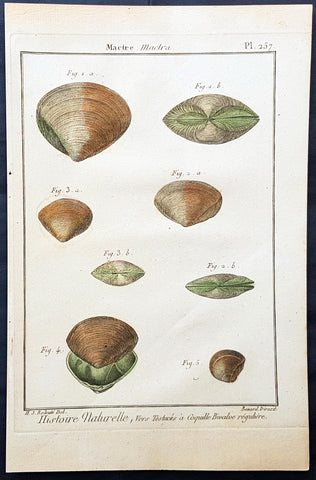
1789 Jean Baptiste Lamarck Antique Concology Print, Surf Clam Shells Plate 257
- Title : Mactre, Mactra
- Size: 11in x 8in (280mm x 200mm)
- Condition: (A+) Fine Condition
- Date : 1789
- Ref #: 23888
Description:
This fine original copper-plate engraved antique Conchology or Shell print by Jean Baptiste Lamarck was drawn by Henri Joseph Redoute (1766 - 1852) - younger brother of the famous illustrator P J Redoute - engraved by Robert Benard and published in the 1789 edition of Tableau encyclopédique et méthodique des trois règnes de la nature(1782-1832) by the French publisher Charles Joseph Panckoucke.
General Definitions:
Paper thickness and quality: - Heavy and stable
Paper color : - Off white
Age of map color: - Original
Colors used: - Yellow, Green, pink
General color appearance: - Authentic
Paper size: - 11in x 8in (280mm x 200mm)
Plate size: - 10in x 7in (255mm x 180mm)
Margins: - Min 1/2in (12mm)
Imperfections:
Margins: - None
Plate area: - None
Verso: - None
Background:
Tableau encyclopédique et méthodique des trois regnes de la nature was an illustrated encyclopedia of plants, animals and minerals, notable for including the first scientific descriptions of many species, and for its attractive engravings. It was published in Paris by Charles Joseph Panckoucke, from 1788 on. Although its several volumes can be considered a part of the greater Encyclopédie méthodique, they were titled and issued separately.
Encyclopédie méthodique par ordre des matières (Methodical Encyclopedia by Order of Subject Matter) was published between 1782 and 1832 by the French publisher Charles Joseph Panckoucke, his son-in-law Henri Agasse, and the latter´s wife, Thérèse-Charlotte Agasse. Arranged by disciplines, it was a revised and much expanded version, in roughly 210 to 216 volumes (different sets were bound differently), of the alphabetically arranged Encyclopédie, edited by Denis Diderot and Jean le Rond d Alembert.
Two sets of Diderots Encyclopédie and its supplements were cut up into articles. Each subject category was entrusted to a specialized editor, whose job was to collect all articles relating to his subject and exclude those belonging to others. Great care was to be taken of those articles that were of a doubtful nature, which were not to be omitted. For certain topics, such as air (which belonged equally to chemistry, physics and medicine), the methodical arrangement had the unexpected effect of breaking up a single article into several parts. Each volume was to have its own introduction, a table of contents, and a history of the Encyclopédie. The whole work was to be linked together by a Vocabulaire universel (Vol. 1 – 4), with references to all locations where each word appears.
The prospectus, issued early in 1782, proposed three editions, each with seven volumes of 250 to 300 plates:
84 volumes;
43 volumes, with 3 columns per page; and
53 volumes of about 100 sheets, with 2 columns per page.
The publication was continued by Henri Agasse, Panckouckes son-in-law, from 1794 to 1813, and then by the latters widow, Mme Agasse, until 1832, when it was completed in 102 livraisons or 337 parts, forming roughly 166½ volumes of text (depending on how the parts were bound) as well as 51 illustrated parts containing 6,439 plates. The number of pages totalled 124,210 pages, of which 5,458 pages were plates. To save money, the plates belonging to architecture were not published. Pharmacy (separated from chemistry), minerals, education, Ponts et chausses were not published as had been announced.
Many dictionaries have a classed index of articles. The one in Oeconomie politique is an excellent example, giving the contents of each article, so that any passage can be found easily.
When completed, the encyclopedia suffered at least one great weakness. As the Vocabulaire Universel, the key and index to the entire work, was not published, it was difficult to carry out any research or to find all the articles on any particular subject. The original parts had often been subdivided, and had been so added onto by other dictionaries, supplements, and appendices that an exact account could not be given of the work, which contained 88 alphabets, 83 indexes, 166 introductions, discourses, prefaces, etc. Overall, probably no more an unmanageable body of dictionaries has ever been published, except Jacques Paul Mignes Encyclopédie théologique, Paris, 1844–1875, with 168 volumes, 101 dictionaries, and 119,059 pages.
The Encyclopédie méthodique par ordre des matières occupied a thousand workers in production, and 2,250 contributors.
Lamarck, Jean-Baptiste Pierre Antoine de Monet, Chevalier de1744 – 1829
Lamarck was a pioneer French biologist, who is best known for his idea that acquired characters are inheritable, an idea known as Lamarckism, which is controverted by modern evolutionary theorygenetics.
Lamarck was the youngest of 11 children in a family of the lesser nobility. His family intended him for the priesthood, but, after the death of his father and the expulsion of the Jesuits from France, Lamarck embarked on a military career in 1761. As a soldier garrisoned in the south of France, he became interested in collecting plants. An injury forced him to resign in 1768, but his fascination for botany endured, and it was as a botanist that he first built his scientific reputation.
Lamarck gained attention among the naturalists in Paris at the Jardin et Cabinet du Roi (the kings garden and natural history collection, known informally as the Jardin du Roi) by claiming he could create a system for identifying the plants of France that would be more efficient than any system currently in existence, including that of the great Swedish naturalist Carolus Linnaeus. This project appealed to Georges-Louis Leclerc, comte de Buffon, who was the director of the Jardin du Roi and Linnaeuss greatest rival. Buffon arranged to have Lamarcks work published at government expense, and Lamarck received the proceeds from the sales. The work appeared in three volumes under the title Flore française (1778; French Flora). Lamarck designed the Flore française specifically for the task of plant identification and used dichotomous keys, which are classification tools that allow the user to choose between opposing pairs of morphological characters (see taxonomy: The objectives of biological classification) to achieve this end.
With Buffons support, Lamarck was elected to the Academy of Sciences in 1779. Two years later Buffon named Lamarck correspondent of the Jardin du Roi, evidently to give Lamarck additional status while he escorted Buffons son on a scientific tour of Europe. This provided Lamarck with his first official connection, albeit an unsalaried one, with the Jardin du Roi. Shortly after Buffons death in 1788, his successor, Flahault de la Billarderie, created a salaried position for Lamarck with the title of botanist of the King and keeper of the Kings herbaria.
Between 1783 and 1792 Lamarck published three large botanical volumes for the Encyclopédie méthodique (Methodical Encyclopaedia) , a massive publishing enterprise begun by French publisher Charles-Joseph Panckoucke in the late 18th century. Lamarck also published botanical papers in the Mémoires of the Academy of Sciences. In 1792 he cofounded and coedited a short-lived journal of natural history, the Journal dhistoire naturelle.
Lamarcks career changed dramatically in 1793 when the former Jardin du Roi was transformed into the Muséum National dHistoire Naturelle (National Museum of Natural History). In the changeover, all 12 of the scientists who had been officers of the previous establishment were named as professors and coadministrators of the new institution; however, only two professorships of botany were created. The botanists Antoine-Laurent de Jussieu and René Desfontaines held greater claims to these positions, and Lamarck, in a striking shift of responsibilities, was made professor of the insects, worms, and microscopic animals. Although this change of focus was remarkable, it was not wholly unjustified, as Lamarck was an ardent shell collector. Lamarck then set out to classify this large and poorly analyzed expanse of the animal kingdom. Later he would name this group animals without vertebrae and invent the term invertebrate. By 1802 Lamarck had also introduced the term biology.
This challenge would have been enough to occupy the energies of most naturalists; however, Lamarcks intellectual aspirations ran well beyond that of reforming invertebrate classification. In the 1790s he began promoting the broad theories of physics, chemistry, and meteorology that he had been nurturing for almost two decades. He also began thinking about Earths geologic history and developed notions that he would eventually publish under the title of Hydrogéologie (1802). In his physico-chemical writings, he advanced an old-fashioned, four-element theory that was self-consciously at odds with the revolutionary advances of the emerging pneumatic chemistry of Antoine-Laurent Lavoisier. His colleagues at the Institute of France (the successor to the Academy of Sciences) saw Lamarcks broad theorizing as unscientific system building. Lamarck in turn became increasingly scornful of scientists who preferred small facts to larger, more important ones. He began to characterize himself as a naturalist-philosopher, a person more concerned with the broader processes of nature than the details of the chemists laboratory or naturalists closet.
In 1800 Lamarck first set forth the revolutionary notion of species mutability during a lecture to students in his invertebrate zoology class at the National Museum of Natural History. By 1802 the general outlines of his broad theory of organic transformation had taken shape. He presented the theory successively in his Recherches sur lorganisation des corps vivans (1802; Research on the Organization of Living Bodies), his Philosophie zoologique (1809; Zoological Philosophy), and the introduction to his great multivolume work on invertebrate classification, Histoire naturelle des animaux sans vertèbres (1815–22; Natural History of Invertebrate Animals) . Lamarcks theory of organic development included the idea that the very simplest forms of plant and animal life were the result of spontaneous generation. Life became successively diversified, he claimed, as the result of two very different sorts of causes. He called the first the power of life, or the cause that tends to make organization increasingly complex, whereas he classified the second as the modifying influence of particular circumstances (that is, the effects of the environment). He explained this in his Philosophie zoologique : The state in which we now see all the animals is on the one hand the product of the increasing composition of organization, which tends to form a regular gradation, and on the other hand that of the influences of a multitude of very different circumstances that continually tend to destroy the regularity in the gradation of the increasing composition of organization.
With this theory, Lamarck offered much more than an account of how species change. He also explained what he understood to be the shape of a truly natural system of classification of the animal kingdom. The primary feature of this system was a single scale of increasing complexity composed of all the different classes of animals, starting with the simplest microscopic organisms, or infusorians, and rising up to the mammals. The species, however, could not be arranged in a simple series. Lamarck described them as forming lateral ramifications with respect to the general masses of organization represented by the classes. Lateral ramifications in species resulted when they underwent transformations that reflected the diverse, particular environments to which they had been exposed.
By Lamarcks account, animals, in responding to different environments, adopted new habits. Their new habits caused them to use some organs more and some organs less, which resulted in the strengthening of the former and the weakening of the latter. New characters thus acquired by organisms over the course of their lives were passed on to the next generation (provided, in the case of sexual reproduction, that both of the parents of the offspring had undergone the same changes). Small changes that accumulated over great periods of time produced major differences. Lamarck thus explained how the shapes of giraffes, snakes, storks, swans, and numerous other creatures were a consequence of long-maintained habits. The basic idea of the inheritance of acquired characters had originated with Anaxagoras, Hippocrates, and others, but Lamarck was essentially the first naturalist to argue at length that the long-term operation of this process could result in species change.
Later in the century, after English naturalist Charles Darwin advanced his theory of evolution by natural selection, the idea of the inheritance of acquired characters came to be identified as a distinctively Lamarckian view of organic change (though Darwin himself also believed that acquired characters could be inherited). The idea was not seriously challenged in biology until the German biologist August Weismann did so in the 1880s. In the 20th century, since Lamarcks idea failed to be confirmed experimentally and the evidence commonly cited in its favour was given different interpretations, it became thoroughly discredited. Epigenetics, the study of the chemical modification of genes and gene-associated proteins, has since offered an explanation for how certain traits developed during an organisms lifetime can be passed along to its offspring.
Lamarck made his most important contributions to science as a botanical and zoological systematist, as a founder of invertebrate paleontology, and as an evolutionary theorist. In his own day, his theory of evolution was generally rejected as implausible, unsubstantiated, or heretical. Today he is primarily remembered for his notion of the inheritance of acquired characteristics. Nonetheless, Lamarck stands out in the history of biology as the first writer to set forth—both systematically and in detail—a comprehensive theory of organic evolution that accounted for the successive production of all the different forms of life on Earth.
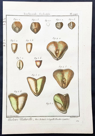
1789 Jean Baptiste Lamarck Antique Concology Print, Terebratula Lamp Shells Plate 240
- Title : Terebratule, Terebratula
- Size: 11in x 8in (280mm x 200mm)
- Condition: (A+) Fine Condition
- Date : 1789
- Ref #: 23871
Description:
This fine original copper-plate engraved antique Conchology or Shell print by Jean Baptiste Lamarck was drawn by Henri Joseph Redoute (1766 - 1852) - younger brother of the famous illustrator P J Redoute - engraved by Robert Benard and published in the 1789 edition of Tableau encyclopédique et méthodique des trois règnes de la nature(1782-1832) by the French publisher Charles Joseph Panckoucke.
General Definitions:
Paper thickness and quality: - Heavy and stable
Paper color : - Off white
Age of map color: - Original
Colors used: - Yellow, Green, pink
General color appearance: - Authentic
Paper size: - 11in x 8in (280mm x 200mm)
Plate size: - 10in x 7in (255mm x 180mm)
Margins: - Min 1/2in (12mm)
Imperfections:
Margins: - None
Plate area: - None
Verso: - None
Background:
Tableau encyclopédique et méthodique des trois regnes de la nature was an illustrated encyclopedia of plants, animals and minerals, notable for including the first scientific descriptions of many species, and for its attractive engravings. It was published in Paris by Charles Joseph Panckoucke, from 1788 on. Although its several volumes can be considered a part of the greater Encyclopédie méthodique, they were titled and issued separately.
Encyclopédie méthodique par ordre des matières (Methodical Encyclopedia by Order of Subject Matter) was published between 1782 and 1832 by the French publisher Charles Joseph Panckoucke, his son-in-law Henri Agasse, and the latter´s wife, Thérèse-Charlotte Agasse. Arranged by disciplines, it was a revised and much expanded version, in roughly 210 to 216 volumes (different sets were bound differently), of the alphabetically arranged Encyclopédie, edited by Denis Diderot and Jean le Rond d Alembert.
Two sets of Diderots Encyclopédie and its supplements were cut up into articles. Each subject category was entrusted to a specialized editor, whose job was to collect all articles relating to his subject and exclude those belonging to others. Great care was to be taken of those articles that were of a doubtful nature, which were not to be omitted. For certain topics, such as air (which belonged equally to chemistry, physics and medicine), the methodical arrangement had the unexpected effect of breaking up a single article into several parts. Each volume was to have its own introduction, a table of contents, and a history of the Encyclopédie. The whole work was to be linked together by a Vocabulaire universel (Vol. 1 – 4), with references to all locations where each word appears.
The prospectus, issued early in 1782, proposed three editions, each with seven volumes of 250 to 300 plates:
84 volumes;
43 volumes, with 3 columns per page; and
53 volumes of about 100 sheets, with 2 columns per page.
The publication was continued by Henri Agasse, Panckouckes son-in-law, from 1794 to 1813, and then by the latters widow, Mme Agasse, until 1832, when it was completed in 102 livraisons or 337 parts, forming roughly 166½ volumes of text (depending on how the parts were bound) as well as 51 illustrated parts containing 6,439 plates. The number of pages totalled 124,210 pages, of which 5,458 pages were plates. To save money, the plates belonging to architecture were not published. Pharmacy (separated from chemistry), minerals, education, Ponts et chausses were not published as had been announced.
Many dictionaries have a classed index of articles. The one in Oeconomie politique is an excellent example, giving the contents of each article, so that any passage can be found easily.
When completed, the encyclopedia suffered at least one great weakness. As the Vocabulaire Universel, the key and index to the entire work, was not published, it was difficult to carry out any research or to find all the articles on any particular subject. The original parts had often been subdivided, and had been so added onto by other dictionaries, supplements, and appendices that an exact account could not be given of the work, which contained 88 alphabets, 83 indexes, 166 introductions, discourses, prefaces, etc. Overall, probably no more an unmanageable body of dictionaries has ever been published, except Jacques Paul Mignes Encyclopédie théologique, Paris, 1844–1875, with 168 volumes, 101 dictionaries, and 119,059 pages.
The Encyclopédie méthodique par ordre des matières occupied a thousand workers in production, and 2,250 contributors.
Lamarck, Jean-Baptiste Pierre Antoine de Monet, Chevalier de1744 – 1829
Lamarck was a pioneer French biologist, who is best known for his idea that acquired characters are inheritable, an idea known as Lamarckism, which is controverted by modern evolutionary theorygenetics.
Lamarck was the youngest of 11 children in a family of the lesser nobility. His family intended him for the priesthood, but, after the death of his father and the expulsion of the Jesuits from France, Lamarck embarked on a military career in 1761. As a soldier garrisoned in the south of France, he became interested in collecting plants. An injury forced him to resign in 1768, but his fascination for botany endured, and it was as a botanist that he first built his scientific reputation.
Lamarck gained attention among the naturalists in Paris at the Jardin et Cabinet du Roi (the kings garden and natural history collection, known informally as the Jardin du Roi) by claiming he could create a system for identifying the plants of France that would be more efficient than any system currently in existence, including that of the great Swedish naturalist Carolus Linnaeus. This project appealed to Georges-Louis Leclerc, comte de Buffon, who was the director of the Jardin du Roi and Linnaeuss greatest rival. Buffon arranged to have Lamarcks work published at government expense, and Lamarck received the proceeds from the sales. The work appeared in three volumes under the title Flore française (1778; French Flora). Lamarck designed the Flore française specifically for the task of plant identification and used dichotomous keys, which are classification tools that allow the user to choose between opposing pairs of morphological characters (see taxonomy: The objectives of biological classification) to achieve this end.
With Buffons support, Lamarck was elected to the Academy of Sciences in 1779. Two years later Buffon named Lamarck correspondent of the Jardin du Roi, evidently to give Lamarck additional status while he escorted Buffons son on a scientific tour of Europe. This provided Lamarck with his first official connection, albeit an unsalaried one, with the Jardin du Roi. Shortly after Buffons death in 1788, his successor, Flahault de la Billarderie, created a salaried position for Lamarck with the title of botanist of the King and keeper of the Kings herbaria.
Between 1783 and 1792 Lamarck published three large botanical volumes for the Encyclopédie méthodique (Methodical Encyclopaedia) , a massive publishing enterprise begun by French publisher Charles-Joseph Panckoucke in the late 18th century. Lamarck also published botanical papers in the Mémoires of the Academy of Sciences. In 1792 he cofounded and coedited a short-lived journal of natural history, the Journal dhistoire naturelle.
Lamarcks career changed dramatically in 1793 when the former Jardin du Roi was transformed into the Muséum National dHistoire Naturelle (National Museum of Natural History). In the changeover, all 12 of the scientists who had been officers of the previous establishment were named as professors and coadministrators of the new institution; however, only two professorships of botany were created. The botanists Antoine-Laurent de Jussieu and René Desfontaines held greater claims to these positions, and Lamarck, in a striking shift of responsibilities, was made professor of the insects, worms, and microscopic animals. Although this change of focus was remarkable, it was not wholly unjustified, as Lamarck was an ardent shell collector. Lamarck then set out to classify this large and poorly analyzed expanse of the animal kingdom. Later he would name this group animals without vertebrae and invent the term invertebrate. By 1802 Lamarck had also introduced the term biology.
This challenge would have been enough to occupy the energies of most naturalists; however, Lamarcks intellectual aspirations ran well beyond that of reforming invertebrate classification. In the 1790s he began promoting the broad theories of physics, chemistry, and meteorology that he had been nurturing for almost two decades. He also began thinking about Earths geologic history and developed notions that he would eventually publish under the title of Hydrogéologie (1802). In his physico-chemical writings, he advanced an old-fashioned, four-element theory that was self-consciously at odds with the revolutionary advances of the emerging pneumatic chemistry of Antoine-Laurent Lavoisier. His colleagues at the Institute of France (the successor to the Academy of Sciences) saw Lamarcks broad theorizing as unscientific system building. Lamarck in turn became increasingly scornful of scientists who preferred small facts to larger, more important ones. He began to characterize himself as a naturalist-philosopher, a person more concerned with the broader processes of nature than the details of the chemists laboratory or naturalists closet.
In 1800 Lamarck first set forth the revolutionary notion of species mutability during a lecture to students in his invertebrate zoology class at the National Museum of Natural History. By 1802 the general outlines of his broad theory of organic transformation had taken shape. He presented the theory successively in his Recherches sur lorganisation des corps vivans (1802; Research on the Organization of Living Bodies), his Philosophie zoologique (1809; Zoological Philosophy), and the introduction to his great multivolume work on invertebrate classification, Histoire naturelle des animaux sans vertèbres (1815–22; Natural History of Invertebrate Animals) . Lamarcks theory of organic development included the idea that the very simplest forms of plant and animal life were the result of spontaneous generation. Life became successively diversified, he claimed, as the result of two very different sorts of causes. He called the first the power of life, or the cause that tends to make organization increasingly complex, whereas he classified the second as the modifying influence of particular circumstances (that is, the effects of the environment). He explained this in his Philosophie zoologique : The state in which we now see all the animals is on the one hand the product of the increasing composition of organization, which tends to form a regular gradation, and on the other hand that of the influences of a multitude of very different circumstances that continually tend to destroy the regularity in the gradation of the increasing composition of organization.
With this theory, Lamarck offered much more than an account of how species change. He also explained what he understood to be the shape of a truly natural system of classification of the animal kingdom. The primary feature of this system was a single scale of increasing complexity composed of all the different classes of animals, starting with the simplest microscopic organisms, or infusorians, and rising up to the mammals. The species, however, could not be arranged in a simple series. Lamarck described them as forming lateral ramifications with respect to the general masses of organization represented by the classes. Lateral ramifications in species resulted when they underwent transformations that reflected the diverse, particular environments to which they had been exposed.
By Lamarcks account, animals, in responding to different environments, adopted new habits. Their new habits caused them to use some organs more and some organs less, which resulted in the strengthening of the former and the weakening of the latter. New characters thus acquired by organisms over the course of their lives were passed on to the next generation (provided, in the case of sexual reproduction, that both of the parents of the offspring had undergone the same changes). Small changes that accumulated over great periods of time produced major differences. Lamarck thus explained how the shapes of giraffes, snakes, storks, swans, and numerous other creatures were a consequence of long-maintained habits. The basic idea of the inheritance of acquired characters had originated with Anaxagoras, Hippocrates, and others, but Lamarck was essentially the first naturalist to argue at length that the long-term operation of this process could result in species change.
Later in the century, after English naturalist Charles Darwin advanced his theory of evolution by natural selection, the idea of the inheritance of acquired characters came to be identified as a distinctively Lamarckian view of organic change (though Darwin himself also believed that acquired characters could be inherited). The idea was not seriously challenged in biology until the German biologist August Weismann did so in the 1880s. In the 20th century, since Lamarcks idea failed to be confirmed experimentally and the evidence commonly cited in its favour was given different interpretations, it became thoroughly discredited. Epigenetics, the study of the chemical modification of genes and gene-associated proteins, has since offered an explanation for how certain traits developed during an organisms lifetime can be passed along to its offspring.
Lamarck made his most important contributions to science as a botanical and zoological systematist, as a founder of invertebrate paleontology, and as an evolutionary theorist. In his own day, his theory of evolution was generally rejected as implausible, unsubstantiated, or heretical. Today he is primarily remembered for his notion of the inheritance of acquired characteristics. Nonetheless, Lamarck stands out in the history of biology as the first writer to set forth—both systematically and in detail—a comprehensive theory of organic evolution that accounted for the successive production of all the different forms of life on Earth.
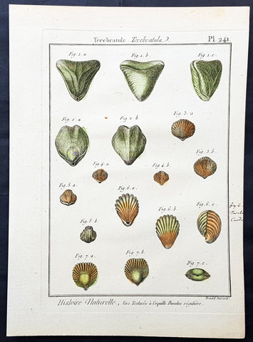
1789 Jean Baptiste Lamarck Antique Concology Print, Terebratula Lamp Shells Plate 241
- Title : Terebratule, Terebratula
- Size: 11in x 8in (280mm x 200mm)
- Condition: (A+) Fine Condition
- Date : 1789
- Ref #: 23872
Description:
This fine original copper-plate engraved antique Conchology or Shell print by Jean Baptiste Lamarck was drawn by Henri Joseph Redoute (1766 - 1852) - younger brother of the famous illustrator P J Redoute - engraved by Robert Benard and published in the 1789 edition of Tableau encyclopédique et méthodique des trois règnes de la nature(1782-1832) by the French publisher Charles Joseph Panckoucke.
General Definitions:
Paper thickness and quality: - Heavy and stable
Paper color : - Off white
Age of map color: - Original
Colors used: - Yellow, Green, pink
General color appearance: - Authentic
Paper size: - 11in x 8in (280mm x 200mm)
Plate size: - 10in x 7in (255mm x 180mm)
Margins: - Min 1/2in (12mm)
Imperfections:
Margins: - None
Plate area: - None
Verso: - None
Background:
Tableau encyclopédique et méthodique des trois regnes de la nature was an illustrated encyclopedia of plants, animals and minerals, notable for including the first scientific descriptions of many species, and for its attractive engravings. It was published in Paris by Charles Joseph Panckoucke, from 1788 on. Although its several volumes can be considered a part of the greater Encyclopédie méthodique, they were titled and issued separately.
Encyclopédie méthodique par ordre des matières (Methodical Encyclopedia by Order of Subject Matter) was published between 1782 and 1832 by the French publisher Charles Joseph Panckoucke, his son-in-law Henri Agasse, and the latter´s wife, Thérèse-Charlotte Agasse. Arranged by disciplines, it was a revised and much expanded version, in roughly 210 to 216 volumes (different sets were bound differently), of the alphabetically arranged Encyclopédie, edited by Denis Diderot and Jean le Rond d Alembert.
Two sets of Diderots Encyclopédie and its supplements were cut up into articles. Each subject category was entrusted to a specialized editor, whose job was to collect all articles relating to his subject and exclude those belonging to others. Great care was to be taken of those articles that were of a doubtful nature, which were not to be omitted. For certain topics, such as air (which belonged equally to chemistry, physics and medicine), the methodical arrangement had the unexpected effect of breaking up a single article into several parts. Each volume was to have its own introduction, a table of contents, and a history of the Encyclopédie. The whole work was to be linked together by a Vocabulaire universel (Vol. 1 – 4), with references to all locations where each word appears.
The prospectus, issued early in 1782, proposed three editions, each with seven volumes of 250 to 300 plates:
84 volumes;
43 volumes, with 3 columns per page; and
53 volumes of about 100 sheets, with 2 columns per page.
The publication was continued by Henri Agasse, Panckouckes son-in-law, from 1794 to 1813, and then by the latters widow, Mme Agasse, until 1832, when it was completed in 102 livraisons or 337 parts, forming roughly 166½ volumes of text (depending on how the parts were bound) as well as 51 illustrated parts containing 6,439 plates. The number of pages totalled 124,210 pages, of which 5,458 pages were plates. To save money, the plates belonging to architecture were not published. Pharmacy (separated from chemistry), minerals, education, Ponts et chausses were not published as had been announced.
Many dictionaries have a classed index of articles. The one in Oeconomie politique is an excellent example, giving the contents of each article, so that any passage can be found easily.
When completed, the encyclopedia suffered at least one great weakness. As the Vocabulaire Universel, the key and index to the entire work, was not published, it was difficult to carry out any research or to find all the articles on any particular subject. The original parts had often been subdivided, and had been so added onto by other dictionaries, supplements, and appendices that an exact account could not be given of the work, which contained 88 alphabets, 83 indexes, 166 introductions, discourses, prefaces, etc. Overall, probably no more an unmanageable body of dictionaries has ever been published, except Jacques Paul Mignes Encyclopédie théologique, Paris, 1844–1875, with 168 volumes, 101 dictionaries, and 119,059 pages.
The Encyclopédie méthodique par ordre des matières occupied a thousand workers in production, and 2,250 contributors.
Lamarck, Jean-Baptiste Pierre Antoine de Monet, Chevalier de1744 – 1829
Lamarck was a pioneer French biologist, who is best known for his idea that acquired characters are inheritable, an idea known as Lamarckism, which is controverted by modern evolutionary theorygenetics.
Lamarck was the youngest of 11 children in a family of the lesser nobility. His family intended him for the priesthood, but, after the death of his father and the expulsion of the Jesuits from France, Lamarck embarked on a military career in 1761. As a soldier garrisoned in the south of France, he became interested in collecting plants. An injury forced him to resign in 1768, but his fascination for botany endured, and it was as a botanist that he first built his scientific reputation.
Lamarck gained attention among the naturalists in Paris at the Jardin et Cabinet du Roi (the kings garden and natural history collection, known informally as the Jardin du Roi) by claiming he could create a system for identifying the plants of France that would be more efficient than any system currently in existence, including that of the great Swedish naturalist Carolus Linnaeus. This project appealed to Georges-Louis Leclerc, comte de Buffon, who was the director of the Jardin du Roi and Linnaeuss greatest rival. Buffon arranged to have Lamarcks work published at government expense, and Lamarck received the proceeds from the sales. The work appeared in three volumes under the title Flore française (1778; French Flora). Lamarck designed the Flore française specifically for the task of plant identification and used dichotomous keys, which are classification tools that allow the user to choose between opposing pairs of morphological characters (see taxonomy: The objectives of biological classification) to achieve this end.
With Buffons support, Lamarck was elected to the Academy of Sciences in 1779. Two years later Buffon named Lamarck correspondent of the Jardin du Roi, evidently to give Lamarck additional status while he escorted Buffons son on a scientific tour of Europe. This provided Lamarck with his first official connection, albeit an unsalaried one, with the Jardin du Roi. Shortly after Buffons death in 1788, his successor, Flahault de la Billarderie, created a salaried position for Lamarck with the title of botanist of the King and keeper of the Kings herbaria.
Between 1783 and 1792 Lamarck published three large botanical volumes for the Encyclopédie méthodique (Methodical Encyclopaedia) , a massive publishing enterprise begun by French publisher Charles-Joseph Panckoucke in the late 18th century. Lamarck also published botanical papers in the Mémoires of the Academy of Sciences. In 1792 he cofounded and coedited a short-lived journal of natural history, the Journal dhistoire naturelle.
Lamarcks career changed dramatically in 1793 when the former Jardin du Roi was transformed into the Muséum National dHistoire Naturelle (National Museum of Natural History). In the changeover, all 12 of the scientists who had been officers of the previous establishment were named as professors and coadministrators of the new institution; however, only two professorships of botany were created. The botanists Antoine-Laurent de Jussieu and René Desfontaines held greater claims to these positions, and Lamarck, in a striking shift of responsibilities, was made professor of the insects, worms, and microscopic animals. Although this change of focus was remarkable, it was not wholly unjustified, as Lamarck was an ardent shell collector. Lamarck then set out to classify this large and poorly analyzed expanse of the animal kingdom. Later he would name this group animals without vertebrae and invent the term invertebrate. By 1802 Lamarck had also introduced the term biology.
This challenge would have been enough to occupy the energies of most naturalists; however, Lamarcks intellectual aspirations ran well beyond that of reforming invertebrate classification. In the 1790s he began promoting the broad theories of physics, chemistry, and meteorology that he had been nurturing for almost two decades. He also began thinking about Earths geologic history and developed notions that he would eventually publish under the title of Hydrogéologie (1802). In his physico-chemical writings, he advanced an old-fashioned, four-element theory that was self-consciously at odds with the revolutionary advances of the emerging pneumatic chemistry of Antoine-Laurent Lavoisier. His colleagues at the Institute of France (the successor to the Academy of Sciences) saw Lamarcks broad theorizing as unscientific system building. Lamarck in turn became increasingly scornful of scientists who preferred small facts to larger, more important ones. He began to characterize himself as a naturalist-philosopher, a person more concerned with the broader processes of nature than the details of the chemists laboratory or naturalists closet.
In 1800 Lamarck first set forth the revolutionary notion of species mutability during a lecture to students in his invertebrate zoology class at the National Museum of Natural History. By 1802 the general outlines of his broad theory of organic transformation had taken shape. He presented the theory successively in his Recherches sur lorganisation des corps vivans (1802; Research on the Organization of Living Bodies), his Philosophie zoologique (1809; Zoological Philosophy), and the introduction to his great multivolume work on invertebrate classification, Histoire naturelle des animaux sans vertèbres (1815–22; Natural History of Invertebrate Animals) . Lamarcks theory of organic development included the idea that the very simplest forms of plant and animal life were the result of spontaneous generation. Life became successively diversified, he claimed, as the result of two very different sorts of causes. He called the first the power of life, or the cause that tends to make organization increasingly complex, whereas he classified the second as the modifying influence of particular circumstances (that is, the effects of the environment). He explained this in his Philosophie zoologique : The state in which we now see all the animals is on the one hand the product of the increasing composition of organization, which tends to form a regular gradation, and on the other hand that of the influences of a multitude of very different circumstances that continually tend to destroy the regularity in the gradation of the increasing composition of organization.
With this theory, Lamarck offered much more than an account of how species change. He also explained what he understood to be the shape of a truly natural system of classification of the animal kingdom. The primary feature of this system was a single scale of increasing complexity composed of all the different classes of animals, starting with the simplest microscopic organisms, or infusorians, and rising up to the mammals. The species, however, could not be arranged in a simple series. Lamarck described them as forming lateral ramifications with respect to the general masses of organization represented by the classes. Lateral ramifications in species resulted when they underwent transformations that reflected the diverse, particular environments to which they had been exposed.
By Lamarcks account, animals, in responding to different environments, adopted new habits. Their new habits caused them to use some organs more and some organs less, which resulted in the strengthening of the former and the weakening of the latter. New characters thus acquired by organisms over the course of their lives were passed on to the next generation (provided, in the case of sexual reproduction, that both of the parents of the offspring had undergone the same changes). Small changes that accumulated over great periods of time produced major differences. Lamarck thus explained how the shapes of giraffes, snakes, storks, swans, and numerous other creatures were a consequence of long-maintained habits. The basic idea of the inheritance of acquired characters had originated with Anaxagoras, Hippocrates, and others, but Lamarck was essentially the first naturalist to argue at length that the long-term operation of this process could result in species change.
Later in the century, after English naturalist Charles Darwin advanced his theory of evolution by natural selection, the idea of the inheritance of acquired characters came to be identified as a distinctively Lamarckian view of organic change (though Darwin himself also believed that acquired characters could be inherited). The idea was not seriously challenged in biology until the German biologist August Weismann did so in the 1880s. In the 20th century, since Lamarcks idea failed to be confirmed experimentally and the evidence commonly cited in its favour was given different interpretations, it became thoroughly discredited. Epigenetics, the study of the chemical modification of genes and gene-associated proteins, has since offered an explanation for how certain traits developed during an organisms lifetime can be passed along to its offspring.
Lamarck made his most important contributions to science as a botanical and zoological systematist, as a founder of invertebrate paleontology, and as an evolutionary theorist. In his own day, his theory of evolution was generally rejected as implausible, unsubstantiated, or heretical. Today he is primarily remembered for his notion of the inheritance of acquired characteristics. Nonetheless, Lamarck stands out in the history of biology as the first writer to set forth—both systematically and in detail—a comprehensive theory of organic evolution that accounted for the successive production of all the different forms of life on Earth.

1789 Jean Baptiste Lamarck Antique Concology Print, Terebratula Lamp Shells Plate 242
- Title : Terebratule, Terebratula
- Size: 11in x 8in (280mm x 200mm)
- Condition: (A+) Fine Condition
- Date : 1789
- Ref #: 23873
Description:
This fine original copper-plate engraved antique Conchology or Shell print by Jean Baptiste Lamarck was drawn by Henri Joseph Redoute (1766 - 1852) - younger brother of the famous illustrator P J Redoute - engraved by Robert Benard and published in the 1789 edition of Tableau encyclopédique et méthodique des trois règnes de la nature(1782-1832) by the French publisher Charles Joseph Panckoucke.
General Definitions:
Paper thickness and quality: - Heavy and stable
Paper color : - Off white
Age of map color: - Original
Colors used: - Yellow, Green, pink
General color appearance: - Authentic
Paper size: - 11in x 8in (280mm x 200mm)
Plate size: - 10in x 7in (255mm x 180mm)
Margins: - Min 1/2in (12mm)
Imperfections:
Margins: - None
Plate area: - None
Verso: - None
Background:
Tableau encyclopédique et méthodique des trois regnes de la nature was an illustrated encyclopedia of plants, animals and minerals, notable for including the first scientific descriptions of many species, and for its attractive engravings. It was published in Paris by Charles Joseph Panckoucke, from 1788 on. Although its several volumes can be considered a part of the greater Encyclopédie méthodique, they were titled and issued separately.
Encyclopédie méthodique par ordre des matières (Methodical Encyclopedia by Order of Subject Matter) was published between 1782 and 1832 by the French publisher Charles Joseph Panckoucke, his son-in-law Henri Agasse, and the latter´s wife, Thérèse-Charlotte Agasse. Arranged by disciplines, it was a revised and much expanded version, in roughly 210 to 216 volumes (different sets were bound differently), of the alphabetically arranged Encyclopédie, edited by Denis Diderot and Jean le Rond d Alembert.
Two sets of Diderots Encyclopédie and its supplements were cut up into articles. Each subject category was entrusted to a specialized editor, whose job was to collect all articles relating to his subject and exclude those belonging to others. Great care was to be taken of those articles that were of a doubtful nature, which were not to be omitted. For certain topics, such as air (which belonged equally to chemistry, physics and medicine), the methodical arrangement had the unexpected effect of breaking up a single article into several parts. Each volume was to have its own introduction, a table of contents, and a history of the Encyclopédie. The whole work was to be linked together by a Vocabulaire universel (Vol. 1 – 4), with references to all locations where each word appears.
The prospectus, issued early in 1782, proposed three editions, each with seven volumes of 250 to 300 plates:
84 volumes;
43 volumes, with 3 columns per page; and
53 volumes of about 100 sheets, with 2 columns per page.
The publication was continued by Henri Agasse, Panckouckes son-in-law, from 1794 to 1813, and then by the latters widow, Mme Agasse, until 1832, when it was completed in 102 livraisons or 337 parts, forming roughly 166½ volumes of text (depending on how the parts were bound) as well as 51 illustrated parts containing 6,439 plates. The number of pages totalled 124,210 pages, of which 5,458 pages were plates. To save money, the plates belonging to architecture were not published. Pharmacy (separated from chemistry), minerals, education, Ponts et chausses were not published as had been announced.
Many dictionaries have a classed index of articles. The one in Oeconomie politique is an excellent example, giving the contents of each article, so that any passage can be found easily.
When completed, the encyclopedia suffered at least one great weakness. As the Vocabulaire Universel, the key and index to the entire work, was not published, it was difficult to carry out any research or to find all the articles on any particular subject. The original parts had often been subdivided, and had been so added onto by other dictionaries, supplements, and appendices that an exact account could not be given of the work, which contained 88 alphabets, 83 indexes, 166 introductions, discourses, prefaces, etc. Overall, probably no more an unmanageable body of dictionaries has ever been published, except Jacques Paul Mignes Encyclopédie théologique, Paris, 1844–1875, with 168 volumes, 101 dictionaries, and 119,059 pages.
The Encyclopédie méthodique par ordre des matières occupied a thousand workers in production, and 2,250 contributors.
Lamarck, Jean-Baptiste Pierre Antoine de Monet, Chevalier de1744 – 1829
Lamarck was a pioneer French biologist, who is best known for his idea that acquired characters are inheritable, an idea known as Lamarckism, which is controverted by modern evolutionary theorygenetics.
Lamarck was the youngest of 11 children in a family of the lesser nobility. His family intended him for the priesthood, but, after the death of his father and the expulsion of the Jesuits from France, Lamarck embarked on a military career in 1761. As a soldier garrisoned in the south of France, he became interested in collecting plants. An injury forced him to resign in 1768, but his fascination for botany endured, and it was as a botanist that he first built his scientific reputation.
Lamarck gained attention among the naturalists in Paris at the Jardin et Cabinet du Roi (the kings garden and natural history collection, known informally as the Jardin du Roi) by claiming he could create a system for identifying the plants of France that would be more efficient than any system currently in existence, including that of the great Swedish naturalist Carolus Linnaeus. This project appealed to Georges-Louis Leclerc, comte de Buffon, who was the director of the Jardin du Roi and Linnaeuss greatest rival. Buffon arranged to have Lamarcks work published at government expense, and Lamarck received the proceeds from the sales. The work appeared in three volumes under the title Flore française (1778; French Flora). Lamarck designed the Flore française specifically for the task of plant identification and used dichotomous keys, which are classification tools that allow the user to choose between opposing pairs of morphological characters (see taxonomy: The objectives of biological classification) to achieve this end.
With Buffons support, Lamarck was elected to the Academy of Sciences in 1779. Two years later Buffon named Lamarck correspondent of the Jardin du Roi, evidently to give Lamarck additional status while he escorted Buffons son on a scientific tour of Europe. This provided Lamarck with his first official connection, albeit an unsalaried one, with the Jardin du Roi. Shortly after Buffons death in 1788, his successor, Flahault de la Billarderie, created a salaried position for Lamarck with the title of botanist of the King and keeper of the Kings herbaria.
Between 1783 and 1792 Lamarck published three large botanical volumes for the Encyclopédie méthodique (Methodical Encyclopaedia) , a massive publishing enterprise begun by French publisher Charles-Joseph Panckoucke in the late 18th century. Lamarck also published botanical papers in the Mémoires of the Academy of Sciences. In 1792 he cofounded and coedited a short-lived journal of natural history, the Journal dhistoire naturelle.
Lamarcks career changed dramatically in 1793 when the former Jardin du Roi was transformed into the Muséum National dHistoire Naturelle (National Museum of Natural History). In the changeover, all 12 of the scientists who had been officers of the previous establishment were named as professors and coadministrators of the new institution; however, only two professorships of botany were created. The botanists Antoine-Laurent de Jussieu and René Desfontaines held greater claims to these positions, and Lamarck, in a striking shift of responsibilities, was made professor of the insects, worms, and microscopic animals. Although this change of focus was remarkable, it was not wholly unjustified, as Lamarck was an ardent shell collector. Lamarck then set out to classify this large and poorly analyzed expanse of the animal kingdom. Later he would name this group animals without vertebrae and invent the term invertebrate. By 1802 Lamarck had also introduced the term biology.
This challenge would have been enough to occupy the energies of most naturalists; however, Lamarcks intellectual aspirations ran well beyond that of reforming invertebrate classification. In the 1790s he began promoting the broad theories of physics, chemistry, and meteorology that he had been nurturing for almost two decades. He also began thinking about Earths geologic history and developed notions that he would eventually publish under the title of Hydrogéologie (1802). In his physico-chemical writings, he advanced an old-fashioned, four-element theory that was self-consciously at odds with the revolutionary advances of the emerging pneumatic chemistry of Antoine-Laurent Lavoisier. His colleagues at the Institute of France (the successor to the Academy of Sciences) saw Lamarcks broad theorizing as unscientific system building. Lamarck in turn became increasingly scornful of scientists who preferred small facts to larger, more important ones. He began to characterize himself as a naturalist-philosopher, a person more concerned with the broader processes of nature than the details of the chemists laboratory or naturalists closet.
In 1800 Lamarck first set forth the revolutionary notion of species mutability during a lecture to students in his invertebrate zoology class at the National Museum of Natural History. By 1802 the general outlines of his broad theory of organic transformation had taken shape. He presented the theory successively in his Recherches sur lorganisation des corps vivans (1802; Research on the Organization of Living Bodies), his Philosophie zoologique (1809; Zoological Philosophy), and the introduction to his great multivolume work on invertebrate classification, Histoire naturelle des animaux sans vertèbres (1815–22; Natural History of Invertebrate Animals) . Lamarcks theory of organic development included the idea that the very simplest forms of plant and animal life were the result of spontaneous generation. Life became successively diversified, he claimed, as the result of two very different sorts of causes. He called the first the power of life, or the cause that tends to make organization increasingly complex, whereas he classified the second as the modifying influence of particular circumstances (that is, the effects of the environment). He explained this in his Philosophie zoologique : The state in which we now see all the animals is on the one hand the product of the increasing composition of organization, which tends to form a regular gradation, and on the other hand that of the influences of a multitude of very different circumstances that continually tend to destroy the regularity in the gradation of the increasing composition of organization.
With this theory, Lamarck offered much more than an account of how species change. He also explained what he understood to be the shape of a truly natural system of classification of the animal kingdom. The primary feature of this system was a single scale of increasing complexity composed of all the different classes of animals, starting with the simplest microscopic organisms, or infusorians, and rising up to the mammals. The species, however, could not be arranged in a simple series. Lamarck described them as forming lateral ramifications with respect to the general masses of organization represented by the classes. Lateral ramifications in species resulted when they underwent transformations that reflected the diverse, particular environments to which they had been exposed.
By Lamarcks account, animals, in responding to different environments, adopted new habits. Their new habits caused them to use some organs more and some organs less, which resulted in the strengthening of the former and the weakening of the latter. New characters thus acquired by organisms over the course of their lives were passed on to the next generation (provided, in the case of sexual reproduction, that both of the parents of the offspring had undergone the same changes). Small changes that accumulated over great periods of time produced major differences. Lamarck thus explained how the shapes of giraffes, snakes, storks, swans, and numerous other creatures were a consequence of long-maintained habits. The basic idea of the inheritance of acquired characters had originated with Anaxagoras, Hippocrates, and others, but Lamarck was essentially the first naturalist to argue at length that the long-term operation of this process could result in species change.
Later in the century, after English naturalist Charles Darwin advanced his theory of evolution by natural selection, the idea of the inheritance of acquired characters came to be identified as a distinctively Lamarckian view of organic change (though Darwin himself also believed that acquired characters could be inherited). The idea was not seriously challenged in biology until the German biologist August Weismann did so in the 1880s. In the 20th century, since Lamarcks idea failed to be confirmed experimentally and the evidence commonly cited in its favour was given different interpretations, it became thoroughly discredited. Epigenetics, the study of the chemical modification of genes and gene-associated proteins, has since offered an explanation for how certain traits developed during an organisms lifetime can be passed along to its offspring.
Lamarck made his most important contributions to science as a botanical and zoological systematist, as a founder of invertebrate paleontology, and as an evolutionary theorist. In his own day, his theory of evolution was generally rejected as implausible, unsubstantiated, or heretical. Today he is primarily remembered for his notion of the inheritance of acquired characteristics. Nonetheless, Lamarck stands out in the history of biology as the first writer to set forth—both systematically and in detail—a comprehensive theory of organic evolution that accounted for the successive production of all the different forms of life on Earth.
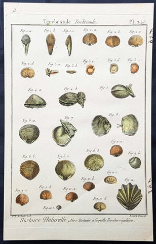
1789 Jean Baptiste Lamarck Antique Concology Print, Terebratula Lamp Shells Plate 243
- Title : Terebratule, Terebratula
- Size: 11in x 8in (280mm x 200mm)
- Condition: (A+) Fine Condition
- Date : 1789
- Ref #: 23874
Description:
This fine original copper-plate engraved antique Conchology or Shell print by Jean Baptiste Lamarck was drawn by Henri Joseph Redoute (1766 - 1852) - younger brother of the famous illustrator P J Redoute - engraved by Robert Benard and published in the 1789 edition of Tableau encyclopédique et méthodique des trois règnes de la nature(1782-1832) by the French publisher Charles Joseph Panckoucke.
General Definitions:
Paper thickness and quality: - Heavy and stable
Paper color : - Off white
Age of map color: - Original
Colors used: - Yellow, Green, pink
General color appearance: - Authentic
Paper size: - 11in x 8in (280mm x 200mm)
Plate size: - 10in x 7in (255mm x 180mm)
Margins: - Min 1/2in (12mm)
Imperfections:
Margins: - None
Plate area: - None
Verso: - None
Background:
Tableau encyclopédique et méthodique des trois regnes de la nature was an illustrated encyclopedia of plants, animals and minerals, notable for including the first scientific descriptions of many species, and for its attractive engravings. It was published in Paris by Charles Joseph Panckoucke, from 1788 on. Although its several volumes can be considered a part of the greater Encyclopédie méthodique, they were titled and issued separately.
Encyclopédie méthodique par ordre des matières (Methodical Encyclopedia by Order of Subject Matter) was published between 1782 and 1832 by the French publisher Charles Joseph Panckoucke, his son-in-law Henri Agasse, and the latter´s wife, Thérèse-Charlotte Agasse. Arranged by disciplines, it was a revised and much expanded version, in roughly 210 to 216 volumes (different sets were bound differently), of the alphabetically arranged Encyclopédie, edited by Denis Diderot and Jean le Rond d Alembert.
Two sets of Diderots Encyclopédie and its supplements were cut up into articles. Each subject category was entrusted to a specialized editor, whose job was to collect all articles relating to his subject and exclude those belonging to others. Great care was to be taken of those articles that were of a doubtful nature, which were not to be omitted. For certain topics, such as air (which belonged equally to chemistry, physics and medicine), the methodical arrangement had the unexpected effect of breaking up a single article into several parts. Each volume was to have its own introduction, a table of contents, and a history of the Encyclopédie. The whole work was to be linked together by a Vocabulaire universel (Vol. 1 – 4), with references to all locations where each word appears.
The prospectus, issued early in 1782, proposed three editions, each with seven volumes of 250 to 300 plates:
84 volumes;
43 volumes, with 3 columns per page; and
53 volumes of about 100 sheets, with 2 columns per page.
The publication was continued by Henri Agasse, Panckouckes son-in-law, from 1794 to 1813, and then by the latters widow, Mme Agasse, until 1832, when it was completed in 102 livraisons or 337 parts, forming roughly 166½ volumes of text (depending on how the parts were bound) as well as 51 illustrated parts containing 6,439 plates. The number of pages totalled 124,210 pages, of which 5,458 pages were plates. To save money, the plates belonging to architecture were not published. Pharmacy (separated from chemistry), minerals, education, Ponts et chausses were not published as had been announced.
Many dictionaries have a classed index of articles. The one in Oeconomie politique is an excellent example, giving the contents of each article, so that any passage can be found easily.
When completed, the encyclopedia suffered at least one great weakness. As the Vocabulaire Universel, the key and index to the entire work, was not published, it was difficult to carry out any research or to find all the articles on any particular subject. The original parts had often been subdivided, and had been so added onto by other dictionaries, supplements, and appendices that an exact account could not be given of the work, which contained 88 alphabets, 83 indexes, 166 introductions, discourses, prefaces, etc. Overall, probably no more an unmanageable body of dictionaries has ever been published, except Jacques Paul Mignes Encyclopédie théologique, Paris, 1844–1875, with 168 volumes, 101 dictionaries, and 119,059 pages.
The Encyclopédie méthodique par ordre des matières occupied a thousand workers in production, and 2,250 contributors.
Lamarck, Jean-Baptiste Pierre Antoine de Monet, Chevalier de1744 – 1829
Lamarck was a pioneer French biologist, who is best known for his idea that acquired characters are inheritable, an idea known as Lamarckism, which is controverted by modern evolutionary theorygenetics.
Lamarck was the youngest of 11 children in a family of the lesser nobility. His family intended him for the priesthood, but, after the death of his father and the expulsion of the Jesuits from France, Lamarck embarked on a military career in 1761. As a soldier garrisoned in the south of France, he became interested in collecting plants. An injury forced him to resign in 1768, but his fascination for botany endured, and it was as a botanist that he first built his scientific reputation.
Lamarck gained attention among the naturalists in Paris at the Jardin et Cabinet du Roi (the kings garden and natural history collection, known informally as the Jardin du Roi) by claiming he could create a system for identifying the plants of France that would be more efficient than any system currently in existence, including that of the great Swedish naturalist Carolus Linnaeus. This project appealed to Georges-Louis Leclerc, comte de Buffon, who was the director of the Jardin du Roi and Linnaeuss greatest rival. Buffon arranged to have Lamarcks work published at government expense, and Lamarck received the proceeds from the sales. The work appeared in three volumes under the title Flore française (1778; French Flora). Lamarck designed the Flore française specifically for the task of plant identification and used dichotomous keys, which are classification tools that allow the user to choose between opposing pairs of morphological characters (see taxonomy: The objectives of biological classification) to achieve this end.
With Buffons support, Lamarck was elected to the Academy of Sciences in 1779. Two years later Buffon named Lamarck correspondent of the Jardin du Roi, evidently to give Lamarck additional status while he escorted Buffons son on a scientific tour of Europe. This provided Lamarck with his first official connection, albeit an unsalaried one, with the Jardin du Roi. Shortly after Buffons death in 1788, his successor, Flahault de la Billarderie, created a salaried position for Lamarck with the title of botanist of the King and keeper of the Kings herbaria.
Between 1783 and 1792 Lamarck published three large botanical volumes for the Encyclopédie méthodique (Methodical Encyclopaedia) , a massive publishing enterprise begun by French publisher Charles-Joseph Panckoucke in the late 18th century. Lamarck also published botanical papers in the Mémoires of the Academy of Sciences. In 1792 he cofounded and coedited a short-lived journal of natural history, the Journal dhistoire naturelle.
Lamarcks career changed dramatically in 1793 when the former Jardin du Roi was transformed into the Muséum National dHistoire Naturelle (National Museum of Natural History). In the changeover, all 12 of the scientists who had been officers of the previous establishment were named as professors and coadministrators of the new institution; however, only two professorships of botany were created. The botanists Antoine-Laurent de Jussieu and René Desfontaines held greater claims to these positions, and Lamarck, in a striking shift of responsibilities, was made professor of the insects, worms, and microscopic animals. Although this change of focus was remarkable, it was not wholly unjustified, as Lamarck was an ardent shell collector. Lamarck then set out to classify this large and poorly analyzed expanse of the animal kingdom. Later he would name this group animals without vertebrae and invent the term invertebrate. By 1802 Lamarck had also introduced the term biology.
This challenge would have been enough to occupy the energies of most naturalists; however, Lamarcks intellectual aspirations ran well beyond that of reforming invertebrate classification. In the 1790s he began promoting the broad theories of physics, chemistry, and meteorology that he had been nurturing for almost two decades. He also began thinking about Earths geologic history and developed notions that he would eventually publish under the title of Hydrogéologie (1802). In his physico-chemical writings, he advanced an old-fashioned, four-element theory that was self-consciously at odds with the revolutionary advances of the emerging pneumatic chemistry of Antoine-Laurent Lavoisier. His colleagues at the Institute of France (the successor to the Academy of Sciences) saw Lamarcks broad theorizing as unscientific system building. Lamarck in turn became increasingly scornful of scientists who preferred small facts to larger, more important ones. He began to characterize himself as a naturalist-philosopher, a person more concerned with the broader processes of nature than the details of the chemists laboratory or naturalists closet.
In 1800 Lamarck first set forth the revolutionary notion of species mutability during a lecture to students in his invertebrate zoology class at the National Museum of Natural History. By 1802 the general outlines of his broad theory of organic transformation had taken shape. He presented the theory successively in his Recherches sur lorganisation des corps vivans (1802; Research on the Organization of Living Bodies), his Philosophie zoologique (1809; Zoological Philosophy), and the introduction to his great multivolume work on invertebrate classification, Histoire naturelle des animaux sans vertèbres (1815–22; Natural History of Invertebrate Animals) . Lamarcks theory of organic development included the idea that the very simplest forms of plant and animal life were the result of spontaneous generation. Life became successively diversified, he claimed, as the result of two very different sorts of causes. He called the first the power of life, or the cause that tends to make organization increasingly complex, whereas he classified the second as the modifying influence of particular circumstances (that is, the effects of the environment). He explained this in his Philosophie zoologique : The state in which we now see all the animals is on the one hand the product of the increasing composition of organization, which tends to form a regular gradation, and on the other hand that of the influences of a multitude of very different circumstances that continually tend to destroy the regularity in the gradation of the increasing composition of organization.
With this theory, Lamarck offered much more than an account of how species change. He also explained what he understood to be the shape of a truly natural system of classification of the animal kingdom. The primary feature of this system was a single scale of increasing complexity composed of all the different classes of animals, starting with the simplest microscopic organisms, or infusorians, and rising up to the mammals. The species, however, could not be arranged in a simple series. Lamarck described them as forming lateral ramifications with respect to the general masses of organization represented by the classes. Lateral ramifications in species resulted when they underwent transformations that reflected the diverse, particular environments to which they had been exposed.
By Lamarcks account, animals, in responding to different environments, adopted new habits. Their new habits caused them to use some organs more and some organs less, which resulted in the strengthening of the former and the weakening of the latter. New characters thus acquired by organisms over the course of their lives were passed on to the next generation (provided, in the case of sexual reproduction, that both of the parents of the offspring had undergone the same changes). Small changes that accumulated over great periods of time produced major differences. Lamarck thus explained how the shapes of giraffes, snakes, storks, swans, and numerous other creatures were a consequence of long-maintained habits. The basic idea of the inheritance of acquired characters had originated with Anaxagoras, Hippocrates, and others, but Lamarck was essentially the first naturalist to argue at length that the long-term operation of this process could result in species change.
Later in the century, after English naturalist Charles Darwin advanced his theory of evolution by natural selection, the idea of the inheritance of acquired characters came to be identified as a distinctively Lamarckian view of organic change (though Darwin himself also believed that acquired characters could be inherited). The idea was not seriously challenged in biology until the German biologist August Weismann did so in the 1880s. In the 20th century, since Lamarcks idea failed to be confirmed experimentally and the evidence commonly cited in its favour was given different interpretations, it became thoroughly discredited. Epigenetics, the study of the chemical modification of genes and gene-associated proteins, has since offered an explanation for how certain traits developed during an organisms lifetime can be passed along to its offspring.
Lamarck made his most important contributions to science as a botanical and zoological systematist, as a founder of invertebrate paleontology, and as an evolutionary theorist. In his own day, his theory of evolution was generally rejected as implausible, unsubstantiated, or heretical. Today he is primarily remembered for his notion of the inheritance of acquired characteristics. Nonetheless, Lamarck stands out in the history of biology as the first writer to set forth—both systematically and in detail—a comprehensive theory of organic evolution that accounted for the successive production of all the different forms of life on Earth.
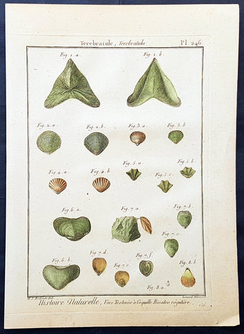
1789 Jean Baptiste Lamarck Antique Concology Print, Terebratula Lamp Shells Plate 246
- Title : Terebratule, Terebratula
- Size: 11in x 8in (280mm x 200mm)
- Condition: (A+) Fine Condition
- Date : 1789
- Ref #: 23877
Description:
This fine original copper-plate engraved antique Conchology or Shell print by Jean Baptiste Lamarck was drawn by Henri Joseph Redoute (1766 - 1852) - younger brother of the famous illustrator P J Redoute - engraved by Robert Benard and published in the 1789 edition of Tableau encyclopédique et méthodique des trois règnes de la nature(1782-1832) by the French publisher Charles Joseph Panckoucke.
General Definitions:
Paper thickness and quality: - Heavy and stable
Paper color : - Off white
Age of map color: - Original
Colors used: - Yellow, Green, pink
General color appearance: - Authentic
Paper size: - 11in x 8in (280mm x 200mm)
Plate size: - 10in x 7in (255mm x 180mm)
Margins: - Min 1/2in (12mm)
Imperfections:
Margins: - None
Plate area: - None
Verso: - None
Background:
Tableau encyclopédique et méthodique des trois regnes de la nature was an illustrated encyclopedia of plants, animals and minerals, notable for including the first scientific descriptions of many species, and for its attractive engravings. It was published in Paris by Charles Joseph Panckoucke, from 1788 on. Although its several volumes can be considered a part of the greater Encyclopédie méthodique, they were titled and issued separately.
Encyclopédie méthodique par ordre des matières (Methodical Encyclopedia by Order of Subject Matter) was published between 1782 and 1832 by the French publisher Charles Joseph Panckoucke, his son-in-law Henri Agasse, and the latter´s wife, Thérèse-Charlotte Agasse. Arranged by disciplines, it was a revised and much expanded version, in roughly 210 to 216 volumes (different sets were bound differently), of the alphabetically arranged Encyclopédie, edited by Denis Diderot and Jean le Rond d Alembert.
Two sets of Diderots Encyclopédie and its supplements were cut up into articles. Each subject category was entrusted to a specialized editor, whose job was to collect all articles relating to his subject and exclude those belonging to others. Great care was to be taken of those articles that were of a doubtful nature, which were not to be omitted. For certain topics, such as air (which belonged equally to chemistry, physics and medicine), the methodical arrangement had the unexpected effect of breaking up a single article into several parts. Each volume was to have its own introduction, a table of contents, and a history of the Encyclopédie. The whole work was to be linked together by a Vocabulaire universel (Vol. 1 – 4), with references to all locations where each word appears.
The prospectus, issued early in 1782, proposed three editions, each with seven volumes of 250 to 300 plates:
84 volumes;
43 volumes, with 3 columns per page; and
53 volumes of about 100 sheets, with 2 columns per page.
The publication was continued by Henri Agasse, Panckouckes son-in-law, from 1794 to 1813, and then by the latters widow, Mme Agasse, until 1832, when it was completed in 102 livraisons or 337 parts, forming roughly 166½ volumes of text (depending on how the parts were bound) as well as 51 illustrated parts containing 6,439 plates. The number of pages totalled 124,210 pages, of which 5,458 pages were plates. To save money, the plates belonging to architecture were not published. Pharmacy (separated from chemistry), minerals, education, Ponts et chausses were not published as had been announced.
Many dictionaries have a classed index of articles. The one in Oeconomie politique is an excellent example, giving the contents of each article, so that any passage can be found easily.
When completed, the encyclopedia suffered at least one great weakness. As the Vocabulaire Universel, the key and index to the entire work, was not published, it was difficult to carry out any research or to find all the articles on any particular subject. The original parts had often been subdivided, and had been so added onto by other dictionaries, supplements, and appendices that an exact account could not be given of the work, which contained 88 alphabets, 83 indexes, 166 introductions, discourses, prefaces, etc. Overall, probably no more an unmanageable body of dictionaries has ever been published, except Jacques Paul Mignes Encyclopédie théologique, Paris, 1844–1875, with 168 volumes, 101 dictionaries, and 119,059 pages.
The Encyclopédie méthodique par ordre des matières occupied a thousand workers in production, and 2,250 contributors.
Lamarck, Jean-Baptiste Pierre Antoine de Monet, Chevalier de1744 – 1829
Lamarck was a pioneer French biologist, who is best known for his idea that acquired characters are inheritable, an idea known as Lamarckism, which is controverted by modern evolutionary theorygenetics.
Lamarck was the youngest of 11 children in a family of the lesser nobility. His family intended him for the priesthood, but, after the death of his father and the expulsion of the Jesuits from France, Lamarck embarked on a military career in 1761. As a soldier garrisoned in the south of France, he became interested in collecting plants. An injury forced him to resign in 1768, but his fascination for botany endured, and it was as a botanist that he first built his scientific reputation.
Lamarck gained attention among the naturalists in Paris at the Jardin et Cabinet du Roi (the kings garden and natural history collection, known informally as the Jardin du Roi) by claiming he could create a system for identifying the plants of France that would be more efficient than any system currently in existence, including that of the great Swedish naturalist Carolus Linnaeus. This project appealed to Georges-Louis Leclerc, comte de Buffon, who was the director of the Jardin du Roi and Linnaeuss greatest rival. Buffon arranged to have Lamarcks work published at government expense, and Lamarck received the proceeds from the sales. The work appeared in three volumes under the title Flore française (1778; French Flora). Lamarck designed the Flore française specifically for the task of plant identification and used dichotomous keys, which are classification tools that allow the user to choose between opposing pairs of morphological characters (see taxonomy: The objectives of biological classification) to achieve this end.
With Buffons support, Lamarck was elected to the Academy of Sciences in 1779. Two years later Buffon named Lamarck correspondent of the Jardin du Roi, evidently to give Lamarck additional status while he escorted Buffons son on a scientific tour of Europe. This provided Lamarck with his first official connection, albeit an unsalaried one, with the Jardin du Roi. Shortly after Buffons death in 1788, his successor, Flahault de la Billarderie, created a salaried position for Lamarck with the title of botanist of the King and keeper of the Kings herbaria.
Between 1783 and 1792 Lamarck published three large botanical volumes for the Encyclopédie méthodique (Methodical Encyclopaedia) , a massive publishing enterprise begun by French publisher Charles-Joseph Panckoucke in the late 18th century. Lamarck also published botanical papers in the Mémoires of the Academy of Sciences. In 1792 he cofounded and coedited a short-lived journal of natural history, the Journal dhistoire naturelle.
Lamarcks career changed dramatically in 1793 when the former Jardin du Roi was transformed into the Muséum National dHistoire Naturelle (National Museum of Natural History). In the changeover, all 12 of the scientists who had been officers of the previous establishment were named as professors and coadministrators of the new institution; however, only two professorships of botany were created. The botanists Antoine-Laurent de Jussieu and René Desfontaines held greater claims to these positions, and Lamarck, in a striking shift of responsibilities, was made professor of the insects, worms, and microscopic animals. Although this change of focus was remarkable, it was not wholly unjustified, as Lamarck was an ardent shell collector. Lamarck then set out to classify this large and poorly analyzed expanse of the animal kingdom. Later he would name this group animals without vertebrae and invent the term invertebrate. By 1802 Lamarck had also introduced the term biology.
This challenge would have been enough to occupy the energies of most naturalists; however, Lamarcks intellectual aspirations ran well beyond that of reforming invertebrate classification. In the 1790s he began promoting the broad theories of physics, chemistry, and meteorology that he had been nurturing for almost two decades. He also began thinking about Earths geologic history and developed notions that he would eventually publish under the title of Hydrogéologie (1802). In his physico-chemical writings, he advanced an old-fashioned, four-element theory that was self-consciously at odds with the revolutionary advances of the emerging pneumatic chemistry of Antoine-Laurent Lavoisier. His colleagues at the Institute of France (the successor to the Academy of Sciences) saw Lamarcks broad theorizing as unscientific system building. Lamarck in turn became increasingly scornful of scientists who preferred small facts to larger, more important ones. He began to characterize himself as a naturalist-philosopher, a person more concerned with the broader processes of nature than the details of the chemists laboratory or naturalists closet.
In 1800 Lamarck first set forth the revolutionary notion of species mutability during a lecture to students in his invertebrate zoology class at the National Museum of Natural History. By 1802 the general outlines of his broad theory of organic transformation had taken shape. He presented the theory successively in his Recherches sur lorganisation des corps vivans (1802; Research on the Organization of Living Bodies), his Philosophie zoologique (1809; Zoological Philosophy), and the introduction to his great multivolume work on invertebrate classification, Histoire naturelle des animaux sans vertèbres (1815–22; Natural History of Invertebrate Animals) . Lamarcks theory of organic development included the idea that the very simplest forms of plant and animal life were the result of spontaneous generation. Life became successively diversified, he claimed, as the result of two very different sorts of causes. He called the first the power of life, or the cause that tends to make organization increasingly complex, whereas he classified the second as the modifying influence of particular circumstances (that is, the effects of the environment). He explained this in his Philosophie zoologique : The state in which we now see all the animals is on the one hand the product of the increasing composition of organization, which tends to form a regular gradation, and on the other hand that of the influences of a multitude of very different circumstances that continually tend to destroy the regularity in the gradation of the increasing composition of organization.
With this theory, Lamarck offered much more than an account of how species change. He also explained what he understood to be the shape of a truly natural system of classification of the animal kingdom. The primary feature of this system was a single scale of increasing complexity composed of all the different classes of animals, starting with the simplest microscopic organisms, or infusorians, and rising up to the mammals. The species, however, could not be arranged in a simple series. Lamarck described them as forming lateral ramifications with respect to the general masses of organization represented by the classes. Lateral ramifications in species resulted when they underwent transformations that reflected the diverse, particular environments to which they had been exposed.
By Lamarcks account, animals, in responding to different environments, adopted new habits. Their new habits caused them to use some organs more and some organs less, which resulted in the strengthening of the former and the weakening of the latter. New characters thus acquired by organisms over the course of their lives were passed on to the next generation (provided, in the case of sexual reproduction, that both of the parents of the offspring had undergone the same changes). Small changes that accumulated over great periods of time produced major differences. Lamarck thus explained how the shapes of giraffes, snakes, storks, swans, and numerous other creatures were a consequence of long-maintained habits. The basic idea of the inheritance of acquired characters had originated with Anaxagoras, Hippocrates, and others, but Lamarck was essentially the first naturalist to argue at length that the long-term operation of this process could result in species change.
Later in the century, after English naturalist Charles Darwin advanced his theory of evolution by natural selection, the idea of the inheritance of acquired characters came to be identified as a distinctively Lamarckian view of organic change (though Darwin himself also believed that acquired characters could be inherited). The idea was not seriously challenged in biology until the German biologist August Weismann did so in the 1880s. In the 20th century, since Lamarcks idea failed to be confirmed experimentally and the evidence commonly cited in its favour was given different interpretations, it became thoroughly discredited. Epigenetics, the study of the chemical modification of genes and gene-associated proteins, has since offered an explanation for how certain traits developed during an organisms lifetime can be passed along to its offspring.
Lamarck made his most important contributions to science as a botanical and zoological systematist, as a founder of invertebrate paleontology, and as an evolutionary theorist. In his own day, his theory of evolution was generally rejected as implausible, unsubstantiated, or heretical. Today he is primarily remembered for his notion of the inheritance of acquired characteristics. Nonetheless, Lamarck stands out in the history of biology as the first writer to set forth—both systematically and in detail—a comprehensive theory of organic evolution that accounted for the successive production of all the different forms of life on Earth.
1789 John Harrison Large Antique Map of Western Europe - Italy to Germania to UK
- Title : Germanie, France, Italie, Espange, Isles Britanniques Dans un Age intermediare de L Ancienne Geographie et de la Moderne Drawn & engraved from D Anvilles Atlas for John Harrison...1789
- Date : 1789
- Size: 19in x 16 1/2in (480mm x 420mm)
- Condition: (A+) Fine Condition
- Ref: 15645
Description:
This large magnificent original copper-plate engraved antique map of Western Europe, after J B D Anville, was engraved in 1789 - dated in the title - and was published for John Harrisons Ancient & Modern Atlas
General Definitions:
Paper thickness and quality: - Heavy and stable
Paper color : - off white
Age of map color: -
Colors used: -
General color appearance: -
Paper size: - 19in x 16 1/2in (480mm x 420mm)
Plate size: - 19in x 14in (480mm x 355mm)
Margins: - Min 1/2in (8mm)
Imperfections:
Margins: - None
Plate area: - Folds as issued
Verso: - None
Background:
The Roman Empire was the post-Roman Republic period of the ancient Roman civilization, with a government headed by emperors and large territorial holdings around the Mediterranean Sea in Europe, Africa and Asia. The city of Rome was the largest city in the world c. 100 BC – c. AD 400, with Constantinople (New Rome) becoming the largest around AD 500, and the Empire\\\'s population grew to an estimated 50 to 90 million inhabitants (roughly 20% of the world\\\'s population at the time) The 500-year-old republic which preceded it had been severely destabilized in a series of civil wars and political conflict, during which Julius Caesar was appointed as perpetual dictator and then assassinated in 44 BC. Civil wars and executions continued, culminating in the victory of Octavian, Caesar\\\'s adopted son, over Mark Antony and Cleopatra at the Battle of Actium in 31 BC and the annexation of Egypt. Octavian\\\'s power was then unassailable and in 27 BC the Roman Senate formally granted him overarching power and the new title Augustus, effectively marking the end of the Roman Republic.
1790 Aaron Arrowsmith Original Antique Map of Spain, Portugal & Balearic Islands
- Title : A Map of Spain & Portugal Drawn from the Best Authorities
- Size: 11 1/2in x 9 1/2in (290mm x 245mm)
- Ref #: 30218
- Date : 1790
- Condition: (A+) Fine Condition
Description:
This fine original copper-plate engraved antique map by Aaron Arrowsmith was published in the 1790 edition of Cruttwells Atlas, to his GazetterJohn Arrowsmithaaron Arrowsmith
General Definitions:
Paper thickness and quality: - Heavy and stable
Paper color : - off white
Age of map color: -
Colors used: -
General color appearance: -
Paper size: - 11 1/2in x 9 1/2in (290mm x 245mm)
Plate size: - 11 1/2in x 9 1/2in (290mm x 245mm)
Margins: - Min 1/2in (12mm)
Imperfections:
Margins: - None
Plate area: - Folds as issued
Verso: - None
1794 John Russell Large Antique Map of South America
- Title : A General Map of South America Drawn fro the Best Surveys by J Russell 1794
- Ref #: 92579
- Size: 18 1/2in x 15in (470mm x 380mm)
- Date : 1794
- Condition: (A) Good Condition
Description:
This large original copper-plate engraved antique map of South America by John Russell was published by H D Symonds in 1794 - dated. (Ref Tooley M&B)
General Definitions:
Paper thickness and quality: - Heavy and stable
Paper color : - off white
Age of map color: -
Colors used: -
General color appearance: -
Paper size: - 18 1/2in x 15in (470mm x 380mm)
Plate size: - 18 1/2in x 15in (470mm x 380mm)
Margins: - Min 1/4in (5mm)
Imperfections:
Margins: - None
Plate area: - Folds as issued, small repair to left fold & right side of image no loss
Verso: - Folds as issued, soiling along folds
1794 Laurie & Whittle Large Very Rare Blueback Map, Sea Chart of The Baltic Sea
- Title : A New Chart of the Baltic or East Sea Drawn Principally from the Maritime Surveys Collected in the Russian Neptune compared with the Observations of the most experienceed Pilots, and Chiefly with the Charts and Draughts of Professor Christian Charles Lous, Nils Mareluis and James Schmid Published by Authority at Copenhagen, Stockholm and St Petersburg...London Published by Laurie & Whittle No 53 Fleet Street as the Act, 12th May, 1794
- Size: 48in x 39in (1.225m x 1.015mm)
- Condition: (A) Very Good Condition
- Date : 1794
- Ref #: 93046
Description:
This is a very large, extremely rare, copper-plate engraved and highly detailed working Blueback Nautical Chart or Maritime map of the Baltic or East Sea was engraved in 1794 and published by the Laurie & Whittle firm, London 1794. The details for this map have been collected from expeditions by the ship the Russian Neptune and Professor Christian Charles Lous, Nils Mareluis and James Schmid.
This rare Blueback map, a method of mounting working sea charts that was begun by Robert Sayer in the late 18th century. These working maps were extremely expensive to buy and labour intensive to put together so only a limited number were published and sold and even fewer have survived. I have found no other examples of this map either commercially or in other map collections.
The map depicts the Baltic Sea from Scandia Sweden & Pomeranian, Germany in the west to the Baltic States of Estonia and Latvia (Eastland, Livonia, Courland) & southern Finland in the east. The map is highly detailed with numerous cities are labelled, including Copenhagen, Stockholm (Christiana), Gdansk (Dazing), Tallinn (Revel), and Riga. Myriad depth soundings are indicated in the Baltic Sea and along the coastlines. Numerous inset maps are included, the first of Copenhagen and the Straits, the second of Stockholm and directions through the various channels and islands, the third inset is Rogerwick Bay, the fourth is the Island of Gottland and the fifth of Riga and Bay. Copious notes about sailing directions, channels, entrance to the Duna River.
General Definitions:
Paper thickness and quality: - Heavy and stable
Paper color : - off white
Age of map color: -
Colors used: -
General color appearance: -
Paper size: - 48in x 39in (1.225m x 1.015mm)
Plate size: - 48in x 39in (1.225m x 1.015mm)
Margins: - Min 1/2in (12mm)
Imperfections:
Margins: - Soiling, chipping to edges not affecting the image
Plate area: - Soiling, light brown spots top of map, light creasing
Verso: - Original Blueback
Background:
Blueback Charts
Blueback nautical charts began appearing in London in the late 18th century. Bluebacks, as they came to be called, were privately published large format nautical charts known for their distinctive blue paper backing. The backing, a commonly available blue manila paper traditionally used by publishers to warp unbound pamphlets, was adopted as a practical way to reinforce the low-quality paper used by private chart publishers in an effort to cut costs. The earliest known Blueback charts include a 1760 chart issued by Mount and Page, and a 1787 chart issued by Robert Sayer. The tradition took off in the early 19th century, when British publishers like John Hamilton Moore, Robert Blachford, James Imray, William Heather, John William Norie, Charles Wilson, David Steel, R. H. Laurie, and John Hobbs, among others, rose to dominate the chart trade. Bluebacks became so popular that the convention was embraced by chartmakerJacques Nicholas Bellins outside of England, including Americans Edmund March Blunt and George Eldridge, as well as Scandinavian, French, German, Russian, and Spanish chartmakers. Blueback charts remained popular until the late 19th century, when government subsidized organizations like the British Admiralty Hydrographic Office and the United States Coast Survey, began issuing their own superior charts on high quality paper that did not require reinforcement.
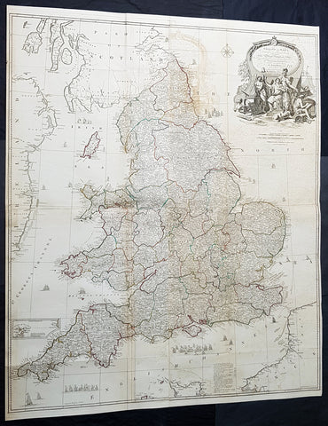
1794 Laurie & Whittle, John Rocque Large Antique Map England & Wales, Sea Battle
Antique Map
- Titles: England and Wales Drawn from the Most Accurate Surveys...by John Rocque...Laurie & whittle...1794
Sizes: 47 1/2in x 39 1/2in (1.21m x 1.050m) - Condition: (A) Very Good Condition
- Date: 1794
- Ref #: 93417-1
Description:
This very large - 4 sheet joined - famous mid 18th century original hand coloured copper-plate engraved antique map of England and Wales, by John Rocque, was published by Laurie & Whittle in the large 1794 - dated - of A General Atlas Describing the Whole Universe.
General Definitions:
Paper thickness and quality: - Heavy and stable
Paper color : - off white
Age of map color: - Original
Colors used: - Yellow, green, blue, pink
General color appearance: - Authentic
Paper size: - 47 1/2in x 39 1/2in (1.21m x 1.050m)
Plate size: - 47 1/2in x 39 1/2in (1.21m x 1.050m)
Margins: - Min 1/2in (10mm)
Imperfections:
Margins: - None
Plate area: - Folds as issued, offsetting, uplift and creasing along some folds
Verso: - Folds as issued
Background:
The map exemplifies the strong graphic presence of Rocques signature topographic detail as well as an elaborate cartouche, here uncolored as issued. Rocque is recognized as an innovator of the British town plan and a master of large-scale cartographic style. The map of England and Wales was conceived during the high point of the map makers career and seems to have been completed as a part of a series of four-sheet British Isles maps.
A wonderfully detailed four-sheet map with title contained within a large decorative allegorical cartouche depicting the artistic, scientific, and commercial accomplishments of the English. Abbeys and castles are duly noted. Small inset of the Isles of Scilly. Tall ships sailing solo and as part of fleets decorate the seas around the islands.
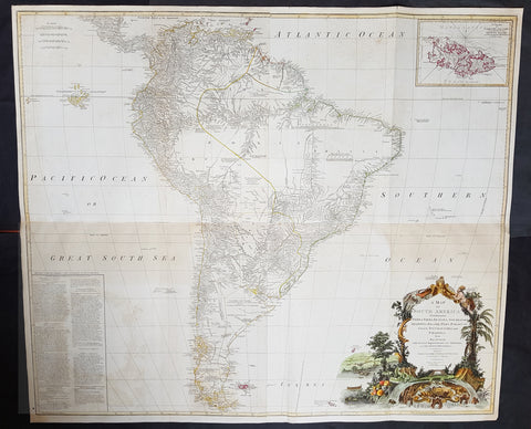
1794 Laurie, Whittle & Kitchin Very Large Original Antique Map of South America - Rare
- Title : A Map of South America containing Tierra-Firma, Guayana, New Granada, Amazonia, Brasil, Peru, Paraguay, Chaco, Tucuman, Chili and Patagonia from M. d'Anville with Several Imporvements and Additions, and The Newest Discoveries.
- Date : 1794
- Size: 48in x 41in (1.22m x 1.10m)
- Ref #: 16257
- Condition: (+) Very Good Condition
Description: This very large, incredibly important, highly detailed beautifully hand coloured original antique map of South America, with contributions from two prominent 18th century cartographers, Thomas Kitchin & Jean-Baptiste Bourguinon D'Anville, was updated and published by Laurie & Whittle in 1794, dated in the title cartouche, for the Elephant Folio General Atlas.
Condition Report:
Paper thickness and quality: - Heavy and stable
Paper colour: - Off white
Age of map colour: - Original & early
Colours used: - Yellow, pink, green
General colour appearance: - Authentic
Paper size: - 48in x 41in (1.22m x 1.10m)
Plate size: - 47in x 40in (1.19m x 1.04m)
Margins: - Min 1/2in (10mm)
Imperfections:
Margins: - Small repair to bottom margin,
Plate area: - Folds as issued, offsetting & browning to bottom half of image
Verso: - Folds as issued, light browning
Background:
This is probably the most important two panel wall map of South America produced in the 18th century. Largely based upon the earlier D'Anville map, this map has been enlarged and expanded by the English publishing house of Laurie and Whittle. Depicts the continent in full with an inset of the Falkland Islands. This map is unique in that it is a serious attempt to compile all of the accurate scientific knowledge of the South American continent available at the time. Offers a smorgasbord of factual, speculative, and historical detail.
This extraordinary and highly decorative map bears up to almost endless perusal and volumes could be composed upon its content. The cartographer attempts to depict both known and unknown parts of the continent with actual data reported by both contemporary and historic travelers. In most cases it is extremely difficult to identify specific sources as much of the data is vague and uncertain.
Our survey of this map beings with the coast which Spanish and Portuguese navigators had mapped with considerable accuracy as early as the late 16th century. This, like most early maps of the area, contrasts a detailed mapping of the coast with a speculative discussion of the interior, particularly Patagonia and the Amazon Basin. Offers a fairly accurate discussion of both the east and west coasts with exceptional detail in the populated Andean regions of Venezuela, Columbia, Ecuador (Labeled Quito), and Peru. Notes Cuzco, Lima, Quito, Valladolid, Arequipa, Trujillo and other important trading centers of the region. In Portuguese controlled Brazil, Rio de Janeiro, San Salvador and San Sebastian are noted.
It is in the interior that this map becomes exceptionally fascinating. In the northern part of the continent D'Anville maps a number of confusions associated with the English adventurer Sir Walter Raleigh's search for El Dorado. Believing El Dorado to lie in the northern part of the Amazon, Raleigh sailed down the Orinoco River just before the onset of the rainy season. Reaching a remote tribal village, Raleigh noted canoes arriving bearing gold, silver, and other treasures. Asked where the gold came from, the natives replied, 'Manoa,' the term for the tribe to which the river traders belonged. Manoa, the natives claimed could be reached following a long river voyage southward to a Great Lake, called Parima. Raleigh and his associates immediately associated Manoa and Lake Parima with the golden kingdom of El Dorado, though they never visited the city or lake. Subsequent maps, including this one, mapped El Dorado and Lake Parima in this location for several hundred years. Both Raleigh and the natives were describing an actual event known to occur annually in the region. Rains would annually swell the Amazon and Orinoco river systems creating a linkage in the Parima flood plain, which, during heavy rains, can resemble a massive lake. The Manoa were a large and populous trading nation active pre-colonial days whose vast empire, based in the Amazon Basin, extended form the Andes to the Orinoco. Curiously, in addition to noting the city of Manoa on Lake Parima, D'Anville also correctly maps the center of the ancient Manoan civilization between the Amazon tributaries Rio Negro and Rio Yapura. Sadly the Manoa and many of the other populous South American indigenous nations noted by the earliest explores to the region vanished, brought low by European epidemics.
A similar error appears far to the south where the Paraguay rivers empties into the Laguna de Xarayes. The Xarayes, a corruption of 'Xaraies' meaning 'Masters of the River,' were an indigenous people occupying what are today parts of Brazil's Matte Grosso and the Pantanal. When Spanish and Portuguese explorers first navigated up the Paraguay River, as always in search of El Dorado, they encountered the vast Pantanal flood plain at the height of its annual inundation. Understandably misinterpreting the flood plain as a gigantic inland sea, they named it after the local inhabitants, the Xaraies. The Laguna de los Xarayes almost immediately began to appear on early maps of the region and, at the same time, almost immediately took on a legendary aspect. Later missionaries and chroniclers, particularly Diaz de Guzman, imagined an island in this lake and curiously identified it as an 'Island of Paradise,'
...an island [of the Paraguay River] more than ten leagues [56 km] long, two or three [11-16 km] wide. A very mild land rich in a thousand types of wild fruit, among them grapes, pears and olives: the Indians created plantations throughout, and throughout the year sow and reap with no difference in winter or summer, ... the Indians of that island are of good will and are friends to the Spaniards; Orejon they call them, and they have their ears pierced with wheels of wood ... which occupy the entire hole. They live in round houses, not as a village, but each apart though keep up with each other in much peace and friendship. They called of old this island Land of Paradise for its abundance and wonderful qualities.
To the north of the 'Island of Paradise' appeared the 'Puerto de los Reyes' which was considered to be a gateway to the Amazon and the Kingdom of El Dorado. D'Anville, to his credit, shows the 'Laguna' and it's island in a much reduced form compared to earlier cartographers and also comments that its existence is 'dubious.'
Far to the south Patagonia is crisscrossed with a number of speculative rivers based upon assumptions from earlier cartographers. D'Anville notes several questionable river passes that suggest a possible navigable communication between the east and west coasts of the continent. Speculation on such a pass fueled the famous South Sea Company, one of the modern world's first stock bubbles, but when no such pass was discovered, the bubble burst.
D'Anville also notes several offshore discoveries including the Galapagos, which he calls the Inchanted Islands, the Isle of Georgia, the Juan Fernandez islands, the Falkands, and some curious land masses just west of the Galapagos labeled 'Isles known to the Spanish.' Curiously, he also notes a 'a Bank of Sounding Discovered by Capt. Hook in 1767.' We know of no navigator by the name of Captain Hook except Peter Pan's fictional nemesis. Most likely this is a misprinted reference to Captain Cook, who was active in the Atlantic at this time. One can only wonder if J.M. Barrie had this map handy when imagining his fictional villain.
Prepared from work by D'Anville and published by Laurie & Whittle in Kitchin's 1794 General Atlas.
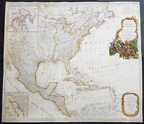
1794 Thomas Pownall & Kitchin Large Post Revolutionary War Map of North America
- Title : A New Map of North America with the West India Islands, divided according to the Preliminary Articles of Peace, Singed at Versailles, 20, jan 1783, wherein are particularly Distinguished The United States, and the Several Provinces, Governments & ca which Compose the British Dominions, Laid down according to the Latest Surveys, and Corrected from the Original Materials of Goverr. Pownall, Membr. of Parlimt....1794
- Size: 47in x 41in (1.20m x 1.04m)
- Condition: (A+) Fine Condition
- Date : 1794
- Ref #: 70824
Description:
A large, extraordinary important, original rare copper-plate engraved map of North America by Governor Thomas Pownell, was engraved & updated by Thomas Kitchin in 1794 - dated in cartouche - and published in A general atlas, describing the whole universe: being a complete collection of the most approved maps extant; corrected with the greatest care, and augmented from the latest discoveries by Laurie and Whittle (active 1794 - 1858) London.
This map was first issued by Emmanuel Bowen and John Gibson in 1755 and went through numerous iterations over the next 40 years. This edition was issued shortly after the end of the American Revolutionary War and the Treaty of Paris in 1783. The map details the newly formed United States of America, the British dominions in Canada, the French territory of Louisiana, the West Indies, and Spanish holdings in Mexico, Florida, and Central America. As one might expect from a map of this size, the detail throughout is extraordinary.
General Definitions:
Paper thickness and quality: - Heavy and stable
Paper color : - off white
Age of map color: - Original
Colors used: - Yellow, green, blue, pink
General color appearance: - Authentic
Paper size: - 47in x 41in (1.20m x 1.04m)
Plate size: - 46in x 40in (1.10m x 990mm)
Margins: - Min 1/2in (12mm)
Imperfections:
Margins: - Soiling in margins
Plate area: - Light toning
Verso: - Age toning.
Background:
This monumental 1794 map of North America by Governor Thomas Pownell was issued shortly after the end of the American Revolutionary War. The United States at this time extended from the Pacific to the Mississippi River and from Georgia to the Great Lakes and Maine. The early state boundaries roughly conform to their original colonial charters. Virginia, North Carolina, and South Carolina are drawn with indefinite western borders, suggesting claims to further unexplored land beyond the Appellation Mountains. By this time most of the boundary issues in the New England states had been resolved, though there remained some vagaries regarding the Massachusetts Connecticut border and, though Vermont is noted textually, its boundaries are not drawn in. At this time there were also some unresolved issues regarding the national borders between Maine and Nova Scotia. In Pennsylvania, the western border displays some surveying confusions that would not be resolved until the early 1800s and the creation of Ohio.
It is beyond the old colonial centers where this map really gets interesting. Pownall offers copious notations on the lands and territories between the Appellation range and this Mississippi River. In some cases he offers commentary on the various indigenous tribes including the Creeks, Chickasaws, Chocktaws, Senekas, Eriez, Delawares, Shawnee, Iroquois, Algonquians, Ottawas and others. The cartographer was clearly concerned with the development of these western regions and offers copious commentary on fit sites for factories, the alliances and temperaments of tribes, and the navigability of various river systems, particularly the Mississippi and Ohio.
The Great Lakes are mapped with considerable accuracy though several apocryphal islands do appear in Lake Superior. The most notable of these are Phelipeaux and Pontchartrain. Phelipeaux Island first appeared in French maps of this region in the 1740s. Later it was mentioned as a boundary marker in the 1783 Treaty of Paris which ended the American Revolutionary War. The nonexistence of these islands was not conclusively proven until about 1820.
To the west of the Mississippi we pass into the largely unknown lands of the Great Plains. In what is roughly modern day Missouri, between Memphis and St. Louis, there is an interesting note suggesting that this region is Full of Mines, with a secondary note suggesting that these mines gave rise to the Mississippi Scheme of 1719. This refers to the Mississippi Company (Compagnie du Mississippi) or, as it was more commonly known the Indies Company (Compagnie d Occident). This organization was part of a French investment plan comparable to the South Seas Company which was developing contemporaneously in England. The Mississippi Companys charter was to trade the riches of the Louisiana Territory. The main proponent of the Mississippi Company, John Law, greatly exaggerated the wealth of Louisiana by describing a rich mining region easily accessible along the Mississippi from New Orleans. This resulted in a stock buying rush which disproportionately overvalued Mississippi Company stock, resulting in one of the world\'s first Bubble Economies.
Further North, along the northern border between the United States and British America (Canada), Rain Lake, the Lake of the Woods, and Lake Winnepeg are noted. This region was a hotbed of exploration throughout the 18th century. French and English concerns in the New World were desperate for access to the Pacific and the rich Asian markets. These markets had long been dominated by the Spanish who had easy access to the Pacific via Mexico and South America. The French and English set their hopes on a Northwest Passage. By the late 18th century the search for a route through the high Arctic had long been abandoned. Instead, explorers and theoretical cartographers believed that a water route might be found among the elaborate network of lakes and rivers that meandered through central Canada. Our map shows evidence of some of this exploration, particularly the travels of the Quebec born Pierre de La Verendrye and his sons around Lake Alimipigon, the Lake of the Woods (Lake Minitti) and Lake Winnipeg (Lake Ouinipigon).
As we progress even further west, passing out of Louisiana into the Spanish holdings we begin to see significant mapping - both conjectural and factual. The Spanish had long been passively active in the exploration of New Mexico. Though no concerted effort had been put forth to map the region, various missionaries and territorial governors had, over roughly 200 years of occupation added considerable data, both fact and fiction to the cartographic picture. Numerous American Indian groups are noted including the Pimas, the Apaches ,the Navajo and others. Along the Rio del Norte or upper Rio Grande there are a quantity mission stations including the regional capital of Santa Fe.
Just to the west of these missions we begin to enter more mythical territory and both Cibola and Teguayo are noted. Cibola and Teguayo are both associated with the legendary Seven Cities of Gold. It was believed that in 1150 when Merida, Spain, was conquered by Moors ,the city\'s seven bishops fled to unknown lands taking with them much of the city\'s riches. Each Bishop supposedly founded a great city in a far away place. With the discovery of the New World and the fabulous riches plundered by Cortez and Pizarro, the Seven Cities became associated with New World legends. Coronado, hearing tales of the paradise-like mythical Aztec homeland of Azatlan somewhere to the north of Mexico , determined to hunt for these cities in what is today the American southwest. In time indigenous legends of rich and prosperous lands became attached to the seven cities. Two of these appear on our map - Cibola and Teguayo.
The gulf of Mexico, the West Indies, and the Caribbean are charted with considerable and typical accuracy. Notes numerous offshore shoals, reefs, and other dangers - especially around the Bahamas. Also describes several important shipping routes, particularly the former routes of Spanish galleons from Veracruz to Havana, the route from Cartagena to Havana, and the route from Cartagena to Europe.
There are also two particularly interesting insets. The first, in the upper left quadrant, depicts the Canadian arctic, particularly the Hudson and Baffin Bays. Notes all of the most recent discoveries in this region and offers interesting notes such as If there is Northwest Passage it appears to be through one of these inlets. In the northwestern quadrant of this inset, the supposed discoveries of Admiral de Fonte are included, despite a notation that they are Imaginary.
The second inset of interest in located in the lower left quadrant. This smaller maps depicts the northern parts of the Gulf of California and the Colorado River Delta based upon the explorations of the Jesuit Father Eusebius Francis Kino. The actual cartography of this region has been vague since the mid 17th century when it was postulated that California must be an Island. It was not until Kino\'s historic expedition, recorded here, that Baja California was conclusively proven to be a peninsula.
A magnificent title cartouche appears in the upper right quadrant. The cartouche, which angles around Bermuda, depicts two stylized American Indians surrounded by the presumed flora and fauna of the new world. These include a small monkey, a parrot, and a jaguar. Above the cartouche is a textual quotation from Article III of the Treaty of Paris, affirming the rights of the United States to access the rich cod fields of Newfoundland\'s Grand Banks.
The Treaty of Paris, signed in Paris by representatives of King George III of Great Britain and representatives of the United States of America on September 3, 1783, ended the American Revolutionary War. The treaty set the boundaries between the British Empire in North America and the United States, on lines exceedingly generous to the latter. Details included fishing rights and restoration of property and prisoners of war.
This treaty and the separate peace treaties between Great Britain and the nations that supported the American cause—France, Spain, and the Dutch Republic—are known collectively as the Peace of Paris. Only Article 1 of the treaty, which acknowledges the United States existence as free, sovereign, and independent states, remains in force.
Thomas Pownall 1722 - 1805 was a British scholar, statesman and soldier active in the colonial administration of North America just prior to the American Revolutionary War. Pownell was born in England and educated at Trinity College, Cambridge. After graduation he was employed by his brother, John Pownall, at the office of the Lords Commissioners of Trade and Plantations, which oversaw British economic interests in its North American colonies. In 1753, Pownall was appointed secretary to the governor of New York, Sir Danvers Osborne. Osborne, himself having be only recently appointed to the position, committed suicide shortly after taking office. Despite this setback, Pownall remained in America and devoted himself to studying and researching the colonies. In the process Pownall became close lifelong friends with Benjamin Franklin and other New World luminaries. He also published several notable works on the colonial administration of North America. In 1757 Pownall was appointed Governor of the Massachusetts Bay colony. In this position he frequently found himself at odds with the restrictive policies of the Board of Trade. It was not long before he was pushed out of office and, declining the governorship of Jamaica, reassigned to South Carolina. Despite nominally holding the governorship of South Carolina, Pownall never visited the colony. Instead he returned to England where he eventually became a member of Parliament. In Parliament, he advocated for reduced taxes towards the colonies - had he been heeded, the American Revolution may have never happened. Pownall retired from public life around 1780, but continued to pursue his scholarly interests. Pownalls research contributed significantly to several important maps and scholarly work on North America.
Laurie and Whittle 1794 - 1858 based in London, were map and atlas publishers active in the late 18th and early 19th century. Generally considered to be the successors to the Robert Sayer firm, Laurie and Whittle was founded by Robert Laurie (c. 1755 - 1836) and James Whittle (1757-1818). Robert Laurie was a skilled mezzotint engraver and is known to have worked with Robert Sayer on numerous projects. James Whittle was a well-known London socialite and print seller whose Fleet Street shop was a popular haunt for intellectual luminaries. The partnership began taking over the general management of Sayers firm around 1787; however, they did not alter the Sayer imprint until after Sayers death in 1794. Apparently Laurie did most of the work in managing the firm and hence his name appeared first in the Laurie and Whittle imprint. Together Laurie and Whittle published numerous maps and atlases, often bringing in other important cartographers of the day, including Kitchin, Faden, Jefferys and others to update and modify their existing Sayer plates. Robert Laurie retired in 1812, leaving the day to day management of the firm to his son, Richard Holmes Laurie (1777 - 1858). Under R. H. Laurie and James Whittle, the firm renamed itself Whittle and Laurie. Whittle diedin 1818, and thereafter the firm continued under the imprint of R. H. Laurie. After Lauries death the publishing house and its printing stock came under control of Alexander George Findlay, who had long been associated with Laurie and Whittle. Since, Laurie and Whittle has passed through numerous permeations, with part of the firm still extant as an English publisher of maritime or nautical charts, Imray, Laurie, Norie and Wilson Ltd. The firm remains the oldest surviving chart publisher in Europe.
1794 William Hall Antique Print Newly Invented Farm machinery Thrashing Machines
- Title : New Invented Implements used in Husbandry....Royal Encylopedia....C Cooke....1794
- Date : 1794
- Condition: (A+) Fine Condition
- Ref: 91127
- Size: 15in x 9in (380mm x 230mm)
Description:
This large original copper-plate engraved antique print by William Henry Hall was published in the 1798 edition of The new royal encyclopedia; or, complete modern universal dictionary of arts and sciences on a new and improved plan.... Charles Cooke, London.
General Definitions:
Paper thickness and quality: - Heavy and stable
Paper color : - off white
Age of map color: -
Colors used: -
General color appearance: -
Paper size: - 15in x 9in (380mm x 230mm)
Plate size: - 14 1/2in x 8 1/2in (370mm x 215mm)
Margins: - Min 1/2in (12mm)
Imperfections:
Margins: - None
Plate area: - None
Verso: - None
Hall, William Henry
Hall was responsible for a significant publication in the middle of the 18th century The new royal encyclopedia; or, complete modern universal dictionary of arts and sciences on a new and improved plan . containing a digest and display of the whole theory and practice of the liberal and mechanical arts comprising a general repository of ancient and modern literature . including all the material information that is contained in Chamber s Cyclopedia, the Encyclopædia Britannica, and the French Encyclopædie . first published in 1788 going into many re-issues over the next 50 years.
The three volume set contained 153 copper-plate prints and maps, including some folding maps. Contained many brief encyclopedic entries in alphabetical orders plus longer, mainly illustrated, sections (systems or treatises) on a variety of subjects: Aerology; Aerostation (hot air balloons); Agriculture; Algebra; Amphibiology; Anatomy; Annuities; Architecture; Arithmetic; Astronomy (includes plates of telescopes); Book-Keeping; Botany; Brewing; Chronology; Chymistry; Comparative Anatomy; Concology; Dialling; Distillation; Drawing; Earth; Earthquakes; Electricity; Entomology; Farriery; Fencing; Fluxions; Fortification; Gardening; Geography (this section includes six folding maps); Geometry; Globes; Grammar; Heraldry; Hydrostatics and Hydraulics (one plate included a diving bell); Icthyology; Knighthood; Logic; Mammalia (included a plate showing whales); Mechanics; Medicine; Mensuration and Gauging; Miscroscopic Apparatus (microscopes); Midwifery; Military Affairs; Music; Natural History; Naval Affairs; Navigation (includes a folding map showing Cooks voyages); Optics; Oratory; Ornithology; Peerage; Perspective; Pneumatics; Projectiles; Steam Engines; Surgery; Surveying; Trigonometry; Vermeology; Volcanos; and War. Hard to find a complete set, as many have been broken up for their handsome copper plate engravings and maps.
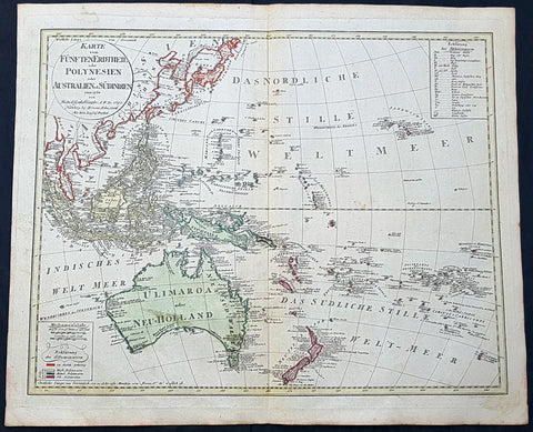
1795 (1806) Canzler Large Antique Map Australia, Ulimaroa, New Zealand SE Asia
Antique Map
- Title : Karte vom Funften Erdtheil oder Polynaesien-Inselwelt oder Australien oder Sudindien (Map of the fifth earth or Polynesia or Australia or South India.)
- Size: 24 1/4in x 20 1/2in (615mm x 520mm)
- Condition: (A+) Fine Condition
- Date : 1795 (1806)
- Ref #: 93121
Description:
This large original hand coloured copper-plate engraved, antique map of Australia, New Zealand and SE Asia by Friedrich Gottlieb Canzler in 1795, was published by the Homann Firm in 1806.
A distinct map with the short lived alternative name of Ulimaroa for New Holland, given by Canzler after Daniel Djurberg mistakenly interperated the New Zealand Maori word, Olhemaroa, from Cooks diary, for Australia. The real interpretation being Long Hand, the Maori name for New Caledonia.
There are two records in Cooks diary relating to Ulimaroa....
5th Feb 1769....This place we concluded to be the land difcovered by Tafman, which he called Cape Maria Van Diemen, and finding thefe people fo intelligent, we inquired farther, if they knew of any country befides their own: they anfwered, that they never had vifisted any other, but that their anceftors had told them, that to the N.W. by N., or N.N.W. there was a country of great extent, called Ulimaroa, which people had failed in a very large canoe
5th Feb 1770.....When we were under fail, our old man aTopaa came on board to take his leave of us, and as we were ftill defirous of making farther enquiries whether any memory of Tafman had been preferved among thefe people, Tupia was directed to afk him whether he had ever heard that fuch a veffel as ours had vifited the country. To this he replied in the negative, but faid, that his anceftors had told him there had once come to this place a fmall veffel, from a distant country, called Ulimaroa, in which were four men, who, upon coming on fhore, were all killed: upon being afked where this diftant land lay, he pointed to the northward. Of Ulimaroa we had heard fome-thing before, from people about the Bay of Iflands, who faid that their anceftors had vifisted it; and Tupia had alfo talked to us of Ulimaroa.
General Definitions:
Paper thickness and quality: - Heavy and stable
Paper color : - off white
Age of map color: - Original
Colors used: - Yellow, green, blue, pink
General color appearance: - Authentic
Paper size: - 24 1/4in x 20 1/2in (615mm x 520mm)
Plate size: - 24 1/2in x 19in (620mm x 490mm)
Margins: - Min 1in (25mm)
Imperfections:
Margins: - Light age toning
Plate area: - None
Verso: - None
Background:
Ulimaroa was a name given to Australia by the Swedish geographer and cartographer Daniel Djurberg in 1776. Djurberg adapted the name from Olhemaroa, a Māori word found in Hawkesworths edition of Captain James Cook and Sir Joseph Banks journals which is thought to have been a misunderstood translation — the Māori were actually referring to Grand Terre, the largest island of New Caledonia. Djurberg believed the name meant something like big red land, whereas modern linguists believe it meant long hand — echoing the geography of Grand Terre. The spurious name continued to be reproduced on certain European maps, particularly some Austrian, Czech, German and Swedish maps, until around 1820, including in Carl Almqvists 1817 novel Parjumouf Saga ifrån Nya Holland (Stockholm, 1817).
Canzler, Friedrich Gottlieb 1764-1811
Friedrich Gottlieb Canzler was born in Wolgast, Sweden in 1764. He graduated from the school in his hometown and from 1781 to 1783 the Sundische Gymnasium in Stralsund . He then studied history , geography , statistics and the Swedish language at the University of Göttingen . After completing his studies, he also received his doctorate and habilitation in Göttingen, and worked as a Privatdozent for history, geography, statistics and cameralistics .
In addition, he published in Göttingen from July 1789 to February 1791 the General Political State Newspaper for all Stands, for which he ran his own university and newspaper printing plant, and founded in 1797 an Academic Reading Museum. Two years later he was appointed Professor of Statistics, State Economics, Cameral, Financial and Commerz Sciences at the University of Greifswald where he worked until his death in 1811.
Selected Works:
- New magazine for recent history, Earth and ethnology. Leipzig 1790
- English language teaching for Germans. Göttingen 1796
- General Litteraturarchiv for history, geography and statistics. Leipzig 1792-1798 (as publisher)
- Map of the fifth earth or Polynesia or Australia or South India. Nuremberg 1795, 1805 and 1806 (as well as 1813 with corrections by Christian Gottlieb Reichard)
- Front India or Hindostan or East India on the side of the Ganges. Nuremberg 1804
1795 William Hall Antique Print The Human Nervous System Thorax Abdomen & Pelvis
- Title : Representation of the Nerves as they pass off to the Thorax Abdomen & Pelvis....Royal Encylopedia....C Cooke...1795
- Date : 1795
- Condition: (A) Very Good Condition
- Ref: 01-7324
- Size: 15in x 9in (380mm x 230mm)
Description:
This large original copper-plate engraved antique print by William Henry Hall was engraved in 1795 - dated - and was published in the 1798 edition of The new royal encyclopedia; or, complete modern universal dictionary of arts and sciences on a new and improved plan.... Charles Cooke, London.
General Definitions:
Paper thickness and quality: - Heavy and stable
Paper color : - off white
Age of map color: -
Colors used: -
General color appearance: -
Paper size: - 15in x 9in (380mm x 230mm)
Plate size: - 13 1/2in x 8 1/2in (345mm x 215mm)
Margins: - Min 1/2in (12mm)
Imperfections:
Margins: - None
Plate area: - None
Verso: - None
Hall, William Henry
Hall was responsible for a significant publication in the middle of the 18th century The new royal encyclopedia; or, complete modern universal dictionary of arts and sciences on a new and improved plan . containing a digest and display of the whole theory and practice of the liberal and mechanical arts comprising a general repository of ancient and modern literature . including all the material information that is contained in Chamber s Cyclopedia, the Encyclopædia Britannica, and the French Encyclopædie . first published in 1788 going into many re-issues over the next 50 years.
The three volume set contained 153 copper-plate prints and maps, including some folding maps. Contained many brief encyclopedic entries in alphabetical orders plus longer, mainly illustrated, sections (systems or treatises) on a variety of subjects: Aerology; Aerostation (hot air balloons); Agriculture; Algebra; Amphibiology; Anatomy; Annuities; Architecture; Arithmetic; Astronomy (includes plates of telescopes); Book-Keeping; Botany; Brewing; Chronology; Chymistry; Comparative Anatomy; Concology; Dialling; Distillation; Drawing; Earth; Earthquakes; Electricity; Entomology; Farriery; Fencing; Fluxions; Fortification; Gardening; Geography (this section includes six folding maps); Geometry; Globes; Grammar; Heraldry; Hydrostatics and Hydraulics (one plate included a diving bell); Icthyology; Knighthood; Logic; Mammalia (included a plate showing whales); Mechanics; Medicine; Mensuration and Gauging; Miscroscopic Apparatus (microscopes); Midwifery; Military Affairs; Music; Natural History; Naval Affairs; Navigation (includes a folding map showing Cooks voyages); Optics; Oratory; Ornithology; Peerage; Perspective; Pneumatics; Projectiles; Steam Engines; Surgery; Surveying; Trigonometry; Vermeology; Volcanos; and War. Hard to find a complete set, as many have been broken up for their handsome copper plate engravings and maps.
1795 William Henry Hall Large Antique Print of Male & Female Reproductive System
Antique Map
- Title : Male Organs of Generation; Female Organs of Generation...Halls Encyclopedia...C. Cooke 1795
- Condition: (A) Very Good Condition
- Ref: 01-7304
- Size: 15in x 9in (380mm x 230mm)
- Date: 1795
Description:
This large original copper-plate engraved antique print was engraved in 1795 - dated - and was published by William Henry Hall in the 1798 edition of The new royal encyclopedia; or, complete modern universal dictionary of arts and sciences on a new and improved plan.... printed by Charles Cooke, London.
General Definitions:
Paper thickness and quality: - Heavy and stable
Paper color : - off white
Age of map color: -
Colors used: -
General color appearance: -
Paper size: - 15in x 9in (380mm x 230mm)
Plate size: - 15in x 9in (380mm x 230mm)
Margins: - Min 1/2in (10mm)
Imperfections:
Margins: - Age toning
Plate area: - Light age toning
Verso: - Age toning
Background:
The reproductive system or genital system is a system of sex organs within an organism which work together for the purpose of sexual reproduction. Many non-living substances such as fluids, hormones, and pheromones are also important accessories to the reproductive system. Unlike most organ systems, the sexes of differentiated species often have significant differences. These differences allow for a combination of genetic material between two individuals, which allows for the possibility of greater genetic fitness of the offspring.
Hall, William Henry
Hall was responsible for a significant publication in the middle of the 18th century The new royal encyclopedia; or, complete modern universal dictionary of arts and sciences on a new and improved plan . containing a digest and display of the whole theory and practice of the liberal and mechanical arts comprising a general repository of ancient and modern literature . including all the material information that is contained in Chamber s Cyclopedia, the Encyclopædia Britannica, and the French Encyclopædie . first published in 1788 going into many re-issues over the next 50 years.
The three volume set contained 153 copper-plate prints and maps, including some folding maps. Contained many brief encyclopedic entries in alphabetical orders plus longer, mainly illustrated, sections (systems or treatises) on a variety of subjects: Aerology; Aerostation (hot air balloons); Agriculture; Algebra; Amphibiology; Anatomy; Annuities; Architecture; Arithmetic; Astronomy (includes plates of telescopes); Book-Keeping; Botany; Brewing; Chronology; Chymistry; Comparative Anatomy; Concology; Dialling; Distillation; Drawing; Earth; Earthquakes; Electricity; Entomology; Farriery; Fencing; Fluxions; Fortification; Gardening; Geography (this section includes six folding maps); Geometry; Globes; Grammar; Heraldry; Hydrostatics and Hydraulics (one plate included a diving bell); Icthyology; Knighthood; Logic; Mammalia (included a plate showing whales); Mechanics; Medicine; Mensuration and Gauging; Miscroscopic Apparatus (microscopes); Midwifery; Military Affairs; Music; Natural History; Naval Affairs; Navigation (includes a folding map showing Cooks voyages); Optics; Oratory; Ornithology; Peerage; Perspective; Pneumatics; Projectiles; Steam Engines; Surgery; Surveying; Trigonometry; Vermeology; Volcanos; and War. Hard to find a complete set, as many have been broken up for their handsome copper plate engravings and maps.
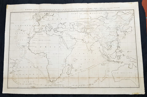
1796 Barrow Large Antique Map Sea Chart Lord Macartneys Voyage England to China
Antique Map
- Title : A General Chart on Mercators Projection, To Shew The Track of the Lion and Hindostan from England to the Gulph of Pekin in China, and of their return to England, with the daily statement of the Barometer and Thermometer as observed at noon; containing also the limits of the Chinese Empire, as extended by the Conquests of the present Emperor Tchien-Lung
- Ref #: 93409
- Size: 39 1/2in x 26 1/2in (1.00m x 675mm)
- Date : 1796
- Condition: (A) Very Good Condition
Description:
This very large original copper plate engraved antique map, a chart, by John Barrow, in 1796, was issued in the atlas volume of the official account by George Staunton of Lord George Macartneys travels to China, An Authentic Account of an Embassy from the King of Great Britain to the Emporer of China in 1796..
General Definitions:
Paper thickness and quality: - Light and stable
Paper color : - off white
Age of map color: - Original
Colors used: - Yellow, green, blue, pink
General color appearance: - Authentic
Paper size: - 39 1/2in x 26 1/2in (1.00m x 675mm)
Plate size: - 38in x 24 1/2in (960mm x 620mm)
Margins: - Min 1in (25mm)
Imperfections:
Margins: - Folds as issued
Plate area: - Light soiling along bottom folds, as issued
Verso: - Bottom folds re-enforced along bottom folds
Background:
Lord George Macartney was Britains first envoy to China, tasked with convincing Emperor Qianlong to ease restrictions on trade between Great Britain and China and to allow the 1st British embassy to be established. He was not successful in either of these endeavours.
The map shows the track of two ships, the Lion and Hindostan, on their routes from England to China and back. Each days progress was recorded along the route, with several notations to the dangers along the way.
The map was drawn by John Barrow, who was the private secretary to Lord Macartney.
The chart extends from Turon Bay (present day Da Nang, Vietnam) up the coast of eastern Asia to the Gulph of Leao-Tung in the Whang-Hai or Yellow Sea (the Gulf of Bohai in the Yellow Sea). The track of the Lion, Hindostan, and Tenders is traced, with soundings, sea bottom classifications, temperature and barometric readings, dates, and assorted notes, such as Lion and Tenders parted from the Hindostan in the fog. China is divided into several provinces, and many towns and cities are named, including Beijing (here referred to as Pekin). A portion of the Great Wall of China is depicted and rivers are accompanied by notes on their courses and sources. Taiwan is depicted with incomplete borders to the east of the ships\' track. Engraved by B. Baker and published by George Nicol.
Barrow, Sir John 1764 - 1848
Barrow, 1st Baronet, was an English civil servant, geographer, linguist and writer. Barrows legacy has been met with mixed analysis. Some historians regard Barrow as an instrument of imperialism who portrayed Africa as a resource rich land devoid of any human or civilized elements. Nonetheless, other historians consider Barrow to have promoted humanitarianism and rights for South Africans.
Barrow was born the only child of Roger Barrow, a tanner in the village of Dragley Beck, in the parish of Ulverston, Lancashire. He was schooled at Town Bank grammar school, Ulverston, but left at age 13 to found a Sunday school for the poor.
Barrow was employed as superintending clerk of an iron foundry at Liverpool. At only 16, he went on a whaling expedition to Greenland. By his twenties, he was teaching mathematics, in which he had always excelled, at a private school in Greenwich.
Barrow taught mathematics to the son of Sir George Leonard Staunton; through Stauntons interest, he was attached on the first British embassy to China from 1792 to 1794 as comptroller of the household to Lord Macartney. He soon acquired a good knowledge of the Chinese language, on which he subsequently contributed articles to the Quarterly Review; and the account of the embassy published by Sir George Staunton records many of Barrows valuable contributions to literature and science connected with China.
Barrow ceased to be officially connected with Chinese affairs after the return of the embassy in 1794, but he always took much interest in them, and on critical occasions was frequently consulted by the British government.
Some historians attribute the stagnation thesis to Barrow; that China was an extremely civilized nation that was in a process of decay by the time of European contact.
In 1797, Barrow accompanied Lord Macartney as private secretary in his important and delicate mission to settle the government of the newly acquired colony of the Cape of Good Hope. Barrow was entrusted with the task of reconciling the Boer settlers and the native Black population and of reporting on the country in the interior. In the course of the trip, he visited all parts of the colony; when he returned, he was appointed auditor-general of public accounts. He then decided to settle in South Africa, married, and bought a house in 1800 in Cape Town. However, the surrender of the colony at the peace of Amiens (1802) upset this plan.
During his travels through South Africa, Barrow compiled copious notes and sketches of the countryside that he was traversing. The outcome of his journeys was a map which, despite its numerous errors, was the first published modern map of the southern parts of the Cape Colony. Barrows descriptions of South Africa greatly influenced Europeans understanding of South Africa and its peoples. William John Burchell (1781–1863) was particularly scathing: As to the miserable thing called a map, which has been prefixed to Mr. Barrows quarto, I perfectly agree with Professor Lichtenstein, that it is so defective that it can seldom be found of any use.
Barrow returned to Britain in 1804 and was appointed Second Secretary to the Admiralty by Viscount Melville, a post which he held for forty years – apart from a short period in 1806–1807 when there was a Whig government in power. Lord Grey took office as Prime Minister in 1830, and Barrow was especially requested to remain in his post, starting the principle that senior civil servants stay in office on change of government and serve in a non-partisan manner. Indeed, it was during his occupancy of the post that it was renamed Permanent Secretary. Barrow enjoyed the esteem and confidence of all the eleven chief lords who successively presided at the Admiralty board during that period, and more especially of King William IV while lord high admiral, who honoured him with tokens of his personal regard.
In his position at the Admiralty, Barrow was a great promoter of Arctic voyages of discovery, including those of John Ross, William Edward Parry, James Clark Ross and John Franklin. The Barrow Strait in the Canadian Arctic as well as Point Barrow and the city of Barrow in Alaska are named after him. He is reputed to have been the initial proposer of Saint Helena as the new place of exile for Napoleon Bonaparte following the Battle of Waterloo in 1815. Barrow was a fellow of the Royal Society and received the degree of LL.D from the University of Edinburgh in 1821. A baronetcy was conferred on him by Sir Robert Peel in 1835. He was also a member of the Raleigh Club, a forerunner of the Royal Geographical Society.
Barrow retired from public life in 1845 and devoted himself to writing a history of the modern Arctic voyages of discovery (1846), as well as his autobiography, published in 1847. He died suddenly on 23 November 1848. The Sir John Barrow monument was built in his honour on Hoad Hill overlooking his home town of Ulverston, though locally it is more commonly called Hoad Monument. Mount Barrow and Barrow Island in Australia are believed to have been named for him.
1796 Von Reilly Very Large Antique Map Norway, Sweden & Lapland - Scandinavia
Antique Map
- Title : Karte von dem Konigreiche Norwegen...Franz Von Reilly...Wein 1796
- Ref #: 40441
- Size: 31 1/2in x 26in (800mm x 600mm)
- Date : 1796
- Condition: (A+) Fine Condition
Description:
This large copper-plate engraved original antique map of Norway with parts of Sweden - with an inset map of Lapland - was engraved in 1796 - the date is engraved at the foot of the map - and was published by Franz Joseph Von Reilly in his 1794-96 Grosser Deutscher Atlas.
Von Reilly was a Viennese art dealer who in his early twenties turned to map publishing, and between 1789 and 1806 produced a total of 830 maps. His Schauplatz...der Welt (World Atlas) in fac t covered only maps of Europe, whilst theGrosser Deutscher Atlas also included maps of other continents and was therefore the first World Atlas produced by an Austrian. (Ref: M&B; Tooley)
General Description:
Paper thickness and quality: - Heavy & stable
Paper color: - White
Age of map color: - Original
Colors used: - Yellow, pink, green
General color appearance: - Authentic
Paper size: - 31 1/2in x 26in (800mm x 600mm)
Plate size: - 30in x 24in (760mm x 610mm)
Margins: - Min 1in (25mm)
Imperfections:
Margins: - None
Plate area: - None
Verso: - None
1797 John Cary Original Antique Map of Europe
- Title : Europe from the Best Authorities
- Size: 12 1/2in x 10in (315mm x 255mm)
- Ref #: 92766
- Date : 1797
- Condition: (A+) Fine Condition
General Definitions:
Paper thickness and quality: - Heavy and stable
Paper color : - off white
Age of map color: -
Colors used: -
General color appearance: -
Paper size: - 12 1/2in x 10in (315mm x 255mm)
Plate size: - 12 1/2in x 10in (315mm x 255mm)
Margins: - Min 1/2in (12mm)
Imperfections:
Margins: - None
Plate area: - Folds as issued
Verso: - None
1797 John Cary Original Antique Map of Spain, Portugal & The Balearic Islands
- Title : A Map of Spain & Portugal Drawn from the Best Authorities
- Size: 12in x 10in (305mm x 255mm)
- Ref #: 92755
- Date : 1797
- Condition: (A+) Fine Condition
Description:
This fine original copper-plate engraved antique map by John Cary was published in the 1797 edition of Moores Geography
General Definitions:
Paper thickness and quality: - Heavy and stable
Paper color : - off white
Age of map color: -
Colors used: -
General color appearance: -
Paper size: - 12in x 10in (305mm x 255mm)
Plate size: - 12in x 10in (305mm x 255mm)
Margins: - Min 1/2in (12mm)
Imperfections:
Margins: - None
Plate area: - Folds as issued
Verso: - None
1797 John Russell Old, Antique Map of South America
- Title : South America from the best Authorities
- Ref : 70198
- Size: 10in x 8in (255mm x 205mm)
- Date : 1797
- Condition: (A+) Fine Condition
Description:
This fine hand coloured original antique map of South America was engraved in 1797 by John Russell and published by Charles Dilly & John Robinson. London.(Ref: M&B; Tooley)
General Description:
Paper thickness and quality: - Light & stable
Paper color: - White
Age of map color: - Early
Colors used: - Red, green, orange
General color appearance: - Authentic
Paper size: - 10in x 8in (260mm x 205mm)
Plate size: - 10in x 8in (260mm x 205mm)
Margins: - Min 1/2in (12mm)
Imperfections:
Margins: - None
Plate area: - Folds as issued
Verso: - None
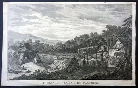
1797 Laperouse Antique Print View De Kastri Bay, Ulchsky Khabarovsk Kai, Russia
- Title : Tombeaux de la Baie de Castries
- Ref : 21436
- Size: 17in x 11in (435mm x 280mm)
- Date : 1797
- Condition: (A+) Fine Condition
Description:
This large original copper plate engraved antique print, a view of the very early settlement at De Kastri Bay, in the Ulchsky District of Khabarovsk Kai, Eastern Russia - opposite the Sakhalin Islands - by Jean-François de Galaup, Comte de la Pérouse was published in the 1st edition of the Atlas du voyage de La Perouse, Paris 1797.
General Definitions:
Paper thickness and quality: - Heavy and stable
Paper color : - off white
Age of map color: -
Colors used: -
General color appearance: -
Paper size: - 17in x 11in (435mm x 280mm)
Plate size: - 17in x 11in (435mm x 280mm)
Margins: - Min 1/2in (12mm)
Imperfections:
Margins: - Small repairs to margins, no loss
Plate area: - None
Verso: - None
Background:
De-Kastri was named for the former name of the bay on which it stands. The bay was discovered by La Pérouse on July 25, 1787 and named after the sponsor of the expedition—the then Secretary of State of the French Navy, the Marquis de Castries. The bay is a convenient natural refuge for vessels, giving it strategic importance from a military viewpoint.
The settlement was officially founded in 1853, although the land where it was situated would not officially be Russian territory until the signing of the Treaty of Aigun five years later.
In 1854, the difficult task of defending Petropavlovsk-Kamchatsky when it came under siege from the British and French forces during the Crimean War brought to attention the difficulties of supply and defense of the Kamchatka Peninsula, where a large section of the Russian Pacific Fleet was based. It was decided to move the port from Kamchatka without waiting for another attack. In the spring of 1855, the Russian navy\'s weapons and sailors under the leadership of Rear Admiral Vasily Zavoyko headed toward the mouth of the Amur River; however, the river mouth was still covered with ice. It was decided to wait for the break-up, hiding in the Bay of de Castries from the superior forces of French and English. Russian ships were discovered there, but managed to escape to the Amur River in the Strait of Tartary before the arrival of enemy reinforcements. The British and French did not know that Sakhalin was an island, and spent the later years of the war waiting in vain for the Russian fleet at its southern coast.
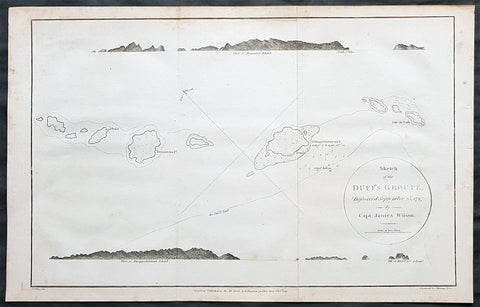
1797 Wilson Large Antique Map of the Duff Isles, Solomon Islands, South Pacific
- Title : 1799 James Wilson Antique Map of Duff or Wilson Islands, Santa Cruz Solomons Is.
- Date : 1799
- Condition: (A) Very Good Condition
- Ref: 90613
- Size: 16in x 10 1/2in (405mm x 255mm)
Description:
This copper-plate engraved original antique map of Duff or Wilson Islands located northeast of the Santa Cruz Islands in the Solomon Islands province of Temotu, in the South Pacific was engraved in by Thomas foot and was published in the 1799 edition Captain James Wilsons A missionary voyage to the Southern Pacific Ocean, performed in the years 1796, 1797, 1798, in the ship Duff commanded by Captain James Wilson.Compiled from journals of the officers and the missionaries. With a preliminary discourse on the geography and history of the South Sea Islands; and an appendix, including details never before published of the natural and civil state of Otaheite.
Captain James Wilson (1760–1814), commanded the British ship Duff, which the London Missionary Society contracted in 1797 to convey a team of missionaries (consisting of thirty men, six women, and three children) to their postings in Tahiti, Tonga, and the Marquesas Islands. During the voyage, Wilson also surveyed (or confirmed the locations of) numerous islands in the Pacific, including Vanua Balavu, Fulaga and Ogea Levu in Fiji, Mangareva in the Gambier Islands, Pukarua in the Tuamotus, and Satawal, Elato, and Lamotrek, in the Caroline Islands.
Three years after the establishment of the British mission in Tahiti, the directors of the Society appointed a committee to consider a suitable memorial for presentation to Wilson for his services in helping to establish the first mission in the South Seas.
He published an account of his voyage: A Missionary Voyage to the Southern Pacific Ocean in 1799. (Ref: M&B; Tooley)
General Definitions:
Paper thickness and quality: - Heavy and stable
Paper color : - off white
Age of map color: -
Colors used: -
General color appearance: -
Paper size: - 16in x 10 1/2in (405mm x 255mm)
Plate size: - 15in x 9 1/2in (380mm x 240mm)
Margins: - Min 1/4in (5mm)
Imperfections:
Margins: - Light soling
Plate area: - Folds as issued
Verso: - Light soling
Background:
The Duff Islands are a small island group lying to the northeast of the Santa Cruz Islands in the Solomon Islands province of Temotu. They are also sometimes known as the Wilson Islands.
The first recorded sighting by Europeans of the Duff Islands was by the Spanish expedition of Pedro Fernández de Quirós where it anchored on 8 April 1606. Its inhabitants named the islands as Taumako. They were charted by Quirós as Nuestra Señora del Socorro (Our Lady of Succour in Spanish).
The Duff Islands were named after missionary ship Duff, captained by James Wilson, which reached them in 1797.
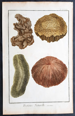
1798 Comte De Buffon Large Antique Print of Various Different Types of Corals
- Title : Histoire Naturelle, Polypiers
- Size: 15in x 10in (380mm x 255mm)
- Condition: (A+) Fine Condition
- Date : 1798
- Ref #: 91251
Description:
This original copper-plate engraved antique print was published in the 1798 quatro edition of Comte de Buffons Histoire Naturelle, générale et particulière, avec la description du Cabinet du Roi (Natural History, General and Particular, with a Description of the King\'s Cabinet)
General Definitions:
Paper thickness and quality: - Heavy and stable
Paper color : - off white
Age of map color: - Original
Colors used: - Blue, pink, red, green, yellow
General color appearance: - Authentic
Paper size: - 15in x 10in (380mm x 255mm)
Plate size: - 14in x 9in (355mm x 230mm)
Margins: - Min 1/2in (12mm)
Imperfections:
Margins: - Light age toning
Plate area: - None
Verso: - None
Background:
The Histoire Naturelle, générale et particulière, avec la description du Cabinet du Roi (Natural History, General and Particular, with a Description of the Kings Cabinet) is an encyclopaedic collection of 36 large (quarto) volumes written between 1749–1804 by the Comte de Buffon, and continued in eight more volumes after his death by his colleagues, led by Bernard Germain de Lacépède. The books cover what was known of the natural sciences at the time, including what would now be called material science, physics, chemistry and technology as well as the natural history of animals.
The Histoire Naturelle, générale et particulière, avec la description du Cabinet du Roi is the work that the Comte de Buffon (1707–1788) is remembered for. He worked on it for some 50 years, initially at Montbard in his office in the Tour Saint-Louis, then in his library at Petit Fontenet. 36 volumes came out between 1749 and 1789, followed by 8 more after his death, thanks to Bernard Germain de Lacépède. It includes all the knowledge available in his time on the natural sciences, a broad term that includes disciplines which today would be called material science, physics, chemistry and technology. Buffon notes the morphological similarities between men and apes, although he considered apes completely devoid of the ability to think, differentiating them sharply from human beings. Buffons attention to internal anatomy made him an early comparative anatomist. Lintérieur, dans les êtres vivants, est le fond du dessin de la nature, he wrote in his Quadrupèdes, the interior, in living things, is the foundation of natures design.
The Histoire Naturelle, which was meant to address the whole of natural history, actually covers only minerals, birds, and the quadrupeds among animals. It is accompanied by some discourses and a theory of the earth by way of introduction, and by supplements including an elegantly written account of the epochs of nature.
The Suppléments cover a wide range of topics; for example, in (Suppléments IV), there is a Discours sur le style (Discourse on Style) and an Essai darithmétique morale (essay on Moral Arithmetic).
Louis Jean-Marie Daubenton assisted Buffon on the quadrupeds; Philippe Guéneau de Montbeillard worked on the birds. They were joined, from 1767, by Barthélemy Faujas de Saint-Fond, the abbot Gabriel Bexon and Charles-Nicolas-Sigisbert Sonnini de Manoncourt. The whole descriptive and anatomical part of lHistoire des Quadrupèdes was the work of Daubenton and Jean-Claude Mertrud.
Buffon attached much importance to the illustrations; Jacques de Sève illustrated the quadrupeds and François-Nicolas Martinet illustrated the birds. Nearly 2000 plates adorn the work, representing animals with care given both to aesthetics and anatomical accuracy, with dreamlike and mythological settings.
On minerals, Buffon collaborated with André Thouin. Barthélemy Faujas de Saint-Fond and Louis Bernard Guyton de Morveau provided sources for the mineral volumes.
L Histoire Naturelle met immense success, almost as great as Encyclopédie by Diderot, which came out in the same period. The first three volumes of LHistoire Naturelle, générale et particulière, avec la description du cabinet du Roi were reprinted three times in six weeks.
The encyclopaedia appeared in 36 volumes :
3 volumes in 1749 : De la manière détudier lhistoire naturelle followed by Théorie de la Terre, Histoire Générale des animaux and Histoire Naturelle de lhomme
12 volumes on quadrupeds (1753 to 1767)
9 volumes on birds (1770 to 1783])
5 volumes on minerals (1783 to 1788), the last including Traité de laimant, the last work published by Buffon in his lifetime
7 volumes of supplements (1774 to 1789), including Époques de la nature (from 1778).
LHistoire Naturelle was initially printed at the Imprimerie royale in 36 volumes (1749–1789). In 1764 Buffon bought back the rights to his work. It was continued by Bernard Germain de Lacépède, who described the egg-laying quadrupeds, snakes, fishes and cetaceans in 8 volumes (1788–1804).
Buffon was assisted in the work by Jacques-François Artur (1708–1779), Gabriel Léopold Charles Amé Bexon (1748–1785), Louis Jean-Marie Daubenton (1716–1799), Edme-Louis Daubenton (1732–1786), Jacques de Sève (actif 1742–1788), Barthélemy Faujas de Saint-Fond (1741–1819), Philippe Guéneau de Montbeillard (1720–1785), Louis-Bernard Guyton-Morveau (1737–1816), Bernard Germain de Lacépède (1756–1825), François-Nicolas Martinet (1731–1800), the anatomist Jean-Claude Mertrud (1728–1802), Charles-Nicolas-Sigisbert Sonnini de Manoncourt (1751–1812), and André Thouin (1747–1823).
Each group is introduced with a general essay. This is followed by an article, sometimes of many pages, on each animal (or other item). The article on the wolf begins with the claim that it is one of the animals with a specially strong appetite for flesh; it asserts that the animal is naturally coarse and cowardly (grossier et poltron), but becoming crafty at need, and hardy by necessity, driven by hunger.[4] The language, as in this instance, is elegant and elaborate, even flowery and ornate.[5] Buffon was roundly criticised by his fellow academics for writing a purely popularizing work, empty and puffed up, with little real scientific value.
The species is named in Greek, Latin, Italian, Spanish, German, English, Swedish, and Polish. The zoological descriptions of the species by Gessner, Ray, Linnaeus, Klein and Buffon himself (Canis ex griseo flavescens. Lupus vulgaris. Buffon. Reg. animal. pag. 235) are cited.
The text is written as a continuous essay, without the sections on identification, distribution and behaviour that might have been expected from other natural histories. Parts concern human responses rather than the animal itself, as for example that the wolf likes human flesh, and the strongest wolves sometimes eat nothing else.[6] Measurements may be included; in the case of the wolf, 41 separate measurements are tabulated, in pre-revolutionary French feet and inches[a] starting with the Length of the whole body measured in a straight line from the end of the muzzle to the anus........3 feet. 7 inches. (1.2 m); the Length of the largest claws is given as 10 lines (2.2 cm).
The wolf is illustrated standing in farmland, and as a complete skeleton standing on a stone plinth in a landscape. The account of the species occupies 32 pages including illustrations.
The original edition of the Histoire Naturelle by Buffon comprised 36 volumes in quarto, divided into the following series: Histoire de la Terre et de lHomme, Quadrupèdes, Oiseaux, Minéraux, Suppléments. Buffon edited 35 volumes in his lifetime. Soon after his death, the fifth and final volume of lHistoire des minéraux appeared in 1788 at the Imprimerie des Bâtiments du Roi. The seventh and final volume of Suppléments by Buffon was published posthumously in 1789 through Lacépèdes hands. Lacépède continued the part of the Histoire Naturelle which dealt with animals. A few months before Buffons death, en 1788, Lacépède published, as a continuation, the first volume of his Histoire des Reptiles, on egg-laying quadrupeds. The next year, he wrote a second volume on snakes, published during the French Revolution. Between 1798 and 1803, he brought out the volume Histoire des Poissons. Lacépède made use of the notes and collections left by Philibert Commerson (1727–1773). He wrote Histoire des Cétacés which was printed in 1804. At that point, the Histoire Naturelle, by Buffon and Lacépède, thus contained 44 quarto volumes forming the definitive edition.
Another edition in quarto format was printed by the Imprimerie royale in 36 volumes (1774–1804). It consisted of 28 volumes par Buffon, and 8 volumes by Lacépède. The part containing anatomical articles by Louis Jean-Marie Daubenton was dropped. The supplements were merged into the relevant articles in the main volumes.
The Imprimerie royale also published two editions of the Histoire Naturelle in duodecimo format (1752–1805), occupying 90 or 71 volumes, depending on whether or not they included the part on anatomy. In this print format, the original work by Buffon occupied 73 volumes with the part on anatomy, or 54 volumes without the part on anatomy. The continuation by Lacépède took up 17 duodecimo volumes.
A de luxe edition of Histoire Naturelle des Oiseaux (Birds) (1771–1786) was produced by the Imprimerie royale in 10 folio and quarto volumes, with 1008 engraved and hand-coloured plates, executed under Buffons personal supervision by Edme-Louis Daubenton, cousin and brother-in-law of Buffons principal collaborator.
The original edition was arranged as follows:
Natural history, and description of the kings cabinet of curiosities
Volume I : Premier Discours - De la manière détudier et de traiter lhistoire naturelle, Second Discours - Histoire et théorie de la Terre, Preuves de la théorie de la Terre, 1749
Volume II : Histoire générale des Animaux, Histoire Naturelle de lHomme, 1749
Volume III : Description du cabinet du Roi, Histoire Naturelle de lHomme, 1749
Quadrupèdes (Quadrupeds)
Volume IV (Quadrupèdes I) : Discours sur la nature des Animaux, Les Animaux domestiques, 1753
Volume V (Quadrupèdes II) : 1755
Volume VI (Quadrupèdes III) : Les Animaux sauvages, 1756
Volume VII (Quadrupèdes IV) : Les Animaux carnassiers, 1758
Volume VIII (Quadrupèdes V) : 1760
Volume IX (Quadrupèdes VI) : 1761
Volume X (Quadrupèdes VII) : 1763
Volume XI (Quadrupèdes VIII) : 1764
Volume XII (Quadrupèdes IX) : 1764
Volume XIII (Quadrupèdes X) : 1765
Volume XIV (Quadrupèdes XI) : Nomenclature des Singes, De la dégénération des Animaux, 1766
Volume XV (Quadrupèdes XII) : 1767
Histoire Naturelle des Oiseaux (Birds) (1770–1783)
Volume XVI (Oiseaux I) : 1770
Volume XVII (Oiseaux II) : 1771
Volume XVIII (Oiseaux III) : 1774
Volume XIX (Oiseaux IV) : 1778
Volume XX (Oiseaux V) : 1778
Volume XXI (Oiseaux VI) : 1779
Volume XXII (Oiseaux VII) : 1780
Volume XXIII (Oiseaux VIII) : 1781
Volume XXIV (Oiseaux IX) : 1783
Histoire Naturelle des Minéraux (Minerals) (1783–1788)
Volume XXV (Minéraux I) : 1783
Volume XXVI (Minéraux II) : 1783
Volume XXVII (Minéraux III) : 1785
Volume XXVIII (Minéraux IV) : 1786
Volume XXIX (Minéraux V) : Traité de lAimant et de ses usages, 1788
Suppléments à lHistoire Naturelle, générale et particulière (Supplements) (1774–1789)
Volume XXX (Suppléments I) : Servant de suite à la Théorie de la Terre, et dintroduction à lHistoire des Minéraux, 1774
Volume XXXI (Suppléments II) : Servant de suite à la Théorie de la Terre, et de préliminaire à lHistoire des Végétaux - Parties Expérimentale & Hypothétique, 1775
Volume XXXII (Suppléments III) : Servant de suite à lHistoire des Animaux quadrupèdes, 1776
Volume XXXIII (Suppléments IV) : Servant de suite à lHistoire Naturelle de lHomme, 1777
Volume XXXIV (Suppléments V) : Des Époques de la nature, 1779
Volume XXXV (Suppléments VI) : Servant de suite à lHistoire des Animaux quadrupèdes, 1782
Volume XXXVI (Suppléments VII) : Servant de suite à lHistoire des Animaux quadrupèdes, 1789
Histoire Naturelle des Quadrupèdes ovipares et des Serpents (Egg-laying Quadrupeds and Snakes) (1788–1789)
The Gecko, 1788
Volume XXXVII (Reptiles I) : Histoire générale et particulière des Quadrupèdes ovipares, 1788
Volume XXXVIII (Reptiles II) : Histoire des Serpents, 1789
Histoire Naturelle des Poissons (Fish) (1798–1803)
Volume XXXIX (Poissons I) : 1798
Volume XXXX (Poissons II) : 1800
Volume XXXXI (Poissons III) : 1802
Volume XXXXII (Poissons IV) : 1802
Volume XXXXIII (Poissons V) : 1803
Histoire Naturelle des Cétacés (Cetaceans) (1804)
Volume XXXXIV (Cétacés) : 1804
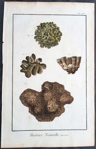
1798 Comte De Buffon Large Antique Print of Various Types of Corals
- Title : Histoire Naturelle, Polypiers
- Size: 15in x 10in (380mm x 255mm)
- Condition: (A+) Fine Condition
- Date : 1798
- Ref #: 91251
Description:
This original copper-plate engraved antique print was published in the 1798 quatro edition of Comte de Buffons Histoire Naturelle, générale et particulière, avec la description du Cabinet du Roi (Natural History, General and Particular, with a Description of the King\'s Cabinet)
General Definitions:
Paper thickness and quality: - Heavy and stable
Paper color : - off white
Age of map color: - Original
Colors used: - Blue, pink, red, green, yellow
General color appearance: - Authentic
Paper size: - 15in x 10in (380mm x 255mm)
Plate size: - 14in x 9in (355mm x 230mm)
Margins: - Min 1/2in (12mm)
Imperfections:
Margins: - Light age toning
Plate area: - None
Verso: - None
Background:
The Histoire Naturelle, générale et particulière, avec la description du Cabinet du Roi (Natural History, General and Particular, with a Description of the Kings Cabinet) is an encyclopaedic collection of 36 large (quarto) volumes written between 1749–1804 by the Comte de Buffon, and continued in eight more volumes after his death by his colleagues, led by Bernard Germain de Lacépède. The books cover what was known of the natural sciences at the time, including what would now be called material science, physics, chemistry and technology as well as the natural history of animals.
The Histoire Naturelle, générale et particulière, avec la description du Cabinet du Roi is the work that the Comte de Buffon (1707–1788) is remembered for. He worked on it for some 50 years, initially at Montbard in his office in the Tour Saint-Louis, then in his library at Petit Fontenet. 36 volumes came out between 1749 and 1789, followed by 8 more after his death, thanks to Bernard Germain de Lacépède. It includes all the knowledge available in his time on the natural sciences, a broad term that includes disciplines which today would be called material science, physics, chemistry and technology. Buffon notes the morphological similarities between men and apes, although he considered apes completely devoid of the ability to think, differentiating them sharply from human beings. Buffons attention to internal anatomy made him an early comparative anatomist. Lintérieur, dans les êtres vivants, est le fond du dessin de la nature, he wrote in his Quadrupèdes, the interior, in living things, is the foundation of natures design.
The Histoire Naturelle, which was meant to address the whole of natural history, actually covers only minerals, birds, and the quadrupeds among animals. It is accompanied by some discourses and a theory of the earth by way of introduction, and by supplements including an elegantly written account of the epochs of nature.
The Suppléments cover a wide range of topics; for example, in (Suppléments IV), there is a Discours sur le style (Discourse on Style) and an Essai darithmétique morale (essay on Moral Arithmetic).
Louis Jean-Marie Daubenton assisted Buffon on the quadrupeds; Philippe Guéneau de Montbeillard worked on the birds. They were joined, from 1767, by Barthélemy Faujas de Saint-Fond, the abbot Gabriel Bexon and Charles-Nicolas-Sigisbert Sonnini de Manoncourt. The whole descriptive and anatomical part of lHistoire des Quadrupèdes was the work of Daubenton and Jean-Claude Mertrud.
Buffon attached much importance to the illustrations; Jacques de Sève illustrated the quadrupeds and François-Nicolas Martinet illustrated the birds. Nearly 2000 plates adorn the work, representing animals with care given both to aesthetics and anatomical accuracy, with dreamlike and mythological settings.
On minerals, Buffon collaborated with André Thouin. Barthélemy Faujas de Saint-Fond and Louis Bernard Guyton de Morveau provided sources for the mineral volumes.
L Histoire Naturelle met immense success, almost as great as Encyclopédie by Diderot, which came out in the same period. The first three volumes of LHistoire Naturelle, générale et particulière, avec la description du cabinet du Roi were reprinted three times in six weeks.
The encyclopaedia appeared in 36 volumes :
3 volumes in 1749 : De la manière détudier lhistoire naturelle followed by Théorie de la Terre, Histoire Générale des animaux and Histoire Naturelle de lhomme
12 volumes on quadrupeds (1753 to 1767)
9 volumes on birds (1770 to 1783])
5 volumes on minerals (1783 to 1788), the last including Traité de laimant, the last work published by Buffon in his lifetime
7 volumes of supplements (1774 to 1789), including Époques de la nature (from 1778).
LHistoire Naturelle was initially printed at the Imprimerie royale in 36 volumes (1749–1789). In 1764 Buffon bought back the rights to his work. It was continued by Bernard Germain de Lacépède, who described the egg-laying quadrupeds, snakes, fishes and cetaceans in 8 volumes (1788–1804).
Buffon was assisted in the work by Jacques-François Artur (1708–1779), Gabriel Léopold Charles Amé Bexon (1748–1785), Louis Jean-Marie Daubenton (1716–1799), Edme-Louis Daubenton (1732–1786), Jacques de Sève (actif 1742–1788), Barthélemy Faujas de Saint-Fond (1741–1819), Philippe Guéneau de Montbeillard (1720–1785), Louis-Bernard Guyton-Morveau (1737–1816), Bernard Germain de Lacépède (1756–1825), François-Nicolas Martinet (1731–1800), the anatomist Jean-Claude Mertrud (1728–1802), Charles-Nicolas-Sigisbert Sonnini de Manoncourt (1751–1812), and André Thouin (1747–1823).
Each group is introduced with a general essay. This is followed by an article, sometimes of many pages, on each animal (or other item). The article on the wolf begins with the claim that it is one of the animals with a specially strong appetite for flesh; it asserts that the animal is naturally coarse and cowardly (grossier et poltron), but becoming crafty at need, and hardy by necessity, driven by hunger.[4] The language, as in this instance, is elegant and elaborate, even flowery and ornate.[5] Buffon was roundly criticised by his fellow academics for writing a purely popularizing work, empty and puffed up, with little real scientific value.
The species is named in Greek, Latin, Italian, Spanish, German, English, Swedish, and Polish. The zoological descriptions of the species by Gessner, Ray, Linnaeus, Klein and Buffon himself (Canis ex griseo flavescens. Lupus vulgaris. Buffon. Reg. animal. pag. 235) are cited.
The text is written as a continuous essay, without the sections on identification, distribution and behaviour that might have been expected from other natural histories. Parts concern human responses rather than the animal itself, as for example that the wolf likes human flesh, and the strongest wolves sometimes eat nothing else.[6] Measurements may be included; in the case of the wolf, 41 separate measurements are tabulated, in pre-revolutionary French feet and inches[a] starting with the Length of the whole body measured in a straight line from the end of the muzzle to the anus........3 feet. 7 inches. (1.2 m); the Length of the largest claws is given as 10 lines (2.2 cm).
The wolf is illustrated standing in farmland, and as a complete skeleton standing on a stone plinth in a landscape. The account of the species occupies 32 pages including illustrations.
The original edition of the Histoire Naturelle by Buffon comprised 36 volumes in quarto, divided into the following series: Histoire de la Terre et de lHomme, Quadrupèdes, Oiseaux, Minéraux, Suppléments. Buffon edited 35 volumes in his lifetime. Soon after his death, the fifth and final volume of lHistoire des minéraux appeared in 1788 at the Imprimerie des Bâtiments du Roi. The seventh and final volume of Suppléments by Buffon was published posthumously in 1789 through Lacépèdes hands. Lacépède continued the part of the Histoire Naturelle which dealt with animals. A few months before Buffons death, en 1788, Lacépède published, as a continuation, the first volume of his Histoire des Reptiles, on egg-laying quadrupeds. The next year, he wrote a second volume on snakes, published during the French Revolution. Between 1798 and 1803, he brought out the volume Histoire des Poissons. Lacépède made use of the notes and collections left by Philibert Commerson (1727–1773). He wrote Histoire des Cétacés which was printed in 1804. At that point, the Histoire Naturelle, by Buffon and Lacépède, thus contained 44 quarto volumes forming the definitive edition.
Another edition in quarto format was printed by the Imprimerie royale in 36 volumes (1774–1804). It consisted of 28 volumes par Buffon, and 8 volumes by Lacépède. The part containing anatomical articles by Louis Jean-Marie Daubenton was dropped. The supplements were merged into the relevant articles in the main volumes.
The Imprimerie royale also published two editions of the Histoire Naturelle in duodecimo format (1752–1805), occupying 90 or 71 volumes, depending on whether or not they included the part on anatomy. In this print format, the original work by Buffon occupied 73 volumes with the part on anatomy, or 54 volumes without the part on anatomy. The continuation by Lacépède took up 17 duodecimo volumes.
A de luxe edition of Histoire Naturelle des Oiseaux (Birds) (1771–1786) was produced by the Imprimerie royale in 10 folio and quarto volumes, with 1008 engraved and hand-coloured plates, executed under Buffons personal supervision by Edme-Louis Daubenton, cousin and brother-in-law of Buffons principal collaborator.
The original edition was arranged as follows:
Natural history, and description of the kings cabinet of curiosities
Volume I : Premier Discours - De la manière détudier et de traiter lhistoire naturelle, Second Discours - Histoire et théorie de la Terre, Preuves de la théorie de la Terre, 1749
Volume II : Histoire générale des Animaux, Histoire Naturelle de lHomme, 1749
Volume III : Description du cabinet du Roi, Histoire Naturelle de lHomme, 1749
Quadrupèdes (Quadrupeds)
Volume IV (Quadrupèdes I) : Discours sur la nature des Animaux, Les Animaux domestiques, 1753
Volume V (Quadrupèdes II) : 1755
Volume VI (Quadrupèdes III) : Les Animaux sauvages, 1756
Volume VII (Quadrupèdes IV) : Les Animaux carnassiers, 1758
Volume VIII (Quadrupèdes V) : 1760
Volume IX (Quadrupèdes VI) : 1761
Volume X (Quadrupèdes VII) : 1763
Volume XI (Quadrupèdes VIII) : 1764
Volume XII (Quadrupèdes IX) : 1764
Volume XIII (Quadrupèdes X) : 1765
Volume XIV (Quadrupèdes XI) : Nomenclature des Singes, De la dégénération des Animaux, 1766
Volume XV (Quadrupèdes XII) : 1767
Histoire Naturelle des Oiseaux (Birds) (1770–1783)
Volume XVI (Oiseaux I) : 1770
Volume XVII (Oiseaux II) : 1771
Volume XVIII (Oiseaux III) : 1774
Volume XIX (Oiseaux IV) : 1778
Volume XX (Oiseaux V) : 1778
Volume XXI (Oiseaux VI) : 1779
Volume XXII (Oiseaux VII) : 1780
Volume XXIII (Oiseaux VIII) : 1781
Volume XXIV (Oiseaux IX) : 1783
Histoire Naturelle des Minéraux (Minerals) (1783–1788)
Volume XXV (Minéraux I) : 1783
Volume XXVI (Minéraux II) : 1783
Volume XXVII (Minéraux III) : 1785
Volume XXVIII (Minéraux IV) : 1786
Volume XXIX (Minéraux V) : Traité de lAimant et de ses usages, 1788
Suppléments à lHistoire Naturelle, générale et particulière (Supplements) (1774–1789)
Volume XXX (Suppléments I) : Servant de suite à la Théorie de la Terre, et dintroduction à lHistoire des Minéraux, 1774
Volume XXXI (Suppléments II) : Servant de suite à la Théorie de la Terre, et de préliminaire à lHistoire des Végétaux - Parties Expérimentale & Hypothétique, 1775
Volume XXXII (Suppléments III) : Servant de suite à lHistoire des Animaux quadrupèdes, 1776
Volume XXXIII (Suppléments IV) : Servant de suite à lHistoire Naturelle de lHomme, 1777
Volume XXXIV (Suppléments V) : Des Époques de la nature, 1779
Volume XXXV (Suppléments VI) : Servant de suite à lHistoire des Animaux quadrupèdes, 1782
Volume XXXVI (Suppléments VII) : Servant de suite à lHistoire des Animaux quadrupèdes, 1789
Histoire Naturelle des Quadrupèdes ovipares et des Serpents (Egg-laying Quadrupeds and Snakes) (1788–1789)
The Gecko, 1788
Volume XXXVII (Reptiles I) : Histoire générale et particulière des Quadrupèdes ovipares, 1788
Volume XXXVIII (Reptiles II) : Histoire des Serpents, 1789
Histoire Naturelle des Poissons (Fish) (1798–1803)
Volume XXXIX (Poissons I) : 1798
Volume XXXX (Poissons II) : 1800
Volume XXXXI (Poissons III) : 1802
Volume XXXXII (Poissons IV) : 1802
Volume XXXXIII (Poissons V) : 1803
Histoire Naturelle des Cétacés (Cetaceans) (1804)
Volume XXXXIV (Cétacés) : 1804
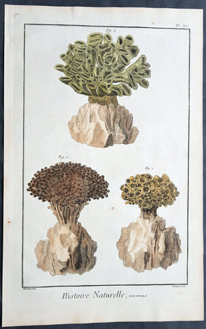
1798 Comte De Buffon Large Antique Print of Various Types of Corals
- Title : Histoire Naturelle, Polypiers
- Size: 15in x 10in (380mm x 255mm)
- Condition: (A+) Fine Condition
- Date : 1798
- Ref #: 91244
Description:
This original copper-plate engraved antique print was published in the 1798 quatro edition of Comte de Buffons Histoire Naturelle, générale et particulière, avec la description du Cabinet du Roi (Natural History, General and Particular, with a Description of the King\'s Cabinet)
General Definitions:
Paper thickness and quality: - Heavy and stable
Paper color : - off white
Age of map color: - Original
Colors used: - Blue, pink, red, green, yellow
General color appearance: - Authentic
Paper size: - 15in x 10in (380mm x 255mm)
Plate size: - 14in x 9in (355mm x 230mm)
Margins: - Min 1/2in (12mm)
Imperfections:
Margins: - Light age toning
Plate area: - None
Verso: - None
Background:
The Histoire Naturelle, générale et particulière, avec la description du Cabinet du Roi (Natural History, General and Particular, with a Description of the Kings Cabinet) is an encyclopaedic collection of 36 large (quarto) volumes written between 1749–1804 by the Comte de Buffon, and continued in eight more volumes after his death by his colleagues, led by Bernard Germain de Lacépède. The books cover what was known of the natural sciences at the time, including what would now be called material science, physics, chemistry and technology as well as the natural history of animals.
The Histoire Naturelle, générale et particulière, avec la description du Cabinet du Roi is the work that the Comte de Buffon (1707–1788) is remembered for. He worked on it for some 50 years, initially at Montbard in his office in the Tour Saint-Louis, then in his library at Petit Fontenet. 36 volumes came out between 1749 and 1789, followed by 8 more after his death, thanks to Bernard Germain de Lacépède. It includes all the knowledge available in his time on the natural sciences, a broad term that includes disciplines which today would be called material science, physics, chemistry and technology. Buffon notes the morphological similarities between men and apes, although he considered apes completely devoid of the ability to think, differentiating them sharply from human beings. Buffons attention to internal anatomy made him an early comparative anatomist. Lintérieur, dans les êtres vivants, est le fond du dessin de la nature, he wrote in his Quadrupèdes, the interior, in living things, is the foundation of natures design.
The Histoire Naturelle, which was meant to address the whole of natural history, actually covers only minerals, birds, and the quadrupeds among animals. It is accompanied by some discourses and a theory of the earth by way of introduction, and by supplements including an elegantly written account of the epochs of nature.
The Suppléments cover a wide range of topics; for example, in (Suppléments IV), there is a Discours sur le style (Discourse on Style) and an Essai darithmétique morale (essay on Moral Arithmetic).
Louis Jean-Marie Daubenton assisted Buffon on the quadrupeds; Philippe Guéneau de Montbeillard worked on the birds. They were joined, from 1767, by Barthélemy Faujas de Saint-Fond, the abbot Gabriel Bexon and Charles-Nicolas-Sigisbert Sonnini de Manoncourt. The whole descriptive and anatomical part of lHistoire des Quadrupèdes was the work of Daubenton and Jean-Claude Mertrud.
Buffon attached much importance to the illustrations; Jacques de Sève illustrated the quadrupeds and François-Nicolas Martinet illustrated the birds. Nearly 2000 plates adorn the work, representing animals with care given both to aesthetics and anatomical accuracy, with dreamlike and mythological settings.
On minerals, Buffon collaborated with André Thouin. Barthélemy Faujas de Saint-Fond and Louis Bernard Guyton de Morveau provided sources for the mineral volumes.
L Histoire Naturelle met immense success, almost as great as Encyclopédie by Diderot, which came out in the same period. The first three volumes of LHistoire Naturelle, générale et particulière, avec la description du cabinet du Roi were reprinted three times in six weeks.
The encyclopaedia appeared in 36 volumes :
3 volumes in 1749 : De la manière détudier lhistoire naturelle followed by Théorie de la Terre, Histoire Générale des animaux and Histoire Naturelle de lhomme
12 volumes on quadrupeds (1753 to 1767)
9 volumes on birds (1770 to 1783])
5 volumes on minerals (1783 to 1788), the last including Traité de laimant, the last work published by Buffon in his lifetime
7 volumes of supplements (1774 to 1789), including Époques de la nature (from 1778).
LHistoire Naturelle was initially printed at the Imprimerie royale in 36 volumes (1749–1789). In 1764 Buffon bought back the rights to his work. It was continued by Bernard Germain de Lacépède, who described the egg-laying quadrupeds, snakes, fishes and cetaceans in 8 volumes (1788–1804).
Buffon was assisted in the work by Jacques-François Artur (1708–1779), Gabriel Léopold Charles Amé Bexon (1748–1785), Louis Jean-Marie Daubenton (1716–1799), Edme-Louis Daubenton (1732–1786), Jacques de Sève (actif 1742–1788), Barthélemy Faujas de Saint-Fond (1741–1819), Philippe Guéneau de Montbeillard (1720–1785), Louis-Bernard Guyton-Morveau (1737–1816), Bernard Germain de Lacépède (1756–1825), François-Nicolas Martinet (1731–1800), the anatomist Jean-Claude Mertrud (1728–1802), Charles-Nicolas-Sigisbert Sonnini de Manoncourt (1751–1812), and André Thouin (1747–1823).
Each group is introduced with a general essay. This is followed by an article, sometimes of many pages, on each animal (or other item). The article on the wolf begins with the claim that it is one of the animals with a specially strong appetite for flesh; it asserts that the animal is naturally coarse and cowardly (grossier et poltron), but becoming crafty at need, and hardy by necessity, driven by hunger.[4] The language, as in this instance, is elegant and elaborate, even flowery and ornate.[5] Buffon was roundly criticised by his fellow academics for writing a purely popularizing work, empty and puffed up, with little real scientific value.
The species is named in Greek, Latin, Italian, Spanish, German, English, Swedish, and Polish. The zoological descriptions of the species by Gessner, Ray, Linnaeus, Klein and Buffon himself (Canis ex griseo flavescens. Lupus vulgaris. Buffon. Reg. animal. pag. 235) are cited.
The text is written as a continuous essay, without the sections on identification, distribution and behaviour that might have been expected from other natural histories. Parts concern human responses rather than the animal itself, as for example that the wolf likes human flesh, and the strongest wolves sometimes eat nothing else.[6] Measurements may be included; in the case of the wolf, 41 separate measurements are tabulated, in pre-revolutionary French feet and inches[a] starting with the Length of the whole body measured in a straight line from the end of the muzzle to the anus........3 feet. 7 inches. (1.2 m); the Length of the largest claws is given as 10 lines (2.2 cm).
The wolf is illustrated standing in farmland, and as a complete skeleton standing on a stone plinth in a landscape. The account of the species occupies 32 pages including illustrations.
The original edition of the Histoire Naturelle by Buffon comprised 36 volumes in quarto, divided into the following series: Histoire de la Terre et de lHomme, Quadrupèdes, Oiseaux, Minéraux, Suppléments. Buffon edited 35 volumes in his lifetime. Soon after his death, the fifth and final volume of lHistoire des minéraux appeared in 1788 at the Imprimerie des Bâtiments du Roi. The seventh and final volume of Suppléments by Buffon was published posthumously in 1789 through Lacépèdes hands. Lacépède continued the part of the Histoire Naturelle which dealt with animals. A few months before Buffons death, en 1788, Lacépède published, as a continuation, the first volume of his Histoire des Reptiles, on egg-laying quadrupeds. The next year, he wrote a second volume on snakes, published during the French Revolution. Between 1798 and 1803, he brought out the volume Histoire des Poissons. Lacépède made use of the notes and collections left by Philibert Commerson (1727–1773). He wrote Histoire des Cétacés which was printed in 1804. At that point, the Histoire Naturelle, by Buffon and Lacépède, thus contained 44 quarto volumes forming the definitive edition.
Another edition in quarto format was printed by the Imprimerie royale in 36 volumes (1774–1804). It consisted of 28 volumes par Buffon, and 8 volumes by Lacépède. The part containing anatomical articles by Louis Jean-Marie Daubenton was dropped. The supplements were merged into the relevant articles in the main volumes.
The Imprimerie royale also published two editions of the Histoire Naturelle in duodecimo format (1752–1805), occupying 90 or 71 volumes, depending on whether or not they included the part on anatomy. In this print format, the original work by Buffon occupied 73 volumes with the part on anatomy, or 54 volumes without the part on anatomy. The continuation by Lacépède took up 17 duodecimo volumes.
A de luxe edition of Histoire Naturelle des Oiseaux (Birds) (1771–1786) was produced by the Imprimerie royale in 10 folio and quarto volumes, with 1008 engraved and hand-coloured plates, executed under Buffons personal supervision by Edme-Louis Daubenton, cousin and brother-in-law of Buffons principal collaborator.
The original edition was arranged as follows:
Natural history, and description of the kings cabinet of curiosities
Volume I : Premier Discours - De la manière détudier et de traiter lhistoire naturelle, Second Discours - Histoire et théorie de la Terre, Preuves de la théorie de la Terre, 1749
Volume II : Histoire générale des Animaux, Histoire Naturelle de lHomme, 1749
Volume III : Description du cabinet du Roi, Histoire Naturelle de lHomme, 1749
Quadrupèdes (Quadrupeds)
Volume IV (Quadrupèdes I) : Discours sur la nature des Animaux, Les Animaux domestiques, 1753
Volume V (Quadrupèdes II) : 1755
Volume VI (Quadrupèdes III) : Les Animaux sauvages, 1756
Volume VII (Quadrupèdes IV) : Les Animaux carnassiers, 1758
Volume VIII (Quadrupèdes V) : 1760
Volume IX (Quadrupèdes VI) : 1761
Volume X (Quadrupèdes VII) : 1763
Volume XI (Quadrupèdes VIII) : 1764
Volume XII (Quadrupèdes IX) : 1764
Volume XIII (Quadrupèdes X) : 1765
Volume XIV (Quadrupèdes XI) : Nomenclature des Singes, De la dégénération des Animaux, 1766
Volume XV (Quadrupèdes XII) : 1767
Histoire Naturelle des Oiseaux (Birds) (1770–1783)
Volume XVI (Oiseaux I) : 1770
Volume XVII (Oiseaux II) : 1771
Volume XVIII (Oiseaux III) : 1774
Volume XIX (Oiseaux IV) : 1778
Volume XX (Oiseaux V) : 1778
Volume XXI (Oiseaux VI) : 1779
Volume XXII (Oiseaux VII) : 1780
Volume XXIII (Oiseaux VIII) : 1781
Volume XXIV (Oiseaux IX) : 1783
Histoire Naturelle des Minéraux (Minerals) (1783–1788)
Volume XXV (Minéraux I) : 1783
Volume XXVI (Minéraux II) : 1783
Volume XXVII (Minéraux III) : 1785
Volume XXVIII (Minéraux IV) : 1786
Volume XXIX (Minéraux V) : Traité de lAimant et de ses usages, 1788
Suppléments à lHistoire Naturelle, générale et particulière (Supplements) (1774–1789)
Volume XXX (Suppléments I) : Servant de suite à la Théorie de la Terre, et dintroduction à lHistoire des Minéraux, 1774
Volume XXXI (Suppléments II) : Servant de suite à la Théorie de la Terre, et de préliminaire à lHistoire des Végétaux - Parties Expérimentale & Hypothétique, 1775
Volume XXXII (Suppléments III) : Servant de suite à lHistoire des Animaux quadrupèdes, 1776
Volume XXXIII (Suppléments IV) : Servant de suite à lHistoire Naturelle de lHomme, 1777
Volume XXXIV (Suppléments V) : Des Époques de la nature, 1779
Volume XXXV (Suppléments VI) : Servant de suite à lHistoire des Animaux quadrupèdes, 1782
Volume XXXVI (Suppléments VII) : Servant de suite à lHistoire des Animaux quadrupèdes, 1789
Histoire Naturelle des Quadrupèdes ovipares et des Serpents (Egg-laying Quadrupeds and Snakes) (1788–1789)
The Gecko, 1788
Volume XXXVII (Reptiles I) : Histoire générale et particulière des Quadrupèdes ovipares, 1788
Volume XXXVIII (Reptiles II) : Histoire des Serpents, 1789
Histoire Naturelle des Poissons (Fish) (1798–1803)
Volume XXXIX (Poissons I) : 1798
Volume XXXX (Poissons II) : 1800
Volume XXXXI (Poissons III) : 1802
Volume XXXXII (Poissons IV) : 1802
Volume XXXXIII (Poissons V) : 1803
Histoire Naturelle des Cétacés (Cetaceans) (1804)
Volume XXXXIV (Cétacés) : 1804
1798 Laperouse & Mourelle Antique Early Map of Queensland, PNG, Fiji etc in 1781
Antique Map
- Title : Carte D Une Partie Du Grand Ocean a l E. et S.E. de la Nouvelle Guinee pour l intelligence du Voyage de la Fregate Espagnole la Princesa commandee par D. Franco. Antonio Maurelle. en 1781..... Published as the (act) directs Novr. 1st 1798, by G.G. & J. Robinson
- Ref #: 31555
- Size: 16 3/4in x 11in (425mm x 280mm)
- Date : 1798
- Condition: (A+) Fine Condition
Description:
This large original copper plate engraved antique early map of Queensland, New Guinea, Fiji, French Polynesia & other South Pacific Islands - tracking the voyages of Francisco Antonio Mourelle in the region in 1781 was engraved in 1798 - dated - and was published in the 1st English edition of the Atlas du voyage de La Perouse G.G & J. Robinson, London in 1799.
La Perouse set sail from France in 1785 to continue the discoveries of Captain Cook. He was shipwrecked in 1788 but his narrative, maps, and views survived and were first published in 1797.
Interesting chart of Eastern Australia and part of the south-western Pacific, showing the routes taken by the Spanish explorer Don Francisco Antonio Maurelle in 1781 along the northern coast of New Guinea and across the Pacific to Fiji and Tonga, including a maunscript grid added in a contemporary hand.
Maurelle was credited with the discovery of the Hermit Islands on this voyage. The map includes the north-eastern coast of Australia, and parts of the coast of New Guinea. The map shows the 1781 route of his ship The Princesa through the Bismarck Archipelago north of New Guinea, through the Archipel de Salomos [i.e. Solomon Islands] and then east across the Pacific to the Iles de Amis [i.e. the Friendly Islands, now Tonga] where he discovered I. Vavao [ i.e. Vavau] with one of the best anchorages in the South Pacific.
The map includes the Iles de Navigateurs [i.e. Samoa], I. Fidji [i.e. Fiji], Iles de Esprit [i.e. Vanuatu or the New Hebrides Isles], and Nouvelle Caledonie [i.e. New Caledonia]. Many small islands are depicted with notes regarding their sightings by Abel Tasman, William Bligh and Maurelle.
A note on the chart states that the publisher has placed the islands according to the longitude of other navigators, rather than on Maurelles figures which were considered estimates only, and also, that Maurelles chart was based on a French chart by Jacques Nicolas Bellin published in 1742.
General Definitions:
Paper thickness and quality: - Heavy and stable
Paper color : - off white
Age of map color: - Early
Colors used: - Yellow
General color appearance: - Authentic
Paper size: - 16 3/4in x 11in (425mm x 280mm)
Plate size: - 16in x 10in (405mm x 255mm)
Margins: - Min 1/2in (12mm)
Imperfections:
Margins: - Light age toning in margins
Plate area: - None
Verso: - None
Background:
Mourelle de la Rúa, Francisco Antonio 1750 – 1820
Mourelle was a Galician naval officer and explorer serving the Spanish crown. He was born in 1750 at San Adrián de Corme (Corme Aldea, Ponteceso), near La Coruña, Galicia
1775 voyage Mourelle served the Spanish navy in the Guyanas, Trinidad, and the Antilles before becoming stationed at New Spain\'s Pacific Ocean naval base at San Blas, Mexico in 1774. He joined the 1775 expedition of Bruno de Heceta and Juan Francisco de la Bodega y Quadra, serving as Quadra\'s pilot on the schooner Sonora. On July 29, at around 49 degrees north latitude, the Sonora became separated from Heceta\'s ship Santiago. Heceta soon returned south while Quadra and Mourelle continued north, eventually reaching 58 degrees 30 minutes north latitude. They found and anchored in Bucareli Bay. Then they sailed south, arriving at Monterey, California, on October 7, and San Blas on November 20, 1775.
Mourelle\'s journal was somehow taken clandestinely to London where it was translated and published. Captain James Cook made use of the information in Mourelle\'s journal during his travels in the Pacific Northwest.
1779 voyage Mourelle again served as the pilot of Quadra, and second in command of the ship Favorita, during the 1779 expedition commanded by Ignacio de Arteaga. Leaving San Blas on February 11, 1779, the expedition reached 61 degrees north and Hinchinbrook Island at the head of the Gulf of Alaska. From there they sailed southwest along the Kenai Peninsula. The ships returned to San Blas on November 21, 1779.
Later career During his service at San Blas, Mourelle traveled extensively throughout the Pacific Ocean. From 1781 on the La Princessa, he attempted to find a southern route from the Philippines to Mexico, mapping 29 of the 50 islands in the Hermit Islands, Ninigo Islands and Tench Island in New Guinea, and Ontong Java in the Solomon Islands . He visited Tonga and travelled through the Ellice Islands (now Tuvalu). Keith S. Chambers and Doug Munro (1980) identify Niutao as the island that Mourelle named on May 5, 1781, thus solving what Europeans had called The Mystery of Gran Cocal. Due to contrary winds, he returned via Guam and took the northern route across the Pacific to Mexico. He was also familiar with the Philippines and Canton, China.
Mourelle was to command the Mexicana for a 1792 voyage to explore the Strait of Georgia but Alessandro Malaspina had one of his own officers, Cayetano Valdés, placed in command of the Mexicana. Dionisio Alcalá Galiano commanded the Sutil, the twin companion of the Mexicana.
Mourelle was transferred to Spain in 1793. He was promoted to frigate captain in the same year as the Action of 19 January 1799 where he took a leading role. He became ship\'s captain in 1806, and commodore in 1811. He commanded a squadron in 1818 that was to put down a rebellion in the Rio de la Plata, but the endeavor never got underway. Mourelle died on May 24, 1820, at the age of 64.
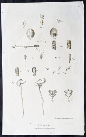
1798 Laperouse Large Antique Print of Insects, Seeds, Plants America & Pacific
- Title : Insects..Published as the act directs Nov 1st 1798 by GG & J Robinson Parnastor Row
- Size: 18in x 11in (460mm x 280mm)
- Condition: (A+) Fine Condition
- Date : 1798
- Ref #: 31730
Description:
This large original copper plate engraved antique print of various insects, seeds & plants collected during the voyages of Jean-François de Galaup, Comte de la Pérouse between 1785 to 1788 was engraved in 1798 - dated - and was published in the 1st English edition of the Atlas du voyage de La Perouse G.G & J. Robinson, London in 1799.
La Perouse set sail from France in 1785 to continue the discoveries of Captain Cook. He was shipwrecked in 1788 but his narrative, maps, and views survived and were first published in 1797.
General Definitions:
Paper thickness and quality: - Heavy and stable
Paper color : - off white
Age of map color: -
Colors used: -
General color appearance: -
Paper size: - 18in x 11in (460mm x 280mm)
Plate size: - 17in x 10 1/2in (430mm x 270mm)
Margins: - Min 1/2in (12mm)
Imperfections:
Margins: - None
Plate area: - None
Verso: - None
Background:
In 1783 the French government resolved to send an expedition to the Pacific to complete Captain James Cook\'s unfinished work, and in particular to explore the passages in the Bering Sea, which had been a mystery to Europeans since the sixteenth century. King Louis XVI himself took a hand in drafting the plan and itinerary, a copy of which is in the Municipal Library at Rouen, France, and when La Pérouse was selected to lead the fleet gave him an audience before he sailed. In command of two ships, La Boussole and L Astrolabe (Commandant de Langle), he left Brest on 1 August 1785 making for Brazil. Doubling Cape Horn he refitted in Chile, then sailed to the Sandwich Islands and thence to Alaska, where he turned south exploring and surveying the coast as far as California. After a short refit at Monterey, he sailed across the Pacific, discovered uncharted islands, and visited Macao and Manila. After six weeks reprovisioning and refreshing he left on 10 April 1787 to survey the coasts and territories north of Korea, which had been described and commented on by Christian missionaries. He sailed up the Gulf of Tartary, naming several points on both its shores and learned that Sakhalin was an island. In September he put in to Kamchatka to replenish his supplies. From there he dispatched an officer, Lesseps, overland to Paris with accounts of his discoveries, while he turned south making for New Holland. In December, at Tutuila, Samoa, which Bougainville had called the Navigator Islands when he explored them in 1768, natives suddenly attacked a party from L\'Astrolabe seeking water and killed de Langle and eleven others. La Pérouse left without taking reprisals and sailed through the Pacific Islands to Norfolk Island and to Botany Bay. He was sighted off the coast there on 24 January 1788 but bad weather prevented his entering the bay for two days. By then Governor Arthur Phillip had sailed to Port Jackson, but John Hunter had remained with the Sirius and the transports, and assisted La Pérouse to anchor. He established a camp on the northern shore, now called after him, and maintained good relations with the English during his six-week stay. He sailed on 10 March and was not heard of again. His disappearance led the French government in 1791 to equip another expedition under Bruny d Entrecasteaux to look for him, but the search was fruitless.
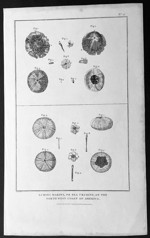
1798 Laperouse Large Antique Print of Sea Urchins of NW America, California
- Title : Echini Marini, or Sea Urchins, of the North West Coast of America. Published as the (act) directs Novr. 1st 1798, by G.G. & J. Robinson
- Size: 16 1/2in x 10 1/2in (420mm x 265mm)
- Condition: (A+) Fine Condition
- Date : 1798
- Ref #: 31738
Description:
This large original copper plate engraved antique print of various Sea Urchins found off the NW coast of America, collected during the voyages of Jean-François de Galaup, Comte de la Pérouse between 1785 to 1788 was engraved in 1798 - dated - and was published in the 1st English edition of the Atlas du voyage de La Perouse G.G & J. Robinson, London in 1799.
La Perouse set sail from France in 1785 to continue the discoveries of Captain Cook. He was shipwrecked in 1788 but his narrative, maps, and views survived and were first published in 1797.
General Definitions:
Paper thickness and quality: - Heavy and stable
Paper color : - off white
Age of map color: -
Colors used: -
General color appearance: -
Paper size: - 16 1/2in x 10 1/2in (420mm x 265mm)
Plate size: - 16 1/2in x 10 1/2in (420mm x 265mm)
Margins: - Min 1/2in (12mm)
Imperfections:
Margins: - Light age toning in margins
Plate area: - None
Verso: - None
Background:
In 1783 the French government resolved to send an expedition to the Pacific to complete Captain James Cook\'s unfinished work, and in particular to explore the passages in the Bering Sea, which had been a mystery to Europeans since the sixteenth century. King Louis XVI himself took a hand in drafting the plan and itinerary, a copy of which is in the Municipal Library at Rouen, France, and when La Pérouse was selected to lead the fleet gave him an audience before he sailed. In command of two ships, La Boussole and L Astrolabe (Commandant de Langle), he left Brest on 1 August 1785 making for Brazil. Doubling Cape Horn he refitted in Chile, then sailed to the Sandwich Islands and thence to Alaska, where he turned south exploring and surveying the coast as far as California. After a short refit at Monterey, he sailed across the Pacific, discovered uncharted islands, and visited Macao and Manila. After six weeks reprovisioning and refreshing he left on 10 April 1787 to survey the coasts and territories north of Korea, which had been described and commented on by Christian missionaries. He sailed up the Gulf of Tartary, naming several points on both its shores and learned that Sakhalin was an island. In September he put in to Kamchatka to replenish his supplies. From there he dispatched an officer, Lesseps, overland to Paris with accounts of his discoveries, while he turned south making for New Holland. In December, at Tutuila, Samoa, which Bougainville had called the Navigator Islands when he explored them in 1768, natives suddenly attacked a party from L\'Astrolabe seeking water and killed de Langle and eleven others. La Pérouse left without taking reprisals and sailed through the Pacific Islands to Norfolk Island and to Botany Bay. He was sighted off the coast there on 24 January 1788 but bad weather prevented his entering the bay for two days. By then Governor Arthur Phillip had sailed to Port Jackson, but John Hunter had remained with the Sirius and the transports, and assisted La Pérouse to anchor. He established a camp on the northern shore, now called after him, and maintained good relations with the English during his six-week stay. He sailed on 10 March and was not heard of again. His disappearance led the French government in 1791 to equip another expedition under Bruny d Entrecasteaux to look for him, but the search was fruitless.
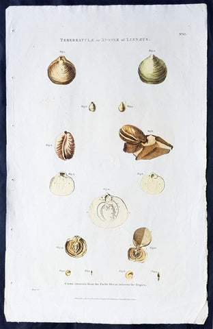
1798 Laperouse Large Antique Print of Shells, Molluscus, Shellfish of Pacific
- Title : Terebratulae, or Anomle of Linnaeus; Cornu Ammonis from the Pacific Ocean between the Tropics.....Published as the act directs Nov 1st 1798 by GG & J Robinson Parnastor Row
- Size: 18in x 11 1/2in (460mm x 295mm)
- Condition: (A+) Fine Condition
- Date : 1798
- Ref #: 31729
Description:
This large original copper plate engraved antique print of various shells, molluscus and shell fish in the Pacific, collected during the voyages of Jean-François de Galaup, Comte de la Pérouse between 1785 to 1788 was engraved in 1798 - dated - and was published in the 1st English edition of the Atlas du voyage de La Perouse G.G & J. Robinson, London in 1799.
La Perouse set sail from France in 1785 to continue the discoveries of Captain Cook. He was shipwrecked in 1788 but his narrative, maps, and views survived and were first published in 1797.
General Definitions:
Paper thickness and quality: - Heavy and stable
Paper color : - off white
Age of map color: -
Colors used: -
General color appearance: -
Paper size: - 18in x 11 1/2in (460mm x 295mm)
Plate size: - 17in x 10 1/2in (430mm x 270mm)
Margins: - Min 1/2in (12mm)
Imperfections:
Margins: - Light age toning in margins
Plate area: - None
Verso: - None
Background:
In 1783 the French government resolved to send an expedition to the Pacific to complete Captain James Cook\'s unfinished work, and in particular to explore the passages in the Bering Sea, which had been a mystery to Europeans since the sixteenth century. King Louis XVI himself took a hand in drafting the plan and itinerary, a copy of which is in the Municipal Library at Rouen, France, and when La Pérouse was selected to lead the fleet gave him an audience before he sailed. In command of two ships, La Boussole and L Astrolabe (Commandant de Langle), he left Brest on 1 August 1785 making for Brazil. Doubling Cape Horn he refitted in Chile, then sailed to the Sandwich Islands and thence to Alaska, where he turned south exploring and surveying the coast as far as California. After a short refit at Monterey, he sailed across the Pacific, discovered uncharted islands, and visited Macao and Manila. After six weeks reprovisioning and refreshing he left on 10 April 1787 to survey the coasts and territories north of Korea, which had been described and commented on by Christian missionaries. He sailed up the Gulf of Tartary, naming several points on both its shores and learned that Sakhalin was an island. In September he put in to Kamchatka to replenish his supplies. From there he dispatched an officer, Lesseps, overland to Paris with accounts of his discoveries, while he turned south making for New Holland. In December, at Tutuila, Samoa, which Bougainville had called the Navigator Islands when he explored them in 1768, natives suddenly attacked a party from L\'Astrolabe seeking water and killed de Langle and eleven others. La Pérouse left without taking reprisals and sailed through the Pacific Islands to Norfolk Island and to Botany Bay. He was sighted off the coast there on 24 January 1788 but bad weather prevented his entering the bay for two days. By then Governor Arthur Phillip had sailed to Port Jackson, but John Hunter had remained with the Sirius and the transports, and assisted La Pérouse to anchor. He established a camp on the northern shore, now called after him, and maintained good relations with the English during his six-week stay. He sailed on 10 March and was not heard of again. His disappearance led the French government in 1791 to equip another expedition under Bruny d Entrecasteaux to look for him, but the search was fruitless.
1798 W H Hall Large Antique Astronomical Print of Measurements & Calculations
Antique Map
- Title : Astronomy....Halls Encyclopedia...C. Cooke
- Condition: (A) Very Good Condition
- Ref: 01-7364
- Size: 15in x 9in (380mm x 230mm)
- Date: 1798
Description:
This large original copper-plate engraved antique print was was published by William Henry Hall in the 1798 edition of The new royal encyclopedia; or, complete modern universal dictionary of arts and sciences on a new and improved plan.... printed by Charles Cooke, London.
General Definitions:
Paper thickness and quality: - Heavy and stable
Paper color : - off white
Age of map color: -
Colors used: -
General color appearance: -
Paper size: - 15in x 9in (380mm x 230mm)
Plate size: - 15in x 9in (380mm x 230mm)
Margins: - Min 1/2in (10mm)
Imperfections:
Margins: - Age toning
Plate area: - Light age toning
Verso: - Age toning
Background:
During the Renaissance, Nicolaus Copernicus proposed a heliocentric model of the solar system. His work was defended by Galileo Galilei and expanded upon by Johannes Kepler. Kepler was the first to devise a system that correctly described the details of the motion of the planets around the Sun. However, Kepler did not succeed in formulating a theory behind the laws he wrote down. It was Isaac Newton, with his invention of celestial dynamics and his law of gravitation, who finally explained the motions of the planets. Newton also developed the reflecting telescope.
Improvements in the size and quality of the telescope led to further discoveries. The English astronomer John Flamsteed catalogued over 3000 stars. More extensive star catalogues were produced by Nicolas Louis de Lacaille. The astronomer William Herschel made a detailed catalog of nebulosity and clusters, and in 1781 discovered the planet Uranus, the first new planet found. The distance to a star was announced in 1838 when the parallax of 61 Cygni was measured by Friedrich Bessel.
During the 18–19th centuries, the study of the three-body problem by Leonhard Euler, Alexis Claude Clairaut, and Jean le Rond dAlembert led to more accurate predictions about the motions of the Moon and planets. This work was further refined by Joseph-Louis Lagrange and Pierre Simon Laplace, allowing the masses of the planets and moons to be estimated from their perturbations.
Significant advances in astronomy came about with the introduction of new technology, including the spectroscope and photography. Joseph von Fraunhofer discovered about 600 bands in the spectrum of the Sun in 1814–15, which, in 1859, Gustav Kirchhoff ascribed to the presence of different elements. Stars were proven to be similar to the Earths own Sun, but with a wide range of temperatures, masses, and sizes.
Hall, William Henry
Hall was responsible for a significant publication in the middle of the 18th century The new royal encyclopedia; or, complete modern universal dictionary of arts and sciences on a new and improved plan . containing a digest and display of the whole theory and practice of the liberal and mechanical arts comprising a general repository of ancient and modern literature . including all the material information that is contained in Chamber s Cyclopedia, the Encyclopædia Britannica, and the French Encyclopædie . first published in 1788 going into many re-issues over the next 50 years.
The three volume set contained 153 copper-plate prints and maps, including some folding maps. Contained many brief encyclopedic entries in alphabetical orders plus longer, mainly illustrated, sections (systems or treatises) on a variety of subjects: Aerology; Aerostation (hot air balloons); Agriculture; Algebra; Amphibiology; Anatomy; Annuities; Architecture; Arithmetic; Astronomy (includes plates of telescopes); Book-Keeping; Botany; Brewing; Chronology; Chymistry; Comparative Anatomy; Concology; Dialling; Distillation; Drawing; Earth; Earthquakes; Electricity; Entomology; Farriery; Fencing; Fluxions; Fortification; Gardening; Geography (this section includes six folding maps); Geometry; Globes; Grammar; Heraldry; Hydrostatics and Hydraulics (one plate included a diving bell); Icthyology; Knighthood; Logic; Mammalia (included a plate showing whales); Mechanics; Medicine; Mensuration and Gauging; Miscroscopic Apparatus (microscopes); Midwifery; Military Affairs; Music; Natural History; Naval Affairs; Navigation (includes a folding map showing Cooks voyages); Optics; Oratory; Ornithology; Peerage; Perspective; Pneumatics; Projectiles; Steam Engines; Surgery; Surveying; Trigonometry; Vermeology; Volcanos; and War. Hard to find a complete set, as many have been broken up for their handsome copper plate engravings and maps.
1798 W H Hall Large Antique Print of Atwood's Machine, Mechanical Laws of Motion
Antique Map
- Title : Atwoods Apparatus for Experiments on Accelerated Motion....Halls Encyclopedia...C. Cooke...
- Condition: (A) Very Good Condition
- Ref: 90676
- Size: 15in x 9in (380mm x 230mm)
- Date: 1798
Description:
This large original copper-plate engraved antique print was was published by William Henry Hall in the 1798 edition of The new royal encyclopedia; or, complete modern universal dictionary of arts and sciences on a new and improved plan.... printed by Charles Cooke, London.
General Definitions:
Paper thickness and quality: - Heavy and stable
Paper color : - off white
Age of map color: -
Colors used: -
General color appearance: -
Paper size: - 15in x 9in (380mm x 230mm)
Plate size: - 15in x 9in (380mm x 230mm)
Margins: - Min 1/2in (10mm)
Imperfections:
Margins: - Age toning
Plate area: - Light age toning
Verso: - Age toning
Background:
The Atwood machine (or Atwoods machine) was invented in 1784 by the English mathematician George Atwood as a laboratory experiment to verify the mechanical laws of motion with constant acceleration. Atwoods machine is a common classroom demonstration used to illustrate principles of classical mechanics.
The ideal Atwood machine consists of two objects of mass m1 and m2, connected by an inextensible massless string over an ideal massless pulley.
Both masses experience uniform acceleration. When m1 = m2, the machine is in neutral equilibrium regardless of the position of the weights.
Hall, William Henry
Hall was responsible for a significant publication in the middle of the 18th century The new royal encyclopedia; or, complete modern universal dictionary of arts and sciences on a new and improved plan . containing a digest and display of the whole theory and practice of the liberal and mechanical arts comprising a general repository of ancient and modern literature . including all the material information that is contained in Chamber s Cyclopedia, the Encyclopædia Britannica, and the French Encyclopædie . first published in 1788 going into many re-issues over the next 50 years.
The three volume set contained 153 copper-plate prints and maps, including some folding maps. Contained many brief encyclopedic entries in alphabetical orders plus longer, mainly illustrated, sections (systems or treatises) on a variety of subjects: Aerology; Aerostation (hot air balloons); Agriculture; Algebra; Amphibiology; Anatomy; Annuities; Architecture; Arithmetic; Astronomy (includes plates of telescopes); Book-Keeping; Botany; Brewing; Chronology; Chymistry; Comparative Anatomy; Concology; Dialling; Distillation; Drawing; Earth; Earthquakes; Electricity; Entomology; Farriery; Fencing; Fluxions; Fortification; Gardening; Geography (this section includes six folding maps); Geometry; Globes; Grammar; Heraldry; Hydrostatics and Hydraulics (one plate included a diving bell); Icthyology; Knighthood; Logic; Mammalia (included a plate showing whales); Mechanics; Medicine; Mensuration and Gauging; Miscroscopic Apparatus (microscopes); Midwifery; Military Affairs; Music; Natural History; Naval Affairs; Navigation (includes a folding map showing Cooks voyages); Optics; Oratory; Ornithology; Peerage; Perspective; Pneumatics; Projectiles; Steam Engines; Surgery; Surveying; Trigonometry; Vermeology; Volcanos; and War. Hard to find a complete set, as many have been broken up for their handsome copper plate engravings and maps.
1798 W H Hall Large Antique Print of Drive Trains Cogs Pulleys for Cranes, Mills
Antique Map
- Title : Mechanical Powers with their Applications in Cranes, Mills & other compound Engines....Halls Encyclopedia...C. Cooke...
- Condition: (A) Very Good Condition
- Ref: 90674
- Size: 15in x 9in (380mm x 230mm)
- Date: 1798
Description:
This large original copper-plate engraved antique print was was published by William Henry Hall in the 1798 edition of The new royal encyclopedia; or, complete modern universal dictionary of arts and sciences on a new and improved plan.... printed by Charles Cooke, London.
General Definitions:
Paper thickness and quality: - Heavy and stable
Paper color : - off white
Age of map color: -
Colors used: -
General color appearance: -
Paper size: - 15in x 9in (380mm x 230mm)
Plate size: - 15in x 9in (380mm x 230mm)
Margins: - Min 1/2in (10mm)
Imperfections:
Margins: - Age toning
Plate area: - Light age toning
Verso: - Age toning
Background:
A crane is a type of machine, generally equipped with a hoist rope, wire ropes or chains, and sheaves, that can be used both to lift and lower materials and to move them horizontally. It is mainly used for lifting heavy things and transporting them to other places. The device uses one or more simple machines to create mechanical advantage and thus move loads beyond the normal capability of a human. Cranes are commonly employed in the transport industry for the loading and unloading of freight, in the construction industry for the movement of materials, and in the manufacturing industry for the assembling of heavy equipment.
The first known crane machine was the shadouf, a water-lifting device that was invented in ancient Mesopotamia (modern Iraq) and then appeared in ancient Egyptian technology. Construction cranes later appeared in ancient Greece, where they were powered by men or animals (such as donkeys), and used for the construction of buildings. Larger cranes were later developed in the Roman Empire, employing the use of human treadwheels, permitting the lifting of heavier weights. In the High Middle Ages, harbour cranes were introduced to load and unload ships and assist with their construction — some were built into stone towers for extra strength and stability. The earliest cranes were constructed from wood, but cast iron, iron and steel took over with the coming of the Industrial Revolution.
For many centuries, power was supplied by the physical exertion of men or animals, although hoists in watermills and windmills could be driven by the harnessed natural power. The first mechanical power was provided by steam engines, the earliest steam crane being introduced in the 18th or 19th century, with many remaining in use well into the late 20th century. Modern cranes usually use internal combustion engines or electric motors and hydraulic systems to provide a much greater lifting capability than was previously possible, although manual cranes are still utilized where the provision of power would be uneconomic.
Hall, William Henry
Hall was responsible for a significant publication in the middle of the 18th century The new royal encyclopedia; or, complete modern universal dictionary of arts and sciences on a new and improved plan . containing a digest and display of the whole theory and practice of the liberal and mechanical arts comprising a general repository of ancient and modern literature . including all the material information that is contained in Chamber s Cyclopedia, the Encyclopædia Britannica, and the French Encyclopædie . first published in 1788 going into many re-issues over the next 50 years.
The three volume set contained 153 copper-plate prints and maps, including some folding maps. Contained many brief encyclopedic entries in alphabetical orders plus longer, mainly illustrated, sections (systems or treatises) on a variety of subjects: Aerology; Aerostation (hot air balloons); Agriculture; Algebra; Amphibiology; Anatomy; Annuities; Architecture; Arithmetic; Astronomy (includes plates of telescopes); Book-Keeping; Botany; Brewing; Chronology; Chymistry; Comparative Anatomy; Concology; Dialling; Distillation; Drawing; Earth; Earthquakes; Electricity; Entomology; Farriery; Fencing; Fluxions; Fortification; Gardening; Geography (this section includes six folding maps); Geometry; Globes; Grammar; Heraldry; Hydrostatics and Hydraulics (one plate included a diving bell); Icthyology; Knighthood; Logic; Mammalia (included a plate showing whales); Mechanics; Medicine; Mensuration and Gauging; Miscroscopic Apparatus (microscopes); Midwifery; Military Affairs; Music; Natural History; Naval Affairs; Navigation (includes a folding map showing Cooks voyages); Optics; Oratory; Ornithology; Peerage; Perspective; Pneumatics; Projectiles; Steam Engines; Surgery; Surveying; Trigonometry; Vermeology; Volcanos; and War. Hard to find a complete set, as many have been broken up for their handsome copper plate engravings and maps.
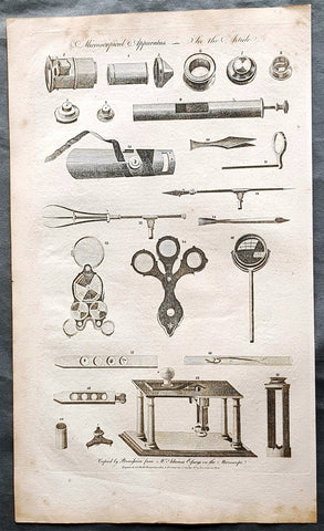
1798 W H Hall Large Antique Print of the Apparatus of The Microscope, Lenses
Antique Map
- Title : Microscophical Apparatus....Halls Encyclopedia...C. Cooke...
- Condition: (A) Very Good Condition
- Ref: 90677
- Size: 15in x 9in (380mm x 230mm)
- Date: 1798
Description:
This large original copper-plate engraved antique print was was published by William Henry Hall in the 1798 edition of The new royal encyclopedia; or, complete modern universal dictionary of arts and sciences on a new and improved plan.... printed by Charles Cooke, London.
General Definitions:
Paper thickness and quality: - Heavy and stable
Paper color : - off white
Age of map color: -
Colors used: -
General color appearance: -
Paper size: - 15in x 9in (380mm x 230mm)
Plate size: - 15in x 9in (380mm x 230mm)
Margins: - Min 1/2in (10mm)
Imperfections:
Margins: - Age toning
Plate area: - Light age toning
Verso: - Age toning
Background:
Although objects resembling lenses date back 4000 years and there are Greek accounts of the optical properties of water-filled spheres (5th century BC) followed by many centuries of writings on optics, the earliest known use of simple microscopes (magnifying glasses) dates back to the widespread use of lenses in eyeglasses in the 13th century. The earliest known examples of compound microscopes, which combine an objective lens near the specimen with an eyepiece to view a real image, appeared in Europe around 1620. The inventor is unknown although many claims have been made over the years. Several revolve around the spectacle-making centers in the Netherlands including claims it was invented in 1590 by Zacharias Janssen (claim made by his son) and/or Zacharias father, Hans Martens, claims it was invented by their neighbor and rival spectacle maker, Hans Lippershey (who applied for the first telescope patent in 1608) and claims it was invented by expatriate Cornelis Drebbel who was noted to have a version in London in 1619. Galileo Galilei (also sometimes cited as compound microscope inventor) seems to have found after 1610 that he could close focus his telescope to view small objects and, after seeing a compound microscope built by Drebbel exhibited in Rome in 1624, built his own improved version. Giovanni Faber coined the name microscope for the compound microscope Galileo submitted to the Accademia dei Lincei in 1625 (Galileo had called it the occhiolino or little eye).
The first detailed account of the microscopic anatomy of organic tissue based on the use of a microscope did not appear until 1644, in Giambattista Odiernas Locchio della mosca, or The Flys Eye.
The microscope was still largely a novelty until the 1660s and 1670s when naturalists in Italy, the Netherlands and England began using them to study biology. Italian scientist Marcello Malpighi, called the father of histology by some historians of biology, began his analysis of biological structures with the lungs. Robert Hookes Micrographia had a huge impact, largely because of its impressive illustrations. A significant contribution came from Antonie van Leeuwenhoek who achieved up to 300 times magnification using a simple single lens microscope. He sandwiched a very small glass ball lens between the holes in two metal plates riveted together, and with an adjustable-by-screws needle attached to mount the specimen. Then, Van Leeuwenhoek re-discovered red blood cells (after Jan Swammerdam) and spermatozoa, and helped popularise the use of microscopes to view biological ultrastructure. On 9 October 1676, van Leeuwenhoek reported the discovery of micro-organisms.
The performance of a light microscope depends on the quality and correct use of the condensor lens system to focus light on the specimen and the objective lens to capture the light from the specimen and form an image. Early instruments were limited until this principle was fully appreciated and developed from the late 19th to very early 20th century, and until electric lamps were available as light sources. In 1893 August Köhler developed a key principle of sample illumination, Köhler illumination, which is central to achieving the theoretical limits of resolution for the light microscope. This method of sample illumination produces even lighting and overcomes the limited contrast and resolution imposed by early techniques of sample illumination. Further developments in sample illumination came from the discovery of phase contrast by Frits Zernike in 1953, and differential interference contrast illumination by Georges Nomarski in 1955; both of which allow imaging of unstained, transparent samples.
Hall, William Henry
Hall was responsible for a significant publication in the middle of the 18th century The new royal encyclopedia; or, complete modern universal dictionary of arts and sciences on a new and improved plan . containing a digest and display of the whole theory and practice of the liberal and mechanical arts comprising a general repository of ancient and modern literature . including all the material information that is contained in Chamber s Cyclopedia, the Encyclopædia Britannica, and the French Encyclopædie . first published in 1788 going into many re-issues over the next 50 years.
The three volume set contained 153 copper-plate prints and maps, including some folding maps. Contained many brief encyclopedic entries in alphabetical orders plus longer, mainly illustrated, sections (systems or treatises) on a variety of subjects: Aerology; Aerostation (hot air balloons); Agriculture; Algebra; Amphibiology; Anatomy; Annuities; Architecture; Arithmetic; Astronomy (includes plates of telescopes); Book-Keeping; Botany; Brewing; Chronology; Chymistry; Comparative Anatomy; Concology; Dialling; Distillation; Drawing; Earth; Earthquakes; Electricity; Entomology; Farriery; Fencing; Fluxions; Fortification; Gardening; Geography (this section includes six folding maps); Geometry; Globes; Grammar; Heraldry; Hydrostatics and Hydraulics (one plate included a diving bell); Icthyology; Knighthood; Logic; Mammalia (included a plate showing whales); Mechanics; Medicine; Mensuration and Gauging; Miscroscopic Apparatus (microscopes); Midwifery; Military Affairs; Music; Natural History; Naval Affairs; Navigation (includes a folding map showing Cooks voyages); Optics; Oratory; Ornithology; Peerage; Perspective; Pneumatics; Projectiles; Steam Engines; Surgery; Surveying; Trigonometry; Vermeology; Volcanos; and War. Hard to find a complete set, as many have been broken up for their handsome copper plate engravings and maps.
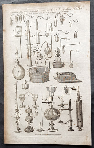
1798 W H Hall Large Antique Print of Various Pneumatic Air & Fluid Equipment
Antique Map
- Title : Pneumatical Apparatus for ascerting Experiments on fixed Air and other Fluids....Halls Encyclopedia...C. Cooke...
- Condition: (A) Very Good Condition
- Ref: 91138
- Size: 15in x 9in (380mm x 230mm)
- Date: 1798
Description:
This large original copper-plate engraved antique print was was published by William Henry Hall in the 1798 edition of The new royal encyclopedia; or, complete modern universal dictionary of arts and sciences on a new and improved plan.... printed by Charles Cooke, London.
General Definitions:
Paper thickness and quality: - Heavy and stable
Paper color : - off white
Age of map color: -
Colors used: -
General color appearance: -
Paper size: - 15in x 9in (380mm x 230mm)
Plate size: - 15in x 9in (380mm x 230mm)
Margins: - Min 1/2in (10mm)
Imperfections:
Margins: - Age toning
Plate area: - Light age toning
Verso: - Age toning
Background:
The origins of pneumatics can be traced back to the first century when ancient Greek mathematician Hero of Alexandria wrote about his inventions powered by steam or the wind.
German physicist Otto von Guericke (1602 to 1686) went a little further. He invented the vacuum pump, a device that can draw out air or gas from the attached vessel. He demonstrated the vacuum pump to separate the pairs of copper hemispheres using air pressures. The field of pneumatics has changed considerably over the years. It has moved from small handheld devices to large machines with multiple parts that serve different functions.
Hall, William Henry
Hall was responsible for a significant publication in the middle of the 18th century The new royal encyclopedia; or, complete modern universal dictionary of arts and sciences on a new and improved plan . containing a digest and display of the whole theory and practice of the liberal and mechanical arts comprising a general repository of ancient and modern literature . including all the material information that is contained in Chamber s Cyclopedia, the Encyclopædia Britannica, and the French Encyclopædie . first published in 1788 going into many re-issues over the next 50 years.
The three volume set contained 153 copper-plate prints and maps, including some folding maps. Contained many brief encyclopedic entries in alphabetical orders plus longer, mainly illustrated, sections (systems or treatises) on a variety of subjects: Aerology; Aerostation (hot air balloons); Agriculture; Algebra; Amphibiology; Anatomy; Annuities; Architecture; Arithmetic; Astronomy (includes plates of telescopes); Book-Keeping; Botany; Brewing; Chronology; Chymistry; Comparative Anatomy; Concology; Dialling; Distillation; Drawing; Earth; Earthquakes; Electricity; Entomology; Farriery; Fencing; Fluxions; Fortification; Gardening; Geography (this section includes six folding maps); Geometry; Globes; Grammar; Heraldry; Hydrostatics and Hydraulics (one plate included a diving bell); Icthyology; Knighthood; Logic; Mammalia (included a plate showing whales); Mechanics; Medicine; Mensuration and Gauging; Miscroscopic Apparatus (microscopes); Midwifery; Military Affairs; Music; Natural History; Naval Affairs; Navigation (includes a folding map showing Cooks voyages); Optics; Oratory; Ornithology; Peerage; Perspective; Pneumatics; Projectiles; Steam Engines; Surgery; Surveying; Trigonometry; Vermeology; Volcanos; and War. Hard to find a complete set, as many have been broken up for their handsome copper plate engravings and maps.
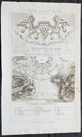
1798 William Hall Antique Print Methods of Defending, Laying Mines Fortification
- Title : Art of War: Fig I. Represents The Method of placing Mines in a Siege; Fig 2. Representation of a fortified Place besieged....Royal Encylopedia....C Cooke....
- Date : 1798
- Condition: (A+) Fine Condition
- Ref: 01-7334
- Size: 15in x 9in (380mm x 230mm)
Description:
This large original copper-plate engraved antique print by William Henry Hall was published in the 1798 edition of The new royal encyclopedia; or, complete modern universal dictionary of arts and sciences on a new and improved plan.... Charles Cooke, London.
General Definitions:
Paper thickness and quality: - Heavy and stable
Paper color : - off white
Age of map color: -
Colors used: -
General color appearance: -
Paper size: - 15in x 9in (380mm x 230mm)
Plate size: - 13 1/2in x 8 1/2in (345mm x 215mm)
Margins: - Min 1/2in (12mm)
Imperfections:
Margins: - None
Plate area: - None
Verso: - None
Hall, William Henry
Hall was responsible for a significant publication in the middle of the 18th century The new royal encyclopedia; or, complete modern universal dictionary of arts and sciences on a new and improved plan . containing a digest and display of the whole theory and practice of the liberal and mechanical arts comprising a general repository of ancient and modern literature . including all the material information that is contained in Chamber s Cyclopedia, the Encyclopædia Britannica, and the French Encyclopædie . first published in 1788 going into many re-issues over the next 50 years.
The three volume set contained 153 copper-plate prints and maps, including some folding maps. Contained many brief encyclopedic entries in alphabetical orders plus longer, mainly illustrated, sections (systems or treatises) on a variety of subjects: Aerology; Aerostation (hot air balloons); Agriculture; Algebra; Amphibiology; Anatomy; Annuities; Architecture; Arithmetic; Astronomy (includes plates of telescopes); Book-Keeping; Botany; Brewing; Chronology; Chymistry; Comparative Anatomy; Concology; Dialling; Distillation; Drawing; Earth; Earthquakes; Electricity; Entomology; Farriery; Fencing; Fluxions; Fortification; Gardening; Geography (this section includes six folding maps); Geometry; Globes; Grammar; Heraldry; Hydrostatics and Hydraulics (one plate included a diving bell); Icthyology; Knighthood; Logic; Mammalia (included a plate showing whales); Mechanics; Medicine; Mensuration and Gauging; Miscroscopic Apparatus (microscopes); Midwifery; Military Affairs; Music; Natural History; Naval Affairs; Navigation (includes a folding map showing Cooks voyages); Optics; Oratory; Ornithology; Peerage; Perspective; Pneumatics; Projectiles; Steam Engines; Surgery; Surveying; Trigonometry; Vermeology; Volcanos; and War. Hard to find a complete set, as many have been broken up for their handsome copper plate engravings and maps.
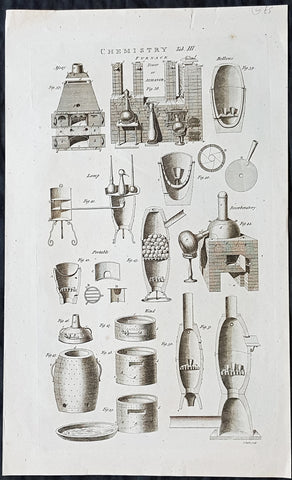
1798 William Hall Antique Print of Chemistry Furnace or Ovens & Sectional Parts
- Title : Chemistry Tab III Furnace Tower or Athanor....Royal Encylopedia....C Cooke....
- Date : 1798
- Condition: (A+) Fine Condition
- Ref: 26247
- Size: 16 1/2in x 10in (420mm x 255mm)
Description:
This large original copper-plate engraved antique print by William Henry Hall was published in the 1798 edition of The new royal encyclopedia; or, complete modern universal dictionary of arts and sciences on a new and improved plan.... Charles Cooke, London.
General Definitions:
Paper thickness and quality: - Heavy and stable
Paper color : - off white
Age of map color: -
Colors used: -
General color appearance: -
Paper size: - 16 1/2in x 10in (420mm x 255mm)
Plate size: - 14 1/2in x 8 1/2in (370mm x 215mm)
Margins: - Min 1/2in (12mm)
Imperfections:
Margins: - None
Plate area: - None
Verso: - None
Hall, William Henry
Hall was responsible for a significant publication in the middle of the 18th century The new royal encyclopedia; or, complete modern universal dictionary of arts and sciences on a new and improved plan . containing a digest and display of the whole theory and practice of the liberal and mechanical arts comprising a general repository of ancient and modern literature . including all the material information that is contained in Chamber s Cyclopedia, the Encyclopædia Britannica, and the French Encyclopædie . first published in 1788 going into many re-issues over the next 50 years.
The three volume set contained 153 copper-plate prints and maps, including some folding maps. Contained many brief encyclopedic entries in alphabetical orders plus longer, mainly illustrated, sections (systems or treatises) on a variety of subjects: Aerology; Aerostation (hot air balloons); Agriculture; Algebra; Amphibiology; Anatomy; Annuities; Architecture; Arithmetic; Astronomy (includes plates of telescopes); Book-Keeping; Botany; Brewing; Chronology; Chymistry; Comparative Anatomy; Concology; Dialling; Distillation; Drawing; Earth; Earthquakes; Electricity; Entomology; Farriery; Fencing; Fluxions; Fortification; Gardening; Geography (this section includes six folding maps); Geometry; Globes; Grammar; Heraldry; Hydrostatics and Hydraulics (one plate included a diving bell); Icthyology; Knighthood; Logic; Mammalia (included a plate showing whales); Mechanics; Medicine; Mensuration and Gauging; Miscroscopic Apparatus (microscopes); Midwifery; Military Affairs; Music; Natural History; Naval Affairs; Navigation (includes a folding map showing Cooks voyages); Optics; Oratory; Ornithology; Peerage; Perspective; Pneumatics; Projectiles; Steam Engines; Surgery; Surveying; Trigonometry; Vermeology; Volcanos; and War. Hard to find a complete set, as many have been broken up for their handsome copper plate engravings and maps.
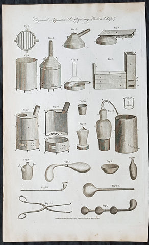
1798 William Hall Antique Print of Chemistry Ovens, Apparatus, Stills, Forceps
- Title : Chymical Apparatus....Royal Encylopedia....C Cooke....
- Date : 1798
- Condition: (A+) Fine Condition
- Ref: 91129
- Size: 15in x 9in (380mm x 230mm)
Description:
This large original copper-plate engraved antique print by William Henry Hall was published in the 1798 edition of The new royal encyclopedia; or, complete modern universal dictionary of arts and sciences on a new and improved plan.... Charles Cooke, London.
General Definitions:
Paper thickness and quality: - Heavy and stable
Paper color : - off white
Age of map color: -
Colors used: -
General color appearance: -
Paper size: - 15in x 9in (380mm x 230mm)
Plate size: - 14 1/2in x 8 1/2in (370mm x 215mm)
Margins: - Min 1/2in (12mm)
Imperfections:
Margins: - Light age toning in margins
Plate area: - None
Verso: - None
Hall, William Henry
Hall was responsible for a significant publication in the middle of the 18th century The new royal encyclopedia; or, complete modern universal dictionary of arts and sciences on a new and improved plan . containing a digest and display of the whole theory and practice of the liberal and mechanical arts comprising a general repository of ancient and modern literature . including all the material information that is contained in Chamber s Cyclopedia, the Encyclopædia Britannica, and the French Encyclopædie . first published in 1788 going into many re-issues over the next 50 years.
The three volume set contained 153 copper-plate prints and maps, including some folding maps. Contained many brief encyclopedic entries in alphabetical orders plus longer, mainly illustrated, sections (systems or treatises) on a variety of subjects: Aerology; Aerostation (hot air balloons); Agriculture; Algebra; Amphibiology; Anatomy; Annuities; Architecture; Arithmetic; Astronomy (includes plates of telescopes); Book-Keeping; Botany; Brewing; Chronology; Chymistry; Comparative Anatomy; Concology; Dialling; Distillation; Drawing; Earth; Earthquakes; Electricity; Entomology; Farriery; Fencing; Fluxions; Fortification; Gardening; Geography (this section includes six folding maps); Geometry; Globes; Grammar; Heraldry; Hydrostatics and Hydraulics (one plate included a diving bell); Icthyology; Knighthood; Logic; Mammalia (included a plate showing whales); Mechanics; Medicine; Mensuration and Gauging; Miscroscopic Apparatus (microscopes); Midwifery; Military Affairs; Music; Natural History; Naval Affairs; Navigation (includes a folding map showing Cooks voyages); Optics; Oratory; Ornithology; Peerage; Perspective; Pneumatics; Projectiles; Steam Engines; Surgery; Surveying; Trigonometry; Vermeology; Volcanos; and War. Hard to find a complete set, as many have been broken up for their handsome copper plate engravings and maps.
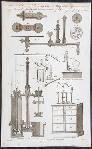
1798 William Hall Antique Print of Pneumatic Air Pump Parts, Air Powered Rifles
- Title : A View with Sections of Princes American Air Pumpwhich is Superior to Smeatons & every other modern construction....Royal Encylopedia....C Cooke....
- Date : 1798
- Condition: (A) Very Good Condition
- Ref: 91136
- Size: 15in x 9in (380mm x 230mm)
Description:
This large original copper-plate engraved antique print by William Henry Hall was published in the 1798 edition of The new royal encyclopedia; or, complete modern universal dictionary of arts and sciences on a new and improved plan.... Charles Cooke, London.
General Definitions:
Paper thickness and quality: - Heavy and stable
Paper color : - off white
Age of map color: -
Colors used: -
General color appearance: -
Paper size: - 15in x 9in (380mm x 230mm)
Plate size: - 14 1/2in x 8 1/2in (370mm x 215mm)
Margins: - Min 1/2in (12mm)
Imperfections:
Margins: - Light age toning in margins
Plate area: - None
Verso: - None
Hall, William Henry
Hall was responsible for a significant publication in the middle of the 18th century The new royal encyclopedia; or, complete modern universal dictionary of arts and sciences on a new and improved plan . containing a digest and display of the whole theory and practice of the liberal and mechanical arts comprising a general repository of ancient and modern literature . including all the material information that is contained in Chamber s Cyclopedia, the Encyclopædia Britannica, and the French Encyclopædie . first published in 1788 going into many re-issues over the next 50 years.
The three volume set contained 153 copper-plate prints and maps, including some folding maps. Contained many brief encyclopedic entries in alphabetical orders plus longer, mainly illustrated, sections (systems or treatises) on a variety of subjects: Aerology; Aerostation (hot air balloons); Agriculture; Algebra; Amphibiology; Anatomy; Annuities; Architecture; Arithmetic; Astronomy (includes plates of telescopes); Book-Keeping; Botany; Brewing; Chronology; Chymistry; Comparative Anatomy; Concology; Dialling; Distillation; Drawing; Earth; Earthquakes; Electricity; Entomology; Farriery; Fencing; Fluxions; Fortification; Gardening; Geography (this section includes six folding maps); Geometry; Globes; Grammar; Heraldry; Hydrostatics and Hydraulics (one plate included a diving bell); Icthyology; Knighthood; Logic; Mammalia (included a plate showing whales); Mechanics; Medicine; Mensuration and Gauging; Miscroscopic Apparatus (microscopes); Midwifery; Military Affairs; Music; Natural History; Naval Affairs; Navigation (includes a folding map showing Cooks voyages); Optics; Oratory; Ornithology; Peerage; Perspective; Pneumatics; Projectiles; Steam Engines; Surgery; Surveying; Trigonometry; Vermeology; Volcanos; and War. Hard to find a complete set, as many have been broken up for their handsome copper plate engravings and maps.
1800 George Kearsley Shaw Antique Early Print The Australian Musky Rat Kangaroo
- Title : Rat Kangaroo...1800 Jan 1 London Published by G Kearsley Fleet St.
- Date : 1800
- Condition: (A+) Fine Condition
- Ref: 33077
- Size: 8 1/2in x 5in (215mm x 125mm)
Description:
This original copper-plate engraved antique print of the Australian Musky rat-kangaroo was engraved by Isaac Taylor (1730-1807) in 1800 - dated - and published by George Kearsley Shaw in the 1803 edition of the Zoology of New Holland one of the earliest publications to name many Australian animals, for the first time.
General Definitions:
Paper thickness and quality: - Heavy and stable
Paper color : - off white
Age of map color: -
Colors used: -
General color appearance: -
Paper size: - 8 1/2in x 5in (215mm x 125mm)
Plate size: - 8 1/2in x 5in (215mm x 125mm)
Margins: - Min 1/2in (12mm)
Imperfections:
Margins: - Light age toning
Plate area: - None
Verso: - None
Background:
The musky rat-kangaroo is a marsupial species found only in the rainforests of northeast Australia. Although some scientists place this species as a subfamily (Hypsiprymnodontinae) of the family Potoroidae, the most recent classification places it in the family Hypsiprymnodontidae with prehistoric rat-kangaroos.
It is the smallest macropod that is quadrupedal and only diurnal. The musky rat-kangaroo is about 21 to 34 cm long with a 6.5- to 12.3-cm-long hairless tail, weighs between 332 and 680 g, and eats fallen fruit and large seeds, as well as small invertebrates.
It moves by extending its body and then bringing both of its hind legs forward, and uses an opposable digit on the hind foot to climb trees.
Shaw, George Kearsley 1751 - 1813
Shaw was an English botanist and zoologist. He was born at Bierton, Buckinghamshire, and was educated at Magdalen Hall, Oxford, receiving his M.A. in 1772. He took up the profession of medical practitioner. In 1786 he became the assistant lecturer in botany at Oxford University. He was a co-founder of the Linnean Society in 1788, and became a fellow of the Royal Society in 1789.
In 1791 Shaw became assistant keeper of the natural history department at the British Museum, succeeding Edward Whitaker Gray as keeper in 1806. He found that most of the items donated to the museum by Hans Sloane were in very bad condition. Medical and anatomical material was sent to the museum at the Royal College of Surgeons, but many of the stuffed animals and birds had deteriorated and had to be burnt. He was succeeded after his death by his assistant Charles Konig.
Shaw published one of the first English descriptions with scientific names of several Australian animals in his Zoology of New Holland first published in 1794. He was among the first scientists to examine a platypus and published the first scientific description of it in The Naturalists Miscellany in 1799.
In the field of herpetology he described numerous new species of reptiles and amphibians.
His other publications included:
- Musei Leveriani explicatio, anglica et Latina, containing select specimens from the museum of the late Sir Ashton Lever (1792–6), which had been moved to be displayed at the Blackfriars Rotunda.
- General Zoology, or Systematic Natural History (16 vol.) (1809–1826) (volumes IX to XVI by James Francis Stephens)
- The Naturalist\\\'s Miscellany: Or, Coloured Figures Of Natural Objects; Drawn and Described Immediately From Nature (1789–1813) with Frederick Polydore Nodder (artist and engraver).
The standard botanical author abbreviation G.Shaw is applied to species he described.