Welcome to Classical Images!
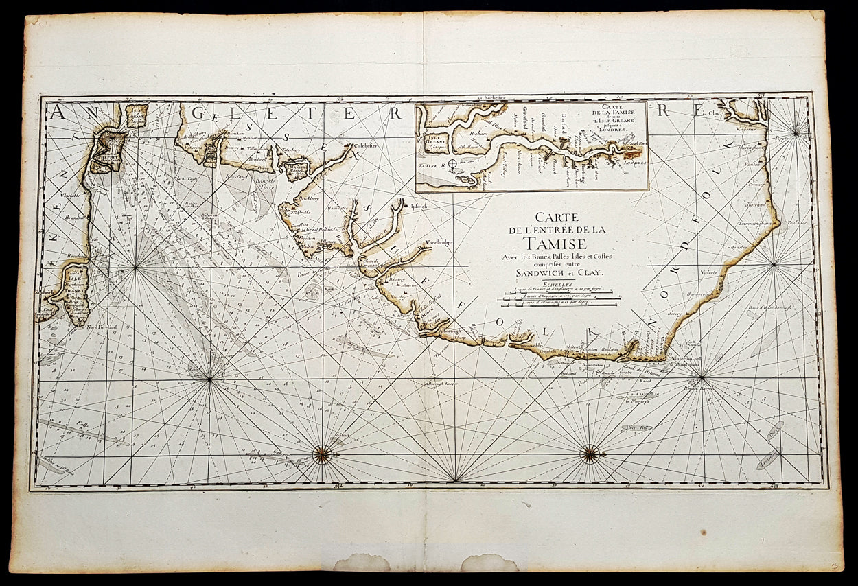
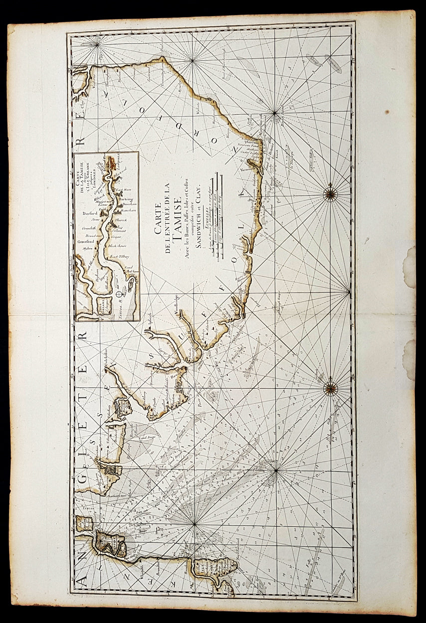
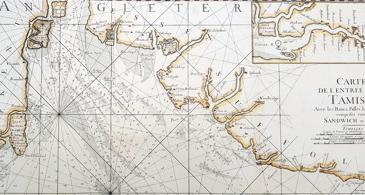
Description:This large beautifully hand coloured original 1693 antique sea-chart, map of SE England from Clay, Norfolk, to Sandwich and the entrance of the Thames Estuary by A H Jaillot was published in his large elephant folio Le Neptune Francois, ou Atlas Nouveau des Cartes MarinesHandsome sea-chart illustrating the importance of this region to Englands dominance by its navy. Shows the Thames Estuary & river to London, showing many sandbars, soundings and coastline, blank verso.
General Definitions:Paper thickness and quality: - Heavy and stablePaper color : - off whiteAge of map color: - OriginalColors used: - YellowGeneral color appearance: - AuthenticPaper size: - 37 1/2in x 25 1/2in (950mm x 650mm)Plate size: - 36in x 18in (930mm x 460mm)Margins: - Min 1in (25mm)
Imperfections:Margins: - Light age toningPlate area: - NoneVerso: - None