Welcome to Classical Images!
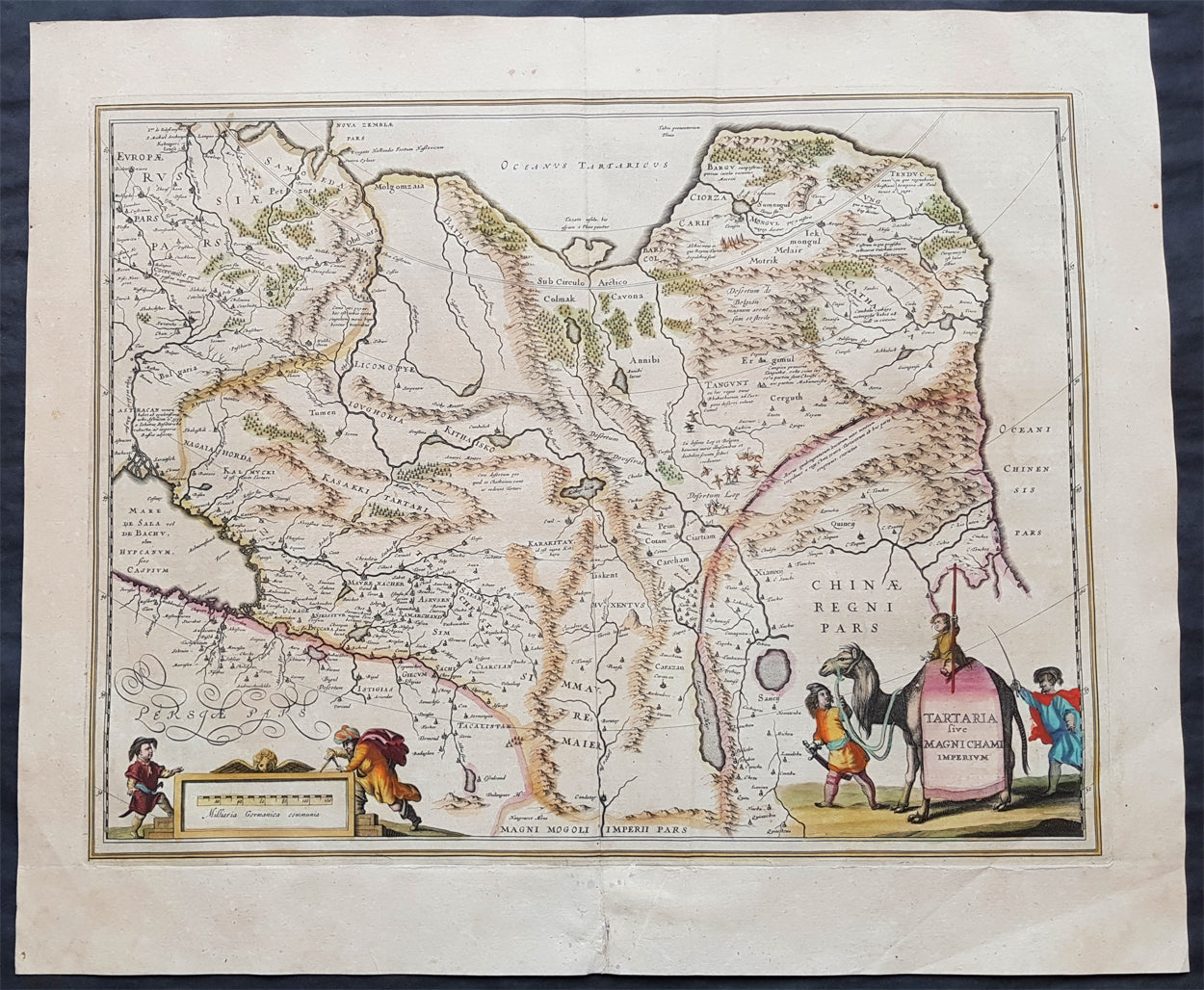
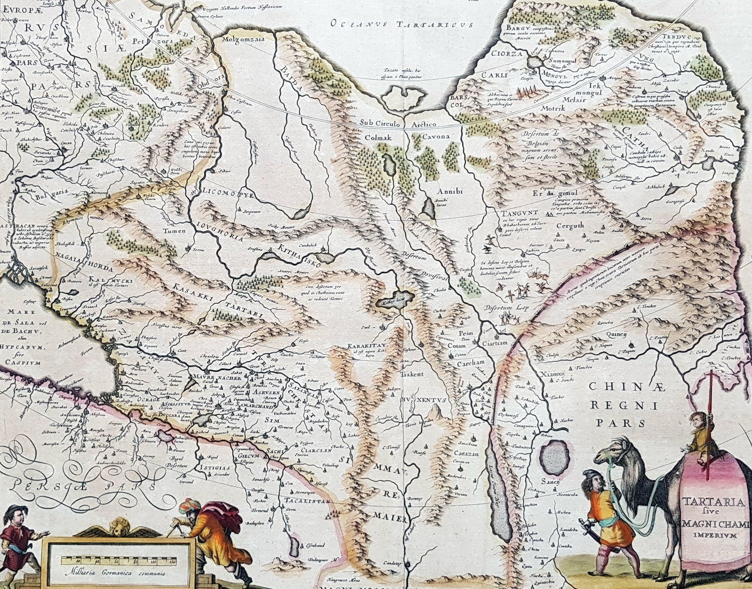
Description:This handsome hand coloured original antique map of China, Tartary (Russian Siberia) & Central Asia was published by Jan Jansson in the 1639 French edition of Atlas Novus.
General Description: Paper thickness and quality: - Heavy and stable Paper color: - off white Age of map color: - Original Colors used: - Green, red, orange, yellow, blue General color appearance: - Authentic Paper size: - 23in x 19 1/2in (585mm x 495mm) Plate size: - 20in x 15 1/2in (510mm x 395mm) Margins: - Min 1in (25mm) Imperfections: Margins: - Uniform age toning Plate area: - Uniform age toning Verso: - Uniform age toning, bottom centerfold re-joined
Background: This handsome map shows all of eastern Asia between the Caspian Sea and a good portion of northern China and Manchuria both from outside and within the confines of The Great Wall. This map of north-eastern Asia is dated when Tartary vaguely meant those regions to the north of Persia and China. The name Siberia only began to be applied with the gradual eastward expansion of the Russian Cossacks into those areas hinted at in the accounts of Marco Polo from three centuries earlier. The Mythical and legendary nature of the geography of this vast interior is illustrated by the inclusion of devils and dragons in the Desertum Lop to the left of the Great Wall. (Ref Tooley M&B)