Welcome to Classical Images!
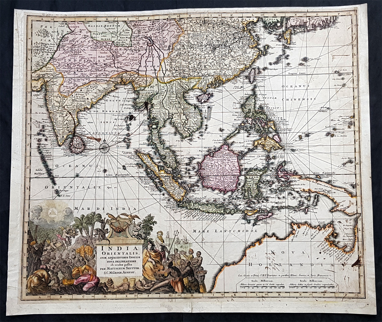
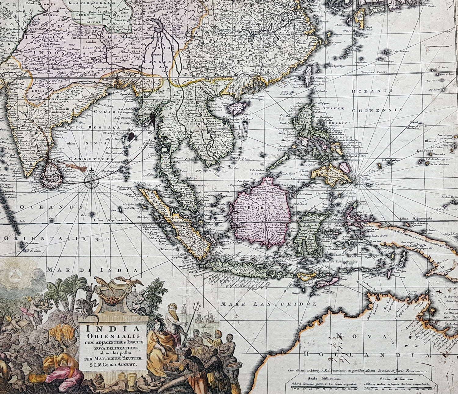
Description:This large, beautifully hand coloured original antique map of the North & NW coastline of New Holland (Australia) East Asia, SE Asia, China, East Indies was published by Georg Mattraus Seutter in 1730.The map is backed on 18th century contemporary paper and has old ink spots & lines but is overall a nice map and is priced accordingly.
General Definitions:Paper thickness and quality: - Heavy and stablePaper color : - off whiteAge of map color: - OriginalColors used: - Yellow, green, blue, pinkGeneral color appearance: - AuthenticPaper size: - 24in x 20in (610mm x 510mm)Plate size: - 22 1/2in x 19in (565mm x 490mm)Margins: - Min 1/2in (12mm)
Imperfections:Margins: - Age toning, light soilingPlate area: - Old ink marks & spots on map, light soiling, creasingVerso: - Backed onto contemporary paper
Background:The map extends from China, Japan and Persia in the North and in the south stretching from The Maldives east to Northern Australia. Of note, Australia continues to be attached to Nova Guinea, albeit with some hesitation, as the image extends outside the inner neat-line to convey this information - even though 20+ names are confidently engraved around Northern Australia Coastline.The detail throughout Southeast Asia is informative and up-to-date and the print style typically strong.The cartouche is one of Seutter\'s most ornate, with elaborate scenes from sea, land, jungle and mythology.This map rarely appears on the market, as it was only included in select copies of Seutters atlas.