Welcome to Classical Images!
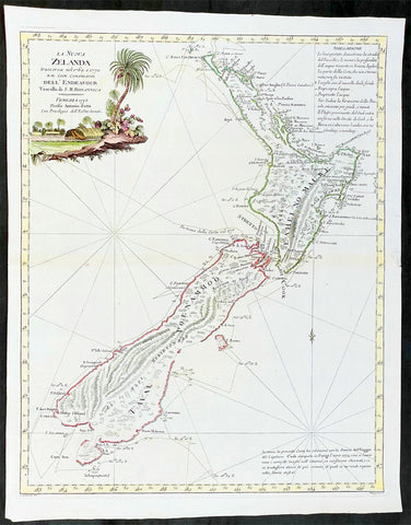
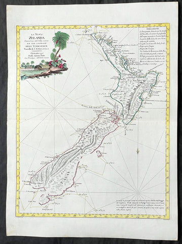
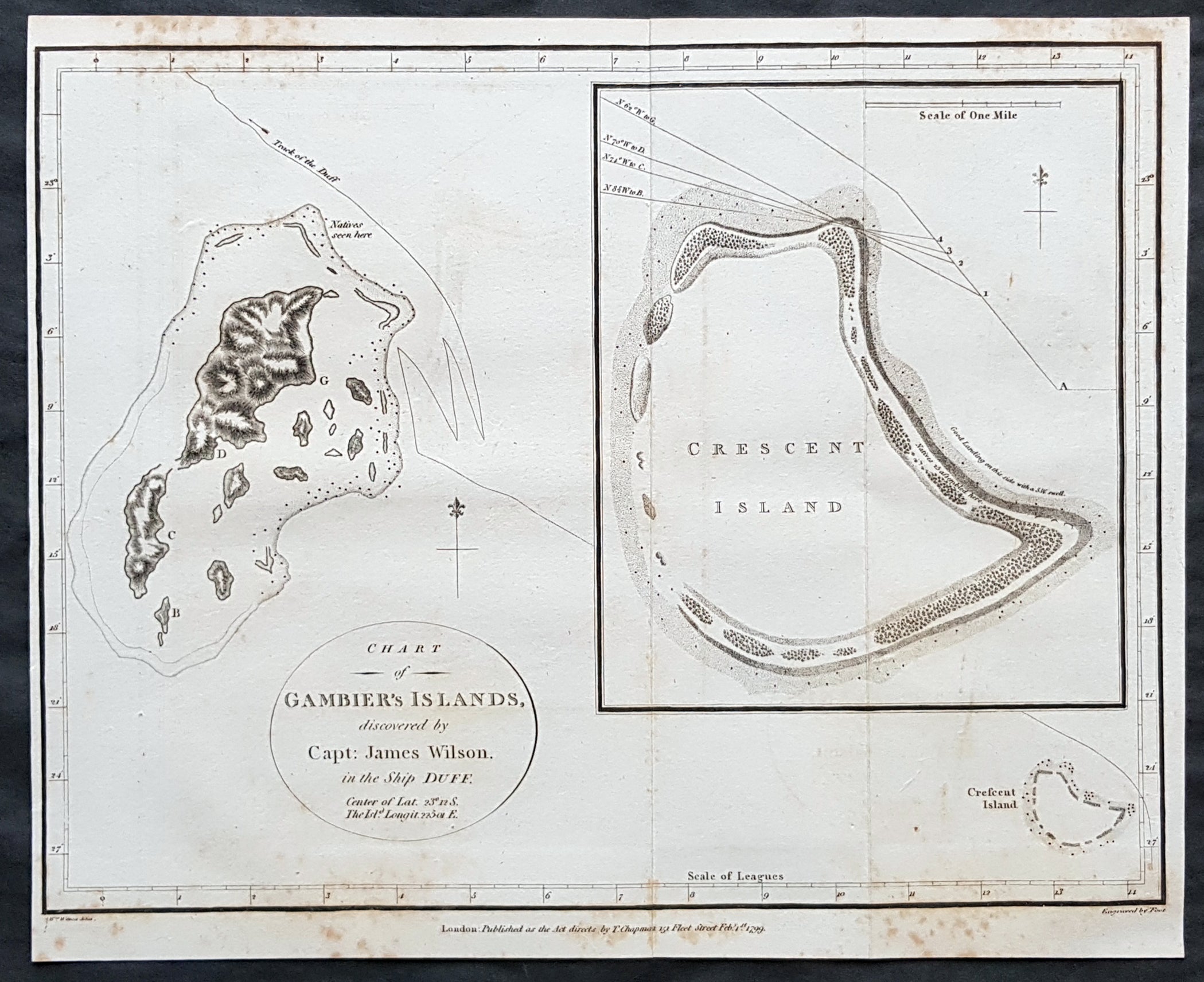
Description:This copper-plate engraved original antique map of the Gambier Islands in French Polynesia located in the South Pacific was engraved in by Thomas foot and was published in the 1799 edition Captain James Wilsons A missionary voyage to the Southern Pacific Ocean, performed in the years 1796, 1797, 1798, in the ship Duff commanded by Captain James Wilson.Compiled from journals of the officers and the missionaries. With a preliminary discourse on the geography and history of the South Sea Islands; and an appendix, including details never before published of the natural and civil state of Otaheite.Captain James Wilson (1760–1814), commanded the British ship Duff, which the London Missionary Society contracted in 1797 to convey a team of missionaries (consisting of thirty men, six women, and three children) to their postings in Tahiti, Tonga, and the Marquesas Islands. During the voyage, Wilson also surveyed (or confirmed the locations of) numerous islands in the Pacific, including Vanua Balavu, Fulaga and Ogea Levu in Fiji, Mangareva in the Gambier Islands, Pukarua in the Tuamotus, and Satawal, Elato, and Lamotrek, in the Caroline Islands.Three years after the establishment of the British mission in Tahiti, the directors of the Society appointed a committee to consider a suitable memorial for presentation to Wilson for his services in helping to establish the first mission in the South Seas.He published an account of his voyage: A Missionary Voyage to the Southern Pacific Ocean in 1799. (Ref: M&B; Tooley)
General Definitions:Paper thickness and quality: - Heavy and stablePaper color : - off whiteAge of map color: -Colors used: -General color appearance: -Paper size: - 12in x 9 1/2in (305mm x 240mm)Plate size: - 12in x 9 1/2in (305mm x 240mm)Margins: - Min 1/4in (5mm)
Imperfections:Margins: - Light solingPlate area: - Folds as issuedVerso: - Light soling
Background: The Gambier Islands are a group of islands, remnants of a caldera along with islets on the surrounding fringing reef, in French Polynesia, located at the southeast terminus of the Tuamotu archipelago. They are generally considered a separate island group from Tuamotu both because their culture and language (Mangarevan) are much more closely related to those of the Marquesas Islands, and because, while the Tuamotus comprise several chains of coral atolls, the Gambiers are of volcanic origin with central high islands.Approximately from the 10th to the 15th centuries, the Gambiers hosted a population of several thousand people and traded with other island groups including the Marquesas, the Society Islands and Pitcairn Islands. However, excessive logging by the islanders resulted in almost complete deforestation on Mangareva, with disastrous results for the islands environment and economy. The folklore of the islands records a slide into civil war and even cannibalism as trade links with the outside world broke down, and archaeological studies have confirmed this. Today, the islands can support a population of only a few hundred.In 1834, the French Picpus priests Honoré Laval and François Caret with their assistant Columba Murphy founded a Roman Catholic mission in the Gambiers. After their success here, they moved to Tahiti in 1836.Mangareva along with its dependencies in the Gambier Islands were ruled by a line of kings and later regents that ruled until the French formally annexed the islands in 1881. A French protectorate was requested on 16 February 1844 by King Maputeoa but was never ratified by the French government. On 4 February 1870, Prince Regent Arone Teikatoara and the Mangarevan government formally withdrew the protectorate request and asked the French to not intervene in the kingdom\'s affairs. After Father Laval was removed to Tahiti, the native government changed their stance and an agreement between the native government and the French colonial authority in Tahiti was signed reaffirming the protectorate status on 30 November 1871. The Gambier Islands were finally annexed on 21 February 1881 under Prince Regent Bernardo Putairi and approved by the President of France on 30 January 1882.The Gambier Islands include the Mangareva Islands (The Gambier Islands proper) which have an enclosing coral reef which is broken by only three passages to the open sea. Besides Mangareva, the other notable high islands of the group are Akamaru, Angakauitai, Aukena, Kamaka, Kouaku, Makapu, Makaroa, Manui, Mekiro and Taravai. These are primarily of volcanic origin. A number of others are actually coral islands, hence of secondary volcanic origin, including Papuri, Puaumu, Totengengie and the Tokorua group.