Welcome to Classical Images!
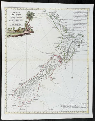
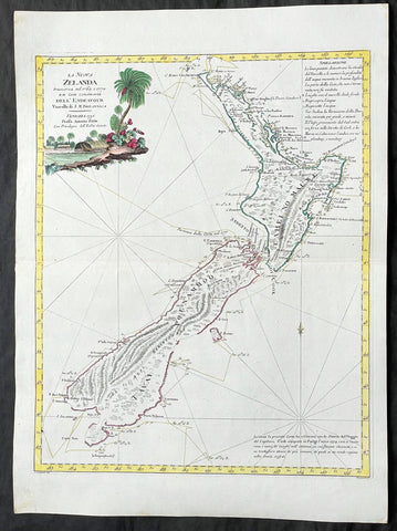
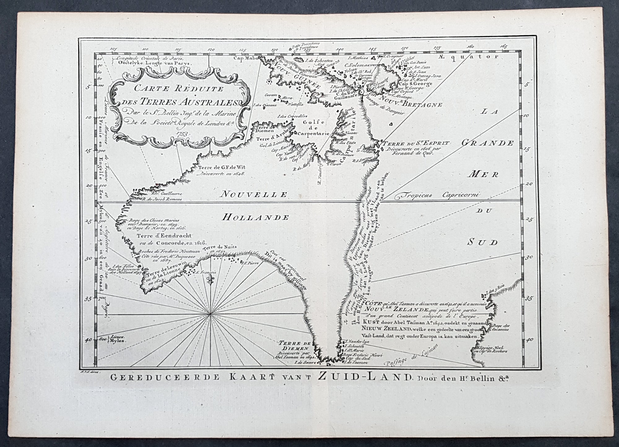
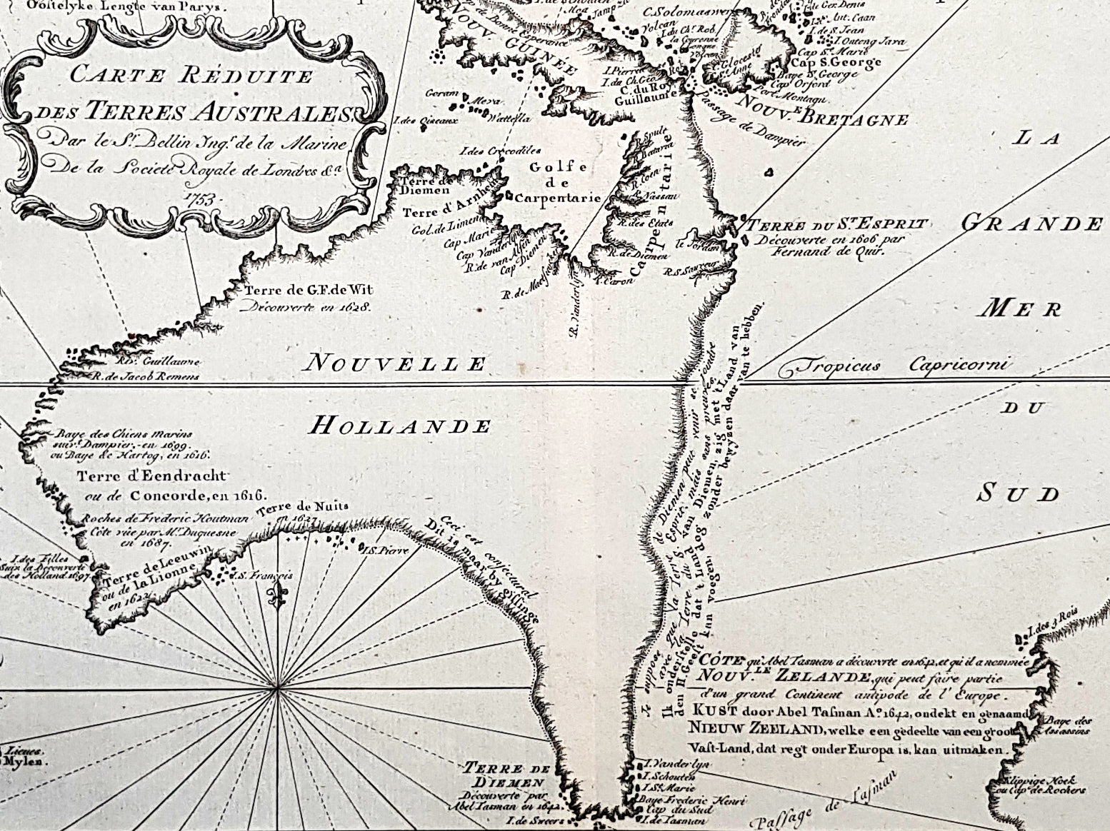
Description:This important, early original copper-plate engraved antique map of Australia, New Zealand & New Guinea, one of the earliest near complete maps dedicated to the Island Continent, by Jacques Nicolas Bellin was engraved by Jakob van der Schley in 1753 - date engraved in the title cartouche - and was published by Abbé Prévosts in the 1755 Dutch edition of Histoire Géneral des Voyages.General Definitions:Paper thickness and quality: - Heavy and stablePaper color : - off whiteAge of map color: -Colors used: -General color appearance: -Paper size: - 14in x 10in (355mm x 255mm)Plate size: - 11 3/4in x 8 1/2in (295mm x 215mm)Margins: - Min 1in (20mm)
Imperfections:Margins: - NonePlate area: - NoneVerso: - None
Background: This is one of the few maps prior to the mid 18th century to focus specifically on the Australian continent & surrounding islands, prior to Captain James Cooks famous first voyage to the south pacific, under secret instruction from the British Admiralty, between 1768 & 1771.Mainland Australia is connected to both Tasmania (Terre de Van Diemen) and Papua New Guinea (Nouv. Guinee) Along the imaginary eastern coastline is a note that reads: I suppose that the land of Diemen can join with the land of Terre du St Esprit, but this is without proof. A partial coastline of New Zealand is shown peeking out of the corner of the map, with a note of discovery along the western coastline by Abel Tasman in 1642 and speculation that it might be part of a great southern continent, Terra Australis.
Jakob van der Schley aka Jakob van Schley 1715 - 1779 was a Dutch draughtsman and engraver. He studied under Bernard Picart (1673-1733) whose style he subsequently copied. His main interests were engraving portraits and producing illustrations for La Vie de Marianne by Pierre Carlet de Chamblain de Marivaux (1688-1763), published in The Hague between 1735 and 1747. He also engraved the frontispieces for a 15-volume edition of the complete works of Pierre de Brantôme (1540-1614), Oeuvres du seigneur de Brantôme, published in The Hague in 1740. Most of the plates in the Hague edition of Prévosts Histoire générale des voyages are signed by van der Schley.This is an important map of Australia depicting the interesting theories & misconceptions of the great southern land just prior to the extensive exploration & discoveries of the region in the later part of the 18th century. (Ref: Tooley; M&B)