Welcome to Classical Images!
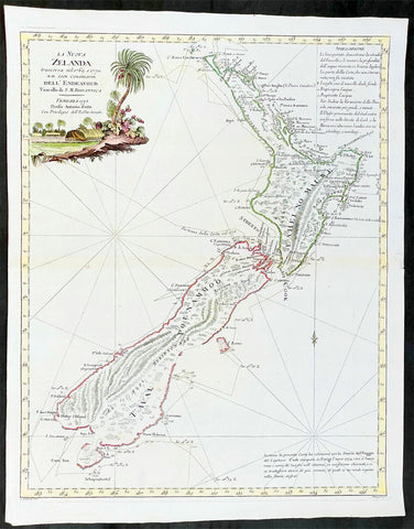
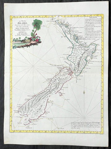
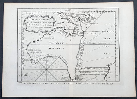
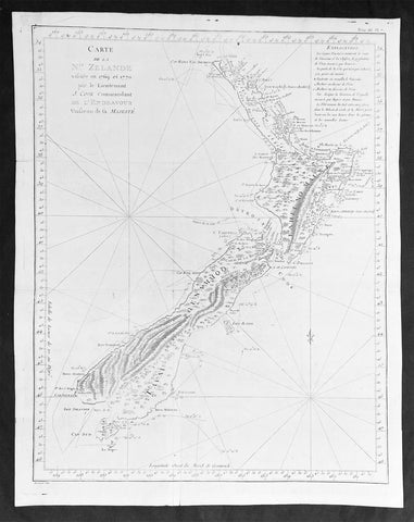
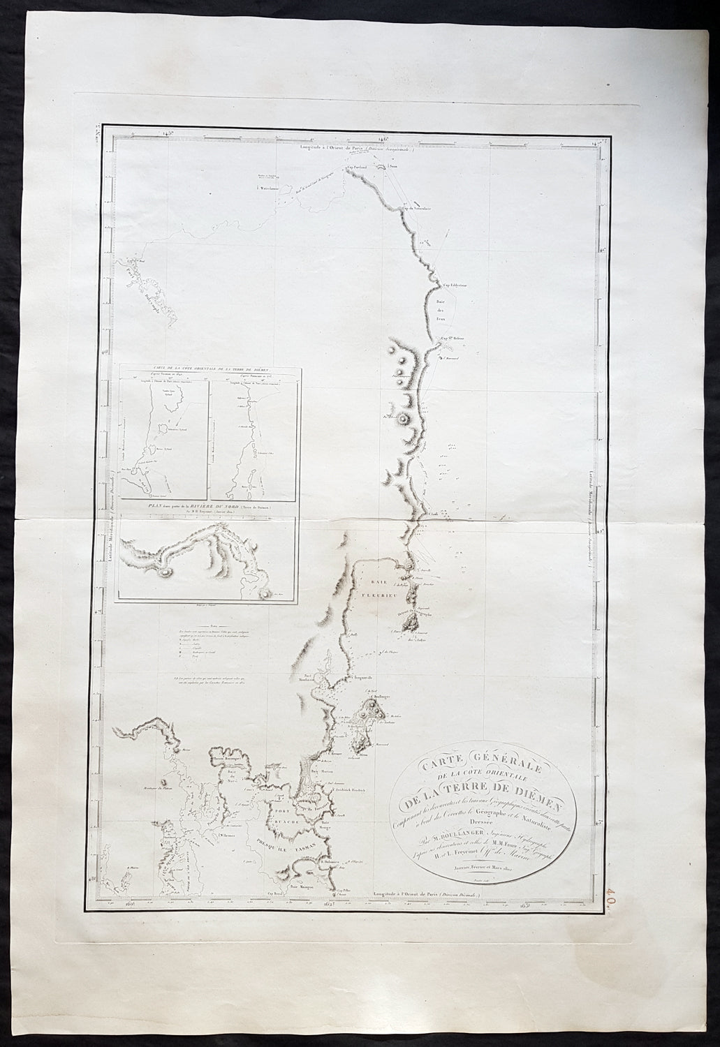
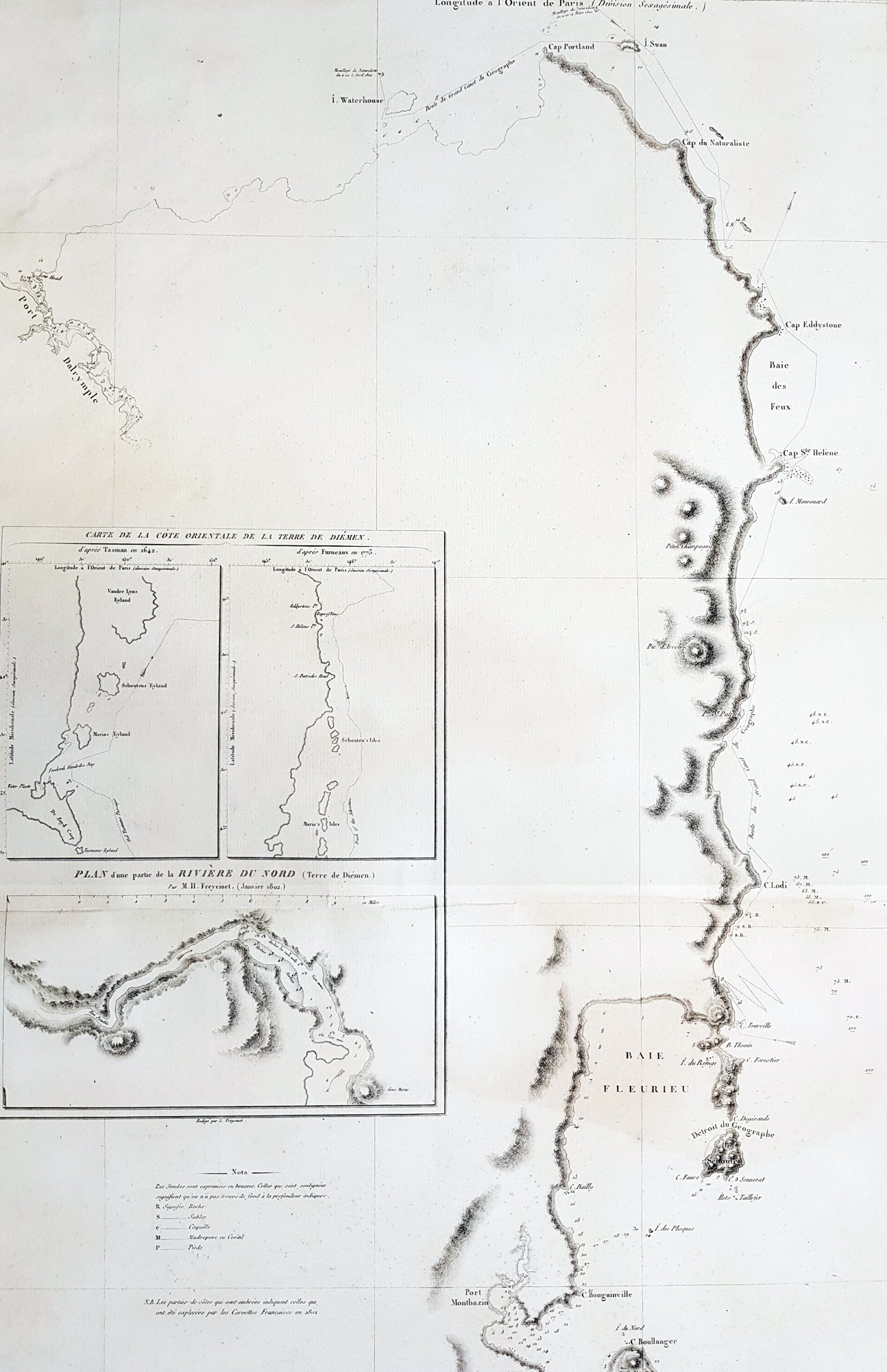
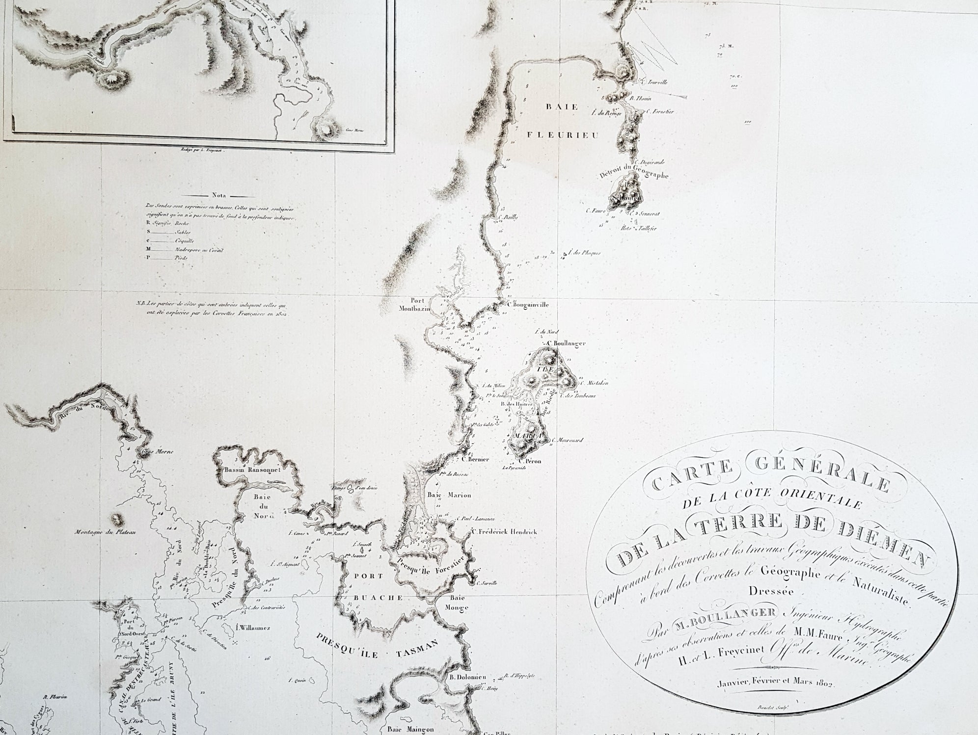
Description: This large beautifully engraved early important original antique map of Tasmania as surveyed by the Baudin expedition in 1802 - from Cape Portland to Maingon Bay - was engraved by Charles Bouclet in 1802 - the date is engraved in the title cartouche - and was published in the 1812 Ist edition of Voyage de descouvertes aux Terres Australes by Louis de Freycinet. This was the largest and most detailed map of Tasmania published up to this time.
Background: The map contains 3 inset maps two of which shows early cartographic details of Van Diemens land by Abel Tasman in 1642 & the English explorer Tobias Furneaux in 1773. The third inset is a map of part of the North River surveyed by Freycinet in 1802.After returning from the first expedition on Le Naturaliste and Le Geographe Louis Freycinet returned to Australia on La Casuarina and aided by Boullanger explored Northern Tasmania and the southern coast of Australia. This and earlier voyages resulted in the publication of Voyage de descouvertes aux Terres Australes in 1812. (Ref: Tooley; M&B)
General Description: Paper thickness and quality: - Heavy and stable Paper color: - off white Age of map color: - Colors used: - General color appearance: - Paper size: - 38in x 26in (965mm x 600mm) Plate size: - 31 1/2in x 21 1/2in (800mm x 545mm) Margins: - Min 2in (50mm) Imperfections: Margins: - Light age toning, repair to top margin Plate area: - Light age toning Verso: - Light age toning