Welcome to Classical Images!
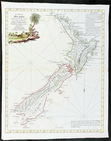
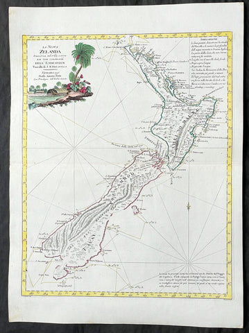
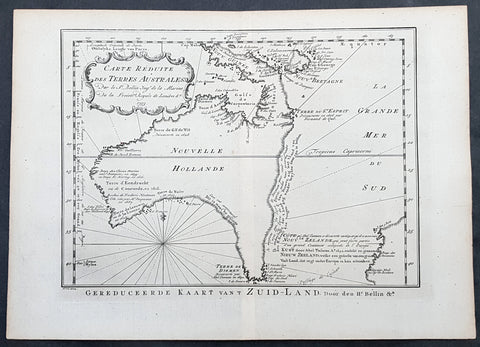
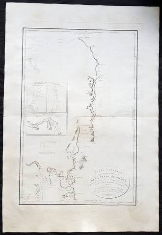
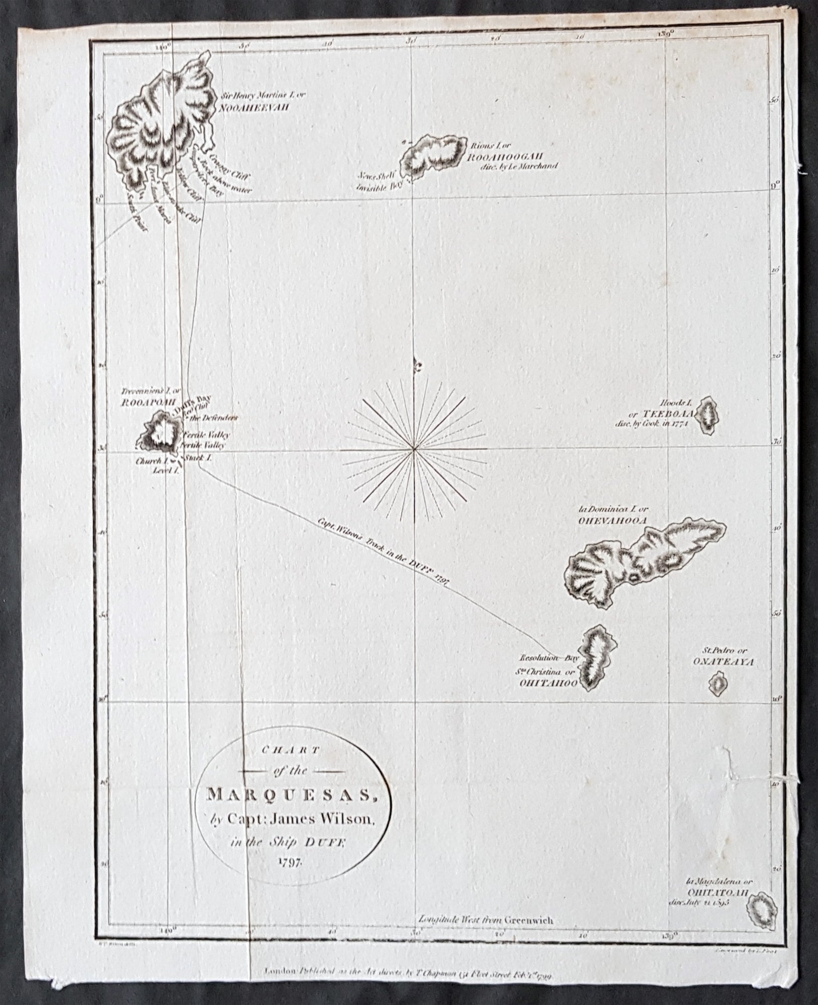
Description:This copper-plate engraved original antique map of the Marquesas group of islands in French Polynesia located in the South Pacific was engraved in 1797 - dated - by Thomas foot and was published in the 1799 edition Captain James Wilsons A missionary voyage to the Southern Pacific Ocean, performed in the years 1796, 1797, 1798, in the ship Duff commanded by Captain James Wilson.Compiled from journals of the officers and the missionaries. With a preliminary discourse on the geography and history of the South Sea Islands; and an appendix, including details never before published of the natural and civil state of Otaheite.Captain James Wilson (1760–1814), commanded the British ship Duff, which the London Missionary Society contracted in 1797 to convey a team of missionaries (consisting of thirty men, six women, and three children) to their postings in Tahiti, Tonga, and the Marquesas Islands. During the voyage, Wilson also surveyed (or confirmed the locations of) numerous islands in the Pacific, including Vanua Balavu, Fulaga and Ogea Levu in Fiji, Mangareva in the Gambier Islands, Pukarua in the Tuamotus, and Satawal, Elato, and Lamotrek, in the Caroline Islands.Three years after the establishment of the British mission in Tahiti, the directors of the Society appointed a committee to consider a suitable memorial for presentation to Wilson for his services in helping to establish the first mission in the South Seas.He published an account of his voyage: A Missionary Voyage to the Southern Pacific Ocean in 1799. (Ref: M&B; Tooley)
General Definitions:Paper thickness and quality: - Heavy and stablePaper color : - off whiteAge of map color: -Colors used: -General color appearance: -Paper size: - 11 1/2in x 9in (295mm x 230mm)Plate size: - 11 1/2in x 9in (295mm x 230mm)Margins: - Min 1/4in (5mm)
Imperfections:Margins: - Light solingPlate area: - Folds as issuedVerso: - Folds as issued
Background: The Marquesas Islands are a group of volcanic islands in French Polynesia, an overseas collective of France in the southern Pacific Ocean.The first Europeans to reach the Marquesas may have been the crew of San Lesmes, a Spanish vessel which disappeared in a storm in June 1526; it was part of an expedition headed by García Jofre de Loaísa.[10] The Spanish explorer Álvaro de Mendaña reached them nearly seventy years later on 21 July 1595. He named them after his patron, García Hurtado de Mendoza, 5th Marquis of Cañete (Spanish: Marqués de Cañete), who served as Viceroy of Peru from 1590 to 1596. Mendaña visited first Fatu Hiva and then Tahuata before continuing on to the Solomon Islands. His expedition charted the four southernmost Marquesas as Magdalena (Fatu Hiva), Dominica (Hiva ʻOa), San Pedro (Moho Tani), and Santa Cristina (Tahuata).In the late 16th century European explorers estimated the population at more than 100,000. Europeans and Americans were impressed with how easy life appeared to be in the islands, which had a rich habitat and environment. In 1791 the American maritime fur trader Joseph Ingraham first visited the northern Marquesas while commanding the brig Hope. He named them the Washington Islands. In 1813 Commodore David Porter claimed Nuku Hiva for the United States, but the United States Congress never ratified that claim.In 1842 France conducted a successful military operation on behalf of the native chief Iotete, who claimed he was king of the whole island of Tahuata. The government laid claim to the whole group and established a settlement on Nuku Hiva. That settlement was abandoned in 1857, but France re-established control over the group in 1870. It later incorporated the Marquesas into French Polynesia.