Welcome to Classical Images!
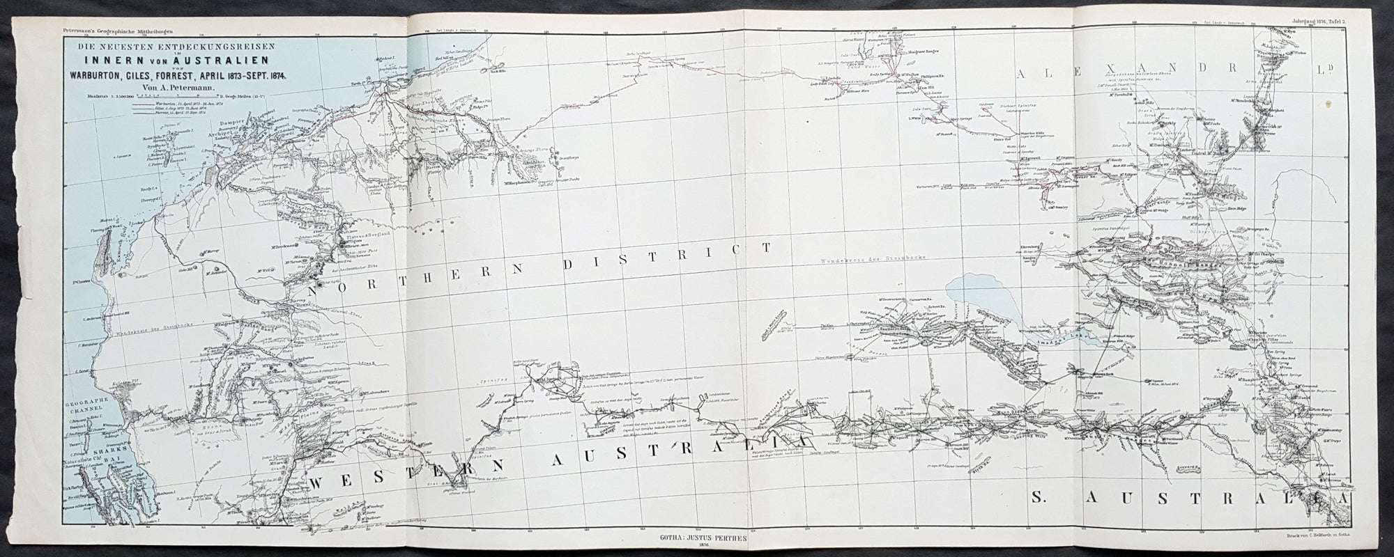
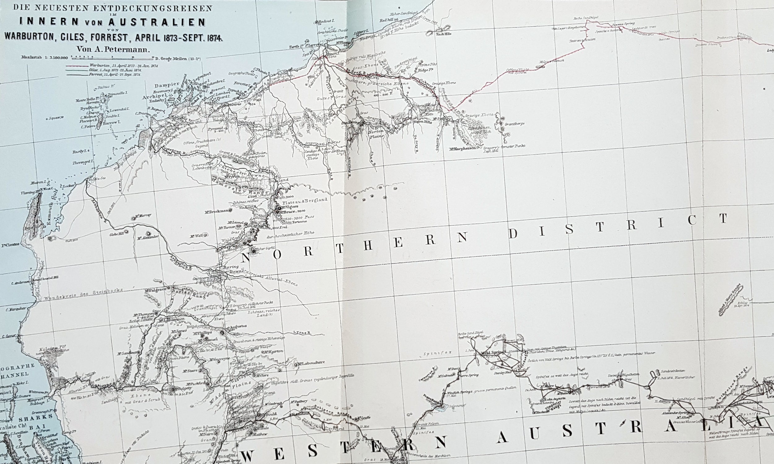
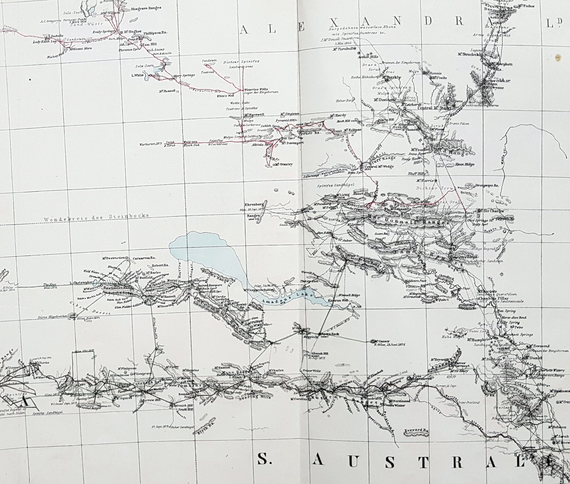
Description:This early folding original antique lithograph map of Western & South Australia and Alexandria land (Northern Territory) with the tracks of 3 explorers - in 1873 & 1874 - Peter Egerton-Warburton, Ernest Giles & Alexander Forrest by Augustus Heinrich Petermann was engraved in 1876 - dated - and was published by Justus Perthes, Gotha Germany.
General Definitions:Paper thickness and quality: - Heavy and stablePaper color : - off whiteAge of map color: - OriginalColors used: - Blue, red, yellowGeneral color appearance: - AuthenticPaper size: - 27in x 11in (285mm x 280mm)Plate size: - 27in x 11in (285mm x 280mm)Margins: - Min 1/2in (12mm)
Imperfections:Margins: - NonePlate area: - Folds as issuedVerso: - None
Background: Colonel Peter Egerton-Warburton CMG (1813–1889), was a British military officer, Commissioner of Police for South Australia, and an Australian explorer. In 1872 he sealed his legacy through a particularly epic expedition from Adelaide crossing the arid centre of Australia to the coast of Western Australia via Alice Springs.William Ernest Powell Giles (1835 – 1897) best known as Ernest Giles, was an Australian explorer who led five major expeditions in central Australia.Alexander Forrest CMG (1849 – 1901) was an explorer and surveyor of Western Australia, and later also a member of parliament.