Welcome to Classical Images!
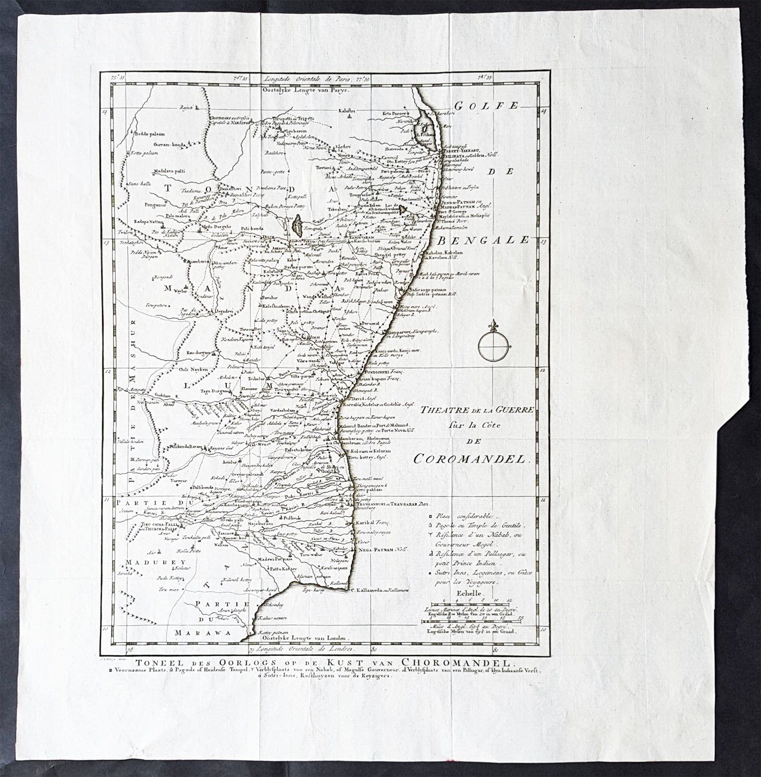
Description:This large original copper-plate engraved antique map of the Coromandel Coast, India during the Carnatic Wars, by Jakob van Schley in 1755, was published in the Dutch edition of Antoine François Prevosts 15 volumes of Histoire Generale des Voyages written by Prevost & other authors between 1746-1790.
General Definitions:Paper thickness and quality: - Heavy and stablePaper color : - off whiteAge of map color: -Colors used: -General color appearance: -Paper size: - 17in x 15in (430mm x 380mm)Plate size: - 13in x 13in (305mm x 305mm)Margins: - Min 1in (25mm)
Imperfections:Margins: - NonePlate area: - Folds as issuedVerso: - None
Background: The Carnatic Wars (also spelled Karnatic Wars) were a series of military conflicts in the middle of the 18th century in India. The conflicts involved numerous nominally independent rulers and their vassals, struggles for succession and territory, and included a diplomatic and military struggle between the French East India Company and the British East India Company. They were mainly fought on the territories in India which were dominated by the Nizam of Hyderabad up to the Godavari delta. As a result of these military contests, the British East India Company established its dominance among the European trading companies within India. The French company was pushed to a corner and was confined primarily to Pondichéry. The East India company\'s dominance eventually led to control by the British Company over most of India and eventually to the establishment of the British Raj.In the 18th century, the coastal Carnatic region was a dependency of Hyderabad. Three Carnatic Wars were fought between 1746 and 1763.The Coromandel Coast is the southeastern coast region of the Indian subcontinent, bounded by the Utkal Plains to the north, the Bay of Bengal to the east, the Kaveri delta to the south, and the Eastern Ghats to the west, extending over an area of about 22,800 square kilometres. Its definition can also include the northwestern coast of the island of Sri Lanka.By late 1530 the Coromandel Coast was home to three Portuguese settlements at Nagapattinam, São Tomé de Meliapore, and Pulicat. In the 17th and 18th centuries, the Coromandel Coast was the scene of rivalries among European powers for control of the India trade. The British established themselves at Fort St George (Madras) and Masulipatnam, the Dutch at Pulicat, Sadras and Covelong, the French at Pondicherry, Karaikal and Nizampatnam, the Danish in Dansborg at Tharangambadi.The Coromandel Coast supplied Indian Muslim eunuchs to the Thai palace and court of Siam. The Thai at times asked eunuchs from China to visit the court in Thailand and advise them on court ritual since they held them in high regard.Eventually the British won out, although France retained the tiny enclaves of Pondichéry and Karaikal until 1954. Chinese lacquer goods, including boxes, screens, and chests, became known as Coromandel goods in the 18th century, because many Chinese exports were consolidated at the Coromandel ports.