Welcome to Classical Images!
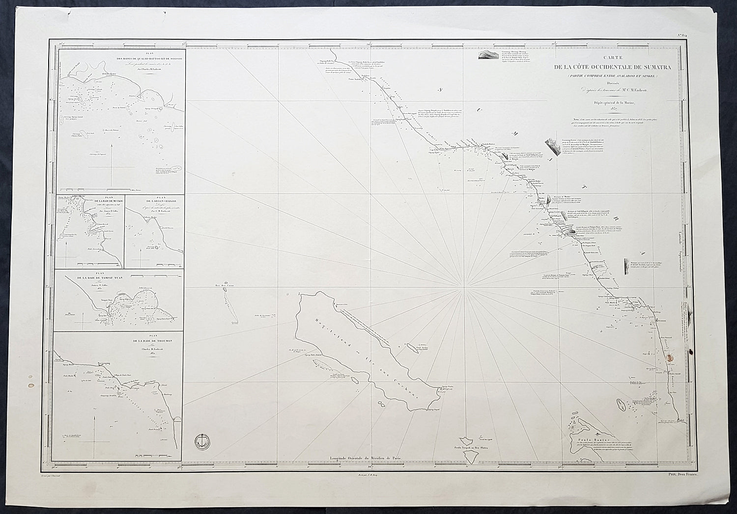
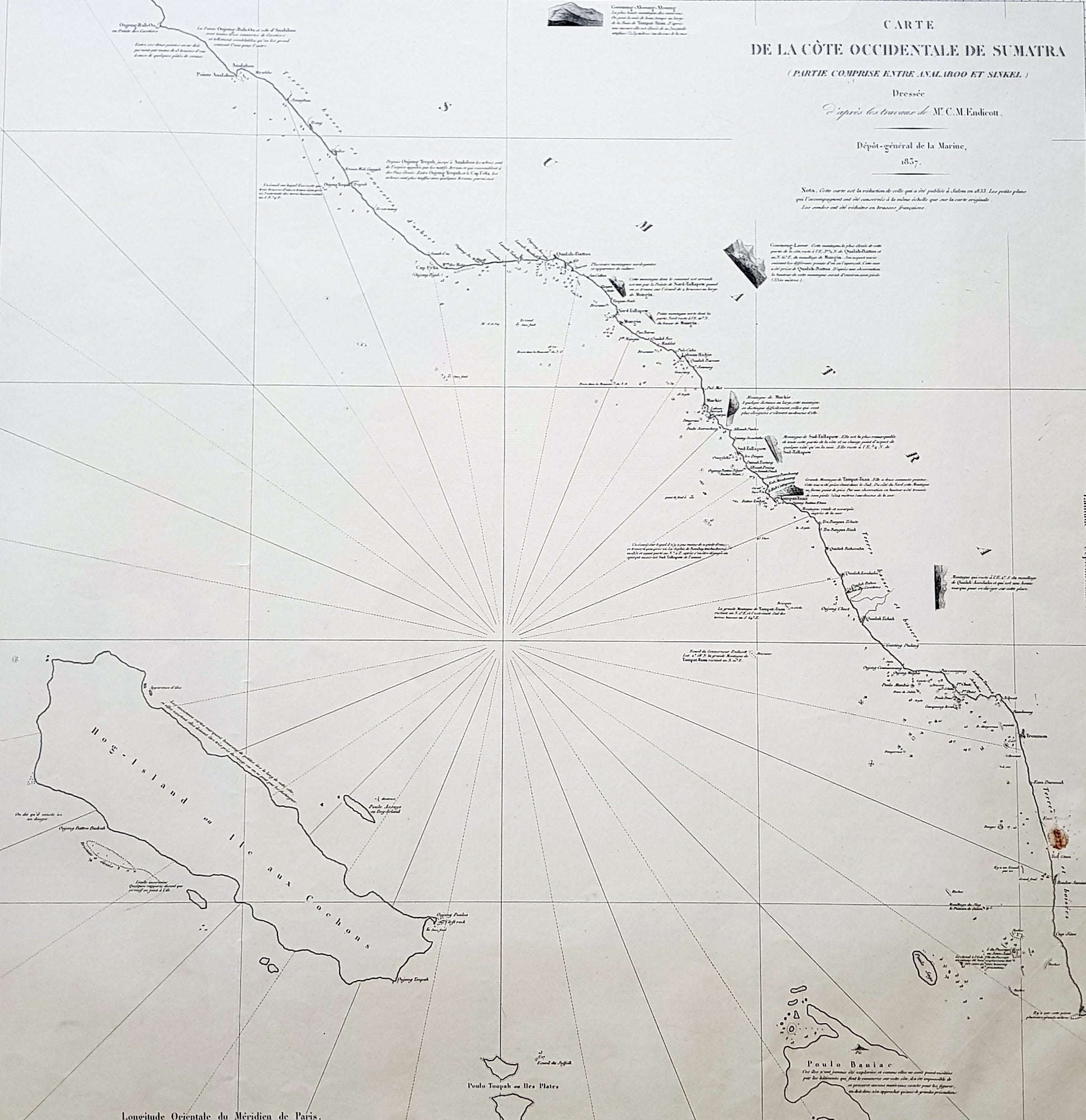
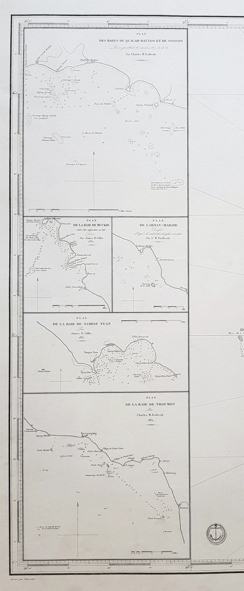
Description:This very large highly detailed original antique map, Sea Chart of the South west coast of Aceh on the North-West tip of the Island of Sumatra, Indonesia was engraved in 1837 - the date is engraved in the title - and was published by The French Admiralty - Depot General de la Marine. At the time of publication Baron Duperre was head of the French Admiralty. This sea chart would have been one of the actual charts used by the French navy during the many voyages of discovery launched by the French in the 18th & 19th centuries.The map stretches from the town of Singkil on the south coast to the town of Meulaboh in the north. Off the coast is the Island of Simeulue. Inset are 5 inset maps of ports and harbours along the SW Aceh coastline.1. Qualh-Battoo et De Soosoo (Susu)2. Baie De Muckie3. De Labon et Hadje (Labuan)4. Baie Tampat Tuan (Tapak Tuan)5. Baie De Troumon (Trumon)
General Definitions:Paper thickness and quality: - Heavy and stablePaper color : - off whiteAge of map color: -Colors used: -General color appearance: -Paper size: - 38in x 26 1/2in (330mm x 255mm)Plate size: - 38in x 26 1/2in (330mm x 255mm)Margins: - Min 1/2in (12mm)
Imperfections:Margins: - NonePlate area: - NoneVerso: - None
Background: Aceh is a province of Indonesia. The territory is located at the northern end of Sumatra. Its capital is Banda Aceh. It is close to the Andaman and Nicobar Islands of India and separated from them by the Andaman Sea. Its population has the highest percentage of Muslims in Indonesia, who mostly live according to Sharia customs and laws.The Sultanate of Aceh was established by Sultan Ali Mughayat Syah in 1511.In 1584–88 the Bishop of Malacca, D. João Ribeiro Gaio, based on information provided by a former captive called Diogo Gil, wrote the Roteiro das Cousas do Achem (Lisboa 1997) – a description of the Sultanate.Later, during its golden era, in the 17th century, its territory and political influence expanded as far as Satun in southern Thailand, Johor in Malay Peninsula, and Siak in what is today the province of Riau. As was the case with most non-Javan pre-colonial states, Acehnese power expanded outward by sea rather than inland. As it expanded down the Sumatran coast, its main competitors were Johor and Portuguese Malacca on the other side of the Straits of Malacca. It was this seaborne trade focus that saw Aceh rely on rice imports from north Java rather than develop self sufficiency in rice production.After the Portuguese occupation of Malacca in 1511, many Islamic traders passing the Malacca Straits shifted their trade to Banda Aceh and increased the Acehnese rulers\' wealth. During the reign of Sultan Iskandar Muda in the 17th century, Aceh\'s influence extended to most of Sumatra and the Malay Peninsula. Aceh allied itself with the Ottoman Empire and the Dutch East India Company in their struggle against the Portuguese and the Johor Sultanate. Acehnese military power waned gradually thereafter, and Aceh ceded its territory of Pariaman in Sumatra to the Dutch in the 18th century.By the early nineteenth century, however, Aceh had become an increasingly influential power due to its strategic location for controlling regional trade. In the 1820s it was the producer of over half the world\'s supply of black pepper. The pepper trade produced new wealth for the Sultanate and for the rulers of many smaller nearby ports that had been under Aceh\'s control, but were now able to assert more independence. These changes initially threatened Acehs integrity, but a new sultan Tuanku Ibrahim, who controlled the kingdom from 1838 to 1870, reasserted power over nearby ports.Under the Anglo-Dutch Treaty of 1824 the British ceded their colonial possessions on Sumatra to the Dutch. In the treaty, the British described Aceh as one of their possessions, although they had no actual control over the Sultanate. Initially, under the agreement the Dutch agreed to respect Aceh\'s independence. In 1871, however, the British dropped previous opposition to a Dutch invasion of Aceh, possibly to prevent France or the United States from gaining a foothold in the region. Although neither the Dutch nor the British knew the specifics, there had been rumors since the 1850s that Aceh had been in communication with the rulers of France and of the Ottoman Empire
Depot des cartes et plans de la MarineThe Naval Hydrographic and Oceanographic Service is a French public establishment of an administrative nature, administered by the Ministry of Defence. It is the successor to the Dépôt des cartes et plans de la Marine, founded in 1720 which became the Naval Hydrographic Service in 1886 and the Naval and Oceanographic Service in 1971.