Welcome to Classical Images!
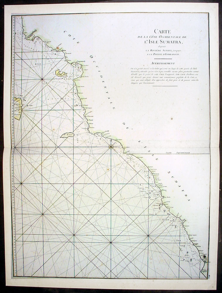
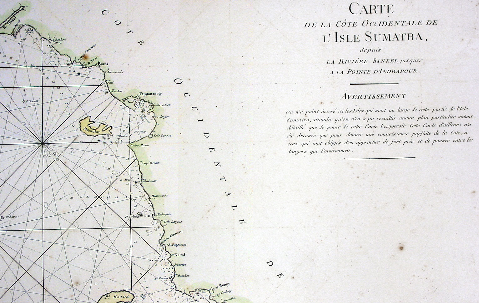
Description: This large hand coloured original antique map a sea chart of the west coast of Sumatra, Indonesia - centering on the city of Padang stretching south to Indrapura and north to Aceh - was published in the enlarged version of Le Neptune Oriental by Jean Baptiste De Mannevillette in 1745. (Ref: Tooley; M&B)
General Description: Paper thickness and quality: - Heavy and stable Paper color: - off white Age of map color: - Early Colors used: - Yellow, green, red, brown. General color appearance: - Authentic and fresh Paper size: - 27 1/2in x 20 1/2in (700mm x 520mm) Plate size: - 26 1/2n x 20in (675mm x 510mm) Margins: - Min ½in (12mm)
Imperfections: Margins: - None Plate area: - None Verso: - None