Welcome to Classical Images!
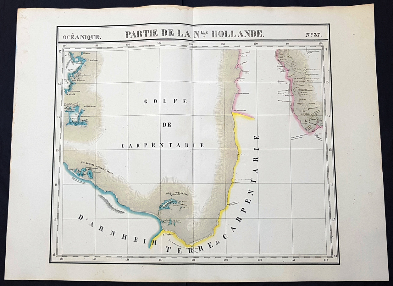
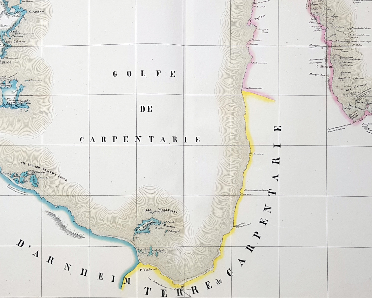
Description:This very large original hand coloured antique lithograph map of the Gulf of Carpentaria was published by Philippe Vandermaelen in his revolutionary 1825 Atlas universel de geographie physique, politique, statistique et mineralogique.Until the publication of this atlas, large detailed maps of this region of remote Australia were uncommon. The clean detailed lines and added hand colouring make this one of the most desirable early maps of northern Queensland and the NT.
General Definitions:Paper thickness and quality: - Heavy and stablePaper color : - off whiteAge of map color: - OriginalColors used: - Yellow, green, blue, pinkGeneral color appearance: - AuthenticPaper size: - 28 1/2in x 21in (725mm x 550mm)Plate size: - 28 1/2in x 21in (725mm x 550mm)Margins: - Min 1in (25mm)
Imperfections:Margins: - NonePlate area: - NoneVerso: - None
Background: The first European explorer to visit the region (and Australia) was the Dutch Willem Janszoon (whose name is also written as Jansz) in 1605–6. His fellow countryman, Jan Carstenszoon (or Carstensz), visited in 1623 and named the gulf in honour of Pieter de Carpentier, at that time the Governor-General of the Dutch East Indies. Abel Tasman also explored the coast in 1644. The region was later explored and charted by Matthew Flinders in 1802 and 1803.The first overland expedition to reach the Gulf was the Burke and Wills expedition, led by Robert O Hara Burke and William John Wills which left Melbourne, Victoria in August 1860 and reached the mouth of the Bynoe River in February 1861.