Welcome to Classical Images!
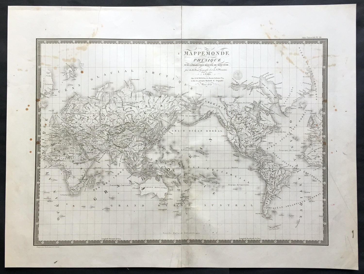
Description: This large original antique World map on Mercator's projection was engraved in 1821 - the date is engraved in the title - and was published in Adrien Brue's (1786 - 1832) large Atlas Universel de Geographie.
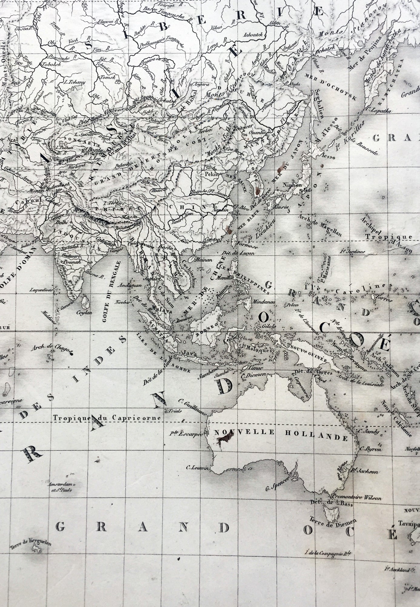
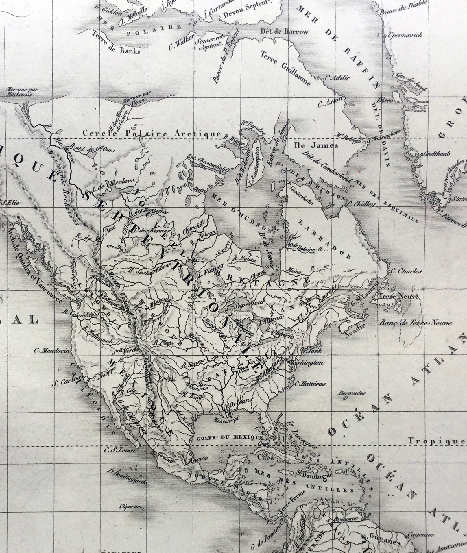
A fantastic World map in a time of great change. The map centres on New Holland or Australia (officially named Australia in 1824 by the British) Mexico still holds sway on the western portion of North America. Much of Capt. Cooks discoveries are recognised on this map in NW America and the south Pacific but not his explorations in Antarctica and beyond. Central Africa still remains relatively unexplored by the Europeans as does the Artic north of Canada. A fantastic map. (Ref: M&B; Tooley)
General Description: Paper thickness and quality: - Heavy and stable Paper color: - Off white Age of map color: - Colors used: - General color appearance: - Paper size: - 24in x 18in (610mm x 460mm) Plate size: - 21 1/2in x 15 1/2in (545mm x 395mm) Margins: - Min 1in (25mm)
Imperfections: Margins: - Soiling in margins, repair to top margin, no loss Plate area: - Soiling and spotting to top of map Verso: - Soiling