Adrien Brue
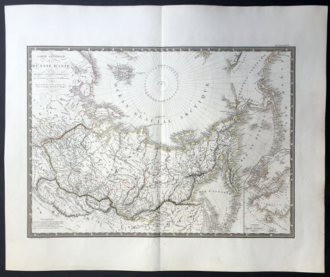
1821 Brue Large Antique Map of Siberia, Alaska, Behring Straits, North America
- Title : Carte Generale De La Russie D Asie et des Regions Polaris Borales...1821
- Ref #: 32455
- Size: 24in x 20in (610mm x 510mm)
- Date : 1821
- Condition: (A+) Fine Condition
Description:
This large beautifully engraved hand coloured original antique map of Siberia and more importantly an early mapping of Alaska and the Bering Straits - was engraved in 1821 - the date is engraved in the title - and was published in Adrien Brues (1786 - 1832) Universel de Geographie. (Ref: M&B; Tooley)
General Description:
Paper thickness and quality: - Heavy and stable
Paper color: - Off white
Age of map color: - Original
Colors used: - Yellow, pink, green, blue
General color appearance: - Authentic
Paper size: - 24in x 20in (610mm x 510mm)
Plate size: - 22in x 16in (560mm x 410mm)
Margins: - Min 1in (25mm)
Imperfections:
Margins: - None
Plate area: - None
Verso: - Bottom centerfold re-joined, no loss
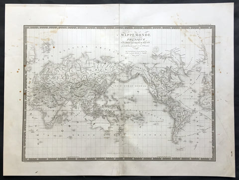
1821 Brue Large Antique World Map of Mercators Projection - New Holland, Texas
- Title : Mappemonde Physique...par Brue......1821
- Ref #: 32440
- Size: 24in x 18in (610mm x 460mm)
- Date : 1821
- Condition: (A) Very Good Condition
Description:
This large original antique World map on Mercator's projection was engraved in 1821 - the date is engraved in the title - and was published in Adrien Brue's (1786 - 1832) large Atlas Universel de Geographie.
A fantastic World map in a time of great change. The map centres on New Holland or Australia (officially named Australia in 1824 by the British) Mexico still holds sway on the western portion of North America. Much of Capt. Cooks discoveries are recognised on this map in NW America and the south Pacific but not his explorations in Antarctica and beyond. Central Africa still remains relatively unexplored by the Europeans as does the Artic north of Canada. A fantastic map. (Ref: M&B; Tooley)
General Description:
Paper thickness and quality: - Heavy and stable
Paper color: - Off white
Age of map color: -
Colors used: -
General color appearance: -
Paper size: - 24in x 18in (610mm x 460mm)
Plate size: - 21 1/2in x 15 1/2in (545mm x 395mm)
Margins: - Min 1in (25mm)
Imperfections:
Margins: - Soiling in margins, repair to top margin, no loss
Plate area: - Soiling and spotting to top of map
Verso: - Soiling
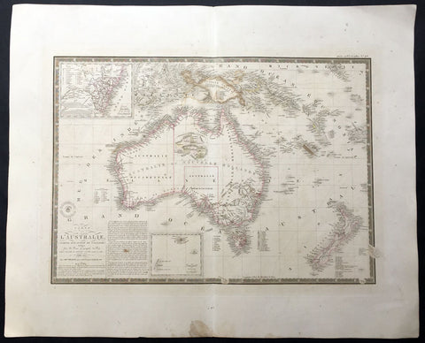
1826 (1834) Brue Large Antique Map of Australia and New Zealand
-
Title : Carte de L'Australie...1826...1834
- Date : 1826 (1834)
- Condition: (A) Very Good Condition
- Ref: 35092
- Size: 26in x 21in (660mm x 535mm)
Description:
This large beautifully engraved hand coloured original antique early map of Australia & New Zealand - with an inset map of the colony of New South Wales - was engraved in 1826 with an update in 1834 - dated in the title - was published by Adrien Brue (1786 - 1832) in his atlas Universel de Geographie. (Ref: M&B; Tooley)
General Description:
Paper thickness and quality: - Heavy and stable
Paper color: - Off white
Age of map color: - Original
Colors used: - Yellow, pink, green, blue
General color appearance: - Authentic
Paper size: - 26in x 21in (660mm x 535mm)
Plate size: - 22in x 16in (560mm x 410mm)
Margins: - Min 1in (25mm)
Imperfections:
Margins: - Light soiling
Plate area: - Light offsetting
Verso: - Light soiling
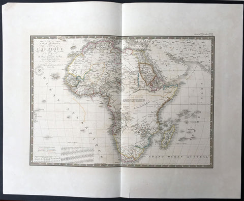
1834 Brue Large Antique Map of Africa
- Title : Carte Generale De L Afrique...1828...1834
- Ref #: 34266
- Size: 26in x 21in (660mm x 535mm)
- Date : 1834
- Condition: (A+) Fine Condition
Description:
This large beautifully hand coloured originalantique map of Africa - was engraved in 1834 - the date is engraved in the title - and was published in Adrien Brue's (1786 - 1832) Universel de Geographie. (Ref: M&B; Tooley)
General Description:
Paper thickness and quality: - Heavy and stable
Paper color: - Off white
Age of map color: - Original
Colors used: - Yellow, pink, green, blue
General color appearance: - Authentic
Paper size: - 26in x 21in (660mm x 535mm)
Plate size: - 22in x 16in (560mm x 410mm)
Margins: - Min 2in (50mm)
Imperfections:
Margins: - None
Plate area: - Light offsetting
Verso: - None
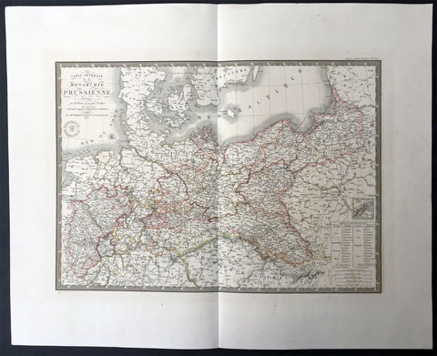
1836 Brue Very Large Antique Map of Prussia - Poland To Germany
- Title : Carte Generale De La Monarchie Prussienne...1836
- Ref #: 34249
- Size: 26in x 21in (660mm x 535mm)
- Date : 1836
- Condition: (A+) Fine Condition
Description:
This large beautifully hand coloured originalantique map of Prussia stretching from Poland into Germany - was engraved in 1836 - the date is engraved in the title - and was published in Adrien Brue's (1786 - 1832) Universel de Geographie.
General Description:
Paper thickness and quality: - Heavy and stable
Paper color: - Off white
Age of map color: - Original
Colors used: - Yellow, pink, green, blue
General color appearance: - Authentic
Paper size: - 26in x 21in (660mm x 535mm)
Plate size: - 22in x 16in (560mm x 410mm)
Margins: - Min 2in (50mm)
Imperfections:
Margins: - None
Plate area: - None
Verso: - None

