Welcome to Classical Images!
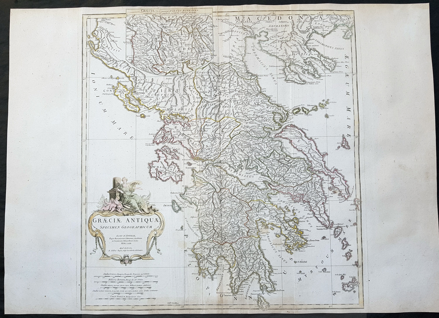
Description:This large finely engraved and highly detailed original antique map of Greece by Jean Baptiste Bourguignon D\'Anville was engraved in 1762 - dated in the tile cartouche - and was published in Jean-Baptiste Bourguinon D\'Anville\'s large elephant folio atlas Atlas Generale.
General Definitions:Paper thickness and quality: - Heavy and stablePaper color : - off whiteAge of map color: - EarlyColors used: - Yellow, green, pink, blueGeneral color appearance: - AuthenticPaper size: - 29 1/2in x 21 1/2in (750mm x 545mm)Plate size: - 21in x 20in (535mm x 510mm)Margins: - Min 1/2in (12mm)
Imperfections:Margins: - Age toning bottom marginPlate area: - Creasing along centerfoldVerso: - Creasing along centerfold
Background: From the early days of map-making, cartographers have always had a keen interest he mapping of Greece and of the particular continental and insular Greek areas. In other words the \"Greek chorography\", as it is often called had been a cartographic item of special importance, both in manuscript and printed cartography, the later having produced an impressive number of Greek maps. All of these have been include in almost all the European Atlases and travel books, since the first printed edition of Ptolemy\'s Gepgraphia in1447. This prominent presence of Greece in the field of European cartography is due to various historic, political and cultural reasons.In the first place, the Eastern Mediterranean basin has been for many centuries the center of the civilized European world and, consequently, an area of special attraction. It was only natural, therefore, that from the early days journeys to Greece made necessary the cartographic description of the region. The relevant mapping of the ancients was followed up and developed by the efficient Byzantium administration, thus providing a rich material which was later used by European cartographers of the 16th, 17th and 18th centuries.Secondly, like any other artistic and scientific activity of the period under review, cartography was influenced by and reflected intense interest in Greece, enhanced by the revival of Greek culture and the flourishing of Classical studies during and after the renaissance.Finally, the prolific production of Greek maps is due to the fact that, quite often cartographers used to delineate \"historical\" maps of Greece, with the ancient nomenclature and state structure, based manly on the Ptolemaic cartography and the works of all the classical authors, as well \"contemporary\" ones, which were the outcome of the journeys of travelers, merchants and intellectuals at the time. Greece was usually depicted as a province of the Ottoman empire or the Greek Islands as territories of the Venetian republic. Hence the distinction between maps of \"Graecia Antiqua\" and maps of \"Graecia Nova\" or \"European Turkey\" or \"Southern part of Turkey in Europe\" and the use of such Latin explanatory terms as \"Olim\" (formerly) and \"Nunc\" (presently) for the identification of places, according to their ancient (Greek, Latin) or contemporary (modern Greek, Turkish, Slavic, Italian) names.