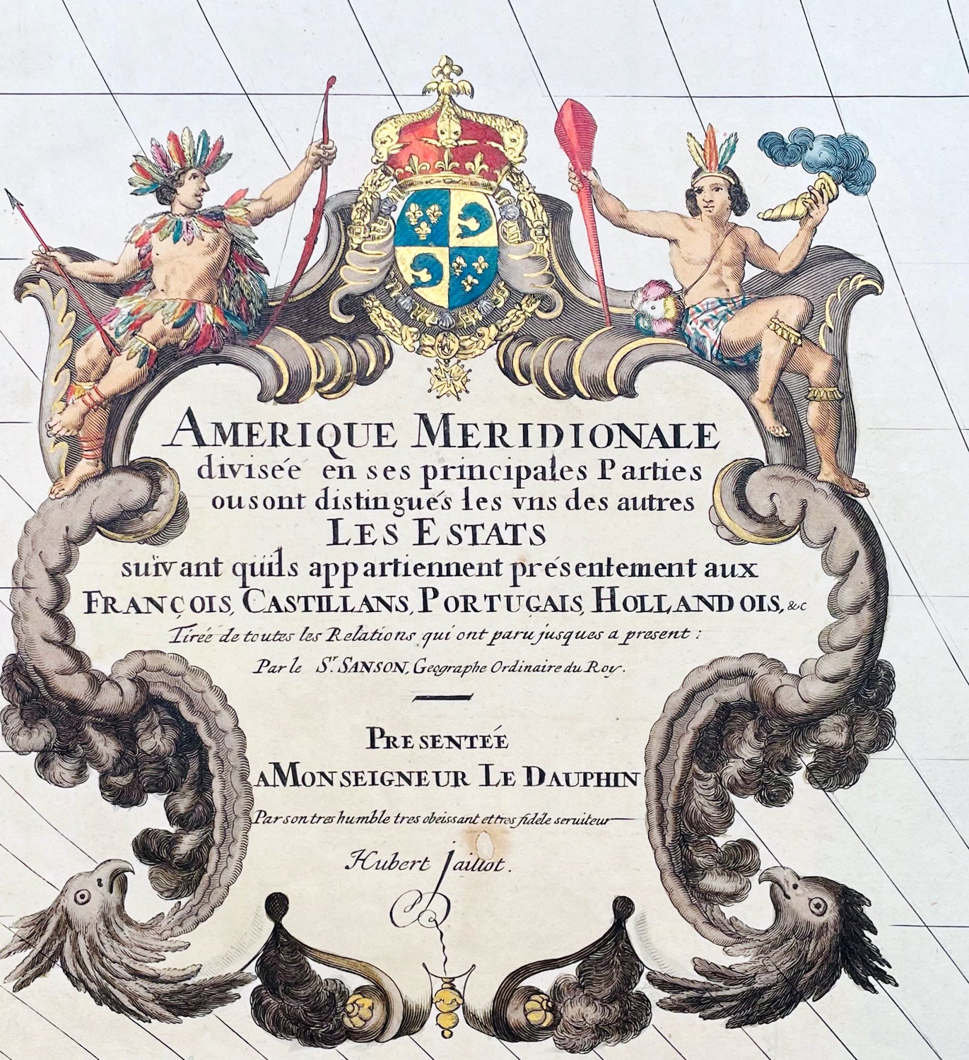
Welcome to Classical Images!
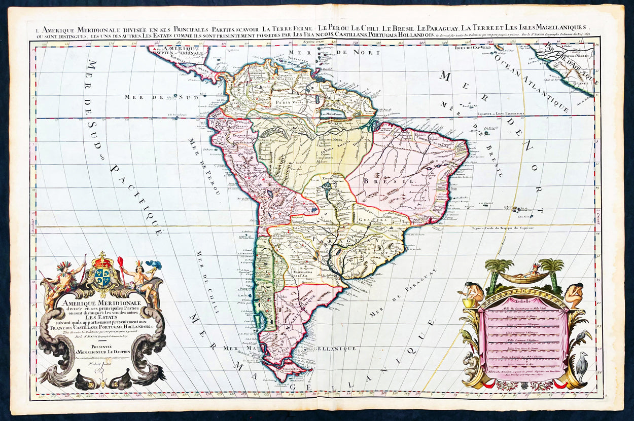
Description:This original beautifully hand coloured (with gold highlights) antique very large map of South America was engraved in 1691 - dated in Cartouche - and was published by Hubert Jaillot in his monumental Atlas Nouveau.This map is beautifully hand coloured with gold highlights along country borders and the cartouches indicating it was once part of an Imperial Atlas.The Imperial atlases were hand coloured using gold highlights and other rare colours which at the time was extremely expensive and available at the time only to royalty and the very rich.
General Definitions:Paper thickness and quality: - Heavy and stablePaper color : - Off whiteAge of map color: - OriginalColors used: - Yellow, green, blue, pink, blue, goldGeneral color appearance: - AuthenticPaper size: - 37 1/2in x 24 3/4in (940mm x 630mm)Plate size: - 35 1/2in x 23in (900mm x 590mm)Margins: - Min 1in (25mm)
Imperfections:Margins: - Age toning along marginsPlate area: - Crease along centerfoldVerso: - None
Background:The map include lines of latitude and longitude, some topographical details, location of settlements, rivers, and lakes (including the lakes Parime, thought to be where the fabulous El Dorado was located) as well as the boundaries of the possessions of the European claimants to South America.Extremely decorative cartouche with dedication to Le Dauphin, and his coat of arms in top.After Nicolas Sanson, Hubert Jaillot and Pierre Duval were the most important French cartographers of the seventeenth & eighteenth centuries. Jaillot, originally a sculptor, became interested in geography after his marriage to the daughter of Nicolas Berey (1606-65), a famous map colourist, and went into partnership in Paris with Sanson's sons. There, from about 1669, he undertook the re-engraving, enlarging and re-publishing of the Sanson maps in sheet form and in atlases, sparing no effort to fill the gap in the map trade left by the destruction of Blaeu's printing establishment in Amsterdam in 1672. Many of his maps were printed in Amsterdam (by Pierre Mortier) as well as in Paris. One of his most important works was a magnificent sea atlas, Le Neptune François, published in 1693 and compiled in co-operation with J D Cassini. This was re-published shortly afterwards by Pierre Mortier in Amsterdam with French, Dutch and English texts, the charts having been re-engraved. Eventually, after half a century, most of the plates were used again as the basis for a revised issue published by J N Bellin in 1753.(Ref: Tooley; M&B)