Welcome to Classical Images!
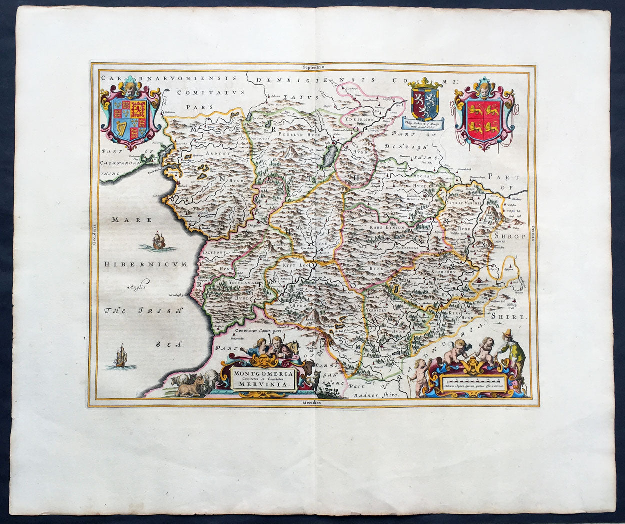
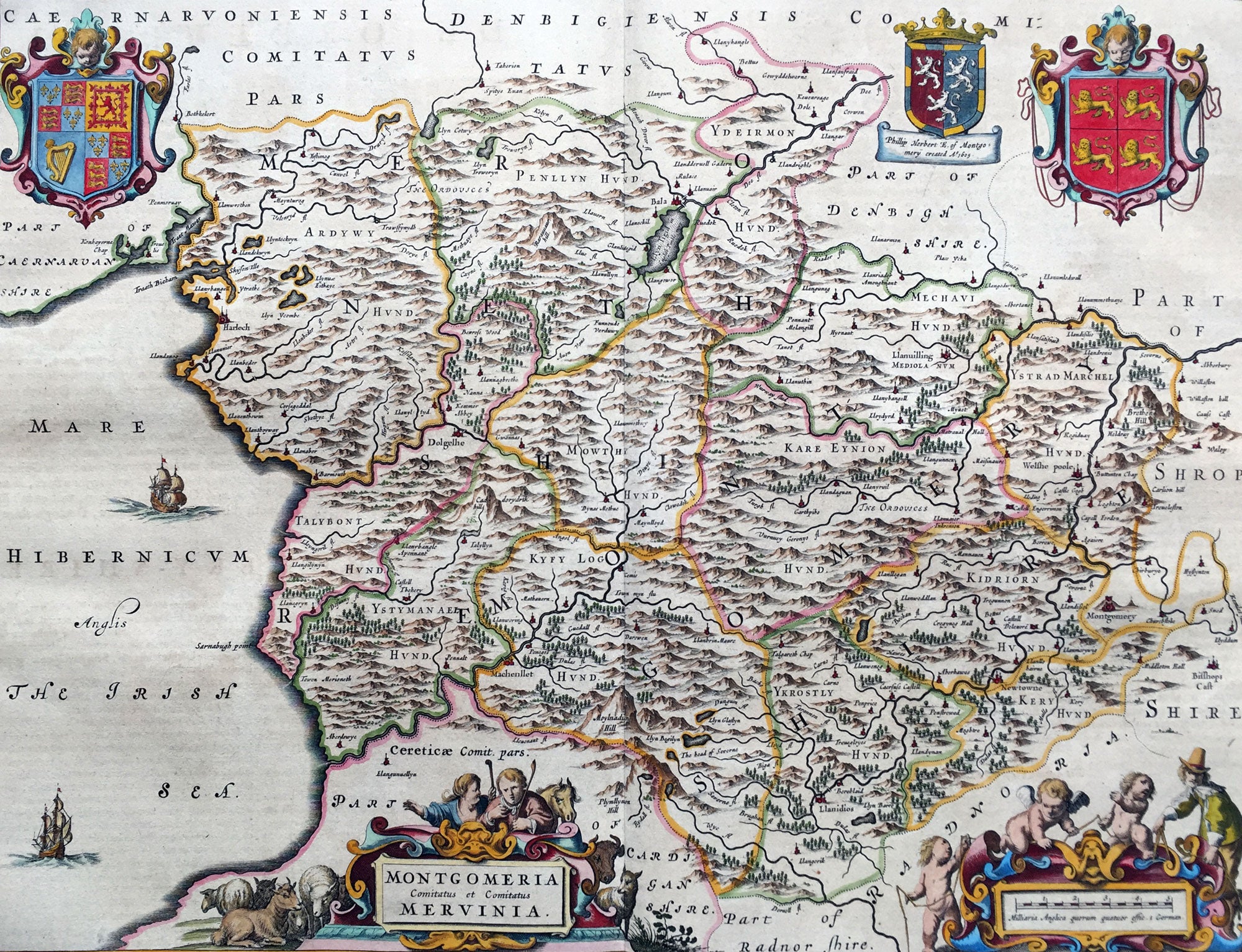
Description: This beautifully hand coloured original antique map of the Welsh County of Montgomery was published in the 1664 Dutch edition of Joan Blaeus Atlas Major.
Blaeus reference for the topographical data is from John Speeds maps from the 1611 Empire of Great Britaine - the beautiful decoration, though, is distinctly Blaeus. (Ref: Koeman; Tooley; M&B)
General Description: Paper thickness and quality: - Heavy and stable Paper color: - White Age of map color: - Early Colors used: - Yellow, pink, red, blue, green General color appearance: - Authentic Paper size: - 25 1/2in x 21 1/2in (650mm x 545mm) Plate size: - 20in x 16 1/2in (510mm x 420mm) Margins: - Min 2in (50mm) Imperfections: Margins: - None Plate area: - None Verso: - None