Welcome to Classical Images!
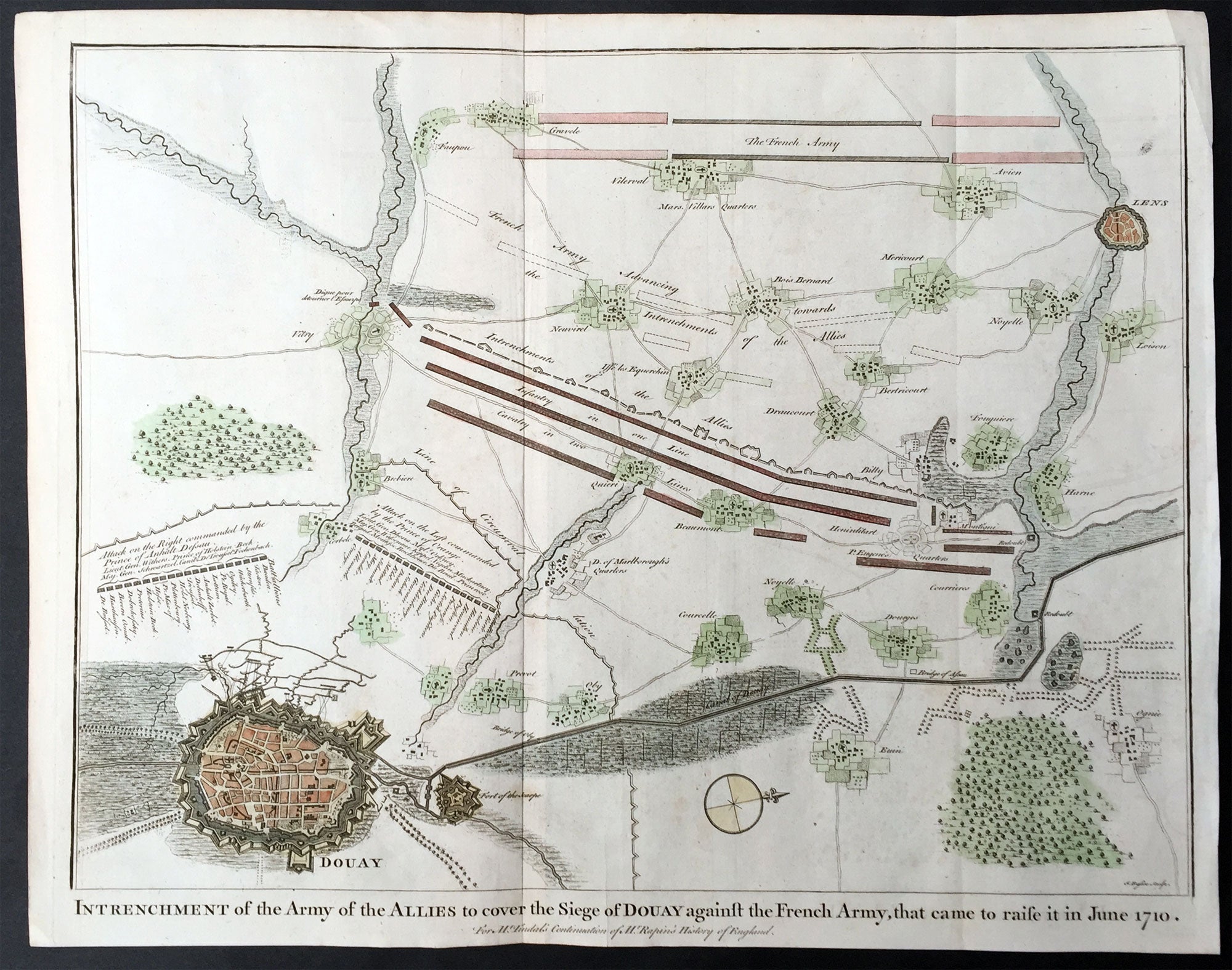
Description:This original copper-plate engraved antique map, plan of the Siege of Douai, Flanders in Northern France - during the Spanish War of Succession (1701-13) - was engraved by John Basire and was published in the 1745 edition of Nicholas Tindals Continuation of Mr. Rapin\'s History of England.
General Definitions:Paper thickness and quality: - Heavy and stablePaper color : - off whiteAge of map color: - EarlyColors used: - Green, pink, blueGeneral color appearance: - AuthenticPaper size: - 19 1/2in x 15 1/2in (495mm x 395mm)Plate size: - 19 1/2in x 15 1/2in (495mm x 395mm)Margins: - Min 1/2in (12mm)
Imperfections:Margins: - NonePlate area: - NoneVerso: - None
Background: A large battle plan showing both siege and works against a fortified Douai, Flanders and the detailed dispositions and battle lines of Lord Marlborough\'s army against the French, and thier attempt to lift the siege in June 1710.Successive sieges from 1710 to 1712 during the Spanish War of Succession (1701-13), almost completely destroyed Douai by the British Army. By 1713, the town was fully integrated into France. Douai became the seat of the Parliament of Flanders.