City & Views (82)
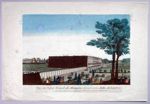
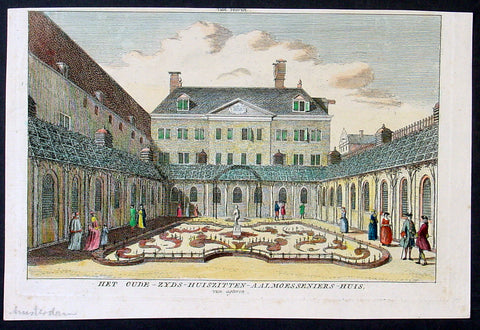
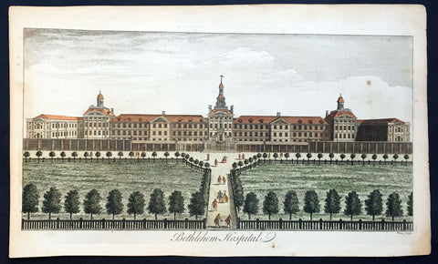
1760 Vue D Optic Antique Print View of Hampton Court Palace, Richmond London
- Title : Vue du Palias Royal de Hampton Court a 15 Milles de Londres
- Date : 1760
- Condition: (A) Very Good Condition
- Ref: 92704
- Size: 19in x 12 3/4in (480mm x 325mm)
Description:
This hand coloured original antique print, a view of Hampton Court Palace was published as part of the Vues d’Optique in 1760.
Hampton Court Palace: is a royal palace in the London Borough of Richmond upon Thames, Greater London, in the historic county of Middlesex, and within the postal town East Molesey, Surrey. It has not been inhabited by the British Royal Family since the 18th century. The palace is 11.7 miles (18.8 kilometres) south west of Charing Cross and upstream of central London on the River Thames. It was originally built in 1514 for Cardinal Thomas Wolsey, a favourite of King Henry VIII. In 1529, as Wolsey fell from favour, the King seized the palace for himself and later enlarged it. Along with St. James's Palace, it is one of only two surviving palaces out of the many owned by King Henry VIII.
In the following century, King William III's massive rebuilding and expansion project was intended to rival Versailles. Work ceased in 1694, leaving the palace in two distinct contrasting architectural styles, domestic Tudor and Baroque. While the palace's styles are an accident of fate, a unity exists due to the use of pink bricks and a symmetrical, if vague, balancing of successive low wings.
Vues d' Optique or Perspective Views: Perspective views, or "vues d'optique," are a special type of popular print published in Europe during the 18th century. These prints provided a form of entertainment when viewed through a device called an "optical machine" or an "optique." The most characteristic feature of the perspective views is their emphasized linear perspective, done to further intensify the enhanced appearance of depth and illusionistic space in the prints when viewed through an optique. When displayed in the optique, the prints might transport the viewer into a far away place---an unknown city, or perhaps into the midst of a dramatic bit of contemporary history. Another attribute of these prints is their bright, often heavy hand coloring, applied boldly so as to show the tints when viewed through the lens.
A number of perspective prints depicted American scenes at the time of the Revolution for a European audience hungry for news of the events in the British colonies. As documents of American history and European printmaking, these are unusual and appealing eighteenth-century prints.
General Description:
Paper thickness and quality: - Heavy & stable
Paper color: - Off white
Age of map color: - Original
Colors used: - Blue, yellow, green, red
General color appearance: - Authentic & bright
Paper size: - 19in x 12 3/4in (480mm x 325mm)
Plate size: - 14 1/2in x 9 1/2in (370mm x 240mm)
Margins: - Min 2in (50mm)
Imperfections:
Margins: - Light soiling
Plate area: - Small smudge & toning to sky
Verso: - Small repair, no loss
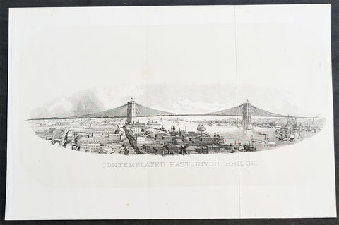
1869 DT Valentine Antique Print of the Proposed East River or Brooklyn Bridge NY
Antique Map
- Title : Contemplated East River Bridge
- Size: 11in x 7 1/2in (280mm x 190mm)
- Condition: (A+) Fine Condition
- Date : 1869
- Ref #: 93310
Description:
This original antique lithograph print, a view of the proposed Brooklyn Bridge in 1869 by George Hayward was published in the 1869 edition of D T Valentines Manual of the Corporation of the City of New York or Valentines Manual.
The Brooklyn Bridge started construction in 1869 and was completed fourteen years later in 1883. It was originally called the New York and Brooklyn Bridge and the East River Bridge, but it was later dubbed the Brooklyn Bridge. However, it was not named as such until the city government passed a law to that effect in 1915. Over the years, the Brooklyn Bridge has undergone several reconfigurations; it formerly carried horse-drawn vehicles and elevated railway lines, but now carries vehicular, pedestrian, and bicycle traffic. Commercial vehicles are banned from the bridge.
General Definitions:
Paper thickness and quality: - Heavy and stable
Paper color : - off white
Age of map color: -
Colors used: -
General color appearance: -
Paper size: - 11in x 7 1/2in (280mm x 190mm)
Plate size: - 11in x 7 1/2in (280mm x 190mm)
Margins: - Min 1/2in (12mm)
Imperfections:
Margins: - None
Plate area: - Folds as issued
Verso: - None
Background:
Manual of the Corporation of the City of New York or Valentines Manuals, published for nearly 30 years, contained hundreds of rare beautifully hand coloured contemporary and historical lithograph maps and views of New York City.
Valentine, David Thomas 1801 - 1869
As the Clerk of the Common Council of New York City, Valentine edited and published a series of books on the history and contemporary facts of New York City entitled Manual of the Corporation Of The City of New York. They became know as Valentines Manuals with updates published annually, between 1841 & 1870. Valentine used his manuals to produce some of the rarest and most important maps & views of the city of New York, some of which occasionally appear on the market. His contribution to the historical record of New York city cannot be over stated.
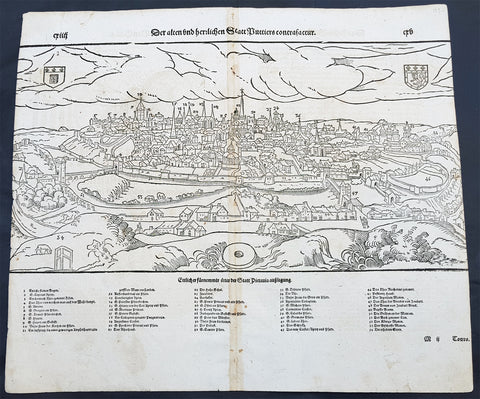
1598 Munster Antique Map Birds Eye View of the city of Poitiers in Poitou France
- Title : Die Statt Puttiers
- Date : 1598
- Condition: (A) Very Good Condition
- Ref # : 30381
- Size : 15in x 13in (380mm x 340mm)
Description:
This fine original wood block engraved antique map a birds eye view of the French city of Poitiers on the Clain River in the Vienne Dept of central western France, was published in the French Section of Sebastian Munsters 1598 edition of Cosmographia, Das ist: Beschreibung der gantzen Welt, Darinnen Aller Monarchien Keyserthumben, Königreichen, Fürstenthumben, Graff- und Herrschafften, Länderen, Stätten und Gemeinden.Ursprung (Cosmographia, that is: description of the whole world, in it all monarchies Keyser thumben, kingdoms, prince thumben, graff and herrschafften, countries, places and municipalities.)
Poitiers is a city on the Clain river in west-central France. It is a commune and the capital of the Vienne department and also of the Poitou.
The type of political organisation existing in Poitiers during the late medieval or early modern period can be glimpsed through a speech given on 14 July 1595 by Maurice Roatin, the town\'s mayor. He compared it to the Roman state, which combined three types of government: monarchy (rule by one person), aristocracy (rule by a few), and democracy (rule by the many). He said the Roman consulate corresponded to Poitiers\' mayor, the Roman senate to the town\'s peers and échevins, and the democratic element in Rome corresponded to the fact that most important matters can not be decided except by the advice of the Mois et Cent (broad council).1 The mayor appears to have been an advocate of a mixed constitution; not all Frenchmen in 1595 would have agreed with him, at least in public; many spoke in favour of absolute monarchy. The democratic element was not as strong as the mayor\'s words may seem to imply: in fact, Poitiers was similar to other French cities, Paris, Nantes, Marseille, Limoges, La Rochelle, Dijon, in that the town\'s governing body (corps de ville) was highly exclusive and oligarchical: a small number of professional and family groups controlled most of the city offices. In Poitiers many of these positions were granted for the lifetime of the office holder.
The city government in Poitiers based its claims to legitimacy on the theory of government where the mayor and échevins held jurisdiction of the citys affairs in fief from the king: that is, they swore allegiance and promised support for him, and in return he granted them local authority. This gave them the advantage of being able to claim that any townsperson who challenged their authority was being disloyal to the king. Every year the mayor and the 24 échevins would swear an oath of allegiance between the hands of the king or his representative, usually the lieutenant général or the sénéchaussée. For example, in 1567, when Maixent Poitevin was mayor, king Henry III came for a visit, and, although some townspeople grumbled about the licentious behaviour of his entourage, Henry smoothed things over with a warm speech acknowledging their allegiance and thanking them for it.
In this era, the mayor of Poitiers was preceded by sergeants wherever he went, consulted deliberative bodies, carried out their decisions, heard civil and criminal suits in first instance, tried to ensure that the food supply would be adequate, visited markets.
In the 16th century, Poitiers impressed visitors because of its large size, and important features, including royal courts, university, prolific printing shops, wealthy religious institutions, cathedral, numerous parishes, markets, impressive domestic architecture, extensive fortifications, and castle.
16th-century Poitiers is closely associated with the life of François Rabelais and with the community of Bitards.
The town saw less activity during the Renaissance. Few changes were made in the urban landscape, except for laying way for the rue de la Tranchée. Bridges were built where the inhabitants had used gués. A few hôtels particuliers were built at that time, such as the hôtels Jean Baucé, Fumé and Berthelot. Poets Joachim du Bellay and Pierre Ronsard met at the University of Poitiers, before leaving for Paris.
During the 17th century, many people emigrated from Poitiers and the Poitou to the French settlements in the new world and thus many Acadians or Cajuns living in North America today can trace ancestry back to this region.
General Definitions:
Paper thickness and quality: - Heavy and stable
Paper color : - off white
Age of map color: -
Colors used: -
General color appearance: -
Paper size: - 15in x 13 1/4in (380mm x 340mm)
Plate size: - 15in x 13 1/4in (380mm x 340mm)
Margins: - Min 1/4in (3mm)
Imperfections:
Margins: - L&R margins cropped into border
Plate area: - Light toning along centerfold
Verso: - Light toning along centerfold
Background:
Cosmographia, Das ist: Beschreibung der gantzen Welt, Darinnen Aller Monarchien Keyserthumben, Königreichen, Fürstenthumben, Graff- und Herrschafften, Länderen, Stätten und Gemeinden.Ursprung, Regiment, Reichthumb, Gewalt und.Beschaffenheit. Dessgleichen Aller deren, beyder Ständen, Regenten: Keysern, Königen, Bäpsten, Bischoffen.Genealogien und Stammbäumen.zusammen getragen. by Sebastian Münster was first published in 1544 and is the earliest German-language description of the world. It had numerous editions in different languages including Latin, French (translated by François de Belleforest), Italian, English, and Czech. The last German edition was published in 1628, long after Munsters death. The Cosmographia was one of the most successful and popular books of the 16th century. It passed through 24 editions in 100 years. This success was due to the notable woodcuts (some by Hans Holbein the Younger, Urs Graf, Hans Rudolph Manuel Deutsch, and David Kandel). It was most important in reviving geography in 16th-century Europe. Among the notable maps within Cosmographia is the map Tabula novarum insularum, which is credited as the first map to show the American continents as geographically discrete.
Munsters earlier geographic works were Germania descriptio (1530) and Mappa Europae (1536). In 1540, he published a Latin edition of Ptolemys Geographia with illustrations.
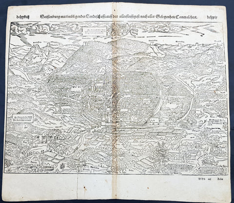
1598 Sebastian Munster Antique Map Birds Eye View of Weissenburg Bavaria Germany
- Title : Die Statt Wyssenburg
- Date : 1598
- Condition: (A+) Fine Condition
- Ref # : 30351
- Size : 15in x 13in (380mm x 340mm)
Description:
This fine original wood block engraved antique map a birds eye view of the German city of Weißenburg (Weissenburg) in Bavaria in Middle Franconia - identified by the cities Coate of Arms with double headed eagle atop of a castle - was published in the German Section of Sebastian Munsters 1598 edition of Cosmographia, Das ist: Beschreibung der gantzen Welt, Darinnen Aller Monarchien Keyserthumben, Königreichen, Fürstenthumben, Graff- und Herrschafften, Länderen, Stätten und Gemeinden.Ursprung (Cosmographia, that is: description of the whole world, in it all monarchies Keyser thumben, kingdoms, prince thumben, graff and herrschafften, countries, places and municipalities.)
Weißenburg in Bayern (formerly also Weißenburg im Nordgau) is a town in Middle Franconia, Germany. It is the capital of the district Weißenburg-Gunzenhausen. Weissenburg is located in central Bavaria, in the south of the administrative region Mittelfranken.
The history of Weißenburg is generally traced back to the Roman fort that was built in the area towards the end of the first century. The settlement, which included Thermae, lay on the border of the Roman Empire and on the Tabula Peutingeriana from the 4th century it had the name Biriciana. Germanic tribes destroyed the fort and settled in what is still the city centre. The first mention of the name Weißenburg is in a deed dating from 867. The city became the seat of a royal residence during the reign of the Franks and according to legend, Charlemagne stayed there to supervise the construction of Fossa Carolina.
The city became a Free Imperial City in 1296 and continued to grow until the Reformation. Following the example of Nuremberg the city joined the Protestant side but it suffered heavily in the ensuing wars. However, the rights of the city as a Free Imperial City and an Imperial Estate were restored in the final peace treaty and some growth resumed. Despite its insignificant size and economic importance, the city, like the other 50-odd free imperial cities, was virtually independent.
Weissenburg lost its independence in 1802 and became part of the Bavarian kingdom in 1806. It was however saved from insignificance with the construction of a railway between Nuremberg and Augsburg which goes through the city and which supported industrialisation. Following World War II over 6,000 refugees and people expelled from the territories which Germany lost settled in the city and have since played an important role in its industry and culture.
The many stages in the history of Weissenburg can still be seen today. There are many ruins from the Roman times. One of the finest is the remains of a Roman bath which was excavated in 1977 and has been turned into a museum. The city wall from the Middle Ages has survived almost intact with its towers and in the Gothic Town Hall the city\'s elected members have held their meetings from 1476.
General Definitions:
Paper thickness and quality: - Heavy and stable
Paper color : - off white
Age of map color: -
Colors used: -
General color appearance: -
Paper size: - 16in x 13in (410mm x 330mm)
Plate size: - 16in x 13in (410mm x 330mm)
Margins: - Min 1in (25mm)
Imperfections:
Margins: - Repair to bottom margin, no loss
Plate area: - Age toning along centerfold
Verso: - Light soiling
Background:
Cosmographia, Das ist: Beschreibung der gantzen Welt, Darinnen Aller Monarchien Keyserthumben, Königreichen, Fürstenthumben, Graff- und Herrschafften, Länderen, Stätten und Gemeinden.Ursprung, Regiment, Reichthumb, Gewalt und.Beschaffenheit. Dessgleichen Aller deren, beyder Ständen, Regenten: Keysern, Königen, Bäpsten, Bischoffen.Genealogien und Stammbäumen.zusammen getragen. by Sebastian Münster was first published in 1544 and is the earliest German-language description of the world. It had numerous editions in different languages including Latin, French (translated by François de Belleforest), Italian, English, and Czech. The last German edition was published in 1628, long after Munsters death. The Cosmographia was one of the most successful and popular books of the 16th century. It passed through 24 editions in 100 years. This success was due to the notable woodcuts (some by Hans Holbein the Younger, Urs Graf, Hans Rudolph Manuel Deutsch, and David Kandel). It was most important in reviving geography in 16th-century Europe. Among the notable maps within Cosmographia is the map Tabula novarum insularum, which is credited as the first map to show the American continents as geographically discrete.
Munsters earlier geographic works were Germania descriptio (1530) and Mappa Europae (1536). In 1540, he published a Latin edition of Ptolemys Geographia with illustrations.
1574 Sebastian Munster Antique Map Birds Eye View of the City of Lubeck, Germany
- Title : Die Statt Lubeck
- Date : 1574
- Condition: (A+) Fine Condition
- Ref # : 22708
- Size : 15in x 13in (380mm x 340mm)
Description:
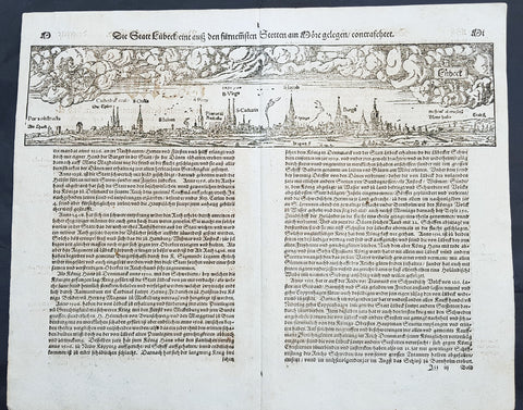
This fine original wood block engraved antique map a birds eye view of the German city of Lubeck, in the northern German state Schleswig-Holstein was published in the German Section of Sebastian Munsters 1574 edition of Cosmographia, Das ist: Beschreibung der gantzen Welt, Darinnen Aller Monarchien Keyserthumben, Königreichen, Fürstenthumben, Graff- und Herrschafften, Länderen, Stätten und Gemeinden.Ursprung (Cosmographia, that is: description of the whole world, in it all monarchies Keyser thumben, kingdoms, prince thumben, graff and herrschafften, countries, places and municipalities.)
Lübeck is a city in Schleswig-Holstein, northern Germany, and one of the major ports of Germany, on the river Trave.
In the 14th century Lübeck became the Queen of the Hanseatic League, being by far the largest and most powerful member of that medieval trade organization. In 1375 Emperor Charles IV named Lübeck one of the five Glories of the Empire, a title shared with Venice, Rome, Pisa and Florence. Several conflicts about trading privileges resulted in fighting between Lübeck (with the Hanseatic League) and Denmark and Norway – with varying outcome. While Lübeck and the Hanseatic League prevailed in conflicts in 1435 and 1512, Lübeck lost when it became involved in the Count\'s Feud, a civil war that raged in Denmark from 1534 to 1536. Lübeck also joined the pro-Lutheran Schmalkaldic League of the mid-16th century.
After its defeat in the Count\'s Feud, Lübeck\'s power slowly declined. The city remained neutral in the Thirty Years\' War of 1618–1648, but the combination of the devastation from the decades-long war and the new transatlantic orientation of European trade caused the Hanseatic League – and thus Lübeck with it – to decline in importance. However, even after the de facto disbanding of the Hanseatic League in 1669, Lübeck still remained an important trading town on the Baltic Sea.
General Definitions:
Paper thickness and quality: - Heavy and stable
Paper color : - off white
Age of map color: -
Colors used: -
General color appearance: -
Paper size: - 16in x 13in (410mm x 330mm)
Plate size: - 16in x 13in (410mm x 330mm)
Margins: - Min 1in (25mm)
Imperfections:
Margins: - None
Plate area: - Folds as issued
Verso: - None
Background:
Cosmographia, Das ist: Beschreibung der gantzen Welt, Darinnen Aller Monarchien Keyserthumben, Königreichen, Fürstenthumben, Graff- und Herrschafften, Länderen, Stätten und Gemeinden.Ursprung, Regiment, Reichthumb, Gewalt und.Beschaffenheit. Dessgleichen Aller deren, beyder Ständen, Regenten: Keysern, Königen, Bäpsten, Bischoffen.Genealogien und Stammbäumen.zusammen getragen. by Sebastian Münster was first published in 1544 and is the earliest German-language description of the world. It had numerous editions in different languages including Latin, French (translated by François de Belleforest), Italian, English, and Czech. The last German edition was published in 1628, long after Munsters death. The Cosmographia was one of the most successful and popular books of the 16th century. It passed through 24 editions in 100 years. This success was due to the notable woodcuts (some by Hans Holbein the Younger, Urs Graf, Hans Rudolph Manuel Deutsch, and David Kandel). It was most important in reviving geography in 16th-century Europe. Among the notable maps within Cosmographia is the map Tabula novarum insularum, which is credited as the first map to show the American continents as geographically discrete.
Munsters earlier geographic works were Germania descriptio (1530) and Mappa Europae (1536). In 1540, he published a Latin edition of Ptolemys Geographia with illustrations.
1755 Prevost & Schley Antique Print City View of Mbanza Loango West Congo Africa
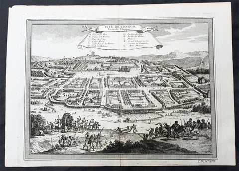
- Title:Cite De Loango Tiree de Dapper
- Date: 1755
- Condition : (A+) Fine Condition
- Ref: 25755
- Size: 14in x 10in (355mm x 255mm)
Description:
This fine, original copper-plate engraved antique print, view of the city of Mbanza Loango in the pre-colonial African Kingdom of Loango - now part of the of western part of the Republic of the Congo - by Jakob van Schley in 1755 - after Olfert Dapper - was published in Antoine François Prevosts 15 volumes of Histoire Generale des Voyages written by Prevost & other authors between 1746-1789.
General Definitions:
Paper thickness and quality: - Heavy and stable
Paper color : - off white
Age of map color: -
Colors used: -
General color appearance: -
Paper size: - 14in x 10in (355mm x 255mm)
Plate size: - 12 1/2in x 9 1/2in (320mm x 240mm)
Margins: - Min 1/2in (5mm)
Imperfections:
Margins: - None
Plate area: - None
Verso: - None
Background:
The Kingdom of Loango was a pre-colonial African state, during approximately the 16th to 19th centuries in what is now the western part of the Republic of the Congo. Situated to the north of the more powerful Kingdom of Kongo, at its height in the 17th century Loango influence extended from Cape St Catherine in the north to almost the mouth of the Congo River.
Loango exported copper to the European market, and was a major producer and exporter of cloth.
The English traveller Andrew Battel, when he was there in about 1610, recorded that the predecessor of the unnamed king ruling at that time was named \"Gembe\" or Gymbe (modernized as Njimbe), possibly the founder of the kingdom. With the death of King Buatu in 1787, the succession of leadership is uncertain.
The kingdom is certain to have come to an end with the Conference of Berlin (1884–1885) at the latest, when European colonial powers divided most of Central Africa between them.
The origins of the kingdom are obscure. The most ancient complex society in the region was at Madingo Kayes, which was already a multi-site settlement in the first century CE. At present archaeological evidence is too scarce to say much more about developments until the late fifteenth or early sixteenth centuries.
Loango is not mentioned in early travelers\' accounts of the region, nor is it mentioned in the titles of King Afonso I of Kongo in 1535, though Kakongo, Vungu, and Ngoyo, its southern neighbors. It is therefore unlikely that there was a major power on the coast of Central Africa north of the Congo River.
The earliest reference to Loango in a documentary source is a mention around 1561 by Sebastião de Souto, a priest in Kongo, that King Diogo I (1545–61) sent missionaries to convert Loango to Christianity. Duarte Lopes, ambassador from Kongo to the Holy See in Rome in 1585, related that \"Loango is a friend of the King of Congo and it is said that he was a vassal in past times\" which is consistent with Loango\'s origins from Kakongo, a vassal of Kongo.
Dutch visitors recorded the first traditional account of the kingdom\'s origin in the 1630s or \'40s. In their account as reported by the geographer Olfert Dapper, the region where Loango would be constructed was populated by a number of small polities including Mayumba, Kilongo, Piri and Wansi, \"each with their own leader\" who \"made war on each other.\" He recorded that the founder of Loango, who boasted hailing from the district in Nzari in the small coastal kingdom of Kakongo, itself a vassal of Kongo, triumphed over all his rivals through the skillful use of alliances to defeat those who opposed him, particularly Wansa, Kilongo and Piri, the latter two of which required two wars to subdue. Once this had been effected, however, a range of more northern regions, including Docke and Sette submitted voluntarily. Having succeeded in the conquest, the new king moved northward and after having founded settlements in a variety of places, eventually built his capital in Buali in the province of Piri (from which the ethnic name \"Muvili\" eventually derived).
The English traveller Andrew Battel wrote when he was there in about 1610, that the predecessor of the unnamed king ruling at that time was named \"Gembe\" or \"Gymbe\" (modernized as \"Njimbe\"). A Dutch description published in 1625 said that a ruler who had died sometime before that date had ruled for 60 years and thus had taken the throne around 1565. The documentary chronology thus makes it very likely that Njimbe was the founder and first ruler mentioned in the traditions, and this supposition is supported by traditions recorded around 1890 by R. E. Dennett which also named Njimbe as the first ruler.
On the basis of later traditions from the nineteenth and twentieth centuries that linked the founding of Loango to that of Kongo, Phyllis Martin posited a much earlier foundation, the late fourteenth or early fifteenth centuries. She then argues that the absence of Loango from early titles of the king of Kongo is evidence that Loango was already independent at that time.
Njimbe had created a rule of succession which was in place around 1600, in which the king gave command over four provinces to members of his family, called the provinces of Kaye, Boke, Selage, and Kabango, and the king was to be chosen from a rotation between them. When the king died the ruler of Kaye took over, as he did indeed in the pre-1624 succession, and if the rule was followed then the ruler of Boke took his place; the other two provincial rulers advanced as well, and the king appointed a new ruler for Kabango.
In 1663, the king ruling then was baptized as Afonso by the Italian Capuchin priest Bernardo Ungaro, but there was considerable opposition to this from within the country, and indeed when he died, a non-Christian took over, but this one was himself overthrown by one of the Christian party in 1665. This civil war was still ongoing in the 1670s. In the aftermath of this civil war, a number of the Christian party fled to neighboring territories, one of whom, known to history as Miguel da Silva, was elected ruler of Ngoyo and was ruling there in 1682.
When Nathaniel Uring, an English merchant came to Loango to trade in 1701, he reported that the king had died and the power of the administration was in the hands of the \"Queen or Chief Governess of that Country,\" named \"Mucundy\" and with whom he had to deal as if with the ruler.[20] This title referred to a woman with a regular role in the administration as overseer of women\'s affairs.
Many years elapsed before we have another snapshot of Loango\'s government; during this time the rules of succession, whether formal or informal seem to have changed. When the French missionaries directed by Abbé Liévin-Bonaventure Proyart came to Loango in 1766, they noted that there was no clear succession to the throne, that anyone born of a person regarded as a princess (only female succession mattered) could aspire to the throne. Moreover, the death of a king was cause for a frequently long interregnum; the king ruling in 1766 had come to power only after an interregnum of seven years, during which time the affairs of the country were managed by a regent called Mani Boman. The Mani Boman was appointed by the king during his lifetime. Usually two were appointed to cover the eventuality of the death of one of the two. They, in turn received the petitions of a number of eligible candidates for the throne.
Eventually, the electors of the kingdom, who were those who held offices appointed by the late king, met to decide on the next king. In theory, as the old constitution maintained, the king named his successor as well and placed him as ruler of Kaye, to succeed him at his death, but as there was so much contention as to who should hold the position, the late king died without naming a Ma-Kaye.
Historian Phyllis Martin contends that the external trade of the country had enriched some members of the nobility ahead of others and had thus put pressure on the older constitution as wealthier upstart princes pressed their case forward. She argues that important members of the council were people who had obtained their positions through contact with external trade, particularly the slave trade, and they had come to share power with the king. She posits that this alteration in relative power allowed the council to dominate the king by forcing longer and longer interregna. In fact, after the death of King Buatu in 1787, no king was elected for over 100 years.However, to some extent royal authority remained in the hands of a person entitled the Nganga Mvumbi (priest of the corpse) who oversaw the body of the dead king awaiting burial. Several of these Nganga Mvumbi succeeded each other in the late eighteenth and through the nineteenth centuries.
1574 Munster Large Antique Print - View of The German City of Landau, Bavaria
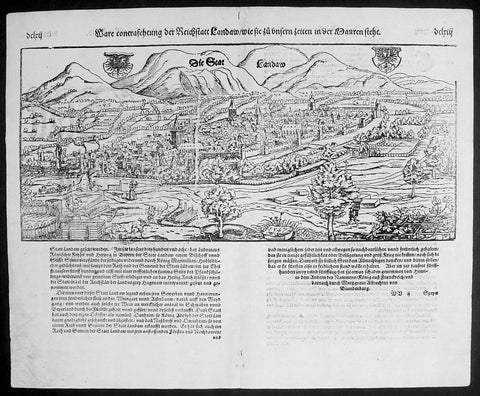
- Title : Die Statt Landaw
- Ref #: 22668
- Size: 16in x 13in (410mm x 330mm)
- Date : 1574
- Condition: (A+) Fine Condition
Description:
This large finely engraved original antique print a view of the Bavarian City of Landau NE of Munich was engraved in 1547 - the date is engraved at the foot of the image - and was published by Sebastian Munster in the 1574 edition of Cosmographia.
Landau or Landau in der Pfalz (pop. 41,821) is an autonomous (kreisfrei) city surrounded by the Südliche Weinstraße ("Southern Wine Route") district of southern Rhineland-Palatinate, Germany. It is a university town (since 1990), a long-standing cultural centre, and a market and shopping town, surrounded by vineyards and wine-growing villages of the Palatinate wine region. Landau lies east of the Palatinate forest, Europe's largest contiguous forest, direct on the German Wine Route.
Background: For a variety of reasons town plans were comparatively latecomers in the long history of cartography. Few cities in Europe in the middle ages had more than 20,00 inhabitants and even London in the late Elizabethan period had only 100-150,000 people which in itself was probably 10 times that of any other English city. The Nuremberg Chronicle in 1493 included one of the first town views of Jerusalem, thereafter, for most of the sixteenth century, German cartographers led the way in producing town plans in a modern sense. In 1544 Sebastian Munster issued in Basle hisCosmographia containing roughly sixty-six plans and views, some in the plan form, but many in the old panorama or birds eye view.
Sebastian Münster (1488-1552) was a German cartographer, cosmographer, and Hebrew scholar whose work Cosmographia (1544; "Cosmography") was the earliest German description of the world and a major work in the revival of geographic thought in 16th-century Europe. It had numerous editions in different languages including Latin, French, Italian, English, and even Czech. Altogether, about 40 editions of the Cosmographiaappeared between 1544 and 1628 and was one of the most successful and popular books of the 16th century. Münster was a major influence in popular thinking in Europe for the next 200 years.
This success was due not only to the level of descriptive detail but also to the fascinating full page maps & views as well as smaller woodcuts that were included in the text. Many of the woodcuts were executed by famous engravers of the time including Hans Holbein the Younger, Urs Graf, Hans Rudolph Manuel Deutsch, and David Kandel.
Aside from the well-known maps present in the Cosmographia, the text is thickly sprinkled with vigorous views: portraits of kings and princes, costumes and occupations, habits and customs, flora and fauna, monsters, wonders, and horrors about the known -- and unknown -- world, and was undoubtedly one of the most widely read books of its time.
Münster acquired the material for his book in three ways. Firstly he researched all available literary sources across Germany, Switzerland and other parts of Europe. Secondly he obtained original manuscript material from locals all over Europe for description of the countryside, cities, villages, towns, rivers and local history. Finally, he obtained further material first hand on his travels (primarily in south-west Germany, Switzerland, and Alsace).
In 1588 Sebastian Petri re-released Cosomgraphia and re-issued many of Munsters maps and views in the "copperplate style". The maps in this release were more sophisticated than with earlier publications ofCosomgraphia and were based on the 1570 release of Abraham Ortelius monumental work Theatrum Orbis Terrarum.(Ref: Tooley; M&B)
General Description:
Paper thickness and quality: - Light and stable
Paper color: - off white
Age of map color: -
Colors used: -
General color appearance: -
Paper size: - 16in x 13in (410mm x 330mm)
Plate size: - 16in x 13in (410mm x 330mm)
Margins: - 1/2in (12mm)
Imperfections:
Margins: - None
Plate area: -None
Verso: - None
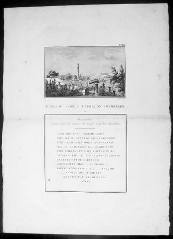
1802 J B Lechevalier Antique Print Tomb of Hector, Ophryneion in Troad, Turkey
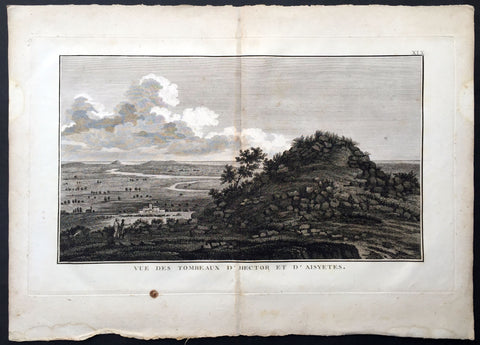
- Title : Vue Des Tombeaux D Hector et D Aisyetes
- Date : 1802
- Size: 19 1/2in x 13 1/2in (495mm x 345mm)
- Ref: 70226
- Condition: (A+) Fine Condition
Description:
This original copper-plate engraved antique print a view of the Tombs of Hector & Aesyetes located in the ancient Greek city of Ophryneion in the Troad region of Çanakkale, now in NW modern Turkey, was published in the 1802 edition of Jean-Baptiste Lechevaliers of Voyage de la Troade, fait dans les années 1785 et 1786
General Definitions:
Paper thickness and quality: - Heavy and stable
Paper color : - off white
Age of map color: -
Colors used: -
General color appearance: -
Paper size: - 19 1/2in x 13 1/2in (495mm x 345mm)
Plate size: - 17 1/2in x 10 3/4in (445mm x 275mm)
Margins: - Min 1/2in (12mm)
Imperfections:
Margins: - Light soiling
Plate area: - Light toning along centerfold
Verso: - Light soiling
Background:
Ophryneion was an ancient Greek city in the northern Troad region of Anatolia. Its territory was bounded to the west by Rhoiteion and to the east by Dardanos. It was located about 1.5 km north-east of the village of İntepe (previously known as Erenköy) in Çanakkale Province, Turkey. The city was situated on the steep brow of a hill overlooking the Dardanelles, hence the origin of its Ancient Greek name ὀφρῦς (ophrus), meaning \'brow of a hill\', crag
In Greek mythology, Aesyetes was a Trojan hero and father of Alcathous. His tomb was the vantage point which Polites, son of Priam, used to scout the Greek camp during the Trojan War.
Aesyetes was also given as the father of Antenor by Cleomestra.
In Greek mythology and Roman mythology, Hector was a Trojan prince and the greatest fighter for Troy in the Trojan War. As the first-born son of King Priam and Queen Hecuba, who was a descendant of Dardanus and Tros, the founder of Troy, he was a prince of the royal house and the heir apparent to his fathers throne. He was married to Andromache, with whom he had an infant son, Scamandrius (whom the people of Troy called Astyanax). He acted as leader of the Trojans and their allies in the defence of Troy, killing 31,000 Greek fighters, offers Hyginus. During the European Middle Ages, Hector figures as one of the Nine Worthies noted by Jacques de Longuyon, known not only for his courage but also for his noble and courtly nature. Indeed, Homer places Hector as peace-loving, thoughtful as well as bold, a good son, husband and father, and without darker motives. James Redfield describes Hector as a martyr to loyalties, a witness to the things of this world, a hero ready to die for the precious imperfections of ordinary life.
The most valuable historical evidence for the Battle of Troy are treaties and letters mentioned in Hittite cuneiform texts of the same approximate era, which mention an unruly Western Anatolian warlord named Piyama-Radu (possibly Priam) and his successor Alaksandu (possibly Alexander, the nickname of Paris) both based in Wilusa (possibly Ilion/Ilios), as well as the god Apaliunas (possibly Apollo).
Other such pieces of evidence are names of Trojan heroes in Linear B tablets. Twenty out of fifty-eight men\'s names also known from Homer, including E-ko-to (Hector) are Trojan warriors and some, including Hector, are in a servile capacity. No such conclusion that they are the offspring of Trojan captive women is warranted. Generally the public has to be content with the knowledge that these names existed in Greek in Mycenaean times, although Page hypothesizes that Hector may very well be ... a familiar Greek form impressed on a similar-sounding foreign name.
When Pausanias visited Thebes in Boeotia, in the second century AD, he was shown Hector\'s tomb and was told that the bones had been transported to Thebes according to a Delphic oracle. Moses I. Finley observes this typical bit of fiction must mean that there was an old Theban hero Hector, a Greek, whose myths antedated the Homeric poems. Even after Homer had located Hector in Troy for all time, the Thebans held on to their hero, and the Delphic oracle provided the necessary sanction.
The pseudepigraphical writer Dares Phrygius states that Hector \"spoke with a slight lisp. His complexion was fair, his hair curly. His eyes would blink attractively. His movements were swift. His face, with its beard, was noble. He was handsome, fierce, and high-spirited, merciful to the citizens, and deserving of love
Jean-Baptiste Lechevalier was the secretary of the Ambassador of France in Constantinople. In the year 1788 he visited the plain of Troy, and was enthusiastically in favour of the theory that the site of Homers Troy was to be found at the village of Bunarbashi. His publication about Troy Voyage de la Troade.....was first published in 1799.
The Troad, also known as Troas, is the historical name of the Biga peninsula (Biga Yarımadası, Τρωάς) in the northwestern part of Anatolia, Turkey. This region now is part of the Çanakkale province of Turkey. Bounded by the Dardanelles to the northwest, by the Aegean Sea to the west and separated from the rest of Anatolia by the massif that forms Mount Ida, the Troad is drained by two main rivers, the Scamander (Karamenderes) and the Simois, which join at the area containing the ruins of Troy. Grenikos, Kebren, Simoeis, Rhesos, Rhodios, Heptaporos and Aisepos were seven rivers of the Troad and the names of the river gods that inhabited each river.
Troy (Ancient Greek: Τροία, Troia or Τροίας, Troias, Truva or Troya) was a city in the far northwest of the region known in late Classical antiquity as Asia Minor, now known as Anatolia in modern Turkey, just south of the southwest mouth of the Dardanelles strait and northwest of Mount Ida. The present-day location is known as Hisarlik. It was the setting of the Trojan War described in the Greek Epic Cycle, in particular in the Iliad, one of the two epic poems attributed to Homer. Metrical evidence from the Iliad and the Odyssey suggests that the name λιον (Ilion) formerly began with a digamma: Ϝίλιον (Wilion); this is also supported by the Hittite name for what is thought to be the same city, Wilusa.
A new capital called Ilium (from Greek: λιον, Ilion) was founded on the site in the reign of the Roman Emperor Augustus. It flourished until the establishment of Constantinople, became a bishopric and declined gradually in the Byzantine era, but is now a Latin Catholic titular see.
In 1865, English archaeologist Frank Calvert excavated trial trenches in a field he had bought from a local farmer at Hisarlik, and in 1868, Heinrich Schliemann, a wealthy German businessman and archaeologist, also began excavating in the area after a chance meeting with Calvert in Çanakkale. These excavations revealed several cities built in succession. Schliemann was at first skeptical about the identification of Hisarlik with Troy, but was persuaded by Calvert and took over Calverts excavations on the eastern half of the Hisarlik site, which was on Calvert\'s property. Troy VII has been identified with the city called Wilusa by the Hittites (the probable origin of the Greek λιον) and is generally (but not conclusively) identified with Homeric Troy.
Today, the hill at Hisarlik has given its name to a small village near the ruins, which supports the tourist trade visiting the Troia archaeological site. It lies within the province of Çanakkale, some 30 km south-west of the provincial capital, also called Çanakkale. The nearest village is Tevfikiye. The map here shows the adapted Scamander estuary with Ilium a little way inland across the Homeric plain. Due to Troys location near the Aegean Sea, the Sea of Marmara, and the Black Sea, it was a central hub for the military and trade(Ref: M&B; Tooley)
1820 Fischer Large Antique Print View of the City & Harbour of Liverpool England
- Title : View of The Town and Harbour of Liverpool, from Seacombe....1820
- Ref : 92895
- Size: 16 1/2in x 10 1/2in (420mm x 270mm)
- Date : 1820
- Condition: (A+) Fine Condition
Description:
This large fine original antique print a view of the very important and busy town and port of Liverpool in Northern England at the turn of the 19th century was engraved in 1820 - dated at the foot of the print - and published by Henry Fisher & co.. (Ref: M&B; Tooley)
General Description:
Paper thickness and quality: - Heavy & stable
Paper color: - White
Age of map color: -
Colors used: -
General color appearance: -
Paper size: - 16 1/2in x 10 1/2in (420mm x 270mm)
Plate size: - 16 1/2in x 10 1/2in (420mm x 270mm)
Margins: - Min 1/2in (10mm)
Imperfections:
Margins: - None
Plate area: - Folds as issued
Verso: - None
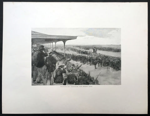
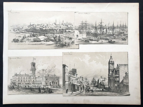
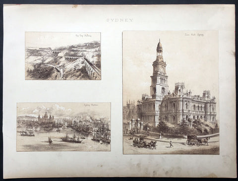
1886 Picturesque Atlas of Australasia Large Antique Print of The Melbourne Cup
- Title : Melbourne Cup - Race Course From Members Stand
- Ref #: 92164
- Size: 17 1/2in x 13 1/2in (440mm x 340mm)
- Date : 1886
- Condition: (A+) Fine Condition
Description:
This fine large original antique lithograph print was published in the extremely significant Australian & New Zealand publication The Picturesque Atlas of Australasia between 1886-88.
The Picturesque Atlas of Australasia was published in Sydney between 1886-88. Many of its over 700 wood-engraved illustrations were specially commissioned works by leading Australian artists. It was released in 42 separate editions usually bound into three large volumes and sold a remarkable 50,000 copies. (Ref: M&B; Tooley)
General Description:
Paper thickness and quality: - Light & stable
Paper color: - White
Age of map color: - Original
Colors used: - Pink, green, yellow, orange
General color appearance: - Authentic
Paper size: - 17 1/2in x 13 1/2in (440mm x 340mm)
Margins: - Min 2in (50mm)
Imperfections:
Margins: - None
Plate area: - None
Verso: - None
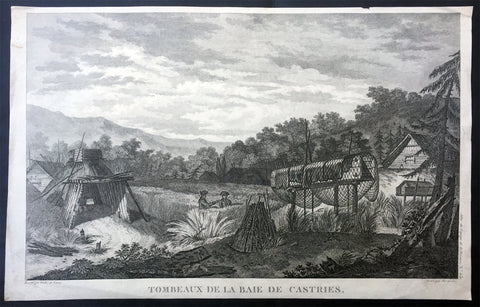
1797 Laperouse Antique Print View De Kastri Bay, Ulchsky Khabarovsk Kai, Russia
- Title : Tombeaux de la Baie de Castries
- Ref : 21436
- Size: 17in x 11in (435mm x 280mm)
- Date : 1797
- Condition: (A+) Fine Condition
Description:
This large original copper plate engraved antique print, a view of the very early settlement at De Kastri Bay, in the Ulchsky District of Khabarovsk Kai, Eastern Russia - opposite the Sakhalin Islands - by Jean-François de Galaup, Comte de la Pérouse was published in the 1st edition of the Atlas du voyage de La Perouse, Paris 1797.
General Definitions:
Paper thickness and quality: - Heavy and stable
Paper color : - off white
Age of map color: -
Colors used: -
General color appearance: -
Paper size: - 17in x 11in (435mm x 280mm)
Plate size: - 17in x 11in (435mm x 280mm)
Margins: - Min 1/2in (12mm)
Imperfections:
Margins: - Small repairs to margins, no loss
Plate area: - None
Verso: - None
Background:
De-Kastri was named for the former name of the bay on which it stands. The bay was discovered by La Pérouse on July 25, 1787 and named after the sponsor of the expedition—the then Secretary of State of the French Navy, the Marquis de Castries. The bay is a convenient natural refuge for vessels, giving it strategic importance from a military viewpoint.
The settlement was officially founded in 1853, although the land where it was situated would not officially be Russian territory until the signing of the Treaty of Aigun five years later.
In 1854, the difficult task of defending Petropavlovsk-Kamchatsky when it came under siege from the British and French forces during the Crimean War brought to attention the difficulties of supply and defense of the Kamchatka Peninsula, where a large section of the Russian Pacific Fleet was based. It was decided to move the port from Kamchatka without waiting for another attack. In the spring of 1855, the Russian navy\'s weapons and sailors under the leadership of Rear Admiral Vasily Zavoyko headed toward the mouth of the Amur River; however, the river mouth was still covered with ice. It was decided to wait for the break-up, hiding in the Bay of de Castries from the superior forces of French and English. Russian ships were discovered there, but managed to escape to the Amur River in the Strait of Tartary before the arrival of enemy reinforcements. The British and French did not know that Sakhalin was an island, and spent the later years of the war waiting in vain for the Russian fleet at its southern coast.
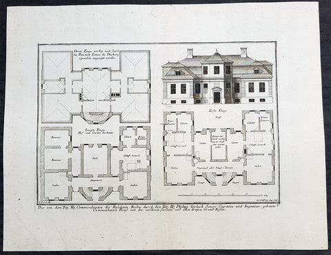
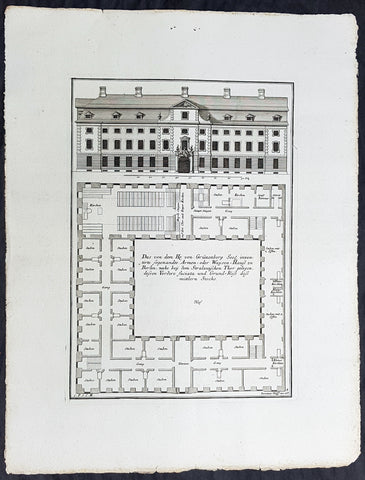
1740 Wolff & Corvinus Antique Arch Plan Officers Quarters, Royal Arsenal, Berlin
Antique Map
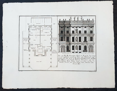
- Title : Das von dem Tit. H. Commendanten der Residentz Berlin, durch den Tit. H. Philipp Gerlach Senior Capitain und Ingenieur gebaute Commendaten Hauß mit der vorderen faciata und allen dreyen Grund-Rissen
- Ref #: 93449
- Size: 19 1/2in x 15in (495mm x 390mm)
- Date : 1740
- Condition: (A+) Fine Condition
Description:
This large rare, original copper-plate engraved antique architectural print, view & plan of officers quarters at the Royal Arsenal in Berlin - plate No.17 of 19 - by Johann August Corvinus 1683 - 1738, after Andreas Mayers 1716 - 1782, was published in Eigentliche Abbildung des Prächtigen Königl. Lust Schlosses Charlottenburg, eine Meile von Berlin, sambt dem darhinden im Walde gelegenen schönen Lust Garten
(Set of 16 numbered plates, the first with the title, with plans and views of the buildings and gardens at Charlottenburg, the palace of the King of Prussia on the outskirts of Berlin.) by Jeremias Wolff Erben in 1740.
General Definitions:
Paper thickness and quality: - Heavy and stable
Paper color : - off white
Age of map color: -
Colors used: -
General color appearance: -
Paper size: - 19in x 12 1/2in (490mm x 335mm)
Plate size: - 14 1/2in x 10 1/2in (370mm x 260mm)
Margins: - Min 1in (25mm)
Imperfections:
Margins: - None
Plate area: - None
Verso: - None
Background:
Berlin straddles the banks of the River Spree, which flows into the River Havel (a tributary of the River Elbe) in the western borough of Spandau. Among the citys main topographical features are the many lakes in the western and southeastern boroughs formed by the Spree, Havel, and Dahme rivers (the largest of which is Lake Müggelsee). Due to its location in the European Plain, Berlin is influenced by a temperate seasonal climate. About one-third of the citys area is composed of forests, parks, gardens, rivers, canals and lakes. The city lies in the Central German dialect area, the Berlin dialect being a variant of the Lusatian-New Marchian dialects.
First documented in the 13th century and situated at the crossing of two important historic trade routes, Berlin became the capital of the Margraviate of Brandenburg (1417–1701), the Kingdom of Prussia (1701–1918), the German Empire (1871–1918), the Weimar Republic (1919–1933), and the Third Reich (1933–1945). Berlin in the 1920s was the third-largest municipality in the world. After World War II and its subsequent occupation by the victorious countries, the city was divided; West Berlin became a de facto West German exclave, surrounded by the Berlin Wall (1961–1989) and East German territory. East Berlin was declared capital of East Germany, while Bonn became the West German capital. Following German reunification in 1990, Berlin once again became the capital of all of Germany.
The Thirty Years War between 1618 and 1648 devastated Berlin. One third of its houses were damaged or destroyed, and the city lost half of its population. Frederick William, known as the Great Elector, who had succeeded his father George William as ruler in 1640, initiated a policy of promoting immigration and religious tolerance. With the Edict of Potsdam in 1685, Frederick William offered asylum to the French Huguenots.
By 1700, approximately 30 percent of Berlins residents were French, because of the Huguenot immigration. Many other immigrants came from Bohemia, Poland, and Salzburg.
Since 1618, the Margraviate of Brandenburg had been in personal union with the Duchy of Prussia. In 1701, the dual state formed the Kingdom of Prussia, as Frederick III, Elector of Brandenburg, crowned himself as king Frederick I in Prussia. Berlin became the capital of the new Kingdom, replacing Königsberg. This was a successful attempt to centralise the capital in the very far-flung state, and it was the first time the city began to grow. In 1709, Berlin merged with the four cities of Cölln, Friedrichswerder, Friedrichstadt and Dorotheenstadt under the name Berlin, Haupt- und Residenzstadt Berlin.
In 1740, Frederick II, known as Frederick the Great (1740–1786), came to power. Under the rule of Frederick II, Berlin became a center of the Enlightenment, but also, was briefly occupied during the Seven Years War by the Russian army. Following Frances victory in the War of the Fourth Coalition, Napoleon Bonaparte marched into Berlin in 1806, but granted self-government to the city. In 1815, the city became part of the new Province of Brandenburg.
The Industrial Revolution transformed Berlin during the 19th century; the citys economy and population expanded dramatically, and it became the main railway hub and economic centre of Germany. Additional suburbs soon developed and increased the area and population of Berlin. In 1861, neighbouring suburbs including Wedding, Moabit and several others were incorporated into Berlin. In 1871, Berlin became capital of the newly founded German Empire. In 1881, it became a city district separate from Brandenburg.
Wolff, Jeremais 1663 - 1724
Wolff was an German engraver and publisher. Born in Augsburg, he originally trained as a clock and automat maker, later changing course and opening a small copperplate engraving shop. His success was impressive and became one of the largest European art, print & map publishers in the first half of the 18th century. Wolff employed some of the best engravers of the time and although not an engraver himself, only Wolffs name was recorded on the engravings. Many of his engravers went uncredited for their work. In 1710 Wolff was one of the founder member of the Empire State Academy of Arts in Augsburg.
After his death in 1724, Wolffs publishing business was inherited by his sons and son-in-law, Johann Balthasar Probst (1673–1750) a notable engraver at the time. The firm continued on in Augsburg under the name Jeremias Wolff Erben.
Together with the Nuremberg copperplate engraver Paul Decker , Wolff published a series of engravings showing the war successes of Prince Eugene of Savoy in Italy , southern Germany and the Spanish Netherlands, during the War of the Spanish Succession . The prints are exhibited in the Museum of Military History, in Vienna .
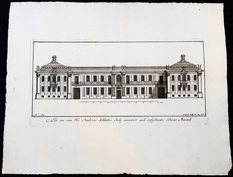
1740 Wolff & Corvinus Antique Arch Print of Charlottenburg Palace Stables Berlin
Antique Map
- Title : Ist ein von Hr. Andreas Schlütter Seel. inventirt und aufgebauer Schöner Marstall Datierung
- Ref #: 93447
- Size: 19in x 12 1/2in (490mm x 335mm)
- Date : 1740
- Condition: (A+) Fine Condition
Description:
This large rare, original copper-plate engraved antique architectural print, view of the facade of the Charlottenburg Palace stables in Berlin - plate No.15 of 16 - by Johann August Corvinus 1683 - 1738, after Andreas Mayers 1716 - 1782, was published in Eigentliche Abbildung des Prächtigen Königl. Lust Schlosses Charlottenburg, eine Meile von Berlin, sambt dem darhinden im Walde gelegenen schönen Lust Garten
(Set of 16 numbered plates, the first with the title, with plans and views of the buildings and gardens at Charlottenburg, the palace of the King of Prussia on the outskirts of Berlin.) by Jeremias Wolff Erben in 1740.
General Definitions:
Paper thickness and quality: - Heavy and stable
Paper color : - off white
Age of map color: -
Colors used: -
General color appearance: -
Paper size: - 19in x 12 1/2in (490mm x 335mm)
Plate size: - 14 1/2in x 10 1/2in (370mm x 260mm)
Margins: - Min 1in (25mm)
Imperfections:
Margins: - None
Plate area: - None
Verso: - None
Background:
Berlin straddles the banks of the River Spree, which flows into the River Havel (a tributary of the River Elbe) in the western borough of Spandau. Among the citys main topographical features are the many lakes in the western and southeastern boroughs formed by the Spree, Havel, and Dahme rivers (the largest of which is Lake Müggelsee). Due to its location in the European Plain, Berlin is influenced by a temperate seasonal climate. About one-third of the citys area is composed of forests, parks, gardens, rivers, canals and lakes. The city lies in the Central German dialect area, the Berlin dialect being a variant of the Lusatian-New Marchian dialects.
First documented in the 13th century and situated at the crossing of two important historic trade routes, Berlin became the capital of the Margraviate of Brandenburg (1417–1701), the Kingdom of Prussia (1701–1918), the German Empire (1871–1918), the Weimar Republic (1919–1933), and the Third Reich (1933–1945). Berlin in the 1920s was the third-largest municipality in the world. After World War II and its subsequent occupation by the victorious countries, the city was divided; West Berlin became a de facto West German exclave, surrounded by the Berlin Wall (1961–1989) and East German territory. East Berlin was declared capital of East Germany, while Bonn became the West German capital. Following German reunification in 1990, Berlin once again became the capital of all of Germany.
The Thirty Years War between 1618 and 1648 devastated Berlin. One third of its houses were damaged or destroyed, and the city lost half of its population. Frederick William, known as the Great Elector, who had succeeded his father George William as ruler in 1640, initiated a policy of promoting immigration and religious tolerance. With the Edict of Potsdam in 1685, Frederick William offered asylum to the French Huguenots.
By 1700, approximately 30 percent of Berlins residents were French, because of the Huguenot immigration. Many other immigrants came from Bohemia, Poland, and Salzburg.
Since 1618, the Margraviate of Brandenburg had been in personal union with the Duchy of Prussia. In 1701, the dual state formed the Kingdom of Prussia, as Frederick III, Elector of Brandenburg, crowned himself as king Frederick I in Prussia. Berlin became the capital of the new Kingdom, replacing Königsberg. This was a successful attempt to centralise the capital in the very far-flung state, and it was the first time the city began to grow. In 1709, Berlin merged with the four cities of Cölln, Friedrichswerder, Friedrichstadt and Dorotheenstadt under the name Berlin, Haupt- und Residenzstadt Berlin.
In 1740, Frederick II, known as Frederick the Great (1740–1786), came to power. Under the rule of Frederick II, Berlin became a center of the Enlightenment, but also, was briefly occupied during the Seven Years War by the Russian army. Following Frances victory in the War of the Fourth Coalition, Napoleon Bonaparte marched into Berlin in 1806, but granted self-government to the city. In 1815, the city became part of the new Province of Brandenburg.
The Industrial Revolution transformed Berlin during the 19th century; the citys economy and population expanded dramatically, and it became the main railway hub and economic centre of Germany. Additional suburbs soon developed and increased the area and population of Berlin. In 1861, neighbouring suburbs including Wedding, Moabit and several others were incorporated into Berlin. In 1871, Berlin became capital of the newly founded German Empire. In 1881, it became a city district separate from Brandenburg.
Wolff, Jeremais 1663 - 1724
Wolff was an German engraver and publisher. Born in Augsburg, he originally trained as a clock and automat maker, later changing course and opening a small copperplate engraving shop. His success was impressive and became one of the largest European art, print & map publishers in the first half of the 18th century. Wolff employed some of the best engravers of the time and although not an engraver himself, only Wolffs name was recorded on the engravings. Many of his engravers went uncredited for their work. In 1710 Wolff was one of the founder member of the Empire State Academy of Arts in Augsburg.
After his death in 1724, Wolffs publishing business was inherited by his sons and son-in-law, Johann Balthasar Probst (1673–1750) a notable engraver at the time. The firm continued on in Augsburg under the name Jeremias Wolff Erben.
Together with the Nuremberg copperplate engraver Paul Decker , Wolff published a series of engravings showing the war successes of Prince Eugene of Savoy in Italy , southern Germany and the Spanish Netherlands, during the War of the Spanish Succession . The prints are exhibited in the Museum of Military History, in Vienna .
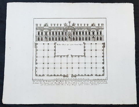
1740 Wolff & Corvinus Antique Arch Print of The Royal Arsenal in Berlin Germany
Antique Map
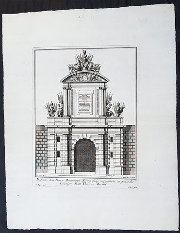
- Title : Das von dem H. Architect und Bau-Meister Nering Seel. angefangne, und von dem unvergleichlichen Architect Ober-Ingenier und Bau-Meistern H. Obrist Both in vollkommenen Perfection Stand gebrachte und von jedermann belobte Herr. Zeug-Haus, dessen vordere faciata
- Ref #: 93454
- Size: 19in x 12 1/2in (490mm x 335mm)
- Date : 1740
- Condition: (A+) Fine Condition
Description:
This large rare, original copper-plate engraved antique architectural print, view & plan of The Royal Arsenal in Berlin Houses - plate No.13 of 16 - by Johann August Corvinus 1683 - 1738, after Andreas Mayers 1716 - 1782, was published in Eigentliche Abbildung des Prächtigen Königl. Lust Schlosses Charlottenburg, eine Meile von Berlin, sambt dem darhinden im Walde gelegenen schönen Lust Garten
(Set of 16 numbered plates, the first with the title, with plans and views of the buildings and gardens at Charlottenburg, the palace of the King of Prussia on the outskirts of Berlin.) by Jeremias Wolff Erben in 1740.
General Definitions:
Paper thickness and quality: - Heavy and stable
Paper color : - off white
Age of map color: -
Colors used: -
General color appearance: -
Paper size: - 19in x 12 1/2in (490mm x 335mm)
Plate size: - 14 1/2in x 10 1/2in (370mm x 260mm)
Margins: - Min 1in (25mm)
Imperfections:
Margins: - None
Plate area: - None
Verso: - None
Background:
Berlin straddles the banks of the River Spree, which flows into the River Havel (a tributary of the River Elbe) in the western borough of Spandau. Among the citys main topographical features are the many lakes in the western and southeastern boroughs formed by the Spree, Havel, and Dahme rivers (the largest of which is Lake Müggelsee). Due to its location in the European Plain, Berlin is influenced by a temperate seasonal climate. About one-third of the citys area is composed of forests, parks, gardens, rivers, canals and lakes. The city lies in the Central German dialect area, the Berlin dialect being a variant of the Lusatian-New Marchian dialects.
First documented in the 13th century and situated at the crossing of two important historic trade routes, Berlin became the capital of the Margraviate of Brandenburg (1417–1701), the Kingdom of Prussia (1701–1918), the German Empire (1871–1918), the Weimar Republic (1919–1933), and the Third Reich (1933–1945). Berlin in the 1920s was the third-largest municipality in the world. After World War II and its subsequent occupation by the victorious countries, the city was divided; West Berlin became a de facto West German exclave, surrounded by the Berlin Wall (1961–1989) and East German territory. East Berlin was declared capital of East Germany, while Bonn became the West German capital. Following German reunification in 1990, Berlin once again became the capital of all of Germany.
The Thirty Years War between 1618 and 1648 devastated Berlin. One third of its houses were damaged or destroyed, and the city lost half of its population. Frederick William, known as the Great Elector, who had succeeded his father George William as ruler in 1640, initiated a policy of promoting immigration and religious tolerance. With the Edict of Potsdam in 1685, Frederick William offered asylum to the French Huguenots.
By 1700, approximately 30 percent of Berlins residents were French, because of the Huguenot immigration. Many other immigrants came from Bohemia, Poland, and Salzburg.
Since 1618, the Margraviate of Brandenburg had been in personal union with the Duchy of Prussia. In 1701, the dual state formed the Kingdom of Prussia, as Frederick III, Elector of Brandenburg, crowned himself as king Frederick I in Prussia. Berlin became the capital of the new Kingdom, replacing Königsberg. This was a successful attempt to centralise the capital in the very far-flung state, and it was the first time the city began to grow. In 1709, Berlin merged with the four cities of Cölln, Friedrichswerder, Friedrichstadt and Dorotheenstadt under the name Berlin, Haupt- und Residenzstadt Berlin.
In 1740, Frederick II, known as Frederick the Great (1740–1786), came to power. Under the rule of Frederick II, Berlin became a center of the Enlightenment, but also, was briefly occupied during the Seven Years War by the Russian army. Following Frances victory in the War of the Fourth Coalition, Napoleon Bonaparte marched into Berlin in 1806, but granted self-government to the city. In 1815, the city became part of the new Province of Brandenburg.
The Industrial Revolution transformed Berlin during the 19th century; the citys economy and population expanded dramatically, and it became the main railway hub and economic centre of Germany. Additional suburbs soon developed and increased the area and population of Berlin. In 1861, neighbouring suburbs including Wedding, Moabit and several others were incorporated into Berlin. In 1871, Berlin became capital of the newly founded German Empire. In 1881, it became a city district separate from Brandenburg.
Wolff, Jeremais 1663 - 1724
Wolff was an German engraver and publisher. Born in Augsburg, he originally trained as a clock and automat maker, later changing course and opening a small copperplate engraving shop. His success was impressive and became one of the largest European art, print & map publishers in the first half of the 18th century. Wolff employed some of the best engravers of the time and although not an engraver himself, only Wolffs name was recorded on the engravings. Many of his engravers went uncredited for their work. In 1710 Wolff was one of the founder member of the Empire State Academy of Arts in Augsburg.
After his death in 1724, Wolffs publishing business was inherited by his sons and son-in-law, Johann Balthasar Probst (1673–1750) a notable engraver at the time. The firm continued on in Augsburg under the name Jeremias Wolff Erben.
Together with the Nuremberg copperplate engraver Paul Decker , Wolff published a series of engravings showing the war successes of Prince Eugene of Savoy in Italy , southern Germany and the Spanish Netherlands, during the War of the Spanish Succession . The prints are exhibited in the Museum of Military History, in Vienna .
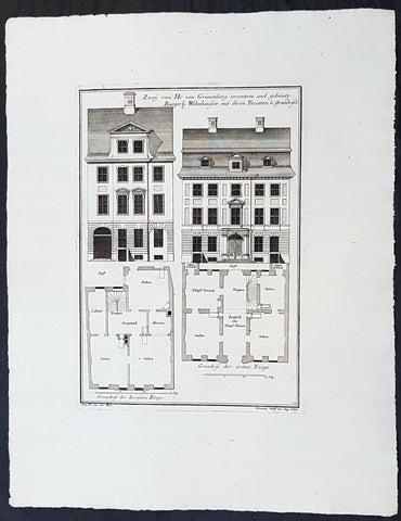
1740 Wolff & Corvinus Antique Arch Print Plans of Residential Houses in Berlin
Antique Map
- Title : Zwey von Hr. von Grünenberg inventirte und gebaute Burgerl. Wohnhäusser mit ihren Faciaten u. Grundrissen
- Ref #: 93450
- Size: 19in x 12 1/2in (490mm x 335mm)
- Date : 1740
- Condition: (A+) Fine Condition
Description:
This large rare, original copper-plate engraved antique architectural print plans of Berlin Houses - plate No. 12 of 16 - by Johann August Corvinus 1683 - 1738, after Andreas Mayers 1716 - 1782, was published in Eigentliche Abbildung des Prächtigen Königl. Lust Schlosses Charlottenburg, eine Meile von Berlin, sambt dem darhinden im Walde gelegenen schönen Lust Garten
(Set of 16 numbered plates, the first with the title, with plans and views of the buildings and gardens at Charlottenburg, the palace of the King of Prussia on the outskirts of Berlin.) by Jeremias Wolff Erben in 1740.
General Definitions:
Paper thickness and quality: - Heavy and stable
Paper color : - off white
Age of map color: -
Colors used: -
General color appearance: -
Paper size: - 19in x 12 1/2in (490mm x 335mm)
Plate size: - 14 1/2in x 10 1/2in (370mm x 260mm)
Margins: - Min 1in (25mm)
Imperfections:
Margins: - None
Plate area: - None
Verso: - None
Background:
Berlin straddles the banks of the River Spree, which flows into the River Havel (a tributary of the River Elbe) in the western borough of Spandau. Among the citys main topographical features are the many lakes in the western and southeastern boroughs formed by the Spree, Havel, and Dahme rivers (the largest of which is Lake Müggelsee). Due to its location in the European Plain, Berlin is influenced by a temperate seasonal climate. About one-third of the citys area is composed of forests, parks, gardens, rivers, canals and lakes. The city lies in the Central German dialect area, the Berlin dialect being a variant of the Lusatian-New Marchian dialects.
First documented in the 13th century and situated at the crossing of two important historic trade routes, Berlin became the capital of the Margraviate of Brandenburg (1417–1701), the Kingdom of Prussia (1701–1918), the German Empire (1871–1918), the Weimar Republic (1919–1933), and the Third Reich (1933–1945). Berlin in the 1920s was the third-largest municipality in the world. After World War II and its subsequent occupation by the victorious countries, the city was divided; West Berlin became a de facto West German exclave, surrounded by the Berlin Wall (1961–1989) and East German territory. East Berlin was declared capital of East Germany, while Bonn became the West German capital. Following German reunification in 1990, Berlin once again became the capital of all of Germany.
The Thirty Years War between 1618 and 1648 devastated Berlin. One third of its houses were damaged or destroyed, and the city lost half of its population. Frederick William, known as the Great Elector, who had succeeded his father George William as ruler in 1640, initiated a policy of promoting immigration and religious tolerance. With the Edict of Potsdam in 1685, Frederick William offered asylum to the French Huguenots.
By 1700, approximately 30 percent of Berlins residents were French, because of the Huguenot immigration. Many other immigrants came from Bohemia, Poland, and Salzburg.
Since 1618, the Margraviate of Brandenburg had been in personal union with the Duchy of Prussia. In 1701, the dual state formed the Kingdom of Prussia, as Frederick III, Elector of Brandenburg, crowned himself as king Frederick I in Prussia. Berlin became the capital of the new Kingdom, replacing Königsberg. This was a successful attempt to centralise the capital in the very far-flung state, and it was the first time the city began to grow. In 1709, Berlin merged with the four cities of Cölln, Friedrichswerder, Friedrichstadt and Dorotheenstadt under the name Berlin, Haupt- und Residenzstadt Berlin.
In 1740, Frederick II, known as Frederick the Great (1740–1786), came to power. Under the rule of Frederick II, Berlin became a center of the Enlightenment, but also, was briefly occupied during the Seven Years War by the Russian army. Following Frances victory in the War of the Fourth Coalition, Napoleon Bonaparte marched into Berlin in 1806, but granted self-government to the city. In 1815, the city became part of the new Province of Brandenburg.
The Industrial Revolution transformed Berlin during the 19th century; the citys economy and population expanded dramatically, and it became the main railway hub and economic centre of Germany. Additional suburbs soon developed and increased the area and population of Berlin. In 1861, neighbouring suburbs including Wedding, Moabit and several others were incorporated into Berlin. In 1871, Berlin became capital of the newly founded German Empire. In 1881, it became a city district separate from Brandenburg.
Wolff, Jeremais 1663 - 1724
Wolff was an German engraver and publisher. Born in Augsburg, he originally trained as a clock and automat maker, later changing course and opening a small copperplate engraving shop. His success was impressive and became one of the largest European art, print & map publishers in the first half of the 18th century. Wolff employed some of the best engravers of the time and although not an engraver himself, only Wolffs name was recorded on the engravings. Many of his engravers went uncredited for their work. In 1710 Wolff was one of the founder member of the Empire State Academy of Arts in Augsburg.
After his death in 1724, Wolffs publishing business was inherited by his sons and son-in-law, Johann Balthasar Probst (1673–1750) a notable engraver at the time. The firm continued on in Augsburg under the name Jeremias Wolff Erben.
Together with the Nuremberg copperplate engraver Paul Decker , Wolff published a series of engravings showing the war successes of Prince Eugene of Savoy in Italy , southern Germany and the Spanish Netherlands, during the War of the Spanish Succession . The prints are exhibited in the Museum of Military History, in Vienna .
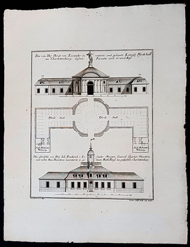
1740 Wolff & Corvinus Antique Arch Print of Charlottenburg Palace Stables Berlin
Antique Map
- Title : Der von Hr. Obrist von Eosander inventirte und gebaute Königl. Pferdt Stall zu Charlottenburg, dessen Faciata und Grund Riss. - Das gleichfals von Hr. Joh. Friederich v. Eosander Obristen General Quartier Meistern, und ersten Bau Directorn inventierte und gebaute Rath Hauss zu gedachten Charlottenburg
- Ref #: 93453
- Size: 19in x 12 1/2in (490mm x 335mm)
- Date : 1740
- Condition: (A+) Fine Condition
Description:
This large rare, original copper-plate engraved antique architectural print of the Royal Horse Stables at Charlottenburg Palace, Berlin - plate No. 11 of 16 - by Johann August Corvinus 1683 - 1738, after Andreas Mayers 1716 - 1782, was published in Eigentliche Abbildung des Prächtigen Königl. Lust Schlosses Charlottenburg, eine Meile von Berlin, sambt dem darhinden im Walde gelegenen schönen Lust Garten
(Set of 16 numbered plates, the first with the title, with plans and views of the buildings and gardens at Charlottenburg, the palace of the King of Prussia on the outskirts of Berlin.) by Jeremias Wolff Erben in 1740.
General Definitions:
Paper thickness and quality: - Heavy and stable
Paper color : - off white
Age of map color: -
Colors used: -
General color appearance: -
Paper size: - 19in x 12 1/2in (490mm x 335mm)
Plate size: - 14 1/2in x 10 1/2in (370mm x 260mm)
Margins: - Min 1in (25mm)
Imperfections:
Margins: - None
Plate area: - None
Verso: - None
Background:
Berlin straddles the banks of the River Spree, which flows into the River Havel (a tributary of the River Elbe) in the western borough of Spandau. Among the citys main topographical features are the many lakes in the western and southeastern boroughs formed by the Spree, Havel, and Dahme rivers (the largest of which is Lake Müggelsee). Due to its location in the European Plain, Berlin is influenced by a temperate seasonal climate. About one-third of the citys area is composed of forests, parks, gardens, rivers, canals and lakes. The city lies in the Central German dialect area, the Berlin dialect being a variant of the Lusatian-New Marchian dialects.
First documented in the 13th century and situated at the crossing of two important historic trade routes, Berlin became the capital of the Margraviate of Brandenburg (1417–1701), the Kingdom of Prussia (1701–1918), the German Empire (1871–1918), the Weimar Republic (1919–1933), and the Third Reich (1933–1945). Berlin in the 1920s was the third-largest municipality in the world. After World War II and its subsequent occupation by the victorious countries, the city was divided; West Berlin became a de facto West German exclave, surrounded by the Berlin Wall (1961–1989) and East German territory. East Berlin was declared capital of East Germany, while Bonn became the West German capital. Following German reunification in 1990, Berlin once again became the capital of all of Germany.
The Thirty Years War between 1618 and 1648 devastated Berlin. One third of its houses were damaged or destroyed, and the city lost half of its population. Frederick William, known as the Great Elector, who had succeeded his father George William as ruler in 1640, initiated a policy of promoting immigration and religious tolerance. With the Edict of Potsdam in 1685, Frederick William offered asylum to the French Huguenots.
By 1700, approximately 30 percent of Berlins residents were French, because of the Huguenot immigration. Many other immigrants came from Bohemia, Poland, and Salzburg.
Since 1618, the Margraviate of Brandenburg had been in personal union with the Duchy of Prussia. In 1701, the dual state formed the Kingdom of Prussia, as Frederick III, Elector of Brandenburg, crowned himself as king Frederick I in Prussia. Berlin became the capital of the new Kingdom, replacing Königsberg. This was a successful attempt to centralise the capital in the very far-flung state, and it was the first time the city began to grow. In 1709, Berlin merged with the four cities of Cölln, Friedrichswerder, Friedrichstadt and Dorotheenstadt under the name Berlin, Haupt- und Residenzstadt Berlin.
In 1740, Frederick II, known as Frederick the Great (1740–1786), came to power. Under the rule of Frederick II, Berlin became a center of the Enlightenment, but also, was briefly occupied during the Seven Years War by the Russian army. Following Frances victory in the War of the Fourth Coalition, Napoleon Bonaparte marched into Berlin in 1806, but granted self-government to the city. In 1815, the city became part of the new Province of Brandenburg.
The Industrial Revolution transformed Berlin during the 19th century; the citys economy and population expanded dramatically, and it became the main railway hub and economic centre of Germany. Additional suburbs soon developed and increased the area and population of Berlin. In 1861, neighbouring suburbs including Wedding, Moabit and several others were incorporated into Berlin. In 1871, Berlin became capital of the newly founded German Empire. In 1881, it became a city district separate from Brandenburg.
Wolff, Jeremais 1663 - 1724
Wolff was an German engraver and publisher. Born in Augsburg, he originally trained as a clock and automat maker, later changing course and opening a small copperplate engraving shop. His success was impressive and became one of the largest European art, print & map publishers in the first half of the 18th century. Wolff employed some of the best engravers of the time and although not an engraver himself, only Wolffs name was recorded on the engravings. Many of his engravers went uncredited for their work. In 1710 Wolff was one of the founder member of the Empire State Academy of Arts in Augsburg.
After his death in 1724, Wolffs publishing business was inherited by his sons and son-in-law, Johann Balthasar Probst (1673–1750) a notable engraver at the time. The firm continued on in Augsburg under the name Jeremias Wolff Erben.
Together with the Nuremberg copperplate engraver Paul Decker , Wolff published a series of engravings showing the war successes of Prince Eugene of Savoy in Italy , southern Germany and the Spanish Netherlands, during the War of the Spanish Succession . The prints are exhibited in the Museum of Military History, in Vienna .
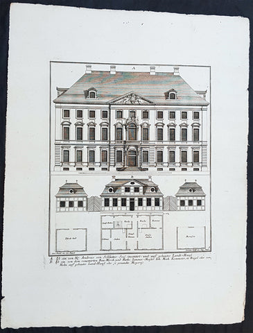
1740 Wolff & Corvinus Antique Arch Print of Berlin Mansions by A. von Schlütter
Antique Map
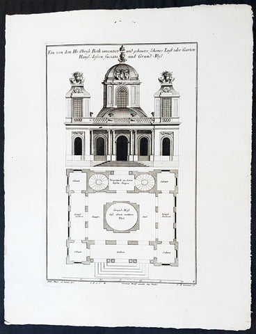
- Title : A. Ist ein von H. Andreas von Schlütter Seel. inventirt- und auff gebautes Landt-Hauss. B. Ist ein von dem renomirten Bau-Werck- und Raths Zimmer-Meister Joh. Mich. Kemmeter, in Riegel oder Holtz auff gebautes Land-Hauß oder so genandte Meyerey
- Ref #: 93445
- Size: 19in x 12 1/2in (490mm x 335mm)
- Date : 1740
- Condition: (A+) Fine Condition
Description:
This large rare, original copper-plate engraved antique architectural print of 18th century Mansions in Berlin designed by Andreas von Schlütter - plate No. 9 of 16 - by Johann August Corvinus 1683 - 1738, after Andreas Mayers 1716 - 1782, was published in Eigentliche Abbildung des Prächtigen Königl. Lust Schlosses Charlottenburg, eine Meile von Berlin, sambt dem darhinden im Walde gelegenen schönen Lust Garten
(Set of 16 numbered plates, the first with the title, with plans and views of the buildings and gardens at Charlottenburg, the palace of the King of Prussia on the outskirts of Berlin.) by Jeremias Wolff Erben in 1740.
General Definitions:
Paper thickness and quality: - Heavy and stable
Paper color : - off white
Age of map color: -
Colors used: -
General color appearance: -
Paper size: - 19in x 12 1/2in (490mm x 335mm)
Plate size: - 14 1/2in x 10 1/2in (370mm x 260mm)
Margins: - Min 1in (25mm)
Imperfections:
Margins: - None
Plate area: - None
Verso: - None
Background:
Berlin straddles the banks of the River Spree, which flows into the River Havel (a tributary of the River Elbe) in the western borough of Spandau. Among the citys main topographical features are the many lakes in the western and southeastern boroughs formed by the Spree, Havel, and Dahme rivers (the largest of which is Lake Müggelsee). Due to its location in the European Plain, Berlin is influenced by a temperate seasonal climate. About one-third of the citys area is composed of forests, parks, gardens, rivers, canals and lakes. The city lies in the Central German dialect area, the Berlin dialect being a variant of the Lusatian-New Marchian dialects.
First documented in the 13th century and situated at the crossing of two important historic trade routes, Berlin became the capital of the Margraviate of Brandenburg (1417–1701), the Kingdom of Prussia (1701–1918), the German Empire (1871–1918), the Weimar Republic (1919–1933), and the Third Reich (1933–1945). Berlin in the 1920s was the third-largest municipality in the world. After World War II and its subsequent occupation by the victorious countries, the city was divided; West Berlin became a de facto West German exclave, surrounded by the Berlin Wall (1961–1989) and East German territory. East Berlin was declared capital of East Germany, while Bonn became the West German capital. Following German reunification in 1990, Berlin once again became the capital of all of Germany.
The Thirty Years War between 1618 and 1648 devastated Berlin. One third of its houses were damaged or destroyed, and the city lost half of its population. Frederick William, known as the Great Elector, who had succeeded his father George William as ruler in 1640, initiated a policy of promoting immigration and religious tolerance. With the Edict of Potsdam in 1685, Frederick William offered asylum to the French Huguenots.
By 1700, approximately 30 percent of Berlins residents were French, because of the Huguenot immigration. Many other immigrants came from Bohemia, Poland, and Salzburg.
Since 1618, the Margraviate of Brandenburg had been in personal union with the Duchy of Prussia. In 1701, the dual state formed the Kingdom of Prussia, as Frederick III, Elector of Brandenburg, crowned himself as king Frederick I in Prussia. Berlin became the capital of the new Kingdom, replacing Königsberg. This was a successful attempt to centralise the capital in the very far-flung state, and it was the first time the city began to grow. In 1709, Berlin merged with the four cities of Cölln, Friedrichswerder, Friedrichstadt and Dorotheenstadt under the name Berlin, Haupt- und Residenzstadt Berlin.
In 1740, Frederick II, known as Frederick the Great (1740–1786), came to power. Under the rule of Frederick II, Berlin became a center of the Enlightenment, but also, was briefly occupied during the Seven Years War by the Russian army. Following Frances victory in the War of the Fourth Coalition, Napoleon Bonaparte marched into Berlin in 1806, but granted self-government to the city. In 1815, the city became part of the new Province of Brandenburg.
The Industrial Revolution transformed Berlin during the 19th century; the citys economy and population expanded dramatically, and it became the main railway hub and economic centre of Germany. Additional suburbs soon developed and increased the area and population of Berlin. In 1861, neighbouring suburbs including Wedding, Moabit and several others were incorporated into Berlin. In 1871, Berlin became capital of the newly founded German Empire. In 1881, it became a city district separate from Brandenburg.
Wolff, Jeremais 1663 - 1724
Wolff was an German engraver and publisher. Born in Augsburg, he originally trained as a clock and automat maker, later changing course and opening a small copperplate engraving shop. His success was impressive and became one of the largest European art, print & map publishers in the first half of the 18th century. Wolff employed some of the best engravers of the time and although not an engraver himself, only Wolffs name was recorded on the engravings. Many of his engravers went uncredited for their work. In 1710 Wolff was one of the founder member of the Empire State Academy of Arts in Augsburg.
After his death in 1724, Wolffs publishing business was inherited by his sons and son-in-law, Johann Balthasar Probst (1673–1750) a notable engraver at the time. The firm continued on in Augsburg under the name Jeremias Wolff Erben.
Together with the Nuremberg copperplate engraver Paul Decker , Wolff published a series of engravings showing the war successes of Prince Eugene of Savoy in Italy , southern Germany and the Spanish Netherlands, during the War of the Spanish Succession . The prints are exhibited in the Museum of Military History, in Vienna .
1740 Wolff & Corvinus Antique Arch Print of a Poorhouse near Stralau Gate Berlin
Antique Map
- Title : Das von dem H. von Grünenberg Seel. inventirte sogenandte Armen- oder Waysen-Hauss zu Berlin, nache bey dem Stralauischen Thor gelegen, ....
- Ref #: 93455
- Size: 19in x 12 1/2in (490mm x 335mm)
- Date : 1740
- Condition: (A+) Fine Condition
Description:
This large rare, original copper-plate engraved antique architectural print of the Poorhouse near the old Stralau Gate (Stralauer Tor) in Berlin - plate No. 8 of 16 - by Johann August Corvinus 1683 - 1738, after Andreas Mayers 1716 - 1782, was published in Eigentliche Abbildung des Prächtigen Königl. Lust Schlosses Charlottenburg, eine Meile von Berlin, sambt dem darhinden im Walde gelegenen schönen Lust Garten
(Set of 16 numbered plates, the first with the title, with plans and views of the buildings and gardens at Charlottenburg, the palace of the King of Prussia on the outskirts of Berlin.) by Jeremias Wolff Erben in 1740.
General Definitions:
Paper thickness and quality: - Heavy and stable
Paper color : - off white
Age of map color: -
Colors used: -
General color appearance: -
Paper size: - 19in x 12 1/2in (490mm x 335mm)
Plate size: - 14 1/2in x 10 1/2in (370mm x 260mm)
Margins: - Min 1in (25mm)
Imperfections:
Margins: - None
Plate area: - None
Verso: - None
Background:
Berlin straddles the banks of the River Spree, which flows into the River Havel (a tributary of the River Elbe) in the western borough of Spandau. Among the citys main topographical features are the many lakes in the western and southeastern boroughs formed by the Spree, Havel, and Dahme rivers (the largest of which is Lake Müggelsee). Due to its location in the European Plain, Berlin is influenced by a temperate seasonal climate. About one-third of the citys area is composed of forests, parks, gardens, rivers, canals and lakes. The city lies in the Central German dialect area, the Berlin dialect being a variant of the Lusatian-New Marchian dialects.
First documented in the 13th century and situated at the crossing of two important historic trade routes, Berlin became the capital of the Margraviate of Brandenburg (1417–1701), the Kingdom of Prussia (1701–1918), the German Empire (1871–1918), the Weimar Republic (1919–1933), and the Third Reich (1933–1945). Berlin in the 1920s was the third-largest municipality in the world. After World War II and its subsequent occupation by the victorious countries, the city was divided; West Berlin became a de facto West German exclave, surrounded by the Berlin Wall (1961–1989) and East German territory. East Berlin was declared capital of East Germany, while Bonn became the West German capital. Following German reunification in 1990, Berlin once again became the capital of all of Germany.
The Thirty Years War between 1618 and 1648 devastated Berlin. One third of its houses were damaged or destroyed, and the city lost half of its population. Frederick William, known as the Great Elector, who had succeeded his father George William as ruler in 1640, initiated a policy of promoting immigration and religious tolerance. With the Edict of Potsdam in 1685, Frederick William offered asylum to the French Huguenots.
By 1700, approximately 30 percent of Berlins residents were French, because of the Huguenot immigration. Many other immigrants came from Bohemia, Poland, and Salzburg.
Since 1618, the Margraviate of Brandenburg had been in personal union with the Duchy of Prussia. In 1701, the dual state formed the Kingdom of Prussia, as Frederick III, Elector of Brandenburg, crowned himself as king Frederick I in Prussia. Berlin became the capital of the new Kingdom, replacing Königsberg. This was a successful attempt to centralise the capital in the very far-flung state, and it was the first time the city began to grow. In 1709, Berlin merged with the four cities of Cölln, Friedrichswerder, Friedrichstadt and Dorotheenstadt under the name Berlin, Haupt- und Residenzstadt Berlin.
In 1740, Frederick II, known as Frederick the Great (1740–1786), came to power. Under the rule of Frederick II, Berlin became a center of the Enlightenment, but also, was briefly occupied during the Seven Years War by the Russian army. Following Frances victory in the War of the Fourth Coalition, Napoleon Bonaparte marched into Berlin in 1806, but granted self-government to the city. In 1815, the city became part of the new Province of Brandenburg.
The Industrial Revolution transformed Berlin during the 19th century; the citys economy and population expanded dramatically, and it became the main railway hub and economic centre of Germany. Additional suburbs soon developed and increased the area and population of Berlin. In 1861, neighbouring suburbs including Wedding, Moabit and several others were incorporated into Berlin. In 1871, Berlin became capital of the newly founded German Empire. In 1881, it became a city district separate from Brandenburg.
Wolff, Jeremais 1663 - 1724
Wolff was an German engraver and publisher. Born in Augsburg, he originally trained as a clock and automat maker, later changing course and opening a small copperplate engraving shop. His success was impressive and became one of the largest European art, print & map publishers in the first half of the 18th century. Wolff employed some of the best engravers of the time and although not an engraver himself, only Wolffs name was recorded on the engravings. Many of his engravers went uncredited for their work. In 1710 Wolff was one of the founder member of the Empire State Academy of Arts in Augsburg.
After his death in 1724, Wolffs publishing business was inherited by his sons and son-in-law, Johann Balthasar Probst (1673–1750) a notable engraver at the time. The firm continued on in Augsburg under the name Jeremias Wolff Erben.
Together with the Nuremberg copperplate engraver Paul Decker , Wolff published a series of engravings showing the war successes of Prince Eugene of Savoy in Italy , southern Germany and the Spanish Netherlands, during the War of the Spanish Succession . The prints are exhibited in the Museum of Military History, in Vienna .
1740 Wolff & Corvinus Antique Arch. Print Jerusalem Church Friedrichstadt.Berlin
Antique Map
- Title : Die von vorgedachten Hr. von Grünenberg invendierte, unter der Direction des Hr. Ioh. Simonetti Hoff Stucator Hoch-Fürstl. Anhaltischen BauMeister aufgebaute so genande Friderich Stättische Kirche sampt dessen Grund u. Faciata.
- Ref #: 93458
- Size: 19in x 12 1/2in (490mm x 335mm)
- Date : 1740
- Condition: (A+) Fine Condition
Description:
This large rare, original copper-plate engraved antique architectural print of the Parochialkirche (literally the Reformed parochial church) in the Mitte suburb of Berlin - plate No. 7 of 16 - by Johann August Corvinus 1683 - 1738, after Andreas Mayers 1716 - 1782, was published in Eigentliche Abbildung des Prächtigen Königl. Lust Schlosses Charlottenburg, eine Meile von Berlin, sambt dem darhinden im Walde gelegenen schönen Lust Garten
(Set of 16 numbered plates, the first with the title, with plans and views of the buildings and gardens at Charlottenburg, the palace of the King of Prussia on the outskirts of Berlin.) by Jeremias Wolff Erben in 1740.
General Definitions:
Paper thickness and quality: - Heavy and stable
Paper color : - off white
Age of map color: -
Colors used: -
General color appearance: -
Paper size: - 19in x 12 1/2in (490mm x 335mm)
Plate size: - 14 1/2in x 10 1/2in (370mm x 260mm)
Margins: - Min 1in (25mm)
Imperfections:
Margins: - None
Plate area: - None
Verso: - None
Background:
Berlin straddles the banks of the River Spree, which flows into the River Havel (a tributary of the River Elbe) in the western borough of Spandau. Among the citys main topographical features are the many lakes in the western and southeastern boroughs formed by the Spree, Havel, and Dahme rivers (the largest of which is Lake Müggelsee). Due to its location in the European Plain, Berlin is influenced by a temperate seasonal climate. About one-third of the citys area is composed of forests, parks, gardens, rivers, canals and lakes. The city lies in the Central German dialect area, the Berlin dialect being a variant of the Lusatian-New Marchian dialects.
First documented in the 13th century and situated at the crossing of two important historic trade routes, Berlin became the capital of the Margraviate of Brandenburg (1417–1701), the Kingdom of Prussia (1701–1918), the German Empire (1871–1918), the Weimar Republic (1919–1933), and the Third Reich (1933–1945). Berlin in the 1920s was the third-largest municipality in the world. After World War II and its subsequent occupation by the victorious countries, the city was divided; West Berlin became a de facto West German exclave, surrounded by the Berlin Wall (1961–1989) and East German territory. East Berlin was declared capital of East Germany, while Bonn became the West German capital. Following German reunification in 1990, Berlin once again became the capital of all of Germany.
The Thirty Years War between 1618 and 1648 devastated Berlin. One third of its houses were damaged or destroyed, and the city lost half of its population. Frederick William, known as the Great Elector, who had succeeded his father George William as ruler in 1640, initiated a policy of promoting immigration and religious tolerance. With the Edict of Potsdam in 1685, Frederick William offered asylum to the French Huguenots.
By 1700, approximately 30 percent of Berlins residents were French, because of the Huguenot immigration. Many other immigrants came from Bohemia, Poland, and Salzburg.
Since 1618, the Margraviate of Brandenburg had been in personal union with the Duchy of Prussia. In 1701, the dual state formed the Kingdom of Prussia, as Frederick III, Elector of Brandenburg, crowned himself as king Frederick I in Prussia. Berlin became the capital of the new Kingdom, replacing Königsberg. This was a successful attempt to centralise the capital in the very far-flung state, and it was the first time the city began to grow. In 1709, Berlin merged with the four cities of Cölln, Friedrichswerder, Friedrichstadt and Dorotheenstadt under the name Berlin, Haupt- und Residenzstadt Berlin.
In 1740, Frederick II, known as Frederick the Great (1740–1786), came to power. Under the rule of Frederick II, Berlin became a center of the Enlightenment, but also, was briefly occupied during the Seven Years War by the Russian army. Following Frances victory in the War of the Fourth Coalition, Napoleon Bonaparte marched into Berlin in 1806, but granted self-government to the city. In 1815, the city became part of the new Province of Brandenburg.
The Industrial Revolution transformed Berlin during the 19th century; the citys economy and population expanded dramatically, and it became the main railway hub and economic centre of Germany. Additional suburbs soon developed and increased the area and population of Berlin. In 1861, neighbouring suburbs including Wedding, Moabit and several others were incorporated into Berlin. In 1871, Berlin became capital of the newly founded German Empire. In 1881, it became a city district separate from Brandenburg.
Wolff, Jeremais 1663 - 1724
Wolff was an German engraver and publisher. Born in Augsburg, he originally trained as a clock and automat maker, later changing course and opening a small copperplate engraving shop. His success was impressive and became one of the largest European art, print & map publishers in the first half of the 18th century. Wolff employed some of the best engravers of the time and although not an engraver himself, only Wolffs name was recorded on the engravings. Many of his engravers went uncredited for their work. In 1710 Wolff was one of the founder member of the Empire State Academy of Arts in Augsburg.
After his death in 1724, Wolffs publishing business was inherited by his sons and son-in-law, Johann Balthasar Probst (1673–1750) a notable engraver at the time. The firm continued on in Augsburg under the name Jeremias Wolff Erben.
Together with the Nuremberg copperplate engraver Paul Decker , Wolff published a series of engravings showing the war successes of Prince Eugene of Savoy in Italy , southern Germany and the Spanish Netherlands, during the War of the Spanish Succession . The prints are exhibited in the Museum of Military History, in Vienna .
1740 Wolff & Corvinus Antique Arch. Print of the Parochialkirche in Mitte Berlin
Antique Map
- Title : Vordere faciata nebst dem halben Grund Riß der vorigen Parochial-Kirche mit verändertem Thurn wie solcher dermahlen sich würklich presentiert. Frontriß, darunter der halbe Grundriß.
- Ref #: 93459
- Size: 19in x 12 1/2in (490mm x 335mm)
- Date : 1740
- Condition: (A+) Fine Condition
Description:
This large rare, original copper-plate engraved antique architectural print of the Parochialkirche (literally the Reformed parochial church) in the Mitte suburb of Berlin - plate No. 6 of 16 - by Johann August Corvinus 1683 - 1738, after Andreas Mayers 1716 - 1782, was published in Eigentliche Abbildung des Prächtigen Königl. Lust Schlosses Charlottenburg, eine Meile von Berlin, sambt dem darhinden im Walde gelegenen schönen Lust Garten.
(Set of 16 numbered plates, the first with the title, with plans and views of the buildings and gardens at Charlottenburg, the palace of the King of Prussia on the outskirts of Berlin.) by Jeremias Wolff Erben in 1740.
General Definitions:
Paper thickness and quality: - Heavy and stable
Paper color : - off white
Age of map color: -
Colors used: -
General color appearance: -
Paper size: - 19in x 12 1/2in (490mm x 335mm)
Plate size: - 14 1/2in x 10 1/2in (370mm x 260mm)
Margins: - Min 1in (25mm)
Imperfections:
Margins: - None
Plate area: - None
Verso: - None
Background:
Berlin straddles the banks of the River Spree, which flows into the River Havel (a tributary of the River Elbe) in the western borough of Spandau. Among the citys main topographical features are the many lakes in the western and southeastern boroughs formed by the Spree, Havel, and Dahme rivers (the largest of which is Lake Müggelsee). Due to its location in the European Plain, Berlin is influenced by a temperate seasonal climate. About one-third of the citys area is composed of forests, parks, gardens, rivers, canals and lakes. The city lies in the Central German dialect area, the Berlin dialect being a variant of the Lusatian-New Marchian dialects.
First documented in the 13th century and situated at the crossing of two important historic trade routes, Berlin became the capital of the Margraviate of Brandenburg (1417–1701), the Kingdom of Prussia (1701–1918), the German Empire (1871–1918), the Weimar Republic (1919–1933), and the Third Reich (1933–1945). Berlin in the 1920s was the third-largest municipality in the world. After World War II and its subsequent occupation by the victorious countries, the city was divided; West Berlin became a de facto West German exclave, surrounded by the Berlin Wall (1961–1989) and East German territory. East Berlin was declared capital of East Germany, while Bonn became the West German capital. Following German reunification in 1990, Berlin once again became the capital of all of Germany.
The Thirty Years War between 1618 and 1648 devastated Berlin. One third of its houses were damaged or destroyed, and the city lost half of its population. Frederick William, known as the Great Elector, who had succeeded his father George William as ruler in 1640, initiated a policy of promoting immigration and religious tolerance. With the Edict of Potsdam in 1685, Frederick William offered asylum to the French Huguenots.
By 1700, approximately 30 percent of Berlins residents were French, because of the Huguenot immigration. Many other immigrants came from Bohemia, Poland, and Salzburg.
Since 1618, the Margraviate of Brandenburg had been in personal union with the Duchy of Prussia. In 1701, the dual state formed the Kingdom of Prussia, as Frederick III, Elector of Brandenburg, crowned himself as king Frederick I in Prussia. Berlin became the capital of the new Kingdom, replacing Königsberg. This was a successful attempt to centralise the capital in the very far-flung state, and it was the first time the city began to grow. In 1709, Berlin merged with the four cities of Cölln, Friedrichswerder, Friedrichstadt and Dorotheenstadt under the name Berlin, Haupt- und Residenzstadt Berlin.
In 1740, Frederick II, known as Frederick the Great (1740–1786), came to power. Under the rule of Frederick II, Berlin became a center of the Enlightenment, but also, was briefly occupied during the Seven Years War by the Russian army. Following Frances victory in the War of the Fourth Coalition, Napoleon Bonaparte marched into Berlin in 1806, but granted self-government to the city. In 1815, the city became part of the new Province of Brandenburg.
The Industrial Revolution transformed Berlin during the 19th century; the citys economy and population expanded dramatically, and it became the main railway hub and economic centre of Germany. Additional suburbs soon developed and increased the area and population of Berlin. In 1861, neighbouring suburbs including Wedding, Moabit and several others were incorporated into Berlin. In 1871, Berlin became capital of the newly founded German Empire. In 1881, it became a city district separate from Brandenburg.
Wolff, Jeremais 1663 - 1724
Wolff was an German engraver and publisher. Born in Augsburg, he originally trained as a clock and automat maker, later changing course and opening a small copperplate engraving shop. His success was impressive and became one of the largest European art, print & map publishers in the first half of the 18th century. Wolff employed some of the best engravers of the time and although not an engraver himself, only Wolffs name was recorded on the engravings. Many of his engravers went uncredited for their work. In 1710 Wolff was one of the founder member of the Empire State Academy of Arts in Augsburg.
After his death in 1724, Wolffs publishing business was inherited by his sons and son-in-law, Johann Balthasar Probst (1673–1750) a notable engraver at the time. The firm continued on in Augsburg under the name Jeremias Wolff Erben.
Together with the Nuremberg copperplate engraver Paul Decker , Wolff published a series of engravings showing the war successes of Prince Eugene of Savoy in Italy , southern Germany and the Spanish Netherlands, during the War of the Spanish Succession . The prints are exhibited in the Museum of Military History, in Vienna .
1740 Wolff & Corvinus Antique Architectural Print Parochialkirche, Mitte, Berlin
Antique Map
- Title : Die Von dem Vortreslich beruhmten Konigl. Preusichen Architect Land u. Ober Bau Directorn etc. Hr. Martin von Grunenberg Seel. inventirte, u. hier Grund u. Seiten Faciata Vorstellende so genandte Parochial Kirche in Berlin in der Closter Strassen
- Ref #: 93451
- Size: 19in x 12 1/2in (490mm x 335mm)
- Date : 1740
- Condition: (A+) Fine Condition
Description:
This large rare, original copper-plate engraved antique architectural print of the Parochialkirche (literally the Reformed parochial church) in the Mitte suburb of Berlin - plate No. 5 of 16 - by Johann August Corvinus 1683 - 1738, after Andreas Mayers 1716 - 1782, was published in Eigentliche Abbildung des Prächtigen Königl. Lust Schlosses Charlottenburg, eine Meile von Berlin, sambt dem darhinden im Walde gelegenen schönen Lust Garten
(Set of 16 numbered plates, the first with the title, with plans and views of the buildings and gardens at Charlottenburg, the palace of the King of Prussia on the outskirts of Berlin.) by Jeremias Wolff Erben in 1740.
General Definitions:
Paper thickness and quality: - Heavy and stable
Paper color : - off white
Age of map color: -
Colors used: -
General color appearance: -
Paper size: - 19in x 12 1/2in (490mm x 335mm)
Plate size: - 14 1/2in x 10 1/2in (370mm x 260mm)
Margins: - Min 1in (25mm)
Imperfections:
Margins: - None
Plate area: - None
Verso: - None
Background:
Berlin straddles the banks of the River Spree, which flows into the River Havel (a tributary of the River Elbe) in the western borough of Spandau. Among the citys main topographical features are the many lakes in the western and southeastern boroughs formed by the Spree, Havel, and Dahme rivers (the largest of which is Lake Müggelsee). Due to its location in the European Plain, Berlin is influenced by a temperate seasonal climate. About one-third of the citys area is composed of forests, parks, gardens, rivers, canals and lakes. The city lies in the Central German dialect area, the Berlin dialect being a variant of the Lusatian-New Marchian dialects.
First documented in the 13th century and situated at the crossing of two important historic trade routes, Berlin became the capital of the Margraviate of Brandenburg (1417–1701), the Kingdom of Prussia (1701–1918), the German Empire (1871–1918), the Weimar Republic (1919–1933), and the Third Reich (1933–1945). Berlin in the 1920s was the third-largest municipality in the world. After World War II and its subsequent occupation by the victorious countries, the city was divided; West Berlin became a de facto West German exclave, surrounded by the Berlin Wall (1961–1989) and East German territory. East Berlin was declared capital of East Germany, while Bonn became the West German capital. Following German reunification in 1990, Berlin once again became the capital of all of Germany.
The Thirty Years War between 1618 and 1648 devastated Berlin. One third of its houses were damaged or destroyed, and the city lost half of its population. Frederick William, known as the Great Elector, who had succeeded his father George William as ruler in 1640, initiated a policy of promoting immigration and religious tolerance. With the Edict of Potsdam in 1685, Frederick William offered asylum to the French Huguenots.
By 1700, approximately 30 percent of Berlins residents were French, because of the Huguenot immigration. Many other immigrants came from Bohemia, Poland, and Salzburg.
Since 1618, the Margraviate of Brandenburg had been in personal union with the Duchy of Prussia. In 1701, the dual state formed the Kingdom of Prussia, as Frederick III, Elector of Brandenburg, crowned himself as king Frederick I in Prussia. Berlin became the capital of the new Kingdom, replacing Königsberg. This was a successful attempt to centralise the capital in the very far-flung state, and it was the first time the city began to grow. In 1709, Berlin merged with the four cities of Cölln, Friedrichswerder, Friedrichstadt and Dorotheenstadt under the name Berlin, Haupt- und Residenzstadt Berlin.
In 1740, Frederick II, known as Frederick the Great (1740–1786), came to power. Under the rule of Frederick II, Berlin became a center of the Enlightenment, but also, was briefly occupied during the Seven Years War by the Russian army. Following Frances victory in the War of the Fourth Coalition, Napoleon Bonaparte marched into Berlin in 1806, but granted self-government to the city. In 1815, the city became part of the new Province of Brandenburg.
The Industrial Revolution transformed Berlin during the 19th century; the citys economy and population expanded dramatically, and it became the main railway hub and economic centre of Germany. Additional suburbs soon developed and increased the area and population of Berlin. In 1861, neighbouring suburbs including Wedding, Moabit and several others were incorporated into Berlin. In 1871, Berlin became capital of the newly founded German Empire. In 1881, it became a city district separate from Brandenburg.
Wolff, Jeremais 1663 - 1724
Wolff was an German engraver and publisher. Born in Augsburg, he originally trained as a clock and automat maker, later changing course and opening a small copperplate engraving shop. His success was impressive and became one of the largest European art, print & map publishers in the first half of the 18th century. Wolff employed some of the best engravers of the time and although not an engraver himself, only Wolffs name was recorded on the engravings. Many of his engravers went uncredited for their work. In 1710 Wolff was one of the founder member of the Empire State Academy of Arts in Augsburg.
After his death in 1724, Wolffs publishing business was inherited by his sons and son-in-law, Johann Balthasar Probst (1673–1750) a notable engraver at the time. The firm continued on in Augsburg under the name Jeremias Wolff Erben.
Together with the Nuremberg copperplate engraver Paul Decker , Wolff published a series of engravings showing the war successes of Prince Eugene of Savoy in Italy , southern Germany and the Spanish Netherlands, during the War of the Spanish Succession . The prints are exhibited in the Museum of Military History, in Vienna .
1740 Wolff & Corvinus Antique Architectural Print of Berlin Gate, Leipziger Tor
Antique Map
- Title : Das von dem Herrn Baumeister Nering Seel. ausgefuhrte so genandte Leipziger Statt Thor in Berlin
- Ref #: 93452
- Size: 19in x 12 1/2in (490mm x 335mm)
- Date : 1740
- Condition: (A+) Fine Condition
Description:
This large fine, original copper-plate engraved antique architectural print of buildings & gardens in 17th & 18th century Berlin - plate No. 3 of 16 - by Johann August Corvinus 1683 - 1738, after Andreas Mayers 1716 - 1782, was published in Eigentliche Abbildung des Prächtigen Königl. Lust Schlosses Charlottenburg, eine Meile von Berlin, sambt dem darhinden im Walde gelegenen schönen Lust Garten
(Set of 16 numbered plates, the first with the title, with plans and views of the buildings and gardens at Charlottenburg, the palace of the King of Prussia on the outskirts of Berlin.) by Jeremias Wolff Erben in 1740.
General Definitions:
Paper thickness and quality: - Heavy and stable
Paper color : - off white
Age of map color: -
Colors used: -
General color appearance: -
Paper size: - 19in x 12 1/2in (490mm x 335mm)
Plate size: - 14 1/2in x 10 1/2in (370mm x 260mm)
Margins: - Min 1in (25mm)
Imperfections:
Margins: - None
Plate area: - None
Verso: - None
Background:
Berlin straddles the banks of the River Spree, which flows into the River Havel (a tributary of the River Elbe) in the western borough of Spandau. Among the citys main topographical features are the many lakes in the western and southeastern boroughs formed by the Spree, Havel, and Dahme rivers (the largest of which is Lake Müggelsee). Due to its location in the European Plain, Berlin is influenced by a temperate seasonal climate. About one-third of the citys area is composed of forests, parks, gardens, rivers, canals and lakes. The city lies in the Central German dialect area, the Berlin dialect being a variant of the Lusatian-New Marchian dialects.
First documented in the 13th century and situated at the crossing of two important historic trade routes, Berlin became the capital of the Margraviate of Brandenburg (1417–1701), the Kingdom of Prussia (1701–1918), the German Empire (1871–1918), the Weimar Republic (1919–1933), and the Third Reich (1933–1945). Berlin in the 1920s was the third-largest municipality in the world. After World War II and its subsequent occupation by the victorious countries, the city was divided; West Berlin became a de facto West German exclave, surrounded by the Berlin Wall (1961–1989) and East German territory. East Berlin was declared capital of East Germany, while Bonn became the West German capital. Following German reunification in 1990, Berlin once again became the capital of all of Germany.
The Thirty Years War between 1618 and 1648 devastated Berlin. One third of its houses were damaged or destroyed, and the city lost half of its population. Frederick William, known as the Great Elector, who had succeeded his father George William as ruler in 1640, initiated a policy of promoting immigration and religious tolerance. With the Edict of Potsdam in 1685, Frederick William offered asylum to the French Huguenots.
By 1700, approximately 30 percent of Berlins residents were French, because of the Huguenot immigration. Many other immigrants came from Bohemia, Poland, and Salzburg.
Since 1618, the Margraviate of Brandenburg had been in personal union with the Duchy of Prussia. In 1701, the dual state formed the Kingdom of Prussia, as Frederick III, Elector of Brandenburg, crowned himself as king Frederick I in Prussia. Berlin became the capital of the new Kingdom, replacing Königsberg. This was a successful attempt to centralise the capital in the very far-flung state, and it was the first time the city began to grow. In 1709, Berlin merged with the four cities of Cölln, Friedrichswerder, Friedrichstadt and Dorotheenstadt under the name Berlin, Haupt- und Residenzstadt Berlin.
In 1740, Frederick II, known as Frederick the Great (1740–1786), came to power. Under the rule of Frederick II, Berlin became a center of the Enlightenment, but also, was briefly occupied during the Seven Years War by the Russian army. Following Frances victory in the War of the Fourth Coalition, Napoleon Bonaparte marched into Berlin in 1806, but granted self-government to the city. In 1815, the city became part of the new Province of Brandenburg.
The Industrial Revolution transformed Berlin during the 19th century; the citys economy and population expanded dramatically, and it became the main railway hub and economic centre of Germany. Additional suburbs soon developed and increased the area and population of Berlin. In 1861, neighbouring suburbs including Wedding, Moabit and several others were incorporated into Berlin. In 1871, Berlin became capital of the newly founded German Empire. In 1881, it became a city district separate from Brandenburg.
Wolff, Jeremais 1663 - 1724
Wolff was an German engraver and publisher. Born in Augsburg, he originally trained as a clock and automat maker, later changing course and opening a small copperplate engraving shop. His success was impressive and became one of the largest European art, print & map publishers in the first half of the 18th century. Wolff employed some of the best engravers of the time and although not an engraver himself, only Wolffs name was recorded on the engravings. Many of his engravers went uncredited for their work. In 1710 Wolff was one of the founder member of the Empire State Academy of Arts in Augsburg.
After his death in 1724, Wolffs publishing business was inherited by his sons and son-in-law, Johann Balthasar Probst (1673–1750) a notable engraver at the time. The firm continued on in Augsburg under the name Jeremias Wolff Erben.
Together with the Nuremberg copperplate engraver Paul Decker , Wolff published a series of engravings showing the war successes of Prince Eugene of Savoy in Italy , southern Germany and the Spanish Netherlands, during the War of the Spanish Succession . The prints are exhibited in the Museum of Military History, in Vienna .
1740 Wolff & Corvinus Antique Architectural Print Buildings, Gardens Berlin - No. 14
Antique Map
- Title : Das von Title Hr. Geheimbten Rath von Krossecks Seel. inventirt - und aussgebaute
- Ref #: 93448
- Size: 19in x 12 1/2in (490mm x 335mm)
- Date : 1740
- Condition: (A+) Fine Condition
Description:
This large fine, original copper-plate engraved antique architectural print of buildings & gardens in the Charlottenburg suburb of Berlin & Charlottenburg Palace, - plate No. 14 of 16 - by Johann August Corvinus 1683 - 1738, after Andreas Mayers 1716 - 1782, was published in Eigentliche Abbildung des Prächtigen Königl. Lust Schlosses Charlottenburg, eine Meile von Berlin, sambt dem darhinden im Walde gelegenen schönen Lust Garten
(Set of 16 numbered plates, the first with the title, with plans and views of the buildings and gardens at Charlottenburg, the palace of the King of Prussia on the outskirts of Berlin.) by Jeremias Wolff Erben in 1740.
General Definitions:
Paper thickness and quality: - Heavy and stable
Paper color : - off white
Age of map color: -
Colors used: -
General color appearance: -
Paper size: - 19in x 12 1/2in (490mm x 335mm)
Plate size: - 14 1/2in x 10 1/2in (370mm x 260mm)
Margins: - Min 1in (25mm)
Imperfections:
Margins: - None
Plate area: - None
Verso: - None
Background:
Charlottenburg is an affluent locality of Berlin within the borough of Charlottenburg-Wilmersdorf. Established as a town in 1705 and named after late Sophia Charlotte of Hanover, Queen consort of Prussia, it is best known for Charlottenburg Palace, the largest surviving royal palace in Berlin, and the adjacent museums.
Charlottenburg is located in Berlins inner city, west of the Großer Tiergarten park. Its historic core, the former village green of Alt Lietzow, is situated on the southern shore of the Spree River running through the Berlin glacial valley. The Straße des 17. Juni road, former Charlottenburger Chaussee, which runs eastwards from Charlottenburg Gate through the Tiergarten park to Brandenburg Gate, connects Charlottenburg with the historic centre of Berlin-Mitte.
In the north and west, the Berlin Ringbahn and the Bundesautobahn 100 (Stadtring) mark the border with the Charlottenburg-Nord and Westend suburbs. Adjacent in the south is the territory of Wilmersdorf. Charlottenburg also borders on the district of Halensee in the southwest, as well as on Moabit, Hansaviertel and Tiergarten (all part of the Mitte borough) in the east and on Schöneberg in the southeast.
In 1695, Sophia Charlotte of Hanover received Lietzow from her husband, Elector Frederick III of Brandenburg, in exchange for her estates in Caputh and Langerwisch near Potsdam. Frederick had a summer residence built there for Sophie Charlotte by the architect Johann Arnold Nering between 1695 and 1699. After he had crowned himself Frederick I, King in Prussia, the Lützenburg castle was extended into a stately building with a cour dhonneur. The Swedish master builder Johann Friedrich Eosander supervised this work. Sophie Charlotte died in February 1705; shortly afterwards the settlement facing the palace was called Charlottenburg - the palace itself became Schloss Charlottenburg - and chartered as a town on April 5, 1705. The king served as the towns mayor until the historic village of Lietzow was incorporated into Charlottenburg in 1720.
Fredericks successor as king, Frederick William I of Prussia, rarely stayed at the palace, which depressed the small town of Charlottenburg. Frederick William even tried to revoke the towns privileges. With the coronation of his successor Frederick II in 1740 the towns significance increased, as regular celebrations again took place at the palace. Between 1740 and 1747 Georg Wenzeslaus von Knobelsdorff built the eastern New Wing as Fredericks residence. Later, Frederick II preferred the palace of Sanssouci, which he had partly designed himself.
When Frederick II died in 1786, his nephew Frederick William II succeeded him, and Charlottenburg became the favourite royal residence, and remained so for his son and successor Frederick William III (reigned 1797-1840). After the defeat of the Prussian army at Jena in 1806, the French occupied Berlin. Napoleon took over the palace, while his troops made a camp nearby. Charlottenburg became part of the new Prussian Province of Brandenburg in 1815 after the Napoleonic Wars.
In the late 18th century, Charlottenburgs development did not depend only on the crown. The town became a recreational area for the expanding city of Berlin. Its first true inn opened in the 1770s, in the street then called Berliner Straße (now Otto-Suhr-Allee), and many other inns and beer gardens were to follow, popular for weekend parties especially. Berliners seeking leisure and entertainment came by boat, by carriage and later by horse-drawn trams, above all to a large amusement park at the shore of the Spree river called Flora, that went into bankruptcy in 1904.
From the 1860s on the wealthy Bourgeoisie of Berlin discovered Charlottenburg as a residential area, among the first were Gerson von Bleichröder and Ernst Werner von Siemens, who had a villa built in the Berliner Straße in 1862. At the same time industrial companies like Siemens & Halske and Schering erected large factories in the north-east, at the border with the Moabit district of Berlin. In 1877 Charlottenburg received town privileges and until World War I saw an enormous increase of population with 100,000 inhabitants as of 1893 and a population of 306,000 in 1920, being the second largest city within the Province of Brandenburg, after Berlin. In the course of industrialization in the 19th century, much of Charlottenburg was incorporated in a network of streets laid out in the Hobrecht-Plan in an area that came to be known architecturally as the Wilhelmine Ring.
Wolff, Jeremais 1663 - 1724
Wolff was an German engraver and publisher. Born in Augsburg, he originally trained as a clock and automat maker, later changing course and opening a small copperplate engraving shop. His success was impressive and became one of the largest European art, print & map publishers in the first half of the 18th century. Wolff employed some of the best engravers of the time and although not an engraver himself, only Wolffs name was recorded on the engravings. Many of his engravers went uncredited for their work. In 1710 Wolff was one of the founder member of the Empire State Academy of Arts in Augsburg.
After his death in 1724, Wolffs publishing business was inherited by his sons and son-in-law, Johann Balthasar Probst (1673–1750) a notable engraver at the time. The firm continued on in Augsburg under the name Jeremias Wolff Erben.
Together with the Nuremberg copperplate engraver Paul Decker , Wolff published a series of engravings showing the war successes of Prince Eugene of Savoy in Italy , southern Germany and the Spanish Netherlands, during the War of the Spanish Succession . The prints are exhibited in the Museum of Military History, in Vienna .
1740 Wolff & Corvinus Antique Architectural Print Charlottenburg Palace, Gardens
Antique Map
- Title : Haupt Hof Grund Riss dess Marstalls...Jeremais Wolff exc Aug. Vind
- Ref #: 93446
- Size: 19in x 12 1/2in (490mm x 335mm)
- Date : 1740
- Condition: (A+) Fine Condition
Description:
This large fine, original copper-plate engraved antique architectural print of buildings in the Charlottenburg suburb of Berlin & Charlottenburg Palace, - plate No. 4 of 16 - by Johann August Corvinus 1683 - 1738, after Andreas Mayers 1716 - 1782, was published in Eigentliche Abbildung des Prächtigen Königl. Lust Schlosses Charlottenburg, eine Meile von Berlin, sambt dem darhinden im Walde gelegenen schönen Lust Garten
(Set of 16 numbered plates, the first with the title, with plans and views of the buildings and gardens at Charlottenburg, the palace of the King of Prussia on the outskirts of Berlin.) by Jeremias Wolff Erben in 1740.
General Definitions:
Paper thickness and quality: - Heavy and stable
Paper color : - off white
Age of map color: -
Colors used: -
General color appearance: -
Paper size: - 19in x 12 1/2in (490mm x 335mm)
Plate size: - 15 1/2in x 10in (385mm x 255mm)
Margins: - Min 1in (25mm)
Imperfections:
Margins: - None
Plate area: - None
Verso: - None
Background:
Charlottenburg is an affluent locality of Berlin within the borough of Charlottenburg-Wilmersdorf. Established as a town in 1705 and named after late Sophia Charlotte of Hanover, Queen consort of Prussia, it is best known for Charlottenburg Palace, the largest surviving royal palace in Berlin, and the adjacent museums.
Charlottenburg is located in Berlins inner city, west of the Großer Tiergarten park. Its historic core, the former village green of Alt Lietzow, is situated on the southern shore of the Spree River running through the Berlin glacial valley. The Straße des 17. Juni road, former Charlottenburger Chaussee, which runs eastwards from Charlottenburg Gate through the Tiergarten park to Brandenburg Gate, connects Charlottenburg with the historic centre of Berlin-Mitte.
In the north and west, the Berlin Ringbahn and the Bundesautobahn 100 (Stadtring) mark the border with the Charlottenburg-Nord and Westend suburbs. Adjacent in the south is the territory of Wilmersdorf. Charlottenburg also borders on the district of Halensee in the southwest, as well as on Moabit, Hansaviertel and Tiergarten (all part of the Mitte borough) in the east and on Schöneberg in the southeast.
In 1695, Sophia Charlotte of Hanover received Lietzow from her husband, Elector Frederick III of Brandenburg, in exchange for her estates in Caputh and Langerwisch near Potsdam. Frederick had a summer residence built there for Sophie Charlotte by the architect Johann Arnold Nering between 1695 and 1699. After he had crowned himself Frederick I, King in Prussia, the Lützenburg castle was extended into a stately building with a cour dhonneur. The Swedish master builder Johann Friedrich Eosander supervised this work. Sophie Charlotte died in February 1705; shortly afterwards the settlement facing the palace was called Charlottenburg - the palace itself became Schloss Charlottenburg - and chartered as a town on April 5, 1705. The king served as the towns mayor until the historic village of Lietzow was incorporated into Charlottenburg in 1720.
Fredericks successor as king, Frederick William I of Prussia, rarely stayed at the palace, which depressed the small town of Charlottenburg. Frederick William even tried to revoke the towns privileges. With the coronation of his successor Frederick II in 1740 the towns significance increased, as regular celebrations again took place at the palace. Between 1740 and 1747 Georg Wenzeslaus von Knobelsdorff built the eastern New Wing as Fredericks residence. Later, Frederick II preferred the palace of Sanssouci, which he had partly designed himself.
When Frederick II died in 1786, his nephew Frederick William II succeeded him, and Charlottenburg became the favourite royal residence, and remained so for his son and successor Frederick William III (reigned 1797-1840). After the defeat of the Prussian army at Jena in 1806, the French occupied Berlin. Napoleon took over the palace, while his troops made a camp nearby. Charlottenburg became part of the new Prussian Province of Brandenburg in 1815 after the Napoleonic Wars.
In the late 18th century, Charlottenburgs development did not depend only on the crown. The town became a recreational area for the expanding city of Berlin. Its first true inn opened in the 1770s, in the street then called Berliner Straße (now Otto-Suhr-Allee), and many other inns and beer gardens were to follow, popular for weekend parties especially. Berliners seeking leisure and entertainment came by boat, by carriage and later by horse-drawn trams, above all to a large amusement park at the shore of the Spree river called Flora, that went into bankruptcy in 1904.
From the 1860s on the wealthy Bourgeoisie of Berlin discovered Charlottenburg as a residential area, among the first were Gerson von Bleichröder and Ernst Werner von Siemens, who had a villa built in the Berliner Straße in 1862. At the same time industrial companies like Siemens & Halske and Schering erected large factories in the north-east, at the border with the Moabit district of Berlin. In 1877 Charlottenburg received town privileges and until World War I saw an enormous increase of population with 100,000 inhabitants as of 1893 and a population of 306,000 in 1920, being the second largest city within the Province of Brandenburg, after Berlin. In the course of industrialization in the 19th century, much of Charlottenburg was incorporated in a network of streets laid out in the Hobrecht-Plan in an area that came to be known architecturally as the Wilhelmine Ring.
Wolff, Jeremais 1663 - 1724
Wolff was an German engraver and publisher. Born in Augsburg, he originally trained as a clock and automat maker, later changing course and opening a small copperplate engraving shop. His success was impressive and became one of the largest European art, print & map publishers in the first half of the 18th century. Wolff employed some of the best engravers of the time and although not an engraver himself, only Wolffs name was recorded on the engravings. Many of his engravers went uncredited for their work. In 1710 Wolff was one of the founder member of the Empire State Academy of Arts in Augsburg.
After his death in 1724, Wolffs publishing business was inherited by his sons and son-in-law, Johann Balthasar Probst (1673–1750) a notable engraver at the time. The firm continued on in Augsburg under the name Jeremias Wolff Erben.
Together with the Nuremberg copperplate engraver Paul Decker , Wolff published a series of engravings showing the war successes of Prince Eugene of Savoy in Italy , southern Germany and the Spanish Netherlands, during the War of the Spanish Succession . The prints are exhibited in the Museum of Military History, in Vienna .
1756 Maitland Large Antique Print of Bridewell Palace, Prison London, England
- Title : Bridewell
- Ref : 26335
- Size: 15in x 9 1/2in (380mm x 245mm)
- Date : 1756
- Condition: (A+) Fine Condition
Description:
This fine hand coloured original antique print of Bridewell Palace as it was as a prison in the 18th century was engraved by Benjamin Cole and published in the 1756 edition of The History of London from its Foundation to the Present Time...', by William Maitland, Osborne & Shipton and Hodges, London.
Bridewell Palace in London was built as a residence of King Henry VIII and was one of his homes early in his reign for eight years. Given to the City of London Corporation by his son King Edward VI for use as an orphanage and place of correction for wayward women, Bridewell later became the first prison/poorhouse to have an appointed doctor.
It was built on the banks of the Fleet River in the City of London between Fleet Street and the River Thames in an area today known as 'Bridewell Court' off New Bridge Street. By 1556 part of it had become a jail known as Bridewell Prison. It was reinvented with lodgings and was closed in 1855 and the buildings demolished in 1863–1864. (Ref: Tooley; M&B)
General Description:
Paper thickness and quality: - Heavy and stable
Paper color: - off white
Age of map color: - Early
Colors used: - Red, yellow, green
General color appearance: - Authentic
Paper size: - 15in x 9 1/2in (380mm x 245mm)
Plate size: - 13 3/4in x 8 1/4in (350mm x 210mm)
Margins: - Min 1in (25mm)
Imperfections:
Margins: - None
Plate area: - None
Verso: - None
1802 J B Lechevalier Antique Print Temple Apollo Ruins Gülpınar Çanakkale Turkey
- Title : Ruines Du Temple D Apollon Thymbreen; Inscription Trouvee dans les Ruines du Temple d Apollon
- Date : 1802
- Condition: (A+) Fine Condition
- Ref: 70222
- Size: 19 1/4in x 14in (495mm x 355mm)
Description:
This original copper-plate engraved antique print view of the ruins of the Temple of Apollo in the ancient city of Hamaxitus in the Troad region of NW Turkey - with Greek inscription from the temple - was published in the 1802 edition of Jean-Baptiste Lechevaliers of Voyage de la Troade, fait dans les années 1785 et 1786
General Definitions:
Paper thickness and quality: - Heavy and stable
Paper color : - off white
Age of map color: -
Colors used: -
General color appearance: -
Paper size: - 20in x 14in (510mm x 360mm)
Plate size: - 15in x 9 1/2in (380mm x 240mm)
Margins: - Min 1/2in (12mm)
Imperfections:
Margins: - Light soiling
Plate area: - Light toning along centerfold
Verso: - Light soiling
Background:
Hamaxitus was an ancient Greek city in the south-west of the Troad region of Anatolia which was considered to mark the boundary between the Troad and Aeolis. Its surrounding territory was known in Greek as Ἁμαξιτία (Hamaxitia) and included the temple of Apollo Smintheus, the salt pans at Tragasai, and the Satnioeis river (modern Tuzla Çay). It has been located on a rise called Beşiktepe near the village of Gülpınar (previously Külahlı) in the Ayvacık district of Çanakkale Province, Turkey
Jean-Baptiste Lechevalier was the secretary of the Ambassador of France in Constantinople. In the year 1788 he visited the plain of Troy, and was enthusiastically in favour of the theory that the site of Homers Troy was to be found at the village of Bunarbashi. His publication about Troy Voyage de la Troade.....was first published in 1799.
The Troad, also known as Troas, is the historical name of the Biga peninsula (Biga Yarımadası, Τρωάς) in the northwestern part of Anatolia, Turkey. This region now is part of the Çanakkale province of Turkey. Bounded by the Dardanelles to the northwest, by the Aegean Sea to the west and separated from the rest of Anatolia by the massif that forms Mount Ida, the Troad is drained by two main rivers, the Scamander (Karamenderes) and the Simois, which join at the area containing the ruins of Troy. Grenikos, Kebren, Simoeis, Rhesos, Rhodios, Heptaporos and Aisepos were seven rivers of the Troad and the names of the river gods that inhabited each river.
Troy (Ancient Greek: Τροία, Troia or Τροίας, Troias, Truva or Troya) was a city in the far northwest of the region known in late Classical antiquity as Asia Minor, now known as Anatolia in modern Turkey, just south of the southwest mouth of the Dardanelles strait and northwest of Mount Ida. The present-day location is known as Hisarlik. It was the setting of the Trojan War described in the Greek Epic Cycle, in particular in the Iliad, one of the two epic poems attributed to Homer. Metrical evidence from the Iliad and the Odyssey suggests that the name λιον (Ilion) formerly began with a digamma: Ϝίλιον (Wilion); this is also supported by the Hittite name for what is thought to be the same city, Wilusa.
A new capital called Ilium (from Greek: λιον, Ilion) was founded on the site in the reign of the Roman Emperor Augustus. It flourished until the establishment of Constantinople, became a bishopric and declined gradually in the Byzantine era, but is now a Latin Catholic titular see.
In 1865, English archaeologist Frank Calvert excavated trial trenches in a field he had bought from a local farmer at Hisarlik, and in 1868, Heinrich Schliemann, a wealthy German businessman and archaeologist, also began excavating in the area after a chance meeting with Calvert in Çanakkale. These excavations revealed several cities built in succession. Schliemann was at first skeptical about the identification of Hisarlik with Troy, but was persuaded by Calvert and took over Calverts excavations on the eastern half of the Hisarlik site, which was on Calvert\'s property. Troy VII has been identified with the city called Wilusa by the Hittites (the probable origin of the Greek λιον) and is generally (but not conclusively) identified with Homeric Troy.
Today, the hill at Hisarlik has given its name to a small village near the ruins, which supports the tourist trade visiting the Troia archaeological site. It lies within the province of Çanakkale, some 30 km south-west of the provincial capital, also called Çanakkale. The nearest village is Tevfikiye. The map here shows the adapted Scamander estuary with Ilium a little way inland across the Homeric plain. Due to Troys location near the Aegean Sea, the Sea of Marmara, and the Black Sea, it was a central hub for the military and trade(Ref: M&B; Tooley)
1888 Large Antique Print Views of Melbourne, Australia
- Title : Melbourne
- Date : 1888
- Condition: (A+) Fine Condition
- Ref: 33074
- Size: 14 1/2in x 11in (370mm x 280mm)
Description:
This fine original antique lithograph print four views Melbourne, The City, Harbour, Gov. House & Collins St, was published in ca 1888. (Ref: M&B; Tooley)
General Description:
Paper thickness and quality: - Heavy & stable
Paper color: - White
Age of map color: -
Colors used: -
General color appearance: -
Paper size: - 14 1/2in x 11in (370mm x 280mm)
Plate size: - 14 1/2in x 11in (370mm x 280mm)
Margins: - Min 1/2in (10mm)
Imperfections:
Margins: - Light soiling
Plate area: - None
Verso: - None
1888 Large Antique Print Views of Sydney Australia
- Title : Sydney
- Date : 1888
- Condition: (A+) Fine Condition
- Ref: 33075
- Size: 14 1/2in x 11in (370mm x 280mm)
Description:
This fine original antique lithograph print three views Sydney - The Zig Zag Railway, Sydney Harbour & the Sydney Town Hall - was published in ca 1888. (Ref: M&B; Tooley)
General Description:
Paper thickness and quality: - Heavy & stable
Paper color: - White
Age of map color: -
Colors used: -
General color appearance: -
Paper size: - 14 1/2in x 11in (370mm x 280mm)
Plate size: - 14 1/2in x 11in (370mm x 280mm)
Margins: - Min 1/2in (10mm)
Imperfections:
Margins: - Light soiling
Plate area: - None
Verso: - None
1765 Isaac Tirion Antique Print of an Alms House in Amsterdam, Holland
- Title : Het Oude-Zyds-Huiszitten-Aalmoesseniers-Huis, van agteren.
- Date : 1765
- Condition: (A+) Fine Condition
- Ref: Het1
- Size: 9in x 6in (230mm x 150mm)
Description:
This beautifully hand coloured original antique print of an Alms House in Amsterdam was published by Isaac Tirion in the 1765 edition ofTopografie van Nederland. (Ref: Tooley; M&B)
General Description:
Paper thickness and quality: - Heavy and stable
Paper color: - off white
Age of map color: - Early
Colors used: - Green, pink, yellow
General color appearance: - Authentic
Paper size: - 9in x 6in (230mm x 150mm)
Plate size: - 8 1/2in x 5 1/2in (215mm x 140mm)
Margins: - Min 1/4in (5mm)
Imperfections:
Margins: - None
Plate area: - None
Verso: - None
1756 Maitland Large Antique Print of Bethlehem or Bedlam Hospital, London
- Title : Bethlehem Hospital
- Ref : 26263
- Size: 16 1/4in x 10in (410mm x 250mm)
- Date : 1756
- Condition: (A+) Fine Condition
Description:
This large hand coloured original antique hand coloured antique print of Bethlehem Hospital, London was engarved by William Toms and published in 1756 edition of William Maitland's The History and Survey of London From Its Foundation to the Present Time.
Background: London’s Bethlem Royal Hospital, long called Bedlam, is one of the oldest mental institutions in the world. It was founded by Christians in 1247 to shelter and care for homeless people, but gradually began to focus on those considered ‘mad’. Patients did not often stay longer than 12 months. Ex-patients were called ‘Bedlamites’ and were licensed to beg on main routes between towns. Bedlam came under the control of the City of London in 1547. It was the only public mental institution in England until well into the 1800s.
Despite its large reputation, Bedlam remained small for centuries - there were no more than 24 patients in 1620. Its location near the walls of London (on land now occupied by Liverpool Street Station) and status as a public institution ensured a stream of visitors eager to view ‘madness’. In 1676 Bedlam moved to a new and larger building at Moorfields with a baroque facade by natural philosopher Robert Hooke that was designed to impress visitors. Commentators have noted visitors and artists often projected onto Bedlam their hopes and fears about ‘madness’.
Bedlam’s high profile saw it repeatedly criticised and mired in scandal. Some of its most outspoken patients were confined because their political enemies wanted to silence or discredit them. Government inquiries into the abuse of Bedlam patients inspired reforms in the 1700s and 1800s. ‘Bedlam’ came to describe any out-of-control situation.
The hospital moved again in 1815 to improve patient conditions. It was further away from the city centre, so patients had more space for indoor and outdoor activities. This was central to moral treatment. In 1930 it moved to its current home, a large campus in the London suburbs housing patients in small, separate, home-like buildings rather than a single fortress-like structure. Bethlem Royal Hospital is now a research and treatment centre, and its small museum holds a renowned collection of art made by people diagnosed with mental illness.
General Description:
Paper thickness and quality: - Heavy & stable
Paper color: - Off white
Age of map color: - Original
Colors used: - Red, yellow, black, gold
General color appearance: - Authentic
Paper size: - 16 1/4in x 10in (410mm x 250mm)
Plate size: - 15in x 8 1/2in (385mm x 210mm)
Margins: - Min 1/2in (12mm)
Imperfections:
Margins: - Light age toning
Plate area: - None
Verso: - None
1773 Grose Large Antique Print View of The London Charter House
- Title : Description of The Charter House
- Ref : 26237
- Size: 15in x 9 1/2in (385mm x 235mm)
- Date : 1773
- Condition: (A+) Fine Condition
Description:
This large original antique print of the London Charter House situated in Smithfield London - accompanied with text page - was published by Francis Grose on the 1773 edition of The Antiquities of England and Wales.
The London Charterhouse is a historic complex of buildings in Smithfield, London dating back to the 14th century. It occupies land to the north of Charterhouse Square. The Charterhouse began as (and takes its name from) a Carthusian priory, founded in 1371 and dissolved in 1537.
Substantial fragments remain from this monastic period, but the site was largely rebuilt after 1545 as a large courtyard house. Thus, today it "conveys a vivid impression of the type of large rambling 16th century mansion that once existed all round London". The Charterhouse was further altered and extended after 1611, when it became an almshouseand school, endowed by Thomas Sutton. The almshouse (a home for gentlemen pensioners) still occupies the site today under the name the Charterhouse.
Francis Grose (1731 –1791) was an English antiquary, draughtsman, and lexicographer. He was born at his father's house in Broad Street, St-Peter-le-Poer, London.
Grose had early on shown a keen interest in drawing, having attempted sketches of medieval buildings as far back as 1749, and having taken formal instruction at a drawing school in the mid-1750s. He was not a particularly gifted draughtsman but he mixed in the London artistic milieu and began to exhibit, first at the Society of Artists in 1767–8 and then at the Royal Academy. His interest was in the field of medieval remains, which were beginning to exercise an increasing grip on the public imagination.
In 1772, he published the first part of The Antiquities of England and Wales, a work which he unashamedly aimed at the popular market. Essentially, it targeted those who wanted to know about antiquities but had neither time nor means to visit them in person, and contained small panoramas of medieval ruins, together with an informative text on a separate page. Sometimes the text was taken from books already published, or from information supplied by other antiquaries (both acknowledged); sometimes Grose collated material himself from which he could work up an article. From 1772 onwards, he also toured the country to visit and draw sites for inclusion in The Antiquities. The fourth and last volume came out in June 1776, and Grose almost immediately began work on a supplement.
General Description:
Paper thickness and quality: - Heavy & stable
Paper color: - Off white
Age of map color: -
Colors used: -
General color appearance: -
Paper size: - 15in x 9 1/2in (385mm x 235mm)
Margins: - Min 1/2in (12mm)
Imperfections:
Margins: - None
Plate area: - None
Verso: - None
1886 Picturesque Australasia Large Antique Print View of Townsville, Queensland
- Title : Townsville
- Ref : 92149
- Size: 17in x 13in (430mm x 330mm)
- Date : 1886
- Condition: (A+) Fine Condition
Description:
This fine large original antique lithograph print was published in the extremely significant Australian & New Zealand publication The Picturesque Atlas of Australasia between 1886-88.
The Picturesque Atlas of Australasia was published in Sydney between 1886-88. Many of its over 700 wood-engraved illustrations were specially commissioned works by leading Australian artists. It was released in 42 separate editions usually bound into three large volumes and sold a remarkable 50,000 copies. (Ref: M&B; Tooley)
General Description:
Paper thickness and quality: - Light & stable
Paper color: - White
Age of map color: - Original
Colors used: - Pink, green, yellow, orange
General color appearance: - Authentic
Paper size: - 17in x 13in (430mm x 330mm)
Margins: - Min 1/2in (10mm)
Imperfections:
Margins: - None
Plate area: - None
Verso: - Light soiling
1886 Pic. Australasia Large Antique Print View of Wellington, New Zealand
- Title : Wellington Harbour
- Ref : 92196
- Size: 17in x 13in (430mm x 330mm)
- Date : 1886
- Condition: (A+) Fine Condition
Description:
This fine large original antique lithograph print was published in the extremely significant Australian & New Zealand publication The Picturesque Atlas of Australasia between 1886-88.
The Picturesque Atlas of Australasia was published in Sydney between 1886-88. Many of its over 700 wood-engraved illustrations were specially commissioned works by leading Australian artists. It was released in 42 separate editions usually bound into three large volumes and sold a remarkable 50,000 copies. (Ref: M&B; Tooley)
General Description:
Paper thickness and quality: - Light & stable
Paper color: - White
Age of map color: - Original
Colors used: - Pink, green, yellow, orange
General color appearance: - Authentic
Paper size: - 17in x 13in (430mm x 330mm)
Margins: - Min 1/2in (10mm)
Imperfections:
Margins: - None
Plate area: - None
Verso: - None
1886 Picturesque Australasia Large Antique Print View of Hobart, Tasmania
- Title : Hobart from Kangaroo Point
- Ref : 92112
- Size: 17in x 13in (430mm x 330mm)
- Date : 1886
- Condition: (A+) Fine Condition
Description:
This fine large original antique lithograph print was published in the extremely significant Australian & New Zealand publication The Picturesque Atlas of Australasia between 1886-88.
The Picturesque Atlas of Australasia was published in Sydney between 1886-88. Many of its over 700 wood-engraved illustrations were specially commissioned works by leading Australian artists. It was released in 42 separate editions usually bound into three large volumes and sold a remarkable 50,000 copies. (Ref: M&B; Tooley)
General Description:
Paper thickness and quality: - Light & stable
Paper color: - White
Age of map color: - Original
Colors used: - Pink, green, yellow, orange
General color appearance: - Authentic
Paper size: - 17in x 13in (430mm x 330mm)
Margins: - Min 1/2in (10mm)
Imperfections:
Margins: - None
Plate area: - None
Verso: - None

