City & Views (1)
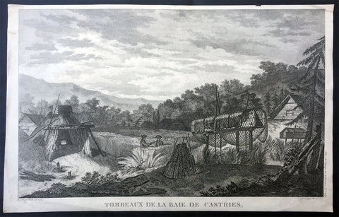
1797 Laperouse Antique Print View De Kastri Bay, Ulchsky Khabarovsk Kai, Russia
- Title : Tombeaux de la Baie de Castries
- Ref : 21436
- Size: 17in x 11in (435mm x 280mm)
- Date : 1797
- Condition: (A+) Fine Condition
Description:
This large original copper plate engraved antique print, a view of the very early settlement at De Kastri Bay, in the Ulchsky District of Khabarovsk Kai, Eastern Russia - opposite the Sakhalin Islands - by Jean-François de Galaup, Comte de la Pérouse was published in the 1st edition of the Atlas du voyage de La Perouse, Paris 1797.
General Definitions:
Paper thickness and quality: - Heavy and stable
Paper color : - off white
Age of map color: -
Colors used: -
General color appearance: -
Paper size: - 17in x 11in (435mm x 280mm)
Plate size: - 17in x 11in (435mm x 280mm)
Margins: - Min 1/2in (12mm)
Imperfections:
Margins: - Small repairs to margins, no loss
Plate area: - None
Verso: - None
Background:
De-Kastri was named for the former name of the bay on which it stands. The bay was discovered by La Pérouse on July 25, 1787 and named after the sponsor of the expedition—the then Secretary of State of the French Navy, the Marquis de Castries. The bay is a convenient natural refuge for vessels, giving it strategic importance from a military viewpoint.
The settlement was officially founded in 1853, although the land where it was situated would not officially be Russian territory until the signing of the Treaty of Aigun five years later.
In 1854, the difficult task of defending Petropavlovsk-Kamchatsky when it came under siege from the British and French forces during the Crimean War brought to attention the difficulties of supply and defense of the Kamchatka Peninsula, where a large section of the Russian Pacific Fleet was based. It was decided to move the port from Kamchatka without waiting for another attack. In the spring of 1855, the Russian navy\'s weapons and sailors under the leadership of Rear Admiral Vasily Zavoyko headed toward the mouth of the Amur River; however, the river mouth was still covered with ice. It was decided to wait for the break-up, hiding in the Bay of de Castries from the superior forces of French and English. Russian ships were discovered there, but managed to escape to the Amur River in the Strait of Tartary before the arrival of enemy reinforcements. The British and French did not know that Sakhalin was an island, and spent the later years of the war waiting in vain for the Russian fleet at its southern coast.

