Welcome to Classical Images!
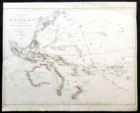
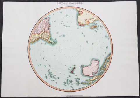
Description:This large original copper plate engraved, hand coloured antique map of Australia (Ulimaroa) New Zealand and the South Pacific was drawn by Christoph Matthais Reinecke in 1804.
Ulimaroa was a name given to Australia by the Swedish geographer and cartographer Daniel Djurberg in 1776. Djurberg adapted the name from Olhemaroa, a Māori word found in Hawkesworths edition of Captain James Cook and Sir Joseph Banks journals which is thought to have been a misunderstood translation — the Māori were actually referring to Grand Terre, the largest island of New Caledonia. Djurberg believed the name meant something like big red land, whereas modern linguists believe it meant long hand — echoing the geography of Grand Terre. The spurious name continued to be reproduced on certain European maps, particularly some Austrian, Czech, German and Swedish maps, until around 1820, including in Carl Almqvists 1817 novel Parjumouf Saga ifrån Nya Holland (Stockholm, 1817).
General Definitions:Paper thickness and quality: - Heavy and stablePaper color : - off whiteAge of map color: - OriginalColors used: - Yellow, green, blue, pinkGeneral color appearance: - AuthenticPaper size: - 24in x 19 1/2in (660mm x 495mm)Plate size: - 24in x 19 1/2in (660mm x 495mm)Margins: - Min 1/2in (15mm)
Imperfections:Margins: - Light soilingPlate area: - Light age toning 4 pin holes, light horizontal foldVerso: - Light soiling on verso
Background: An incredibly early map of Australia with detail of both the west and east coast's. Sydney Cove is clearly marked as it established itself as the premier settlement on the eastern seaboard. The NSW border is marked in a dotted line from the Gulf of Carpentaria south to roughly where Adelaide now sits. Port Philip has not yet been discovered with both Hobart and Adelaide yet to be named. A fantastic very early colonial map of Australia only 31 years after Cook first mapped the east coast and only 13 years after the establishment of the first white settlement in Botany Bay/Sydney. (Ref: M&B; Tooley)