Welcome to Classical Images!
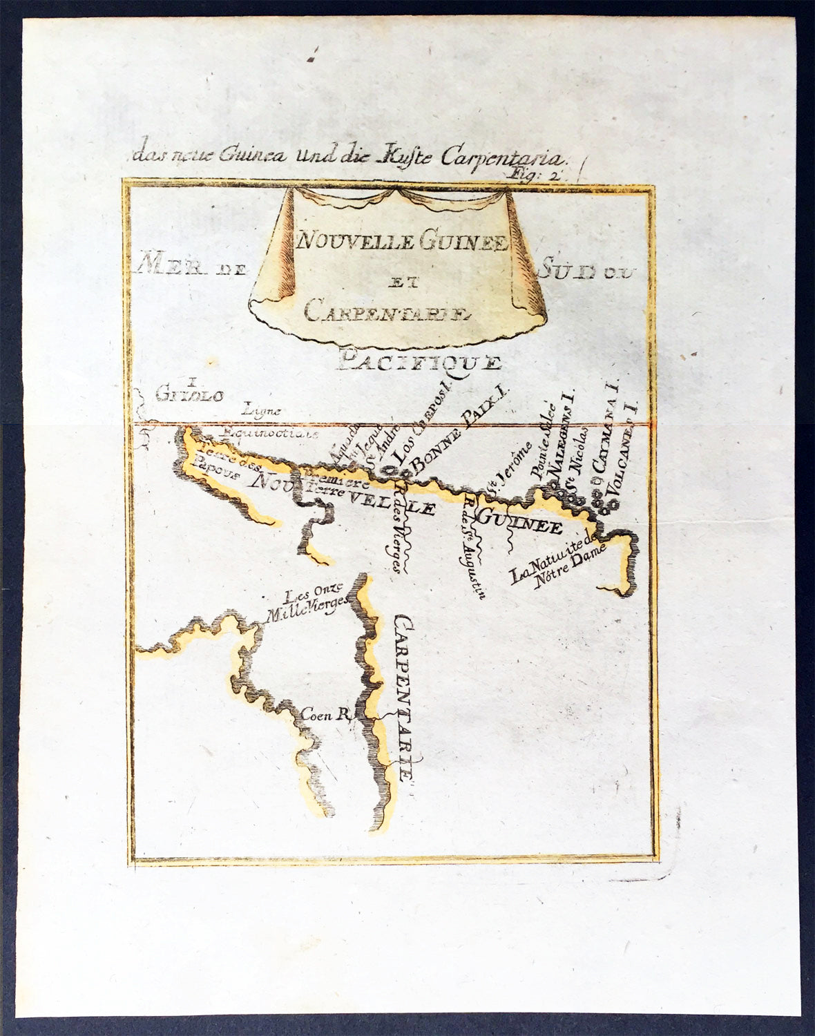
Description:This hand coloured original antique very early map of Cape York Peninsula, the Gulf of Carpenteria and New Guinea - depicted before the Torres Strait was charted - was published as part of the 1683 edition of Alain Manesson Mallet's 1630 - 1706 Description de l' Univers.
Background: The first detailed published map to show any part of Queensland (Tully). Shows New Guinea , the east coast of Cape York Peninsula and part of Arnhem Land. Although not a particularly large map, the significance of Mallet's map of Carpentaria and New Guinea is underrated. It is essentially the first map to concentrate specifically on the Dutch discoveries in Queensland by Jan Cartenszoon in the Pera and the Arnhem that left Ambon on 21 January 1623 and reached the western side of Cape York Peninsula on 12 April. Although De Jode's rare and famous map 'Novae Guineae Forma & Situs', published almost a century earlier also charts the same area, it shows a fictitious Queensland based on the contemporary beliefs of a 'Terra Australis Incongita', or unknown southland. Mallet names 'Coen R', one of the rivers discovered and named by Carstensz in 1623. No other Australian place names are shown except 'Carpentarie' on the Cape York Peninsula . Mallet places an interesting reference at the entrance of the Gulf of Carpentaria, "Les onze mille vierges", referring to the eleven thousand virgins of Cologne . A text carved into stone at the Church of Saint Ursula refers to the martyrdom of virgins. Mallet was a French Engineer who in his early days took service with the Portuguese Army. He later returned to France and served Louis XIV. In 1683 he published Description de l' Univers which contained many hundreds of maps, plans and views. A German edition was published in 1686. This is a beautifully engraved and hand coloured print in excellent condition. (Ref: Tooley; M&B)
Condition Report Paper thickness and quality: - Heavy and stable Paper color: - white Age of map color: - Early Colors used: - Yellow, green, blue, red General color appearance: - Authentic Paper size: - 8in x 6in (205mm x 152mm) Plate size: - 6 1/2in x 5in (165mm x 127 mm) Margins: - min. 1/2in (12mm) Imperfections: Margins: - None Plate area: None Verso: - None